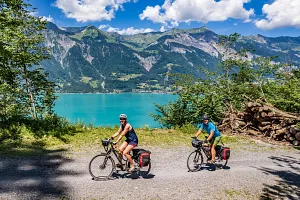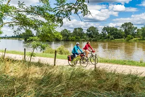
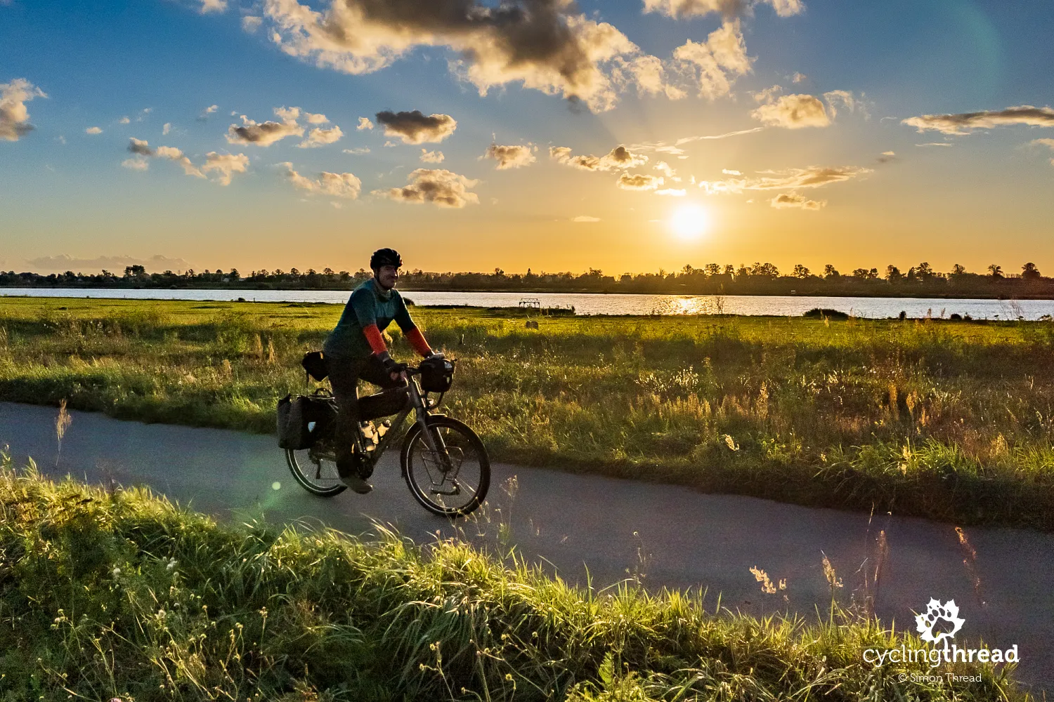
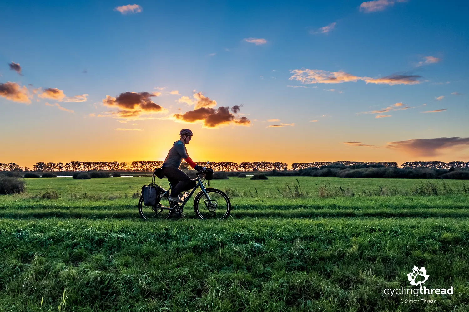
EuroVelo 9 in Poland - Vistula Cycling Route in Pomorskie
The Vistula Cycling Route is not just about Małopolska. The second, and so far the only other Polish region taking the “national” route seriously, is Pomorskie. What's more, Pomorskie has marked the route on both sides of the Vistula River, creating the opportunity for a multi-day cycling adventure in the Lower Vistula Valley or plenty of one-day trips in the area. For us, it was the perfect inspiration to return to the Vistula in Pomorskie after several years away and to make the most of the last warm days of summer.
See also the Vistula Cycling Route in Małopolska.
Join us on our new 🟢 Komoot account!
Cycling Partners
Route on the map
GPX file (GPS track): cyclingthread.com-pomorskie-2024.gpx
Vistula Cycling Route - table of contents
- Vistula Cycling Route, also known as EuroVelo 9
- Five days of a very peaceful ride
- To the new bridge in Sobieszewo
- Along the southern shore of Sobieszewo Island
- Vistula icebreakers in the Przegalina port
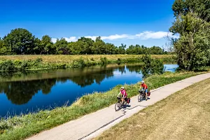
- Excellent cycling roads along the Vistula
- Blue bike path along the Vistula
- Once the longest bridge in Europe
- Visit the Vistula Museum in Tczew
- Following the mennonites of the Lower Vistula Valley
- The jewel of Kociewie and the Lower Vistula Valley
- Encounter with a German cyclist by the river
- Prussian regulator’s monument
- The most beautiful spot on the Vistula route
- Impressive view with the Vistula in the background
- Mennonites saving the route's appeal
- Grudziądz impresses with the Old Town panorama
- The same old Kuyavian-Pomeranian Pitfalls
- Signs inform about rest stops
- It's worth climbing the Vistula embankments
- The highlight of this dection of the Vistula Cycling Route
- Several kilometers of bike paths on the route
- A water gauge that looks like a church
- How the Vistula delta was formed
- Entering the Vistula Żuławy
- The route starts and ends with a great bike path
- Who is the Vistula Cycling Route for?
- Up-to-date information and map online
- With joy and satisfaction, but also wanting more
- Another great cycling route
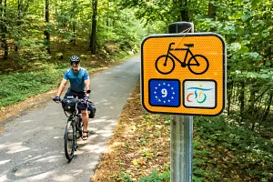
Vistula Cycling Route, also known as EuroVelo 9
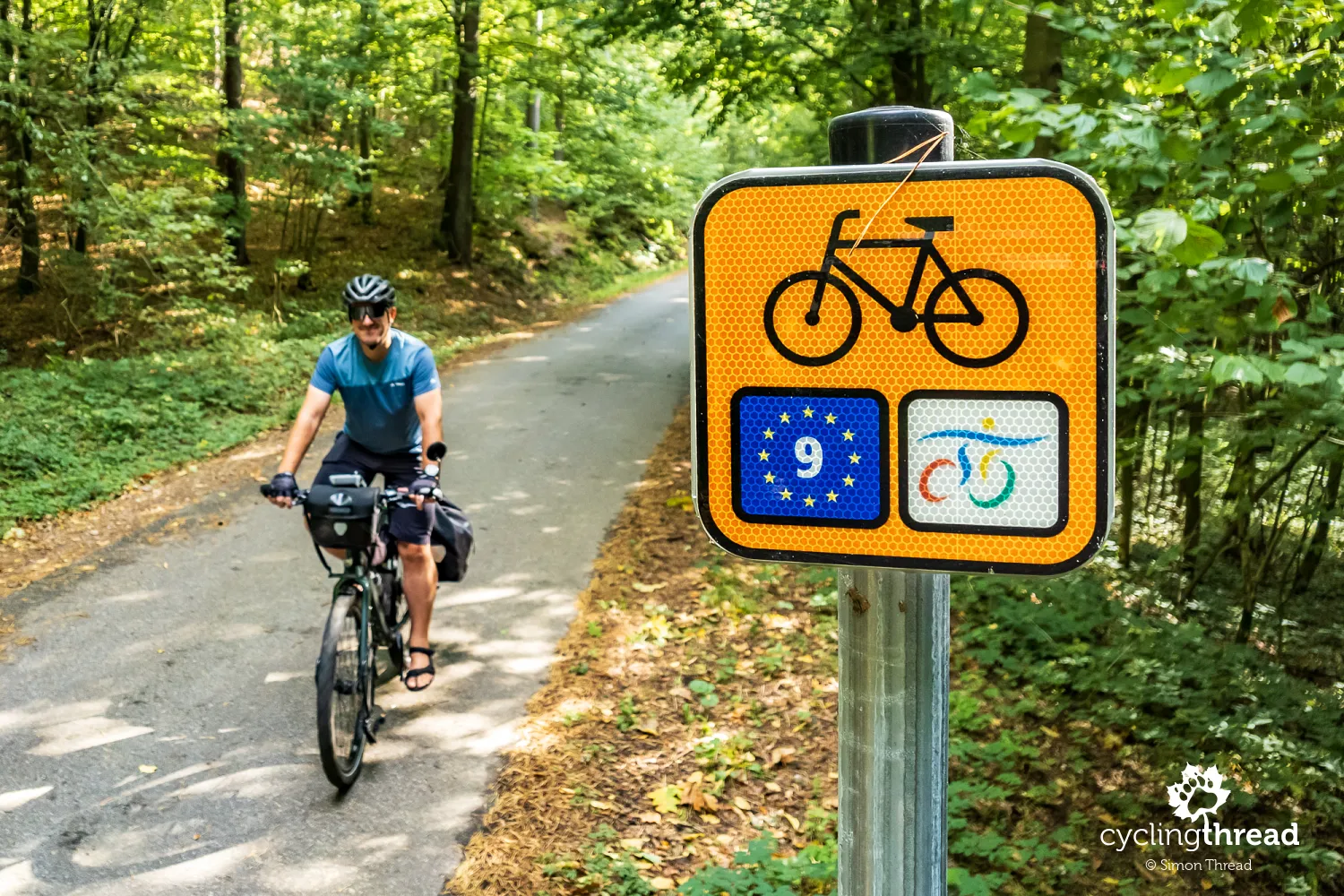
The image of the Vistula Cycling Route in Pomorskie has been refreshed thanks to its integration into the international EuroVelo 9 route, which connects the Baltic Sea to the Adriatic. With funding from the European Union, new cycling paths, rest areas, and guides have been developed. While new roads have been built in selected areas, in others the route still follows existing public roads, which, though not always, usually have very low traffic. As part of the changes to signage of cycling routes in Poland a few years ago, the Vistula Cycling Route is now marked with fluorescent orange signs featuring the EuroVelo project and Vistula Cycling Route symbols.
Five days of a very peaceful ride
The distance I covered during this trip was about 300 kilometers. Any experienced cyclist will surely enjoy planning their own route, but for beginners, I recommend that the cities along the route set comfortable and friendly distances, allowing part of the day to be spent cycling and the rest visiting interesting spots. The stages of the route go as follows: Gdańsk, Tczew, Nowe, Kwidzyn, the areas around Tczew and back to Gdańsk, with respective distances of 54, 66, 65, about 55, and around 60 kilometers. All these cities, except Nowe, are well-connected by train, making it easy to reach the Vistula Cycling Route from any part of Poland by rail.
To the new bridge in Sobieszewo
The Vistula Cycling Route begins at Gdańsk’s main train station. After crossing the Main Town, often mistaken for the Old Town (and frequently called "Starówka" incorrectly), the route smoothly leaves the heart of this large city. It follows bike paths and side roads, heading east towards Sobieszewo Island. In the industrial zone around Elbląska Street, you’ll pass by the grounds of the former Gdańsk Refinery, later Lotos, then Orlen, and now once again named Gdańsk Refinery, with 30% ownership by the Saudi Aramco company. Before the construction of a dedicated cycling road along Sobieszewska Street, the popular cycling route to Sobieszewo Island ran alongside the refinery on Benzynowa Street. Today, it’s still an interesting alternative that rejoins the official Vistula Cycling Route on the bike path by the new Gdańsk-Sobieszewo bridge.
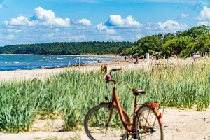
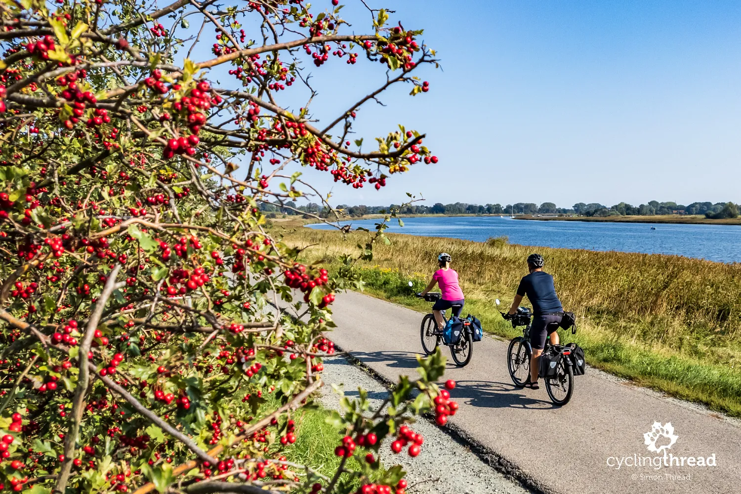
Along the southern shore of Sobieszewo Island
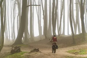
Sobieszewo Island is a popular cycling weekend getaway for Gdańsk residents — for cyclists, but also for hikers, runners, and horseback riders. Its modern shape only came about in 1895 when the current main mouth of the Vistula was created. Earlier, in 1840, meltwater overflowed the banks, forming the Vistula Śmiała on the island’s western side. Though in 2019 a bike path was built through the middle of the island, from Sobieszewo to Świbno, marking the official EuroVelo 9 route, I encourage you to cycle along the southern shore. This alternative section of the trail runs along the Dead Vistula, offering views from the flood embankment over the island's interior and Gdańsk Żuławy, including the 50-meter-high reclaimed phosphogypsum heap, now a silent landmark, next to a renowned shipyard producing luxury yachts.
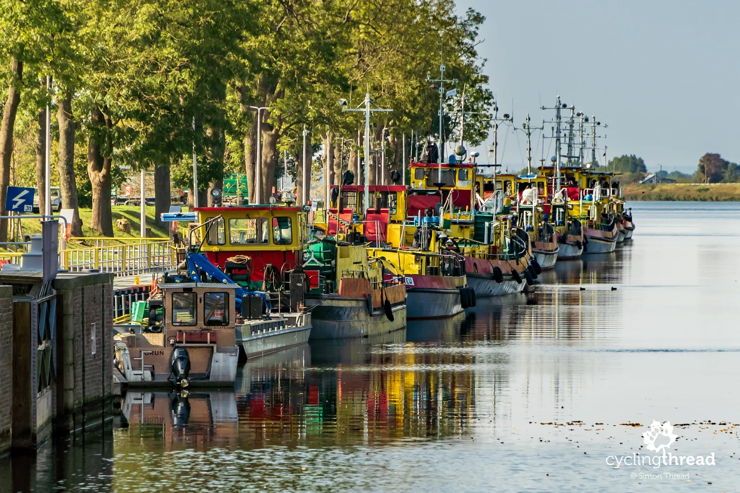
Vistula icebreakers in the Przegalina port
A long line of yellow and red Vistula icebreakers moored in a narrow canal signals our approach to the Przegalina lock. Icebreakers first appeared on the Vistula in the late 19th century when the need arose to actively counter flood threats on the river. Until 1920, the icebreakers were under Prussian control, and during the interwar period, they came under Polish and Gdańsk administration. Today, around 10 icebreakers operate on the Vistula from Włocławek to Świbno, also serving as tugboats or, when needed, rescue ships. Their main task is to prevent ice jams, particularly during northerly winds, which cause a phenomenon called the "backwater," hindering the Vistula’s natural flow into the Baltic Sea.
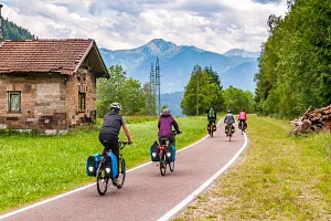
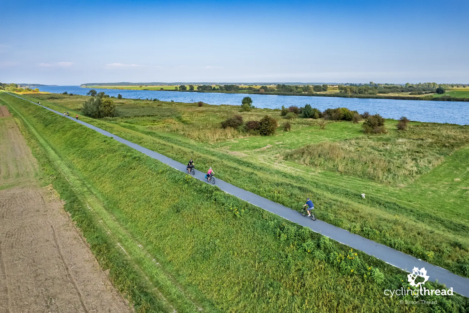
Excellent cycling roads along the Vistula
It’s near Przegalina that the excellent riverside cycling roads along the Vistula begin. Heading north, there’s a short stretch to Świbno, where a seasonal ferry crosses to the other bank of the Vistula — to Mikoszewo and the Vistula Spit. Heading south, you can follow the flood embankment’s bike path for around 27 kilometers all the way to Tczew. It’s a scenic ride along the edge of the Vistula’s floodplain, with its main channel always within view. The only exception is near Steblewo, where there’s still a short, several-kilometer gap in the bike path, currently navigated via a parallel technical road covered with old yomb concrete slabs. Fortunately, most of these slabs lie evenly and fit well together, though the stretch atop the embankment requires a bit more patience. A well-worn path suggests it’s sometimes better to ride on the sand between the slabs. Stay alert — it’s on this section that you’re likely to spot elk.
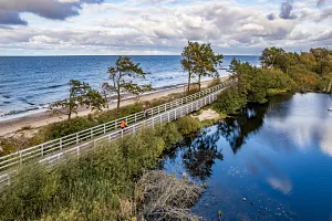
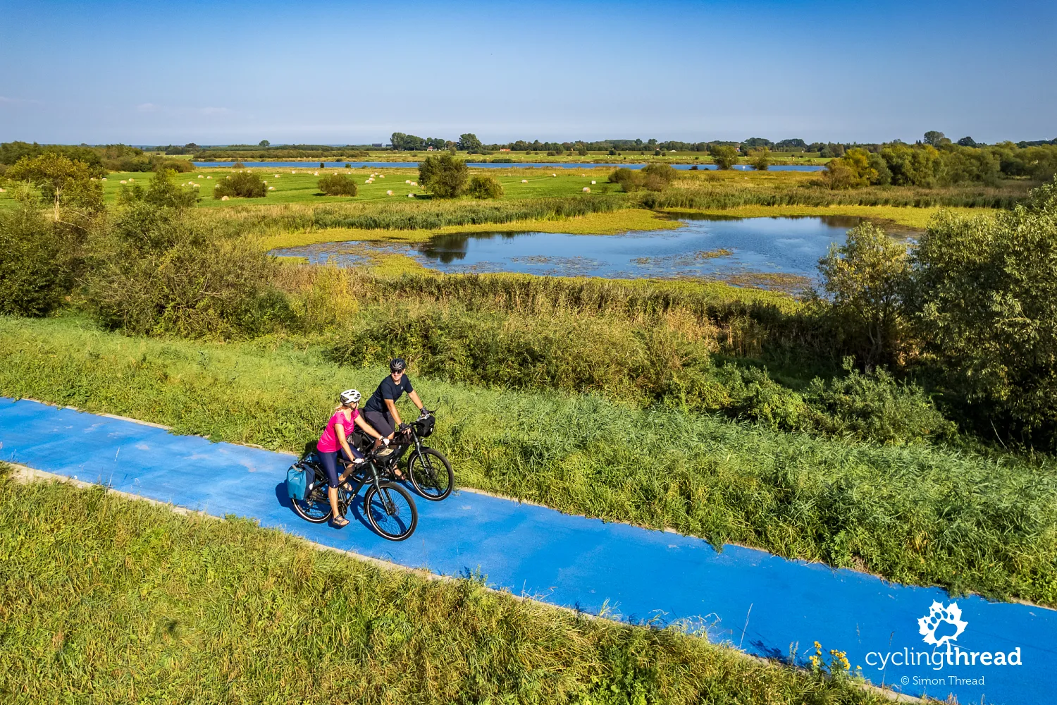
Blue bike path along the Vistula
A great curiosity for travelers is the approximately 100-meter-long blue bike path running atop the flood embankment between Błotnik and Kiezmark. Many cyclists see this stretch as an odd whim of the builders, but it’s actually a brilliant local accent, a nod to the historical events of Żuławy. The blue pavement symbolizes the Vistula and its historic channel, which 140 years ago flowed exactly where the blue path now lies. This is where the Vistula ran towards Gdańsk before the artificial section was dug from 1891-1895 by Prussian engineers, creating the current mouth of the river, known today as the Vistula Cut. The visible floodplains in the photos are also part of the former Vistula riverbed.
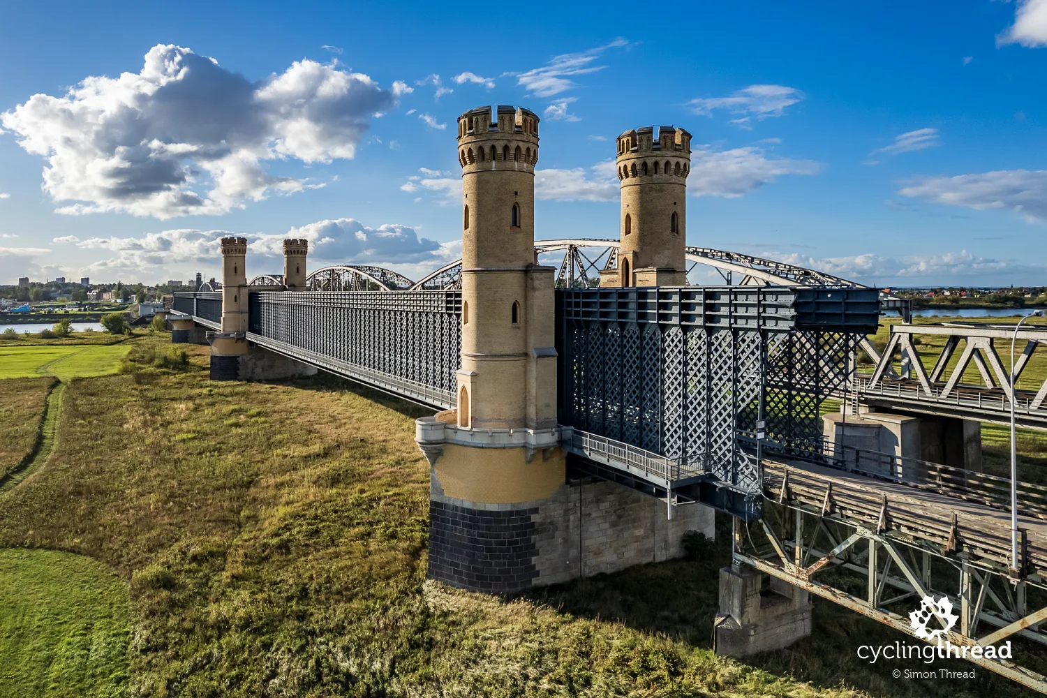
Once the longest bridge in Europe
From the Vistula embankments near Tczew, you can see the so-called "Tczew Bridges" in the distance. These are two bridges, built in the 19th century — one in the middle and the other at the end of the century. Their history deserves more than just a brief mention; it could easily fill a long lecture. The period in European history during which these bridges were constructed, combined with the rapidly advancing knowledge of Prussian engineers, meant that almost every known construction technique from the 18th and early 19th centuries was applied in the building of the Tczew Bridges. A single glance reveals the distinct differences between their segments. The first, southern bridge was even the longest in Europe when it was completed. When the Vistula embankments on the eastern bank were moved, the bridge was extended by several hundred meters. Currently, it's undergoing a major renovation that has been ongoing for ten years. During this work, a time capsule from 1851, placed in one of the pillars by Prussian King Frederick William IV, was discovered.
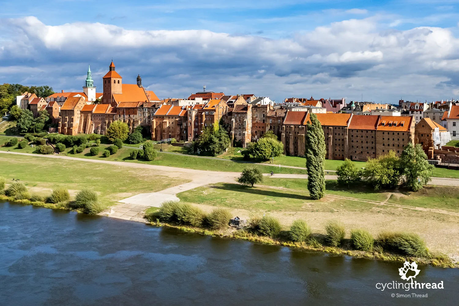
Visit the Vistula Museum in Tczew
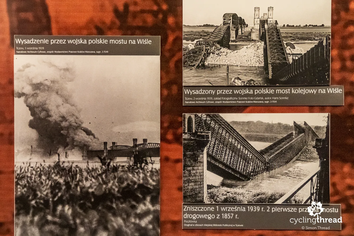
You can admire the beautiful Tczew bridges from the Vistula Boulevard in Tczew, one of the many places that have transformed and become more attractive in recent years. However, the most interesting attraction in Tczew, especially in the context of this cycling trip, is the Vistula Museum, which is worth visiting before continuing your journey on the Vistula Cycling Route. It’s the largest museum in Poland dedicated to the history of the Vistula, housed in 19th-century factory buildings. The exhibition not only tells the story of the Vistula but also of Poland, showcasing the river’s role in the country's development. What stood out to me most was the historical section, which includes models of ships, descriptions of different types, and their uses. One of the displays focuses on the history and construction of the Tczew Bridges, featuring reproductions of historical photographs, including those taken in the first days of September 1939. The one thing I felt was missing was a brief explanation of how the Vistula delta formed, which would provide geographic context for a later visit to Biała Góra and cycling through the Vistula Żuławy region.
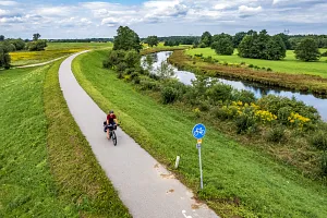
Leaving Tczew to the south involves a short bike path, and after crossing the old "Berlinka" route from Berlin to Königsberg, the Vistula Cycling Route takes a long stretch without cycling infrastructure. It’s not the most ideal condition for bike touring, but it shouldn’t discourage you from continuing your journey. One of the first places worth stopping is Rybaki, with its late 19th-century hydrotechnical complex consisting of three pumping stations and a lock. The complex is designed to manage water relations between the Walichnowy Lowlands and Lake Pelplin and the Vistula River. Interestingly, just a few hundred meters further south, there’s a permanent artillery battery built by the Prussians to protect this vital flood control system. Rybaki is also where you first encounter the Vistula embankments, constructed in the mid-19th century. Instead of following the official route at the foot of the embankment, you can ride along the paved top of the embankment itself. It’s worth climbing to the top for a view of the floodplain and the distant Vistula.
Following the mennonites of the Lower Vistula Valley
In Międzyłęż, a Mennonite cemetery marks the beginning of a series of places and sites that reflect the presence of Mennonites in the Lower Vistula Valley. Fleeing religious persecution, the Mennonites came to the Vistula Żuławy and Lower Vistula Valley in the 16th and 17th centuries, invited by Polish rulers who appreciated their skills in drainage and agriculture. The Mennonites were masters at draining and managing floodplains, significantly contributing to the economic development of the region. They lived in close-knit communities, maintaining their religious and cultural distinctiveness while also playing a key role in advancing agriculture and the Vistula region’s economy. In Wielkie Walichnowy, once the largest Mennonite village along the Vistula, you’ll find the Gothic Church of St. John the Baptist, dating back to the 14th century.
The jewel of Kociewie and the Lower Vistula Valley
Gniew, one of the jewels of Kociewie and the Lower Vistula Valley, marks the southern end of the Walichnowy Lowlands — a great place to plan an overnight stay. This picturesque town is situated on a high escarpment at the confluence of the Wierzyca and Vistula rivers. Its charm and history have always drawn me in. Dominating the skyline is the 13th-14th-century castle, once home to Teutonic commanders and starosts, and now a venue for historical reenactments and outdoor events. Overlooking the intimate market square is St. Nicholas Church, built in the 14th century, with most of its furnishings dating from the 19th century. Interestingly, during archaeological excavations conducted at the church, the largest collection of medieval silk garments in Poland was discovered. I was also pleased to see that the renovation of Gniew’s market square, surrounded by a few arcaded townhouses, had been completed.
Encounter with a German cyclist by the river
South of Gniew, the land dips noticeably, with the Wierzyca River flowing into the Vistula just past a recently renovated bridge. In the bushes near the bridge, I stumbled upon a cyclist from Germany who had pitched her tent for the night and was just packing up her campsite. A little closer to town, right under the city’s escarpment, runs the road leading to the now-closed ferry crossing over the Vistula. About eight years ago, in this very spot, I photographed the sunrise over Gniew in the company of a massive beaver finishing up its nightly chores. Back then, we were on a similar route with Ola - through Kociewie, from Tczew, passing through Pelplin and Gniew, and on to Świecie, when the Vistula Cycling Route in the Pomeranian Voivodeship was still in the planning stages.
Prussian regulator’s monument
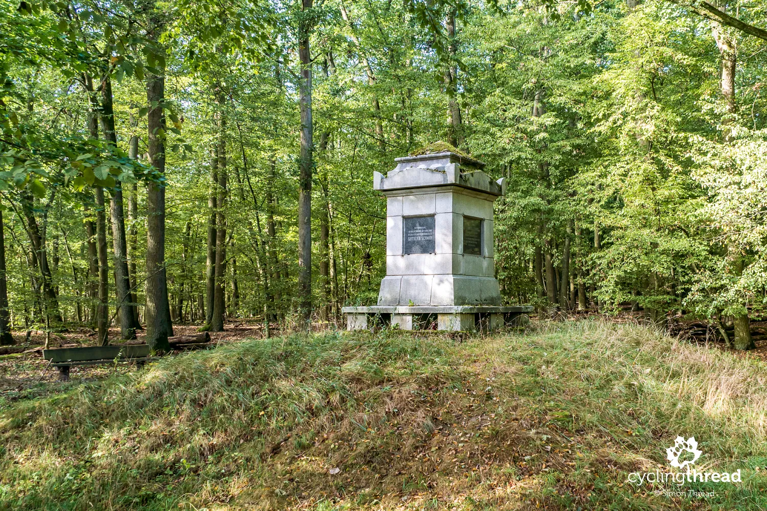
Beyond Gniew, after a scenic descent past Tymawa and through Opalenie, the Vistula Cycling Route follows public roads leading to the Vistula upland. Here, you’ll find a narrow, newly built road that soon disappears into a dense forest. This area is home to two nature reserves - Wiosło Małe and Wiosło Duże - located on the steep slopes of the Vistula valley and its oxbow lakes. These reserves protect beech forests and sunlit meadows with a steppe-like character, where heat-loving herb species thrive. In the first reserve, along the road, there’s a small rest area with wooden shelters, created by the State Forests, from which a forest educational trail leads to a three-meter-high stone structure known as the "regulator's monument." This obelisk is dedicated to Gottlieb Schmidt, a 19th-century engineer responsible for the regulatory work in the Lower Vistula Valley. Though it’s only the base of the former monument, it remains a unique spot worth seeing.
The most beautiful spot on the Vistula route
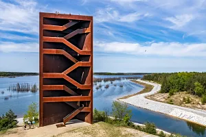
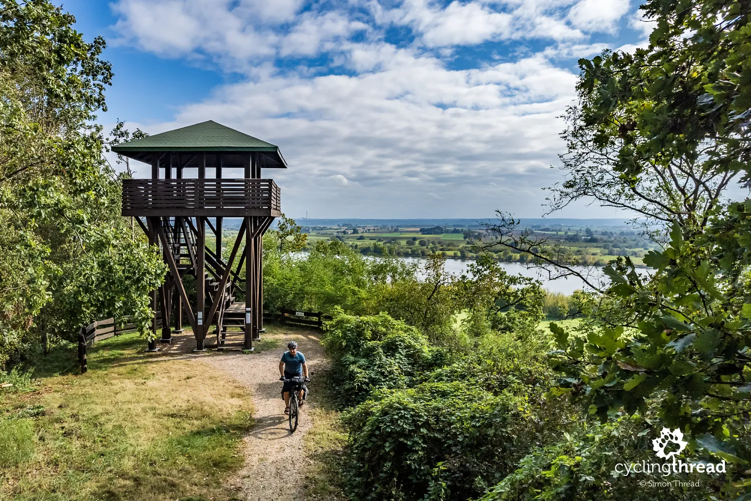
Nearby is the second nature reserve, Wiosło Duże, which features another forest path, built by the State Forests in 2019, leading from a spacious rest area to a lookout point with a tower. From here, you can admire a breathtaking panorama of the Vistula Valley, the distant town of Kwidzyn, and a protected section of the oxbow lake. This is undoubtedly the most beautiful spot on the route, worth a longer stop, and if you're lucky, you might share the moment with a hovering buzzard overhead. This section of the trail stands out for its hilly terrain and more "classic" trail design. As you ride through the forest, you cross the border into the Kuyavian-Pomeranian Voivodeship. It’s a transition you can't miss, as the trail becomes more challenging, and just before reaching Nowe, you even have to ride a few hundred meters on the less safe national road no. 1.
Impressive view with the Vistula in the background
Nowe is a charming stop on your journey. Founded in the 14th century by the Teutonic Knights, it was an important hub on a medieval trade route, contributing to its rapid growth. It was also the last Teutonic stronghold during the Thirteen Years' War. Modern Nowe has preserved many historical landmarks that harken back to its glorious past, including townhouses and churches. At the corner of the old town, overlooking the Vistula, stands the main wing of a castle built by the Teutonic Knights in the 14th century. From the tower of the town’s main church, you can also enjoy an impressive view of the Vistula, almost identical to what a drone would capture.
Mennonites saving the route's appeal
Unlike Pomorskie, the Kuyavian-Pomeranian Voivodeship’s organization of the Vistula Cycling Route is limited to placing orange signs marking the trail’s course and a few informational boards. No new cycling paths were built, meaning there was no improvement in safety or practical cycling appeal along the route. You can feel how necessary this infrastructure is when riding the stretch of the Vistula Cycling Route between Nowe and Grudziądz. The route follows a busy, local transit road between the two cities. And though this section of the Lower Vistula Valley is one of the most scenic, cyclists have no opportunity to enjoy views of the Łosiowe Hills or the unique panorama of Grudziądz - everything is hidden behind a tall embankment.
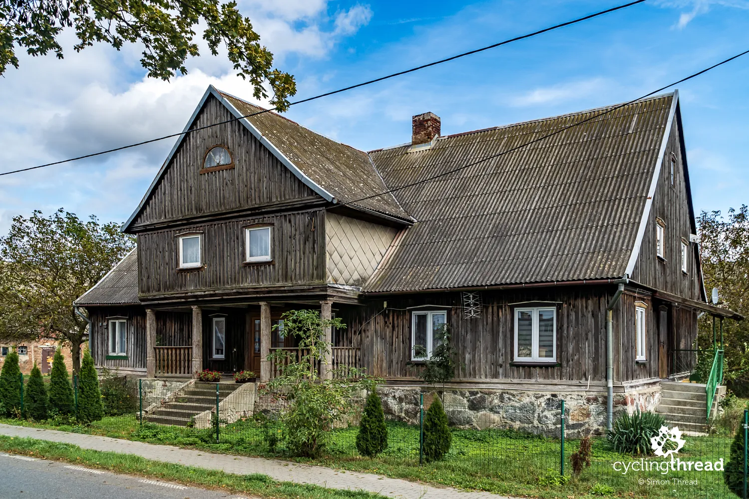
The Mennonites are what save the appeal of this section of the Vistula Cycling Route. In every village you pass through, you can stop at places that serve as reminders of their centuries-long presence in the area. However, visiting the Mennonite cemeteries in Tryl and Wielkie Zajączkowo left me feeling a bit uneasy. From previous one-day trips through the Lower Vistula Valley years ago, I remembered these cemeteries as being much better maintained, cleaner, and showing signs of care that now seem to be lacking. In nearby Mątawy, you can see one of the last Mennonite arcaded houses in the region - though asbestos has replaced the original tiles, the rest of the house nostalgically recalls bygone times. Its sturdy, practical foundation stands out, designed to protect the house from high water.
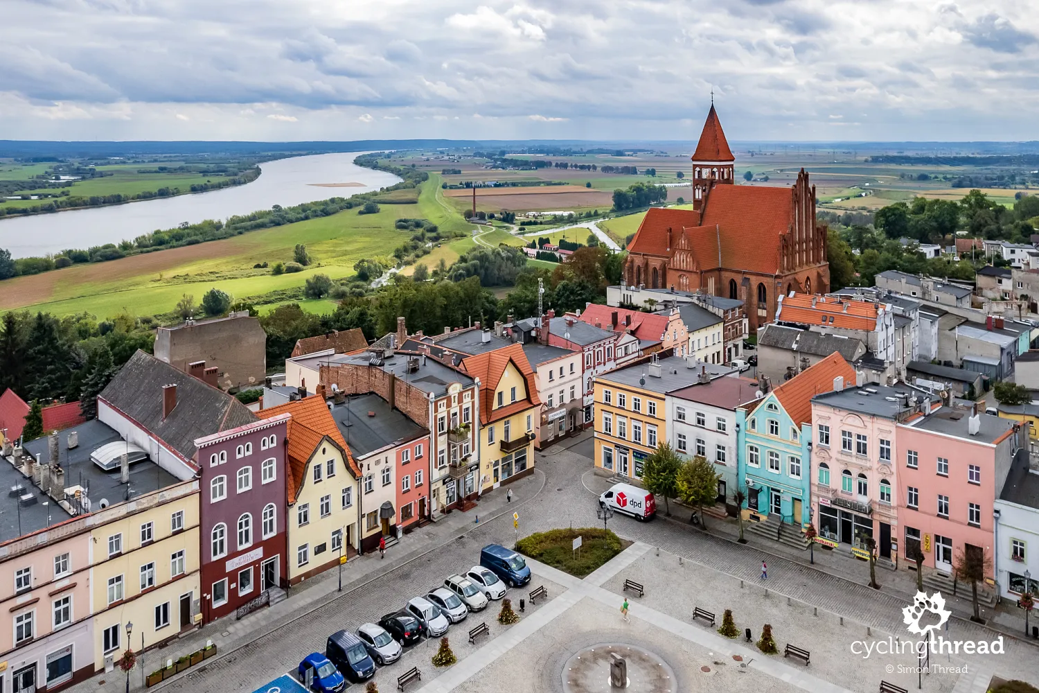
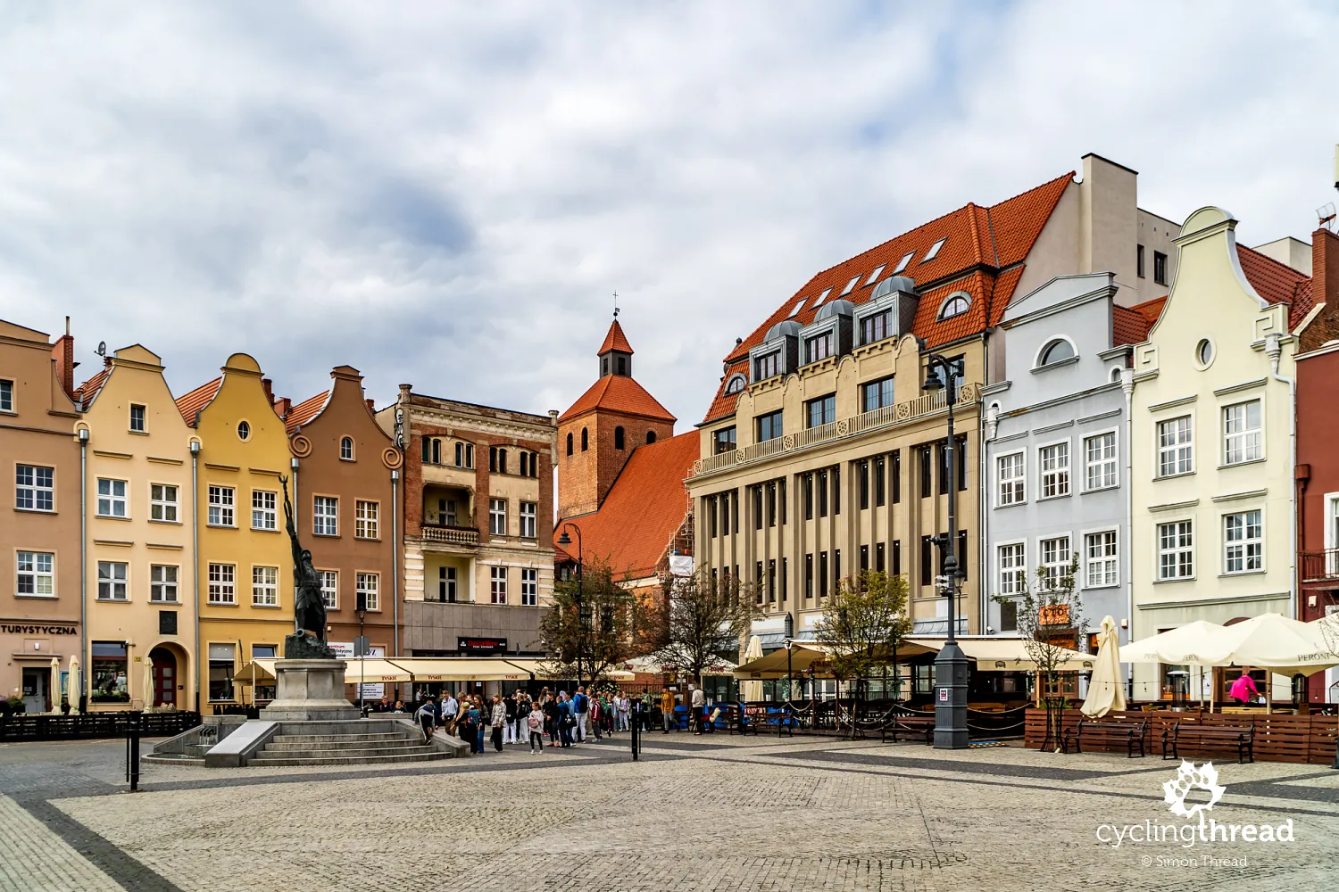
Grudziądz impresses with the Old Town panorama
Soon after, we leave the Vistula embankment and, after climbing the ramp leading to the Bronisław Malinowski Bridge, Grudziądz appears before us, offering one of the most beautiful and unique city panoramas in Poland: the Grudziądz granaries. Built between the 14th and 17th centuries, these granaries owe their existence to the city's strategic location and its role in trade. At their peak, there were around 25 granaries, some of which were destroyed by fire or war, only to be rebuilt, while others were converted into residential buildings. From the outside, the granaries in Grudziądz appear to have 5-7 visible floors, while from the street view along Skarpowa Street, you can only see two or three, due to the steep Vistula escarpment they stand on. These tall, massive supports were built to keep the granaries stable on the Vistula slope. Interestingly, when they were constructed, the Vistula's bank was closer to the city, and the granaries stood right by the waterfront, with grain and other goods loaded onto ships via wooden chutes lowered directly from the granaries.
When you enter the Old Town in Grudziądz, keep an eye out for trams. Not only for your safety but also because of their historic significance — Grudziądz is the smallest Polish city with an operational tram system. Along with modern trams, you can still see over 50-year-old Düwag GT8 trams, which fit nicely with the Old Town’s atmosphere. Another highlight of Grudziądz is the Courbière Fortress, a citadel open to visitors in the northern part of the city. Additionally, Klimek, the only remaining part of the castle once located in the northern Old Town, is a must-see. Just imagine how breathtaking Grudziądz’s already beautiful skyline would be if it still featured a castle like the one in Gniew.
The same old Kuyavian-Pomeranian Pitfalls
Heading north from Grudziądz, you’ll once again encounter the same Kuyavian-Pomeranian "pitfalls" as before. Despite traveling through diverse terrain, there’s a lack of cycling infrastructure and scenic views. I missed the pleasure I experienced on the bike paths near Gdańsk or in the Wiosło Duże and Wiosło Małe nature reserves. You’ll briefly hit a short section along the embankment on (tolerable) concrete slabs and... that’s it for about 30 kilometers. Once again, the Vistula, without any special effort to ascend the embankments, won’t show itself until over 30 kilometers later - in Korzeniewo, past Kwidzyn. It’s no surprise, though - the signage for the Vistula Cycling Route in Grudziądz dates back to before 2013, and it seems that since then, the Kuyavian-Pomeranian Voivodeship has done nothing to improve its section of the route to meet the modern needs of cycling tourism.
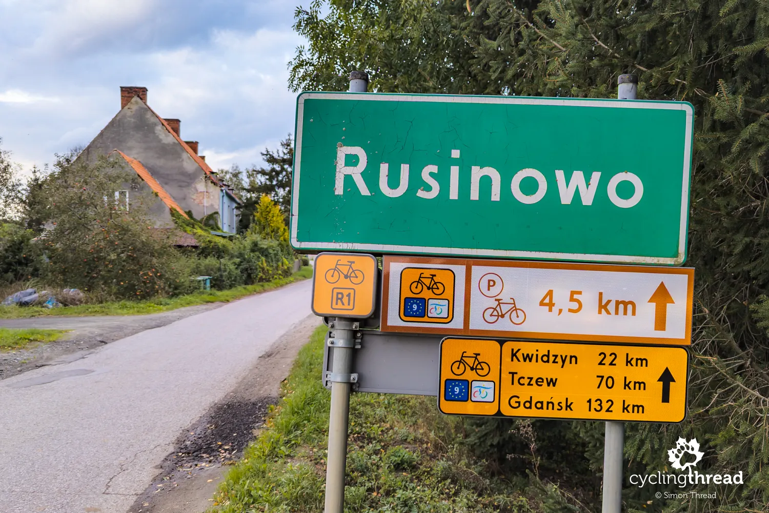
Signs inform about rest stops
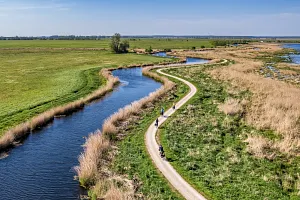
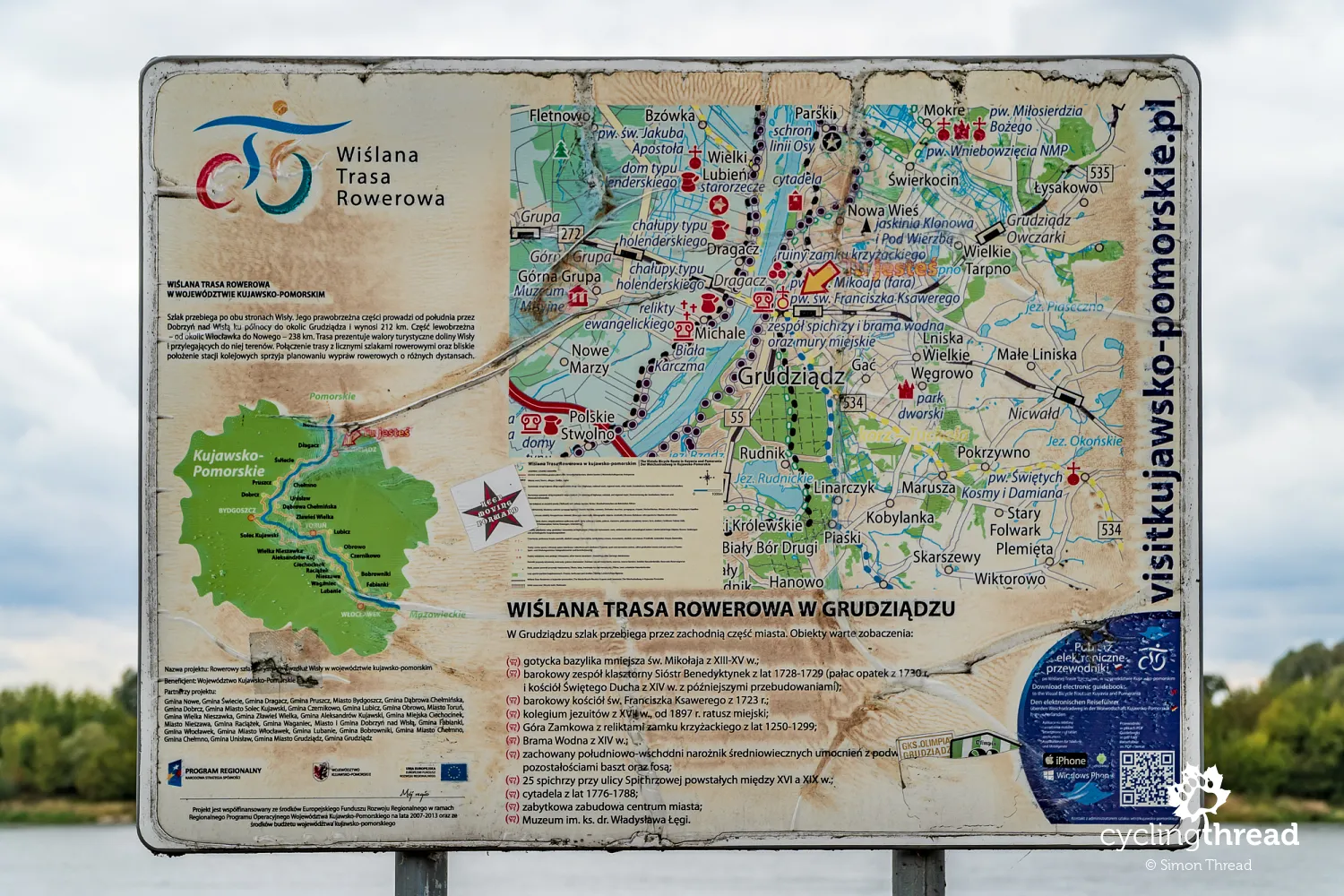
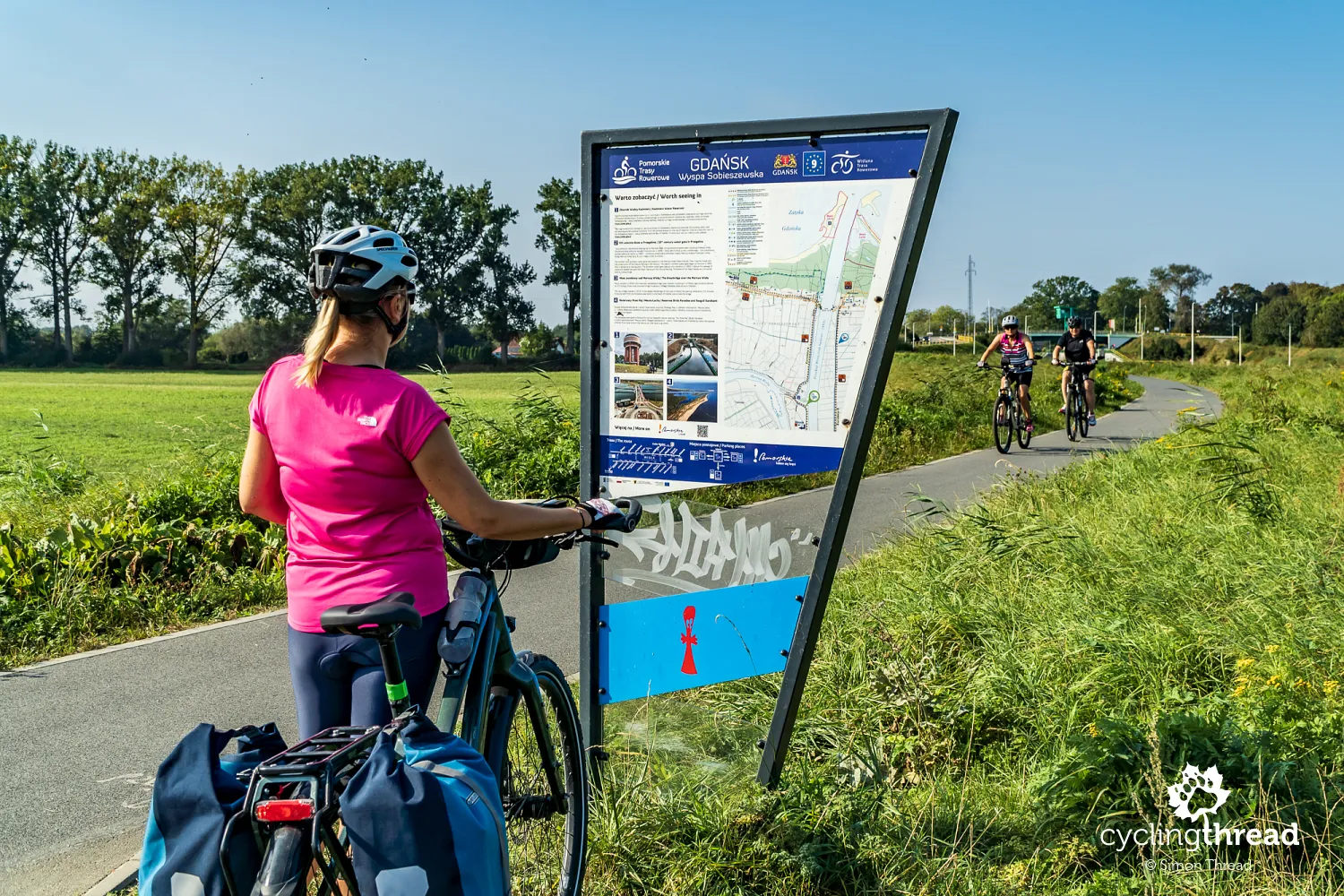
While Kuyavian-Pomeranian signage is limited to small orange markers, in Pomorskie, things are more impressive. In addition to the individual markers, there are also signs indicating distances and numerous rest areas. What’s worth noting is that rest stops aren’t only marked at their locations but also with signs several kilometers in advance, as shown in the photo below. This allows you to plan your break, assess if you need it. These rest stops, marked by a "P" in a circle, offer various types of shelters, viewpoints, and similar facilities. During my trip, all were accessible, in good condition, and clean. The advanced warning about their locations is friendly and original - I don’t recall seeing similar signs on any other bicycle route in Europe.
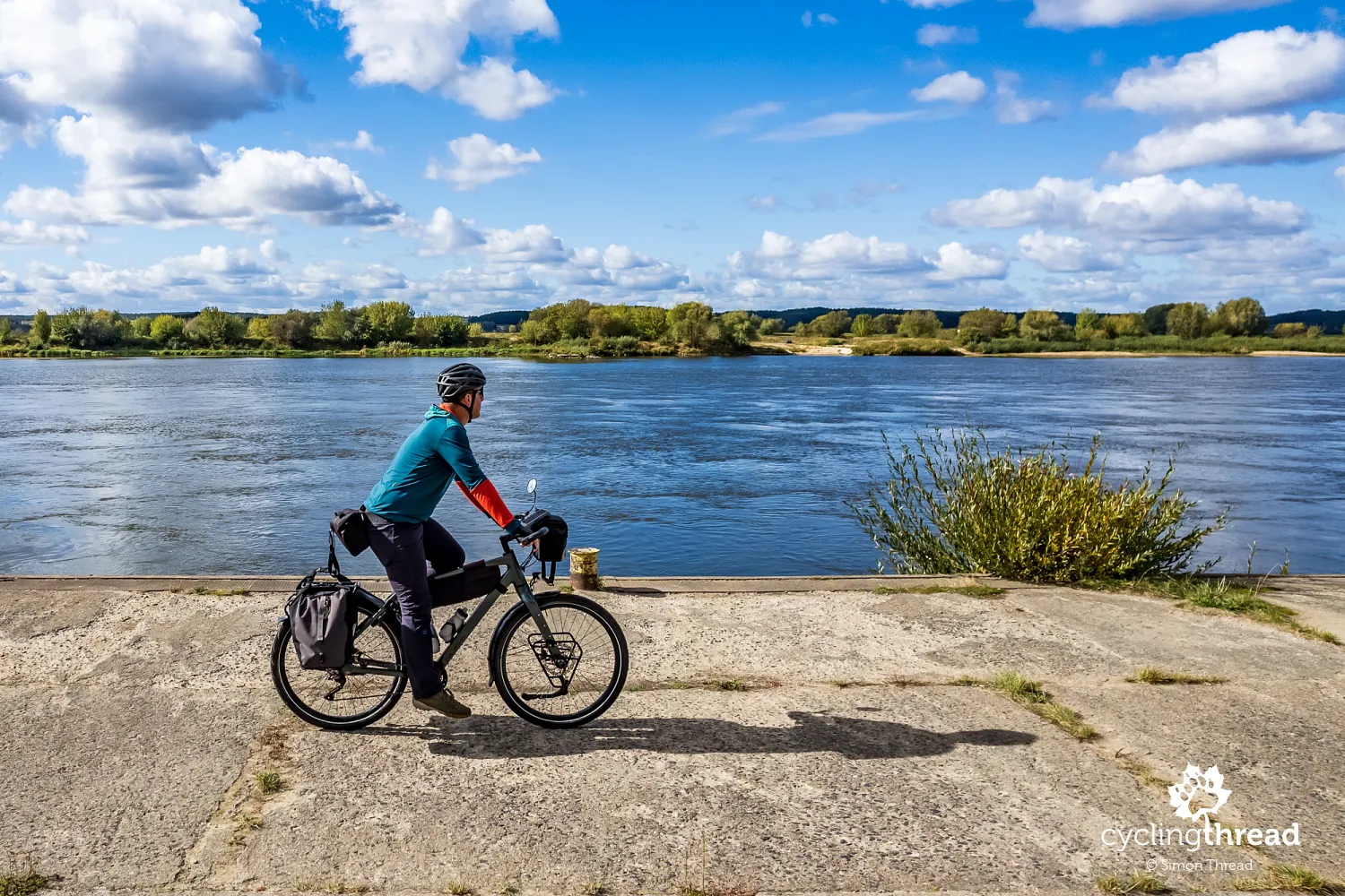
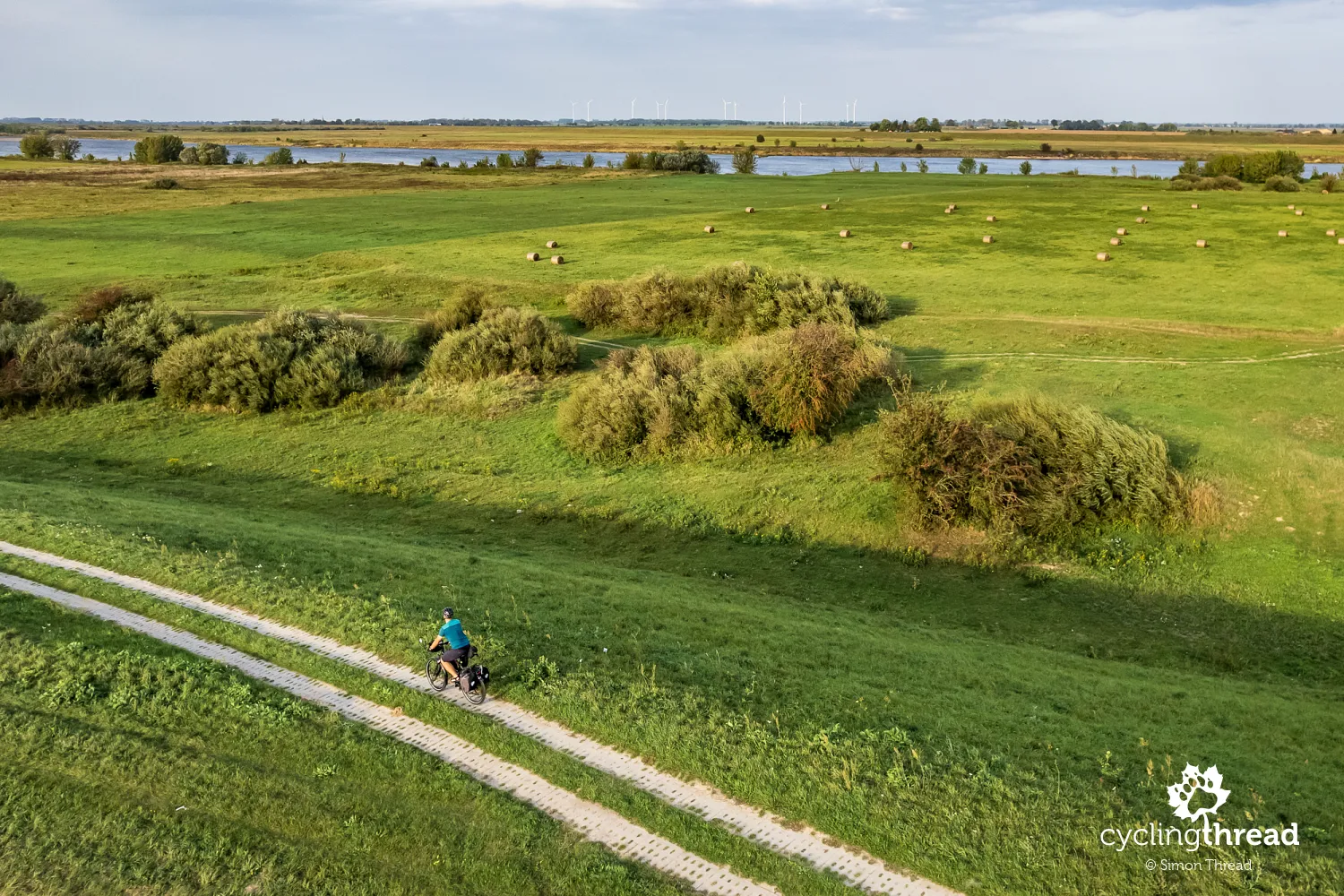
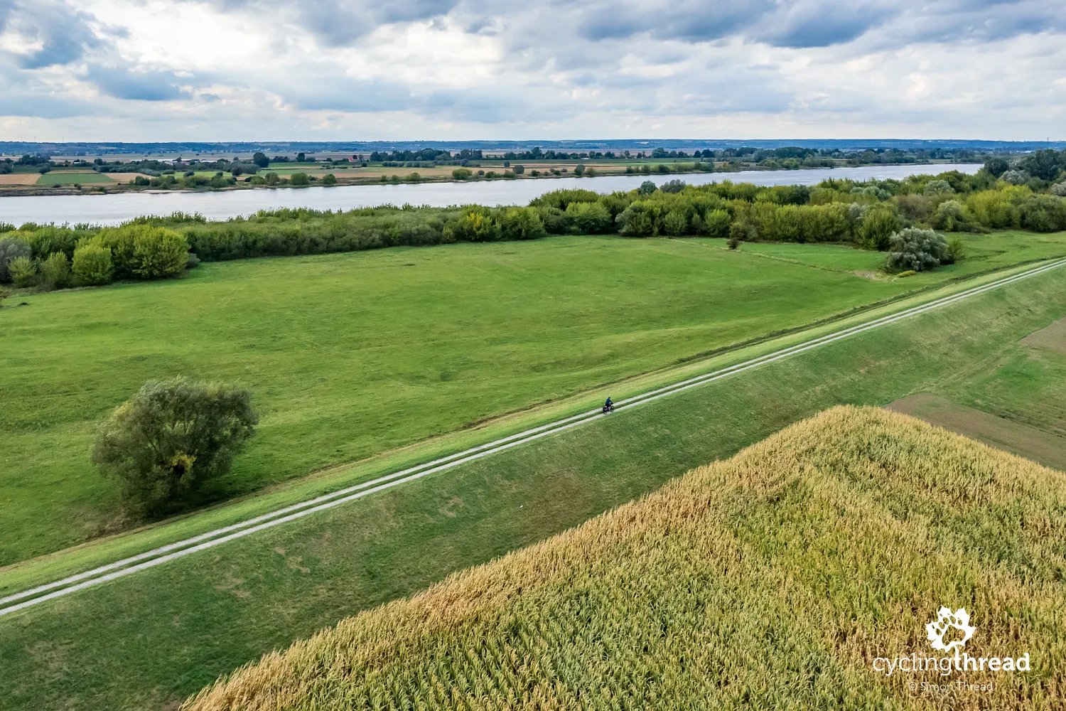
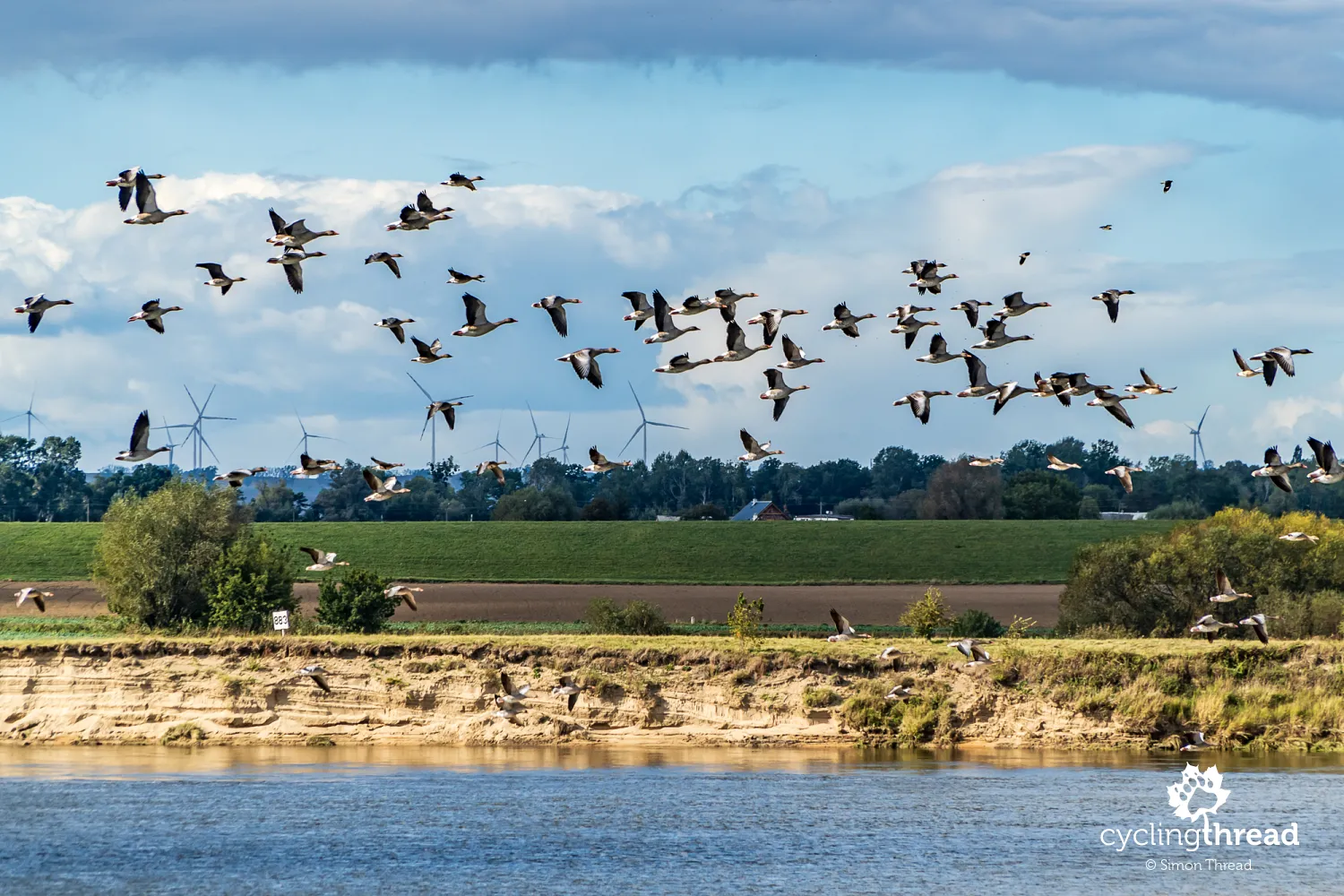
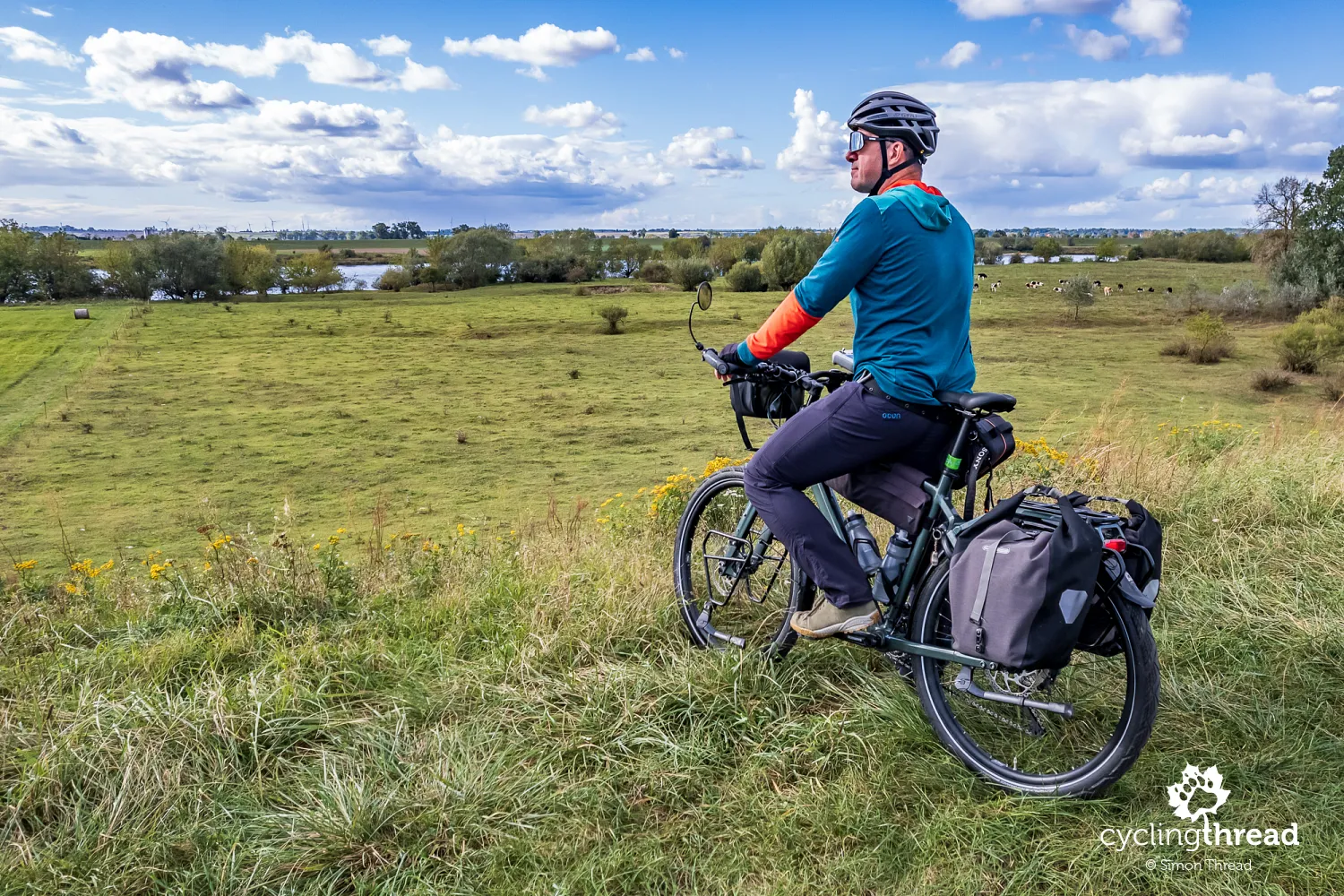
It's worth climbing the Vistula embankments
When the route runs along the outside of the embankment, at its base, it’s really worth stopping occasionally and climbing up to the top of the embankments to take in the expansive Vistula landscapes on the other side. The views from this perspective are often stunning - on one side, the river with its sandy banks, often dotted with flocks of birds, and on the other, vast fields, meadows, and scattered farmhouses. Especially in the early morning or late afternoon, when the light softly drapes over the landscape, you can witness beautiful scenes. It’s also a great idea to bring binoculars - along the Vistula, you can spot various bird species, from herons to cormorants, resting on the islands or searching for food in the shallow waters. These are perfect moments to catch your breath, stretch your muscles, and enjoy the wild, untouched nature that dominates much of the Lower Vistula Valley. These little breaks enrich the journey with unforgettable moments. One such moment I captured in a photo - a flock of several hundred tundra geese took off from one of the Vistula’s sandbanks and gave me a spectacular aerial show.
The highlight of this dection of the Vistula Cycling Route
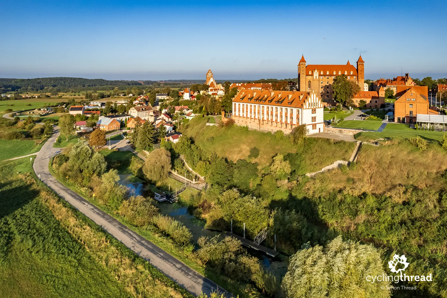
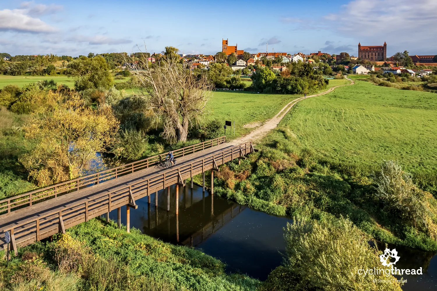
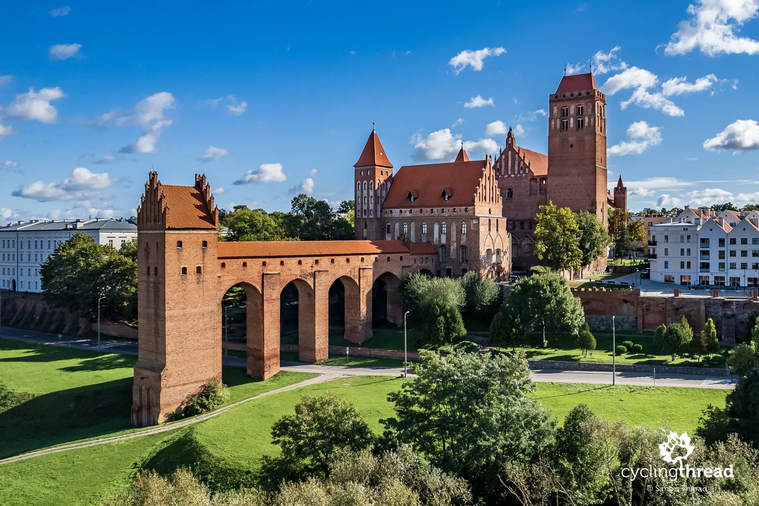
Kwidzyn suddenly emerges on the road as the most significant highlight of this section of the Vistula Cycling Route. The city’s impressive skyline is dominated by the striking silhouette of the Gothic castle and, more specifically, the castle’s latrine tower, known as the gdanisko. The arched connection between the gdanisko and the main structure of Kwidzyn Castle was a practical solution for the architects of the 14th century, but today, it lends the castle an unparalleled picturesque quality. Kwidzyn Castle is also unique because it’s connected to St. John the Evangelist Cathedral. Initially, a small church stood on this spot, which was later transformed into a cathedral by the Pomesanian Chapter, after the castle was built. The cathedral served not only religious functions but also defensive purposes, which is why it was integrated into the city’s fortifications and connected to the castle.
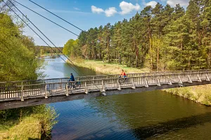
Several kilometers of bike paths on the route
Along the Vistula Cycling Route before Kwidzyn, through the city itself, and further — between Kwidzyn and b, and even beyond — the route includes several kilometers of bike paths built with EU funding for cycling infrastructure. This means that for a significant portion of the route, you can ride away from car traffic, though, unfortunately, the surface is made of paving stones rather than asphalt. Part of this investment in Kwidzyn is a bike path built along the former narrow-gauge railway line that leads towards the PKP station in Kwidzyn. And although, as seen in the photo, it's not the highest quality path, a few kilometers of car-free riding still adds up to about an hour of peaceful cycling. And that’s something to appreciate.
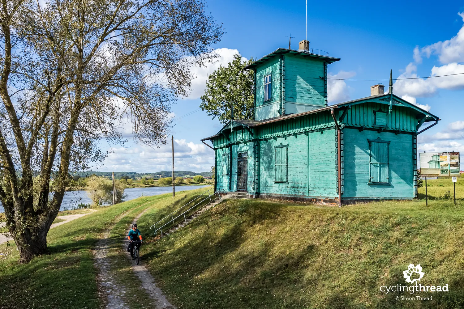
A water gauge that looks like a church
In Korzeniewo, on the flood embankment, near the old Vistula ferry, stands a small wooden house with a turret. This modest structure, its color reminiscent of some Podlaskie Orthodox churches, was built in the 19th century by the Prussian water administration and served as a water gauge. The water gauge mechanism operated on a system of connected vessels - inside the building was a well connected to the waters of the adjacent harbor basin, which, in turn, was linked to the Vistula River. Thanks to this system, a float in the well indicated the current water level of the Vistula on a circular dial visible through a small window facing the river. Unfortunately, this window is now boarded up. The mechanism ceased to function before World War II, and the building currently serves as a Roman Catholic chapel.
How the Vistula delta was formed
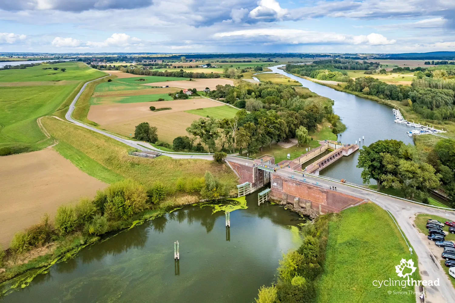
Following local roads with such light traffic that at one point the road is only one lane wide, the Vistula Cycling Route reaches Biała Góra. Here, you’ll find a complex of three locks used to regulate water levels in the Vistula, Nogat, and Liwa rivers, connected to one of those fascinating stories you can bring back from a trip along the Vistula. Today, it’s hard to imagine that in the 19th century, most of the Vistula’s waters flowed to the sea not via the Vistula itself, but through the Nogat, towards Malbork, and emptied into the Vistula Lagoon rather than the Gulf of Gdańsk. This caused navigation difficulties, sometimes even making it impossible to sail towards Gdańsk. To solve this problem, a canal was built, now known as the Old Nogat, whose dry bed you pass just beyond Piekło on the right-hand side.
A few decades later, the largest and most important lock in the Biała Góra complex was constructed. This new chamber lock limited the flow of water from the Vistula to the Nogat and helped create the hydrological system of the Vistula Delta that still functions today. The lock was equipped with massive, double-winged steel gates, closed during high water levels, which have become its distinctive feature. Until 1939, this was where the borders of Poland, the Free City of Gdańsk, and Germany converged, and on a nearby hill, now overgrown with trees, stood a Prussian monument - a large cross that was blown up by the Russians in 1945. Just a few meters from the main lock is the Wielki Upust, a lock separating the Liwa River from the Nogat, with remarkable architecture.
Entering the Vistula Żuławy
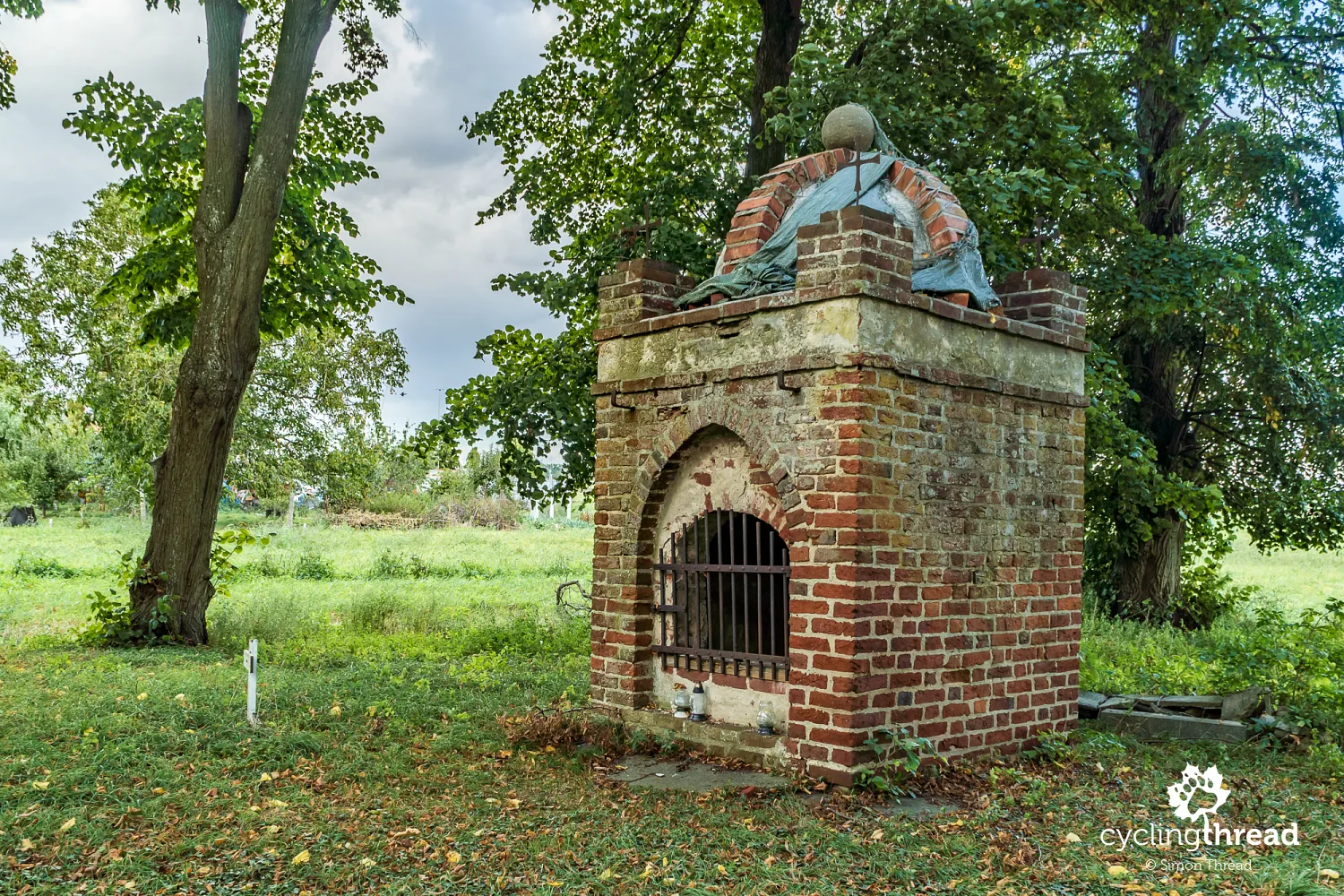
Beyond Biała Góra, you enter the region of the Vistula Żuławy. This area, with its flat, lowland landscape crisscrossed by drainage canals, has been intensively farmed for centuries, drained and protected from floods. Villages here have a linear layout, reflecting historical settlement and drainage efforts. Almost every village has a distinctive Gothic church, and often on the outskirts, you’ll find old Mennonite cemeteries — larger and better preserved than those I passed earlier in the Lower Vistula Valley, with many well-maintained tombstones, monuments, and plaques. A unique structure, just a few meters from the Vistula Cycling Route, is the ossuary in Bystrze, a Gothic chapel used to store the bones of the deceased. Be sure to take a peek inside!
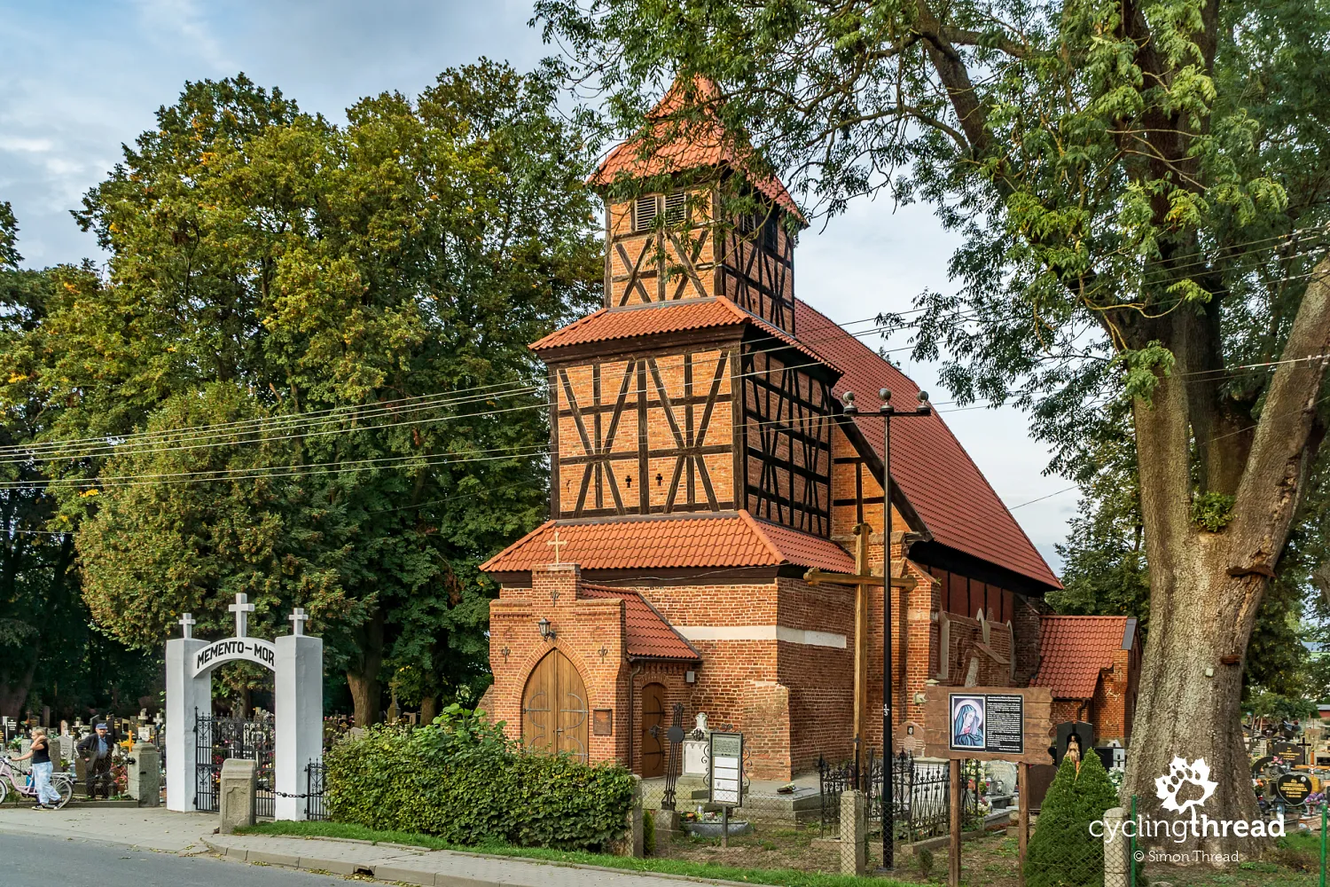
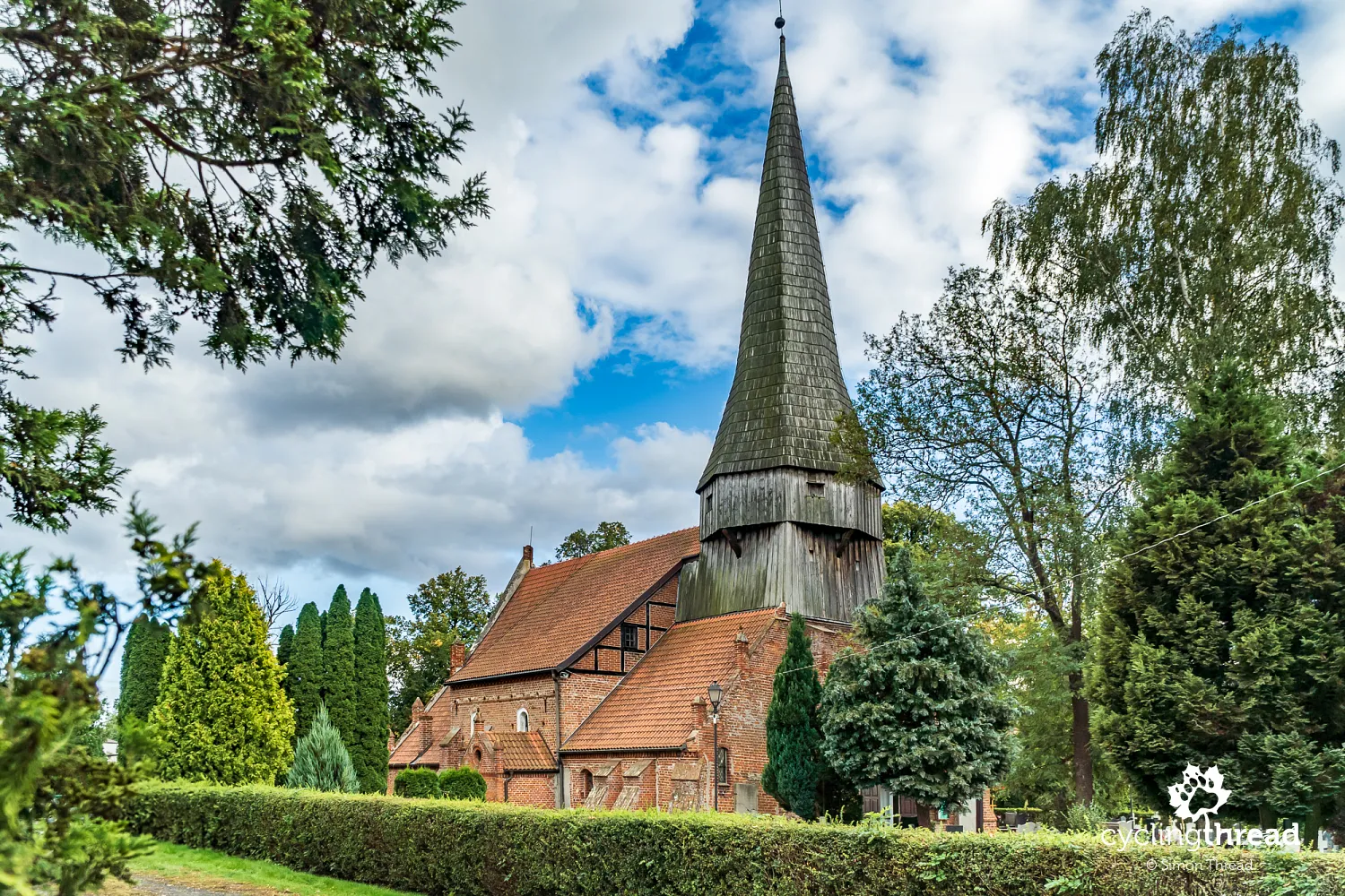
The churches in the Żuławy region were generally modest, due to the limited availability of building materials and the challenging terrain on which they were constructed. Traces in old structures even suggest that many of the churches, now brick, originally had wooden, timber-frame constructions. The churches typically have a single nave with a tower on the western side, and some feature towers with octagonal belfries topped with pointed wooden spires. The interiors are often covered with flat beam ceilings, with brick vaults being a rarity. The first churches you’ll encounter on the Vistula Cycling Route are those in Mątowy Wielkie, Kończewice and Lisewo Malborskie. Each is different, each unique, but all share the special spirit of the Żuławy.
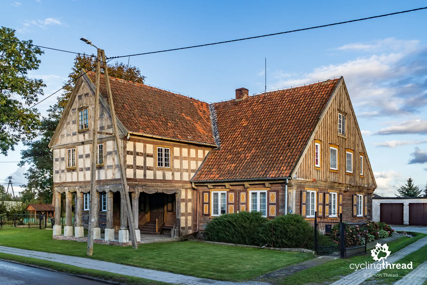
Adding to the charm of the Żuławy landscape are the beautiful arcaded houses. These distinctive structures are a testament to the wealth of the region’s farmers and the uniqueness of the area. The arcades, supported by wooden columns, served both a practical function - as a storage and work area - and a decorative one, adorning the facades of these solid buildings. Built from the 17th century onward, these houses were often part of larger farmsteads, blending into the landscape of fields, meadows, and canals. The wooden constructions and decorations of these arcaded houses highlight the high level of craftsmanship, and they serve as precious remnants of the region's rich history. Fortunately, some of these houses have been lucky to find residents who have become guardians of the Żuławy-Mennonite traditions.
The route starts and ends with a great bike path
The ride along both banks of the Vistula in Pomorskie ends with the same delightful highlight that started our trip. Between Drewnica and Mikoszewo, I rejoin a bike path that runs almost along the crown of a wide, expansive flood embankment. On the other side, the sun was setting, and my thoughts were already turning toward home - I still had to cross the Vistula by foot-passenger ferry from Mikoszewo to Świbno, and then the last dozen or so kilometers along Gdańsk’s bike paths. A word of warning - the Świbno-Mikoszewo ferry operates only from the May long weekend until the end of September, so earlier or later in the year, the nearest crossing is at the bridge in Kiezmark.
Who is the Vistula Cycling Route for?
There isn't a simple answer to this question. Ideally, it would be great to say "for everyone," but unfortunately, that’s not the case. The lack of cycling infrastructure on the left bank above Knybawa (looking downstream) and on most of the right bank (between Grudziądz and Drewnica, with a few exceptions) means that riding the entire Pomeranian section of the Vistula Cycling Route is best suited for those who don’t mind sharing the road with cars. Although traffic is generally light, it’s something to be expected at any moment. Families with children and those seeking complete comfort and safety will find it on the excellent cycling paths between Gdańsk and Tczew - currently the area with the best cycling infrastructure in the region, but clearly located outside the urban core of Gdańsk.
Up-to-date information and map online
You can always find an up-to-date GPX file with the GPS route and a short guide to the Vistula Cycling Route on the website of the Department of Tourism and Sports of the Marshal's Office of the Pomeranian Voivodeship, which manages the WTR in Pomorskie and the Pomorskie section of EuroVelo 9. On the site ptr.pomorskie.eu, there’s a map of all the cycling routes managed by the Pomeranian Voivodeship. One interesting feature of the map is the information about the status and potential construction schedule for missing sections of cycling routes in the region. On the trail itself, you’ll often find practical information on large, detailed signboards with maps, usually located at cycling rest areas.
With joy and satisfaction, but also wanting more
I rode the Vistula Cycling Route in Pomorskie with great joy and scenic satisfaction, but also with a touch of longing. The Pomorskie WTR is a fantastic route for sightseeing, discovering new places, full of interesting spots, lesser-known gems, and stories that change your perception of the region. It offers peaceful panoramas and soothing Vistula landscapes. However, despite riding most of the trip on relatively safe roads, I missed having more dedicated cycling infrastructure, like the comfortable bike paths between Gdańsk and Tczew. I dream of a day when the entire 300 kilometers along both banks of the Vistula can be ridden exclusively on paths separated from cars — with the rich scenic content it offers, it would be a cycling feast that not only Małopolska but all of cycling Europe would envy.
Another great cycling route
In conclusion, the Vistula Cycling Route in Pomorskie, a section of Poland’s EuroVelo 9, is yet another route worth adding to your list. Maybe it’s best to tackle it in autumn, outside of peak season, when accommodation is easier to find, sweat doesn’t trickle down your back, and the castles in Gniew and Kwidzyn aren’t buzzing with noisy tour groups. A multi-day trip along both banks of the Vistula would be a truly wonderful experience :-)
Back to topHave a safe ride! 💚
Simon Thread
(Szymon Nitka)
I'm a passionate cycling traveler and the voice behind Cycling Thread. I explore Europe on two wheels, documenting the most scenic routes, inspiring places and cyclist-friendly practices. My writing blends personal experience with practical insights and a deep love of travel. I'm also a contributor to National Geographic Traveler magazine.