Cycling the Netherlands: the Waterline Route through canals and forts
The Netherlands is famous for its huge share of bicycle traffic in everyday life, and the Waterline Route is one of the country's most interesting long-distance cycle routes. Leading through the heart of the Netherlands along former Dutch water defence lines, it became our choice for finding out what cycling tourism in the country really looks like. Can you also meet crowds of cycle tourists on Dutch bicycle routes and what does the infrastructure for longer journeys look like? We set off through canals, fortresses, windmills and historic Dutch landscapes to find out.
Join us on our new 🟢 Komoot account!
Cycling Partners
Route on the map
GPX file (GPS track): cyclingthread.com-netherlands-2023.gpx
The Waterline Route in the Netherlands
- The Waterline Route in the Netherlands
- Following the former Dutch water defence lines
- From north to south across the Netherlands
- Famous windmill sites in the Netherlands
- Dutch solutions for cycling safety
- Koga WorldTraveller out of the box
- Cycling along the North Holland Canal
- Zaanse Schans - a famous windmill site
- Cycling along Dutch water defence lines
- The impressive infrastructure of the Netherlands
- The history of Dutch fortifications at Muiderslot
- Naarden - a star-shaped fortified town
- Legakkers created by peat extraction
- Cycle the Dutch "2 minus 1" road
- Too short a stay in beautiful Utrecht
- The world’s most famous rainbow cycle path
- An overnight at a campsite in a fort
- Every fort is a piece of Dutch history
- The best-preserved Dutch fortified towns
- Peace and quiet in De Biesbosch National Park
- Easy navigation thanks to the Dutch knooppunten
- Pleasant Breda at the end of the trip
- The Waterline Route among the best
- Peaceful stays at Dutch campsites
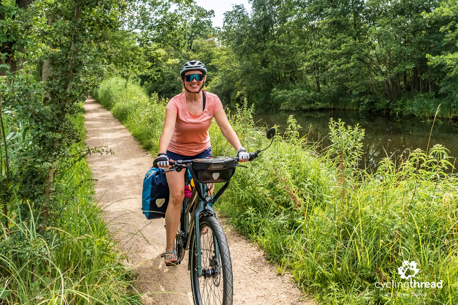
- The first kilometres on Koga bicycles
- Amsterdam as an interesting addition to the route
- An excellent journey along the Dutch waterlines
The Waterline Route in the Netherlands
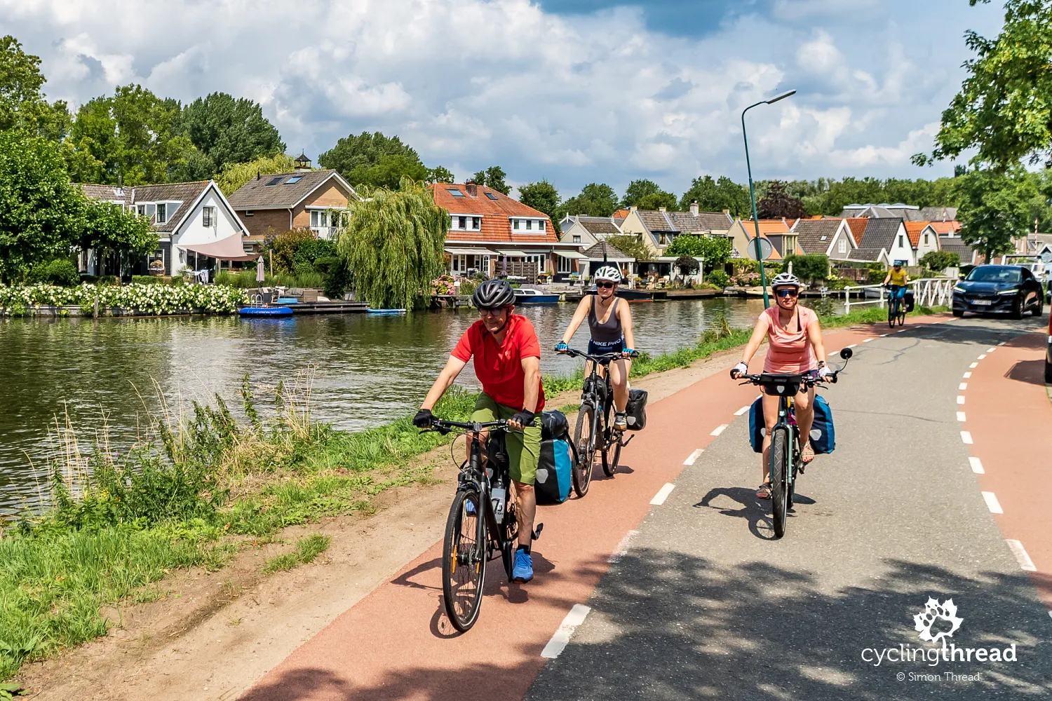
The original name of the Waterline Route is LF Waterlinieroute, where the abbreviation "LF" comes from the Dutch term Langeafstand Fietsroutes, meaning long-distance cycle routes. It is a route for cyclists interested in the history of the Netherlands, old fortifications and the characteristic Dutch polder landscape. The route leads through quiet lowland areas, towns connected with Dutch water management and areas of former defensive water lines. Thanks to very good cycling infrastructure and a dense network of services, both couples and small groups, as well as solo travellers, will feel comfortable here. Planning daily stages is not difficult and most towns along the way offer accommodation, restaurants and convenient access to public transport. It is worth remembering, however, that some sections follow public roads with local car traffic, so the route may not be the best choice for families with small children.
Following the former Dutch water defence lines
The Waterline Route follows the former Dutch water defence lines that were added to the UNESCO World Heritage List - the Stelling van Amsterdam, a ring of forts around Amsterdam, and the New Dutch Waterline (Nieuwe Hollandse Waterlinie). The Dutch used water as a natural defensive weapon - in times of danger, they could deliberately flood large areas between the forts, creating shallow wetlands impossible for infantry, horses, and artillery to cross. A system of canals, locks, dikes, and pumps allowed them to precisely control the water level in the polders and protect the most important cities and roads leading to Amsterdam. Forts were built in places where enemies could try to bypass the flooded areas - near dikes, bridges, railway lines, and higher parts of the landscape.
From north to south across the Netherlands
The route begins in Edam on the shores of Lake Markermeer, among the northern polders and former port towns. The first section leads towards Haarlem through land reclaimed from the sea, a network of canals and coastal plains connected with the Dutch flood protection system. The route makes a wide loop around Amsterdam and reaches Muiden and Naarden - places linked to the Old Dutch Waterline, where bastion fortresses, locks and dikes once used for controlled flooding of the polders can still be seen. The next part of the route continues towards Utrecht, one of the key points of the former Dutch defence system.
South of Utrecht, the route crosses the Lek and Waal - distributaries of the Rhine - and reaches Woudrichem, located at the meeting point of the Meuse and Waal rivers. In its final section, the route passes near De Biesbosch National Park - a delta landscape of the Rhine and former wetlands - towards North Brabant. Officially, the route ends in Bergen op Zoom, in the low-lying coastal areas connected with the North Sea. We shortened our journey along the Waterline Route because of logistics and convenient train connections. As a result, we started cycling in Purmerend and finished in Breda.
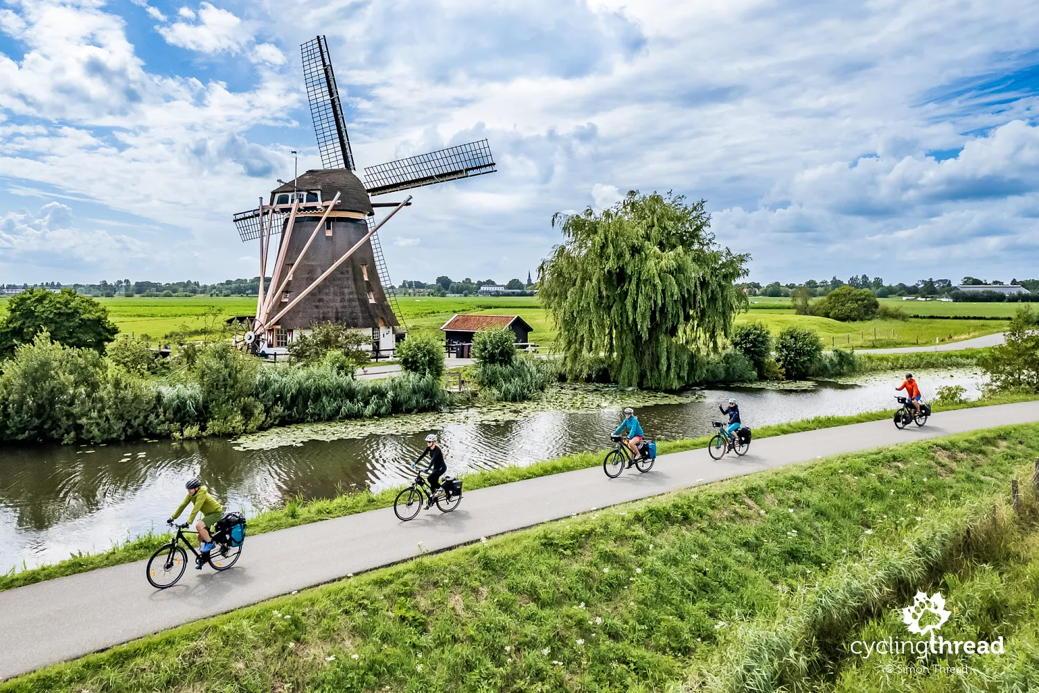
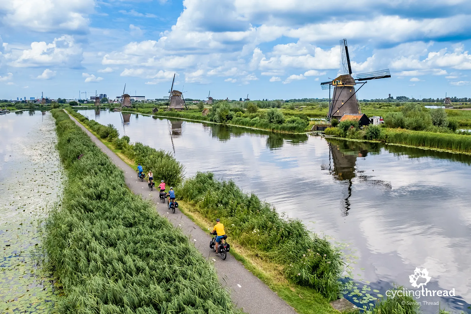
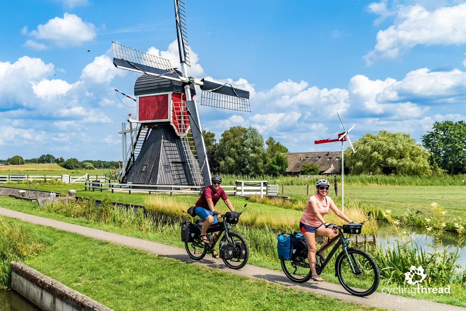
Famous windmill sites in the Netherlands
A big attraction of the Waterline Route are two famous places where you can see larger groups of traditional Dutch windmills in one location. Although they are not located directly on the route, the short distance makes it possible to visit both during a journey along the former Dutch water defence lines. The first is the famous Zaanse Schans, located north of Amsterdam near Zaandam. It is one of the most recognizable landscapes in the Netherlands - several historic windmills standing along canals and former industrial areas of the Zaan region. The second place is the much larger and more spectacular Kinderdijk near Rotterdam. Along the canals and water management system, there are as many as 19 historic windmills listed as a UNESCO World Heritage Site.
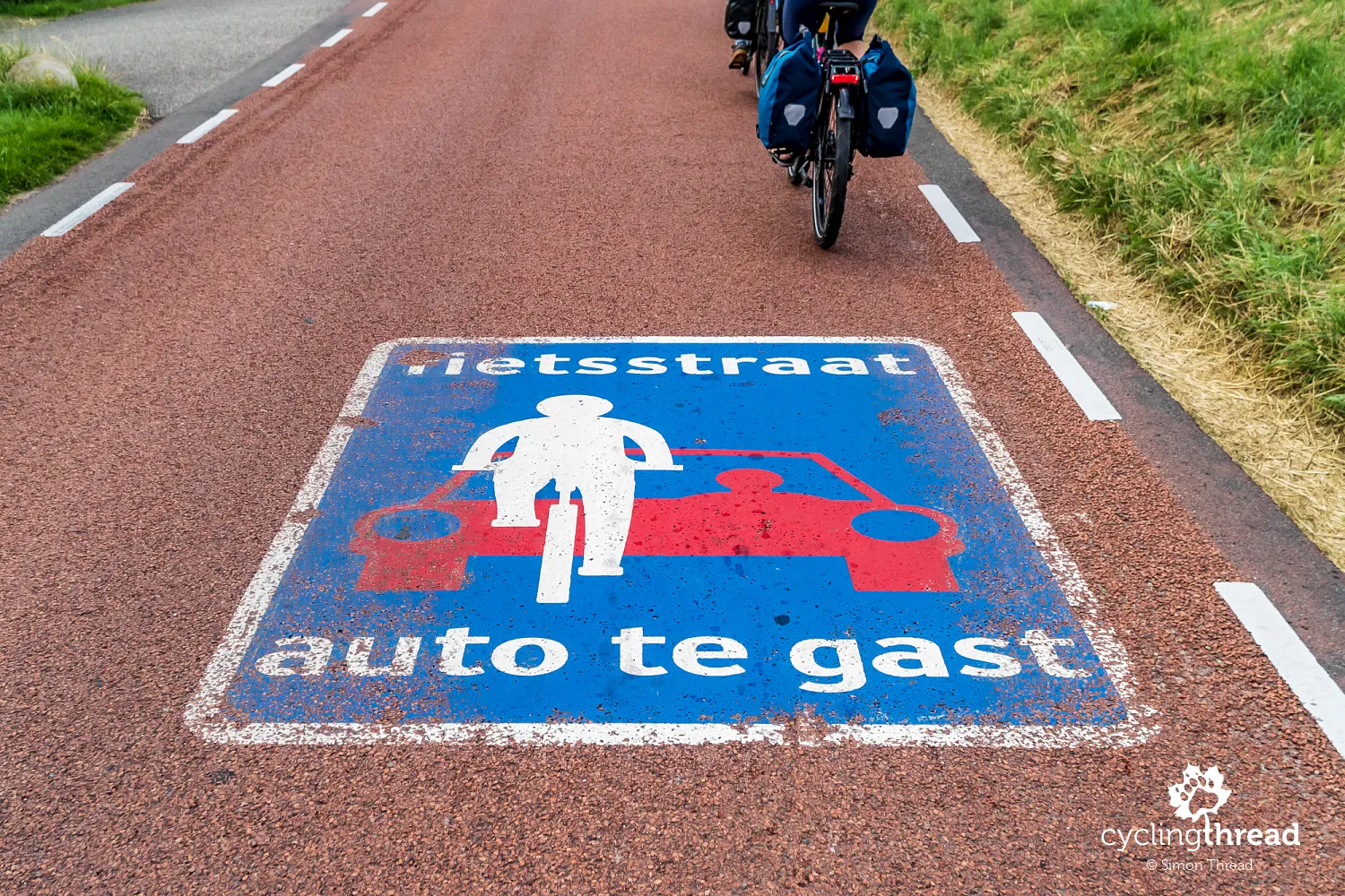
Dutch solutions for cycling safety
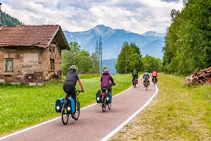
The route along the Dutch fortifications mainly follows asphalt surfaces running beside canals and rivers, often along the tops of flood protection dikes. Dedicated cycle paths and quiet local roads dominate the route, leading between former forts and elements of the Dutch water defence lines. Two solutions typical for the Netherlands, designed to improve cycling safety, can often be seen along the way. The first is the fietsstraat, or "bicycle street", where cyclists have priority and cars are treated as “guests”, expected to adapt their speed to bicycle traffic. The second is the "2 minus 1" road, where cars share a narrow carriageway with cyclists.
Gravel or natural surfaces appear very rarely and are usually limited to short sections in protected areas or access roads leading to forts. In historic towns and around former fortifications, there are short stretches of cobblestones and stone surfaces on old squares and streets. Thanks to the high driving culture in the Netherlands, sections along public roads do not noticeably reduce comfort or the feeling of safety during the journey. Still, it is worth keeping them in mind, especially when planning a trip with small children or people less confident in road traffic.
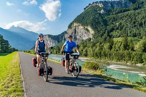
Koga WorldTraveller out of the box
Before we started, however, one more pleasant task was waiting for us. In Heerenveen, at the central warehouse of the Dutch brand Koga, we had to collect Ola's bicycle - the new Koga WorldTraveller model. If someone says that setting off on a multi-day journey with a completely new bicycle is risky, then... apparently it does not apply to Koga ;) From the very first kilometres, the bicycle performed flawlessly and it quickly turned out to be one of the most comfortable bicycles we have ever ridden. At first glance, the WorldTraveller may seem like a bike that is too massive for the flat Dutch routes, but in practice it shows its advantages perfectly during long hours of riding with luggage. Its slightly higher weight and wider tyres are effectively balanced by excellent stability, very well-designed geometry and high-quality components that make the bicycle feel light and enjoyable to ride.

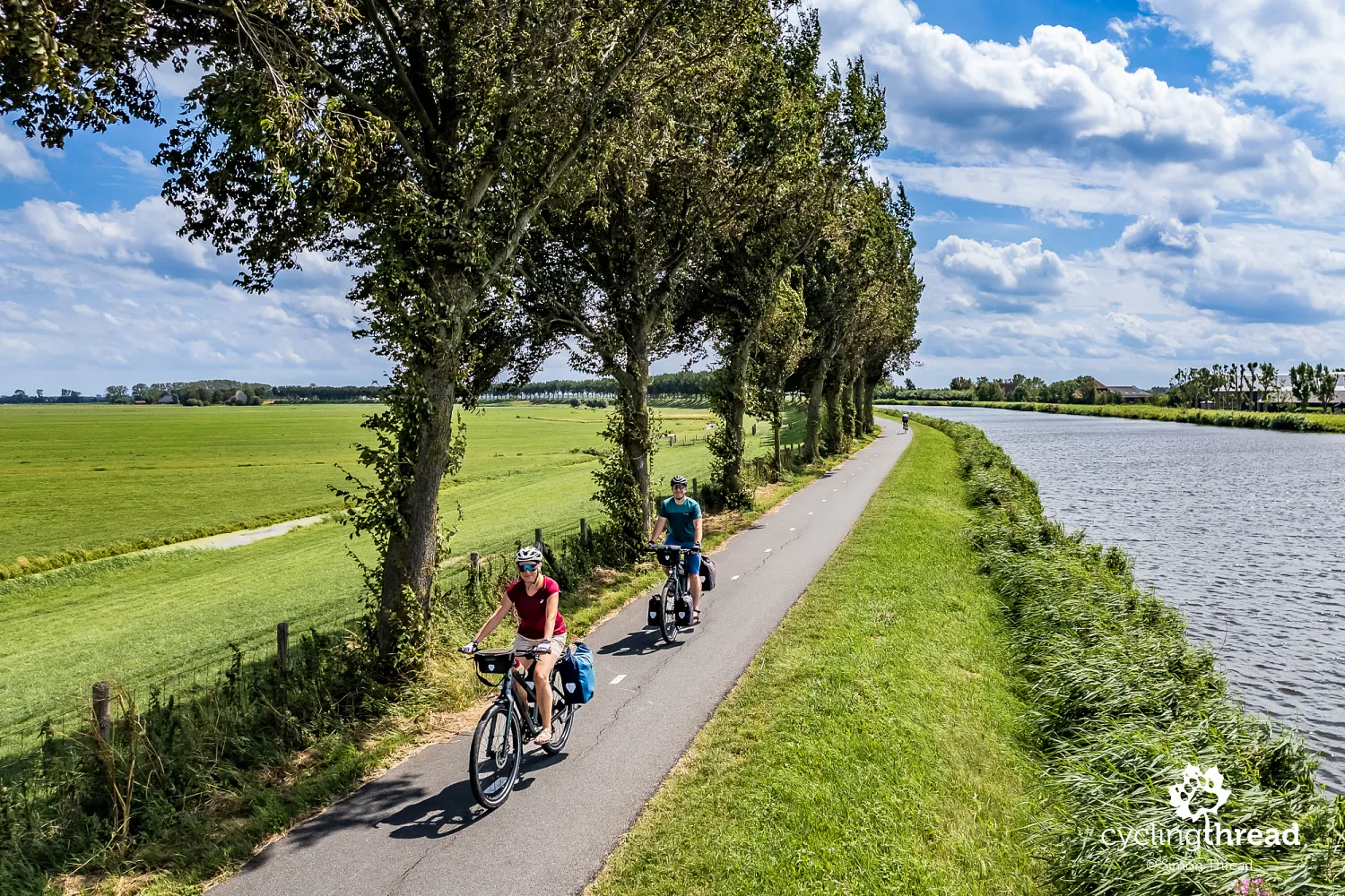
Cycling along the North Holland Canal
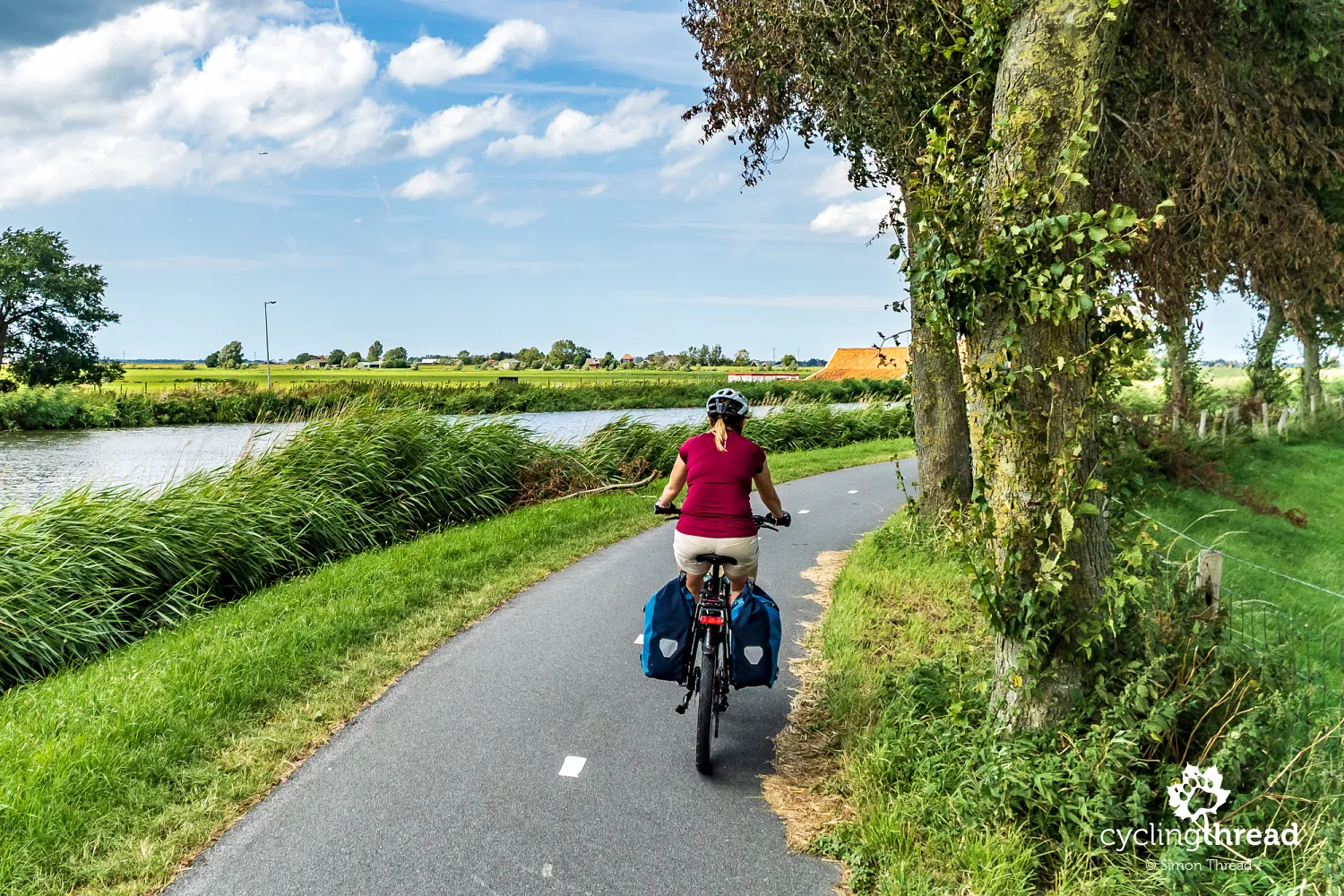
We started the Waterline Route in the quiet small town of Purmerend. Very quickly, we found ourselves on a picturesque cycle path along the North Holland Canal. The Noordhollandsch Kanaal was one of the most important hydraulic engineering projects of 19th-century Netherlands. Built between 1820 and 1824, the canal connected Amsterdam with the port of Den Helder, creating a new route for ships travelling from the North Sea to the Dutch capital. The canal was around 75 kilometres long and for several decades served as the main route for large ocean-going ships, which were towed through northern Holland for even more than a dozen hours. Over time, however, the canal turned out to be too narrow and too winding, and after the opening of the North Sea Canal in 1876, it lost its strategic importance. Today, the Noordhollandsch Kanaal mainly serves recreational, transport and flood protection purposes, while its banks belong to the most characteristic landscapes of cycling northern Holland.
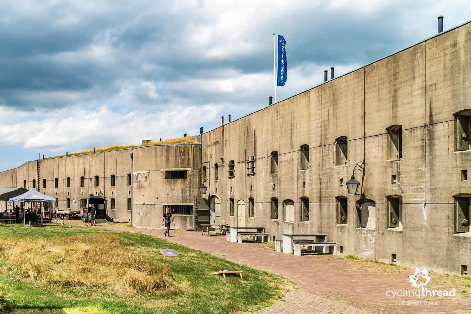
After a few kilometres, the cycle route reaches Fort bij Spijkerboor - the largest land fort of the former Stelling van Amsterdam, hidden among the polders of the Beemster region near Purmerend. Built at the turn of the 19th and 20th centuries, it was designed to protect the western Beemsterringvaart canal and the roads leading to Amsterdam in case the surrounding areas were flooded. It was one of the most modern and best-armed forts of the entire defence line - among other things, it was equipped with an armoured dome with a double quick-firing gun from 1911, preserved to this day. Fort bij Spijkerboor is one of the most characteristic places along the LF Waterlinieroute. Today, visitors can explore its interiors, former ammunition storage rooms and shelters.
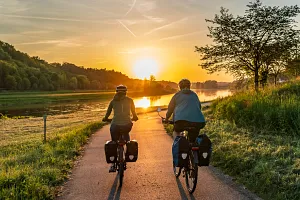
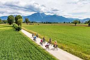
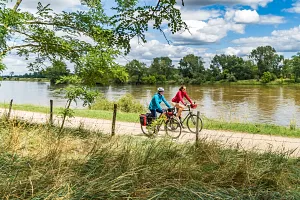
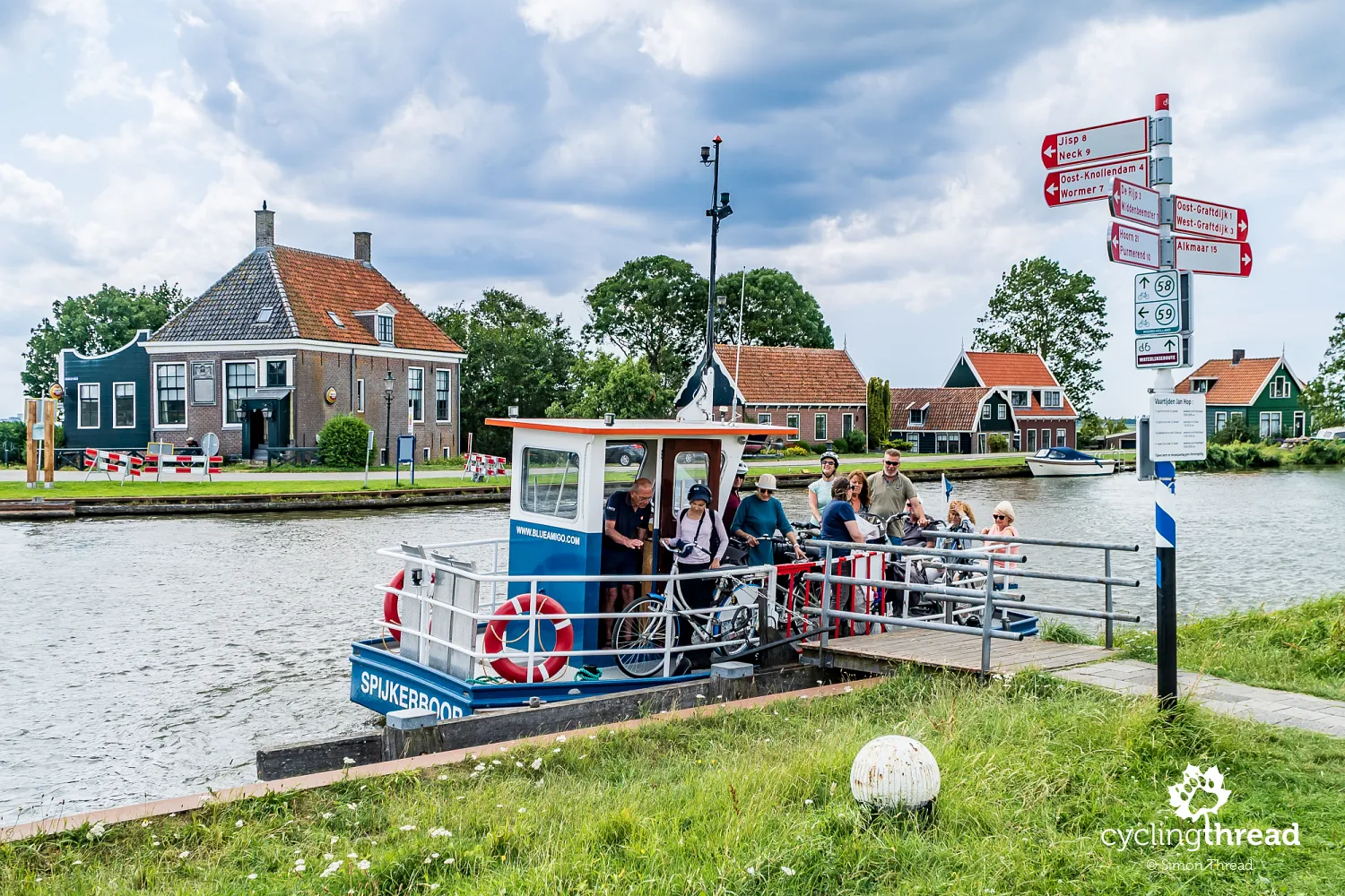
In this area, we notice a scene that perfectly introduces the atmosphere of cycling Holland - and the Netherlands in general. A small bicycle and pedestrian ferry is just arriving at the landing stage on the Vinkenhop canal, and a group of passengers steps ashore, most of them, of course, cyclists. Right next to it stands a characteristic bicycle signpost with markings for the Waterline Route and numbers from the Dutch cycling junction network. In the background, there is the typical peaceful residential landscape of the area, crossed by water, small bridges and local bicycle roads. This canal-and-cycling atmosphere will accompany us throughout the next days of our journey through the Netherlands.
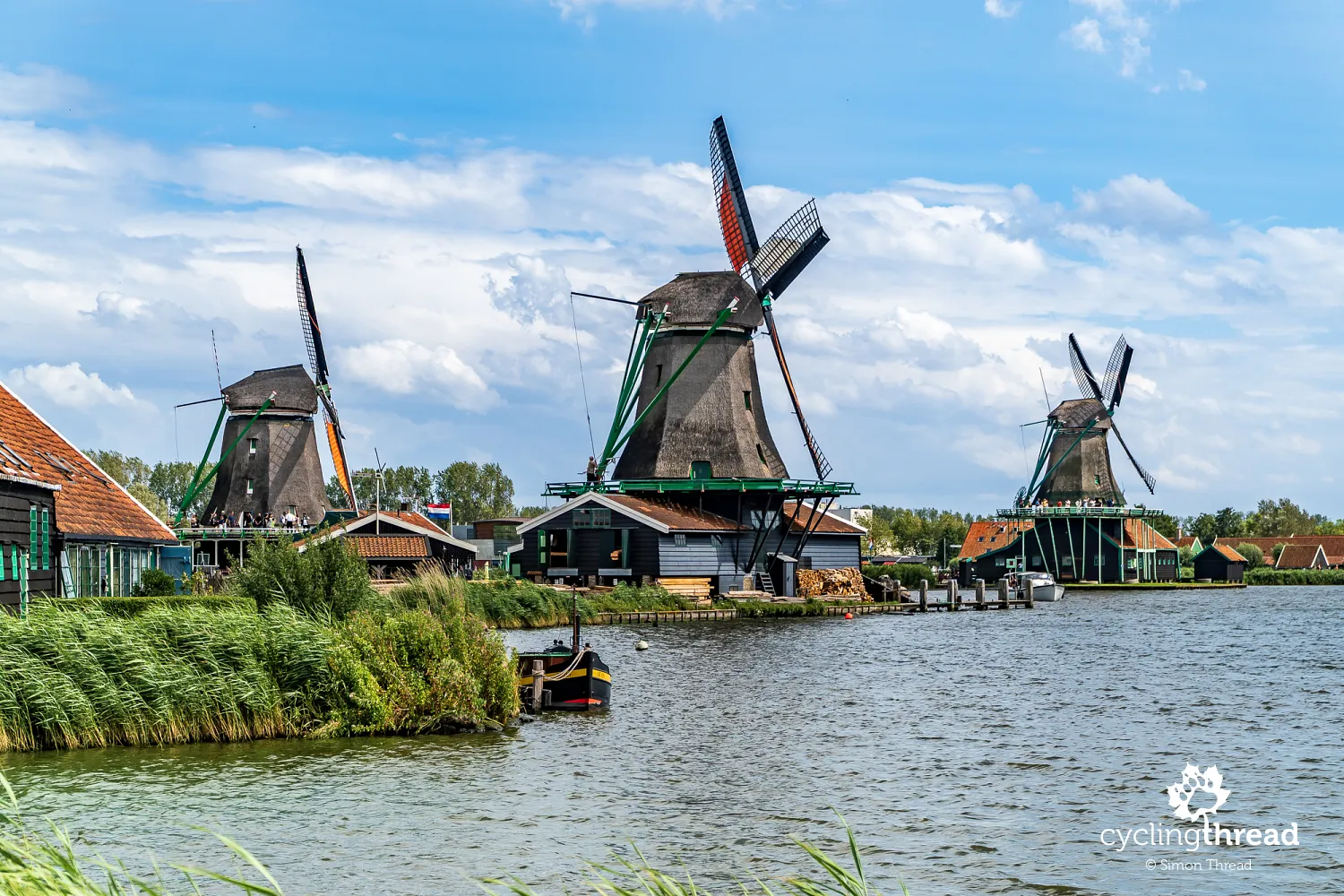
Zaanse Schans - a famous windmill site
We slightly modified the next section of the route to reach the first of the famous windmill locations - Zaanse Schans. It is an open-air museum of the Dutch landscape and industry from the 18th and 19th centuries, where traditional wooden houses, warehouses, workshops and eight characteristic windmills standing along the River Zaan have been preserved. Some of them are still operating, and visitors can see former sawmills, oil mills and windmills once used for grinding spices. For centuries, the area was one of the most important industrial centres in the Netherlands, using wind power to drive hundreds of production facilities. It was here that one of the first modern industrial regions in Europe developed, connected with timber processing and the production of paints, spices and food.
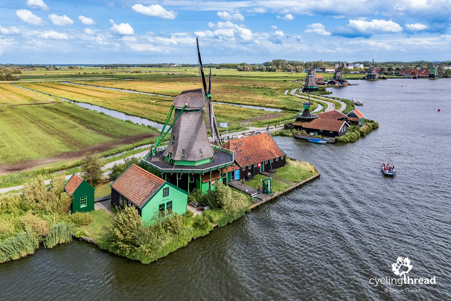
Today, Zaanse Schans is one of the most popular tourist attractions in the Netherlands and one of those places where you can truly experience overtourism - especially in summer and during the middle of the day, when the narrow roads and the area around the windmills become extremely crowded. So if you want to see one of Europe's famous postcard-and-Instagram locations, it is worth making a short detour from the route. For us, however, Zaanse Schans was quite disappointing. It is just a handful of windmills, most of them moved here from other locations. The place looks picturesque mainly from one direction - from the river side. Once you turn the camera around, you see ordinary buildings on the opposite bank of the River Zaan, which take away much of the atmosphere. Probably the best way to describe it is to say that in terms of scenery, Zaanse Schans simply cannot compare with the truly beautiful Kinderdijk.
After a few kilometres, we return to the Waterline Route and the ring of fortifications of the Stelling van Amsterdam, which still makes a wide arc around the Dutch capital. Here, the route passes through a typically Dutch landscape of canals, polders and wet meadows separated by a network of dikes and locks. We pass small towns and the suburbs of Amsterdam, frequently using both cycle paths and the previously mentioned bicycle streets. Unfortunately, the section around Haarlem mainly reminds us of pouring rain, from which we quickly escape to our accommodation. So we leave exploring beautiful Haarlem for our next journey in the Netherlands. Maybe along EuroVelo 12?
Cycling along Dutch water defence lines
When we continued our bicycle journey after the rainy afternoon of the previous day, the images of beautiful, ordinary Holland returned. And so did the fortifications - another section of the ring of defences around Amsterdam, the Stelling van Amsterdam. Among them is Fort aan de Drecht in Uithoorn - a concrete fort from 1911, built along the River Drecht as part of the defence system protecting the southern approaches to Amsterdam. Like many other forts of this line, it was meant to defend places that could not be flooded with water - roads, dikes and higher areas of land. In front of the main building, the original armoured artillery position has been preserved, reminding visitors of the military nature of the entire system. Today, the former military site has been restored and now houses exhibition spaces, workshops and small food venues.
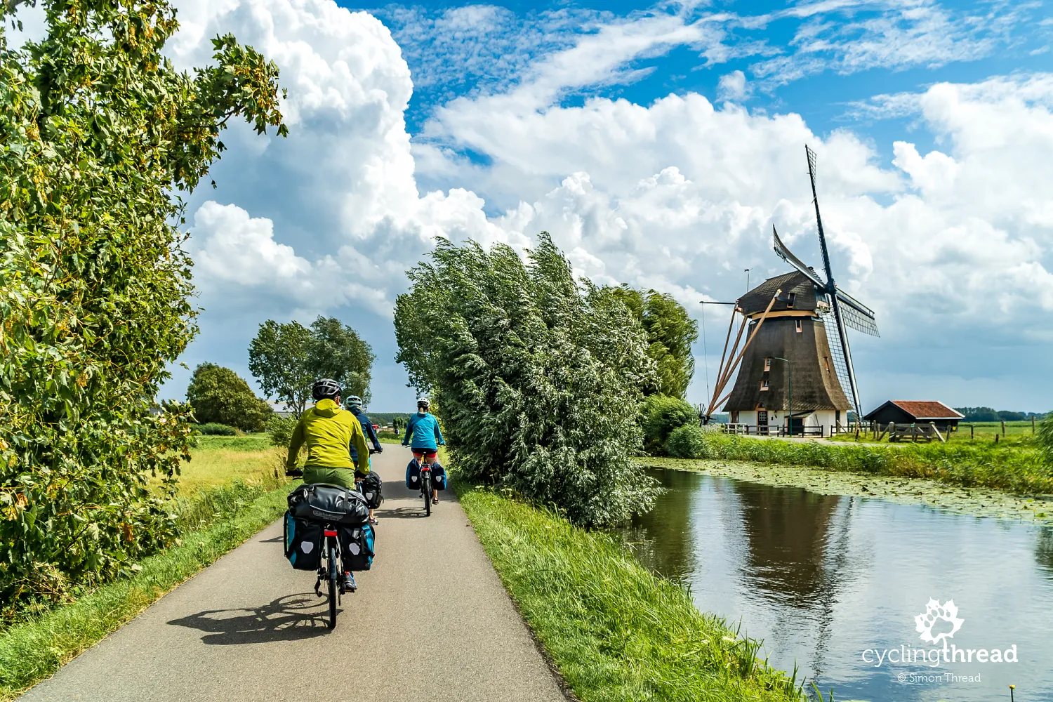
Just beyond Uithoorn begins one of the most beautiful sections of the entire route - several kilometres of bicycle street running along the small River Oude Waver, and later the slightly larger Gein. Right on the edge of Amsterdam, the landscape suddenly opens up, and the river guiding us winds gently through the Dutch countryside. The essence of this section is a beautiful scene with the Mondriaan windmill in the leading role, which became one of my favourite photos from this trip. The windmill is still operational and there is even a small guesthouse inside. Interestingly, the windmill takes its name from the painter Piet Mondrian, considered one of the pioneers of abstract art, who included the windmill on the River Gein in more than a dozen of his paintings.
A little further on, we pass another fort of the Stelling van Amsterdam - Fort bij Nigtevecht, located along the Amsterdam-Rhine Canal where important waterways and former transport routes leading to Amsterdam intersect. The fort was built at the end of the 19th century as part of the Dutch water defence system and was intended to protect areas that could not be effectively flooded in the event of an attack. Its characteristic features are the earth embankments, brick barracks and the wide moat surrounding the entire complex. Originally, the fort also had armoured artillery towers, but during the Second World War they were dismantled by the Germans and removed for use in other fortifications. Today, the interior houses a modern interactive exhibition called "Armed with Water" ("Bewapend met water"), explaining how the Dutch water lines worked and what life looked like for the soldiers stationed here during the First World War. Visitors can see, among other things, a presentation showing how the flooding of the land around the fort was controlled.
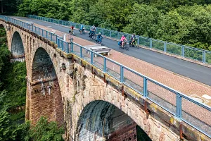
The impressive infrastructure of the Netherlands
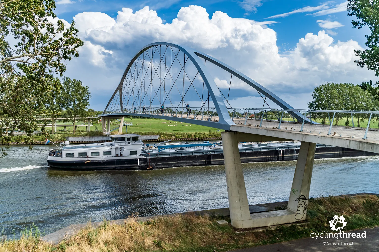
Just a few hundred metres further stands an impressive piece of cycling infrastructure - the Liniebrug. This modern crossing for cyclists and pedestrians passes over the Amsterdam-Rhine Canal and was designed in a characteristic lightweight form with a high steel arch structure. The bridge was built specifically for bicycle traffic and forms part of the cycling route between Amsterdam and Utrecht. Its most distinctive feature is the long, gentle ramps that allow cyclists to comfortably overcome the significant height difference above the heavily used shipping canal. From the top, it is possible to watch traffic on one of the country's most important waterways - barges, cargo vessels and recreational boats regularly pass below. It is also one of the bridges I previously described in my article about the most interesting cycling bridges in Europe.
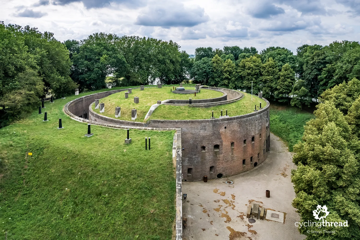
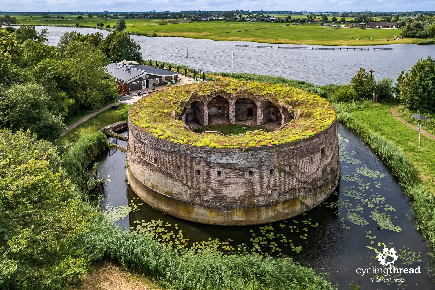
Even though the Stelling van Amsterdam defence line is slowly coming to an end, there is still plenty to see. One of the last forts along our route is Fort Uitermeer, beautifully located along the River Vecht and surrounded by wetlands and meadows. The first fortifications were built here as early as the 19th century, although the current fort was later rebuilt as part of Amsterdam's water defence system. Its characteristic feature is the low, circular form with a central courtyard hidden behind thick walls now covered with grass - almost like modern apartment buildings with green roofs. Thanks to this design, the fort was more difficult to shell and at the same time blended well into the flat polder landscape. Its role was to control nearby dikes, locks and crossings that could allow enemies to bypass the flooded areas.
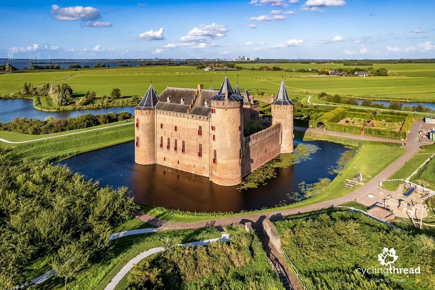
The history of Dutch fortifications at Muiderslot
At the mouth of the River Vecht into the former Zuiderzee lies one of the final fortifications of the Stelling van Amsterdam - the Western Battery in Muiden. On the opposite side of the river stands the famous Muiderslot. For centuries, this medieval castle controlled the important water route leading to Amsterdam and already much earlier had a defensive role in this region. During the time of the Stelling van Amsterdam, the area around Muiden once again gained strategic importance - it was here that the system of locks, dikes and fortifications was meant to protect the eastern approaches to the city. Today, Muiderslot looks almost like a classic Dutch postcard castle - with its brick structure, towers and moat surrounding the walls. Inside, visitors can explore historic living quarters, collections of weapons, old kitchens and exhibitions dedicated to medieval life and the history of Dutch fortifications.
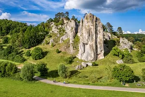
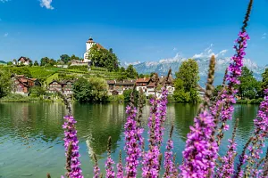
Naarden - a star-shaped fortified town
Another postcard-like view appears on the screen of our drone after a few more kilometres on the route. It is Naarden - one of the best-preserved fortified towns in Europe, famous for its characteristic star-shaped layout surrounded by bastions and moats. The current defence system was mainly built in the 17th century as part of the protection of the Dutch Republic and later Dutch water defence lines. From above, the geometric layout of embankments, canals and green bastions can clearly be seen - a system that for centuries was meant to make artillery attacks on the town much more difficult. Naarden also played an important role during the Eighty Years' War with Spain - in 1572, the town became the site of the famous massacre of its inhabitants carried out by Spanish troops. Today, the former fortress looks peaceful and picturesque, while its historic centre is filled with cafés, small streets and historic buildings hidden within the old fortifications.

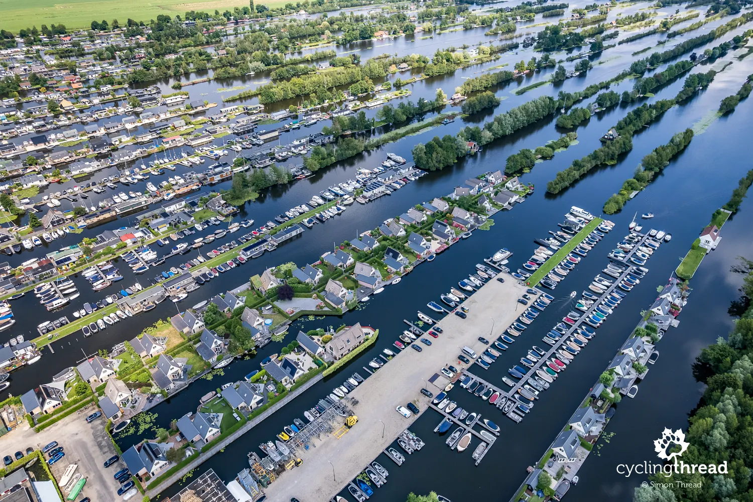
Legakkers created by peat extraction
Our next day begins with several kilometres ridden through slightly greener surroundings. It is in this area that we come across the so-called legakkers - narrow strips of peat and land left between former peat extraction areas. For centuries, peat was an important heating fuel in the Netherlands, and after it was removed, long trenches remained, gradually filling with water and creating a characteristic landscape of lakes and thin islands. Today, many of these places look almost like a water labyrinth - with marinas, houses, small harbours and canals stretching towards the horizon. From the drone, it becomes especially clear how strongly the centuries-long struggle with water - and at the same time the use of it for transport, industry and defence - shaped the appearance of the modern Netherlands.
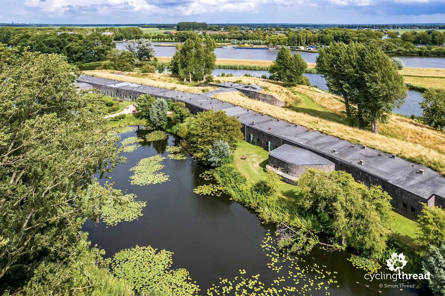
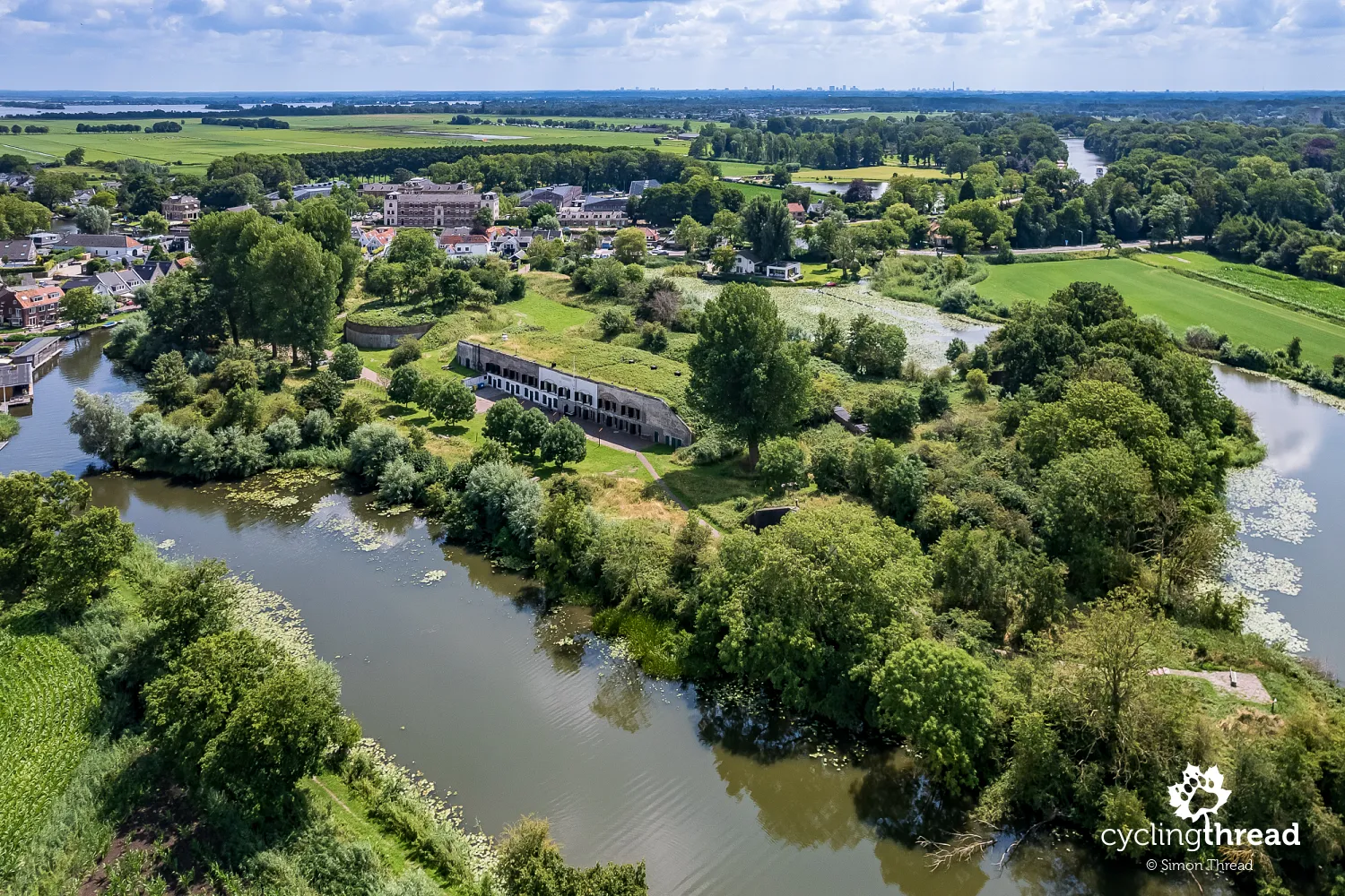
In Nieuwersluis, we reach the first larger fortified structure of the day and at the same time the first one we see while already following the New Dutch Waterline (Nieuwe Hollandse Waterlinie). Fort Nieuwersluis was built at the end of the 19th century in a strategic location between the River Vecht and the Amsterdam-Rhine Canal, and its purpose was to protect the locks and roads leading through areas that could be flooded with water. Its characteristic features are the massive concrete shelters, earth embankments and the wide moat surrounding the fort. For many years, the site also served as a military prison and later as a detention facility for soldiers. Today, the former fort looks much more peaceful - surrounded by greenery and water, it is one of the most characteristic points of the New Dutch Waterline along this section of the route.
Cycle the Dutch "2 minus 1" road
Leaving Nieuwersluis, we ride along one of the many sections of the route following Dutch "2 minus 1" roads. This solution is designed to calm car traffic while at the same time providing more space for cyclists on narrow local roads without the need to build a separate cycle path. A single shared lane for cars is left in the centre, while wide bicycle lanes are marked on both sides, which drivers may enter only temporarily when passing another vehicle. In recent years, however, there have been many protests from cycling organisations in the Netherlands, criticizing the bicycle lanes for being too narrow and therefore not providing sufficient safety for cyclists.
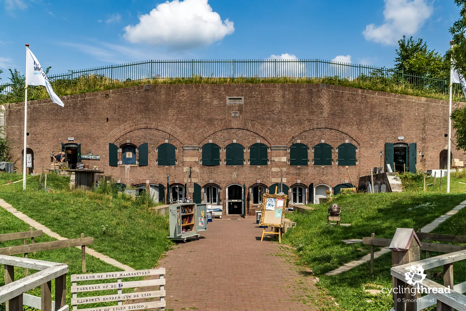
Fort Maarsseveen on the outskirts of Utrecht is an example of those Dutch waterline structures that are now living a second life while serving the local community. Concerts, outdoor events, workshops, meetings and local festivals are organised here, while some of the former military spaces have been adapted into a restaurant and recreational areas. Today, the former fort is surrounded by walking paths, green areas and waterside leisure spots popular with local residents. It is an interesting example of how former military infrastructure can naturally become part of modern city life and everyday recreation in the Netherlands.
Too short a stay in beautiful Utrecht
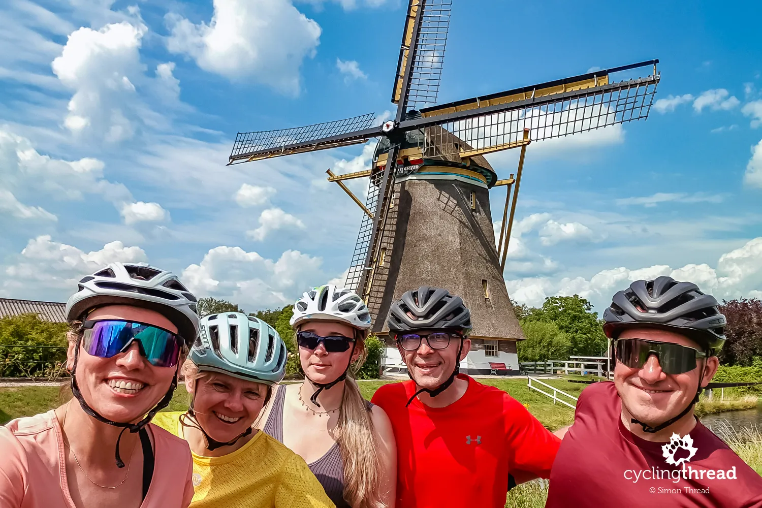
Utrecht welcomed us with two picturesque windmills - Westbroekse Molen and Buitenwegse Molen - which we used for a souvenir photograph. Both once served to drain the surrounding polders and pump excess water into higher canals, helping to keep the areas around Utrecht dry. Their role was to control water levels in areas located below the level of nearby rivers and canals, where without constant drainage, farming and settlement would not have been possible. The characteristic wooden structures powered Archimedes screws or water wheels that moved water between different levels of the polders. Interestingly, the largest and the smallest windmill in the province of Utrecht stand side by side here. Today, they are among the most characteristic sights on the northern outskirts of the city.
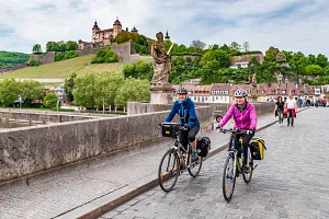
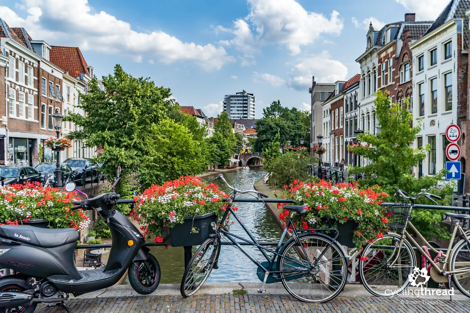
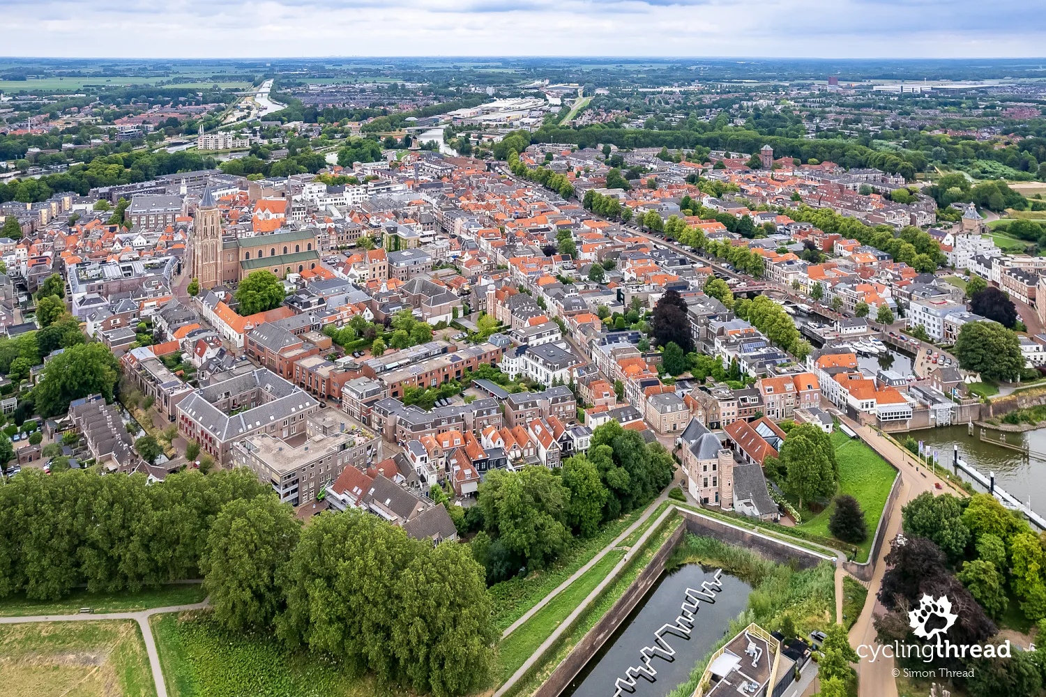
Utrecht turned out to be one of the most pleasant large cities along the entire Waterline Route. Its historic centre has preserved a much calmer and more local atmosphere than Amsterdam, although it is also full of canals, bicycles and historic buildings. The city's most characteristic place remains the Oudegracht - Utrecht's main canal with unique quays and cellars descending directly to the water level, where cafés, restaurants and small shops operate today. Towering above the centre is the high Dom Tower, the remaining part of the former St. Martin's Cathedral and one of the city's symbols. Utrecht also makes a huge impression with its cycling infrastructure - especially the gigantic bicycle parking facility at the main railway station, considered one of the largest of its kind in the world.
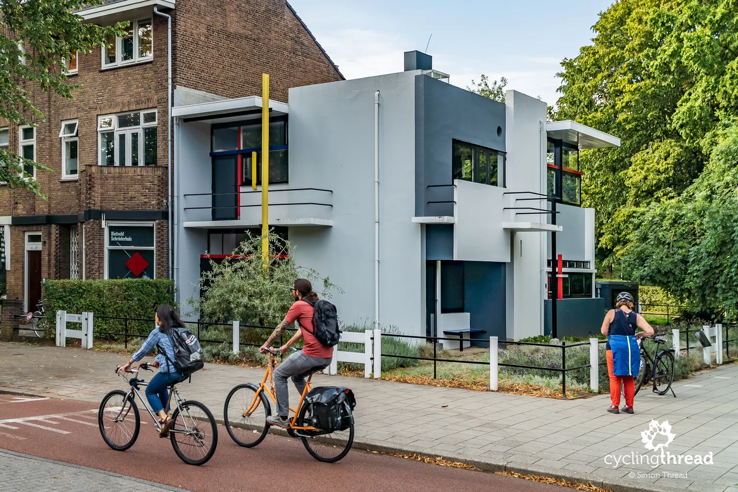
Among the city's interesting places, we also considered the UNESCO-listed Rietveld Schröder House worth visiting. This modernist building was designed in 1924 by the Dutch architect Gerrit Rietveld and is regarded as one of the most important examples of the De Stijl movement in the world. Its characteristic features are the simple geometric forms, sliding walls and the use of primary colours - red, blue and yellow - inspired by the work of Piet Mondrian. Even today, the house looks surprisingly modern and shows how revolutionary the ideas of Dutch modernism were a hundred years ago. A wide and popular bicycle route leads there from the city centre.
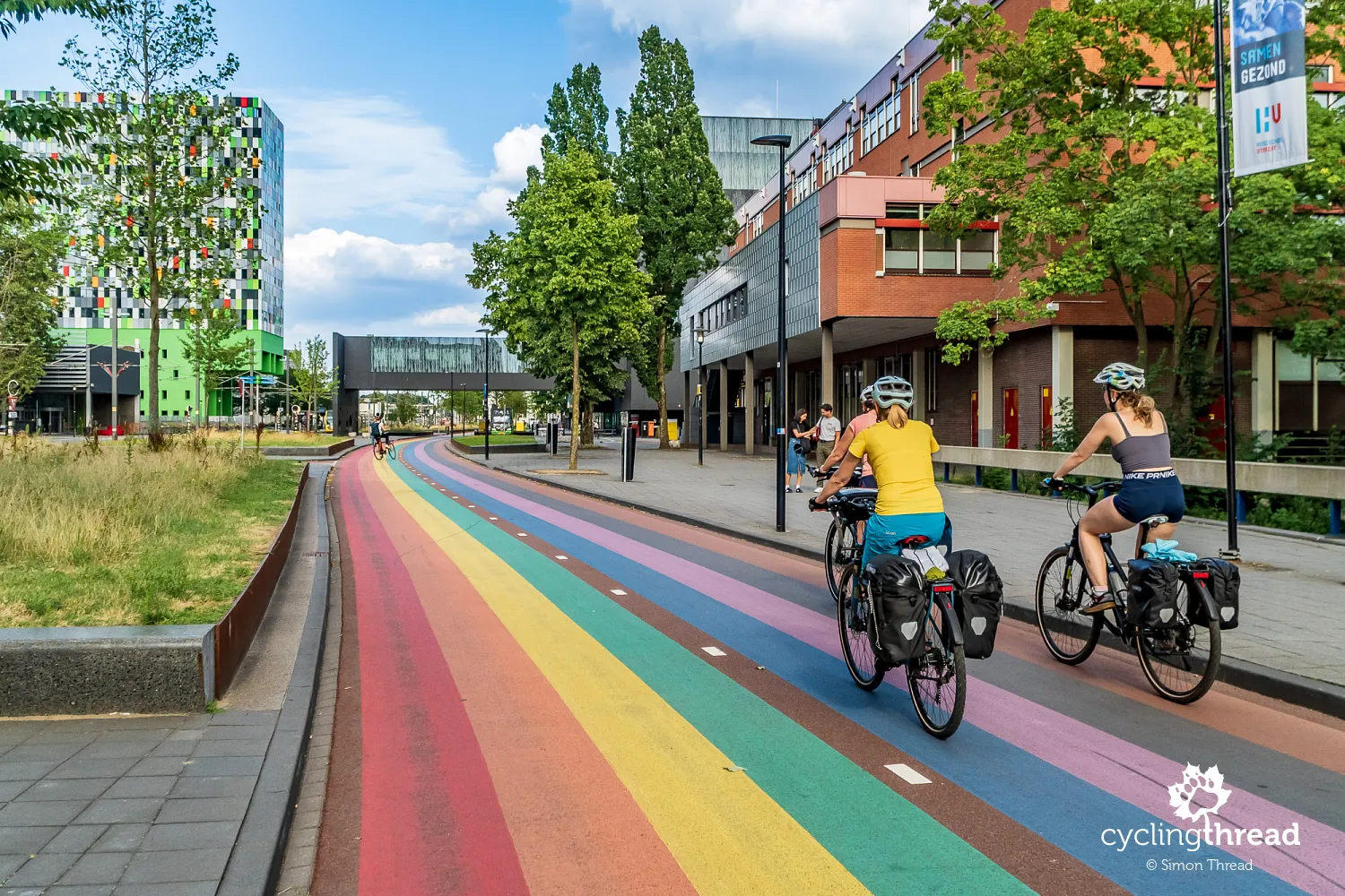
The world’s most famous rainbow cycle path
The previously mentioned bicycle route is the everyday commuting route for students travelling to Utrecht University. At the same time, it is one of the most famous bicycle roads in the world thanks to its characteristic rainbow-coloured surface. The colourful stripes appeared here as a symbol of diversity, openness and equality, values for which Utrecht and its academic community are well known. The route itself quickly became a popular photography spot and one of the more recognizable modern symbols of cycling Utrecht. It also shows how in the Netherlands even ordinary cycling infrastructure can become part of the city's identity and public space.
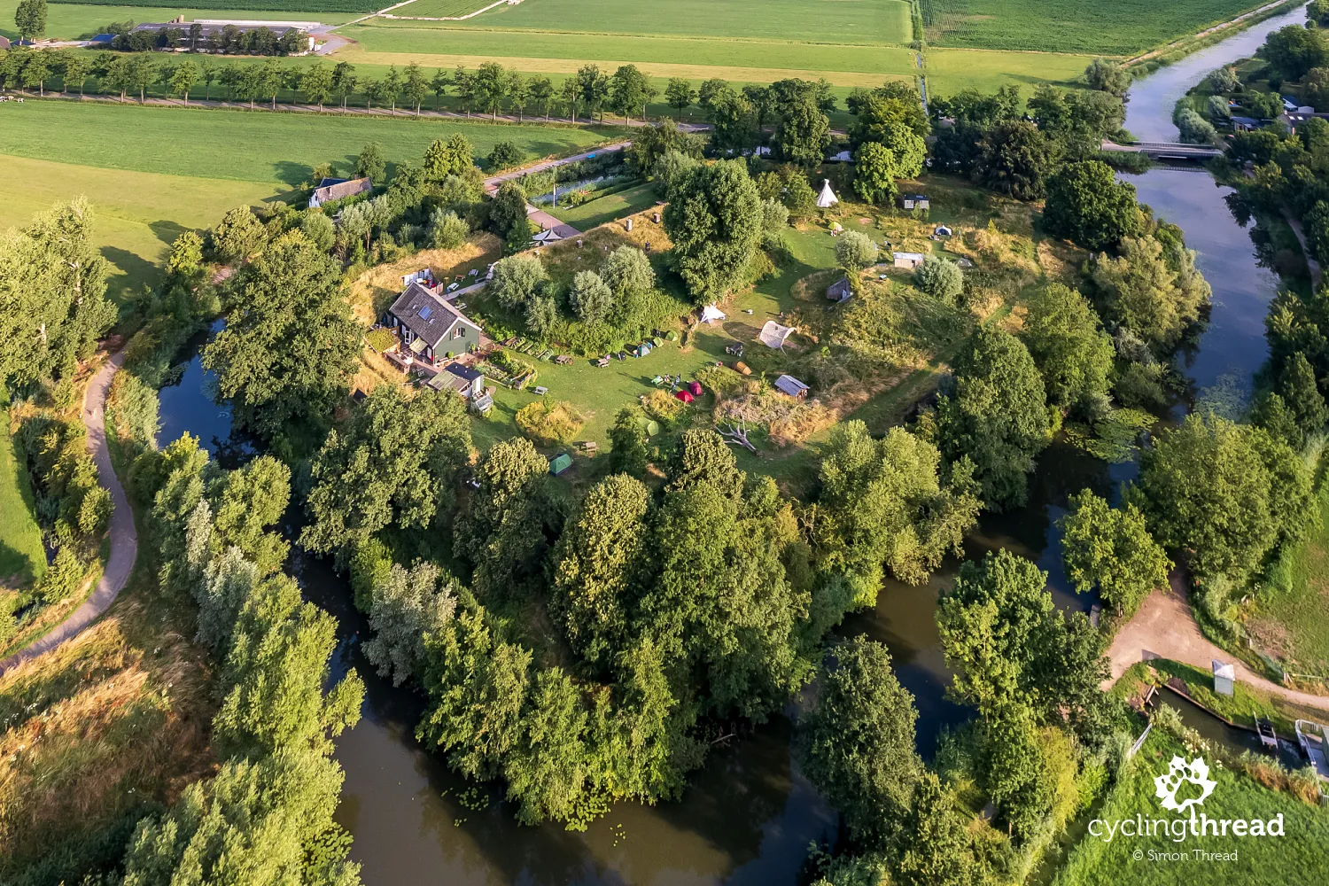
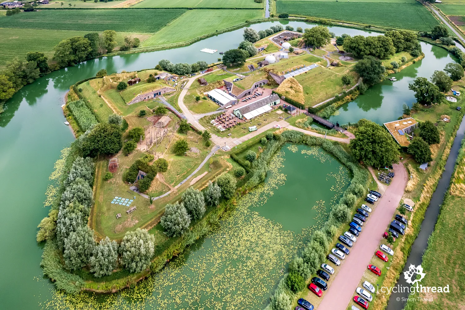
An overnight at a campsite in a fort
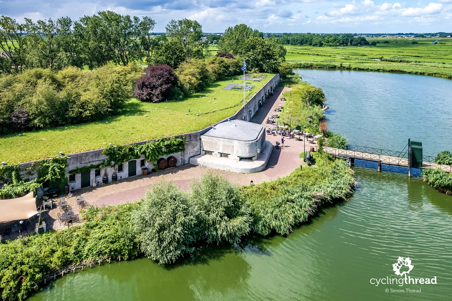
As if we had not seen enough Dutch fortifications already, our accommodation that day was located in... an old fort, of course! At Fort Werk aan de Korte Uitweg, there is a small campsite and accommodation facilities arranged inside former military buildings. The fort was built at the end of the 19th century as part of the New Dutch Waterline and was meant to protect locks and roads leading through areas that could be flooded with water. Today, the former barracks and storage buildings have gained a completely new life - it is possible to stay almost in the middle of historic fortifications, surrounded by earth embankments, a moat and greenery. The campsite itself is quiet, intimate and very popular with cyclists travelling through central Holland. In the evening, the place has a unique atmosphere - it is hard to imagine a more Dutch way to end the day than spending the night inside a former waterline fort.
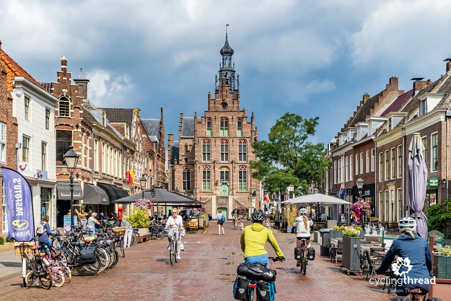
The list of towns we visited the following day began with lively and colourful Culemborg. We almost regretted that it was still early in the day and too soon for a longer break from cycling. The historic centre is full of narrow streets, cafés and small shops located inside former merchant houses. For centuries, Culemborg was an important trading town on the River Lek, and to this day it has preserved much of its old fortifications and medieval street layout. Particularly characteristic is the Binnenpoort city gate - one of the few preserved city gates in the Netherlands, reminding visitors of the times when towns such as Culemborg protected themselves with walls and moats. Another interesting place is the former Elisabeth Weeshuis - the first orphanage in the Netherlands built specifically as a new home for orphans, operating here since the 16th century.
Every fort is a piece of Dutch history
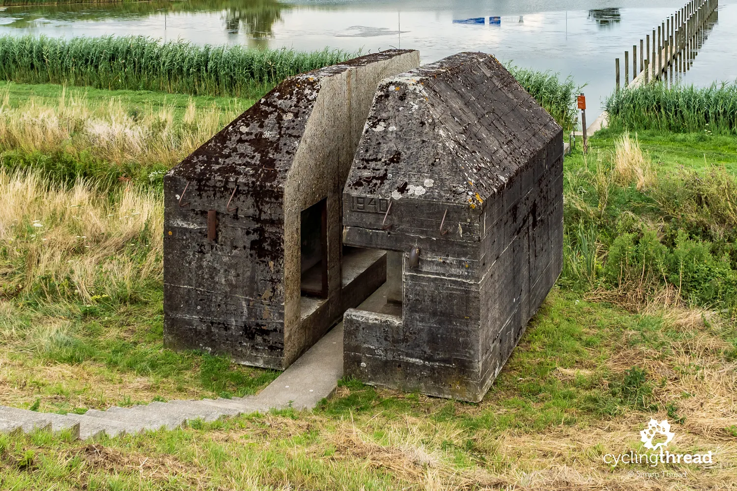
Over the next kilometres, our attention was caught by a small, austere concrete bunker standing close to the road - one of many preserved elements of the New Dutch Waterline. This one, however, looks unique because it has been cut in half, allowing visitors to see its interior and the construction of its thick reinforced concrete walls. Such structures were mainly built in the first half of the 20th century as additions to the older forts and flooding system. Today, the bunker almost resembles a minimalist sculpture placed within the peaceful Dutch landscape, making it easier to imagine the military importance of these areas just a hundred years ago. It is also one of those details along the route that clearly show the scale and careful planning of the entire Dutch waterline system.
Among the green waters of the moats stands Fort bij Herwijnen (Fort bij de Nieuwe Steeg), built at the end of the 19th century. The fort is surrounded by wide moats and earth embankments that were meant to protect the shelters and artillery positions hidden beneath them from shelling. The site was constructed in a strategic location along the River Waal, where the waterline system was designed to protect important crossings and dikes leading through the river valley. A characteristic feature of the fort are the two concrete groepsschuilplaats shelters from the mobilisation period before the Second World War, which have survived to this day within the former fortifications. From the drone, the geometric layout of the moats, embankments and green roofs of the old fortifications - almost blending into the surrounding polder landscape - is especially visible.
The best-preserved Dutch fortified towns
Gorinchem seemed to us a beautiful town, although we visited it in the rain. It is one of the best-preserved fortified towns in the Netherlands, whose characteristic star-shaped fortifications are still clearly visible from above. Gorinchem developed as an important trading port along the Waal and Merwede rivers and its strategic location made it an important defensive point of the Dutch Republic for centuries. In the centre, fragments of the old city walls, bastions and historic buildings with narrow streets, canals and numerous brick townhouses have been preserved. Another characteristic place in the town is the large market square surrounded by cafés and historic merchant buildings. Walking through Gorinchem, it is easy to notice that despite its tourist popularity, the town has preserved a calmer and more local atmosphere than the largest Dutch cities. It is here that the Waterline Route crosses the River Waal, and a small ferry carries travellers from North Holland to North Brabant and another charming town along the route - Woudrichem.
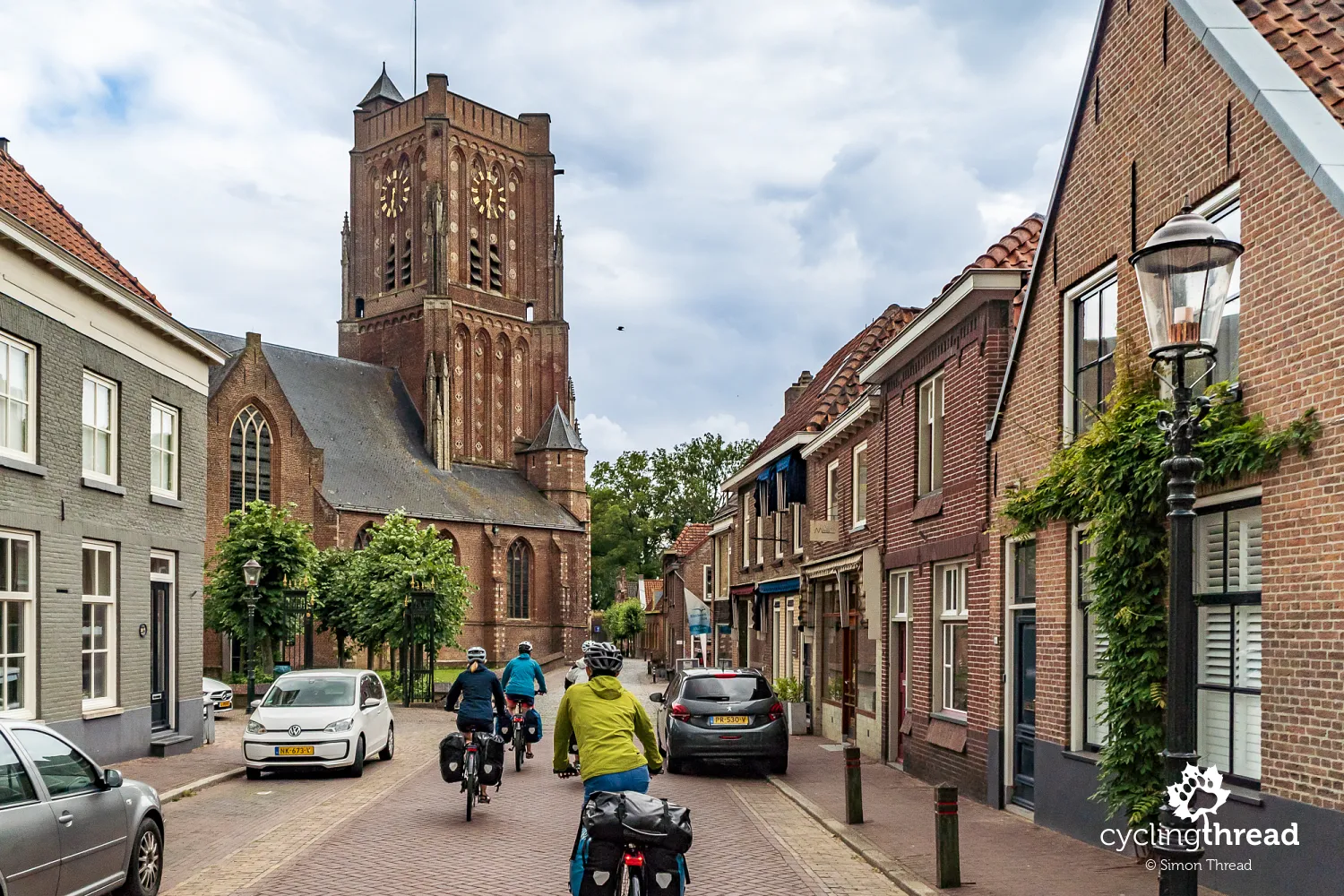
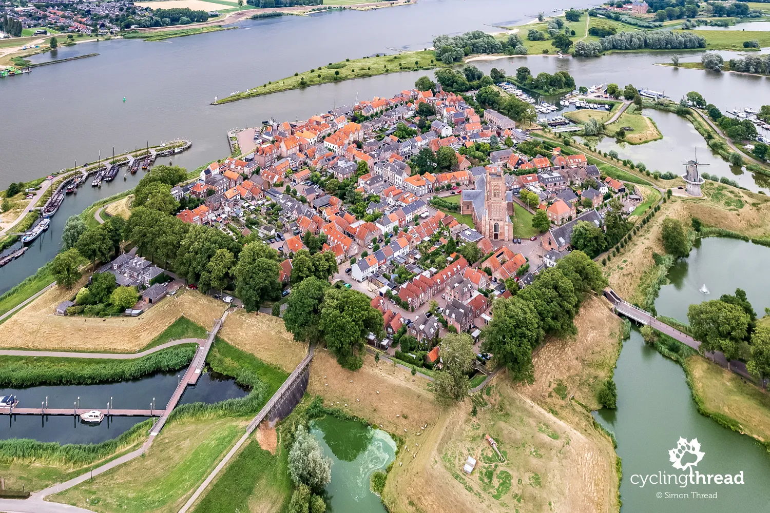
Woudrichem is one of the most atmospheric small towns along the Waterline Route. It is located where the Waal and Afgedamde Maas rivers join to form the Merwede, and its strategic position determined its importance for the defence of the Netherlands for centuries. As early as the 14th century, Woudrichem received city rights, was surrounded by walls and gained fortifications that later became part of the New Dutch Waterline. To this day, the town has preserved an almost complete layout of the former fortress town - with bastions, moats, a historic harbour and narrow streets running between brick houses. Traditional Dutch sailing vessels are still moored in the old harbour, reminding visitors of the town's fishing history and the centuries-long relationship between local people and the river. One of the town's characteristic symbols is the Gothic St. Martin's Church with its massive tower known as the "Mosterdpot", or "mustard pot".
Woudrichem also forms the famous "Fortress Triangle" together with Gorinchem and Loevestein Castle, which can be reached by a small bicycle ferry. The town also has an interesting connection with the history of timekeeping in the Netherlands - it was near Woudrichem that the former Amsterdam meridian passed, which for many years was used to determine the country's official time. In the town itself, the importance of the River Merwede is also clearly visible. It has long been one of the most important waterways in the Netherlands, used for centuries to transport goods between the ports and the interior of the country. Interestingly, the Merwede was created where the Meuse once had its outlet, after the river's course changed due to major floods and numerous hydraulic engineering projects carried out by the Dutch over the centuries.
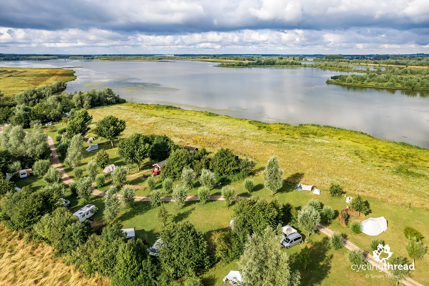
Peace and quiet in De Biesbosch National Park
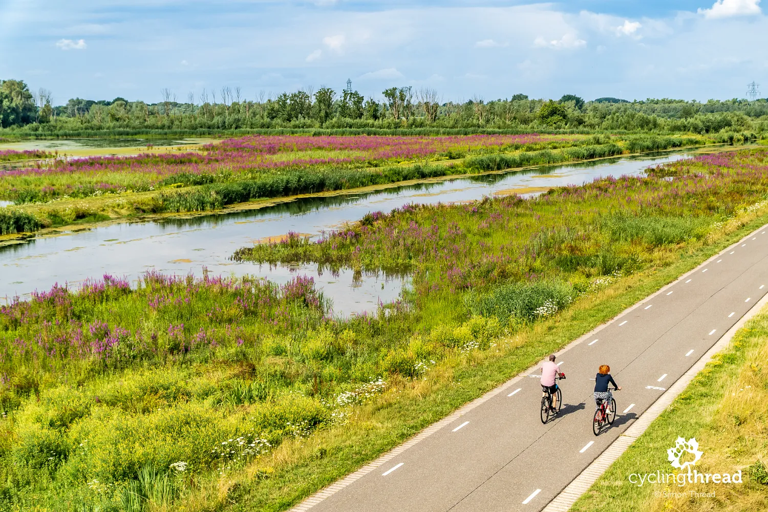
Beyond Woudrichem, south of the Merwede river line, the landscape changed once again. It became even quieter and more natural. In this area, we adjusted the original course of the Waterline Route to our own plans and turned west towards De Biesbosch National Park. De Biesbosch National Park is one of the largest freshwater wetland areas in Europe and one of the most unusual natural places in the Netherlands. It was created after the catastrophic St. Elizabeth's Flood of 1421, which flooded vast agricultural areas and permanently changed the river system in the Rhine-Meuse delta. Today, the landscape is formed by a dense network of canals, river branches, reed beds and wet forests, between which narrow cycle roads and small ferries operate.
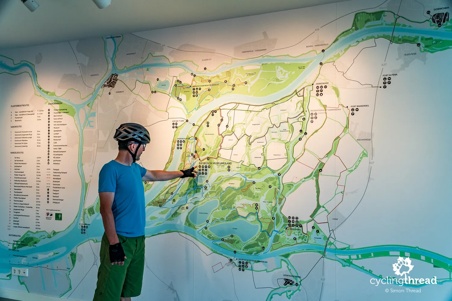
De Biesbosch is also one of the places in the Netherlands where the influence of sea tides can still clearly be felt - despite the great distance from the North Sea, the water level still gently rises and falls with the tides. It is also one of the country's most important bird protection areas and the site of a successful beaver reintroduction programme, which brought beavers back here in the 1980s after centuries of absence. After several days spent cycling between forts, canals and historic towns, De Biesbosch revealed a completely different side of the Netherlands - wilder, quieter and surprisingly natural. The atmosphere of the place was made even more special by a colourful sunset and flocks of birds circling above the nearby wetlands.
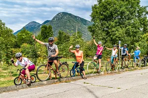
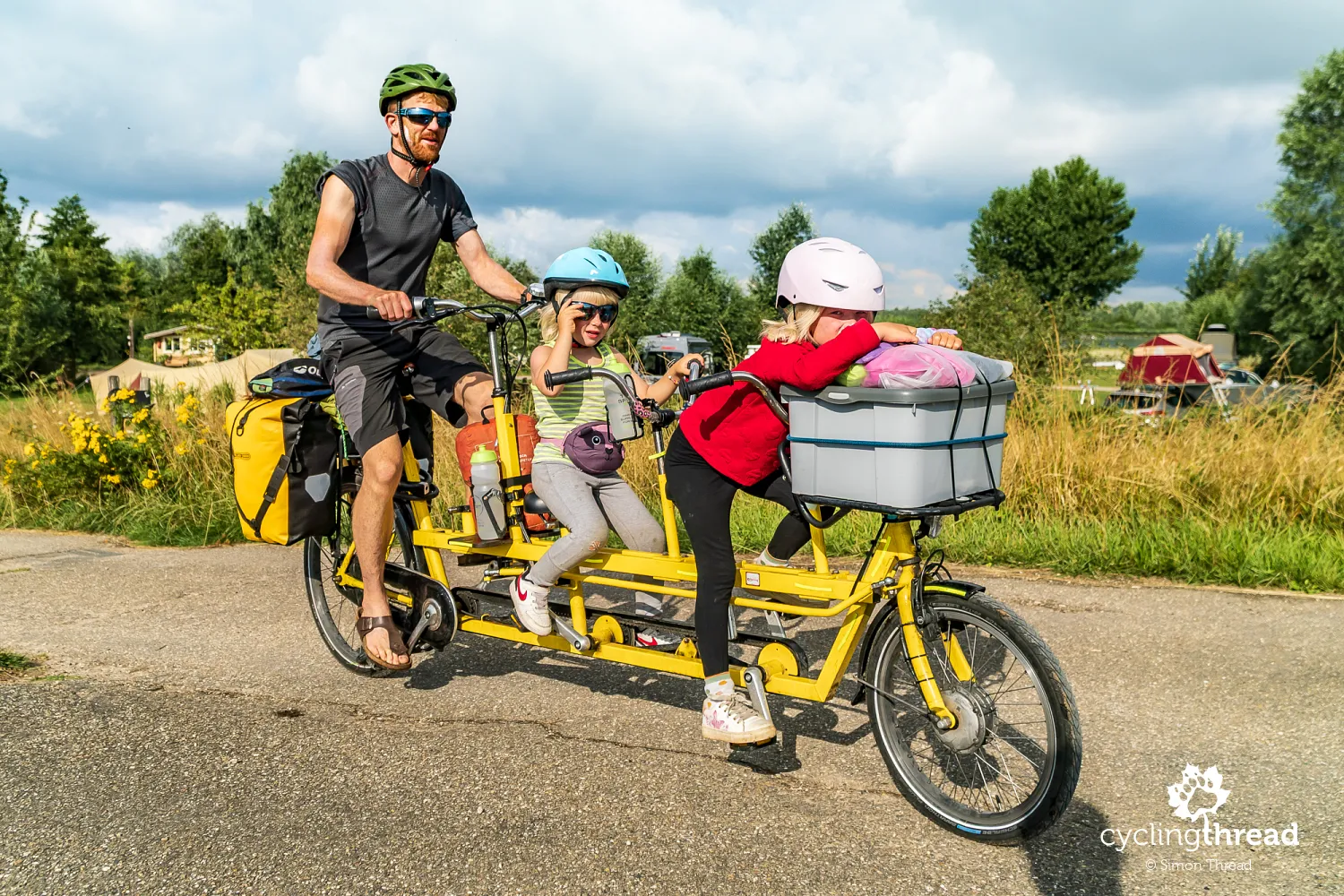
In De Biesbosch National Park, we could also observe the different family "configurations" in which the Dutch set off on cycling holidays. Probably the most charming scene was the sight of a father travelling together with his two daughters on a single bicycle. It is another part of the incredibly broad topic of cycling culture in the Netherlands and the way the bicycle has become integrated into everyday life here. I do not even know whether it was a mass-produced model or rather a local modification, but the whole scene perfectly showed the direction in which Dutch society has been developing for years - with the bicycle as a natural means of transport, a way of travelling and a way of spending time together as a family.
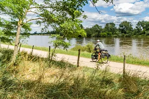
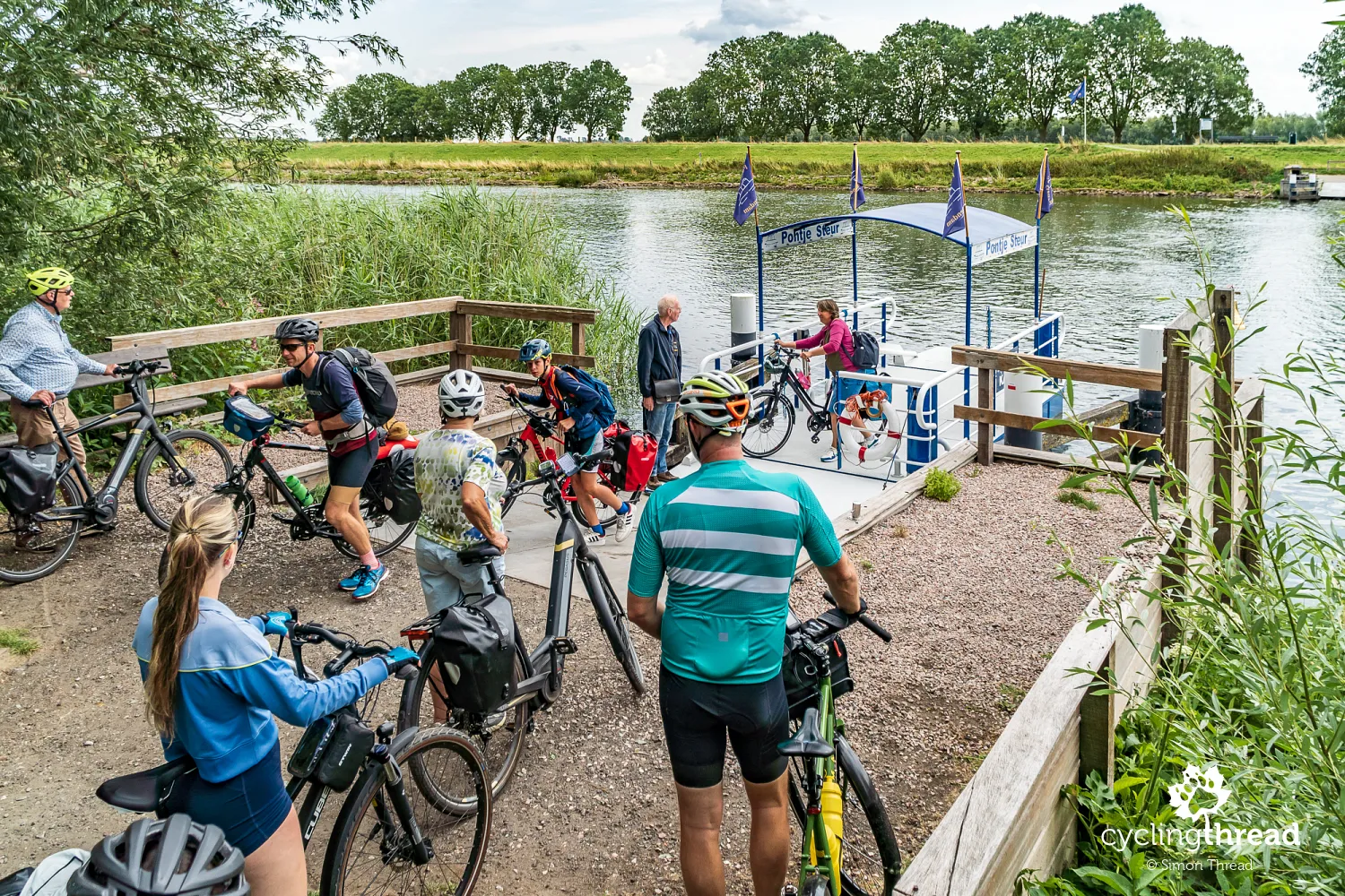
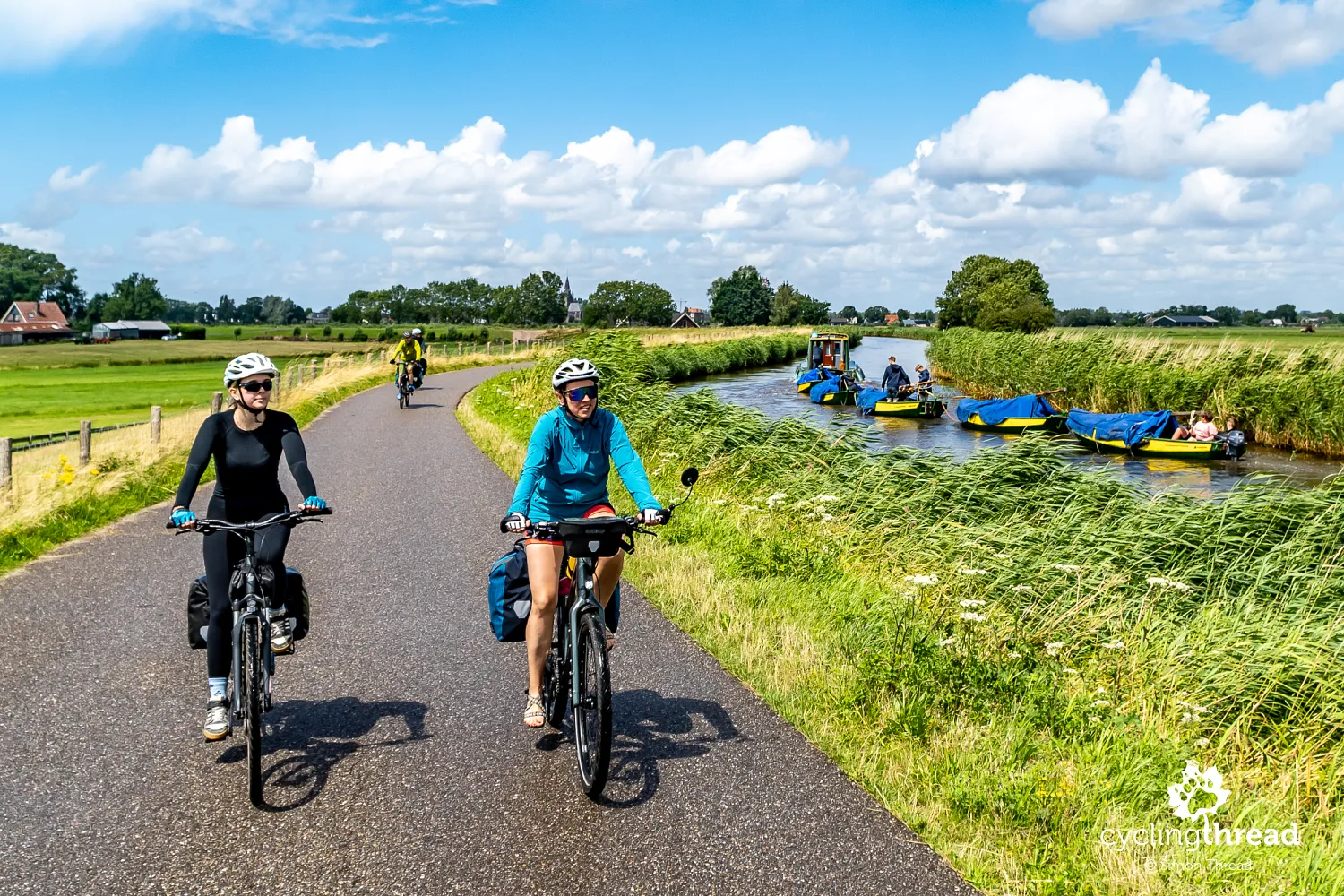
While travelling along the Waterline Route in the Netherlands, be prepared for several crossings over rivers and canals, both small and large. The previous day, we crossed by ferry twice and then by a small water taxi over the Lek and Merwede rivers, while after leaving De Biesbosch National Park we faced another small but, as visible, popular crossing over the narrow Steurgat channel. Everywhere, bicycles are fully accepted, and the ferries and boats are adapted to the needs of cyclists. Sometimes the crossing requires a short wait - either for the scheduled departure time or, as in the photo, until the small ferry arrives from the opposite bank to pick us up.
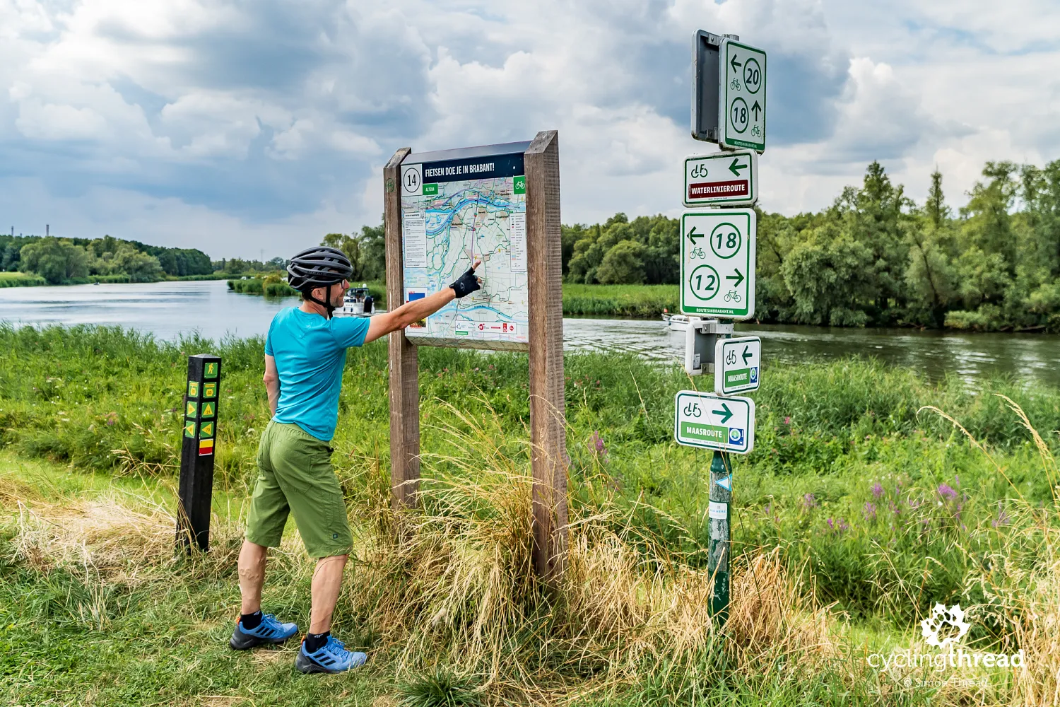
Easy navigation thanks to the Dutch knooppunten
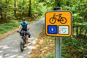
Cycling navigation in Brabant, and along the entire route in general, is easy and should not be a problem for anyone. You can follow a traditional paper map, information boards with maps placed along the route, or GPS navigation using a previously saved GPX file. The Netherlands is also one of the countries where the cycling junction system (knooppunten) works exceptionally well and can be seen at many intersections across the country. On the signposts, it is easy to find both the markings of the Waterline Route (Waterlinieroute), the Meuse Route (Maasroute) and the numbers of nearby cycling junctions, making it simple to plan your own route variations. I especially liked the large local map boards made from natural wood - simple, aesthetic and perfectly matching the calm and well-organized landscape of Dutch cycling routes.
Pleasant Breda at the end of the trip
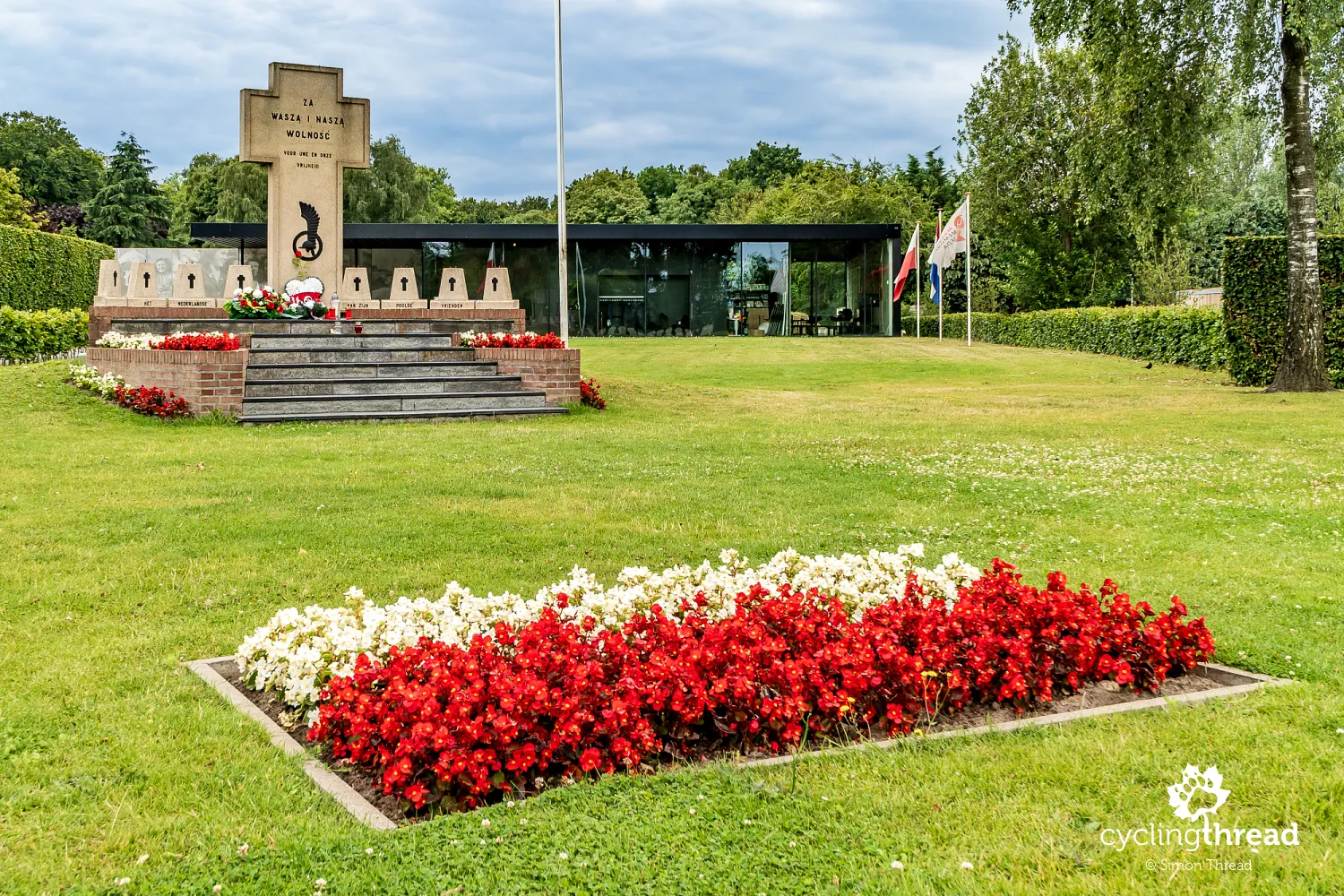
We finished our journey along the Waterline Route in the pleasant city of Breda. Our attention was drawn to the Maczek Memorial Breda - a modern museum and memorial dedicated to the Polish General Stanisław Maczek and the soldiers of the 1st Armoured Division, who liberated the city from German occupation in the autumn of 1944. Breda was captured without heavy fighting or major destruction thanks to the decisions of the Polish command, which wanted to spare the historic centre and protect civilians. The museum presents both the story of the division's soldiers and the everyday life of the liberated Dutch population in a modern and very personal way. Particularly moving are the memories of Breda's residents, who still remember the Polish soldiers as their liberators. In the city itself, it is easy to notice that the memory of General Maczek remains very much alive - streets, roundabouts and institutions are named after him, while Polish flags and symbols regularly appear during local ceremonies.
The Waterline Route among the best
We rate the entire Waterline Route very highly and definitely see it among the best cycling routes in Europe (update coming soon!). We give the cycling infrastructure a 5 out of 5 - although there are actually not that many fully separated cycle paths, the bicycle streets and bicycle lanes provide a high level of comfort and safety. In terms of attractions and sightseeing, the score must also be the highest possible - the Waterline Route is a journey full of fascinating places to discover. The landscape gets a 3, because although it is often green and natural, it is also very flat and includes many urbanized areas. Accessibility by public transport, especially railways - 5. Accommodation base - 4, because we felt that the restaurant offer was not always particularly extensive. Tourist information about the route and the region - flawless, especially considering that the Waterline Route was created only in 2021.
Peaceful stays at Dutch campsites
During our trip, we stayed both in hotels and at campsites. We planned the first and final nights under a roof, while the nights along the route were spent at previously selected campsites. All the campsites were very well maintained, clean and peaceful, and we always ended up with friendly neighbours travelling by campervan, tent, or bicycle. The Dutch clearly love this way of travelling, which is perfectly visible in the quality of the local tourist infrastructure and the organization of the campsites. We especially remember the overnight stay at the campsite located inside a former fort and our stay surrounded by the nature of De Biesbosch National Park. During our hotel stays, we were also provided with safe bicycle storage, which we confirmed already at the booking stage.

The first kilometres on Koga bicycles
The test of the Koga WorldTraveller bicycles, which our journey along the Dutch water fortifications turned into, turned out exceptionally well. Riding a typical expedition bicycle with a greater weight, yet still non-electric, was a very interesting experience - especially because it proved surprisingly pleasant in practice. The seemingly heavy construction actually felt quite lively while riding, and the reasons for this can probably be found in the high-quality components, well-designed geometry and the overall construction of the bicycle. Our Kogas handled both smooth asphalt cycle paths and the rougher surfaces appearing near forts and flood protection dikes very well. As you can see, before the trip I still managed to replace the handlebar grips and install a mirror, which on a bicycle like this may seem a little surprising. But after all - what kind of bicycle would it be without a mirror... ;)

Amsterdam as an interesting addition to the route
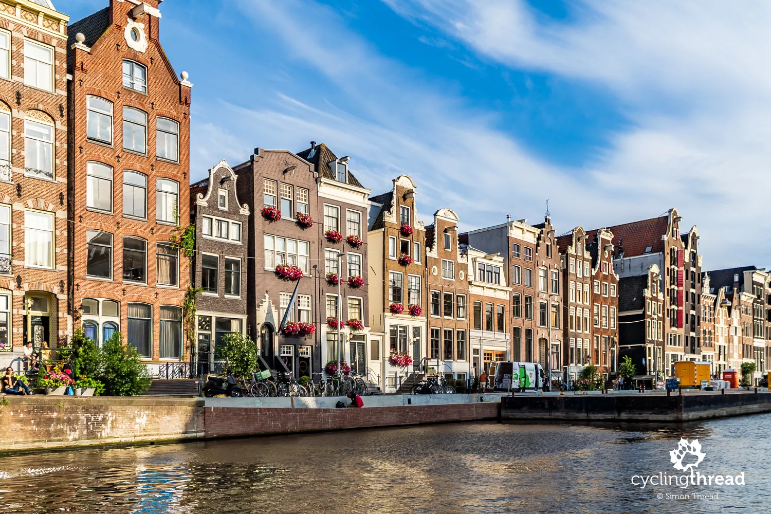
If you have not yet visited Amsterdam, or if after previous visits you still want more of the city's atmosphere, a cycling journey along the Waterline Route is a perfect opportunity to visit Amsterdam. And although Amsterdam is one of the most popular tourist destinations in Europe, there are still places here without crowds, where a visit can broaden your understanding of the world. From the long list of attractions in Amsterdam, both more and less touristy, we chose, among others, the famous Rijksmuseum and the Amsterdam Museum. Later - to relax and absorb the atmosphere of the city - we also took a canal cruise through Amsterdam. It is one of those attractions that sounds very touristy, but allows you to see the city from a completely different perspective - calmer, quieter and more picturesque than the crowded streets in the centre. From the water level, it is easy to admire the characteristic architecture of the narrow townhouses, the bridges connecting the canals, and the everyday life of the ever smaller number of true local residents.
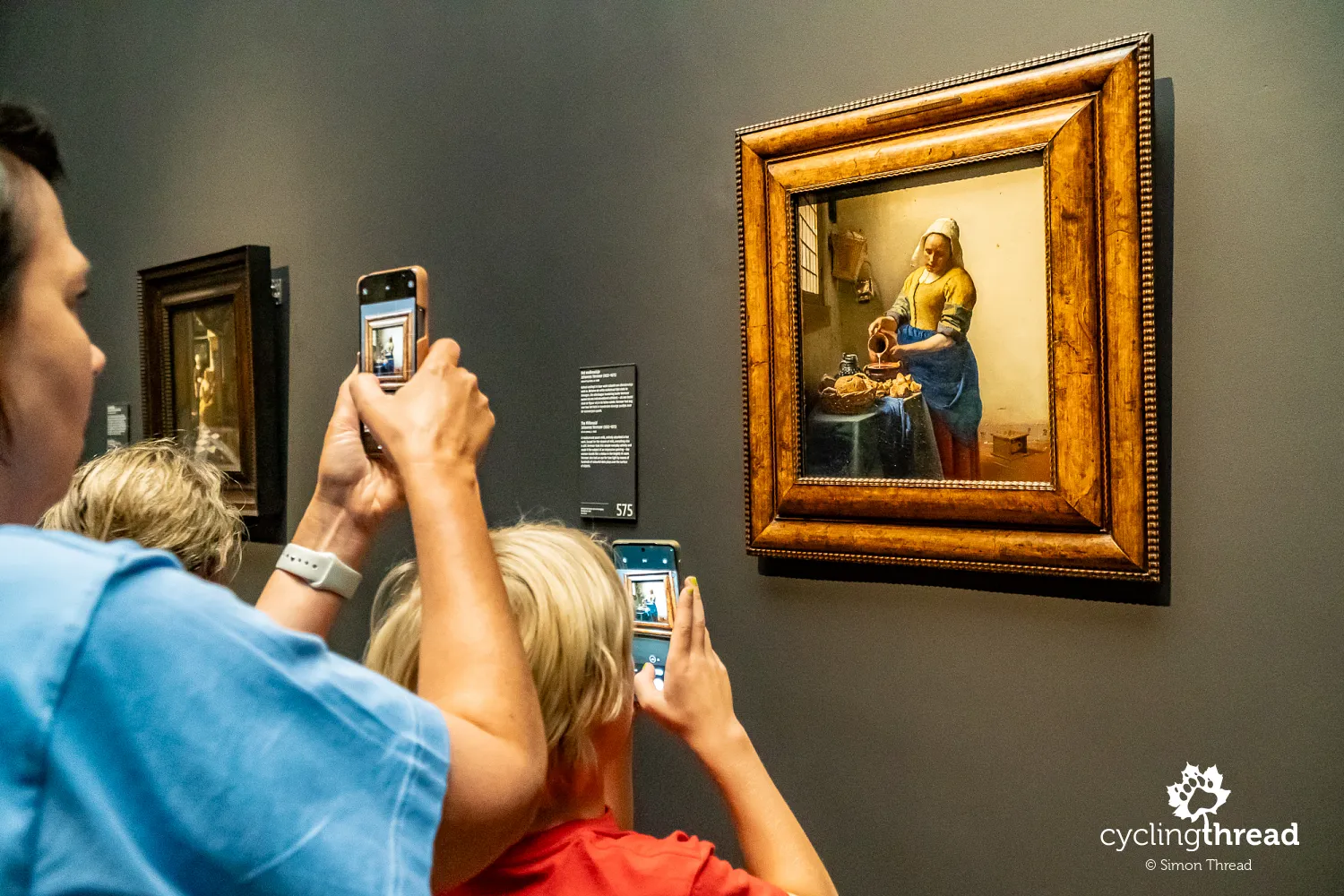
The Rijksmuseum, or National Museum, is an absolute classic and an opportunity to admire works by the greatest masters of Dutch painting - including Rembrandt, Johannes Vermeer and Frans Hals. Most visitors are usually deeply impressed by Rembrandt's famous "Night Watch", around which crowds from all over the world almost always gather, although this time we found the painting undergoing conservation work. Others admire the light that Vermeer captured in "The Milkmaid". Still others cannot take their eyes off the characteristic blue-and-white Delft pottery, which for centuries was one of the symbols of Dutch craftsmanship and trade. The museum building itself is just as impressive as its collection - enormous, representative and full of light, while walking through its galleries allows visitors to see how Dutch culture and art developed over the centuries. The bicycle passage running underneath it is also incredible - that, too, is a form of art, although of a completely different kind.
The next one, the Amsterdam Museum, offers a rich dose of information about the history of the city, presented in a very pleasant and engaging way. Among other things, we saw how Amsterdam developed from a small fishing settlement into one of the most important ports and trading centres in Europe. A lot of space is also dedicated to the everyday life of residents, the city's colonial past and its modern social changes. It is a museum that feels less "postcard-like" than the Rijksmuseum, but one that allows visitors to understand much better where the modern character of Amsterdam comes from.

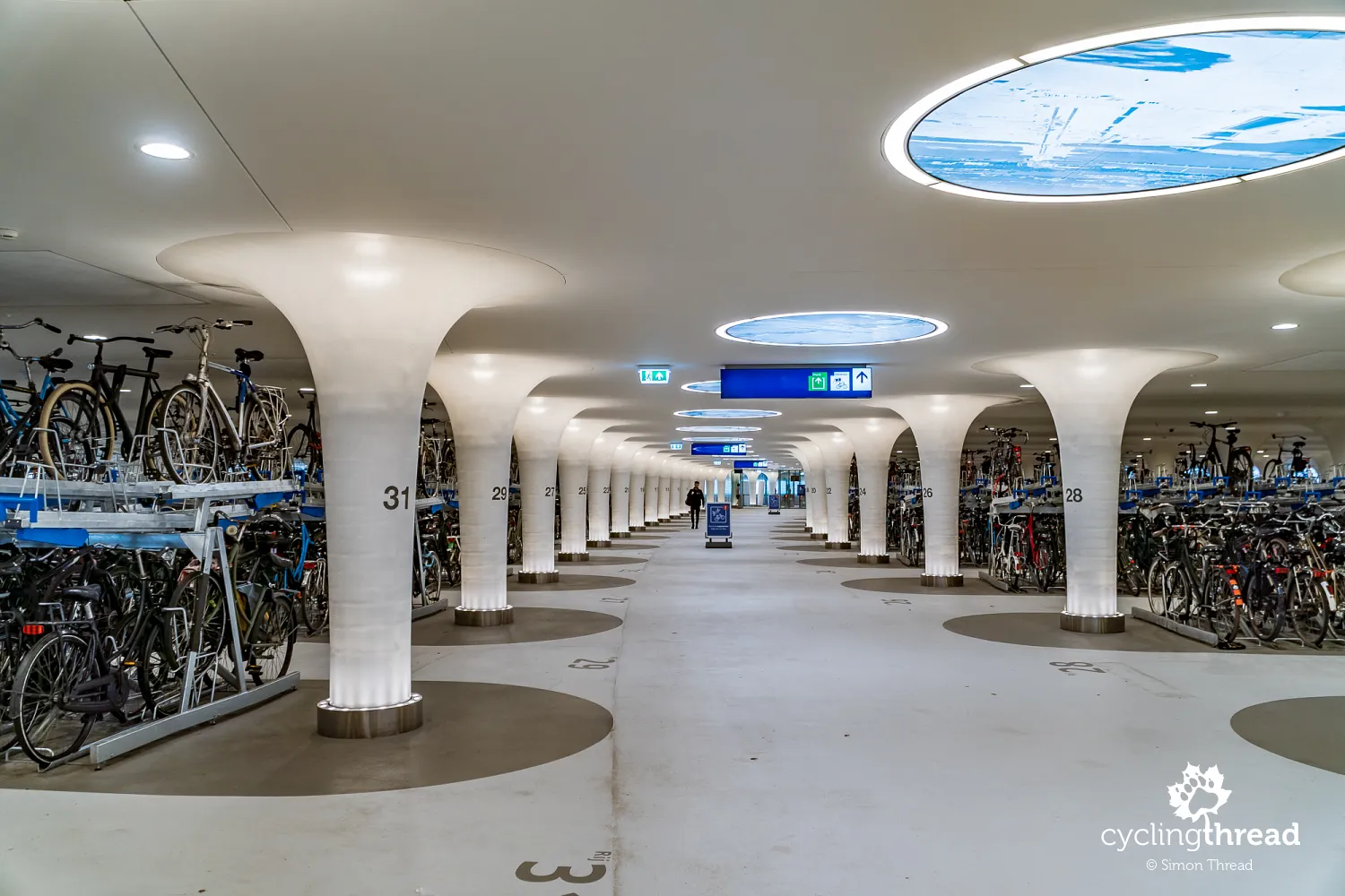
The city itself is also full of impressions for people interested in cycling culture at a truly advanced level and in highly developed active mobility. In Amsterdam, the bicycle is not an addition to transport, but a fully integrated foundation of it - with its own infrastructure, priority at intersections and enormous bicycle parking facilities near railway stations. Particularly impressive is the number of people who commute every day by bicycle to work, school, or shopping regardless of age or weather. For people involved in infrastructure planning, Amsterdam remains one of the most fascinating places to observe in Europe. And then there is the extraordinary bicycle parking facility for 7,000 bicycles built beneath the water surface right in front of Amsterdam Centraal station - wow!
An excellent journey along the Dutch waterlines
It was an excellent journey. Today, without any doubt, I can say that the Netherlands is one of the best countries for cycling tourism in Europe. Some people may miss mountains, climbs and more varied terrain, but for many travellers this almost completely flat profile will be a huge advantage - allowing them to calmly focus on the landscapes, towns and the everyday rhythm of the journey. And when you add the excellent cycling infrastructure, well-organized routes and the truly unique historical and engineering background, the Waterline Route becomes a fantastic inspiration for cycling holidays.
Back to topHave a safe ride! 💚
Simon Thread
(Szymon Nitka)
I'm a passionate cycling traveler and the voice behind Cycling Thread. I explore Europe on two wheels, documenting the most scenic routes, inspiring places and cyclist-friendly practices. My writing blends personal experience with practical insights and a deep love of travel. I'm also a contributor to National Geographic Traveler magazine.