Lusatian Lakeland and the Lower Lusatia Mining Route - cycling Brandenburg
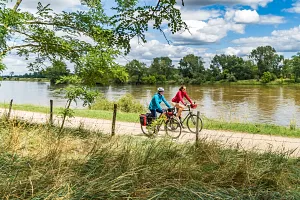
Interesting, safe, and convenient - this perfectly describes the Lusatian Lakeland, a new tourist destination in southern Brandenburg. Once dominated by lignite mining, this area is now transforming into a modern region for active recreation, especially cycling and water sports. Where massive mining excavators once stood, you’ll now find lakes and newly built cycling paths. One of these paths is the Lower Lusatia Mining Route, which stretches across the entire Lusatian Lakeland. We explored a significant portion of it during the first days of the long May weekend.
Join us on our new 🟢 Komoot account!
Cycling Partners
Route on the map
GPX file (GPS track): cyclingthread.com-lower-lusatia-2024.gpx
Lusatian Lakeland - table of contents
- A practical spot for a weekend getaway
- Lusatian Lakeland - Lausitzer Seenland
- Over 20 lakes that were once mines
- The East German Rose Garden is over 110 years old
- Classic cars against the backdrop of a historic pergola
- We cycled the Lower Lusatia Mining Route
- The Old Brickyard tells the story of the Muskau Arch
- One of 100 forest cemeteries in Germany
- Weathering trenches cut through the Muskau Arch
- A chocolate break from cycling
- Spremberg and the geographical center of Germany
- From Spremberg to the Welzow-Süd mine
- Once a village, now a hill with a vineyard
- A viewpoint shaped like a reclining dinosaur
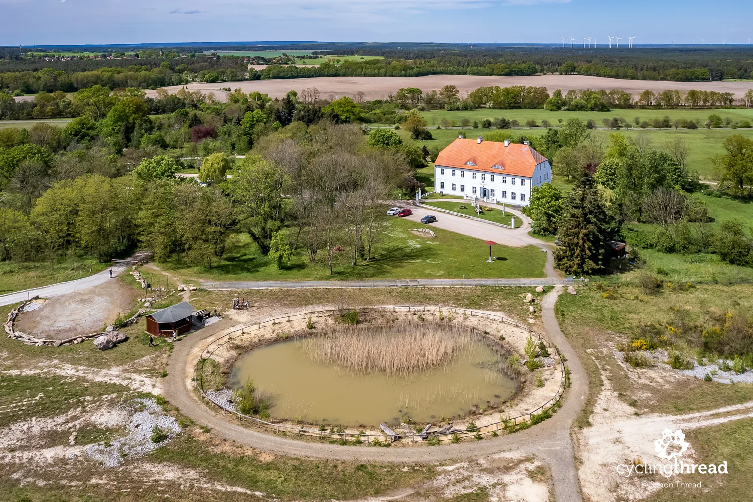
- All that remains of a displaced village is a manor
- A concrete window with a view of the mine
- The Brandenburg Stonehenge by the cycling path
- Großräschener See with numerous examples of revitalization
- Cyclist-friendly accommodations available
- Plenty of excellent cycling infrastructure
- The Rusty Nail: a 30-meter-high observation tower
- Fresh sand by a colorful lake
- The Polish-Saxon postal pillar in Senftenberg
- The Eiffel Tower of Brandenburg lying down
- Through Lusatian Lakeland by bike and train
- Rose Festival at the East German Rose Garden
- A great idea for an exciting weekend
A practical spot for a weekend getaway
These are exactly the kinds of cycling destinations we love. Exploring a region of this size doesn’t require a long stay - just 3-5 days are enough to discover most of the attractions of the Lusatian Lakeland and enjoy its top cycling routes. Since the Lusatian Lakeland lies slightly off the beaten path and its post-industrial yet active vibe might not appeal to everyone, you won’t encounter crowds here. As for getting there, the best option might be to take a train from Berlin or Dresden toward Cottbus and then adjust your route depending on your chosen starting point.
Lusatian Lakeland - Lausitzer Seenland
The Lusatian Lakeland, or Lausitzer Seenland in German, is located in southeastern Brandenburg. This "artificially" created region emerged from extensive reclamation efforts on lands where lignite mining dominated for decades. At one time, Lower Lusatia was even called the dirtiest place in Germany. Intensive mining activity left behind massive open-pit mines, and as coal resources began to deplete, the region faced the challenge of transforming these degraded lands. The first mining pit was filled with water in the early 1970s, but the large-scale reclamation process began in the 1990s and continues to this day.
Over 20 lakes that were once mines
Transforming former mines into a system of interconnected lakes, creating an artificial lakeland, was undertaken to boost the local economy, create new jobs, improve environmental quality, and - most importantly for us - develop an attractive destination for tourism and recreation. The process of filling mining pits with water and creating artificial lakes is lengthy, requiring significant financial investment, advanced technology, and labor-intensive preparation. Today, Lausitzer Seenland boasts over 20 former mining lakes connected by waterways, forming one of Europe’s largest artificial water systems.
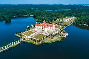
The East German Rose Garden is over 110 years old
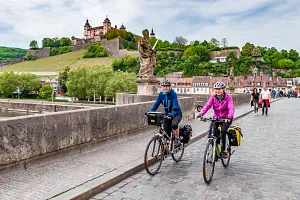
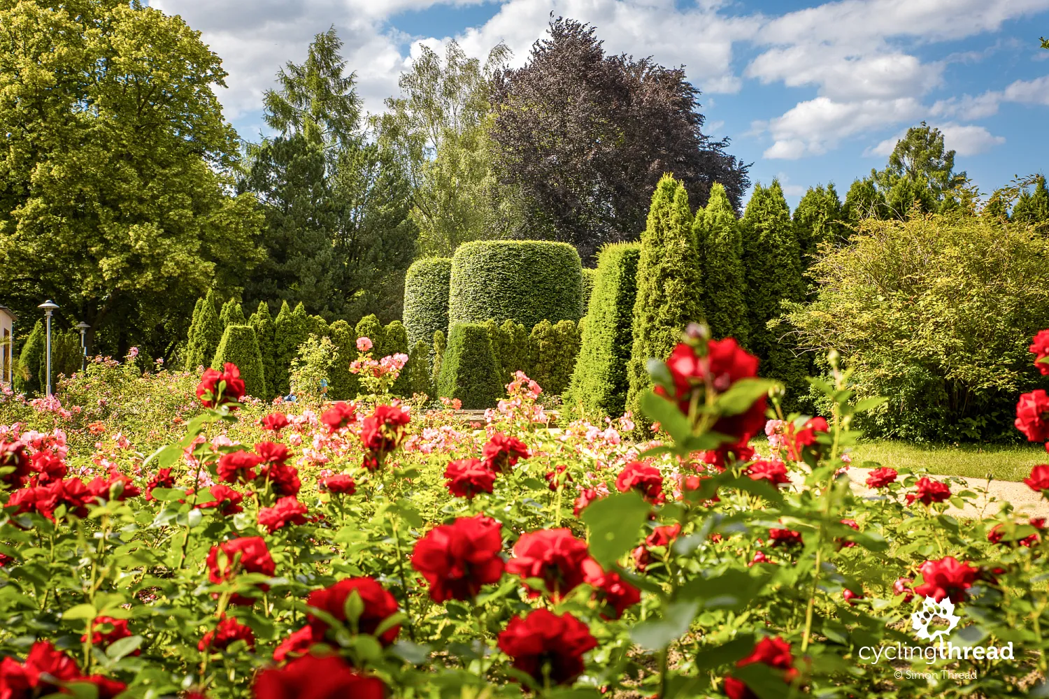
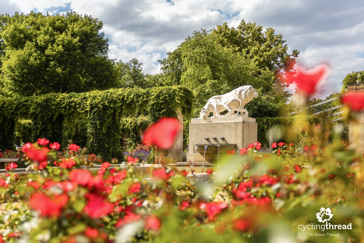
For a perfect starting point for your cycling journey through the Lusatian Lakeland, head to Forst, a small town on the Lusatian Neisse River. Cyclists on the Oder-Neisse Route will recognize it. During World War II, Forst was 80% destroyed, so don’t expect a preserved old town here. However, Forst has another unique attraction that earned it the nickname "City of Roses" in Germany - the vibrant East German Rose Garden, one of the most beautiful rose gardens in the country. It’s worth planning your start in Forst for this reason, and it’s also a convenient spot to leave your car during your trip.
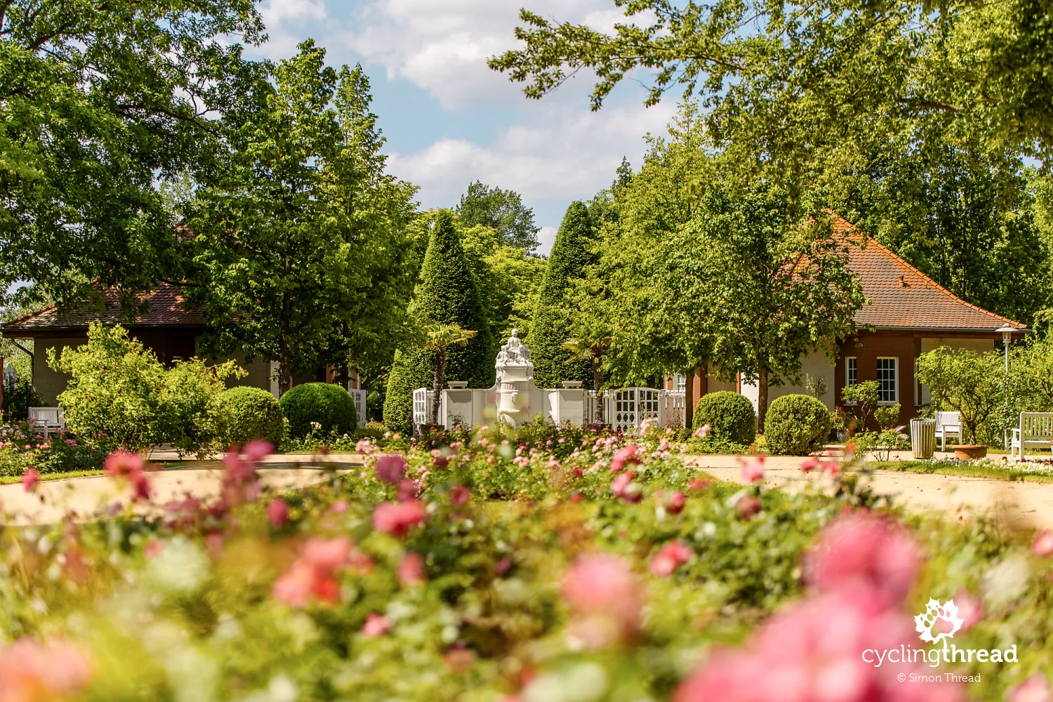
The East German Rose Garden (Ostdeutscher Rosengarten) was established in 1913 during a national horticultural exhibition. After the event, the city of Forst purchased the roses and created a permanent rose garden. By the 1930s, it had become a favorite weekend destination for Berliners. Despite wartime destruction, the garden reopened in 1953, showcasing 20,000 roses to visitors. Today, the East German Rose Garden covers approximately 17 hectares and is home to over 40,000 rose bushes representing about 900 different varieties. It also serves as an important educational and cultural center, hosting festivals, concerts, gardening workshops, and exhibitions that attract visitors from all over Europe. Detailed information is available on its website.
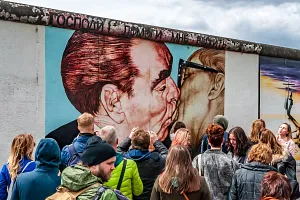
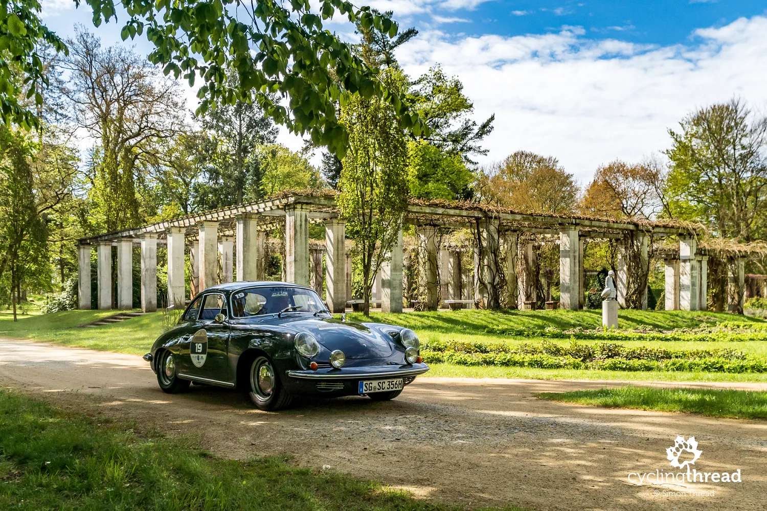
Classic cars against the backdrop of a historic pergola
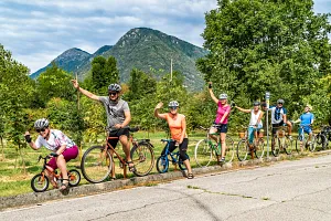
It just so happened that during our visit to Forst, the East German Rose Garden hosted the finish line of one stage of the Preußen Klassik Rallye, a vintage car rally. Each spring, participants drive through historic regions of Germany, primarily former Prussian territories, in beautifully preserved classic cars. Just as we were about to set off, the first gleaming vintage cars began arriving at the garden in Forst. Nearly 70 impeccably maintained vehicles from various eras blended beautifully with the garden’s historic structures. My favorite photos were taken against the backdrop of the courtyard pergolas from 1913, which date back to the garden’s first rose exhibition.
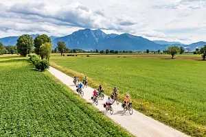
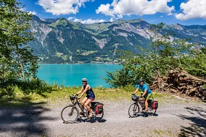
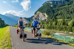
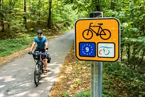
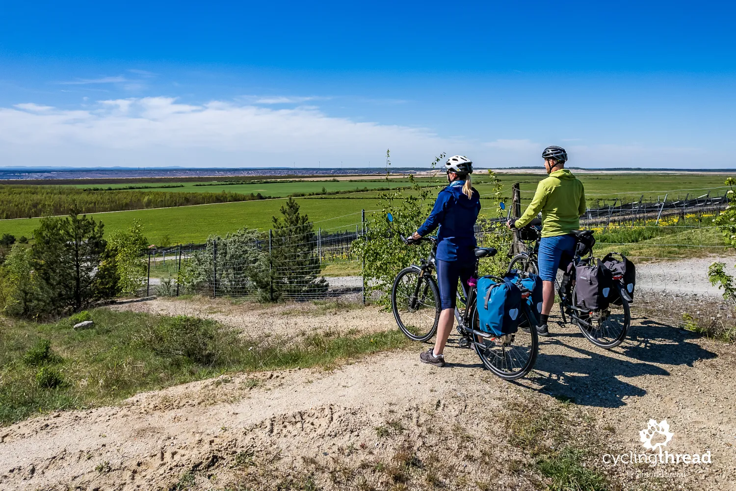
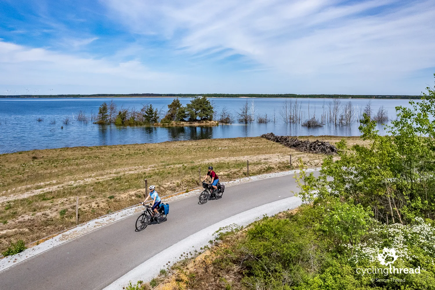
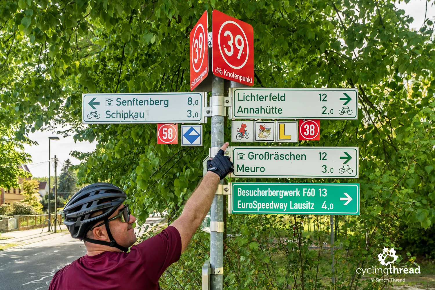
We cycled the Lower Lusatia Mining Route
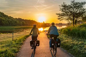
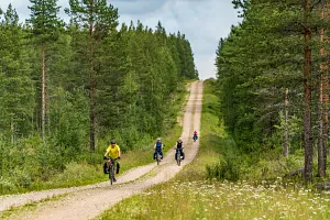
The Lower Lusatia Mining Route, or Niederlausitzer Bergbautour, is the ultimate cycling guide through this part of Brandenburg. The route spans just over 400 kilometers, forming an irregular loop around Lower Lusatia and the Lusatian Lakeland. We started in Forst on the Oder, a town on the Polish-German border. During our trip, we visited the most significant sites in terms of natural and cultural attractions. Finally, we had a smooth train ride from Finsterwalde back to our starting point, avoiding unnecessary loops. Our route from Forst through Spremberg, Großräschen, and Senftenberg to Finsterwalde totaled only 200 kilometers. We consider the Lower Lusatia Mining Route to be among the best cycling routes in Germany.
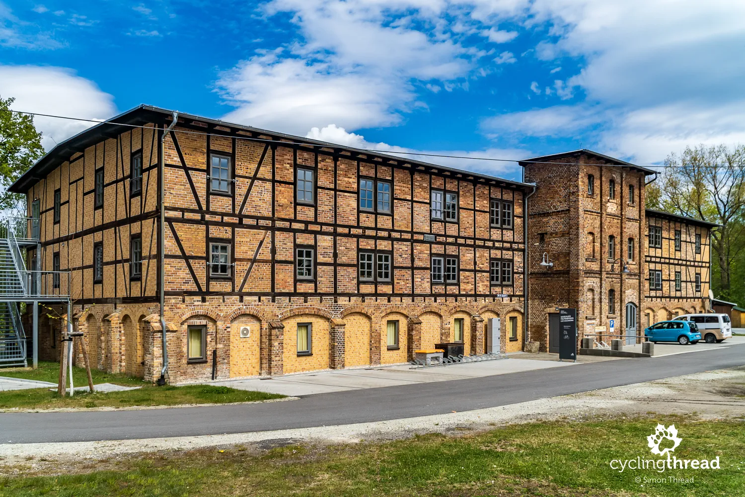
The Old Brickyard tells the story of the Muskau Arch
Shortly after setting out on the route, the gentle climbs revealed the presence of the Muskau Arch - one of those features impossible to miss while cycling the Lower Lusatia Mining Route. The Muskau Arch is a unique geological formation located along the Polish-German border, stretching across the Lubuskie Voivodeship in Poland and Brandenburg and Saxony in Germany. It’s one of the best-preserved examples of a terminal moraine, formed during the last glaciation about 340,000 years ago. While riding, it’s worth glancing at the informational boards near the route, which show your current location against the backdrop of the Muskau Arch. I highly recommend imagining the glacier’s edge that shaped this fascinating moraine.
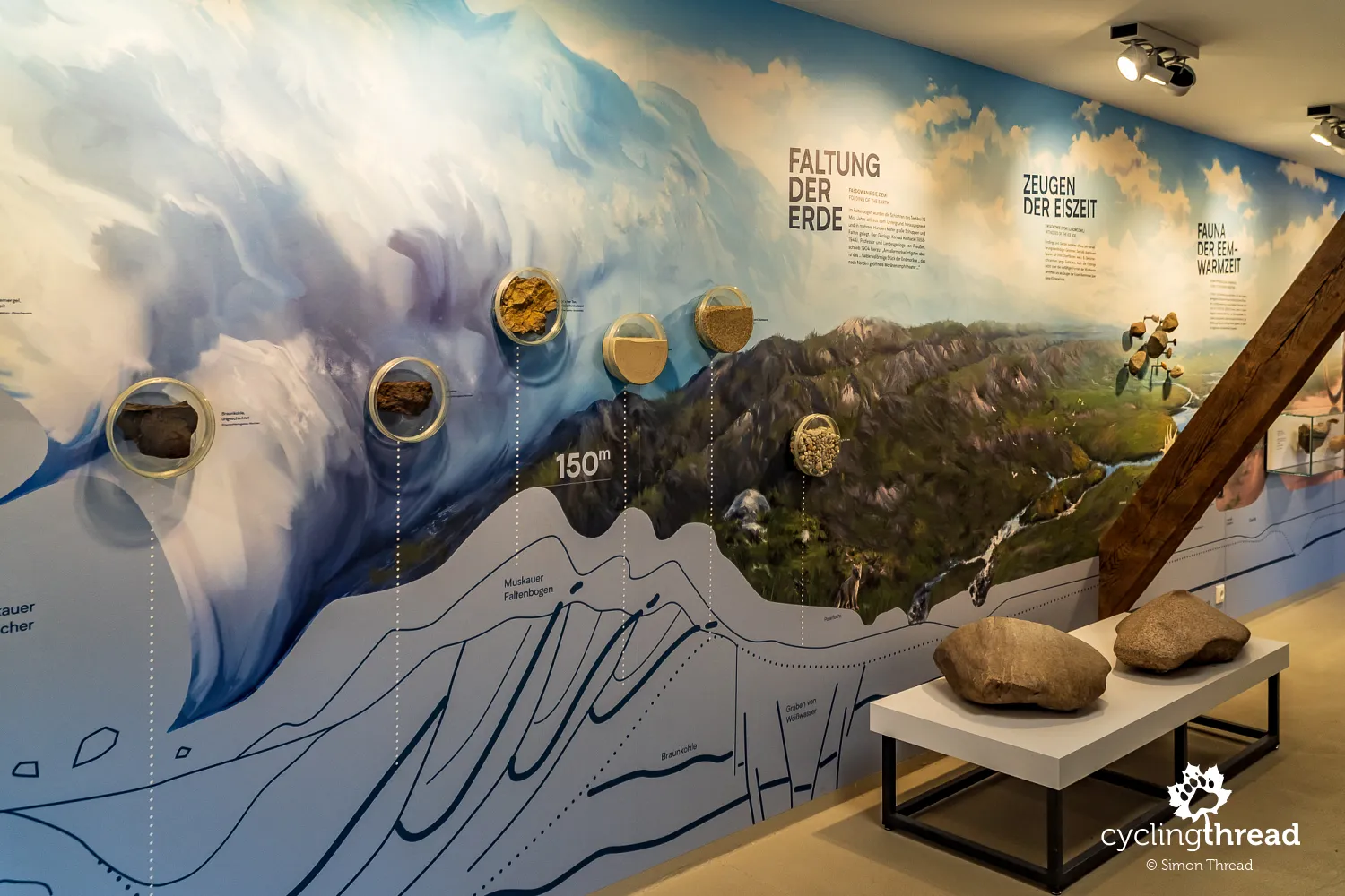
To learn more about the Muskau Arch, visit the exhibition at the Old Brickyard (Alte Ziegelei) in Klein Kölzig. This preserved and renovated site is part of the region’s heritage. Built in the late 19th century, the brickyard is over 130 years old. During its opening hours, you can see a unique ring kiln with 18 firing chambers, as well as an exhibition explaining the geological processes that created the Muskau Arch, including a detailed cross-section. The beautifully restored building itself is worth admiring, and around it, you’ll find tracks of a narrow-gauge freight line, with working rail cars that can also be seen near the route.
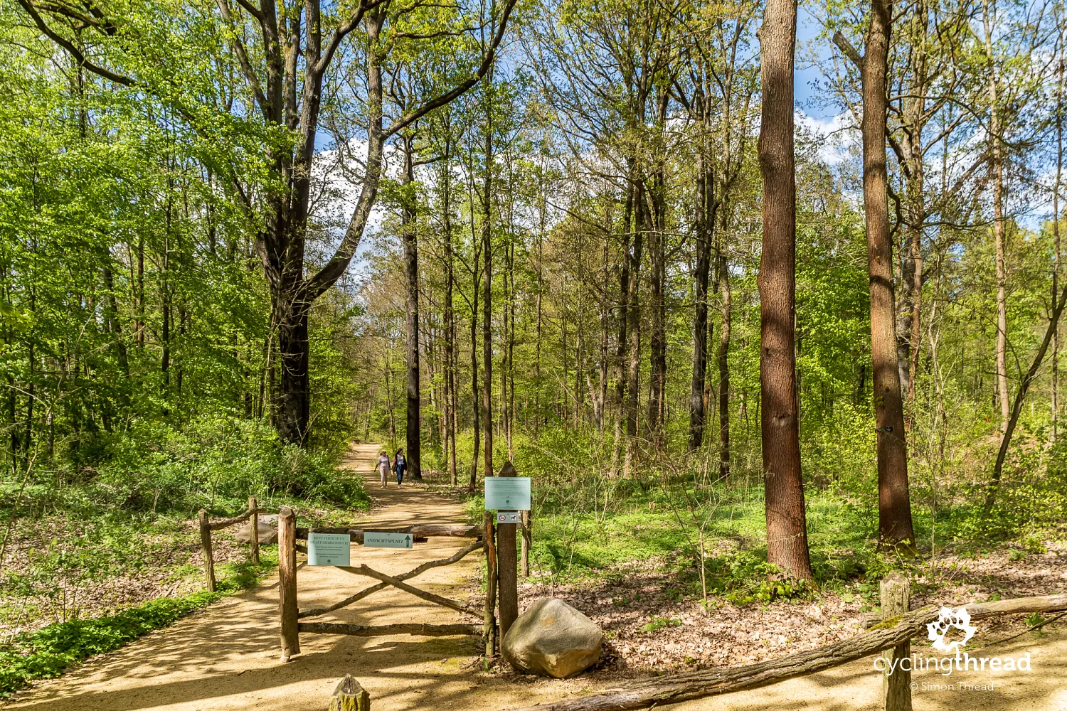
One of 100 forest cemeteries in Germany
In the forest near Döbern, we came across an unusual "attraction." Right next to the route is the entrance to Waldfriedhof Marienberg, one of around 100 forest cemeteries in Germany. These cemeteries offer a natural alternative to traditional burial grounds, where urns containing loved ones’ ashes can be legally buried at the roots of trees. This creates a tranquil and reflective resting place. The cost of such a burial is around €1,000, depending on the tree’s age and the number of urns planned for the shared forest grave.
Weathering trenches cut through the Muskau Arch
A bit further along the route through the Muskau Arch, we crossed several sharply incised valleys that run perpendicular to the road, spanning a width of several dozen meters. These are weathering trenches, characteristic geological features of the Muskau Arch. They form through weathering processes above lignite deposits, which were later pushed to the surface by the glacier. The lignite oxidizes upon contact with oxygen in the soil, creating a process similar to composting, where organic material subsides over time, forming the noticeable valleys. One of these trenches has an informational board with a clear diagram explaining their formation.
A chocolate break from cycling
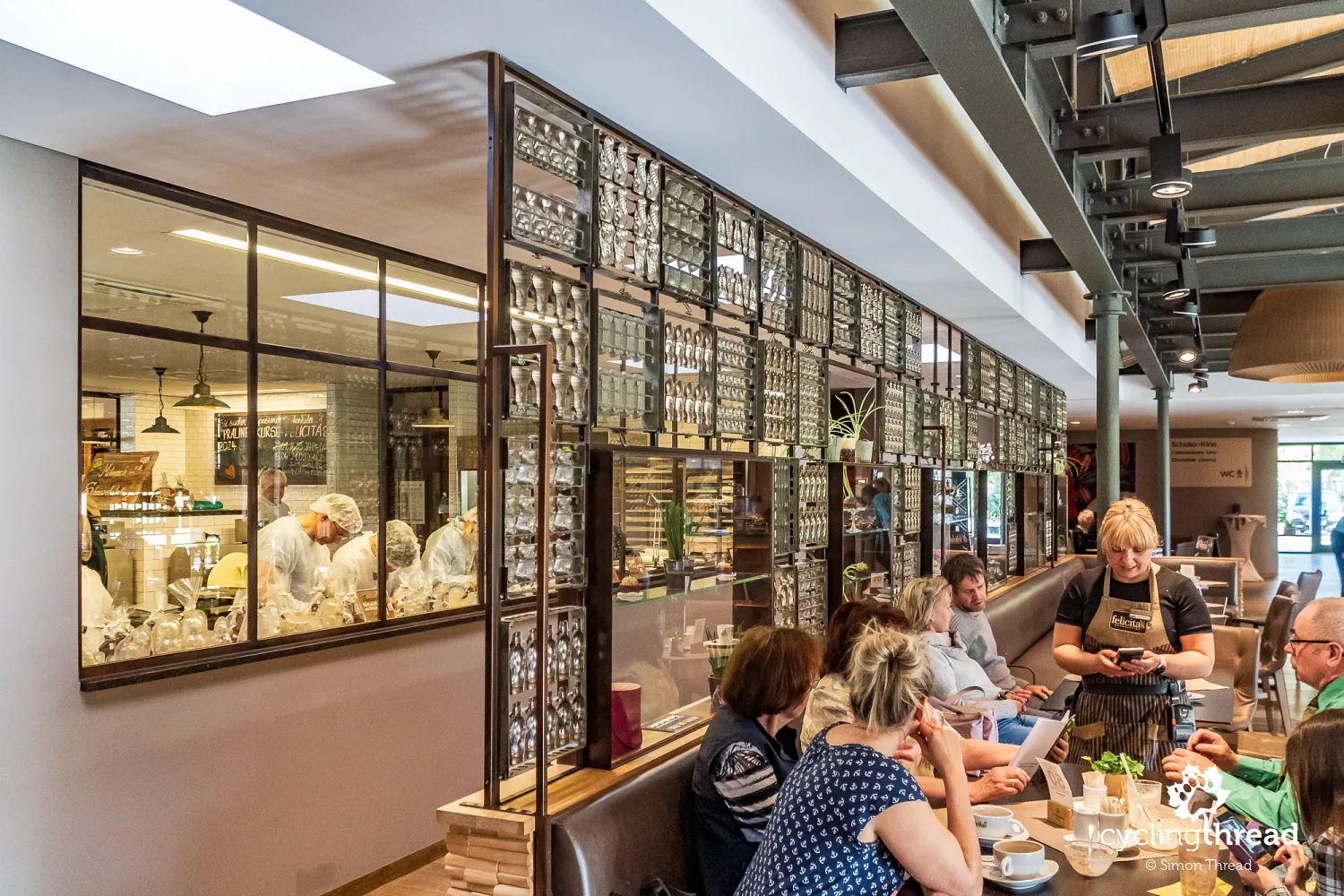
After passing the small turquoise Felixsee lake with its observation tower, we arrived in the village of Hornow, home to the sweetest spot on the route. At the end of this unassuming village is Felicitas Chocolate, a manufactory founded in 1992 by two Belgians. Known throughout Germany for its high-quality handmade chocolate treats crafted using traditional methods, Felicitas offers visitors the chance to take part in chocolate-making workshops or simply enjoy a delicious hot chocolate in the local café while watching the workshops through glass walls. In the Hornow chocolate shop, you can even buy a bicycle. A chocolate one.
Spremberg and the geographical center of Germany
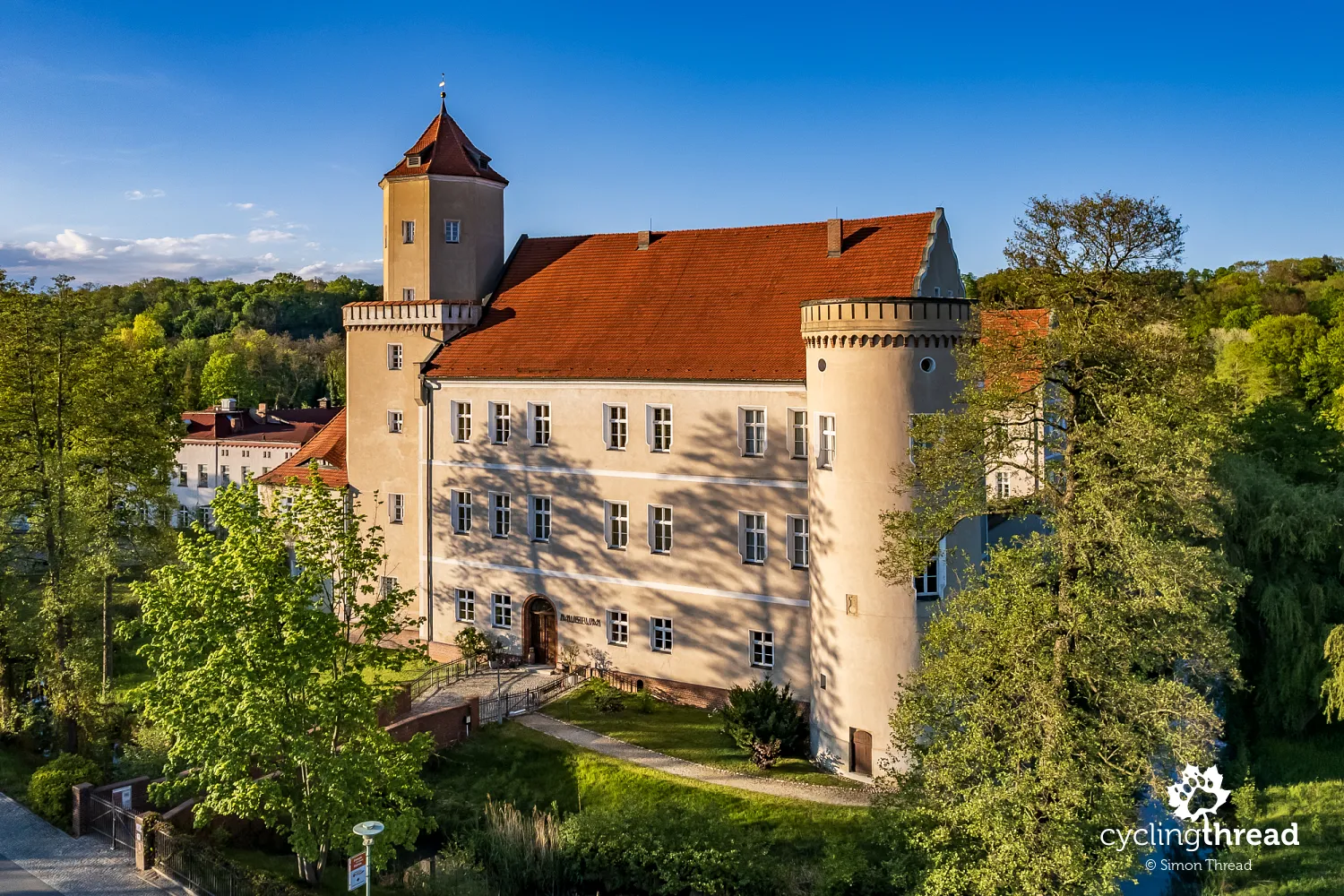
We entered Spremberg along a pleasant cycling path by the Spree River. This is another of Brandenburg’s provincial towns, which, after being heavily damaged during the war, was not restored to its pre-war state. In 1988-1989, the city’s authorities demolished parts of the remaining historic buildings, replacing them with late 20th-century structures. The old town of Spremberg is therefore relatively new, though its long history is reflected in sites like the Gothic Holy Cross Church and the city’s oldest building, Sonntagsches Haus, both dating to the 16th century. The Lower Lusatia Regional Museum (Niederlausitzer Heidemuseum), housed in Spremberg Castle, also recalls the town’s founding in 1301.
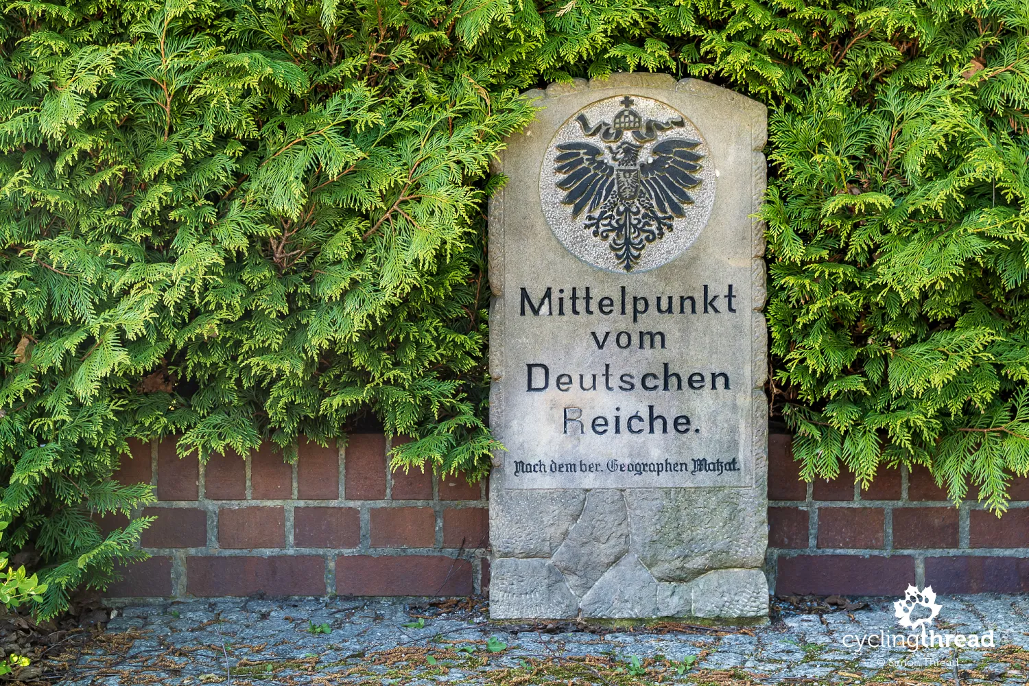
A less prominent yet fascinating site is a stone plaque located on a small square on the town’s outskirts. This plaque, bearing the German Empire’s coat of arms, states that between 1871 and 1920, Spremberg was considered the geographical center of the German Empire. This calculation was made by Heinrich Matzat, a local geography teacher, in 1872 by averaging the furthest northern, southern, eastern, and western points of Germany at the time. Today, this point is far from central - in fact, the plaque lies near the southeastern edge of modern Germany.
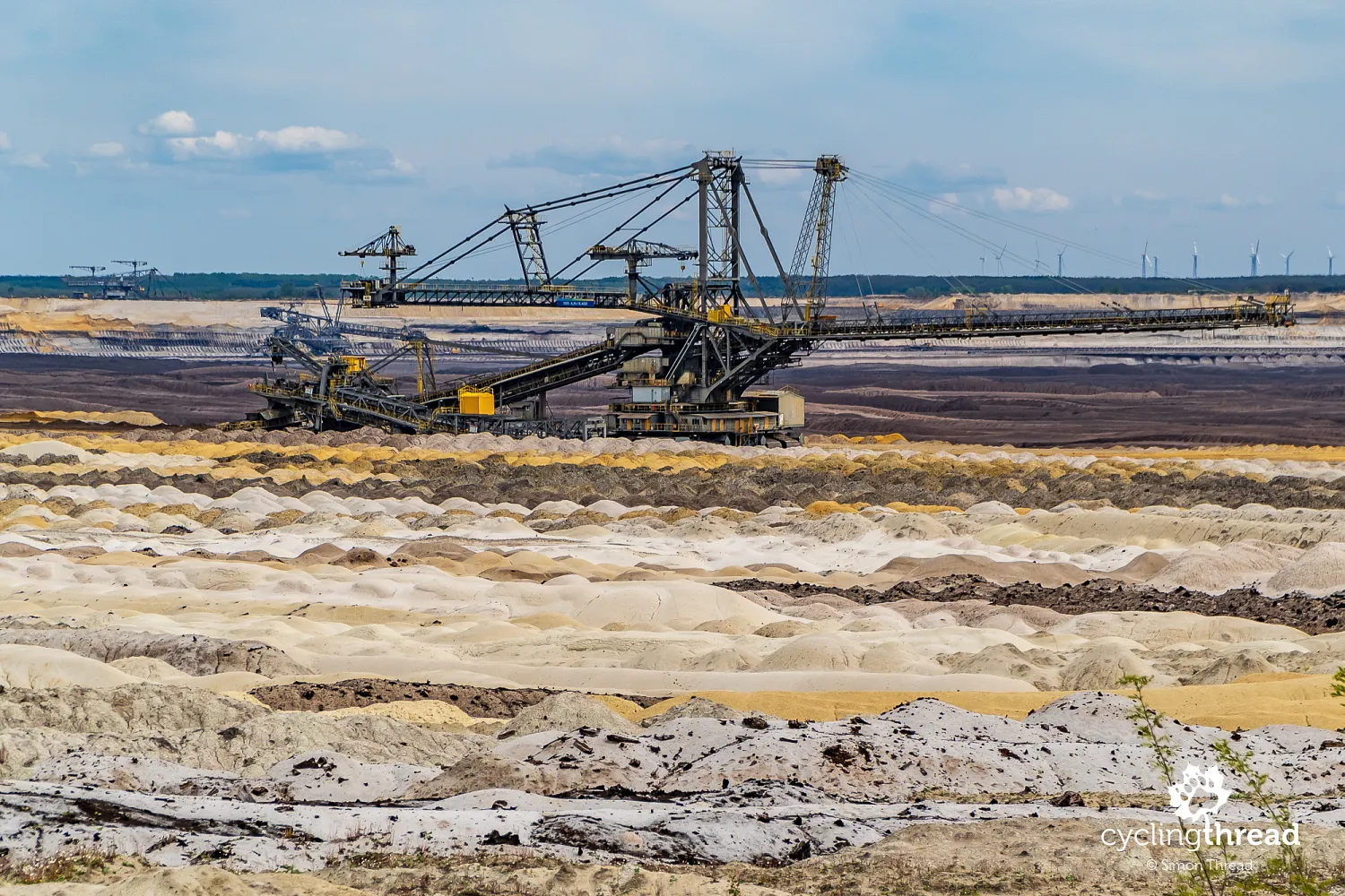
From Spremberg to the Welzow-Süd mine
From Spremberg, we rode along the only stretch of our route that follows slightly busier roads. A few kilometers toward what is likely the last major operational lignite mine in the area, Welzow-Süd, took us along regular roads open to traffic. It wasn’t a big issue, but keep in mind that such sections exist, especially if you’re traveling with younger children. We quickly passed this segment and turned onto a quieter side road, where we encountered just one car over the next several minutes. This road skirts the Welzow-Süd mine to the north, with a gravel path leading straight to Wolkenberg Hill, home to a vineyard on its southern slope.
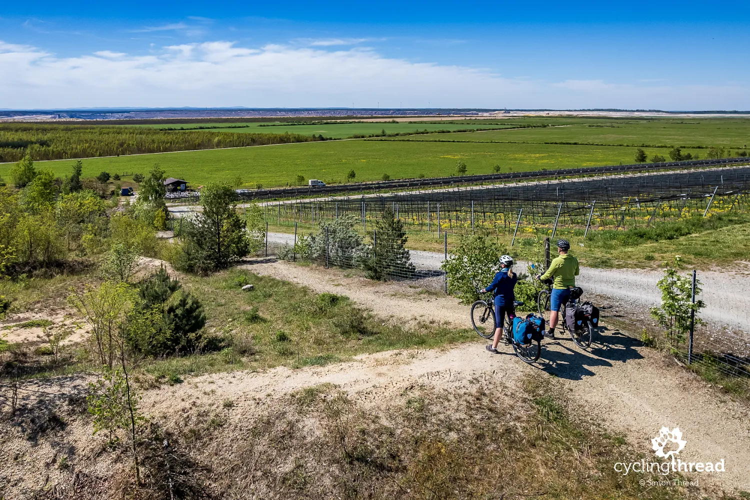
Once a village, now a hill with a vineyard
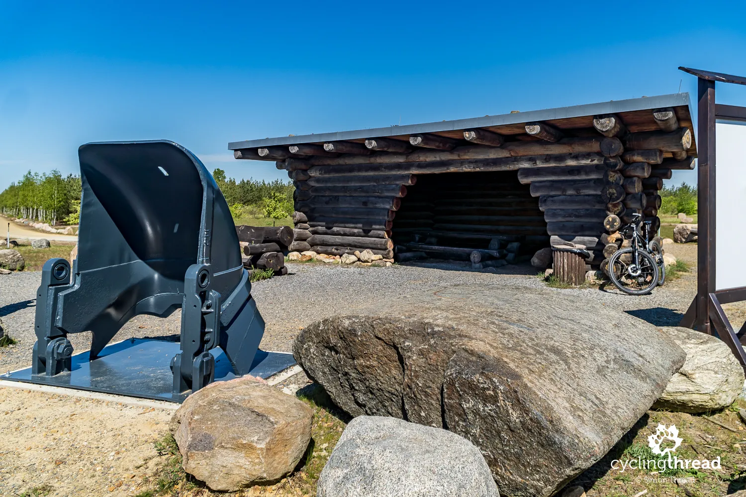
Wolkenberg Hill is not a natural formation - it was created from mining overburden, which was piled up on the site of the former village of Wolkenberg, evacuated for this purpose in 1991. A diagram at the local viewpoint vividly illustrates this transformation. An aerial photo of the present-day hill shows the layout of the former village, revealing that 40 years ago, beneath what is now the hill, there were a school, kindergarten, church, inn, and homes. All of this was buried under millions of tons of soil removed from above the lignite deposits. At the viewpoint, don’t miss the dark-gray object near the shelter - a massive tooth from a bucket wheel excavator, once used to extract material from the mine.
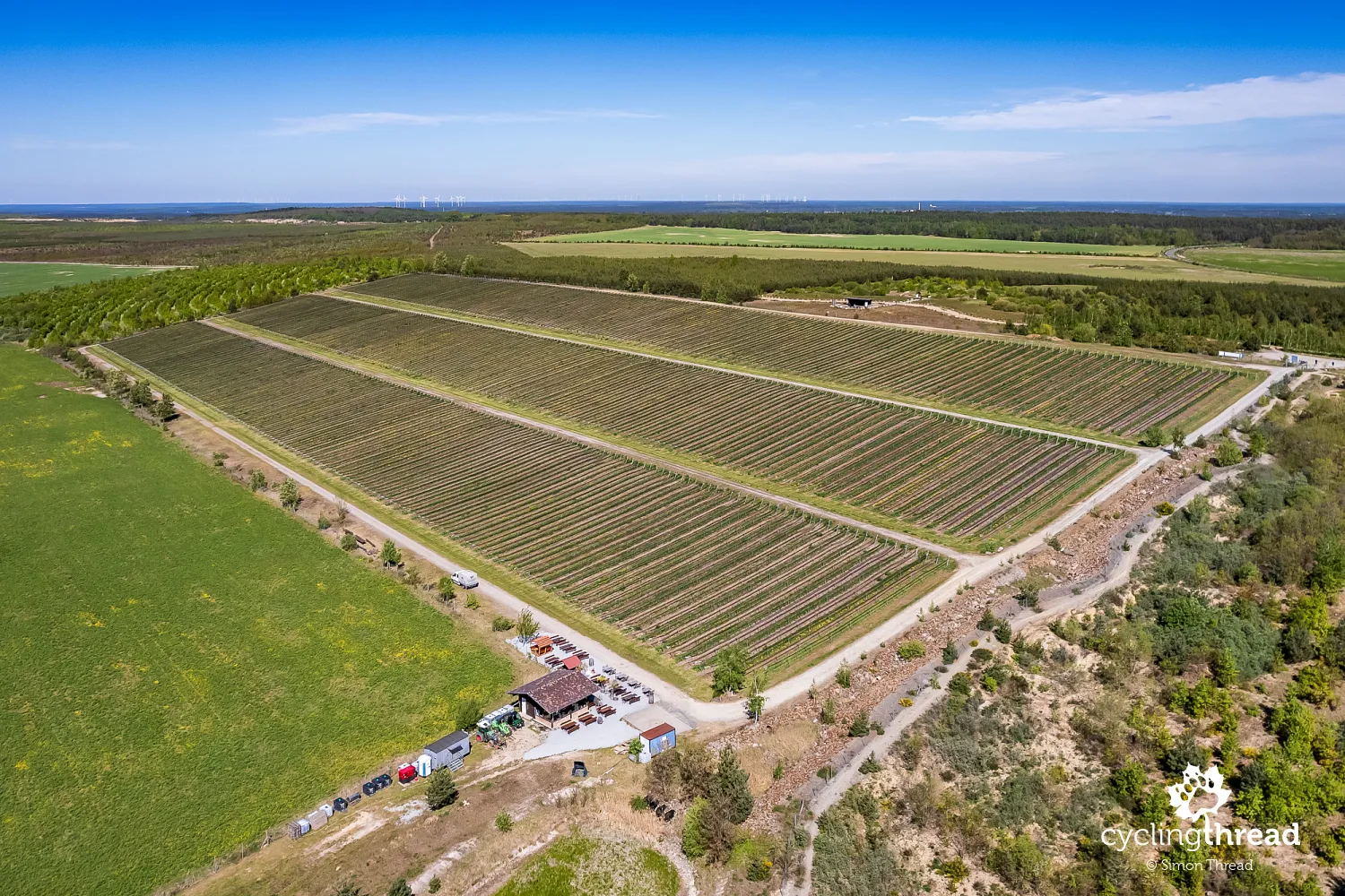
The Wolkenberg Vineyard is an unusual addition to this post-mining area. Spanning about six hectares, it is home to 26,000 vines that thrive in the unique, artificially created soil conditions, contributing to the quality of the wine produced here. The vineyard cultivates a variety of grape types and produces both white and red wines. Wolkenberg has also become a popular tourist destination, offering wine tastings and insights into the winemaking process within the context of a transformed mining landscape. For us, the extraordinary view of the vineyard set against the industrial backdrop was enough.
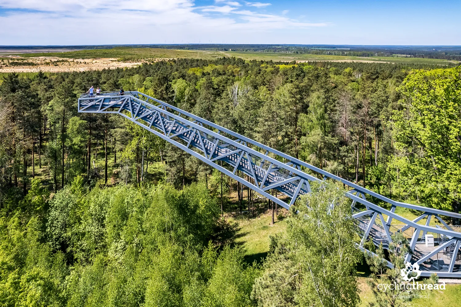
A viewpoint shaped like a reclining dinosaur
Just minutes later, we found ourselves overlooking the Welzow-Süd mine again, this time from one of the most original observation towers we’ve visited. The Steinitzer Treppe is a platform shaped like a reclining dinosaur, although the designer’s inspiration was likely a massive mining bridge. After climbing 101 steps, the small observation deck offers a sweeping view of the reclaimed Welzow-Süd mine and the Lusatian landscape stretching from the Lusatian Highlands in the south to the Spreewald in the north. On clear days, you can even spot the dome of Tropical Islands. This wasn’t our last scenic stop of the day.
All that remains of a displaced village is a manor
A short ride later, we arrived at another site that tells much about the Lusatian Lakeland. Gut Geisendorf is a restored manor, the only building to survive the displacements and demolitions in the former village of Geisendorf, cleared to make way for the expanding Welzow-Süd mine. Today, the manor serves as an educational and cultural center, housing a permanent exhibition on the region’s history and the landscape transformations caused by mining. On weekends, it also operates a simple café. From here, organized tours depart, providing visitors with insights into the reclamation processes of post-industrial areas, organized by Excursio, the local tourist service center based in a restored railway station in Welzow.
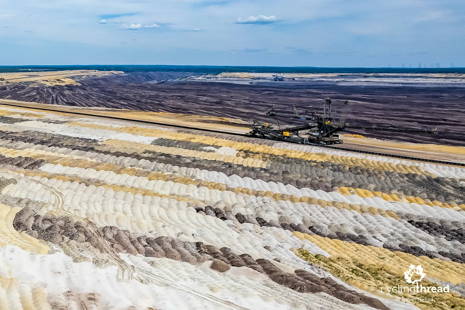
A concrete window with a view of the mine
Before reaching Welzow, we stopped at another viewpoint at the edge of the mine. Here, through a massive concrete frame, you can gaze out at a sea of overburden - the material excavated from above the lignite deposits. The overburden forms colorful mosaics, gradually arranged by the visible mining bridge that continuously dumps the material. This was our final look at an active mining pit; the next ones we’d encounter would be filled with millions of cubic meters of water, bearing little resemblance to their industrial origins.
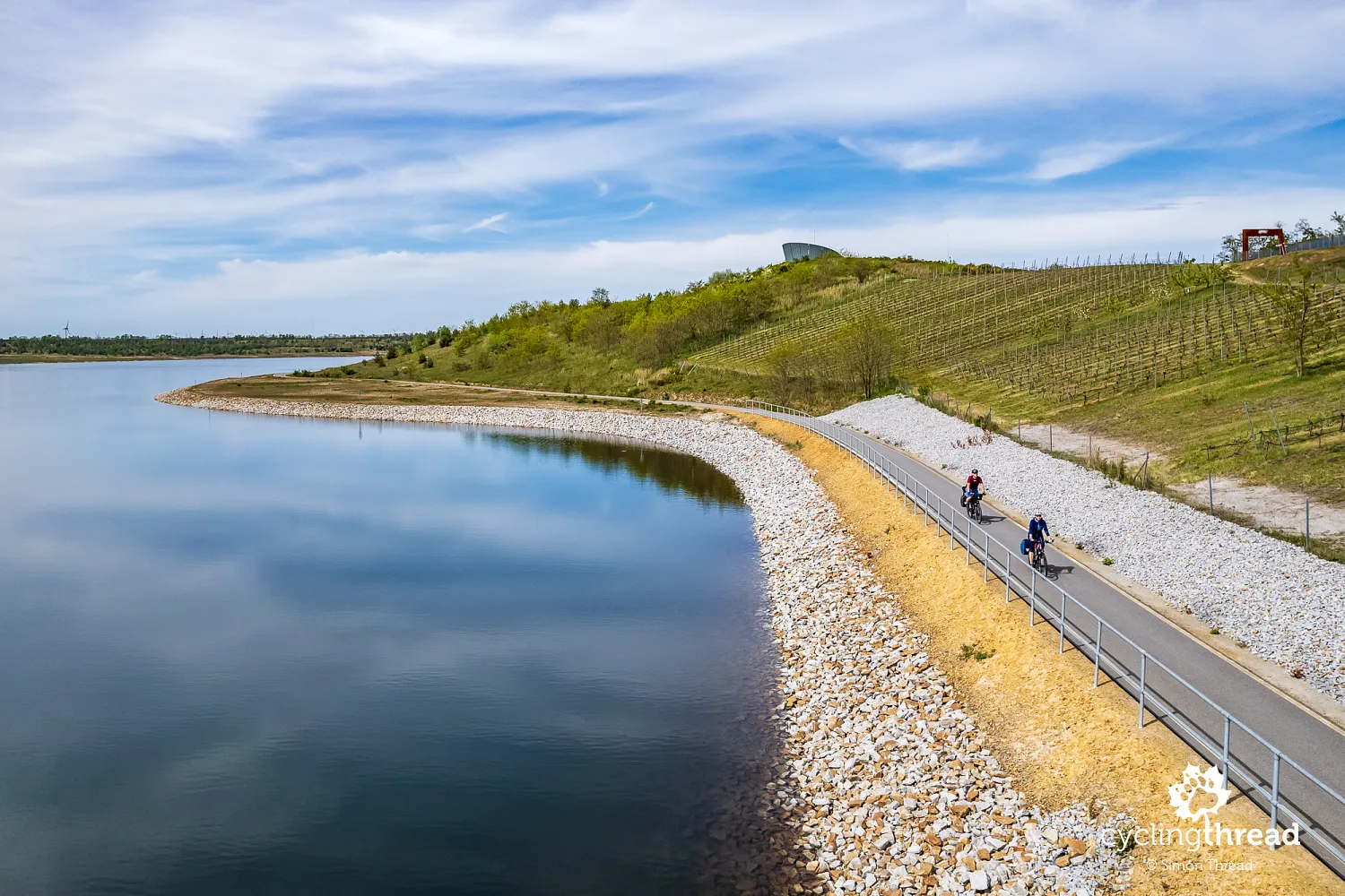
The Brandenburg Stonehenge by the cycling path
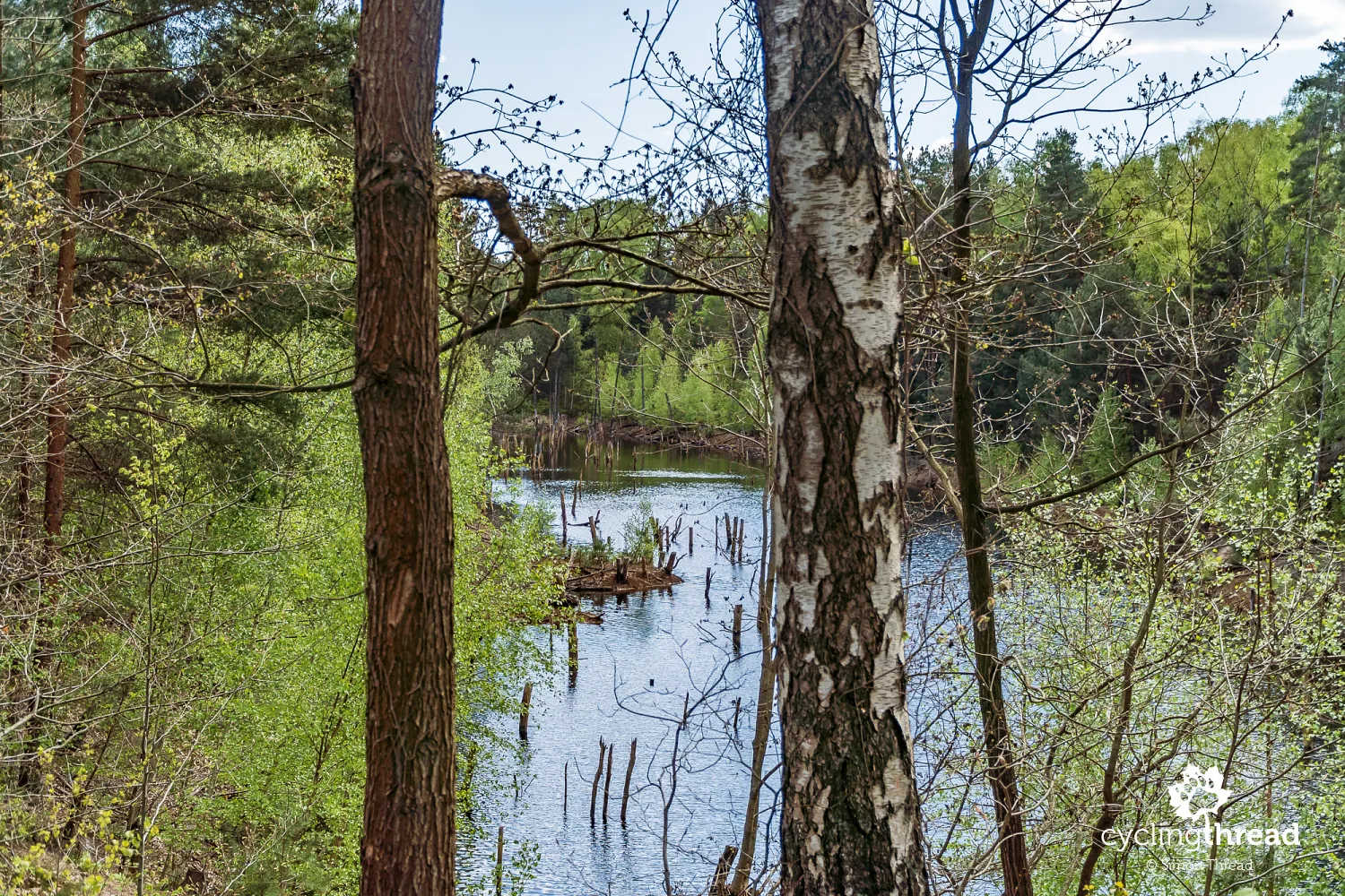
The first reclaimed lake along the Lower Lusatia Mining Route, or rather a former mining pit turned lake, is Altdöberner See. The process of filling the former Greifenhain open-pit mine with water began in 1998 and is expected to finish by 2025. A fantastic cycling path already runs along its southeastern shore, but access to the water’s edge is still restricted, with signs prohibiting entry and fishing, likely due to steep slopes yet to be reached by water. Along the path, you’ll spot a circle of concrete slabs - an art installation made from old road plates from the decommissioned mine, dubbed the Lusatian Stonehenge. While it has little in common with the original, it serves as a great vantage point.
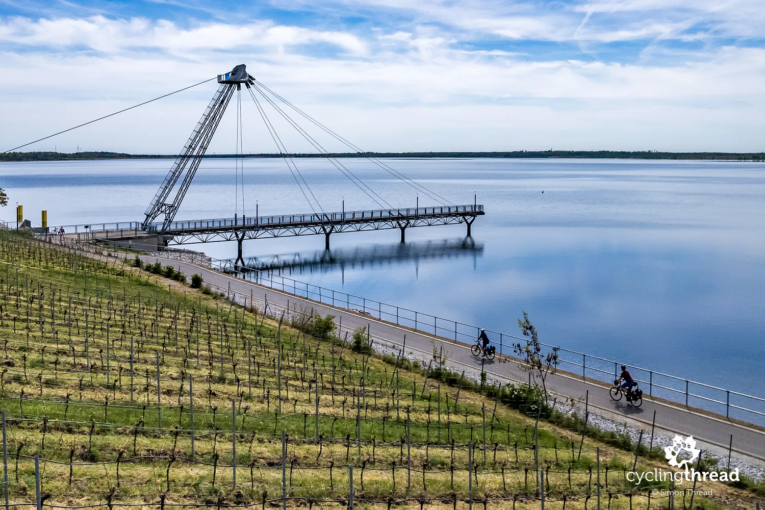
Großräschener See with numerous examples of revitalization
That day, our mining cycling route took us to Großräschen, a town located on the shores of Großräschener See, where we stayed overnight. Here, we witnessed what are likely the largest and most complex examples of successful reclamation, revitalization of a degraded area, and investment in a former mining landscape. At Großräschener See, a yacht marina has been constructed, featuring an information center at its core and a striking pier extending over the water. On one side of the marina stretches a sandy beach, while on the other, a vineyard has been established on the slope overlooking the lake, separated from the water by a smooth asphalt cycling path. A unique bistro is housed in characteristic concrete blocks nearby.
Großräschener See was created on the site of the former Meuro open-pit lignite mine, one of the most important in the region. The Meuro mine operated from the 1950s and was a crucial element of East Germany’s energy industry. Due to changes in energy policy and the restructuring of the mining sector, the mine closed in the 1990s. Efforts to transform the degraded area into an attractive recreational landscape began in 1997. Flooding of the mine site started in 2007, and Großräschener See reached its full level in 2018. The scale of investment in reclaiming and transforming this area is enormous, and it’s hard to believe that 30-40 years ago, massive mining excavators dominated this landscape.
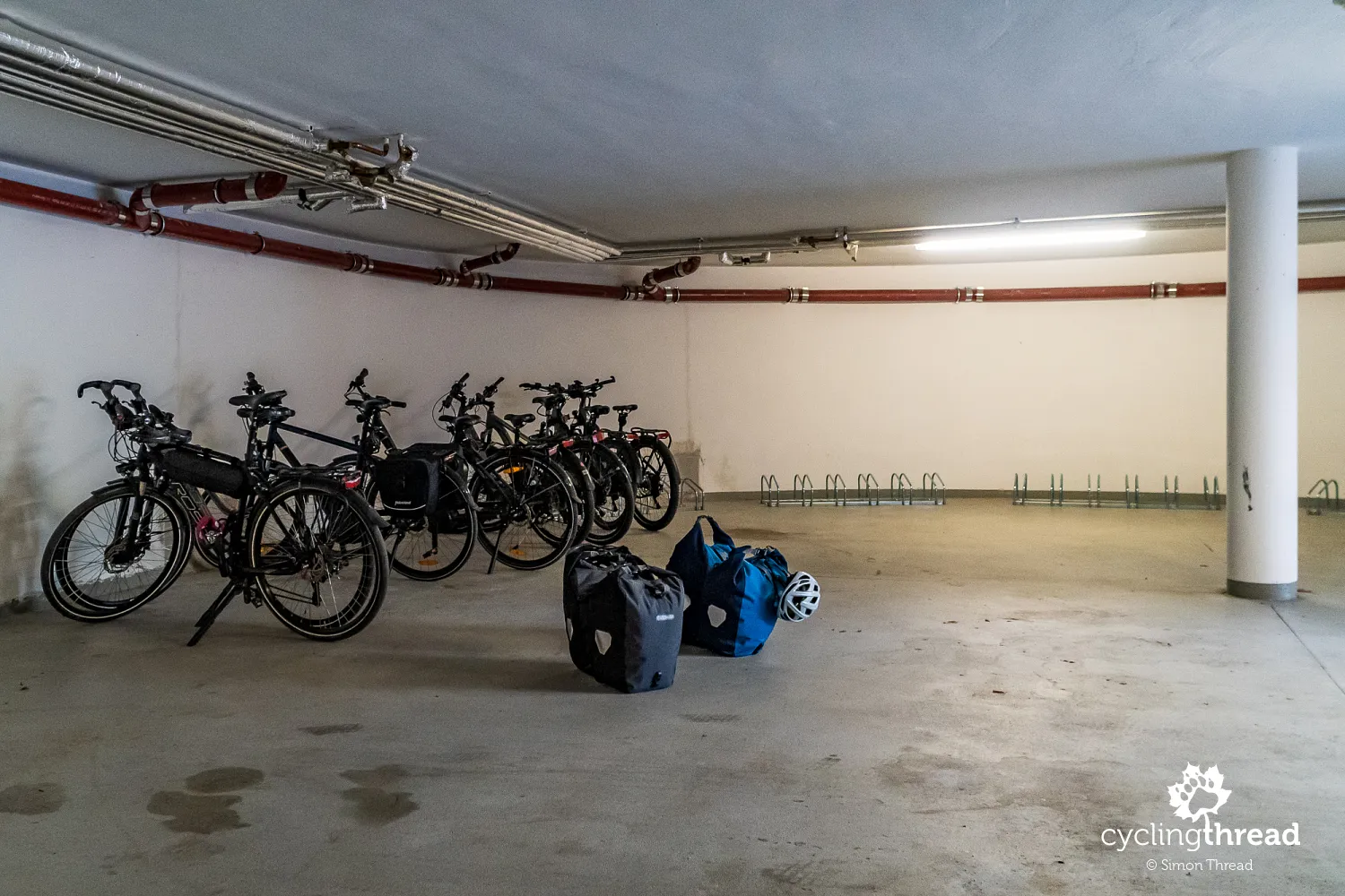
Cyclist-friendly accommodations available
At the hotel where we stayed, we parked our bikes in a convenient underground cycling garage. We have already grown used to the fact that our non-electric bikes are in the minority, even though no section of our route required electric assistance. The spacious garage, directly accessible from the outside, offers parking, repair facilities, and charging stations for e-bikes. This level of cyclist-friendly infrastructure is something we’ve come to expect in Germany. The cyclist-friendly accommodations in Germany belong to the Bett+Bike network, and all those along the Lower Lusatia Mining Route can be found on their website, which is an excellent resource for planning your stay.
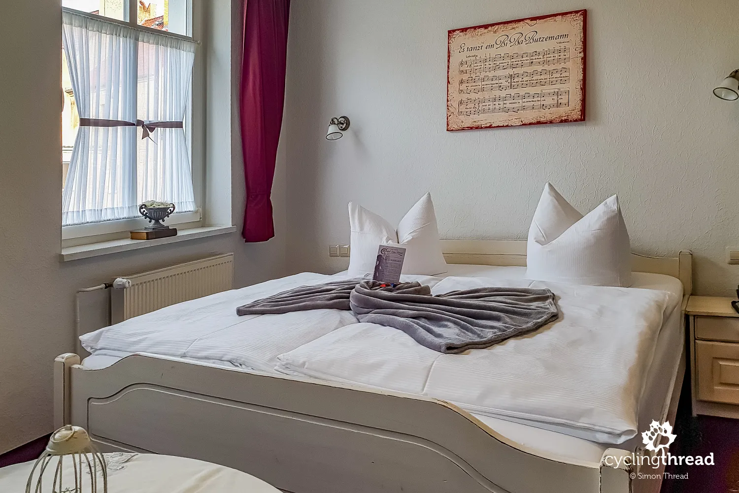
However, we used a popular booking platform offering affordable stays in Lusatian Lakeland to arrange our accommodations. In all the towns, small urban hotels were available, and we had no trouble storing our bicycles. In Forst we stayed at Hotel Haufe, in Spremberg our choice was Hotel Stadt Spremberg, and in Finsterwalde we stayed at Hotel Zum Vetter. In Großräschen we found a much larger hotel - the spacious SeeHotel Großräschen, located right by the new terraces overlooking the lake, just a few steps away from the areas surrounding the modern marina.
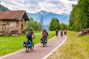
Plenty of excellent cycling infrastructure
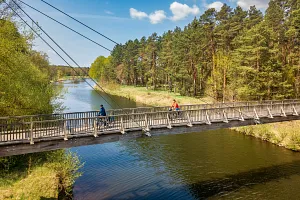
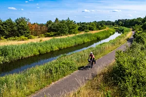
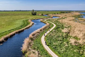
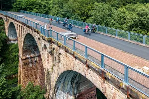
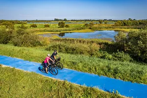
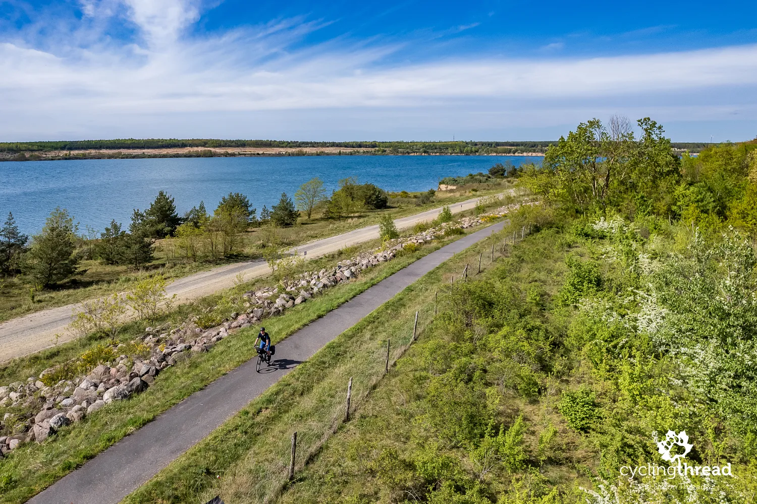
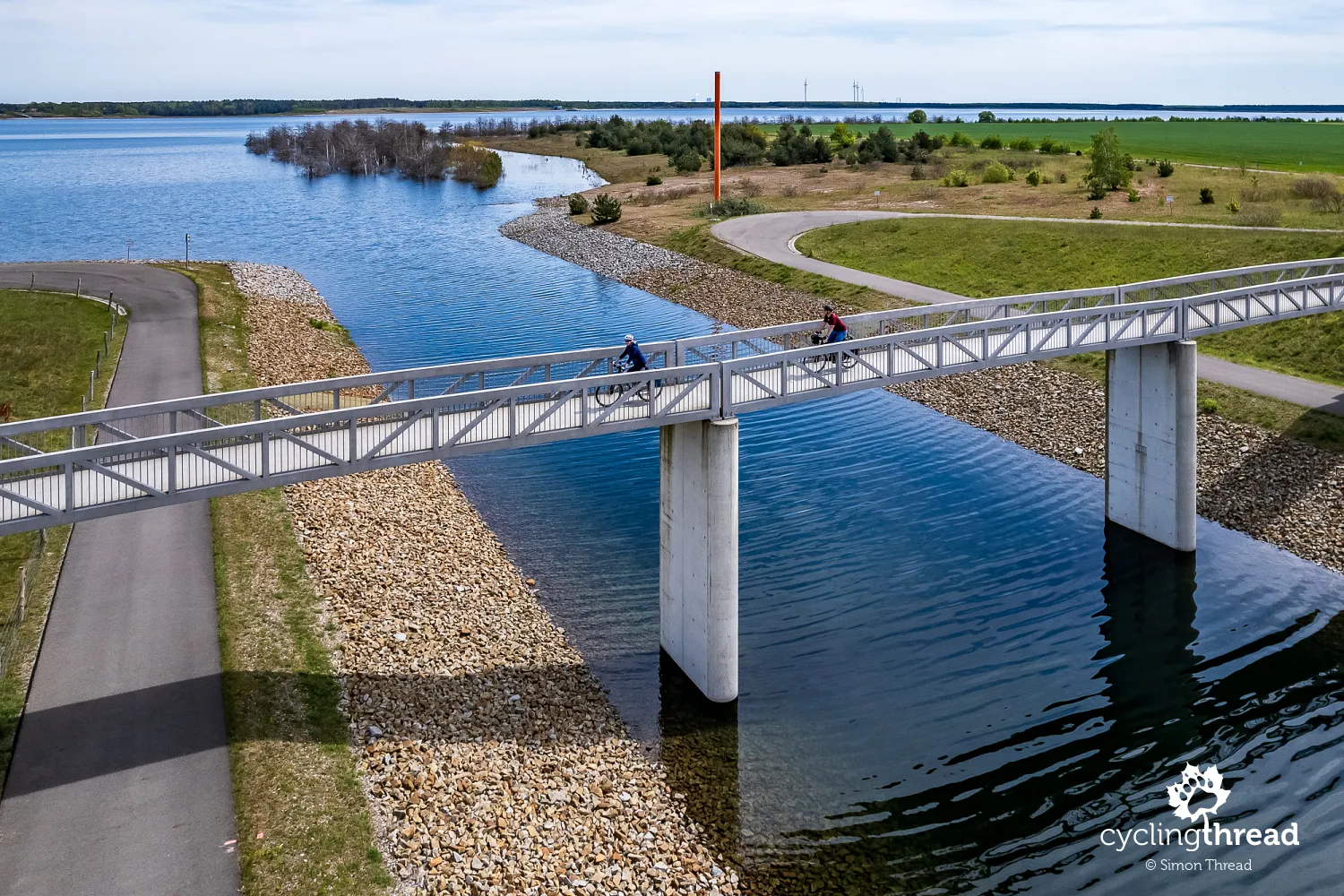
The next day started with several kilometers of riding along the shores of newly created lakes. In some places, we observed patches of young trees partially submerged in water, having grown on reclaimed land before the reservoirs were filled. Around each lake, we cycled on wide, smooth paths and often regretted that we had only one day to explore this part of the Lusatian Lakeland. We visited only 4-5 lakes near Senftenberg, which is just about a quarter of all the lakes created through regional revitalization. The cycling infrastructure here is impressive: paths along lakes and canals, cyclist bridges, underpasses below roads and railways, and inviting rest areas. Germany has done an extraordinary job revitalizing and transforming this region.
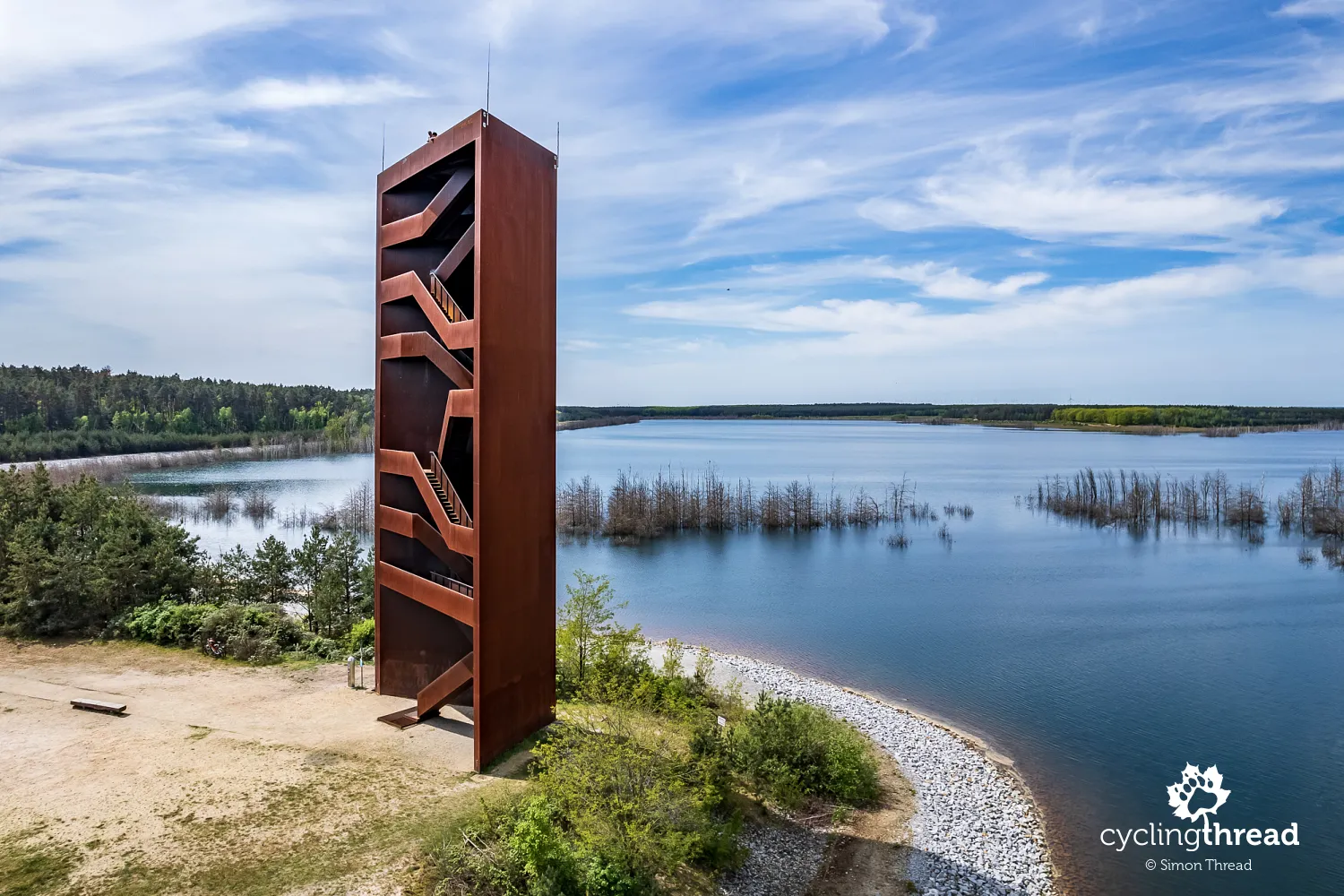
The Rusty Nail: a 30-meter-high observation tower
Soon after, we arrived at a tall, rust-colored structure. Up close, we could see a series of stairs inside its iron frame leading to the top. The Rusty Nail (Rostiger Nagel) is a 30-meter-high observation tower designed to symbolize the region's transition from mining to tourism. Its material, weathering steel with a unique patina, adds to its symbolic value, reminiscent of the iconic European Solidarity Centre in Gdańsk. The Rusty Nail is one of the most distinctive landmarks of the Lusatian Lakeland and a popular destination for cyclists, runners, and hikers. Nearby, a small bar provides a pleasant spot for a break.
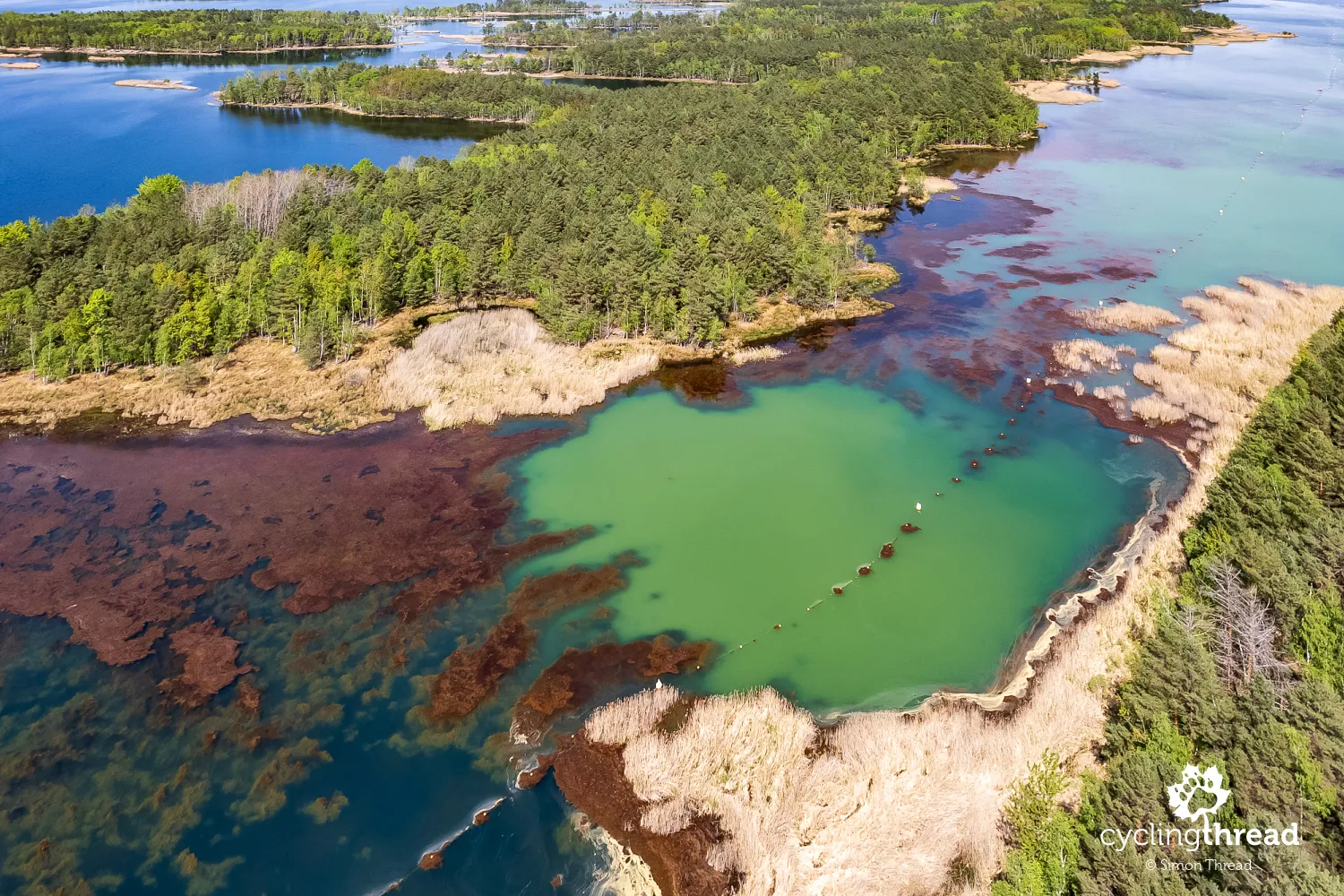
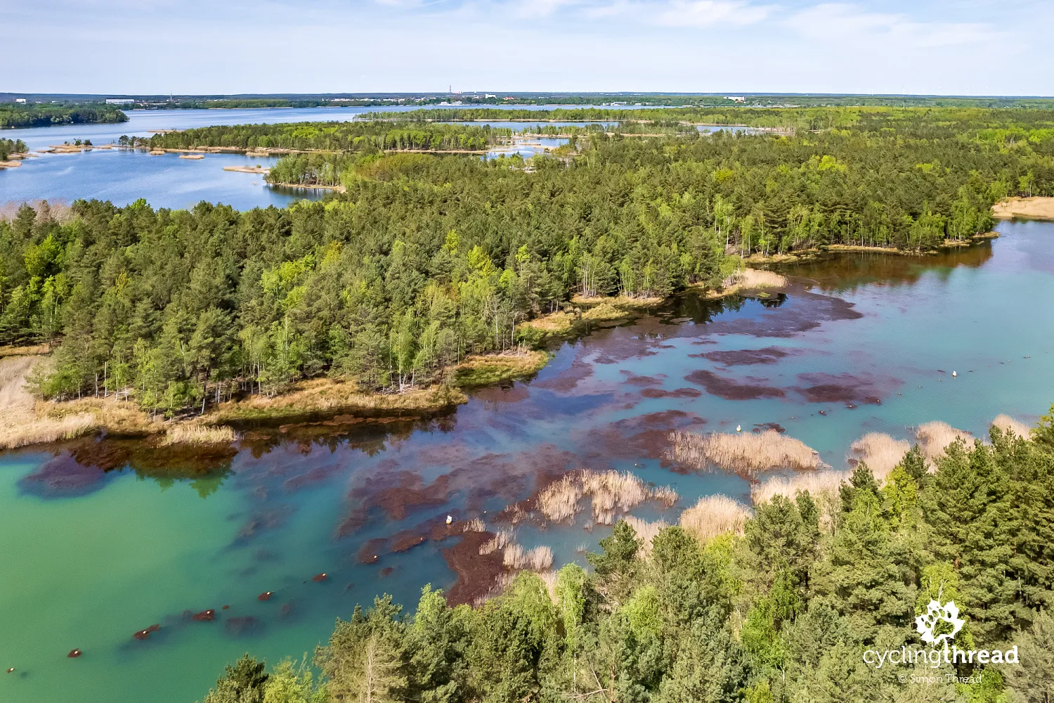
Fresh sand by a colorful lake
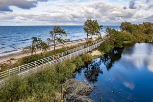
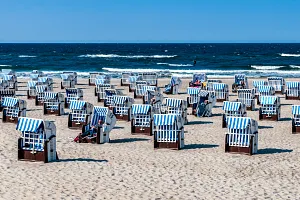
The next few kilometers took us along wide cycling paths, this time around Senftenberger See. This lake marked the beginning of the revitalization of Lower Lusatia, with flooding starting in 1967 and the first beach opening in 1973. A smooth asphalt cycling path led us to another observation tower overlooking colorful mineral deposits near the lake. While the view might be more dramatic from a drone, the tower is still worth climbing. Just a kilometer farther, we watched a truck spreading fresh, light-colored sand on the lakeshore to create a beach in front of a small forest restaurant. Unfortunately, time didn’t allow us to stop here.
The Polish-Saxon postal pillar in Senftenberg
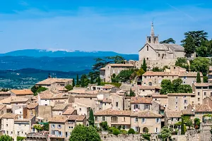
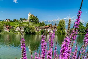
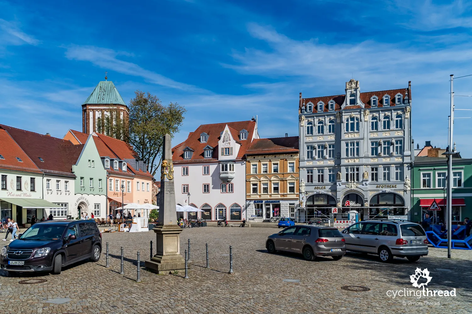
Senftenberg was probably the most charming town we visited during our trip through Brandenburg. Its well-preserved center and pleasant market square reminded us of Beeskow on the Oder-Spree Route or Angermünde in the Uckermark cycling region. Situated by Senftenberger See, the town has a history dating back to the Middle Ages when it was an important trade and defense hub. Significant landmarks include the 16th-century Senftenberg Castle, which houses a museum showcasing the region’s history and is surrounded by a beautiful, dense natural park. This park is worth visiting on your way to the town center from the lake. For Polish visitors, the well-maintained Polish-Saxon postal pillar from the 18th century in the market square is a particular highlight.
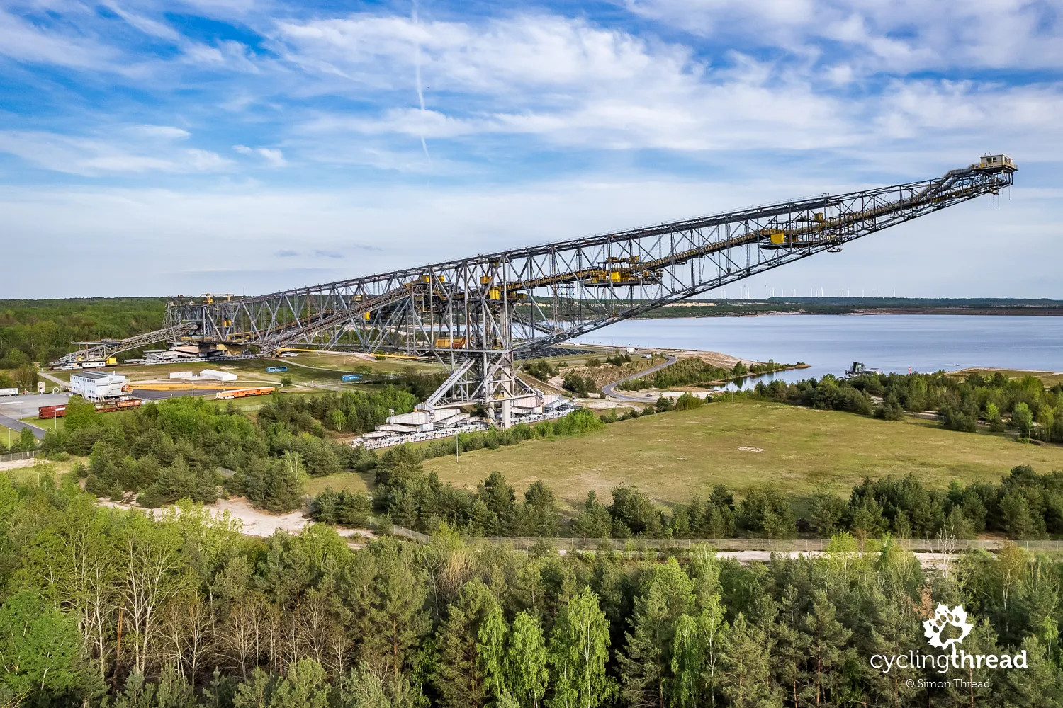
The Eiffel Tower of Brandenburg lying down
A few kilometers before the end of our three-day journey through the Lusatian Lakeland, we finally arrived at the "monument" to southern Brandenburg's mining industry: the F60. This colossal mining bridge and excavating machine, often called the "lying Eiffel Tower," is one of the largest machines of its kind in the world. Its structure measures 502 meters in length, 80 meters in height, and weighs over 11,000 tons. Built in 1991, the F60 transported massive amounts of overburden away from mining areas to access coal deposits. Today, it has been repurposed as a tourist attraction, allowing visitors to walk to its farthest point, now an abstract yet breathtaking observation deck.
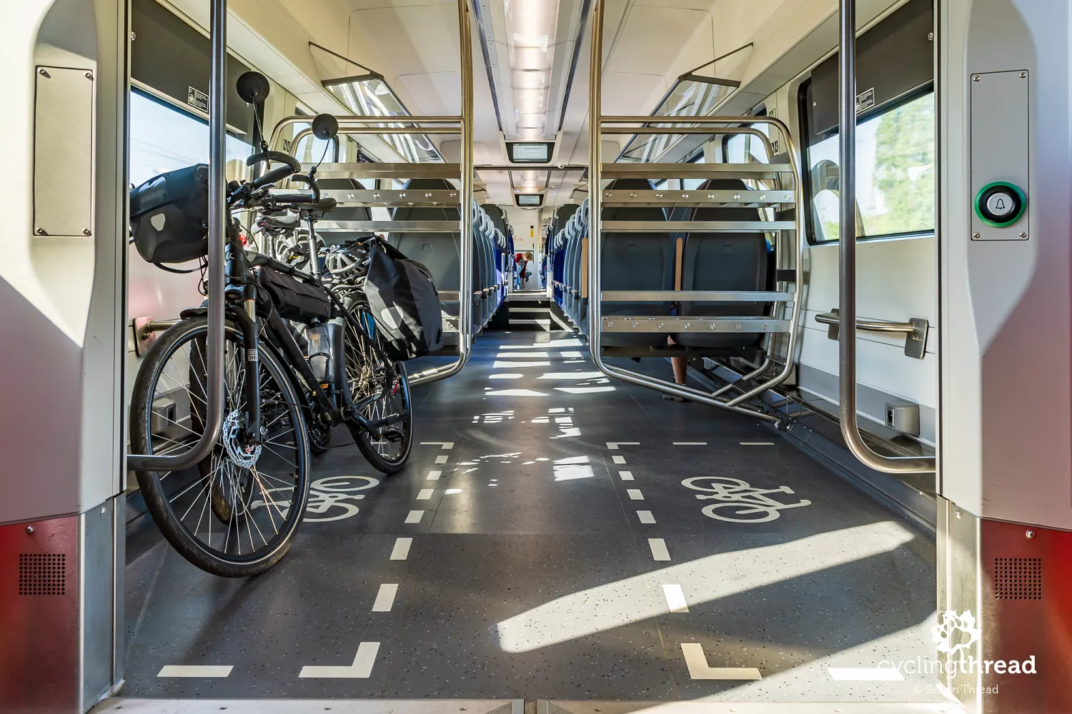
Through Lusatian Lakeland by bike and train
A word on logistics: as mentioned earlier, we arrived in Forst by car, leaving it parked for three days in a public lot near the town hall. From there, we followed the signs of the Lower Lusatia Mining Route westward, ending in the town of Finsterwalde. After a pleasant overnight stay, we boarded a regional train in Finsterwalde and, with a transfer in Cottbus, returned to Forst. The entire journey took about an hour and a half. Both legs were on German regional trains that didn’t require seat or bike reservations. One of them was a sleek, modern Siemens Mireo train operated by Deutsche Bahn. Tickets were easily purchased at red machines at the station before departure.
Rose Festival at the East German Rose Garden
Returning to the start of the route, vintage car rallies aren’t the only events hosted at the East German Rose Garden. The most prominent and popular event in Forst is the annual Rose Festival, celebrating the beauty and diversity of roses. Typically held at the end of June, when the garden is in full bloom, the festival attracts thousands of flower enthusiasts. Visitors can enjoy workshops, concerts, and cultural events while admiring thousands of blooming rose bushes. The festival also features shows, competitions for the most beautiful roses, and exhibitions exploring the history and cultivation of these flowers. This year, the Rose Festival will take place on the last weekend of June.
A great idea for an exciting weekend
The Lusatian Lakeland and the Lower Lusatia Mining Route are undoubtedly excellent inspirations for an active cycling weekend in Germany, offering a unique and unconventional setting. Superb cycling paths lead through reclaimed post-mining landscapes, around numerous lakes, and feature post-industrial views from distinctive observation points. And let’s not forget those roses in Forst!
Back to topHave a safe ride! 💚
Simon Thread
(Szymon Nitka)
I'm a passionate cycling traveler and the voice behind Cycling Thread. I explore Europe on two wheels, documenting the most scenic routes, inspiring places and cyclist-friendly practices. My writing blends personal experience with practical insights and a deep love of travel. I'm also a contributor to National Geographic Traveler magazine.