Switzerland and the Rhine Cycle Route: one of the most beautiful in Europe
Seven days - that is all the time we needed to cycle the route along the Rhine in Switzerland - the most stunning cycling route in Europe we have journeyed so far. A tremendous asset of the Swiss route is its diversity - Switzerland captivates along the Rhine with various landscapes and some of its most beautiful cities - we visited Chur, Schaffhausen, Stein am Rhein and the third-largest city of Switzerland, Basel. Traveling along the Rhine in Switzerland is undoubtedly one of the best suggestions for a cycling holiday in Europe.
Join us on our new 🟢 Komoot account!
Cycling Partners
Route on the map
GPX file (GPS track): cyclingthread.com-switzerland-2020.gpx
Rhine Cycle Route - table of contents
- From the Swiss Alps to the North Sea
- By train to the Alps for the start of the route
- Chasing the world’s most famous train
- On the train, a bike ticket with a reserved spot
- The Swiss Alps greet us with beautiful sunshine
- St. Gotthard, Furka and Oberalp Passes
- Climbing the alpine serpentine
- The highest lighthouse in the world
- Rheinquelle - the beginning of a 1200-kilometer story
- Homely atmospheres at a four-star campsite
- The benedictine abbey and the Romansh language
- Greater elevation than the conquered pass
- Beautiful collection of cowbells in Ilanz
- The highest wooden fountain in Europe
- Now onto the Ruinaulta Gorge - the Swiss Grand Canyon
- A narrow road carved into the Alpine cliff
- One of the most beautiful cities in Switzerland
- Self-service shop for cycling tourists
- Street art, luxury and thermal waters
- The best spot for a souvenir photo
- At the crossroads of Alpine trade routes
- Sardona Tectonic Arena on the UNESCO list
- Underground restaurant and mining museum in Gonzen
- The smallest town and the most beautiful view in Switzerland
- An extraordinary cycling encounter after a year
- The Rhine Route not just for bikes
- The new Rhine delta between the Old and New Rhine
- River regulation to protect against floods
- The bustling southern shore of Lake Constance
- The historic Badhütte and Granary Museum
- The most interesting town on Lake Constance
- Incredible Swiss Automotive Museum
- Rudolf Diesel worked for Saurer
- Bregenz and Constance set aside for later
- The beautiful Stein am Rhein, a jewel of the Rhine valley
- The first winner of the Wakker Prize
- A beautiful wooden bridge over the Upper Rhine
- Schaffhausen - the city of fortresses and bay windows
- Rheinfall - the largest waterfall in Europe
- Switzerland's most beautiful places in miniature
- Munot fortress among the miniatures of Switzerland in Neuhausen
- Benedictine Abbey on an island on the Rhine
- Beautiful Kaiserstuhl, Laufenburg and Rheinfelden
- The beginning and end of the trip in Basel
- Basel - the cultural capital of Switzerland
- Rhein Route - Swiss national route no. 2
- Comfort and safety on the bike route
- We needed a vacation, we needed Switzerland
From the Swiss Alps to the North Sea
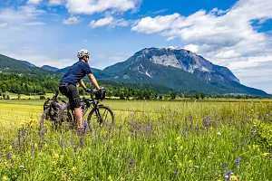
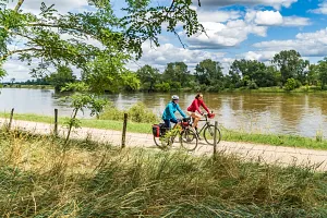
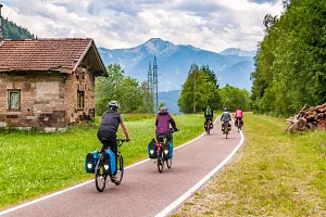
The Rhine Cycle Route in Switzerland is the inaugural stretch of the European cycling route EuroVelo 15, spanning over 1200 kilometers, all the way to the Rhine's estuary into the North Sea. The route kicks off in the heart of the Andermatt resort in the Swiss Alps, from where it snakes towards the Oberalp Pass. From the Rhine's source near the pass down to the city of Chur, the path follows the Rhine's upper section (known as Vorderrhein or the Anterior Rhine) peaking with a dramatic ride through the Ruinaulta - Switzerland's Grand Canyon. Beyond Chur in Graubünden, the river slows and meanders through a broad valley to reach Lake Constance. From there, first through bustling towns along the southern shore of Lake Constance and then past the picturesque Stein am Rhein and Europe's largest waterfall, the bike path through the Rhine valley leads to Basel. The official length of this segment is 430 kilometers, though our odometers showed just under 480 kilometers covered.
By train to the Alps for the start of the route
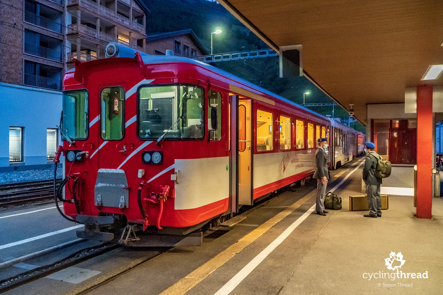
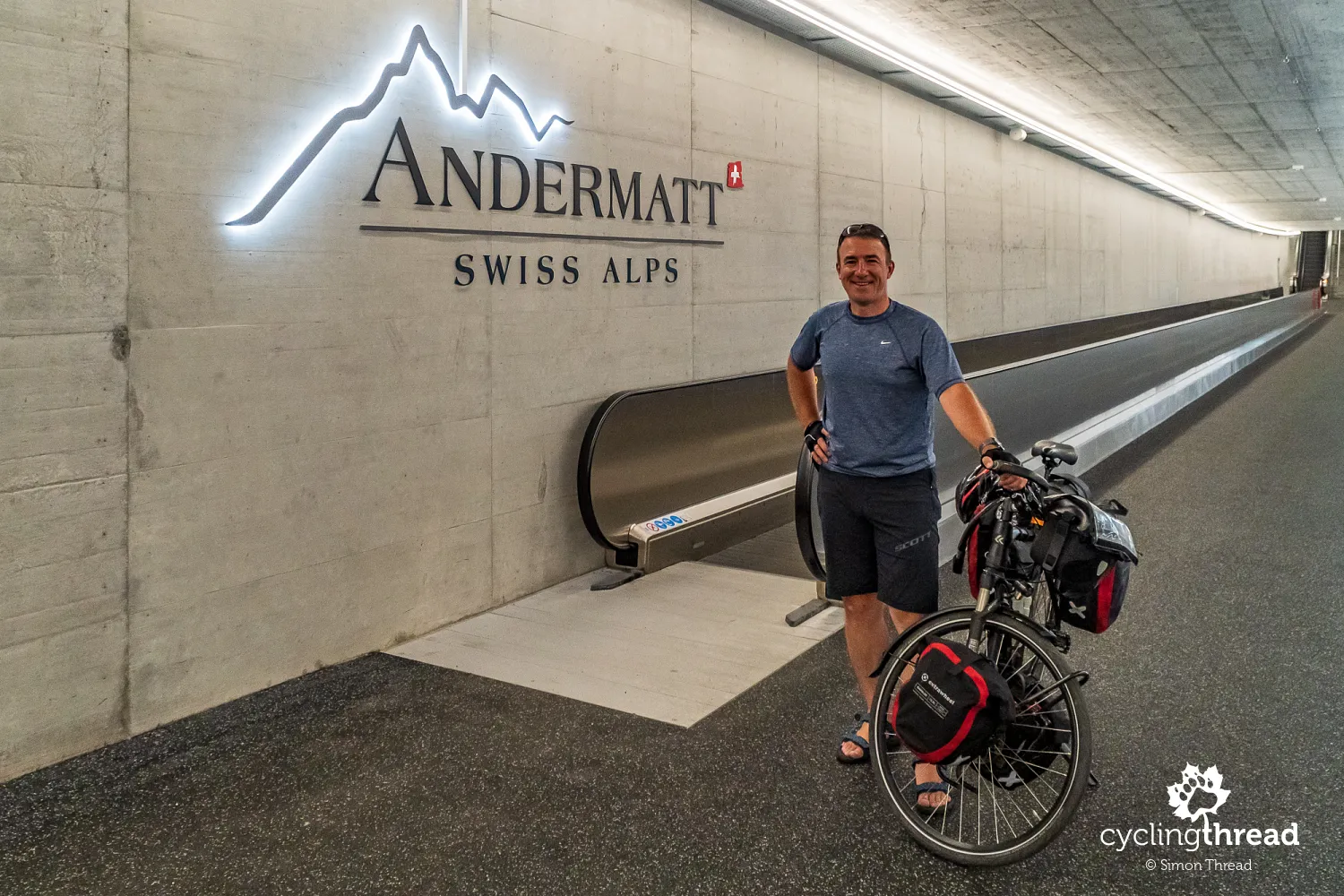
Our Swiss cycling adventure actually began in... Germany, since we couldn’t find a reasonable spot to park our car in Basel for nearly 10 days, which we planned to spend cycling in Switzerland. Thanks to a message to a friend and blogger living in Basel (thanks for the help, Ewa!) and a quick Google search, we found a safe and cheaper parking option in Lörrach, a German town just 11 kilometers from the Basel railway station. From there, with our pre-purchased promotional tickets in hand, we embarked on a several-hour-long train journey through the Swiss railways to Andermatt, where the Rhein Cycle Route - a tourist bike route along the Rhine river - begins.
The train journey from Basel through Lucerne to Andermatt was the perfect introduction to the beauty of the Swiss landscape we could have imagined. It was also an excellent reminder of the legendary punctuality of the Swiss railways. Three short transfers, including one with a couple of hundred Swiss reservists heading to the Alps for training, didn't prevent the Matterhorn Gotthard Railways from bringing us on time from Göschenen to Andermatt. The red carriages of the narrow-gauge Matterhorn Gotthard Railways, running between Visp and Disentis for nearly 130 years, navigate through 33 tunnels and 126 bridges, climbing over 1550 meters in elevation difference between the lowest and highest points on the route (Oberalp Pass), aided by a cogwheel mechanism.
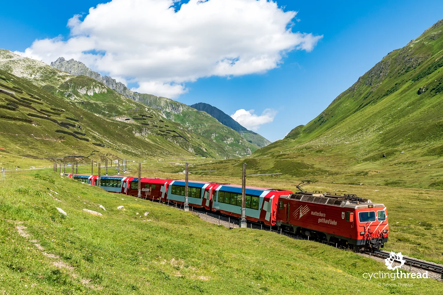
Chasing the world’s most famous train
It’s through Andermatt, then over the Oberalp Pass, as well as through Disentis and Chur - cities we were to reach in the coming days and later over the Albula Pass we cycled a few years back, that the route of one of the world’s most famous trains, the Glacier Express, runs. This express train connects the Swiss mountain resorts of Zermatt and St. Moritz. The approximately 270-kilometer route can be traveled in a panoramic wagon with large windows, offering views of the highest parts of the Swiss Alps, including numerous glaciers that gave the famous train its name. Fortuitously, the Glacier Express posed for our photos three times against the backdrop of extraordinary alpine scenes.
On the train, a bike ticket with a reserved spot
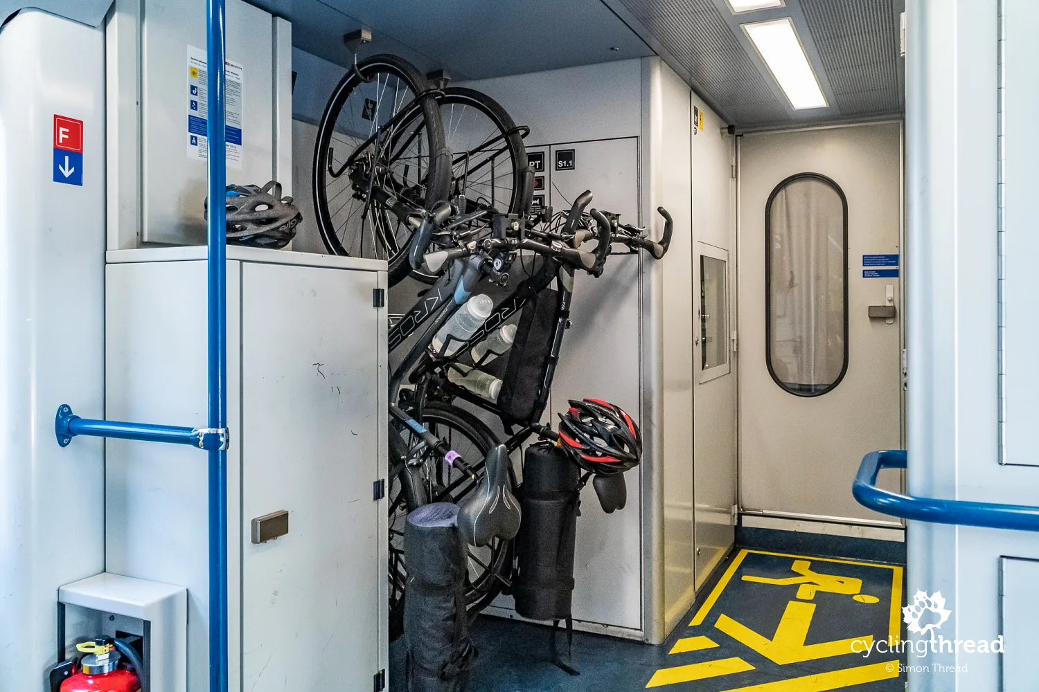
Besides marveling at Switzerland's beauty during our train ride from Basel to the Alps, we reminisced about our last year's journey across Europe. With Interrail passes, we visited the Dresden Elbland, the Enns Cycle Route, South Tyrol and Friesland in the Netherlands. We undertook eight such train journeys then, totaling twenty rides across various classes and providers. As before, so in Switzerland, we encountered no issues transporting our bikes. This was especially true for the journey to Andermatt at the start of the route along the Rhine, a popular choice among cyclists. For this reason, it's wise to secure - in addition to a bike ticket - a reservation for your bike on the train, as their number is unfortunately limited. Without a reservation, bikes are only accepted if there are available spaces.
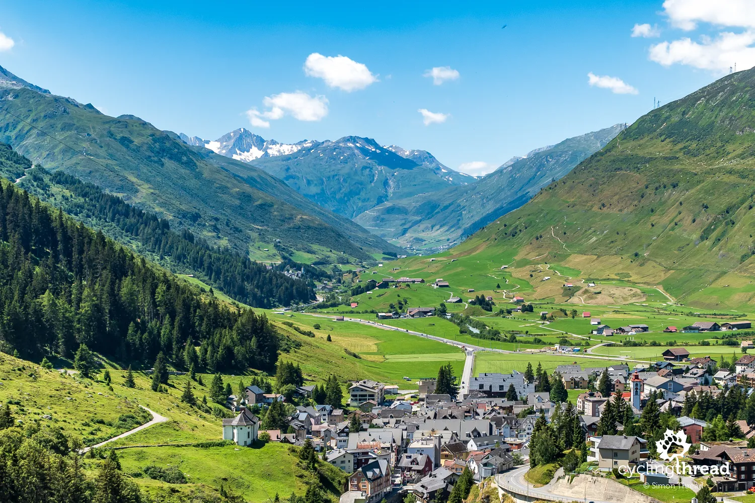
The Swiss Alps greet us with beautiful sunshine
Andermatt welcomed us with nearly clear, blue skies and the Ursern Valley was bathed in sunlight. Despite being peak season, the small resort lacked tourists and the camping site was deserted. The coronavirus pandemic meant we were among the few daring to enjoy traveling through Europe, albeit with a strict approach to hygiene and sanitation measures. Interestingly, during the summer, Switzerland did not mandate the use of masks in public spaces, though many people on the streets and in popular spots wore face coverings. Hand sanitizers were often available and used instead.
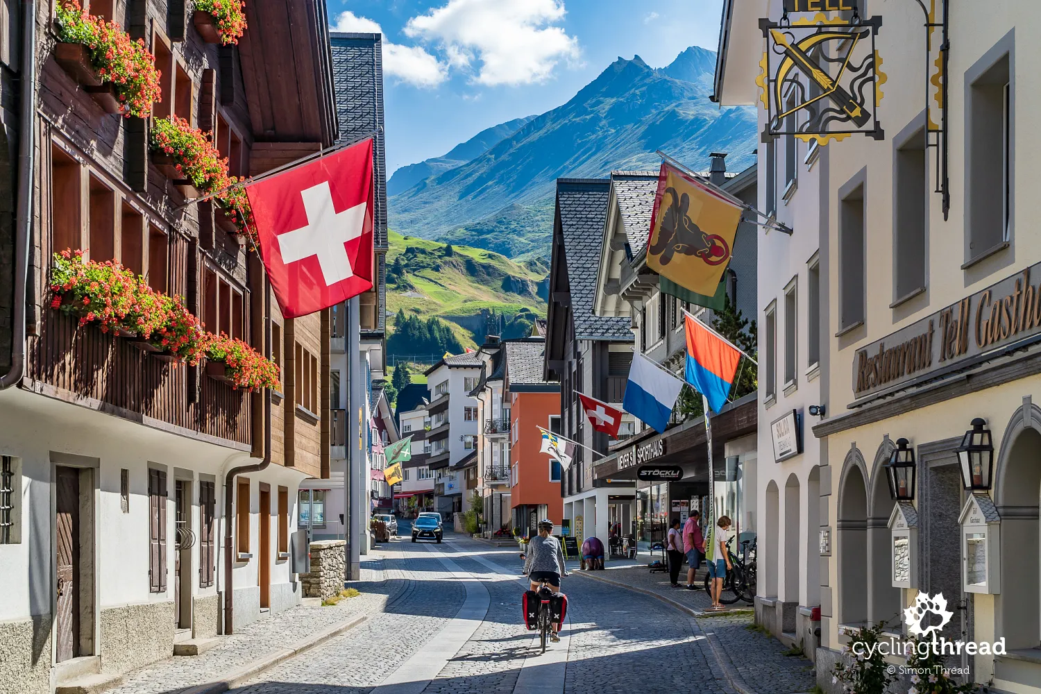
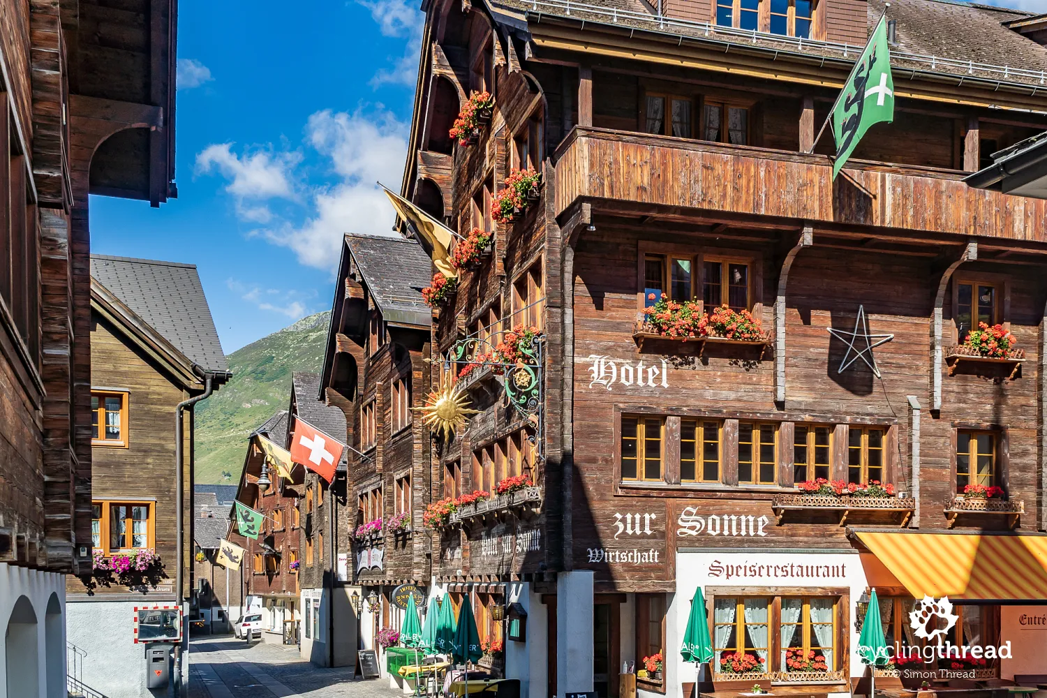
Historically, Andermatt was a crossroads for transalpine trade routes and today, it's a nexus for numerous tourist paths - hiking, biking, driving and even the aforementioned rail routes. The town's historical ambiance is echoed by ancient architecture along the main street, now closed to tourist and through traffic. Among the original 18th-century buildings is the so-called Suworow House - a residence where Russian General Alexander Suvorov stayed during the Second Coalition against France in 1799. It now houses the Ursern Valley Museum. A few hundred meters away stands the small Drei Könige & Post hotel, a lodging for merchants traversing the Alps for five hundred years.
Soon, this small town will change - Egyptian investor Samih Sawiris plans to build a large winter resort, connecting it with nearby ski areas. The first luxury hotel already stands across from Andermatt train station, with more on the way. The future ski resort feel is clear as soon as you step off the train - beneath the simple platforms, wide concrete corridors with moving walkways for skiers stretch out. Oh, almost forgot - the North-South Route runs through Andermatt too.
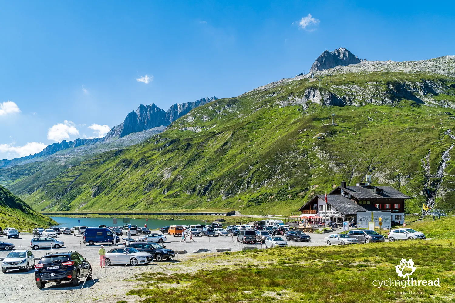
St. Gotthard, Furka and Oberalp Passes
Looking at Andermatt from the serpentine road leading towards the Oberalp Pass and the town of Disentis, one can see the Bannwald forest covering the southern slope of the Ursern Valley. This term describes a forested area established to protect lower-lying lands and settlements from landslides and avalanches - both snow and rock. These forests also serve a recreational purpose - a hiking trail runs through the Bannwald. In the distance, the serpentine roads that are part of the ascent to the renowned Furka Pass can be seen and to the left, the road leads towards the St. Gotthard Pass. It is undoubtedly one of the Alps' communication hubs.
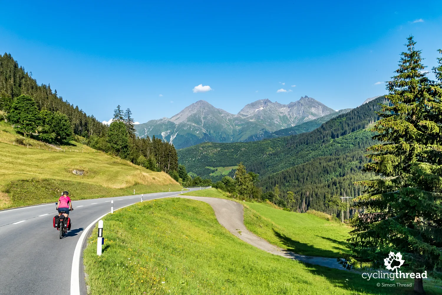
Climbing the alpine serpentine
Climbing the serpentines towards the Oberalp Pass is the only major ascent awaiting tourists on the Rhine Cycle Route. In a typical summer season, riding the popular several-kilometer-long winding Alpine route would have to be done amidst dozens of other vehicles filled with traveling tourists - campers, cars, even loud motorcycles. But in this exceptional year, on the road overlooking the Ursern Valley and the Swiss Alps, we were mostly alone.
The highest lighthouse in the world
After several minutes, we reached the Oberalp Pass and like all cyclists, we first took a commemorative photo under the pass's sign. There was no problem finding a spot in the garden of one of the two local restaurants and an additional attraction was the view of the distinctive lighthouse standing at the highest point of the pass. It's a replica of the lighthouse at the Rhine's estuary near Rotterdam, the highest lighthouse in the world, symbolizing the connection of this area through the Rhine waters with the North Sea.
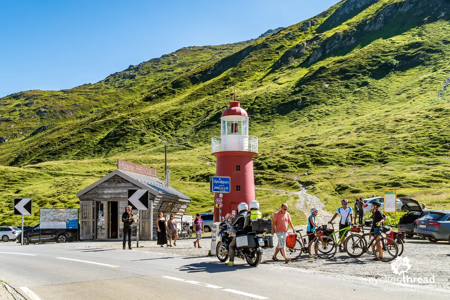
Rheinquelle - the beginning of a 1200-kilometer story
The lighthouse at the Oberalp Pass is part of the Rheinquelle information point, the Rhine's source located near the pass. A several-minute walk from Oberalppass leads to the source, considered to be the small Alpine lake Tomasee. It is here that the Vorderrhein (Rein Anteriur, Front Rhine) begins - one of the two river systems that, 70 kilometers further in Reichenau, after merging with the second - Hinterrhein (Rein Posteriur, Rear Rhine) forms the proper Rhine, referred to as the Alpenrhein (Alpine Rhine) on the stretch to Lake Constance.
Homely atmospheres at a four-star campsite
Beneath the Alpine lighthouse begins the fastest segment of the entire journey along the Rhine. First, a few quick turns of the serpentine, followed by several kilometers of rapid descent. After our positive experience camping in Andermatt, we decided to change our planned stay at a guesthouse in Disentis for a 4-star campsite, part of the Touring Club Suisse, Switzerland's largest tourist organization network. Beautifully located in the Rhine valley, a mile and a half from the town, it took us by surprise. The site was bustling with guests, lit campfires and grills, flying sparks, ubiquitous smoke and music playing… This was not the orderly Switzerland we often imagine.
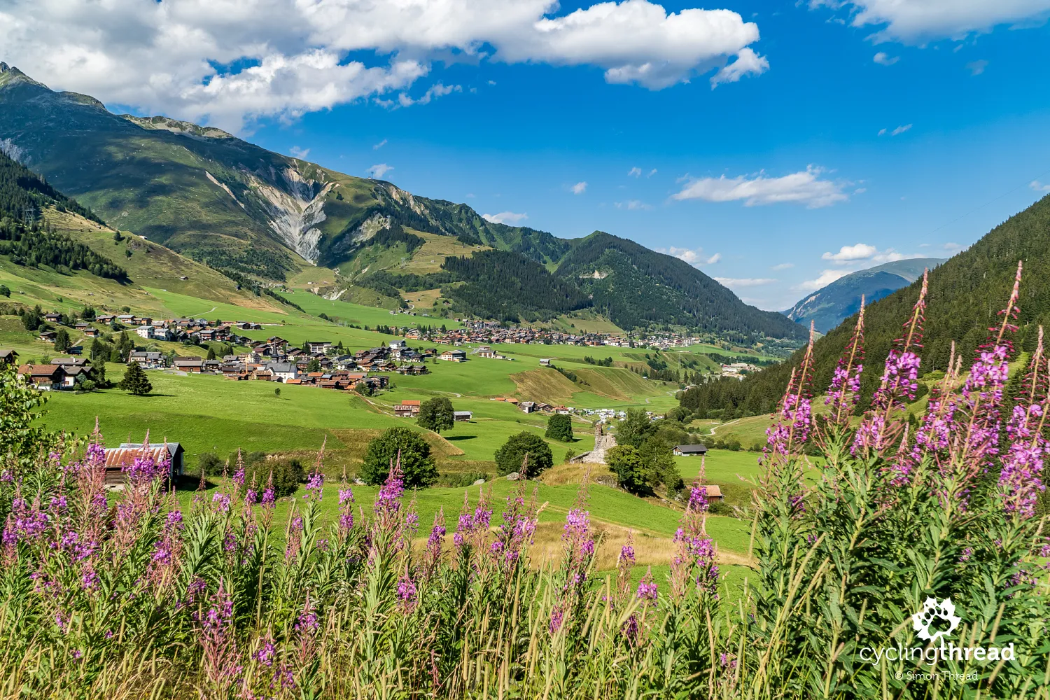
The benedictine abbey and the Romansh language
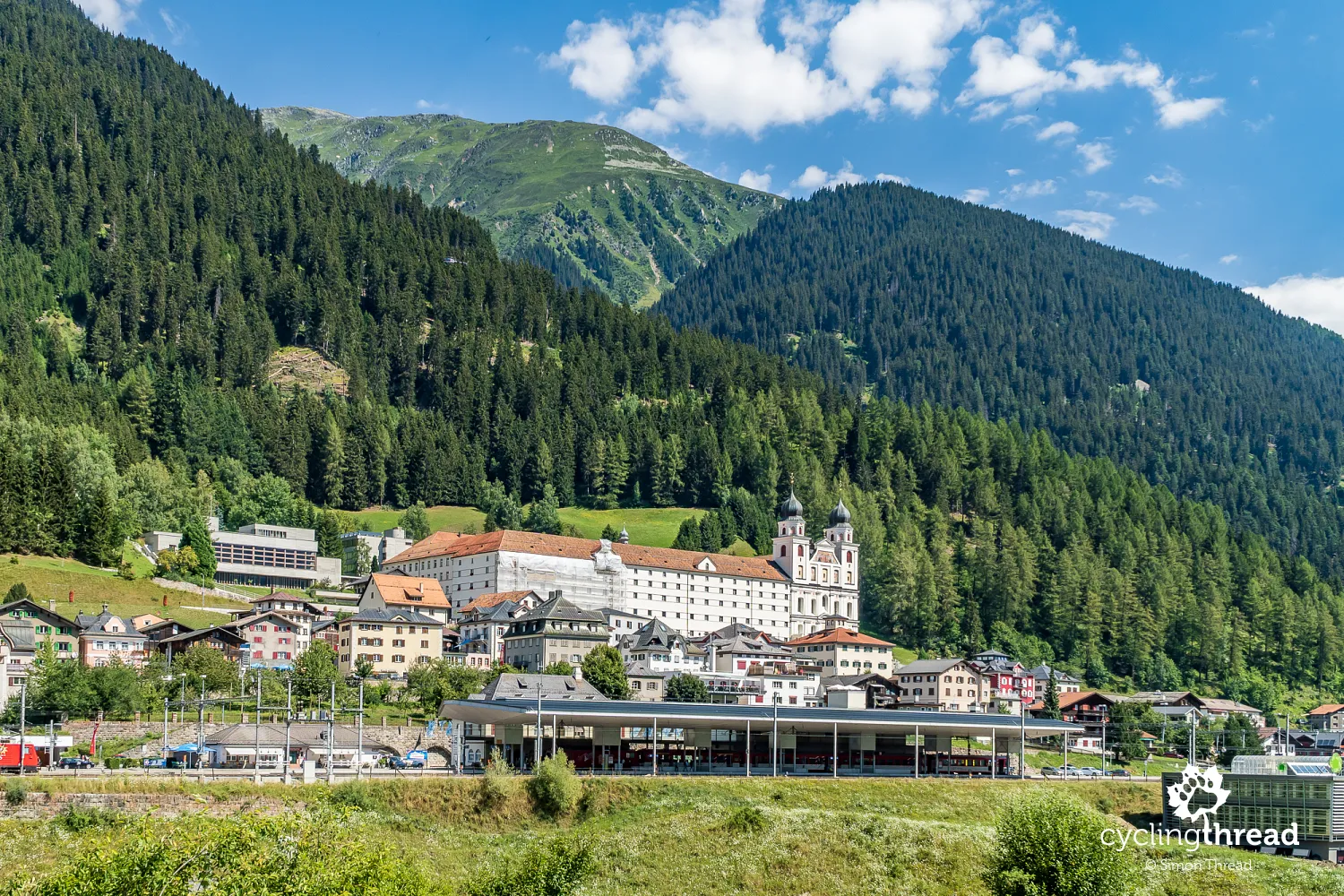
The most significant landmark in Disentis seems to be the town's landscape-dominating Benedictine Abbey. Founded in the 8th century, though the current monastery complex was built at the turn of the 17th and 18th centuries. At the local train station, many trains change engines, as the higher sections of the railway line require cogwheel assistance. Interestingly, the official language in Disentis is Romansh - Romansh, with the Sursilvan dialect typical for the Sursilva region. About 75% of the town's population speaks this language. The next most common language, German, is the primary language for only 20% of residents.
Greater elevation than the conquered pass
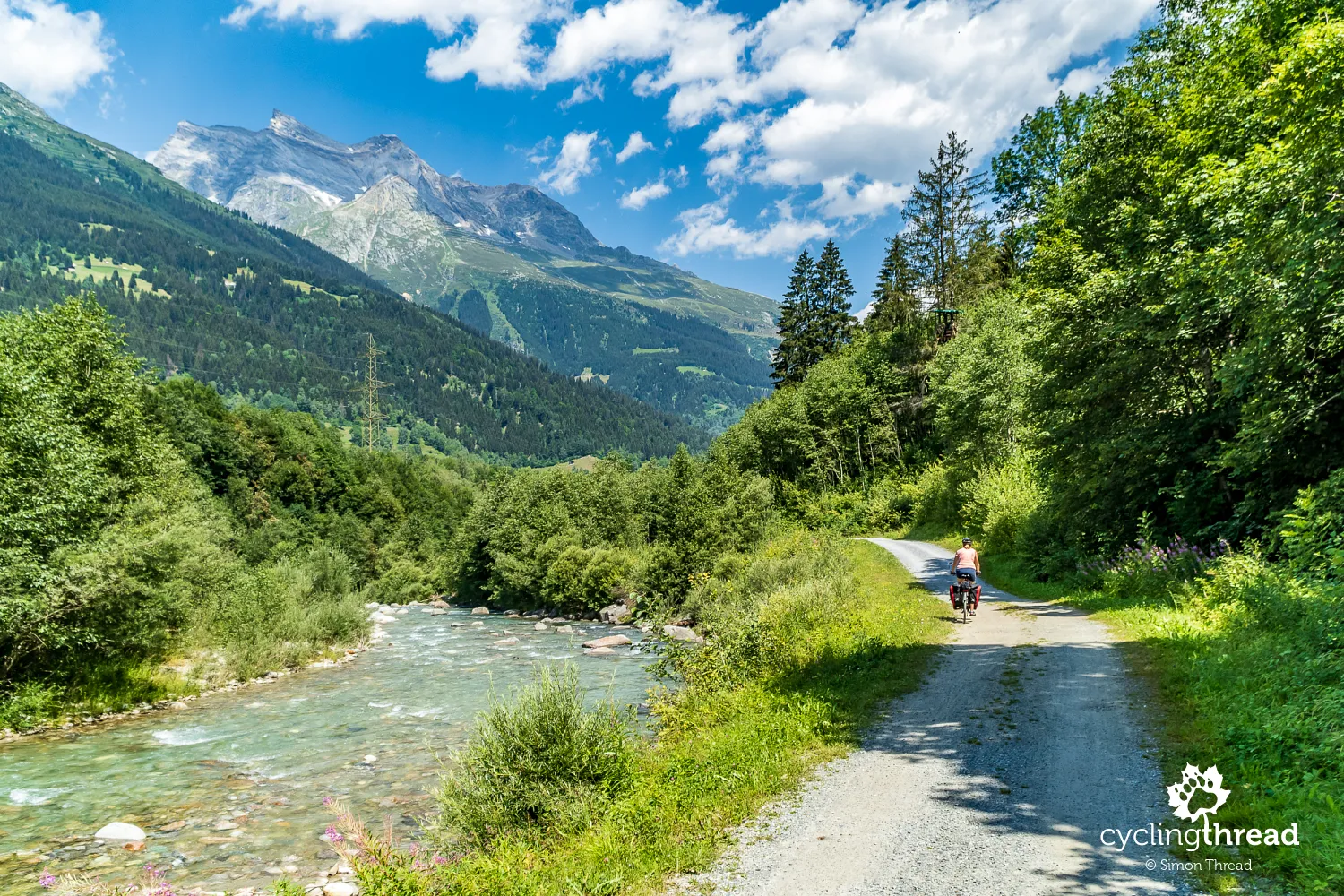
This seemingly easy section of the Rhine Cycle Route didn't spare us from exertion. Although the second day of our journey looked extremely inviting on the elevation profile, in practice, we were surprised by the number of short, though challenging, climbs, resulting in a total elevation gain greater than during the ascent to the Oberalp Pass the previous day. However, the views compensated for all the efforts and the quality of the roads was also very satisfactory. In Disentis, the trail crosses to the right bank of the river and leads alternately on local gravel roads and narrow asphalt roads used only by residents up to Ilanz.
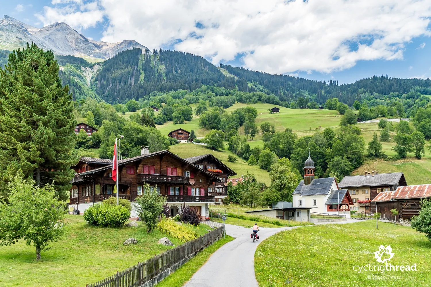
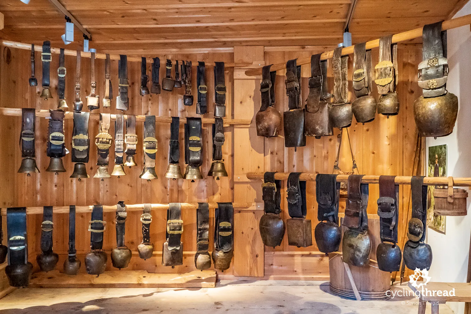
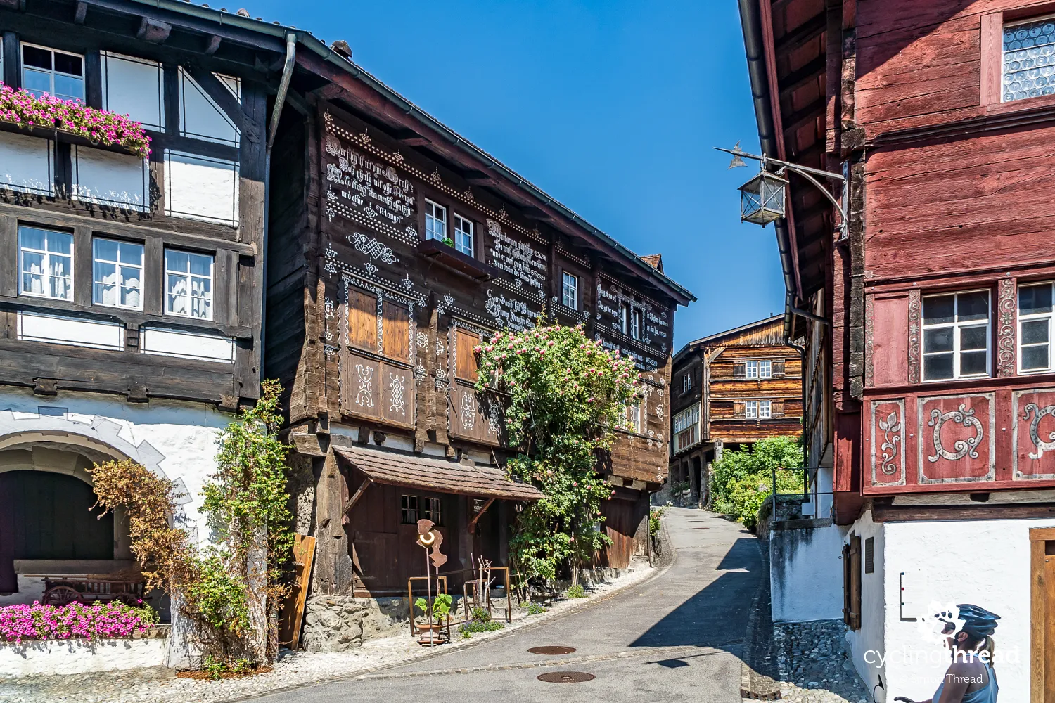
Beautiful collection of cowbells in Ilanz
One of the storms that passed over Switzerland that day provided an opportunity for another break in riding and a visit to the Surselva region museum, with Ilanz being the region's second-largest city. Besides traditional regional souvenirs, the museum in Ilanz has a collection of cowbells that were the most memorable for me. The oldest were over 200 years old! It was easy to imagine that the exhibit bells had been worn by many generations of cows. As time passed, the cow wearers of the bells, their herders, even the shepherd dogs changed, but the same tone of the antique bell still resonated across the Alpine meadow…
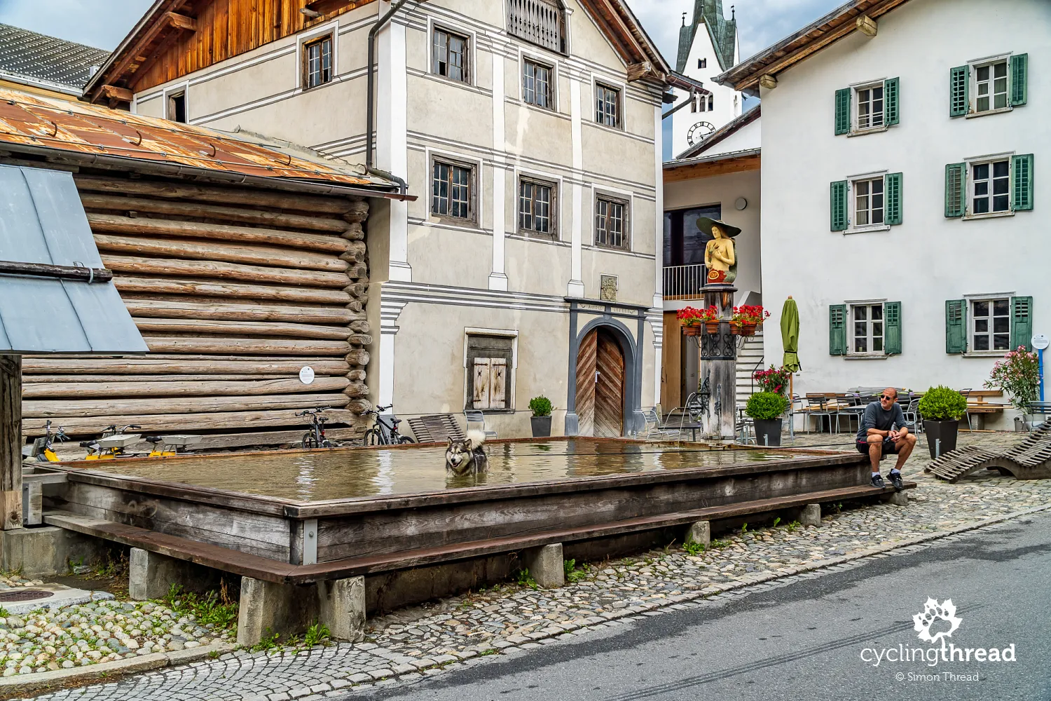
The highest wooden fountain in Europe
The traditional, regional atmosphere accompanied us all the way to the village of Valendas, a few kilometers from Ilanz. In its center stands one of the most precious and the highest wooden fountain in Europe, dating back to 1760, featuring a figure of a mermaid in a Florentine hat. Even in the 1930s, the fountain and its basin served as a water supply for the village residents. Historical records even mention a hundred animals drinking simultaneously from the trough and to this day, a step remains, serving smaller animals like goats or sheep.
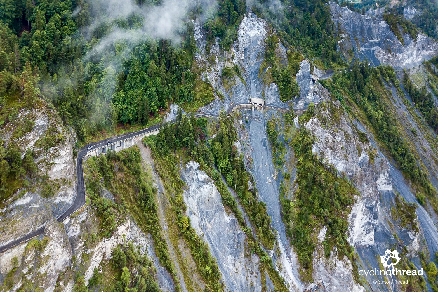
Now onto the Ruinaulta Gorge - the Swiss Grand Canyon
A few kilometers past Valendas, the Ruinaulta Gorge awaited us, heralded by the massive limestone walls appearing in the river valley, visible from the road before reaching Valendas. This incredibly scenic place, known as the Swiss Grand Canyon, was formed 10,000 years ago when the Rhine Valley was filled by debris from the Lepontine Alps and over millennia, the Rhine's waters gradually eroded this deposited rock material.
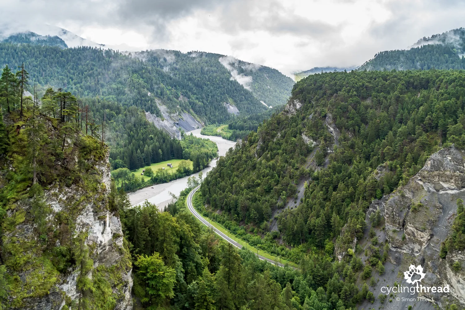
Though it's said the best way to see the Grand Canyon is by taking a train ride through its entire length along the Rhine, including the aforementioned Glacier Express, biking allows not only to look down upon the Grand Canyon from above but also to witness the equally spectacular, though shorter, Vesamer Gorge that precedes it. For a leisurely journey through the Vesamer Gorge and Ruinaulta Gorge, combined with stops at scenic viewpoints, plan for about two hours, though all the scenic spots are within a stretch no longer than 3 kilometers.
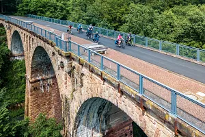
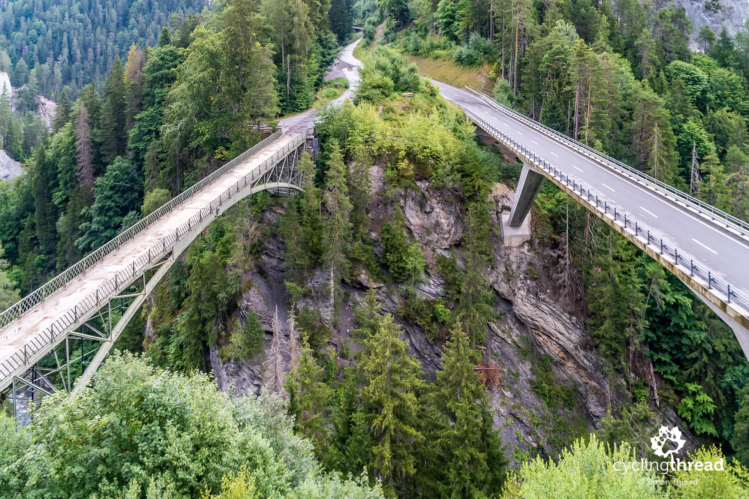
Just past the picturesque church in the village of Versam, the descent into the Versamer Gorge begins, ending with several hairpin turns of the serpentine, which concludes at the new bridge over the Rabiusa River, opened in 2012. Until 2012, traffic was restricted to the old, over 110-year-old bridge (pictured on the left), one of just a few bridges of its kind in Switzerland, now remaining as a pedestrian and bike bridge only. On both sides of the bridges, the massive rock cliffs of the Versamer Gorge stretch, which merges with the Ruinaulta Canyon a kilometer and a half further on.
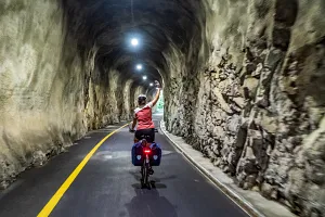
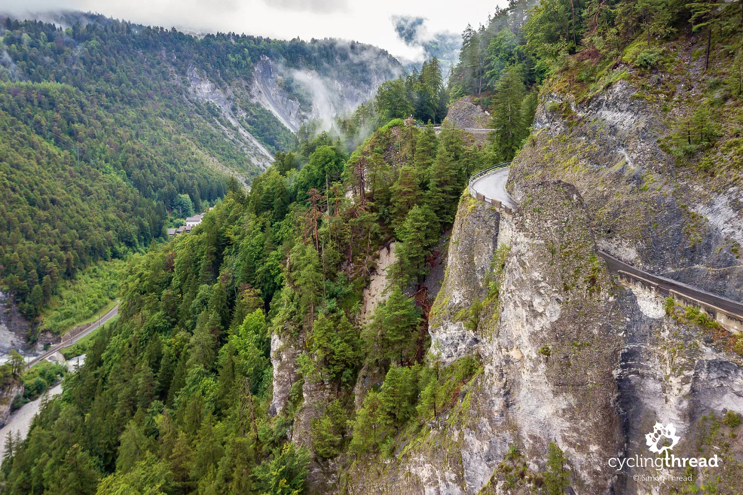
A narrow road carved into the Alpine cliff
From the bridges over the Versamer Gorge, the Rhine Cycle Route for about two kilometers runs along a road carved into the rocky cliff, including through tunnels chiseled out of the rock as well as constructed by humans. Riding this spectacular route, it's worth paying attention to the gravel road that veers off before one of the tunnels - it leads to the Spitg viewpoint, one of the two prepared spots from which you can admire the Ruinaulta Canyon. There, on the slope above the tunnel and viewpoint, we managed to surprise a herd of deer. The presence of such skittish animals near a popular viewpoint can only confirm the thesis of significantly less tourist traffic in the Alps this season.
One of the most beautiful cities in Switzerland
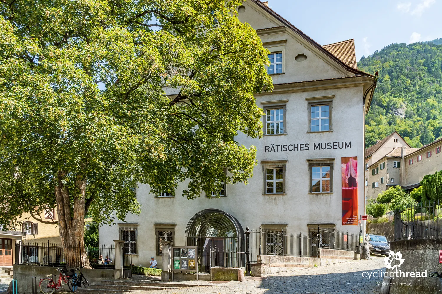
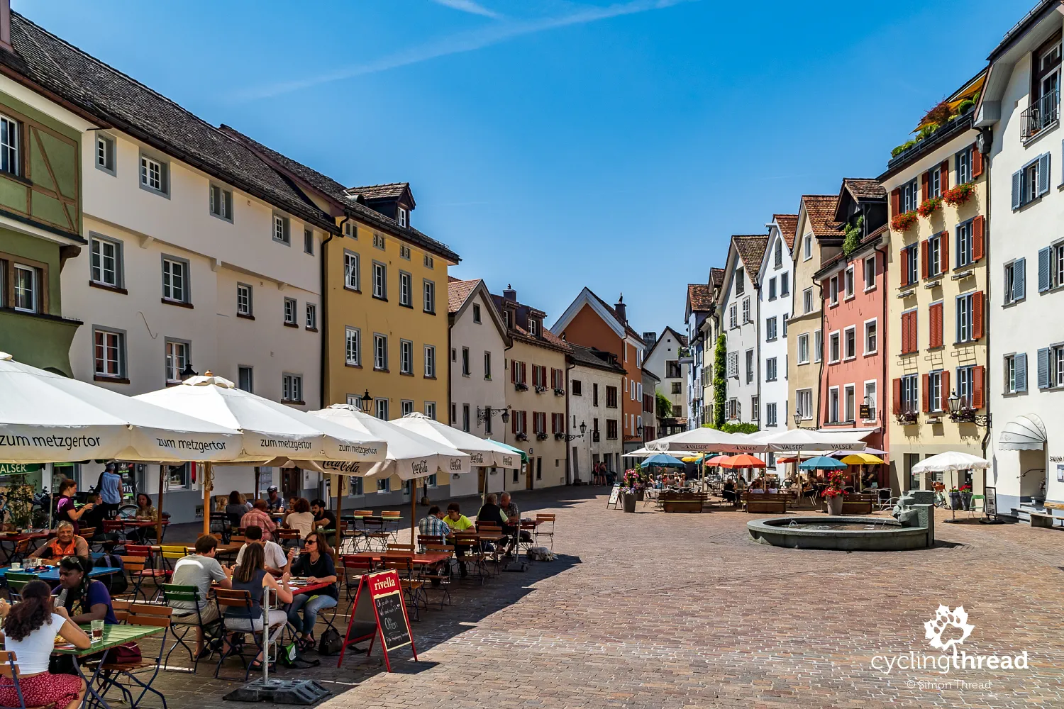
Through the storm and time needed to enjoy the Grand Canyon, we arrive in Chur late in the evening and... unfortunately, we miss our planned evening in Switzerland's oldest city. The next day, we first head to the shaded square behind St. Martin's Church, in front of the Rhaetian Museum building. Besides traditional exhibitions narrating the history of Graubünden, the interestingly arranged displays in the basements of the centuries-old house present local archaeological findings. In the square under the museum, it feels as if time has stood still. In the corner, a fountain still murmurs, from which passing tourists draw water on hot days and depart towards the Cathedral of the Assumption of the Blessed Virgin Mary, towering over the Old Town.
After visiting the splendid Romanesque cathedral in Chur, we take a ride through the streets of Chur. Moving at a pedestrian's pace, we reminisce about the trip a few years ago when we first saw Chur. However, we didn't then visit one of the most delightful places in the capital of Graubünden - the Arcas Square near St. Martin's Church. On the triangular square among colorful houses, water murmured in the fountain and from a few restaurants, the murmur of quietly conducted conversations could be heard. Indeed, it was hard for us to continue on our journey.
Self-service shop for cycling tourists
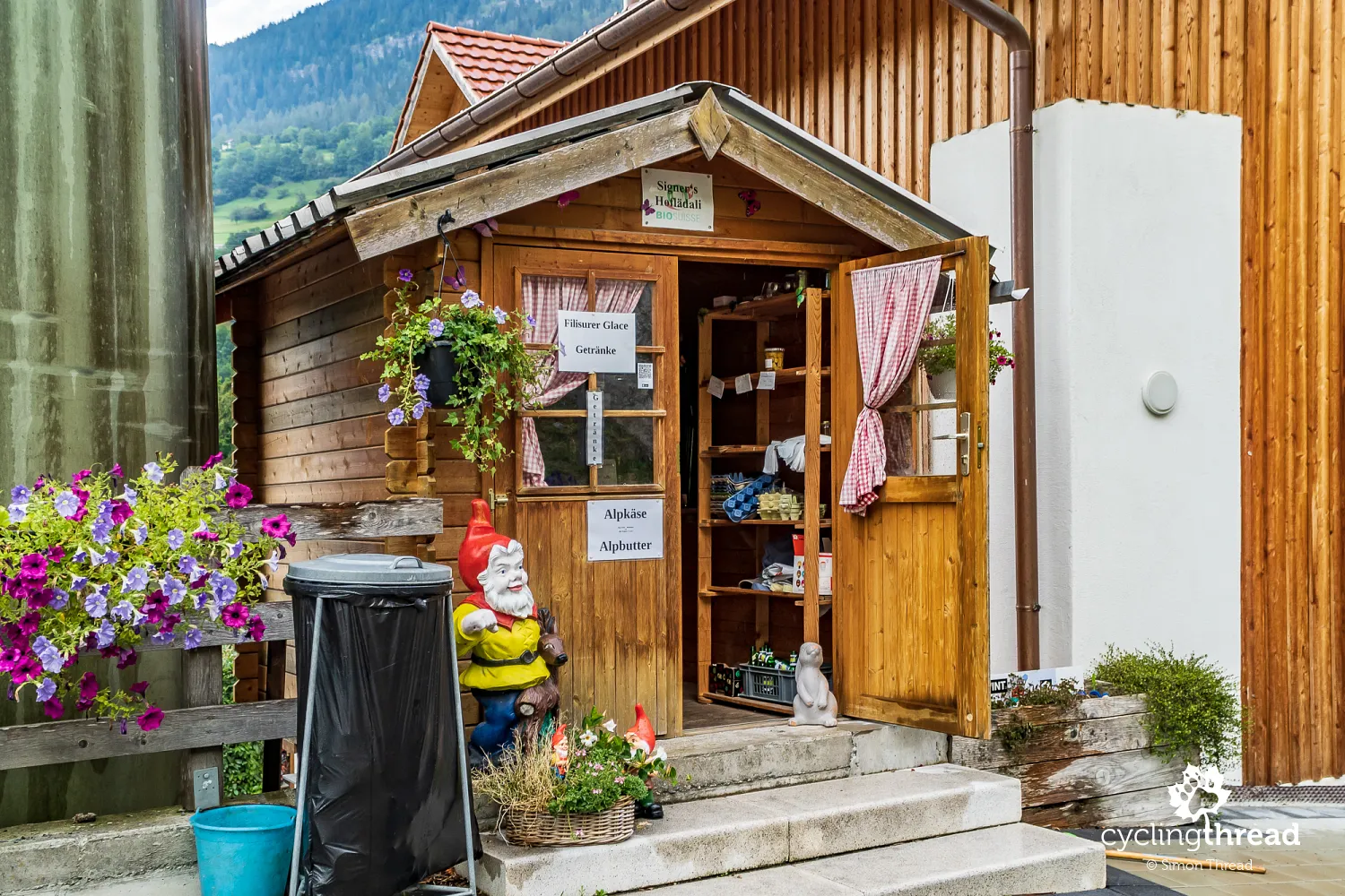
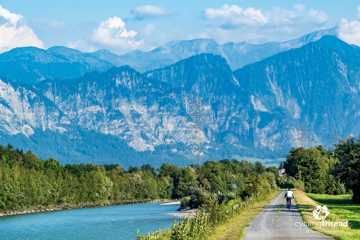
Around Chur, the landscape of the Rhine valley changes completely. Around the riverbed, agricultural crops and orchards appear and local producers in self-service shops encourage the purchase of cheeses, eggs, vegetables and fruits. Here, trade is based on the honesty of cycling tourists and the rules are identical to those we encountered visiting by bike Bornholm, South Tyrol or the Netherlands: after selecting the product and calculating the amount, we drop the counted money into the nearby cash box.
Street art, luxury and thermal waters
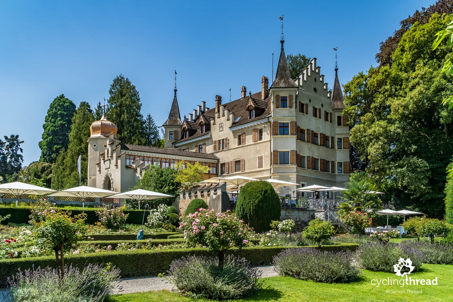
In the wide valley of the Alpine Rhine between Chur and Lake Constance, cyclists await further attractions. The first of these is Bad Ragaz - a famous spa resort to which thermal waters have been channeled from Pfäfers, a few kilometers away, since 1840. It was at the spa in Pfäfers that Paracelsus, a medieval doctor and naturalist from Basel, considered also the father of modern medicine, worked. The atmosphere of the luxury resort is warmed by numerous sculptures and artistic installations, which we noticed during our first joint expedition through the Eastern Alps.
The best spot for a souvenir photo
Just after returning to the Rhine, the trail runs through one of its most spectacular sections. The bike path here runs along the riverbank, along the rock walls of the Fläscherberg massif with the Regitzer Spitz peak. Fläscherberg is used as an area for active recreation by the region's residents but also serves the Swiss army as a natural fortification. It is the most northerly point of the Graubünden canton, beyond which lies the territory of the small Liechtenstein. This might also be the best opportunity for a souvenir photo over the Rhine.
At the crossroads of Alpine trade routes
Near this place lies the town of Sargans, a historical town located at the crossroads of trade routes connecting Zurich with the Rhine valley. The fortress of Sargans Castle, which has played an important role in the region's history multiple times, recalls ancient times. Today, it houses a regional museum, which in 1987 was even one of the most visited museums in the world. A loud men's meeting over beer in the historic part of Sargans allowed me to learn that in Sargans, people root for the footballers of FC St. Gallen.
Sardona Tectonic Arena on the UNESCO list
The vicinity of Sargans belongs to the most interesting places in the Alps and as the Sardona Tectonic Arena, it has been included on the UNESCO World Heritage List. The UNESCO listing includes an area in the Glarus Alps, where continental tectonic plates - European and African - collided and overlapped. As a result, older geological layers were placed on younger ones and these places are clearly visible and easily recognizable during mountain excursions. To get to know the Sardona Tectonic Arena, however, you need to take at least a few hours' break from biking.
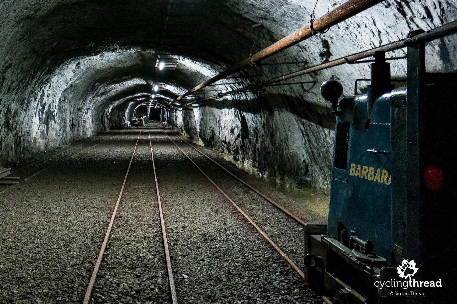
Underground restaurant and mining museum in Gonzen
On the outskirts of Sargans lies the now inactive Gonzen iron and manganese ore mine, where mining operations ceased in 1966. Since the 1980s, the mine has been open for tours and several years ago, it was remodeled to include an underground restaurant and a mining museum. Part of the tour involves a ride on the underground mining train through two of the ninety kilometers of mining tunnels that make up the Gonzen mine network. This Swiss mine instantly reminded me of the Erzgebirge and the mining atmosphere of Germany's Saxony.
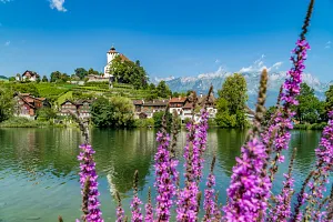
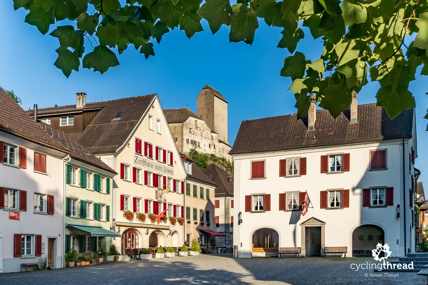
The smallest town and the most beautiful view in Switzerland
The next day, we reached a cozy campsite in Buchs. We remembered the town from our earlier mentioned expedition through the Alps and... just like then, it was unremarkable. Visiting Chur, spending a longer moment in Bad Ragaz, descending from the trail to Sargans, or searching for the Gonzen mine meant we arrived at the campsite just before dusk and viewing the nearby town of Werdenberg was postponed to the next day. The castle, lit by spotlights, promised a substantial dose of scenic impressions for the following day.
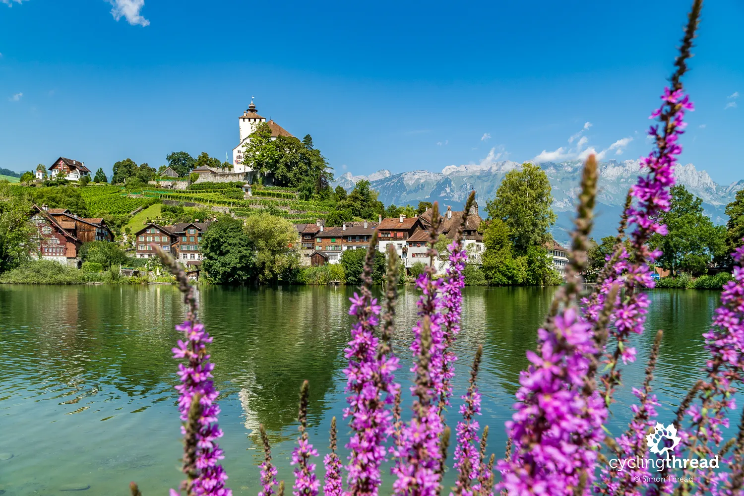
When we stood by the tiny Werdenbergsee lake in the morning, we were speechless. The view of the castle, perched on a small hill, surrounded by a modest vineyard and a row of wooden houses, against the backdrop of the Alpine panorama and highlighted by the blue of a cloudless sky, was perhaps the most beautiful scene during our trip along the Rhine Cycle Route. However, Werdenberg is not only an picturesque place, featured on the list of the most charming towns to visit by bike, but also unique for administrative reasons. It is Switzerland's smallest town, with only about 50-60 residents living in approximately 40 houses, most of which are equally picturesque and feature impressively arranged arcades. One of them houses an interesting Werdenberg museum.
An extraordinary cycling encounter after a year
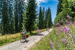
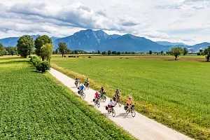
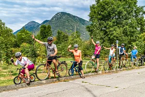
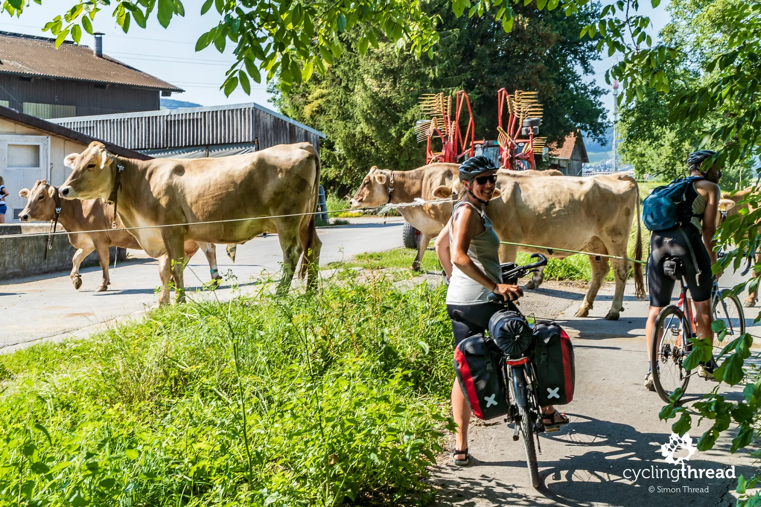
On this section of the trail, we probably passed the highest number of cycling travelers on our entire several-day route. Cyclists with panniers travel here - older and younger, solo and in groups, of all genders. A friendly Lithuanian woman, traveling from Lithuania to Spain, was mistaken for a Pole because of her Crosso panniers. Seeking shade under one of the bridges, we met four young German women heading to the Adriatic. And while preparing photos for this text, I noticed with great surprise that one of the pictures I took was of a cycling family with children, whom... we also passed the previous year on the Via Claudia Augusta bike route in Italy.
The Rhine Route not just for bikes
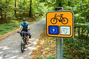
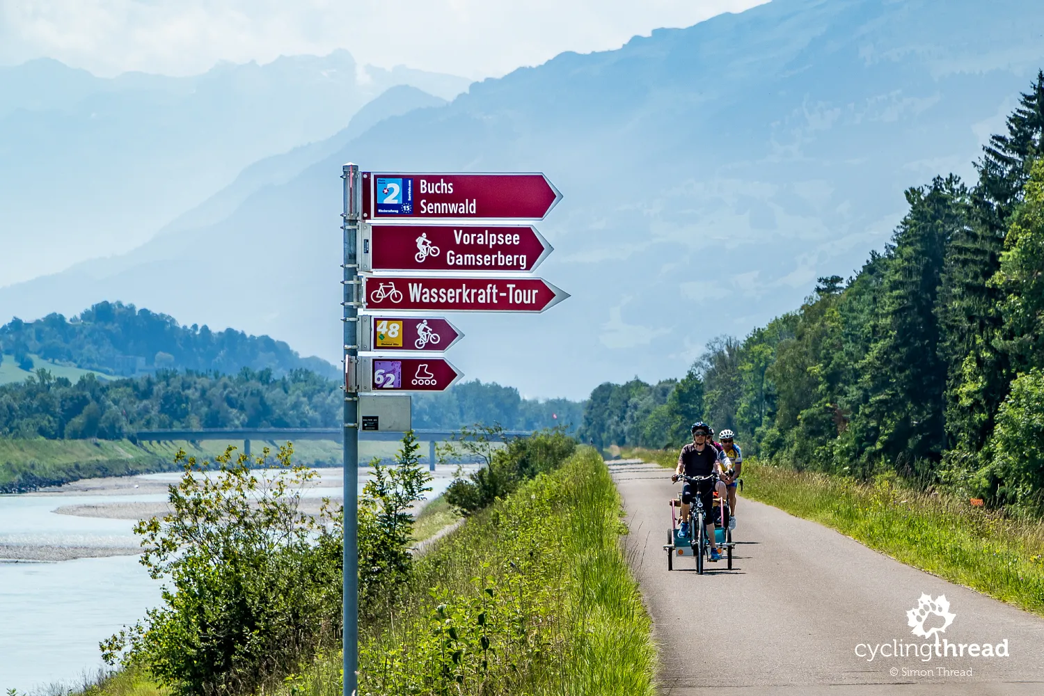
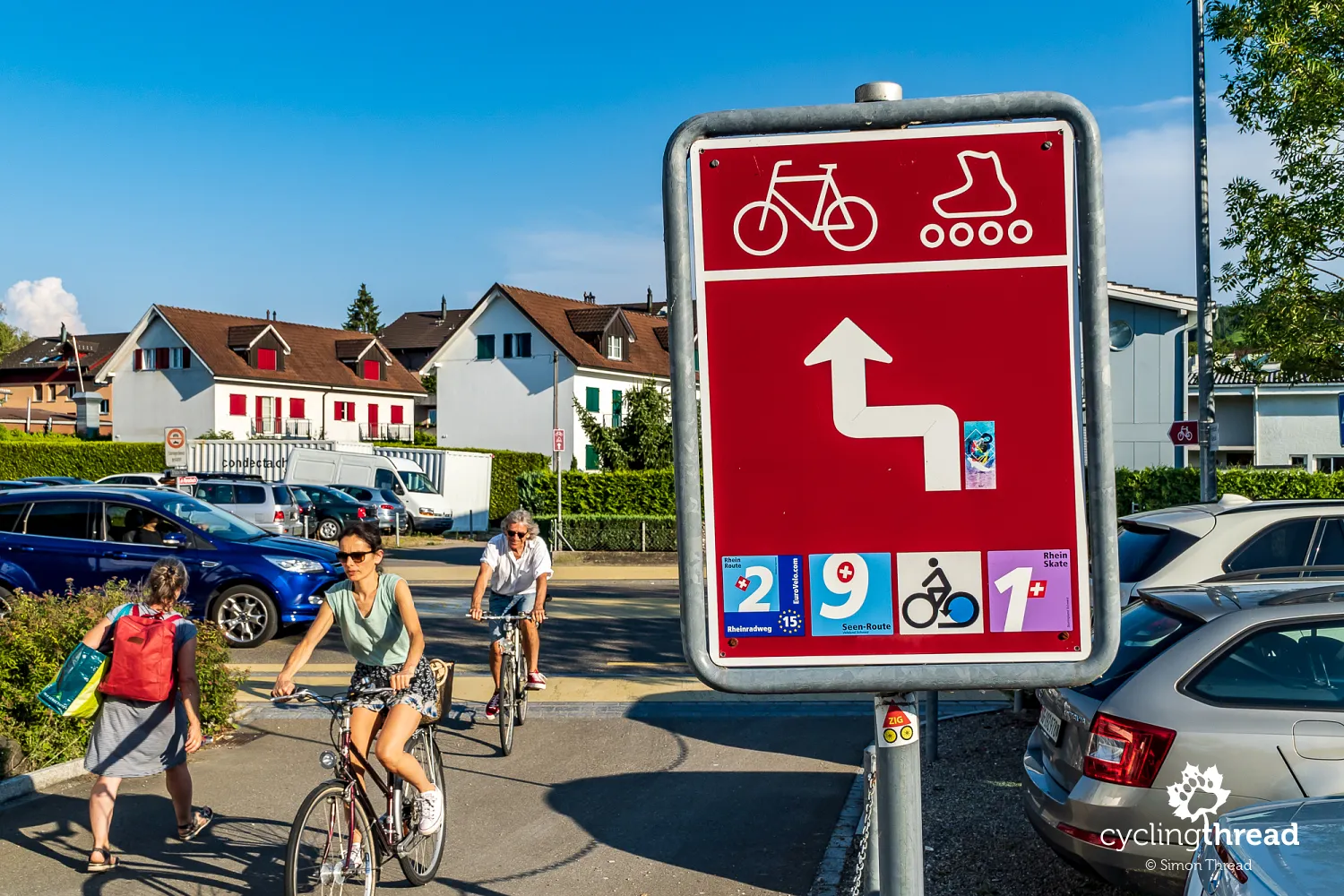
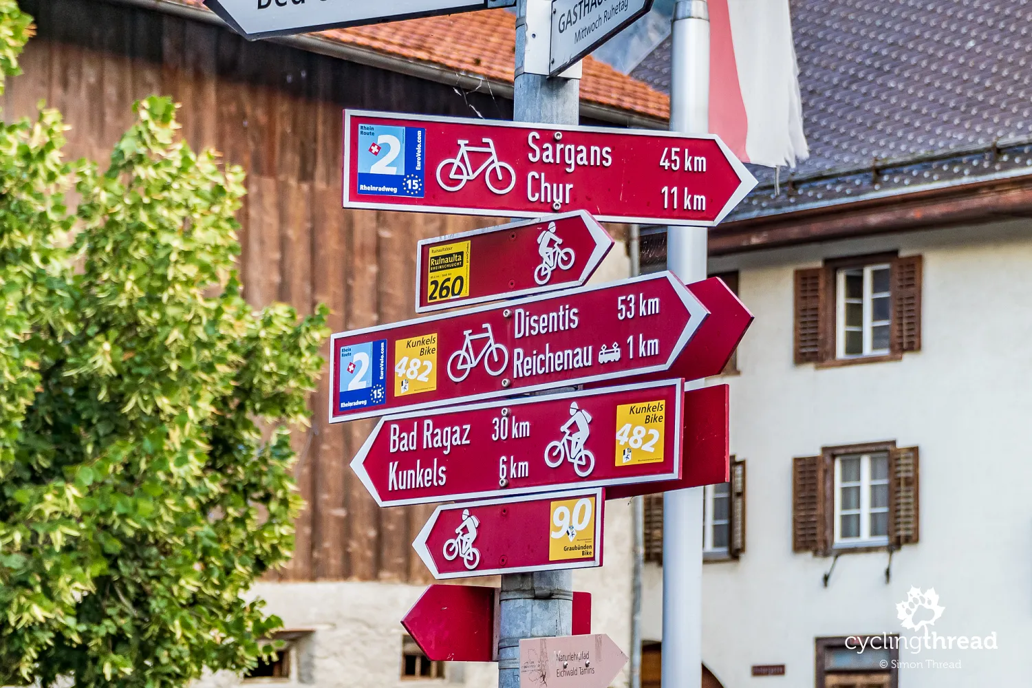
Recalling conflicts that often occur between those engaging in different activities on bike paths, I was curious to observe the signage on tourist signposts along the Rhine. It turns out that most signs with bicycle symbols also feature a rollerblade symbol, making the Rhine Cycle Route also a path for rollerbladers. Switzerland uses a clear, uniform signage system, with brown signs of various sizes displaying symbols of the relevant sports and icons indicating the type and number of the route, sometimes including place names as well. Our task was to look out for the number two on a blue-navy background, denoting the Rhine Cycle Route, part of the EuroVelo bicycle routes.
The new Rhine delta between the Old and New Rhine
A particularly interesting and ecologically valuable spot along the bike journey along the Rhine is its delta at the mouth of the river into Lake Constance. Even a cursory glance at the map suggests that the Rhine's current mouth into Lake Constance has been regulated and constructed by humans. Indeed, in 1900, the construction of a new section of the Rhine shortened the river's course and created a new mouth into Lake Constance. The cut-off old riverbed gained the name Old Rhine and became the western boundary of a nature conservation area. The eastern boundary is the newly created riverbed. The Rhine Cycle Route runs for longer sections along both the new, contemporary bed of the Rhine and the inconspicuous Old Rhine - before and after the wooden bridge in Gaißau.
River regulation to protect against floods
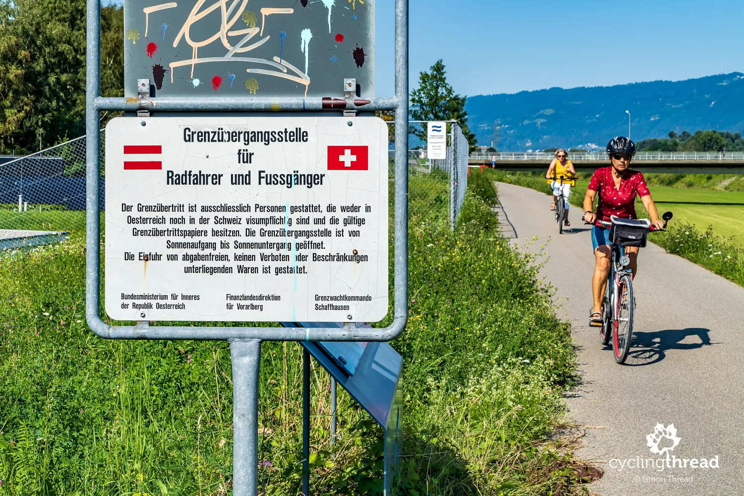
The Rhine was regulated to protect the areas around Lake Constance from floods. To prevent the lake from silting up due to material carried by the Rhine's waters, nearly 5-kilometer-long embankments were built along the Rhine's mouth in the 1920s, creating a characteristic, indented structure of the mouth into the lake. The sediments brought by the Rhine are dredged in this section and used by the local industry. Unfortunately, following the Rhine Route does not provide enough exploration of this interesting area and we did not have time to diversify the route with a trip to the Rhine delta. On the stretch before the mouth, it's worth noting an inconspicuous sign informing that you are crossing the pedestrian-bike border crossing between Austria and Switzerland.
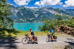
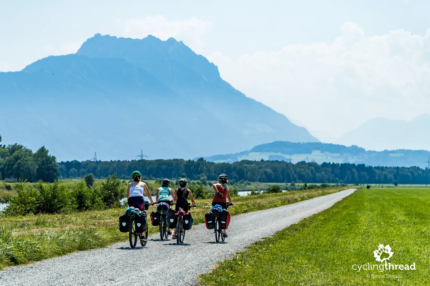
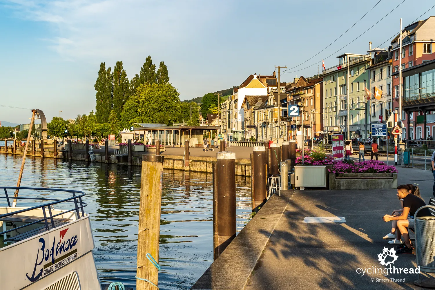
The bustling southern shore of Lake Constance
The southern shore of Lake Constance might evoke quite conflicting feelings in those traveling through. Beyond the Rhine delta, most of the route between Rorschach and Kreuzlingen is urban or semi-urban, with bike route signs often leading through promenades by popular lakeside resorts. In several towns, I was interested to see the compact line where the city meets the lake. Just a few dozen meters are needed by towns along Lake Constance to fit the first row of multi-story buildings, a road and railway station platforms, from which one can directly step onto the seaside recreational pedestrian-bike path transitioning into port promenades.
The historic Badhütte and Granary Museum
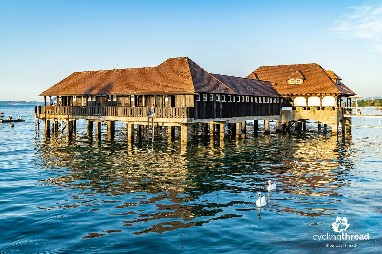
In Rorschach, near the railway station platforms, stands the Badhütte, resting on stilts driven into the bottom of Lake Constance. This nearly 100-year-old bathing establishment, built in 1924, is the last of such facilities preserved in Switzerland. A few dozen meters further, in a preserved waterfront granary building, is the multi-disciplinary Granary Museum, or perhaps more of an educational institution? Using multimedia, didactic exhibits and experiments, it presents several thematic exhibitions, including one on the natural history of the region and another titled "the magic of mathematics".
The most interesting town on Lake Constance
We ended a hot day spent in the Rhine delta and on the southern shore of Lake Constance in Arbon, which seemed to us by far the most pleasant and interesting place on Bodensee. The long distance of that day concluded with a walk through the beautiful streets of the old town and a sweet dinner at a restaurant with a terrace over Lake Constance. The morning greeted us with a wonderful, holiday atmosphere prevailing in the recreational areas around the lake and marinas. Woolen decorations symbolizing hugging trees kept smiles on our faces.
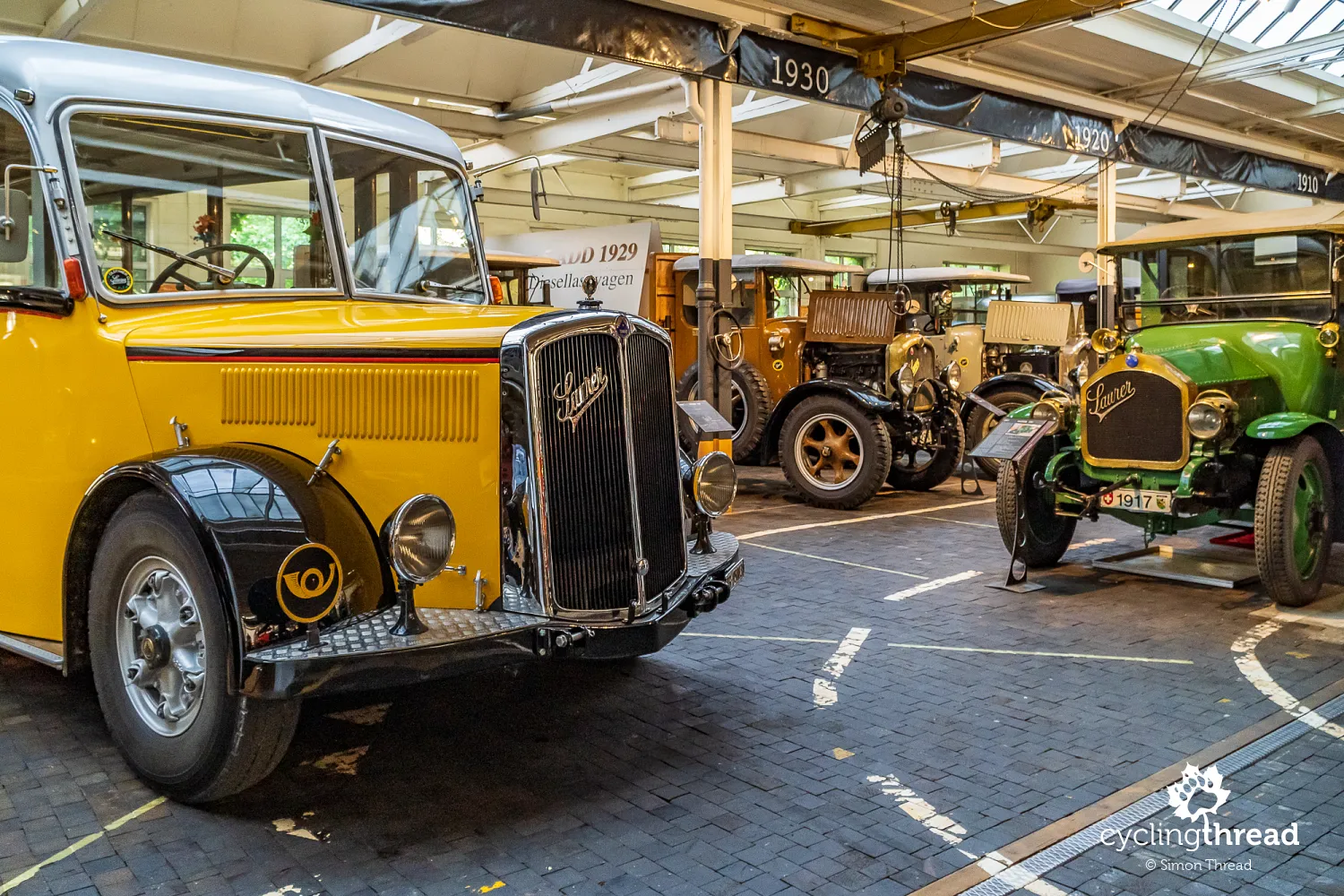
Incredible Swiss Automotive Museum
Part of the great atmosphere in Arbon was the incredible Saurer automotive brand museum, located in an unassuming building by the lakeside bike path. The museum of this brand is one of the most important stops on the Rhine Cycle Route in Switzerland. The hall, scented with car greases, is filled with well-maintained, gleaming exhibits of vehicles and machines produced by the conglomerate, whose trucks were once called the Rolls-Royce of the transport industry. Most of the displayed vehicles are trucks and special-purpose vehicles produced for over 100 years in Switzerland. The curator proudly noted that all of them are operational!
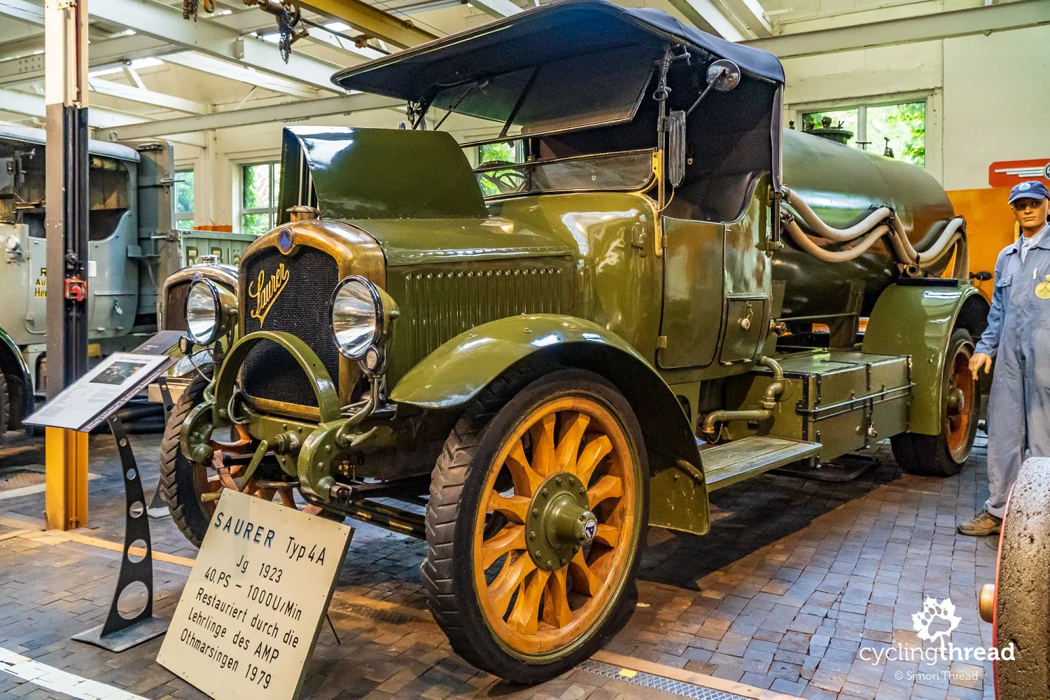
Rudolf Diesel worked for Saurer
However, one of the most fascinating facts about the Saurer brand museum is that this company launched the first diesel engine on the market. This happened because Rudolf Diesel, the famous inventor, was an employee of these workshops at the time. Diesel, initially working for MAN and later for Saurer, invented the type of internal combustion engine commonly named after him. After World War II, Saurer became known, among other things, for reliable military vehicles and also produced the popular yellow postal buses operating in the Alps. Saurer's history ended in the 1980s when the company was acquired and the brand was discontinued by the Daimler conglomerate.
Bregenz and Constance set aside for later
After a glance at Swiss Kreuzlingen, which seamlessly turned into the adjoining German Constance, we continued along the Rhine. Unfortunately, my plan for our Swiss expedition was too optimistic and such places as the famous opera stage in Bregenz or the historic sites of Constance, not strictly related to the Swiss part of the Rhine Cycle Route, had to be postponed for another occasion. By the way, both Bregenz and Constance are located on Lake Constance, around which runs a very popular bike path jointly created by Switzerland, Germany and Austria. I feel there won't be a better opportunity to see these places.
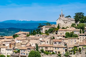
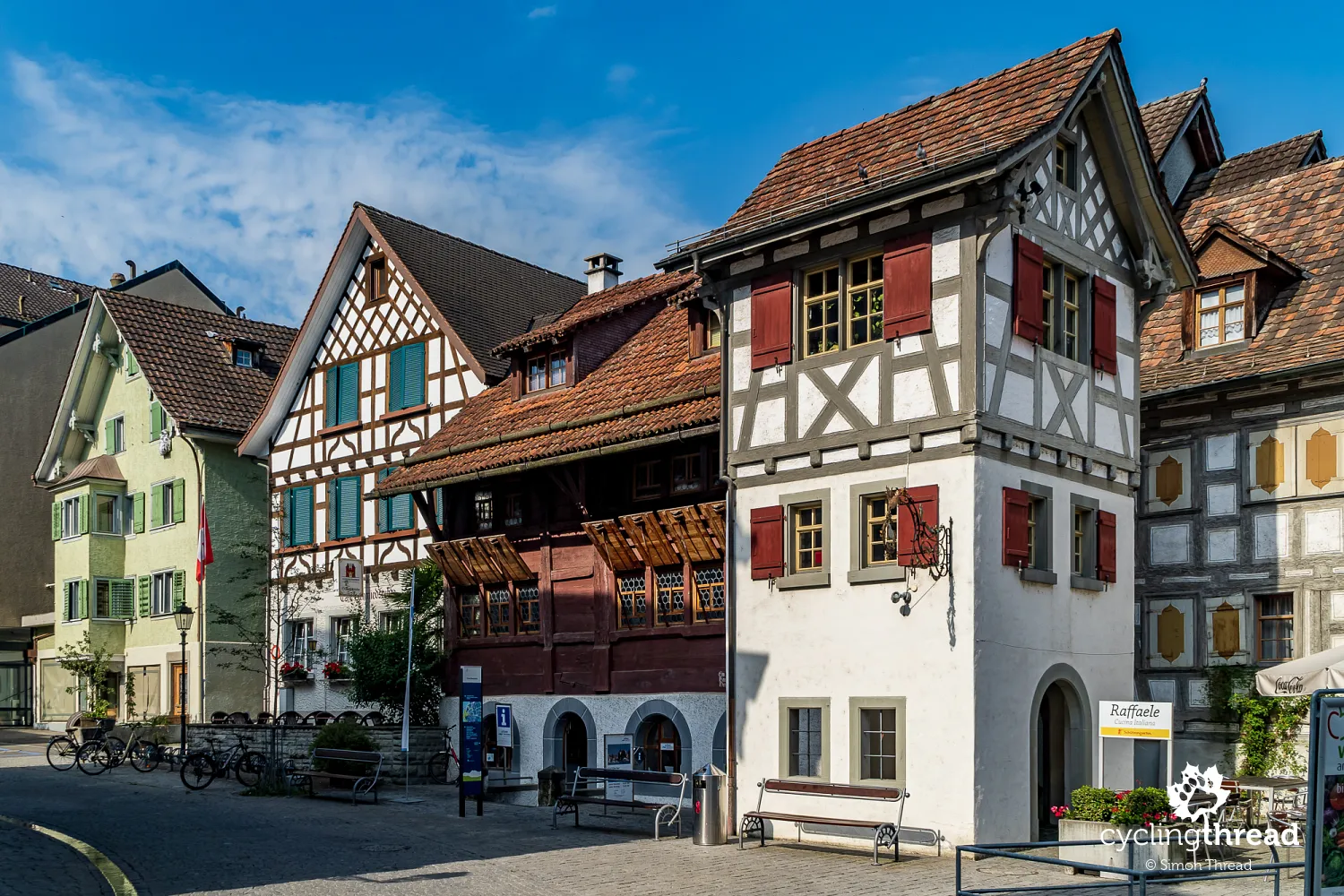
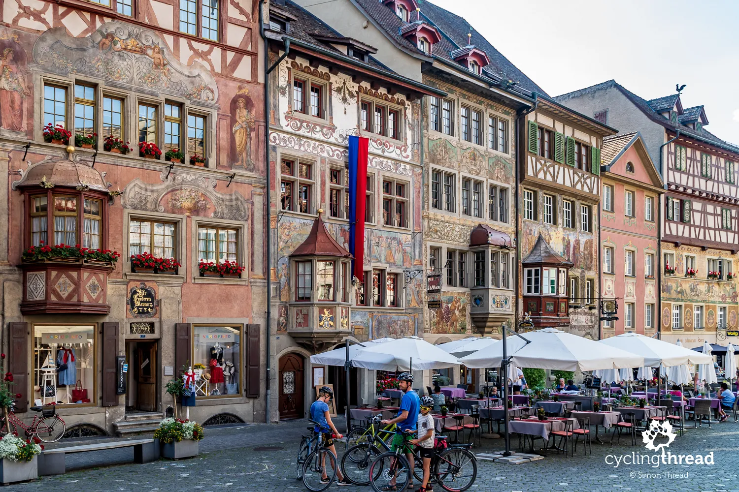
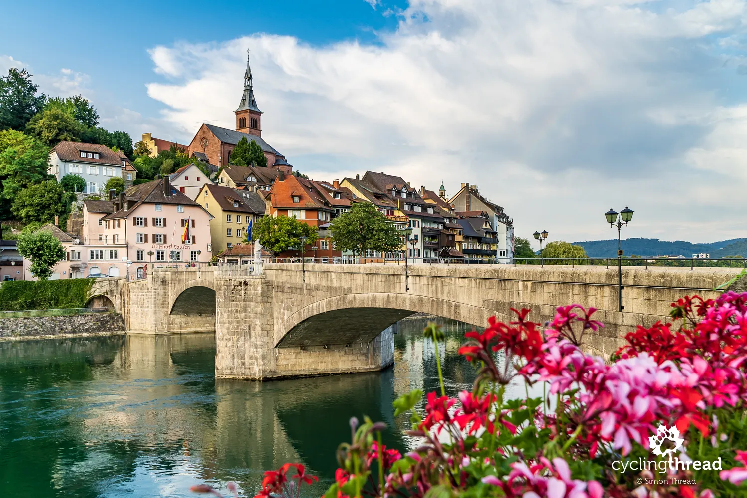
The beautiful Stein am Rhein, a jewel of the Rhine valley
As it leaves Lake Constance, the Rhine, flowing onwards towards the North Sea, finally dons the traditional attire of a riverside landscape. It is here that perhaps the most charming town on the route - Stein am Rhein - shines. It hosts dozens of historical buildings listed as part of Switzerland's national heritage, most of which are clustered along the irregular, sloping market square, capped at its highest point by the massive form of the town hall. We could only imagine the different atmosphere that prevails in this beautiful place at the peak of a normal tourist season.
The first winner of the Wakker Prize
Stein am Rhein was the first winner of the Wakker Prize, awarded for decades for the best practices in the protection of local heritage in Switzerland, including architecture, art, or nature. Among other winners were other towns we visited along the Rhine - interestingly, all located between Constance and Basel. The first was Laufenburg, with its beautiful old town and stone bridge, followed by the rainy Rheinfelden for us. And these are just two of the several captivating towns situated on the last segment of our Rhine journey.
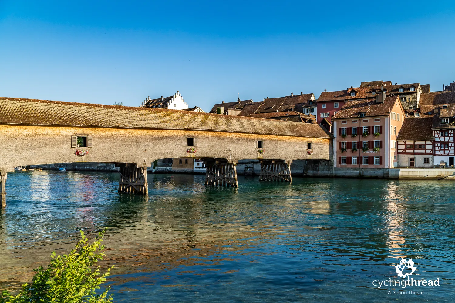
A beautiful wooden bridge over the Upper Rhine
Among the well-preserved historical structures along the Rhine are also traditional, covered wooden bridges. We encountered the first one on the second day, near Ilanz. Another, connecting the banks of the Rhine between the Swiss Diessenhofen and the German Gailingen, was built in 1814 and has served the residents of the Rhine towns since then. Interestingly, such structures are clear obstacles to river navigation. Vessels passing under the bridge must lower masts and all protruding elements during voyages on this section. When the water level rises, navigation is conducted from and to the bridge with a transfer in the local port.
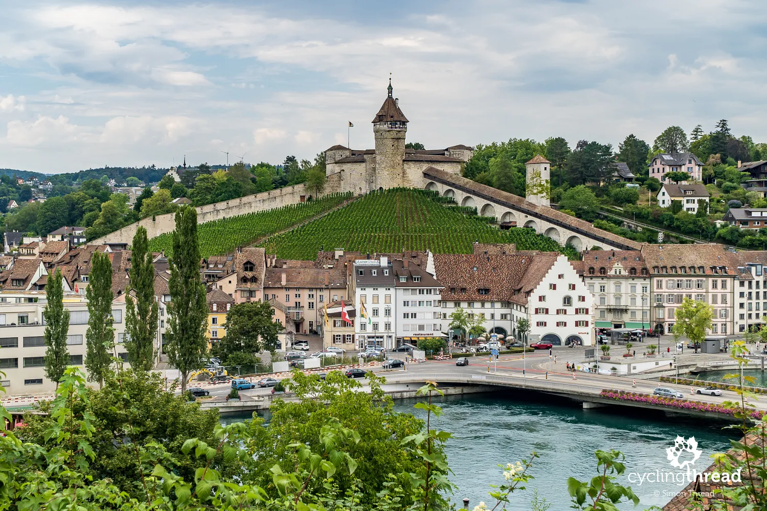
Schaffhausen - the city of fortresses and bay windows
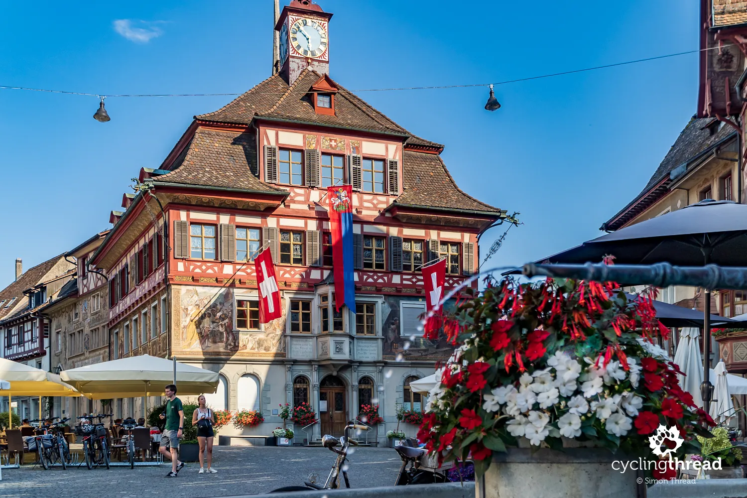
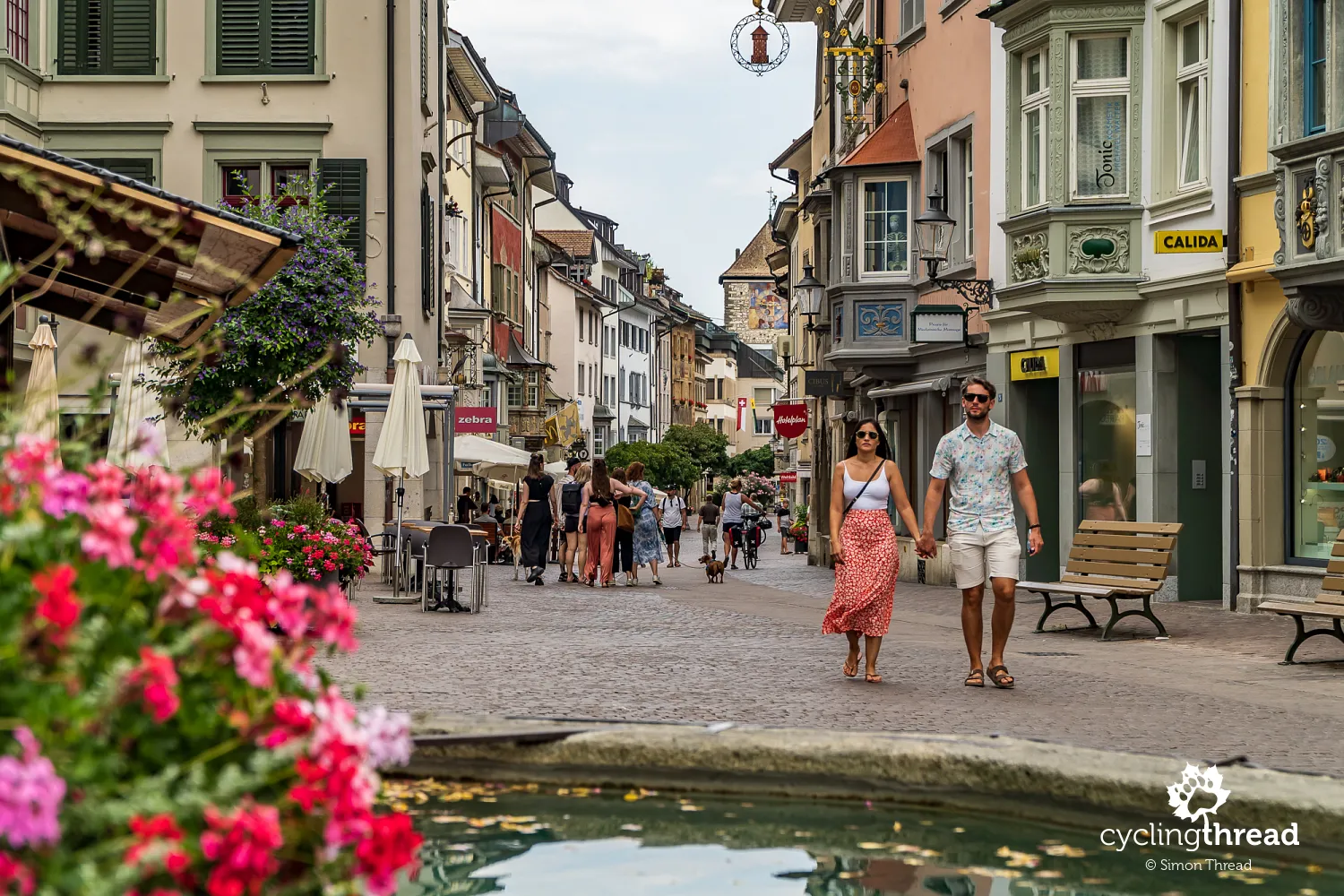
In Switzerland, as if in a Hitchcock tale, just when we leave Stein am Rhein believing we've visited the most beautiful place on the route, the Rhine reveals another gem a few kilometers down, challenging our previously established rankings. In Schaffhausen, we're greeted from afar by Munot, a Renaissance fortress towering over the city, one of the most iconic symbols of Switzerland, even featured on the 20-franc coin. The beautiful structure was only used once for its intended purpose - in 1799, it was taken by French troops. Damaged, it served for many years as a material warehouse for residents but was eventually saved, rebuilt and is now used for cultural purposes.
Thanks to staying overnight in the old town of Schaffhausen, we had the chance to enjoy the atmosphere created by Renaissance mansions with decorated bay windows, of which there are said to be three hundred in Schaffhausen. We had seen Swiss bay windows before, but not in such numbers and variety as in Schaffhausen. Additionally, that day, the residents gather in central Schaffhausen to celebrate the Swiss National Day. Unfortunately, all formal events, including the fireworks display over the famous Rhine Falls just a few kilometers away, were canceled and the celebration was limited to a gathering at Fronwagplatz, the central square of the old town, which once served as a warehouse for goods transported by the river.
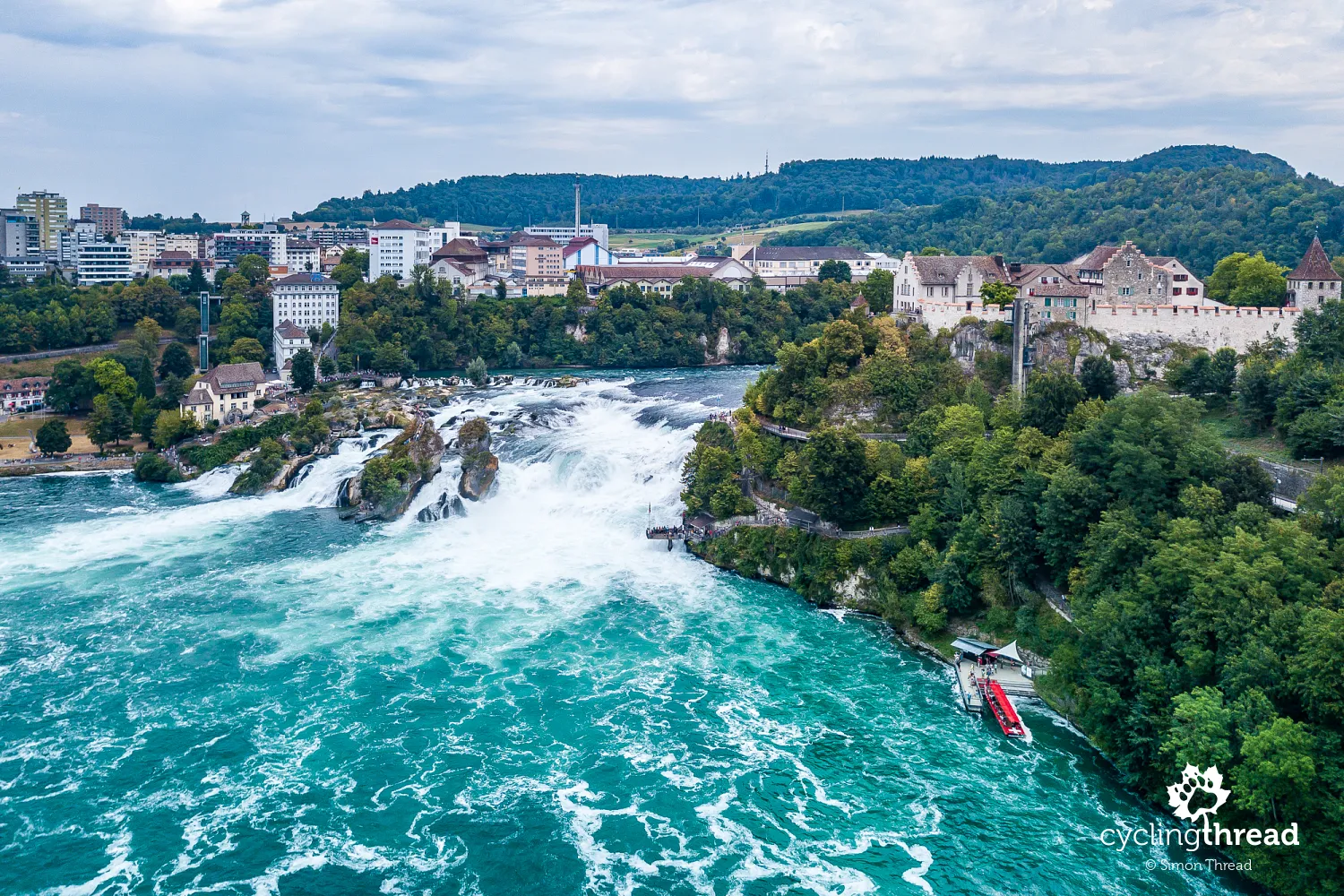
Rheinfall - the largest waterfall in Europe
Having in mind the spectacular waterfalls of Iceland, it was hard for us to believe that Rheinfall is larger. Yet, the numbers don't lie - Rheinfall in Switzerland boasts the largest water flow in Europe, even greater than those in Iceland. The masses of water flowing through the large rock steps can be admired both from the Laufen Castle side overlooking the waterfall and from the viewing terraces on the right bank, from the Neuhausen am Rheinfall side. Although supposedly the best view is from one of the small tour boats that approach the waterfall in an impressive manner.
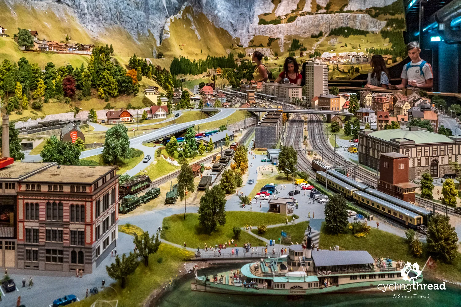
Switzerland's most beautiful places in miniature
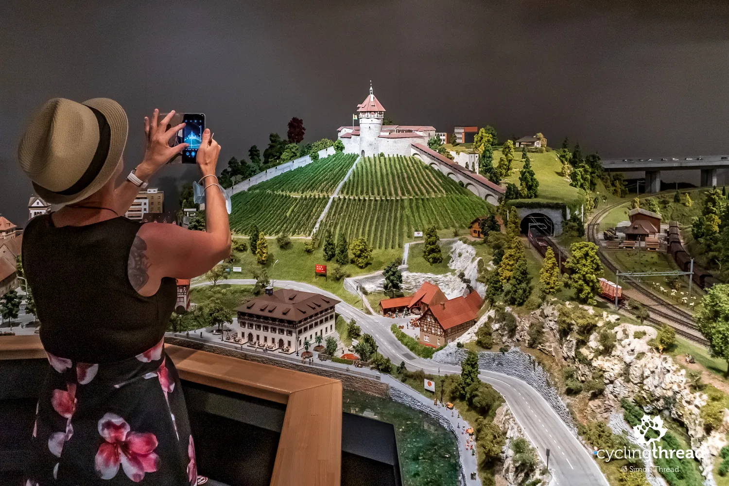
I'm not sure if I should admit it, but I spent more time in the dimly lit room over models of Swiss locations, which we entered right after leaving the famous waterfall area. In a former factory building in Neuhausen am Rheinfall, you can see the Swiss Milestones exhibition - Switzerland presented through miniatures made at a 1:87 scale. I think many middle-aged men will immediately be transported back to their childhood, spent over railway models, among which miniature Piko trains sped by.
Munot fortress among the miniatures of Switzerland in Neuhausen
Among the many iconic places, the Munot Fortress from Schaffhausen, mentioned a few paragraphs earlier, the Rhine Falls and even the famous Matterhorn are not missed. It's a great place to test your knowledge of Switzerland or to just immerse yourself in the atmosphere of this unique country and see how much more there is to discover. The miniature construction utilized as many as 23,000 figures, often representing local customs or events. There are 550 buildings, 700 vehicles on the roads and trains running on tracks totaling 1.3 kilometers in length. To catch all the nuances, one cannot rush.
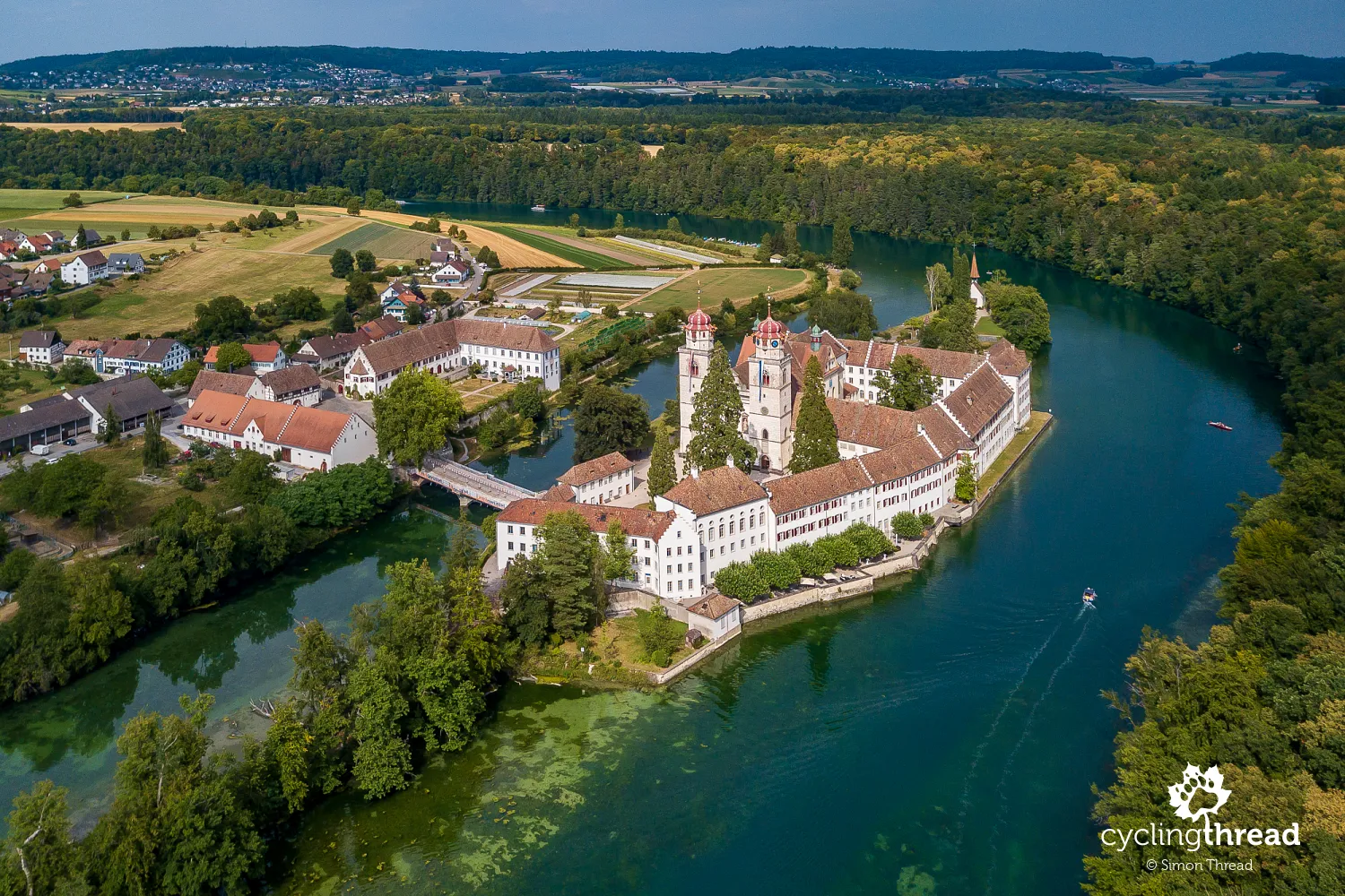
Benedictine Abbey on an island on the Rhine
After leaving Neuhausen am Rheinfall, we continue our journey. Just a few kilometers away is the Benedictine Abbey in Rheinau, picturesquely located on an island on the Rhine. Unfortunately, the signs for the Rhine Cycle Route do not lead to this place, passing it nearby, so it's worth paying attention to turn off at the right moment. Rheinau Abbey was founded in the 10th century, but the current architectural shape of the historic complex dates from the 18th century. Our visit was hindered by restrictions related to the coronavirus pandemic.
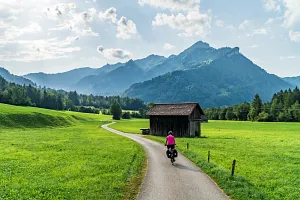
Beautiful Kaiserstuhl, Laufenburg and Rheinfelden
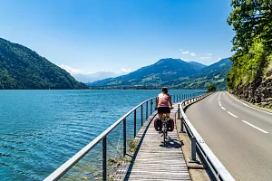
On the stretch of the Rhine before Basel, we are entertained by more historic towns. Kaiserstuhl looks beautiful from above, showing the triangular shape of the town's buildings. The bridge in Laufenburg once crossed a rocky bed of the Rhine, filled with a much lower water level. The construction of the Laufenburg hydroelectric power plant, once the largest on the Rhine, raised the water level, hiding the picturesque rocky gorge of the Rhine. Before Basel, rainy Rheinfelden stops us with the pleasant medieval atmosphere of the old town.
The beginning and end of the trip in Basel
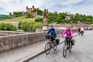
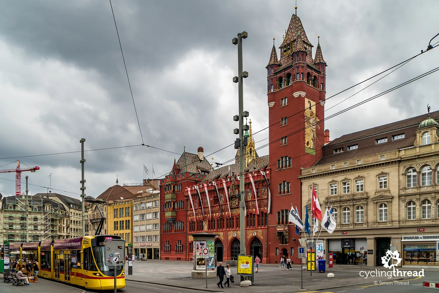
On the ninth, last day of our stay in Switzerland, we dedicated our time to exploring Basel. From the plethora of attractions and curiosities of Switzerland's third-largest city, we chose interesting places in line with our interests, mainly of historical and natural character. We started with one of the symbols of Basel - the town hall with quite unusual coloring and decorations that cover not only the front facade but also the courtyard walls. Unfortunately, touring the interior is only possible in groups under the guidance of a tour guide and on previously specified days, which was further limited due to the coronavirus pandemic.
Basel - the cultural capital of Switzerland
In Basel, even those not particularly fond of museum atmospheres can find a museum to their liking. The city boasts about forty museums, with the most popular ones including the Natural History Museum, the Historical Museum, the Art Museum, the Historical Music Museum and the Museum of Cultures. We visited the first two, enjoying the low attendance caused by fewer people traveling around Europe this summer. We also tried Läckerli - original biscuits that have been baked in Basel for centuries.
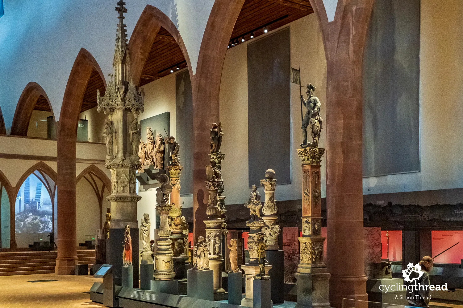
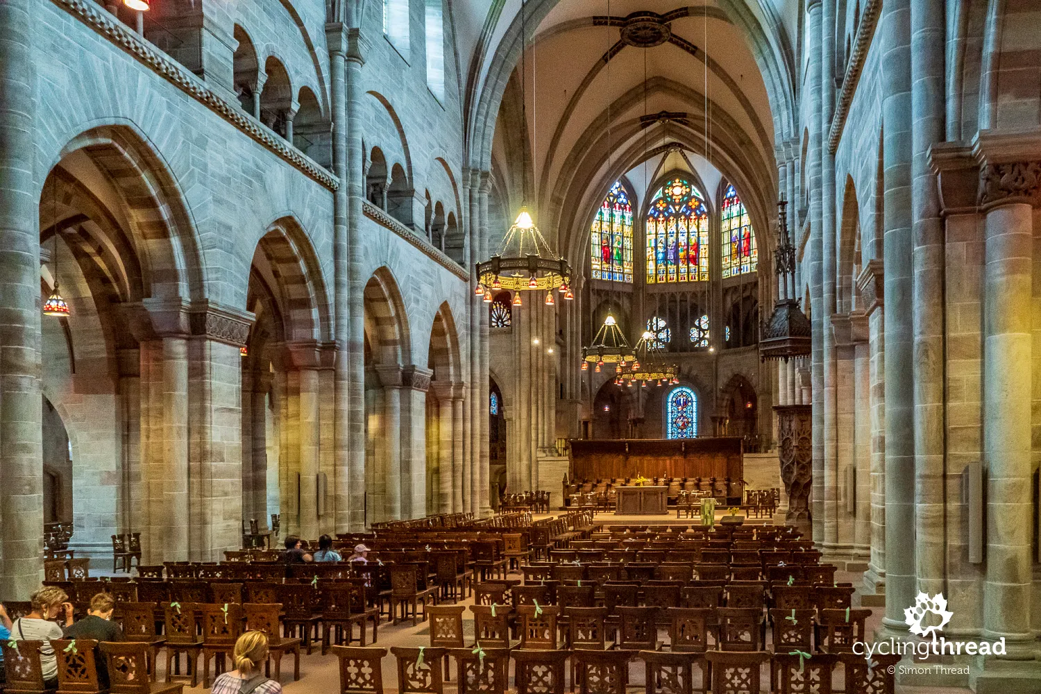
Our stay in Basel practically turned into an all-day walk through the Old Town of "Greater Basel," located on the left, southern bank of the Rhine. It is here that one finds the Natural History Museum and the Historical Museum, with the latter leading up a street to the Cathedral Hill with the cathedral, the oldest part of Basel. And the view of the Rhine from the viewing terrace, located behind the red sandstone cathedral, will be one of the best scenes to conclude more than a week spent on the Rhine Cycle Route in Switzerland.
Rhein Route - Swiss national route no. 2
A very good guide to Swiss bike routes is Schweiz Mobil - a website (and mobile app) showcasing tourist trails in Switzerland - for cycling, both touring and mountain, but also for hiking, rollerblading and kayaking. When planning our trip, I enjoyed clicking through the various bike routes on the map of Switzerland's bike trails - in the coming years, we'll also ride the Lakes Route, the Jura Route, the North-South Route and the Aare Route. Note that the menu on the left side allows displaying types of routes on the map - national (marked with one digit), regional (two digits), or local (three). The site also includes suggestions for the length of individual daily stages and short descriptions of the attractions.
Comfort and safety on the bike route
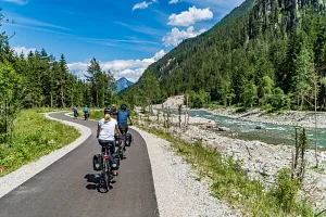
Lastly, a brief note on what the surfaces and journey along the Rhine Cycle Route looked like from a more technical standpoint. Apart from the first few kilometers of ascent and descent from the Oberalp Pass, which took place in general traffic, the rest of the route was almost entirely on bike paths isolated from car traffic or at least restricted to local traffic. Sections on public roads that are part of the official Rhine Cycle Route were rare, of course, to ensure cyclists the greatest possible comfort and safety. Most were paved with asphalt, though there were sometimes long gravel sections, mainly along the Rhine between Chur and Lake Constance. These advantages are the reason why the route is often included in the programs of companies offering the best bike tours in Europe.
We needed a vacation, we needed Switzerland
Our week-long journey along the Rhine Cycle Route showed us a very diverse and interesting Switzerland. Each day was different; landscapes, places and people we passed changed before our eyes, even the languages spoken by the residents changed. Only the bike route leading us through Switzerland remained constant. And though seven days are too short to see all attractions and to hear every interesting story, we left Switzerland full of good travel energy, saturated with beautiful scenes and with the knowledge of time well spent. Maybe in these challenging times, to really rest, we need something more than just a regular vacation. We indeed need Switzerland.
Back to topHave a safe ride! 💚
Simon Thread
(Szymon Nitka)
I'm a passionate cycling traveler and the voice behind Cycling Thread. I explore Europe on two wheels, documenting the most scenic routes, inspiring places and cyclist-friendly practices. My writing blends personal experience with practical insights and a deep love of travel. I'm also a contributor to National Geographic Traveler magazine.