Franconia and the Tauber-Altmühl Radweg: a perfect German getaway
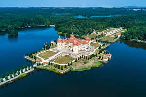
The Tauber and Altmühl rivers cycling route in Franconia, known as the Tauber-Altmühl Radweg, is considered one of the most fascinating cycling routes in Germany. The route has earned glowing reviews thanks to the scenic beauty of its two river valleys, including the rocky formations of the Franconian Jura, which give the Altmühl River its unique charm. The “romantic” atmosphere of the Tauber-Altmühl route is further enhanced by the medieval towns of Franconia, with the famous Rothenburg ob der Tauber, consistently ranked as one of the top attractions in Germany. We spent our long June weekend in this delightful setting.
Route on the map
GPX file (GPS track): cyclingthread.com-franconia-2024.gpx
Tauber-Altmühl Route - table of contents
- From Wertheim through Rothenburg to Kelheim
- To Franconia by German high-speed train
- Rothenburg - the perfect start to the trip
- Plönlein - another icon of Rothenburg
- Exploring Rothenburg with a guide
- Crossing the Great European Watershed
- Cycling along the Altmühl River
- Schnitzel, a golf course, and a castle
- Aviation pioneer born in Leutershausen
- Storks and Franconia’s beautiful stone bridges
- Cycling paths along the rivers of Franconia
- Stone bridges in Ornbau and Pfünz
- Geese welcome us to the Franconian Lake District
- Gunzenhausen on the ancient Roman Limes
- Fantastic cycling vibes in Franconia
- Naturpark Altmühltal sets the atmosphere
- Pappenheim with its unique natural church
- Slightly disappointing the Twelve Apostles
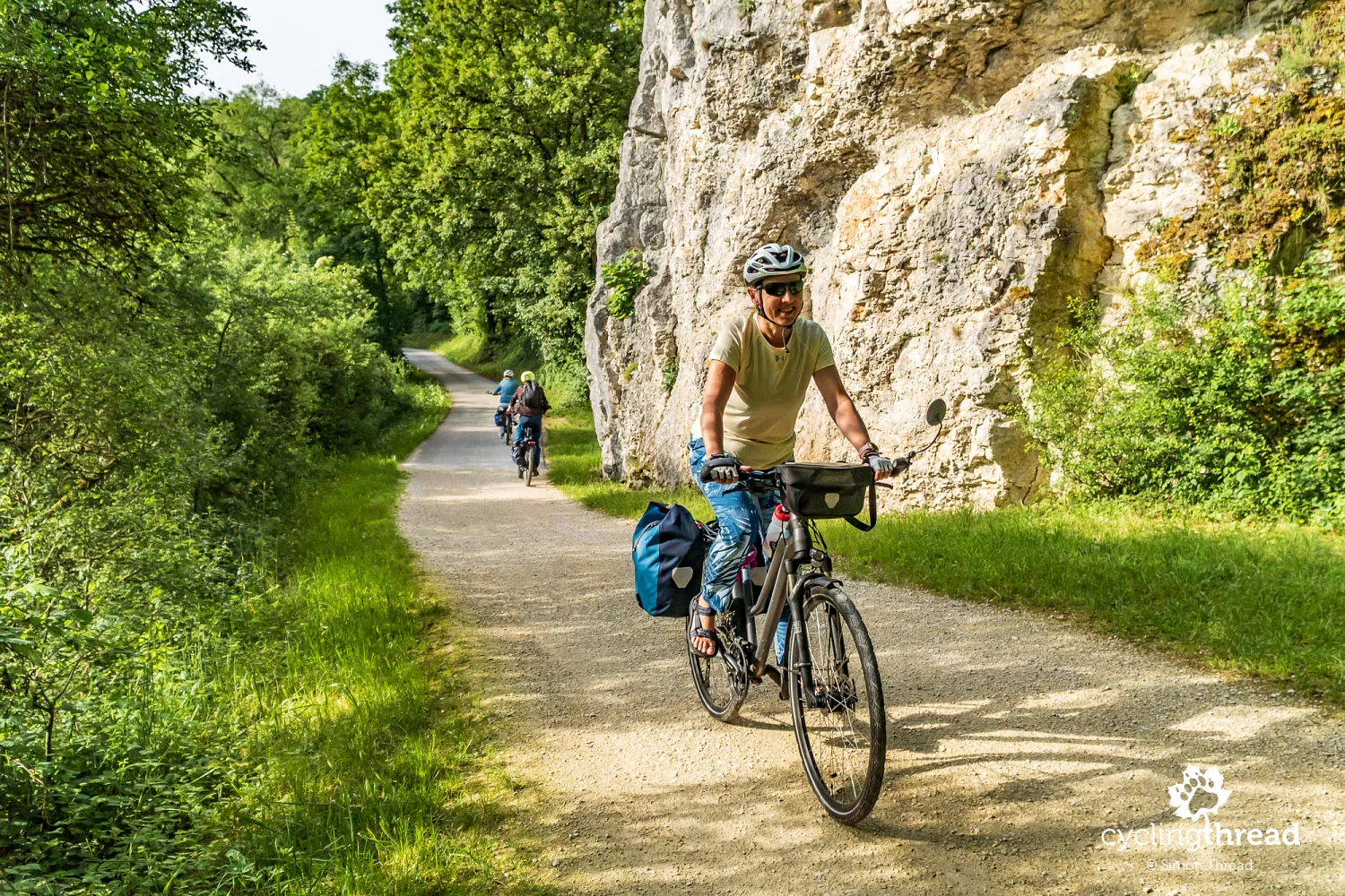
- Gravel paths—less comfortable than asphalt, but...
- Burgstein - one of Altmühl Valley’s geological wonders
- Beautiful Eichstätt and its Jura Museum
- Eichstätt and its witch hunts
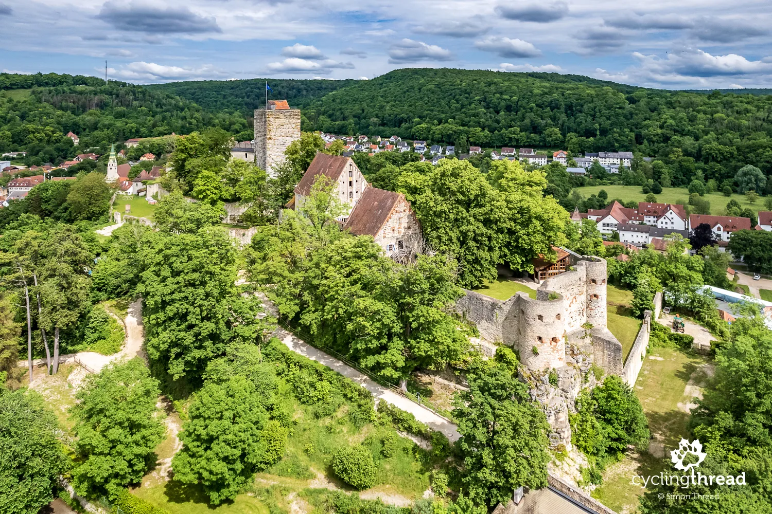
- Franconian castles along the valley
- The wooden lizard above the Altmühl River
- An impressive structure concludes the journey
- In Nuremberg, we are welcomed by Veit Stoss
- The many faces of cycling in Franconia
- Franconia - perfect for a weekend or a longer holiday
From Wertheim through Rothenburg to Kelheim
The Tauber and Altmühl River Cycling Route has an unusual layout - it first follows the Tauber River upstream and then continues downstream along the Altmühl River. It begins in the town of Wertheim, near where the Tauber flows into the Main River. From there, it leads to the magnificent Rothenburg ob der Tauber, the highlight of the route and the highest-elevated city along the way. After leaving this Franconian gem and crossing the nearby European Watershed, the Altmühl River takes over, guiding cyclists all the way to the end of the route at the river's mouth in Kelheim, where the Altmühl meets the Danube. Regardless of where you start, you’ll first face a climb along one river, followed by a gentle, enjoyable descent along the other after visiting Rothenburg. The proportions of the two sections differ - the Tauber River portion is about 100 kilometers long, while the Altmühl stretch is around 250 kilometers.
For the long June weekend (and a bit before), we chose the longer portion of the route - spending four days cycling along the Altmühl River, starting in Rothenburg and ending in Kelheim. Along the way, we visited Gunzenhausen, Eichstätt, Beilngries, and Dietfurt, covering a total of 253 kilometers in four days, according to our GPS tracker. We added two extra two-day trips before and after the cycling adventure, which included traveling to and from Franconia, as well as a leisurely exploration of Nuremberg, the capital of Franconia. This was our third cycling visit to Franconia and the third trail we’ve completed. Our first adventure was the excellent Main River cycling route, which we dedicated to a long May weekend a few years ago. Two years ago, we completed the local Hohenzollern cycling route. Each time, whether then or now, we discovered a different side of charming, intriguing, and very bike-friendly Franconia.
To Franconia by German high-speed train
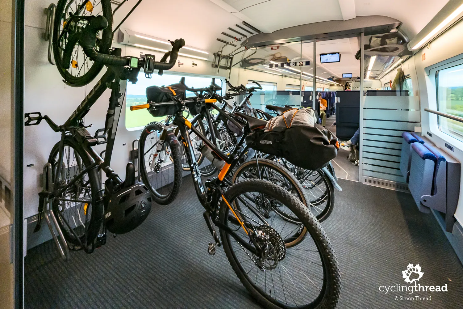
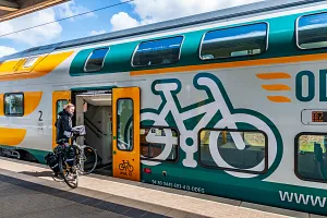
A small highlight of this trip was the way we reached Franconia. Given the considerable distance (1100 kilometers) from Gdańsk (on the Baltic Sea) to Franconia, and our shared desire to relax along the way, we opted for the train. We started by taking the familiar Berlin-Gdynia Express from Gdańsk to Berlin, then switched to the German high-speed ICE train to Nuremberg. Booking the ICE tickets early guaranteed us a decent price and a very comfortable journey. This generation of ICE trains offers 8 bike spots in a special compartment in the first car - some with horizontal hooks and others (on the outside) with vertical ones to allow more space for passengers. It's a completely different experience compared to what our Pendolino offers. We reached Rothenburg the next day via a short local connection through Ansbach.
Rothenburg - the perfect start to the trip
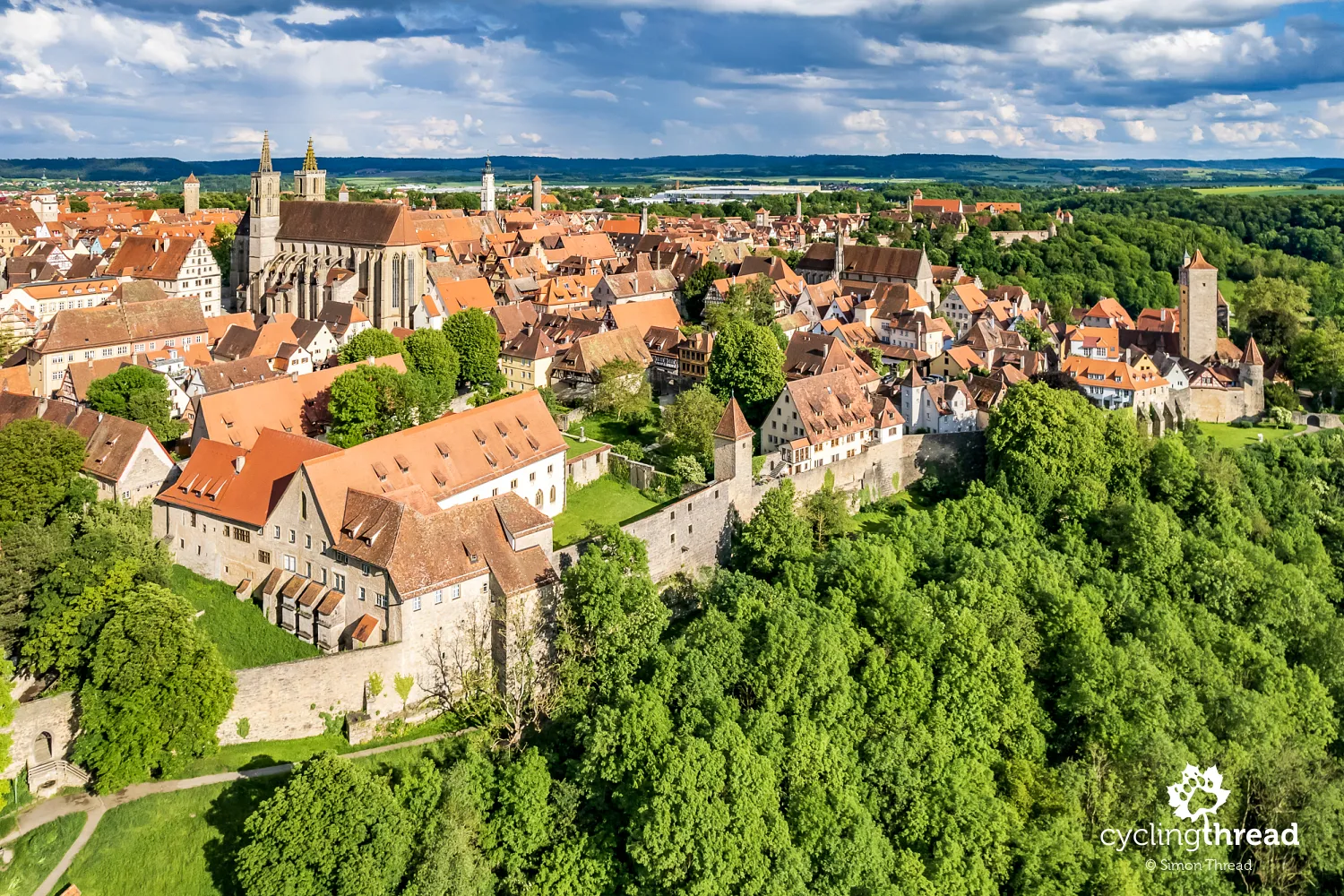
Rothenburg is simply enchanting - the perfect place to begin a “romantic” cycling journey through Franconia. The city is stunning, whether you view it from a drone or stroll through its streets. It looks amazing during the day, and its nighttime atmosphere is equally captivating. Our first impression was also excellent: arriving from the train station, we reached the well-preserved ring of high defensive walls and entered the city’s golden age through the gate tower. I highly recommend organizing your visit to Rothenburg as we did - spend the first night in Nuremberg, take a morning train to Rothenburg, and spend the rest of the day exploring the city on foot. There are numerous sights to see, and when you combine them with the medieval atmosphere of Rothenburg, it’s clear the city deserves at least a full day. The best idea is to hire a local guide for the tour.
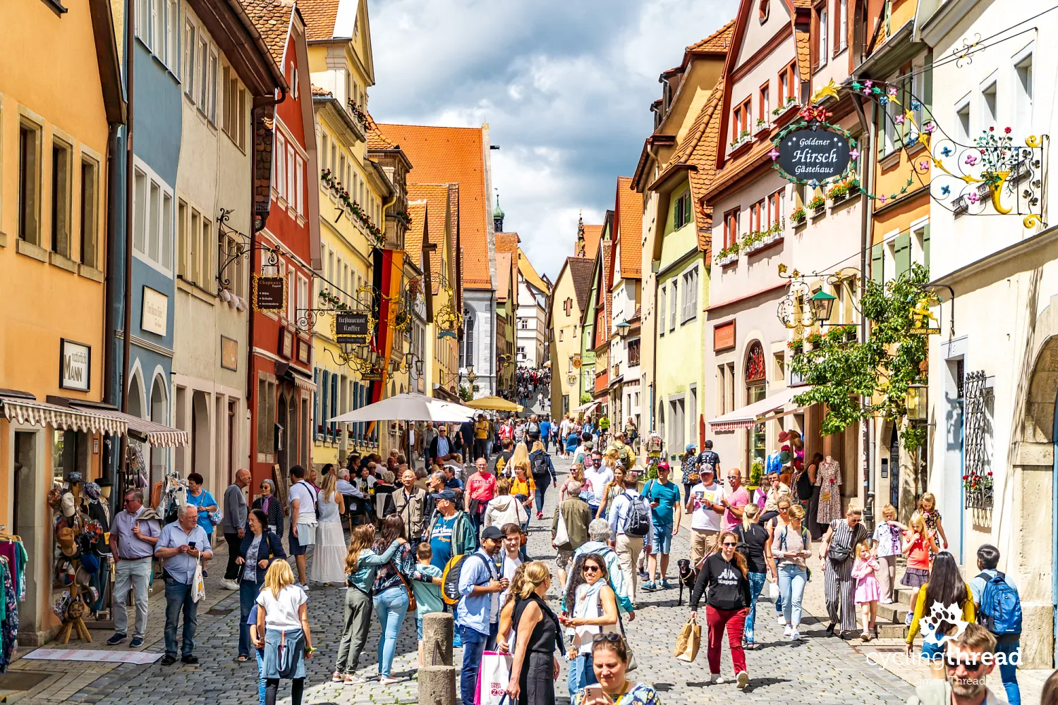
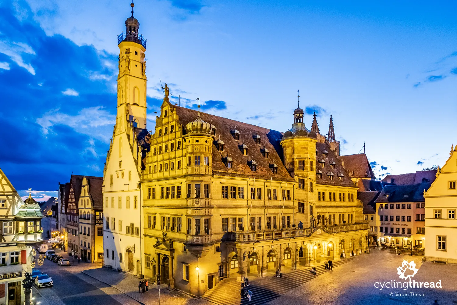
This year, Rothenburg is celebrating the round anniversary of being declared an imperial city - marking 750 years of the city’s prosperous history, which we can thank for Rothenburg’s preservation in its historical form. The city’s most important legend is reenacted eight times a day by figures in the windows of the Ratstrinkstube building, adjacent to the town hall. It recalls Johann von Tilly, the commander of the Catholic League’s forces that besieged Rothenburg in 1631, and Georg Nusch, the city’s mayor, who accepted von Tilly’s challenge and drank a gallon of wine (about 3.25 liters) in one gulp, thereby saving the city from a massacre. While historians doubt the accuracy of this story, the city embraces the legend, organizing an annual festival, Der Meistertrunk (The Master Draught), as a chance for many cultural events and gatherings.
Plönlein - another icon of Rothenburg
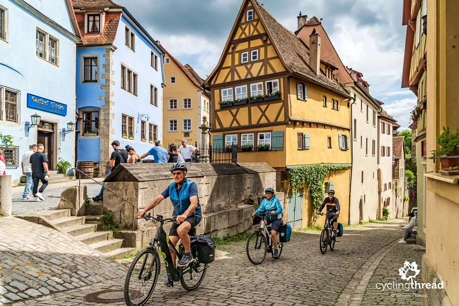
The architectural symbol of Rothenburg is Plönlein - a tiny square at the intersection of two streets, where fish used to be stored and sold. Plönlein is distinctive because it offers a view of two city gates, and... that's about it in terms of its uniqueness. Yet, this has been enough for Plönlein to dominate Rothenburg’s souvenirs, photo albums, and tourist brochures. It’s nearly impossible to capture a shot of the place without other tourists in the frame. Plönlein also caught the eye of Walt Disney, who featured Rothenburg’s iconic scene in the title frame of Pinocchio, his second animated film released in 1940. Below, in contrast to the millions of identical photos of this famous spot, I’m sharing with you a less typical view of Plönlein - with something we love the most - bikes.
Exploring Rothenburg with a guide
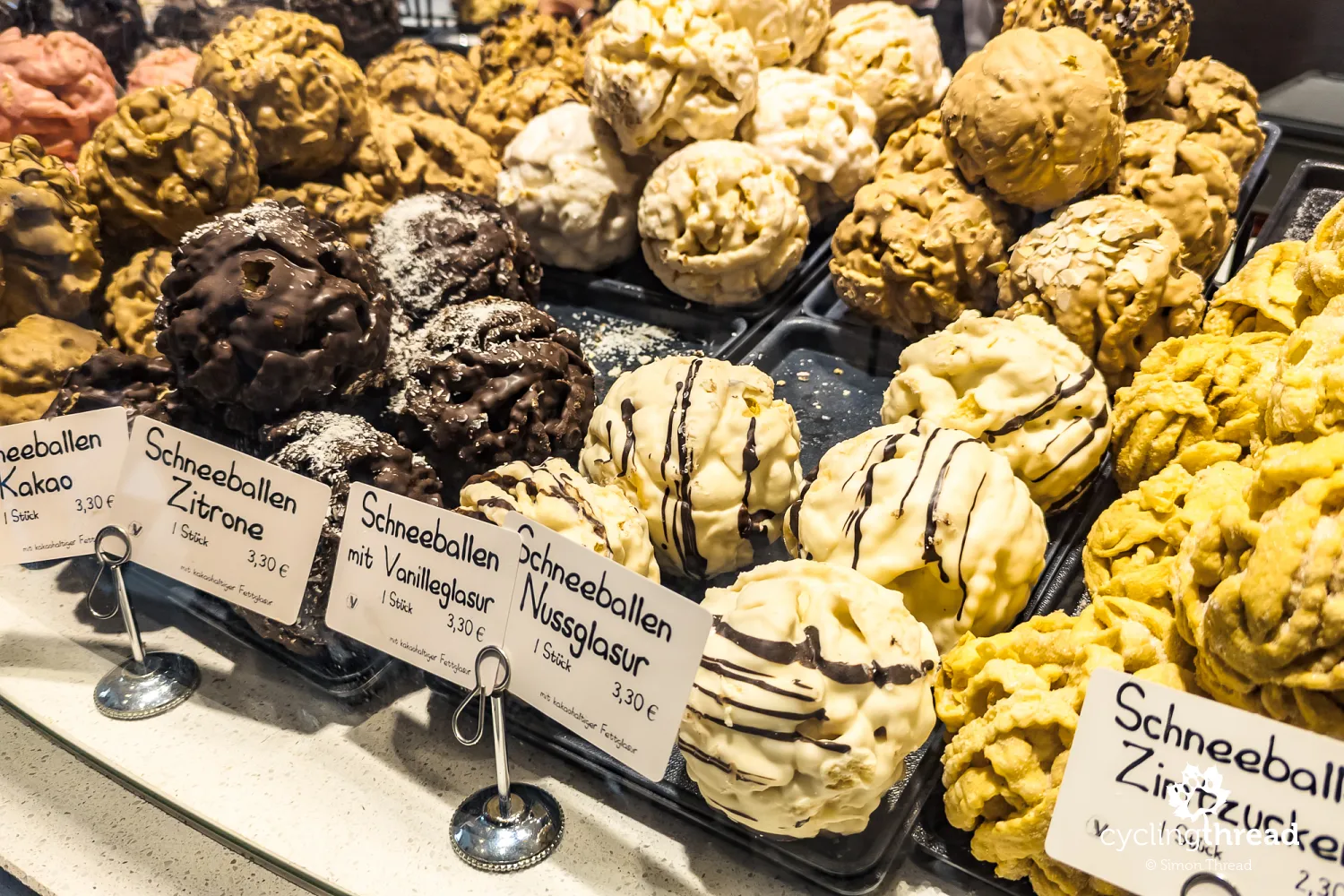
Touring Rothenburg with a guide allows you to see more and discover places you’d likely overlook on your own. One of the unique aspects our guide highlighted was the impressive homes of Rothenburg’s patricians. These houses were not just for living; they also served economic purposes, including storage and processing of goods and crops. You can easily spot these former "warehouse" spaces today, as many have been converted into parking lots. A guide’s knowledge can also come in handy while trying the local treat, Schneeballen - a crunchy pastry shaped like a snowball. Instead of struggling to bite into it, you simply crush it in its bakery bag and eat it like angel wings. The guide might also tell you that the beautiful roses adorning the façades of many buildings weren’t just decorative. Their purpose was to absorb excess moisture from the walls, helping to dry them out.
Crossing the Great European Watershed
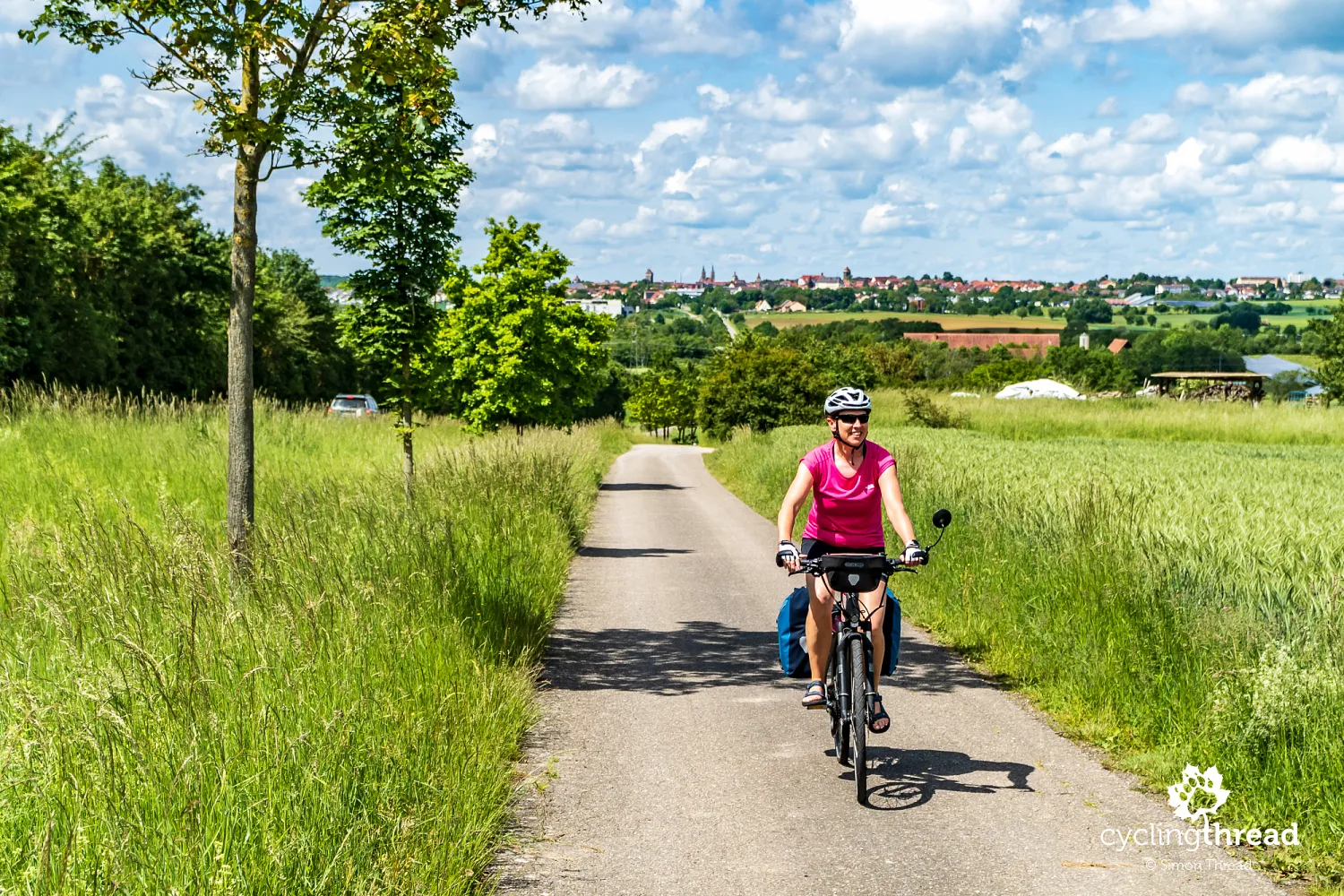
Although I describe the Tauber-Altmühl cycling route as going downstream along the Altmühl River, just after Rothenburg, cyclists face quite a surprise. There’s a steep 16% incline leading up to the forested hills east of Rothenburg. This is where you cross one of the most unique geographical features of Europe - the Great European Watershed. The Great European Watershed is an imaginary line dividing the river basins that drain into the Atlantic Ocean, the North Sea, and the Baltic Sea from those flowing into the Mediterranean, the Adriatic, and the Black Sea. This invisible line, splitting the continent into northern and southern parts, stretches from the tip of the Iberian Peninsula near Gibraltar in the southwest all the way to the Caspian Sea basin in Russia in the northeast. Unfortunately, I was disappointed to find there was no clear signage marking the area where we crossed the watershed, despite reports of such a marker existing just a few years ago.
Cycling along the Altmühl River
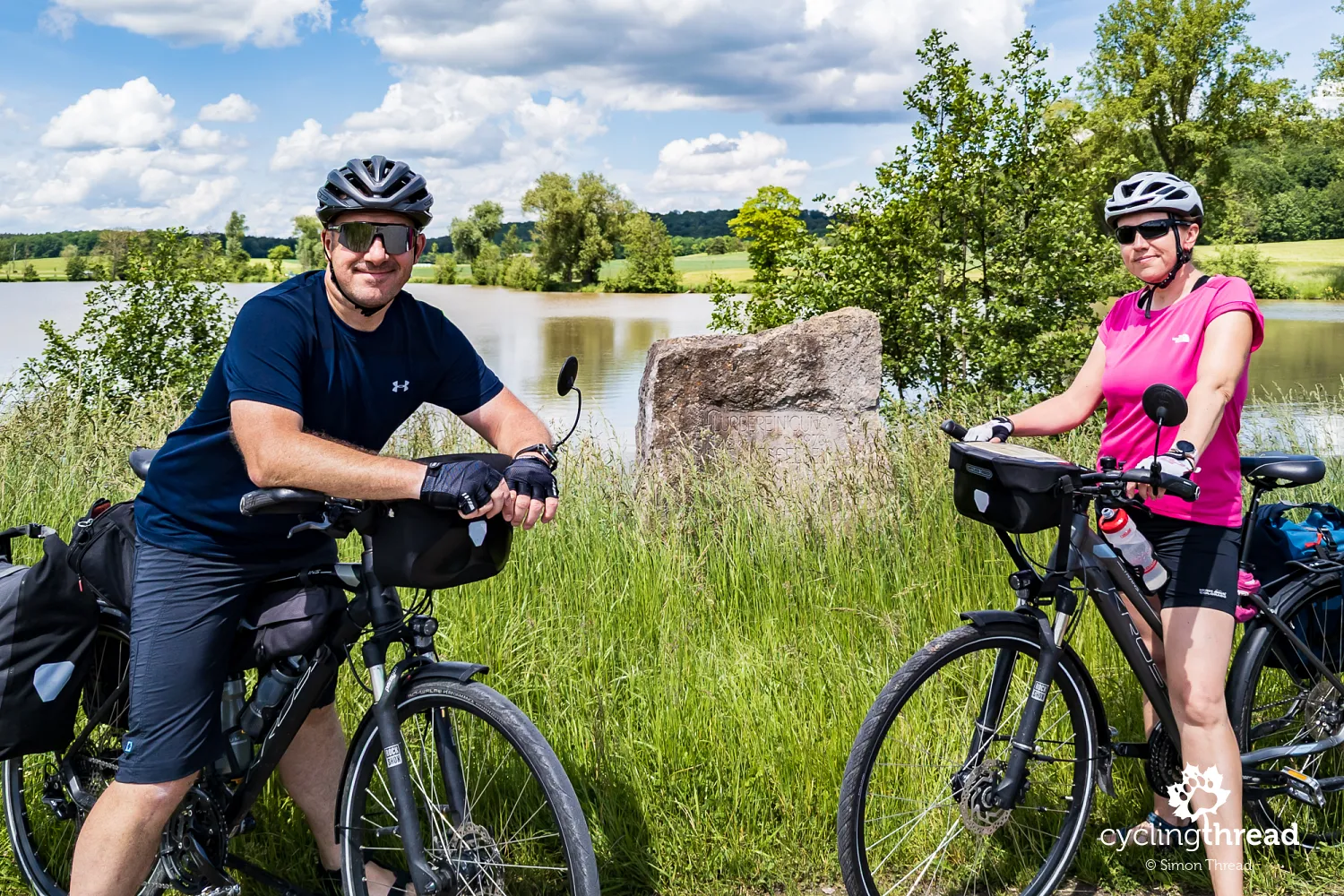
A few kilometers later, near the village of Hornau, we arrived at a small pond called Hornauer Weiher, fed by several nearby streams. This is where the Altmühl River begins its journey, and where it will guide us through Franconia in the coming days. At the source of the Altmühl stands a commemorative stone; however, due to my mistake, we took our commemorative photo next to a stone commemorating land consolidation efforts from the 1970s. For the first few kilometers, the Altmühl is just a narrow stream, sometimes barely noticeable, and the path alongside it varies - from country roads to gravel tracks and quiet streets. By the end of the day, the river widens, and flood embankments rise on its banks, with cycling paths running along the top.
Schnitzel, a golf course, and a castle
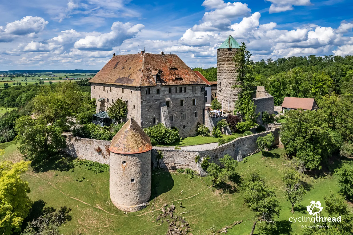
The first castle along the Altmühl River cycling route is the picturesque fortress near the village of Colmberg, surrounded by a golf course. For nearly 500 years, Colmberg Castle and its surrounding lands were owned by the Hohenzollerns and played a role in various wars and skirmishes, including conflicts with Rothenburg. In 1631, the imperial general von Tilly, who had earlier issued a drinking challenge to Rothenburg’s mayor, failed to capture the castle. During World War II, Colmberg Castle housed nearly 1,200 icons, paintings, and other cultural treasures stolen by the Nazis from Pskov and Novgorod, which were transported there in 25 trucks. Below the castle, along the cycling route, there’s a small restaurant where we stopped for a meal. Unfortunately, the schnitzels we ordered were quite disappointing and didn’t live up to the standard of the delicious food we’ve come to expect in Germany.
Aviation pioneer born in Leutershausen
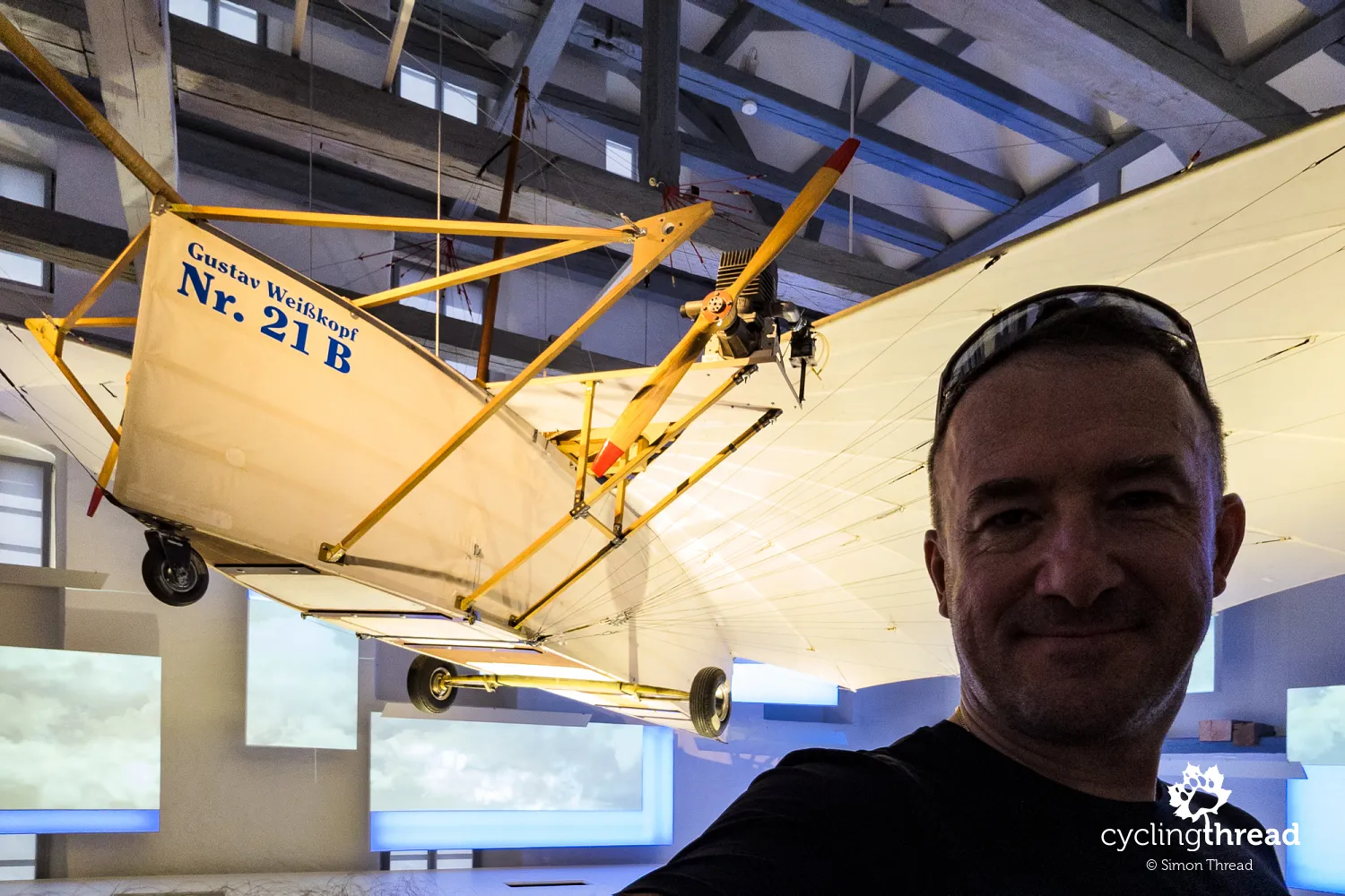
An interesting stop along the route is the Aviation Pioneers Museum in the next town, Leutershausen, dedicated to Gustav Weißkopf, who was born here. Gustav Weißkopf was a German-American aviation pioneer, known for claims that he made a successful powered flight in 1901, two years before the famous Wright brothers’ flight. His alleged flight took place in Bridgeport, Connecticut, but evidence supporting his achievement is controversial and widely debated. Nevertheless, many aviation enthusiasts consider him one of the first people to fly a powered aircraft. The museum in Leutershausen features a replica of the plane he built and supposedly flew. The Aviation Pioneers Museum is housed in a historic granary from 1624, which has also served as a district court. Incidentally, we encountered another German aviation pioneer, Otto Lilienthal, during a visit to the Szczecin Lagoon route.
Storks and Franconia’s beautiful stone bridges
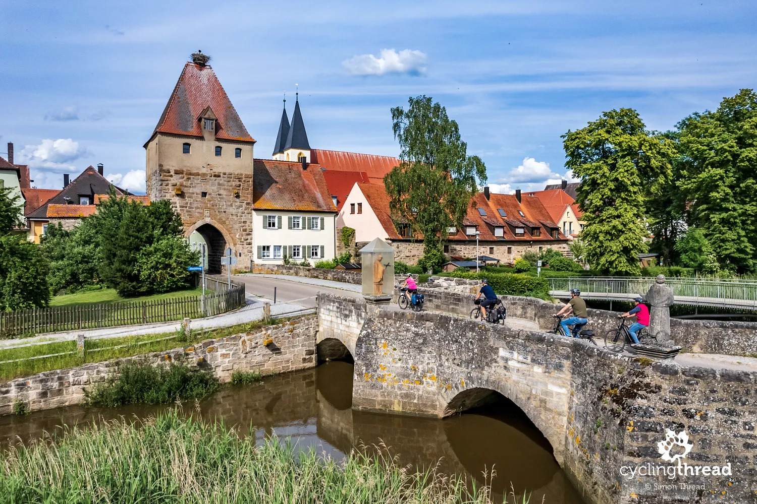
Soon after, we passed through two towns with historic centers and preserved stone bridges over the Altmühl River. The first is Herrieden, where a short ride through the town takes you across a bridge from 1711, built on the site of Franconia’s oldest documented bridge, and past the nearby Stork Tower from 1340. Sources mention that this is one of the few buildings in the Altmühl Valley where storks nest, though we spotted at least three stork nests around Herrieden’s main square. The square also features an original fountain, convenient resting spots, and just around the corner, a café with delicious ice cream. If you're planning a break along the route, this is an excellent spot.
Cycling paths along the rivers of Franconia
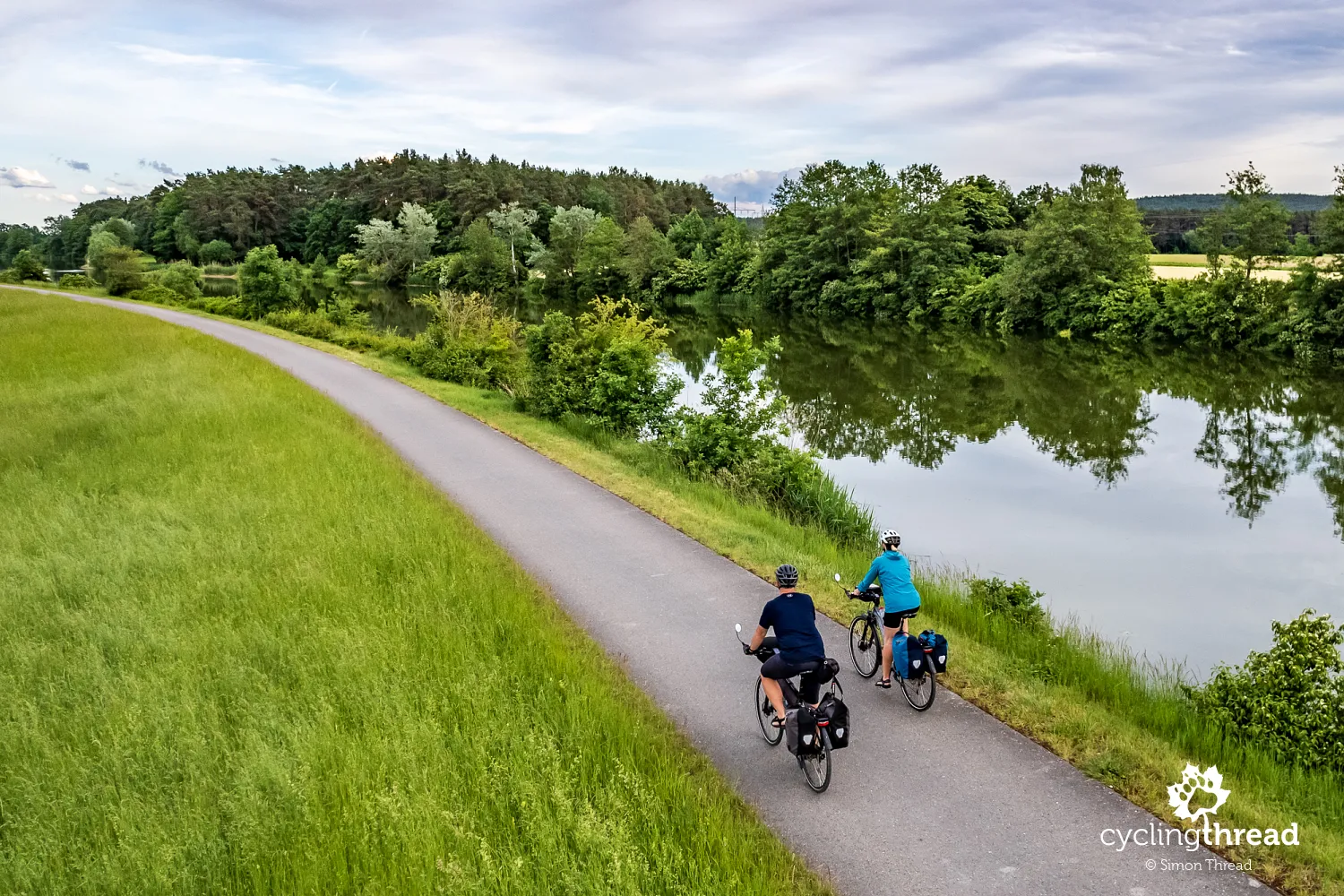
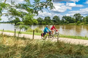
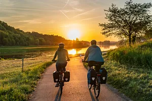
This is where we encounter what we love most in cycling tourism. Here, dedicated cycling paths not only separate cyclists from car traffic, but also start to follow their own route rather than just running parallel to the roads, as they had done previously. Somewhere around Ornbau, we hit a smooth asphalt trail along the Altmühl River, and if I recall correctly, we stayed on it all the way to Gunzenhausen. While the earlier sections running alongside roads were safe and comfortable, they can't compare to the joy of riding along a path that escapes behind the river into the tranquil Franconian nature, away from the hustle of the roads.
Stone bridges in Ornbau and Pfünz
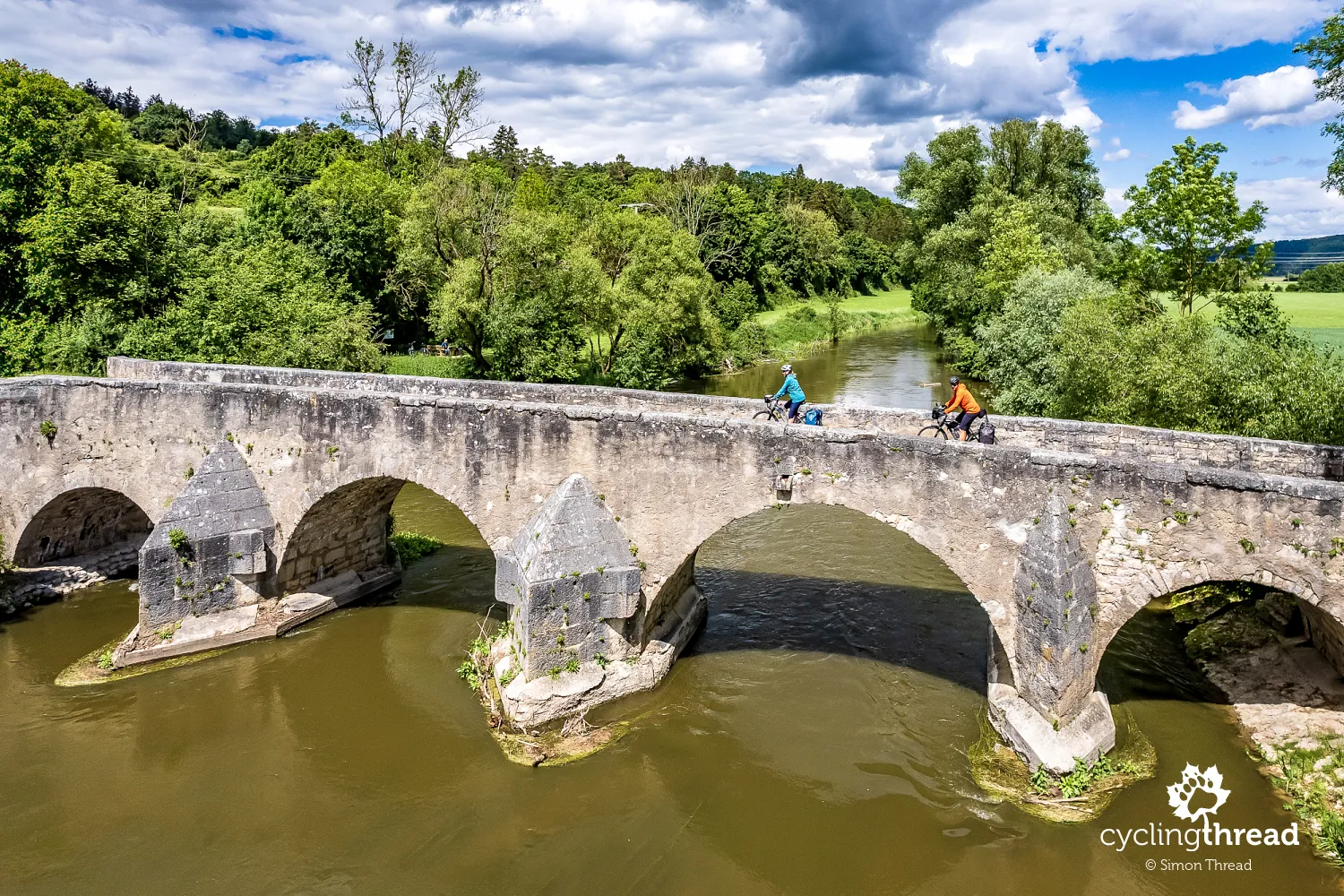
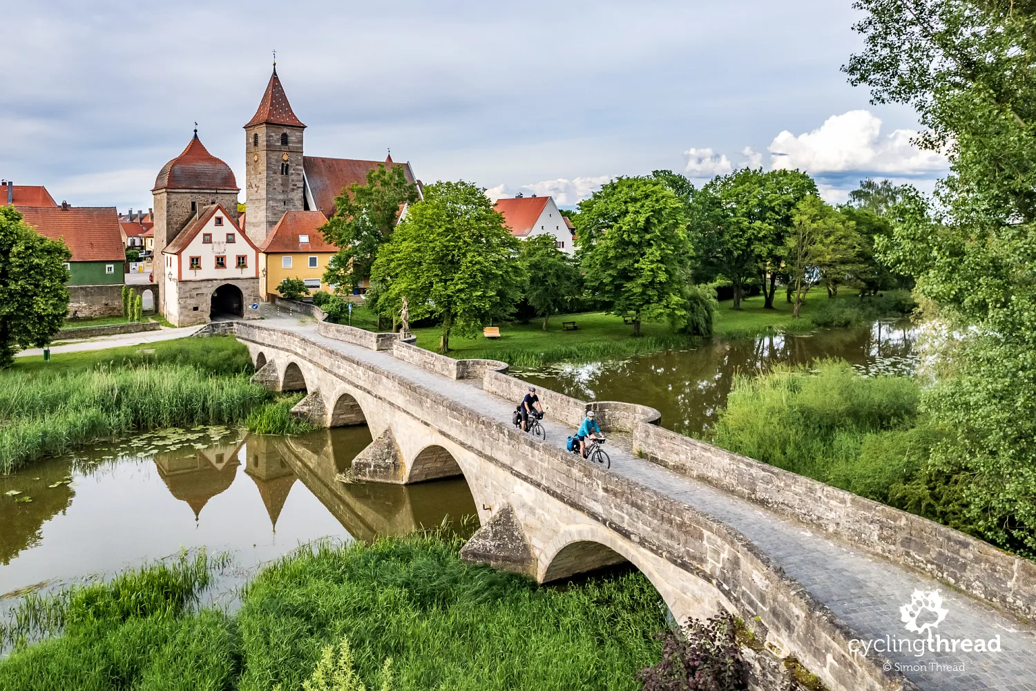
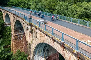
In Ornbau, one of Bavaria’s smallest towns, we encountered another impressive stone bridge after the one we had seen in Herrieden. Although Ornbau is much smaller, its 17th-century bridge over the Altmühl River is longer and makes a greater impression. The bridge was built from thick sandstone blocks, and its central span is adorned with an 18th-century statue of St. John of Nepomuk. It is even called the "pearl of the upper Altmühl Valley." The bridge leads to the town, which has a preserved medieval urban layout, surrounded by 13th-century city walls. Another one of the beautiful medieval bridges that survived over the Altmühl can be found a few days later, just beyond Eichstätt, near the village of Pfünz. This 15th-century bridge, which was blown up by the Austrians in 1800, was rebuilt in 1822 and is one of the most valuable stone bridges in Bavaria. It is also featured in one of the first photos in this article.
Geese welcome us to the Franconian Lake District
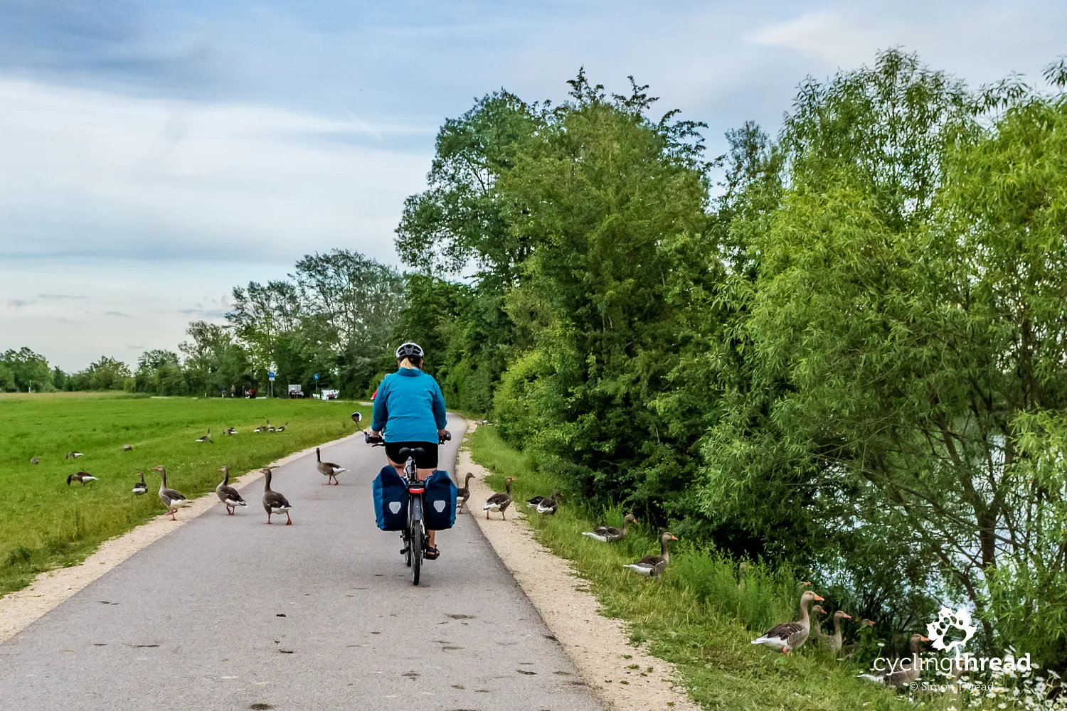
The Franconian Lake District welcomed us beautifully. Just before reaching Altmühlsee Lake, near Muhr am See, a flock of wild geese blocked our cycling path, having chosen this spot for their evening feeding. They didn’t seem particularly disturbed by our presence and kindly let us pass through their occupied territory. This wasn’t the first time we’ve encountered such a situation - traveling in Germany has accustomed us to wild animals not being less afraid of humans than what we usually see. Is this due to a different societal attitude towards nature in Germany, which translates into other instinctive behaviors in wildlife? A bit further on, we passed the entrance to the Bird Island (Vogelinsel im Altmühlsee), where you can take a circular walk and climb a viewing tower.
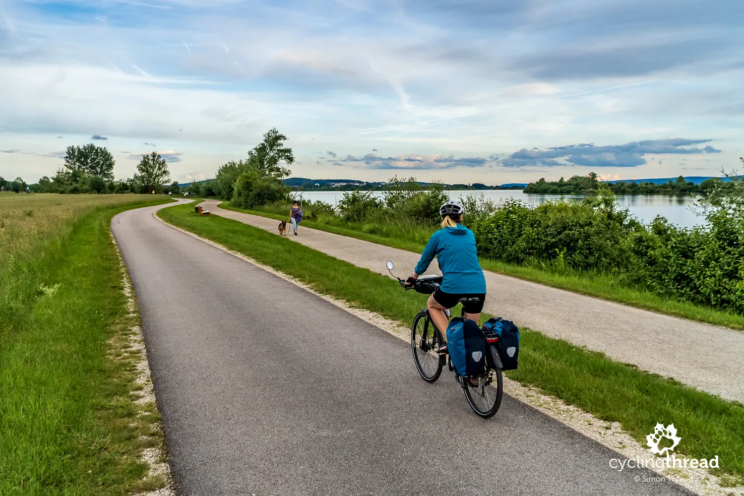
Although our time in the Franconian Lake District was short, it's worth noting that this is an artificially created group of lakes. The project aimed primarily at better managing the limited water resources in this part of Franconia and providing flood protection, with tourism being only a secondary goal. By constructing several dams - including the longest in Germany, which encircles Altmühlsee Lake and stretches 12.5 kilometers - large sections of river valleys were flooded, forming three major water reservoirs. Around these, tourist routes were developed for walking and cycling, and recreational facilities popped up along the shores, offering various types of water activities. This is the third artificial lake district we’ve seen in Germany - we recently visited the Lusatian Lake District and earlier, the New Leipzig Lake District.
Gunzenhausen on the ancient Roman Limes
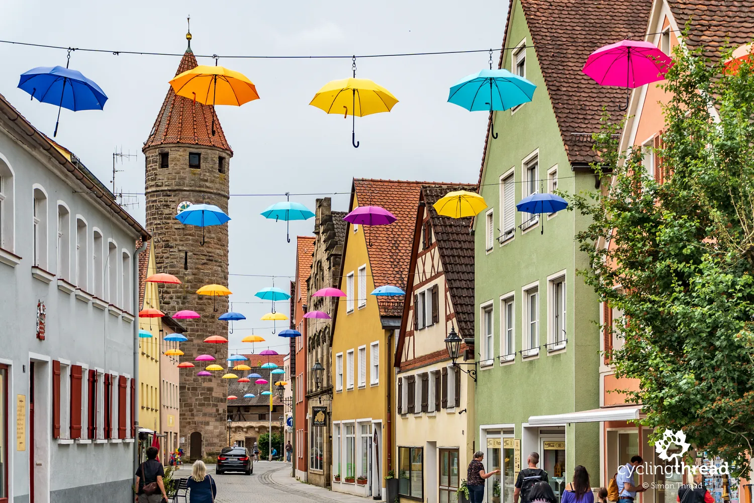
We spent the night in colorful Gunzenhausen, a town with a history dating back to Roman times. Around 90 AD, a section of the historic defensive line known as the Limes is thought to have existed near Gunzenhausen, running along the Altmühl Valley. The Limes was the ancient boundary of the Roman Empire, and the area around Gunzenhausen still contains remnants of forts, watchtowers, and other defensive structures. This is one of the topics covered by the small Archaeological Museum in Gunzenhausen. The town boasts a charming, elongated market square, where baroque influences from the reign of Charles William Frederick can be seen, as well as a vibrant city center brought to life by colorful hanging umbrellas.
Fantastic cycling vibes in Franconia
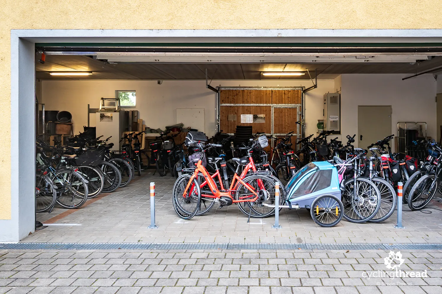
Franconia is one of those regions in Germany that is truly fantastic to explore by bicycle. The terrain is varied yet gentle, with numerous rivers along which cycling routes run, and fascinating places that serve as destinations each day - all of this makes Franconia a magnet for tourists. Additionally, the region offers excellent tourist infrastructure, ready to welcome cyclists. In Gunzenhausen, we stayed at a hotel that had a large garage entirely dedicated to cyclists. It was equipped with tools, pumps, and charging stations for electric bike batteries - everything a cyclist might need.
Naturpark Altmühltal sets the atmosphere
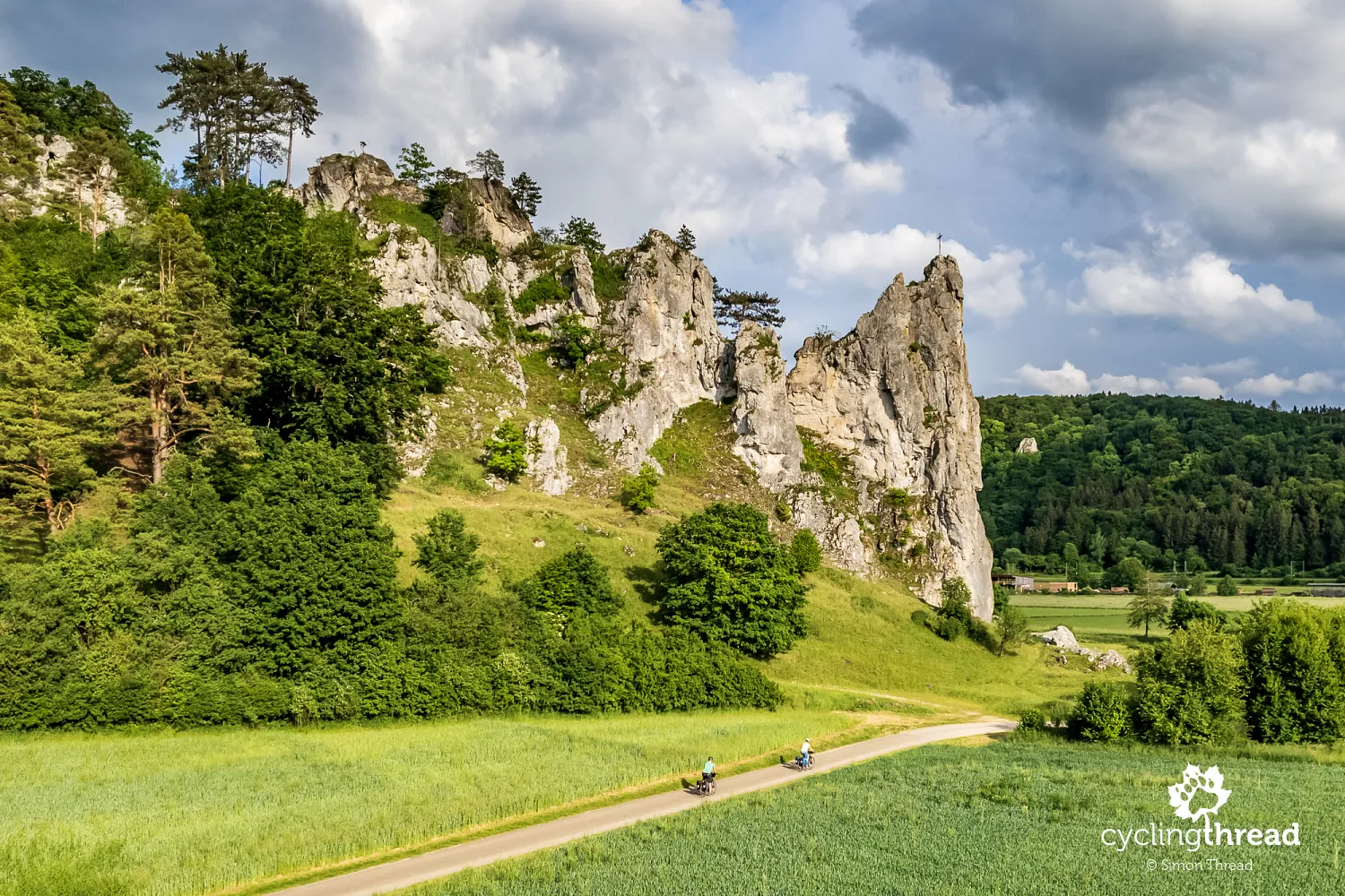
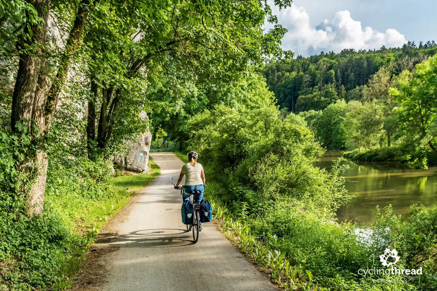
After passing Gunzenhausen, the landscape began to change as we entered the picturesque Naturpark Altmühltal (Altmühl Valley Nature Park), located in the Franconian Highlands, also known as the Franconian Jura. This is one of Germany’s largest landscape parks, renowned for its scenic views, which include limestone hills, deep river valleys, forests, and numerous rock formations. The central feature of the park is, of course, the Altmühl River, which winds lazily through the region, creating meanders and scenic bends that are perfect for canoeing and other water activities. However, the most captivating aspect for visitors might be the spectacular rock formations, often accompanied by castles and castle ruins perched high above the valley floor. Naturally, the best way to explore Naturpark Altmühltal is by bike, and the most popular route is "our" Tauber-Altmühl cycling route.
Pappenheim with its unique natural church
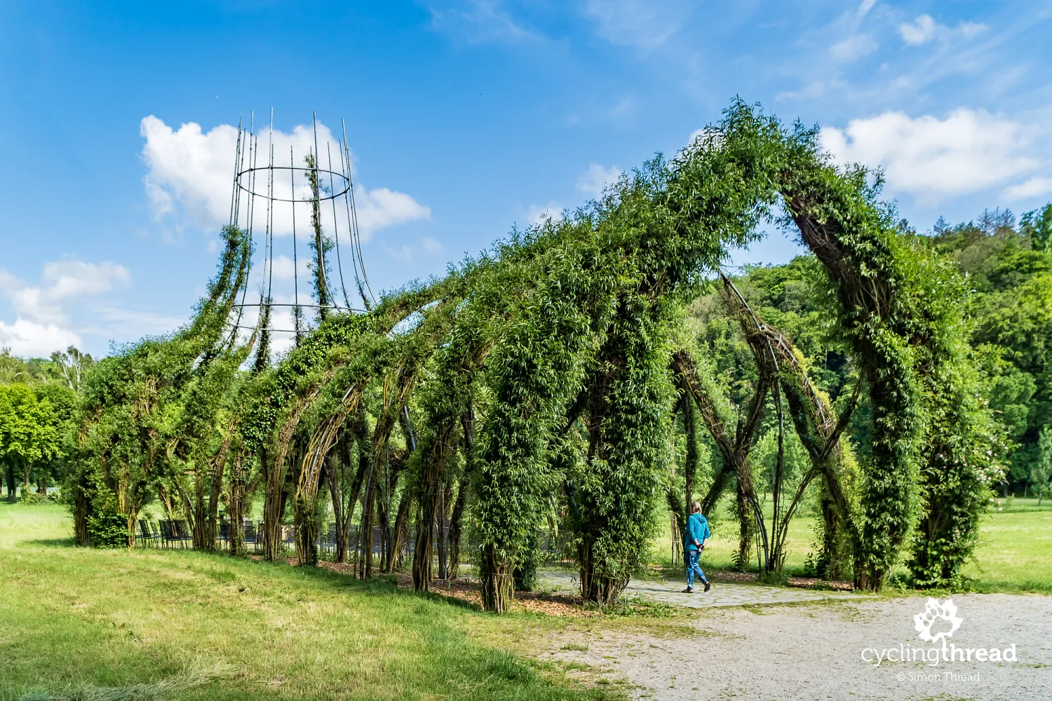
A highlight of the trail is the small town of Pappenheim, which feels as though it’s nestled between hills along the meandering Altmühl. The central feature is the castle hill, believed to have been a settlement site as early as the Neolithic period, around 4000 BC. Today, the well-preserved ruins of a castle, dating back to the 13th century, occupy the hill. The town at the castle’s base offers a charming atmosphere, where you can take a break in one of several local restaurants. A few hundred meters earlier, the trail passes beneath the massive bulk of the New Castle, a neoclassical residence of the Pappenheim family. Another unique site the Tauber-Altmühl cycling route reveals as you leave the town is the Weidenkirche, a structure created in 2007. This metal frame, shaped like a church, is filled with living, growing willow branches.
One more interesting spot that the Tauber-Altmühl cycling route shows us as we leave Pappenheim is the Weidenkirche, the "willow church." Built in 2007, the metal structure, shaped like a church, is filled with living, still-growing willow branches. The young evangelicals from Bavaria who designed it intended the willow church to symbolize the vision of an ideal church community: alive and natural, growing, changing, and open. It is also meant to be built by young people, for young people and adults seeking new ways to experience faith. The green church is about 30 meters long and can accommodate around 150 people.
Slightly disappointing the Twelve Apostles
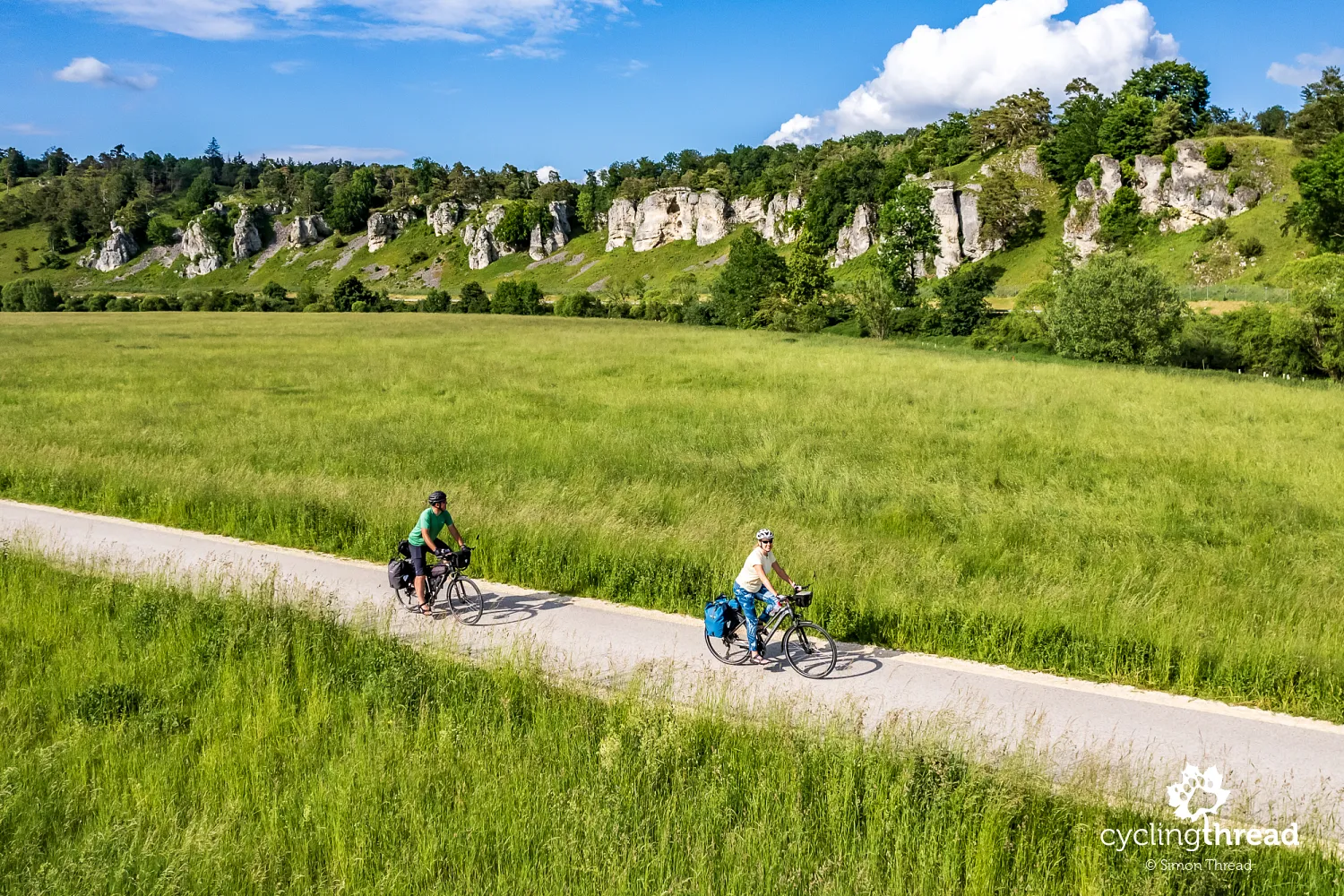
The next few kilometers offer probably the most beautiful, dramatic, and scenic moments of the entire route. The cycling trail’s signs lead us to a long limestone gallery, where the "exhibits" are 12 limestone pillars known as the Twelve Apostles. According to the people of Franconia, these formations symbolize the Twelve Apostles, hence the name of this nearly meter-long rock formation. The view is indeed impressive, though it’s a shame that the Twelve Apostles are visible from a bit of a distance. As a consolation, there is a small rest area where you can stop, take a break, and try to discern familiar shapes among the rocks.
Gravel paths—less comfortable than asphalt, but...
It’s hard not to notice that most cycling paths in the Altmühl Valley Nature Park are gravel, made from fine crushed stone, rather than paved with asphalt. This is quite different from what we see on the best cycling routes in Europe. However, there’s no denying that these gravel sections blend perfectly with the rocky scenery of the valley. As we learned, this is not the final state of the trails but rather the result of limited funding from local municipalities, which cannot afford significant investments in cycling infrastructure. Gravel paths, while picturesque, have higher rolling resistance, create dust, and require more maintenance to ensure a comfortable ride.
Burgstein - one of Altmühl Valley’s geological wonders
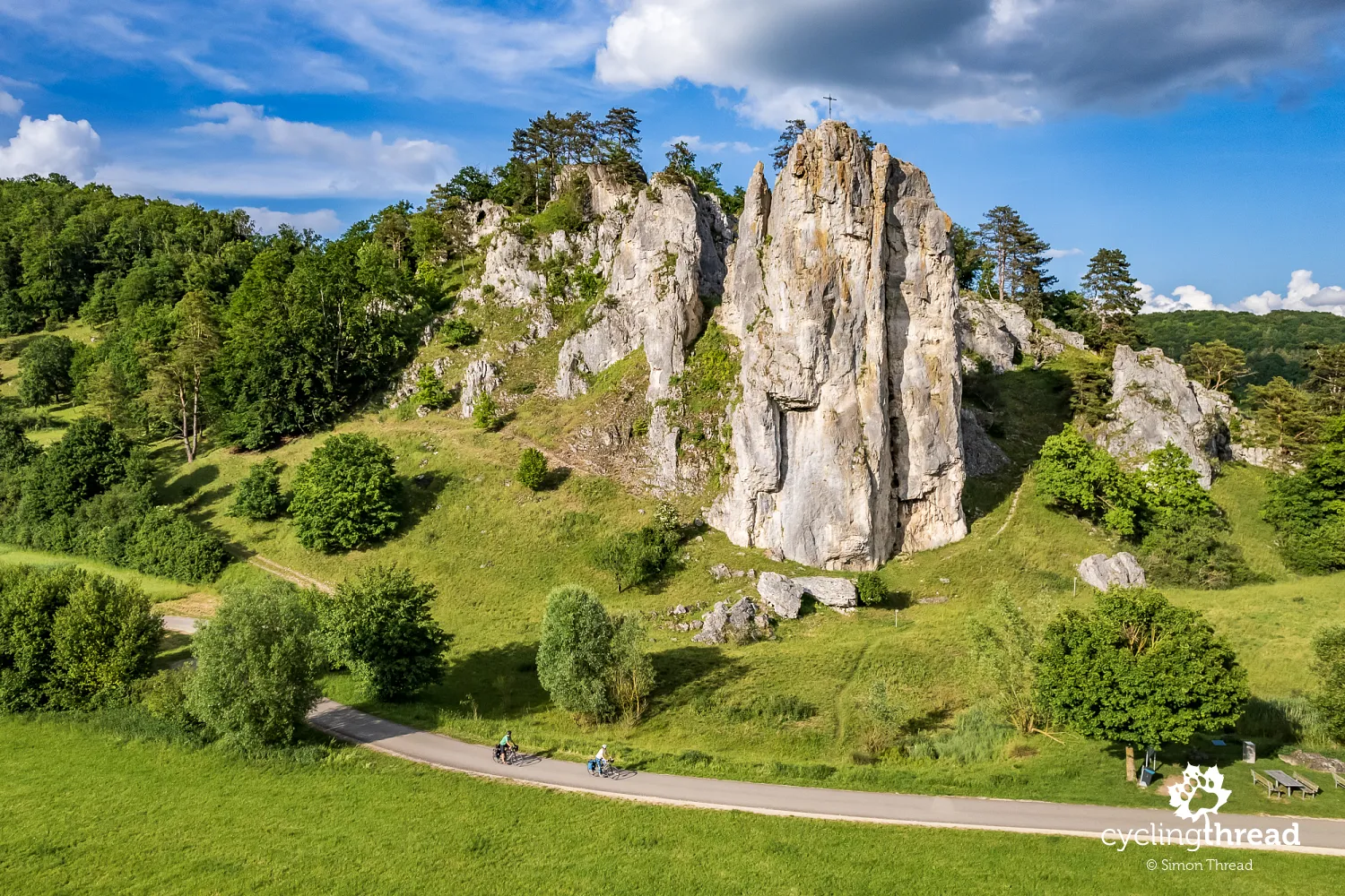
After the Twelve Apostles, we had one more geological highlight awaiting us that day: Burgstein, a massive limestone tower, famous for the fascinating facts related to its formation. The limestone making up the rock dates back 135 to 154 million years, to a time when southern Germany was located at the same latitude as present-day Florida, and the Atlantic Ocean was just beginning to form. What’s even more interesting is that, about 5 million years ago, the rock was still being shaped by the waters of the Danube. It wasn’t until the Ice Age, around 150,000 years ago, that the Danube changed its course, leaving the former valley to today’s Altmühl River. Today, Burgstein is one of Bavaria’s most important geological sites and a perfect spot for a memorable photo.
Beautiful Eichstätt and its Jura Museum
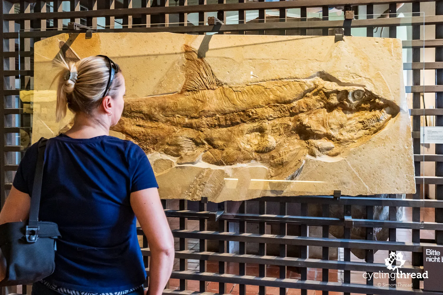
Eichstätt, the next larger town on the route, captivated us with its rich atmosphere, especially the Jura Museum, located in Willibaldsburg Castle. This is one of the most important paleontological museums in Germany, renowned for its extensive collection of fossils from the Jurassic period, many of which were discovered in the Altmühl Valley or its immediate surroundings. The museum features impressive exhibits, including fossilized fish, plants, ammonites, and the famous Archaeopteryx specimens, which are key pieces of evidence in the evolution of birds. It’s a popular destination for tourists and educators alike. To make your visit easier, it’s a good idea to stay overnight in Eichstätt and leave your bikes at your accommodation while you explore the museum. This is especially true right now, as ongoing renovations make it a bit more challenging to reach the castle.
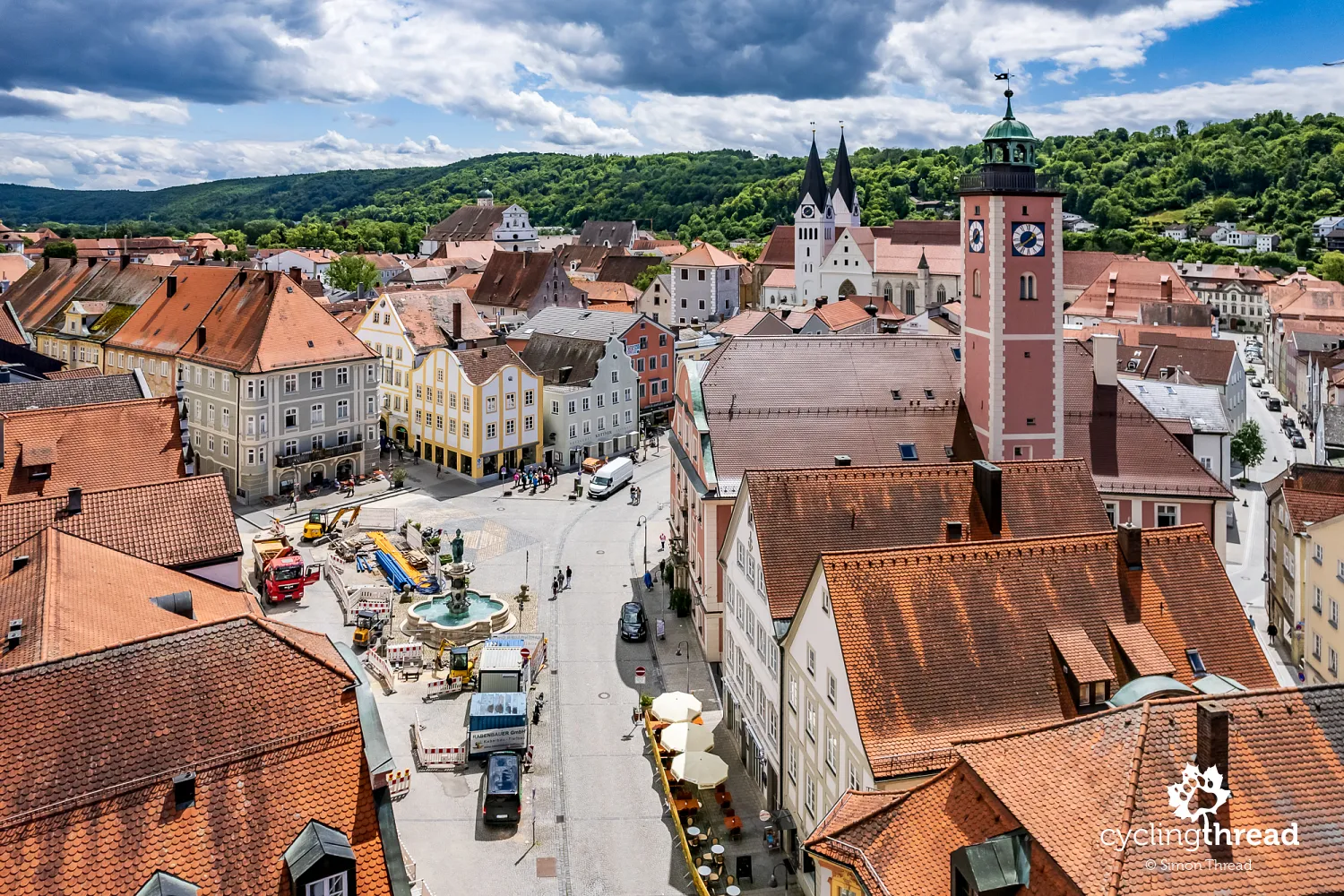
The beauty of the town itself also can't go unnoticed. Eichstätt has been the seat of a bishopric since the Middle Ages, which has significantly influenced its development and architecture. The old town is filled with narrow streets, historic buildings, and picturesque squares. During a short bike ride or an evening stroll, it’s worth paying attention to the impressive Gothic Cathedral of St. Willibald, which houses numerous pieces of sacred art and the tombs of bishops. Residenzplatz, the town's main square, is also a must-see, surrounded by baroque buildings, including the former bishop’s palace. Although it is often referred to as the heart of the town, we were more charmed by the triangular, sloping market square with its town hall, shops, and restaurants, where we spent one of our evenings.
Eichstätt and its witch hunts
Among several chapters of Eichstätt’s history, some of which are less fortunate and less pride-worthy, the town’s role in the witch hunts deserves mention. Eichstätt was one of the main centers of witch trials in southern Germany, with a particularly large number of cases occurring between 1617 and 1631 during the rule of Bishop Johann Christoph von Westerstetten. Those accused of witchcraft were tortured to extract confessions of practicing magic and consorting with the devil. Sentences were carried out by burning at the stake, which was a common method of execution at the time. This chapter is still so vivid that in 2020, Bishop Gregor Maria Hanke expressed the church’s regret for allowing such acts to happen. Perhaps some of the trials or executions took place in the beautiful courtyard of the cathedral and monastery in Eichstätt?
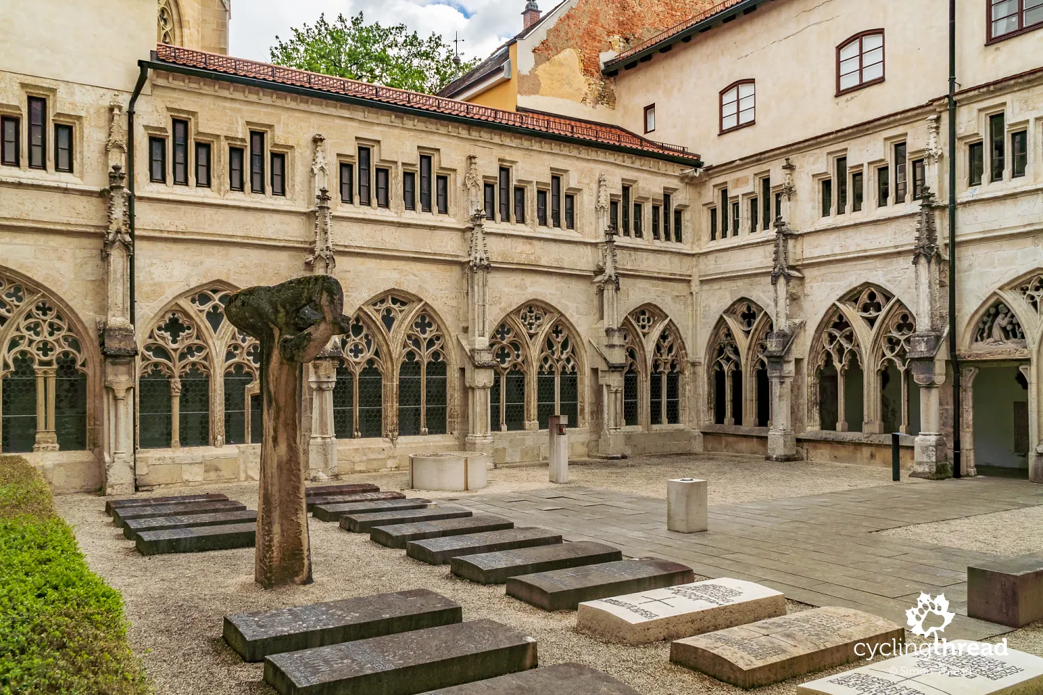
Franconian castles along the valley
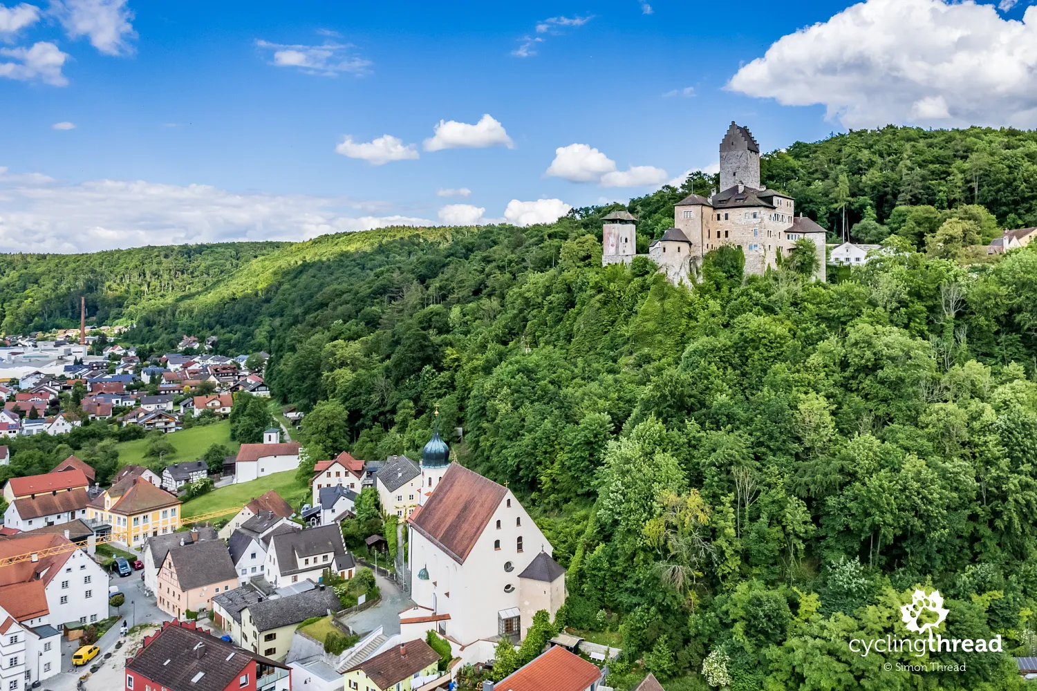
One of the most frequent sights when cycling through Franconia is castles, or sometimes castle ruins, which regularly come into view along the way. The first of these is Colmberg Castle, which I’ve already mentioned, but every few kilometers, you encounter more. Most are privately owned and not open to visitors, although some serve educational and cultural purposes. One such example is Kipfenberg Castle, home to the Roman and Bavarian Museum (Römer und Bajuwaren Museum). The museum, though not directly located within the castle buildings, is dedicated to the history of the Romans and Bavarians in the region. Exhibits include Roman-era artifacts such as coins, pottery, weapons, and jewelry, along with finds from the early medieval period, illustrating the life of the Bavarians.
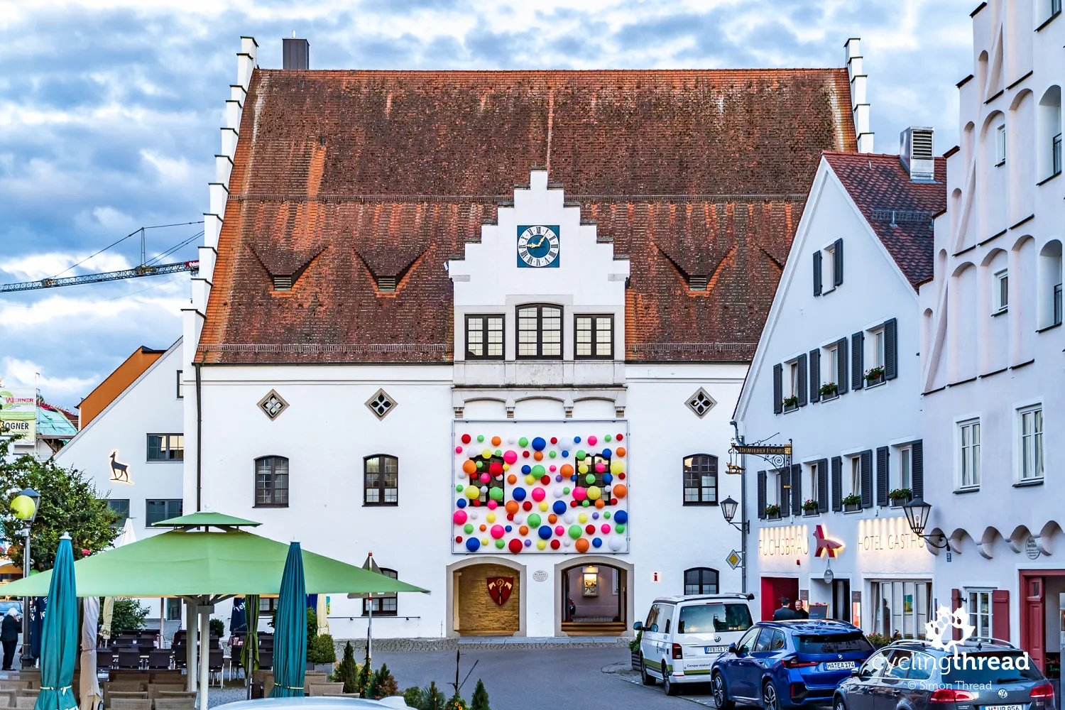
We have fond memories of Beilngries, where we spent our last night on the Tauber-Altmühl Radweg. We were warmly greeted by the design of Haus des Gastes, which looks like a city hall but is actually a cultural center and tourist information hub. We then settled into Hotel Fuchsbräu, right next door. I was impressed by the hotel’s responsible policies, which involve sourcing all ingredients for their dishes from local farmers, breeders, and producers. The restaurant menu even includes a map showing the locations of all the hotel’s partners, revealing that about half of the products come from towns no more than 10 kilometers from Beilngries, while the rest are from within a 35-kilometer radius. We encountered a similar commitment to supporting local producers a few years ago on the Carinthian Lakes Loop in Austria.
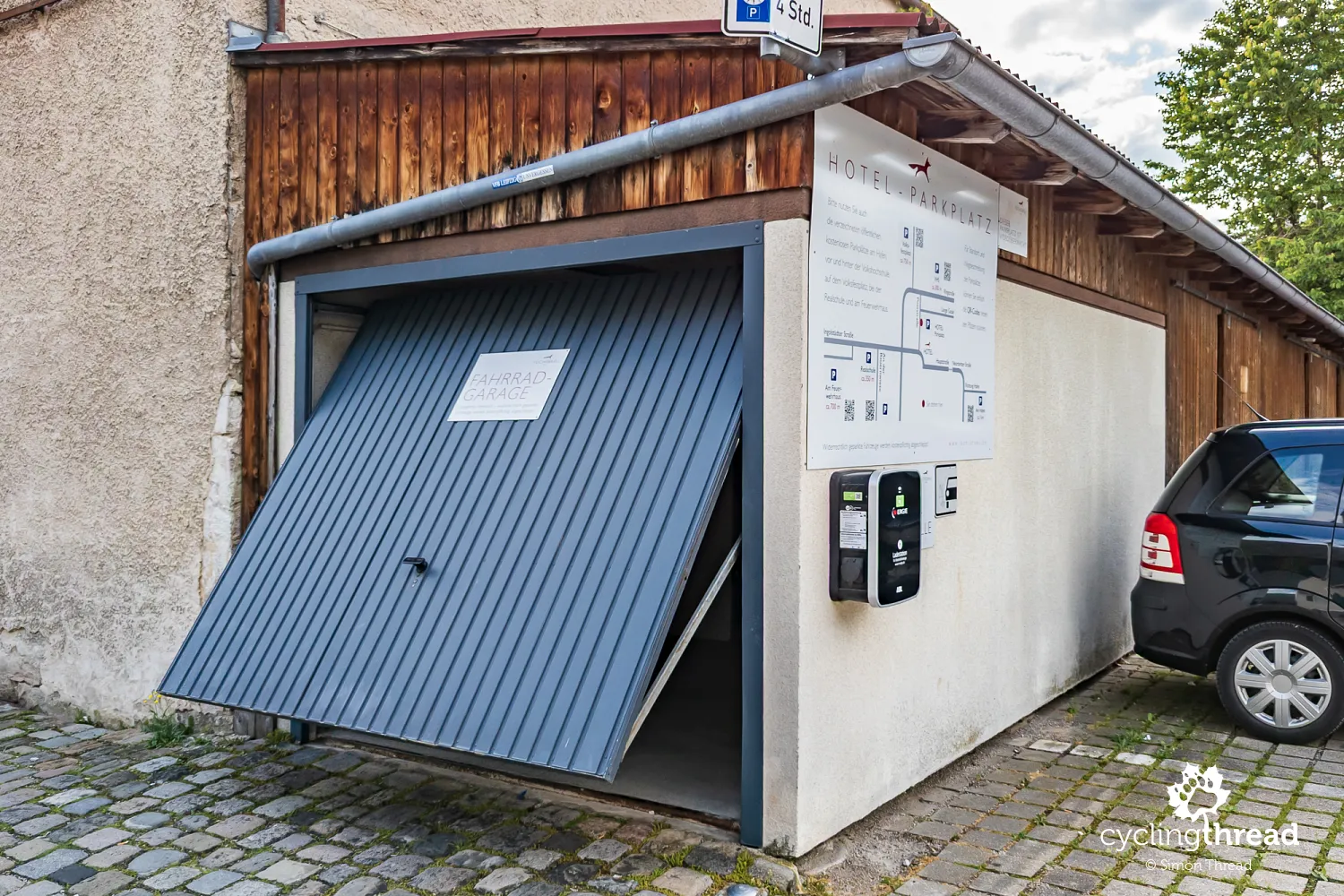
But that wasn’t all that impressed us about our accommodation in Beilngries. What won over my cyclist’s heart was how Hotel Fuchsbräu welcomes cyclists. There’s a special garage, accessible via a code provided by the receptionist, located next to the main hotel building. Inside, the space is divided into a bike storage area and a bike maintenance room, equipped with tools, a storage locker, and outlets for charging e-bike batteries. Everything is styled to match the local architecture, though in practice, it’s just a simple annex. This functional simplicity reminded me of the bike room at a hotel in Amboise, France, where we stayed while cycling through the Loire Valley’s castles.
The wooden lizard above the Altmühl River
Before our trip, we read about various sights along the Altmühl River and got the impression that one of Franconia’s proudest landmarks is the Tatzlwurm. This wooden footbridge near the town of Essing is named after a mythical lizard or dragon, which its design is said to resemble. In practice, the Tatzlwurm Bridge is more of a scenic viewpoint over the river, as crossing it doesn’t really lead to any particularly interesting destinations for cyclists. However, it is notable that, at around 193 meters, it is one of the longest wooden bridges in Europe. Its construction is an excellent example of modern bridge engineering, harmoniously blending with the surrounding Altmühl Valley landscape. As you approach the bridge, keep an eye on the signs - you need to exit the trail well in advance to reach the bridge. Otherwise, you’ll have to cross a rather dangerous road that runs alongside it.
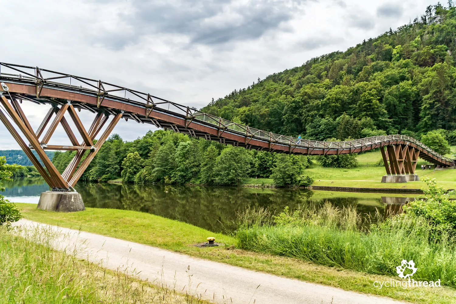
An impressive structure concludes the journey
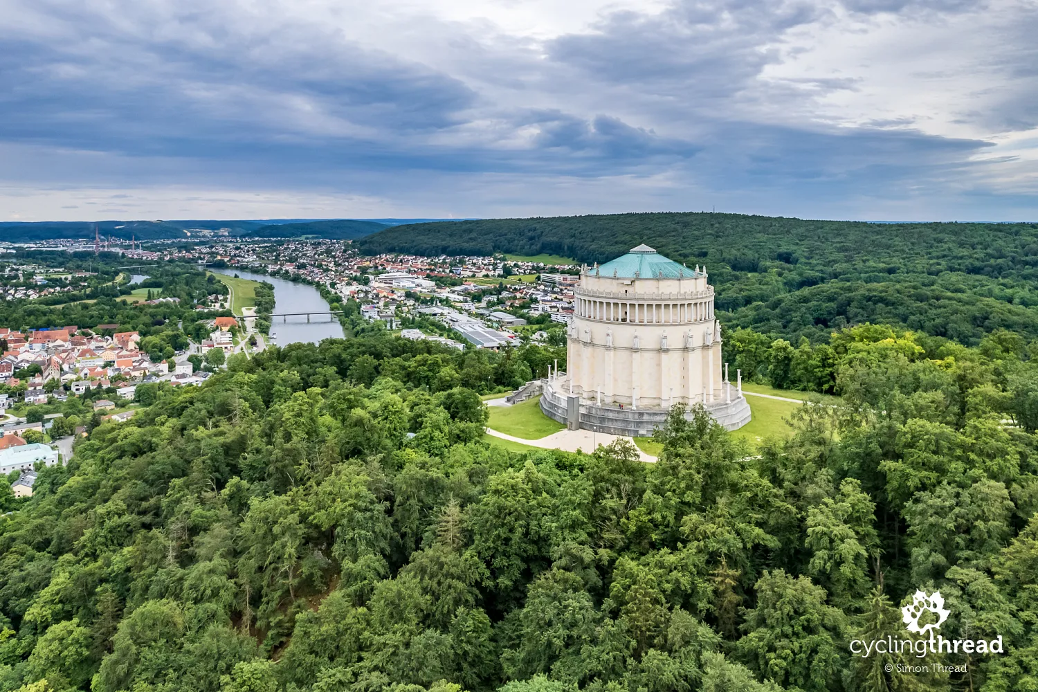
As the Tauber-Altmühl cycling route nears its end, the silhouette of the Befreiungshalle (Hall of Liberation) appears high on the right slope of the Altmühl Valley. This imposing neoclassical building, constructed between 1842 and 1863, stands atop Michelsberg, the last prominent ridge separating the Danube and Altmühl Valleys. The Hall of Liberation was designed by architect Friedrich von Gärtner and was built at the initiative of King Ludwig I of Bavaria to commemorate the victories over Napoleon in the Wars of Liberation (1813-1815). The interior is adorned with columns, sculptures, and reliefs, while a dome crowns the top of the building. Naturally, it reminded us of the monumental Battle of the Nations Monument in Leipzig. You can visit the Hall of Liberation, though it requires a short climb from the valley floor.
In Nuremberg, we are welcomed by Veit Stoss
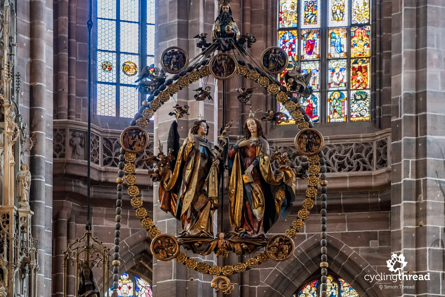
Before and after riding the Tauber-Altmühl Radweg, we explored Nuremberg. An unexpected hero of our time in Nuremberg turned out to be Veit Stoss. Though many Poles assume him to be Polish due to the Polonized version of his name (Wit Stwosz), he was actually a German (or rather a Swabian, from Swabia) artist who spent about 20 years working for clients in Poland. During this period, he created the famous altarpiece in St. Mary's Church in Kraków, among other well-known works. After returning to Nuremberg, where he had unsuccessfully invested the money he earned in Poland, Stoss created The Annunciation, a sculpture that hangs in front of the altar of St. Lawrence's Church in Nuremberg. It’s one of the most beautiful ornaments of the church, which, though Protestant, amazes visitors with its ornate interior. But we’ll dedicate a separate post to Nuremberg.
The many faces of cycling in Franconia
This was our third cycling trip in Franconia, and each time we’ve experienced a different side of the region. The Main River cycling route is one of the most beautiful in Germany, passing through popular cities like Bamberg and Würzburg, which a few years ago first opened our eyes to cycling tourism in Germany. Our second trip along the Hohenzollern cycling trail introduced us to a more local, quiet, provincial Franconia that most tourists never see. Now, the Tauber-Altmühl cycling route felt like a balance between these two experiences. On one hand, we passed through one of Germany’s most beautiful and popular towns, while on the other, we enjoyed the intimate atmosphere of a picturesque, Jurassic landscape. All three routes were worth the effort, but today, we place the Tauber-Altmühl Radweg at the top of our Franconian podium.
Franconia - perfect for a weekend or a longer holiday
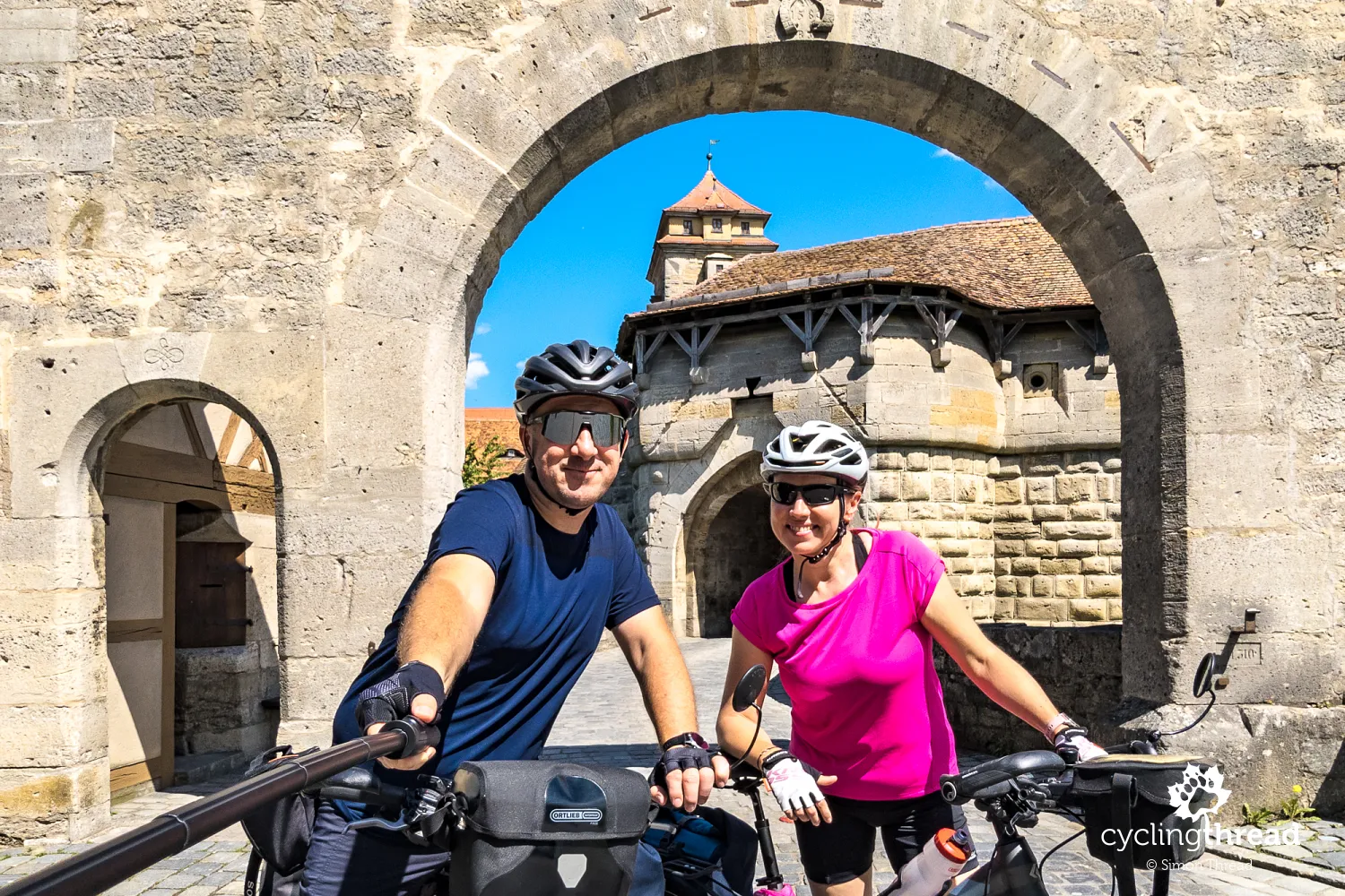
Franconia and the Tauber-Altmühl River cycling route are perfect for spending one of long weekends here, or they can serve as part of a longer cycling holiday in Europe. The scenic landscapes, well-organized cycling trails, interesting places to visit, opportunities for additional activities along the way, and, above all, the romantic Franconian towns make it an ideal destination for your cycling trip. For us, this was one of the most enjoyable cycling getaways to Germany, and we’re sure that romantic Franconia won’t disappoint you either.
Back to topHave a safe ride! 💚
Simon Thread
(Szymon Nitka)
I'm a passionate cycling traveler and the voice behind Cycling Thread. I explore Europe on two wheels, documenting the most scenic routes, inspiring places, and cyclist-friendly practices. My writing blends personal experience with practical insights and a deep love of travel. I'm also a contributor to National Geographic Traveler magazine.


Your Comments
Add new comment