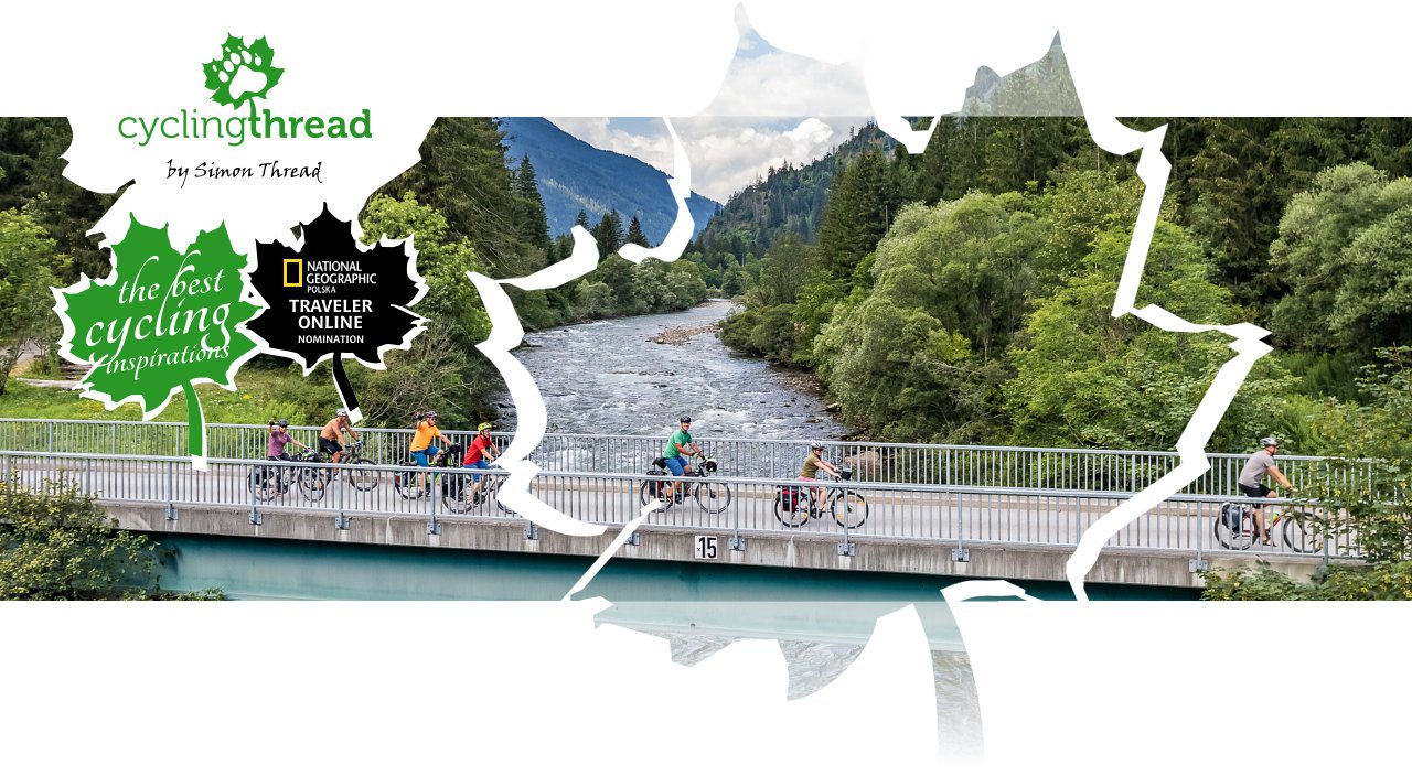
Alpe Adria Bicycle Route: cycling through the Alps to the Adriatic Sea
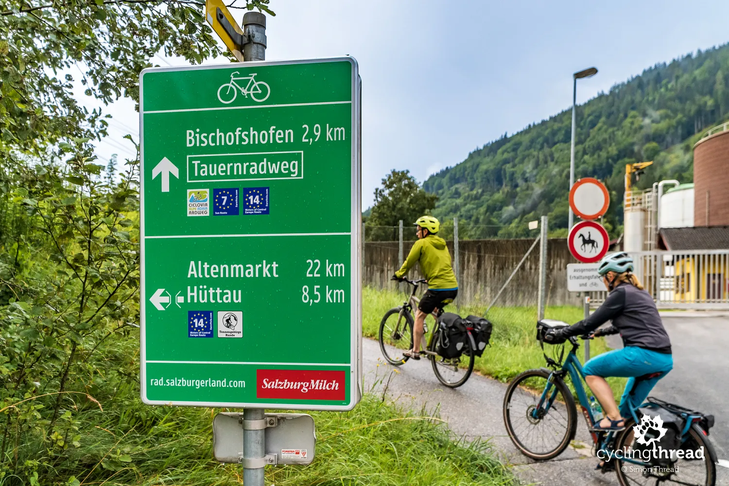
One of the top-ranked beauties and popular cycle routes in Europe is the Alpe-Adria bike route. Austrians call it the Alpe-Adria Radweg, while Italians refer to it as Ciclovia Alpe-Adria. Both highlight the route's most significant feature - its transalpine course, stretching from the northern Alps in Austria to the Adriatic in Italy. What sets Alpe-Adria apart from other European cycling routes is its captivating 60-kilometer stretch that repurposes an unused railway infrastructure in the Alps. This section offers dozens of kilometers of cycling paths following the former railway line, including several tunnels now exclusively used by cyclists, as well as striking old bridges and train stations, which have been revitalized by bicycle tourism.
Join us on our new 🟢 Komoot account!
Cycling Partners
Route on the map
GPX file (GPS track): cyclingthread.com-alpe-adria-2022.gpx
Alpe-Adria - table of contents
- One of the most popular cycling routes
- Nearly 500 kilometers in 7 days of riding
- Bike-friendly pensions and hotels
- Salzburg: more than just an afternoon
- Over a hundred kilometers through the Berchtesgaden Alps
- Silent Night, Holy Night from Salzburg
- Salzburg's oldest brewery
- Aesculapian snake by the waterfall near Golling
- The World of Ice Giants in Werfen
- A few dozen minutes inside the cave of ice "giants"
- Alistair MacLean's novel at Hohenwerfen castle
- Reminiscing EuroVelo 14 by the Enns
- The site of triumphs of Polish ski jumpers
- Walking and biking through the Gastein Valley
- An exceptionally easy bike route through the Alps
- A challenging climb to Bad Gastein
- Bicycle carriage through the tunnel beneath the Alps
- Another year in Carinthia
- One more sunny afternoon in Villach
- Continuously captivating bicycle Carinthia
- Friendly Czech cyclists at the Austria-Italy border
- Coccau: a historical border village
- Stunning views of the Julian Alps
- Former railway line from Tarvisio to Udine
- Numerous former railway bridges and...
- ... several old tunnels on the Alpe-Adria route
- With Extrawheel panniers across Europe's cycling routes
- Café in the old Chiusaforte train station
- Abandoned settlements in the Carnic Alps
- Fella and Tagliamento as examples of braided rivers
- Venzone: the most beautiful town in all of Italy
- Adriatic seafood on our plates
- The patron saint of travelers from Gemona del Friuli
- Gemona del Friuli before and after the earthquake
- The Alpe-Adria route after leaving the Alps
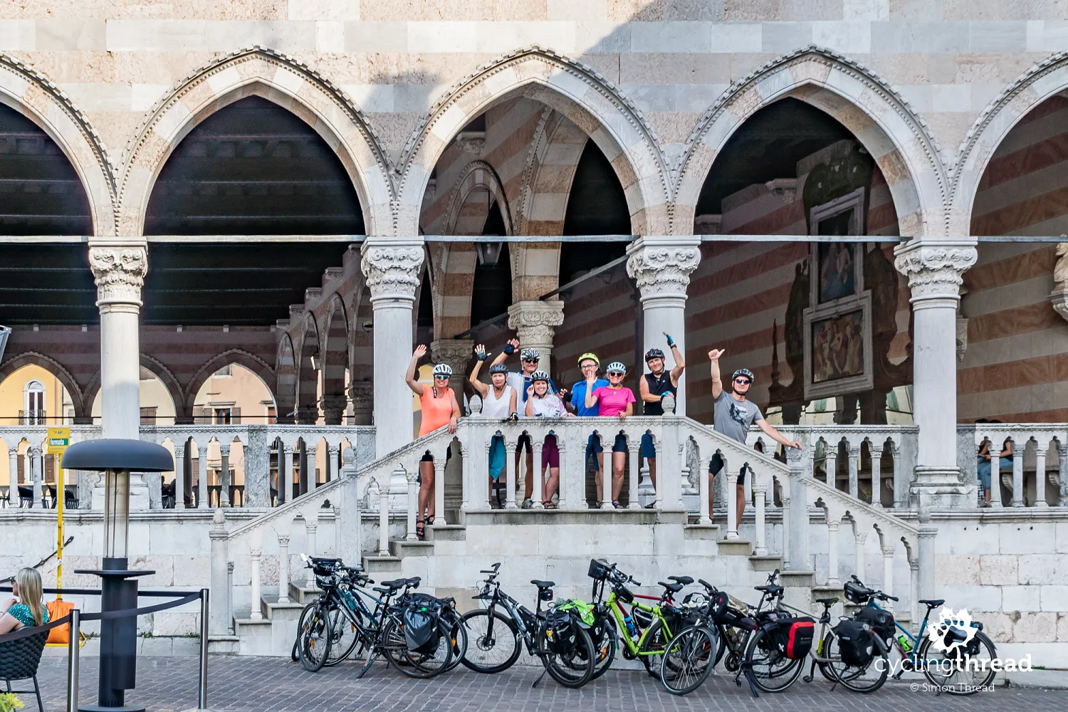
- Not nearly enough time in Udine
- Best moments at the table on the Alpe-Adria
- Cycling amenities on the Alpe-Adria route
- Venetian fortress like a nine-pointed snowflake
- Aquileia on the UNESCO World Heritage List
- 4th-century mosaics in the basilica of Aquileia
- The final five-kilometer causeway to the destination
- Several centuries of history in Grado
- Bus service for cyclists from Grado to Salzburg
- Alpe-Adria offered by a cycling travel agency
- Cycling tourism at its best
- First place among Europe's bike routes
One of the most popular cycling routes
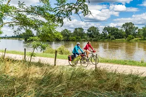
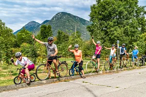
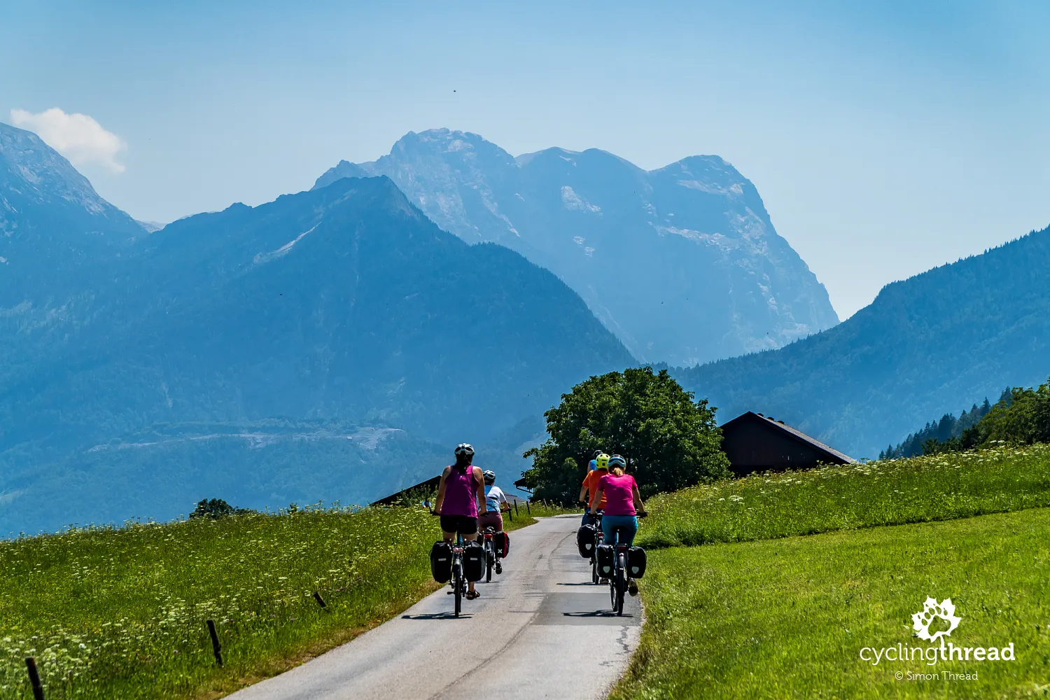
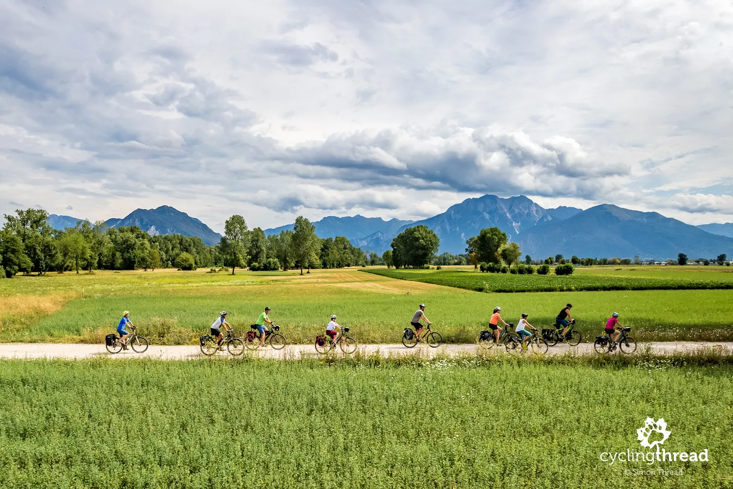
The Alpe-Adria is one of several, perhaps a dozen, classic cycling routes in Europe that enjoy the best reputation among cycling tourists. This attractive, trans-Alpine bicycle route has an official length of 415 kilometers, runs through two countries and three Alpine regions: in Austria through Salzburger Land and Carinthia and the Friuli-Venezia Giulia in Italy. The Alpe-Adria begins in the medieval old town of Salzburg, leads through, among others, Bischofshofen, known for its winter ski jumping competitions, takes a peek at Bad Gastein, hanging on the cliffs, passes through a tunnel under the High Tauern - the highest range of the Austrian Alps and then through picturesque Carinthia reaches the well-known Villach, where Austria's popular cycling routes intersect. Soon after, it crosses the Austrian-Italian border and, along the edge of the Julian Alps, on former railway cycling paths and in an increasingly Mediterranean atmosphere, through Gemona del Friuli and Udine, runs all the way to Grado, on the warm waters of the Adriatic.
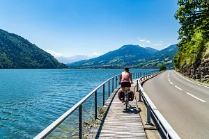
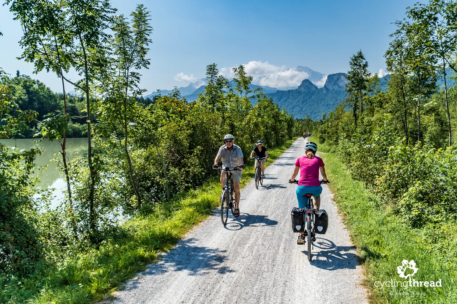
What contributes to the Alpe-Adria route's popularity is the comfort and safety of the cycling journey, ensured by long stretches away from vehicular traffic. This includes one of the best bike roads in Europe, laid along sections of the old railway line from Tarvisio to Udine. The geographical diversity of the route is also crucial - starting with typical East Alpine landscapes, cutting through charming Carinthia and ending in the Mediterranean climates and temperatures of the Adriatic. The effort level varies each day - regardless of the direction of travel, the ride starts with about 2 days of gentle climbs, followed by a pleasant descent to the Villach basin, then another climb and finally about 2 days on a gently descending path to the destination. This is complemented by various interesting places en route, the two very different cuisines of Austria and Italy and a cyclist-friendly tourism infrastructure, including accommodations. Indeed, these are dream conditions for a cycling holiday.
Nearly 500 kilometers in 7 days of riding
To cover the entire Alpe-Adria route at a tourist pace takes about 7 days. However, given the exceptional attractiveness of the route, rushing is probably the least advisable thing on Alpe-Adria. It's a route where it's worth enjoying the company of friends and family, landscapes, bike paths, culinary delights and encounters with other cyclists. Remember that almost every day, the basic route is extended by detours to nearby attractions, restaurants, or accommodations, which should be considered in the planned daily distances. Importantly, while writing this text, I noticed that the Alpe-Adria route shown on the OSM map, which we successfully used to check the route on the ground, differs from the route shown on the official Alpe-Adria website. I noticed differences, among others, on the Italian section: near the town of Valbruna and later past the beautiful Venzone, where the official route is visible on the other side of the Tagliamento River.
Bike-friendly pensions and hotels
All our accommodations were booked through a certain popular booking platform. One the second night, as we were traveling in a large group, we had a beautifully preserved traditional alpine wooden house in Werfen at our disposal. In Villach, a hotel from a popular chain impressed our team with its air conditioning, especially desirable during summer heat. Two days later we enjoyed the terrace of a modest pension in Pontebba. Finally, in Fossalòn near Grado, we stayed in a great pension at the mouth of the Soča River into the Gulf of Trieste. In none of these places were our bikes a problem - everywhere, the hosts had a special place for bike storage. If you enjoy our reports and we've helped you plan your trip, consider booking accommodations through this link. The cost of your stay remains unchanged, but a small portion will go to us, helping to create more cycling trip reports. Thanks!
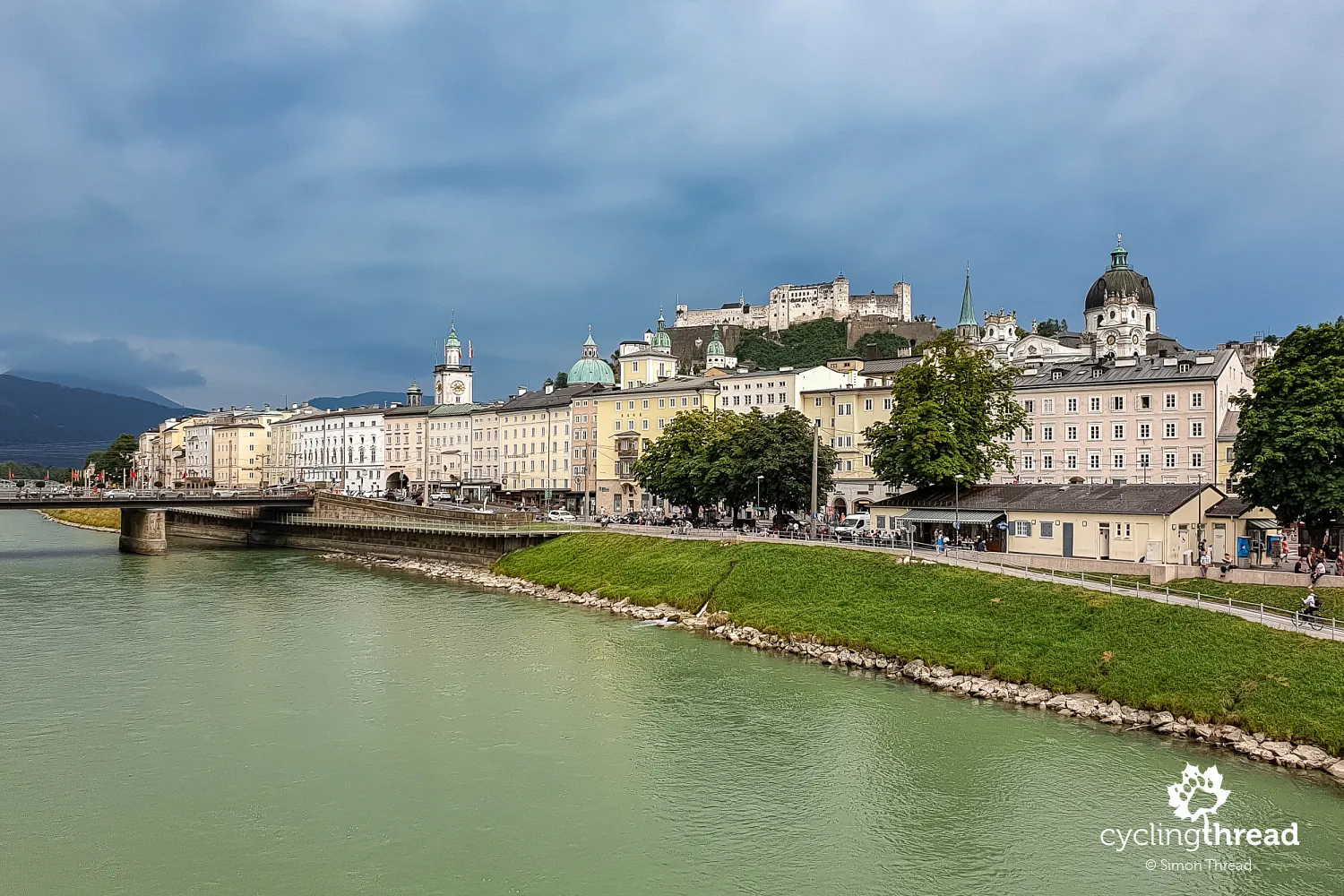
Salzburg: more than just an afternoon
Salzburg is an ideal city to start such a journey. Finding suitable accommodation is easy - from nearby campgrounds to guesthouses and hotels. There's also a place to leave your car if you arrive at Alpe-Adria by vehicle. Our team's cars were parked at the P+R Salzburg Süd, situated south of the city center, practically along the Salzach River bike path, which is part of the Alpe-Adria route. We spent the afternoon and evening on a long walk and bike ride through the old town, a UNESCO World Heritage Site since 1996. Among other sights, we visited the Salzburger Dom - the Salzburg Cathedral, strolled through the must-see Getreidegasse, stood outside Wolfgang Amadeus Mozart's birthplace and entered the Mirabell Palace and Gardens. We only scratched the surface of the city and its attractions - exploring Salzburg and its sights requires at least a cycling weekend.
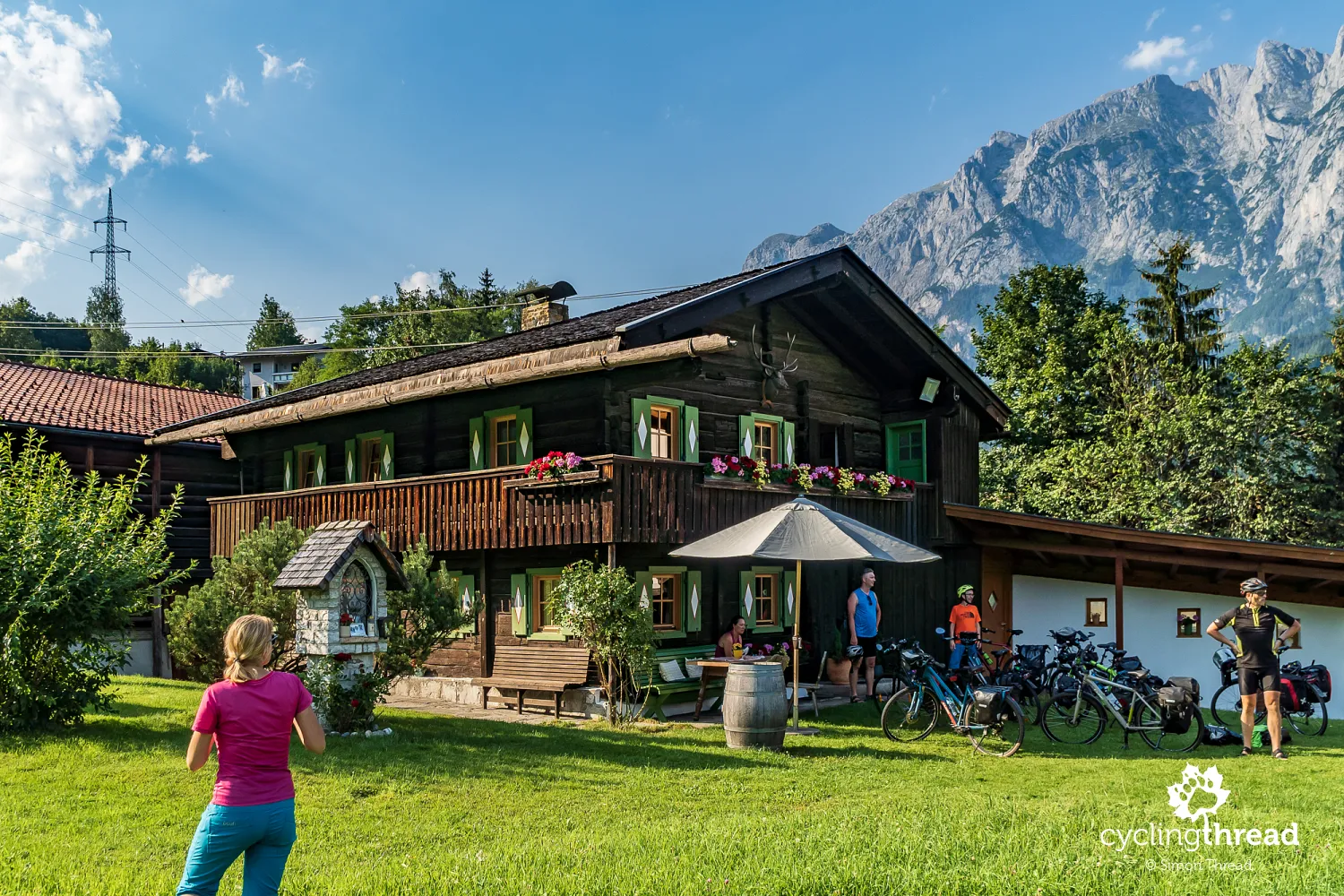
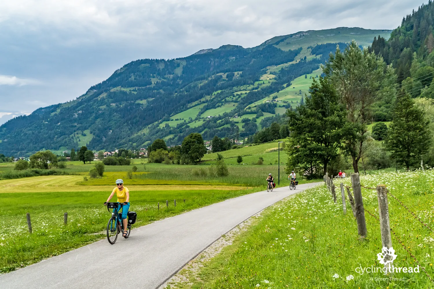
Over a hundred kilometers through the Berchtesgaden Alps
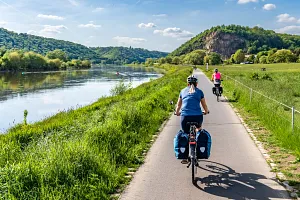
For the first 100 kilometers or so, two days of riding from Salzburg to Bad Gastein, we were accompanied by the landscapes of Salzburger Land. They are dominated by the panoramas of the Northern Limestone Alps, surrounding the Salzach River valley. To our right, or on the left bank of the river, the Berchtesgaden Alps stretched up to Bischofshofen, with Hochkönig, its highest peak at 2941 meters. Naturally, the bike route does not reach these heights; instead, it often follows the riverbed, occasionally veering into nearby towns. In this part of the route, we encountered various surfaces - asphalt bike paths, pleasant gravel roads and before Werfen, a few kilometers along the road. However, car traffic here is minimal - most vehicles travel on the parallel A10 motorway, hidden in rock tunnels on the other side of the river.
Silent Night, Holy Night from Salzburg
One of the towns along the way is Hallein. A place worth visiting here is the Silent Night Museum (Stille Nacht Museum) in Hallein, telling the story of the creators and circumstances behind "Silent Night," arguably the world's most famous Christmas carol. The author of its lyrics, local priest Joseph Mohr, was from Hallein. Franz Xaver Gruber, a primary school teacher and organist from the Salzburg area and the composer of "Silent Night," moved to and died in this town. Mohr and Gruber first performed their carol during the Christmas Eve midnight mass in 1818. Though this event took place several kilometers away in Oberndorf bei Salzburg, Hallein is considered the symbolic birthplace of the famous carol.
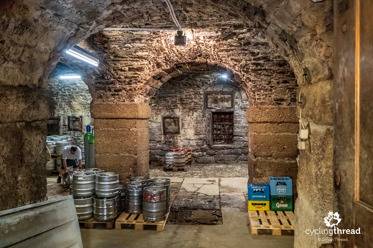
Salzburg's oldest brewery
Before reaching Hallein, it's worth taking a short detour from the bike path to visit Hofbräu Kaltenhausen brewery, located a few hundred meters away. Founded in 1475, it is the oldest brewery in Salzburg and Salzburger Land. Up until 2010, well-known beer types such as Kaiser and Edelweiss were brewed here before their production was moved to other breweries by the new global owner in Hallein. Currently, a local, smaller brewery operates on-site along with a restaurant, which includes Rupertigwölb. This room, dating back to the brewery's early days, features a historic Gothic vault. It once served as a beer storage, part of the brewery's production area and also a locksmith and forge. Now, it has become a unique setting for events, offering a historical ambiance of the old Kaltenhausen.
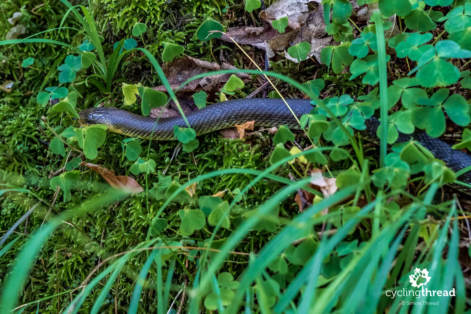
Aesculapian snake by the waterfall near Golling
At the foot of the Berchtesgaden Alps, on the outskirts of Golling an der Salzach, it's worthwhile to visit the 75-meter Gollinger Waterfall. Bikes should be left at the designated parking area near the ticket booths, followed by a 200-meter walk to the viewpoint below the lower part of the waterfall and another 200 meters to the platforms beneath the upper part, offering the best view of the waterfall. A special attraction during our visit to the Gollinger Waterfall was the Aesculapian snake, spotted by the keen eye of Paweł on the forest trail. This is the largest, non-venomous snake living in Central Europe. The Aesculapian snake prefers warm climates, but during hotter days, it seeks cooler, moist hiding spots - and it seems that we stumbled upon "our" Aesculapian snake at just such a moment.
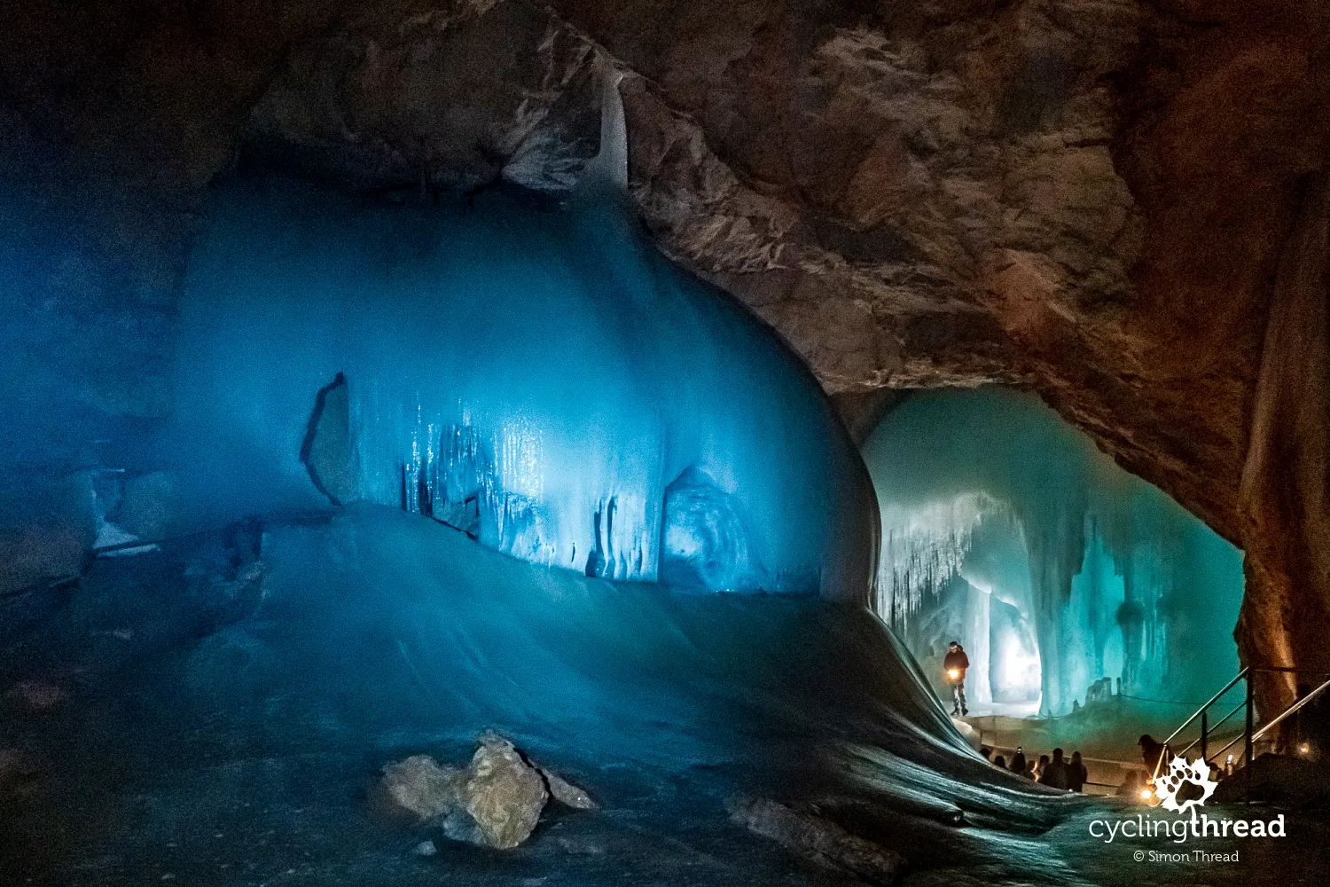
The World of Ice Giants in Werfen
Opposite the Berchtesgaden Alps, on our left, the peaks of the Tennengebirge range loomed. The Tennengebirge is known for its numerous karst formations, the most famous being the world's largest ice cave, accessible for tours as Eisriesenwelt, or "The World of Ice Giants." Eisriesenwelt stretches an impressive 42 kilometers and its discovery dates back to the late 19th century. The easiest access is from Werfen, though "easiest" might not be the best term, as the slope of the road leading from Werfen to the lower cable car station mostly ranges between 10-20 percent. It's convenient to leave bikes in Werfen or at your accommodation and reach the site by a free bus. The cable car takes passengers several hundred meters up the mountain, from where a beautiful, fifteen-minute walk with views of the Salzach River valley leads to the cave.
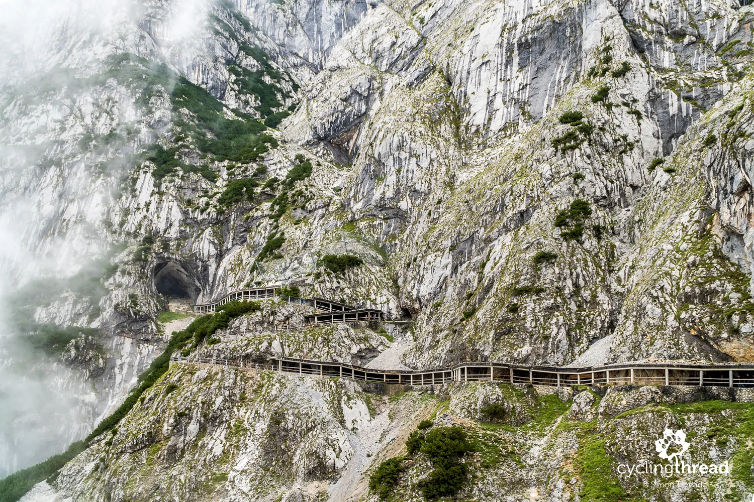
A few dozen minutes inside the cave of ice "giants"
The journey through the cave, filled with ice "monoliths," is worth its price, although not everything seems fully thought out. Without my headlamp, the group I was with would have struggled to navigate the steep, damp stairs and wouldn’t have really seen the cave's interior. The lighting provided by the organizers is just a few carbide mining lamps distributed randomly among the group and magnesium sticks occasionally lit by the guide to illuminate characteristic ice features. Instead of admiring the beauty of the ice cave, visitors spend more time focusing on safely navigating it. Thus, the conditions I encountered were quite different from the promotional materials, which show the most characteristic, gigantic ice blocks in perfect light. Interestingly, one can sometimes spot pipes running under the stairs, likely used to augment nature's handiwork with water.
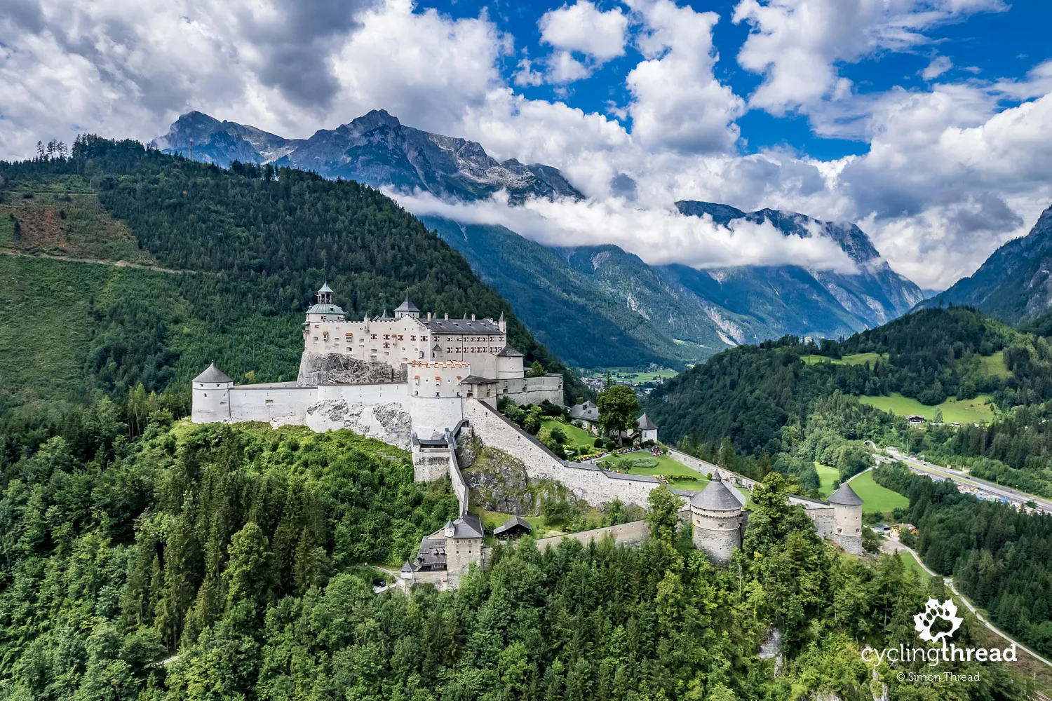
Alistair MacLean's novel at Hohenwerfen castle
On the way to and from the Eisriesenwelt cave, it’s impossible not to notice the incredibly situated Hohenwerfen Castle, guarding the entrance to the higher parts of the Salzach River valley. The history of the castle dates back to the late 11th century, when the first fortification was built to protect Salzburg from the south. Having been expanded and changed hands over the centuries, it has survived in excellent condition and today houses a local museum and a falconry center. The castle's unique location was used in the 1968 war film "Where Eagles Dare," based on Alistair MacLean's novel. Hohenwerfen Castle played the role of the fictional Castle Adler, where an American general, captured by the Nazis, was held and whom American commandos, played by Richard Burton and Clint Eastwood, among others, attempted to rescue.
Reminiscing EuroVelo 14 by the Enns
Among the symbols of bike routes on a signpost before Bischofshofen, I caught a glimpse of a white number 14 on a European Union flag background. These are the signs of one of the EuroVelo bike routes, part of which coincided with our earlier route in Austria, namely the Enns River bike route. I noted with satisfaction another connection to our previous travels, which are gradually forming a fuller, larger picture. This picture is composed of both the cycling routes we’ve ridden and the stories, people and events that intertwine over time into a single whole. Then, by the Enns, we also noticed an interesting detail on the signboard - a sponsor's logo, financially supporting the local government in organizing bicycle tourism in that region of the country. "Pecunia non olet," especially if it were to be spent for such a noble cause as promoting cycling holidays.
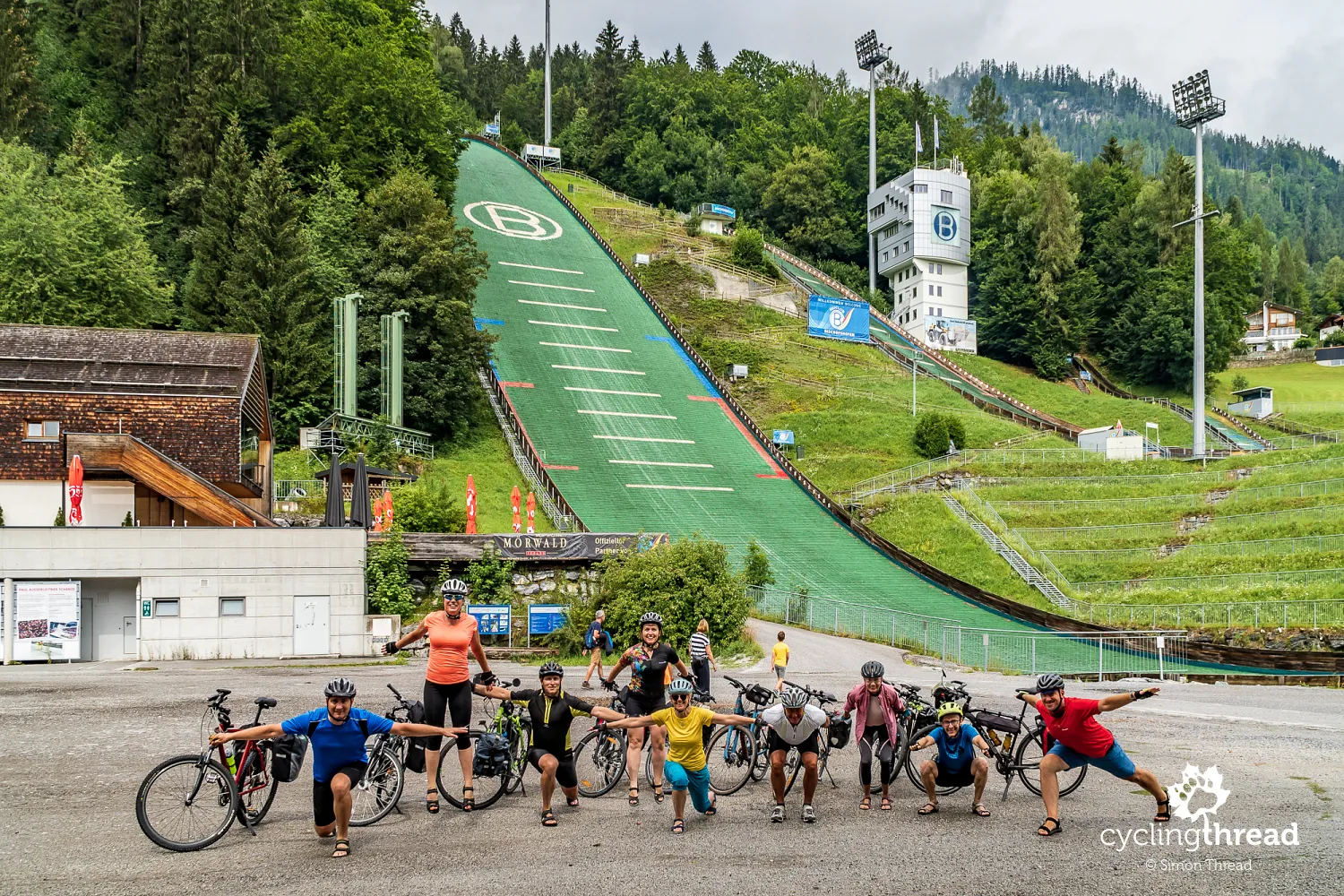
The site of triumphs of Polish ski jumpers
A delightful attraction along the Alpe-Adria route is the town of Bischofshofen, home to the ski jumping hill where World Cup ski jumping competitions are held. Notably, Bischofshofen hosts one of the most important events in the series, the final competition of the famous Four Hills Tournament. At the Paul Ausserleitner ski jump, we attempted a group telemark landing, revealing our varied interpretations of this skiing technique. We also took a commemorative photo under the stone plaque listing all the past winners of the Four Hills Tournament. This place holds special appeal for us, Poles, as in recent years, the winners included Polish jumpers - Kamil Stoch and Dawid Kubacki, with Adam Małysz also among earlier victors.
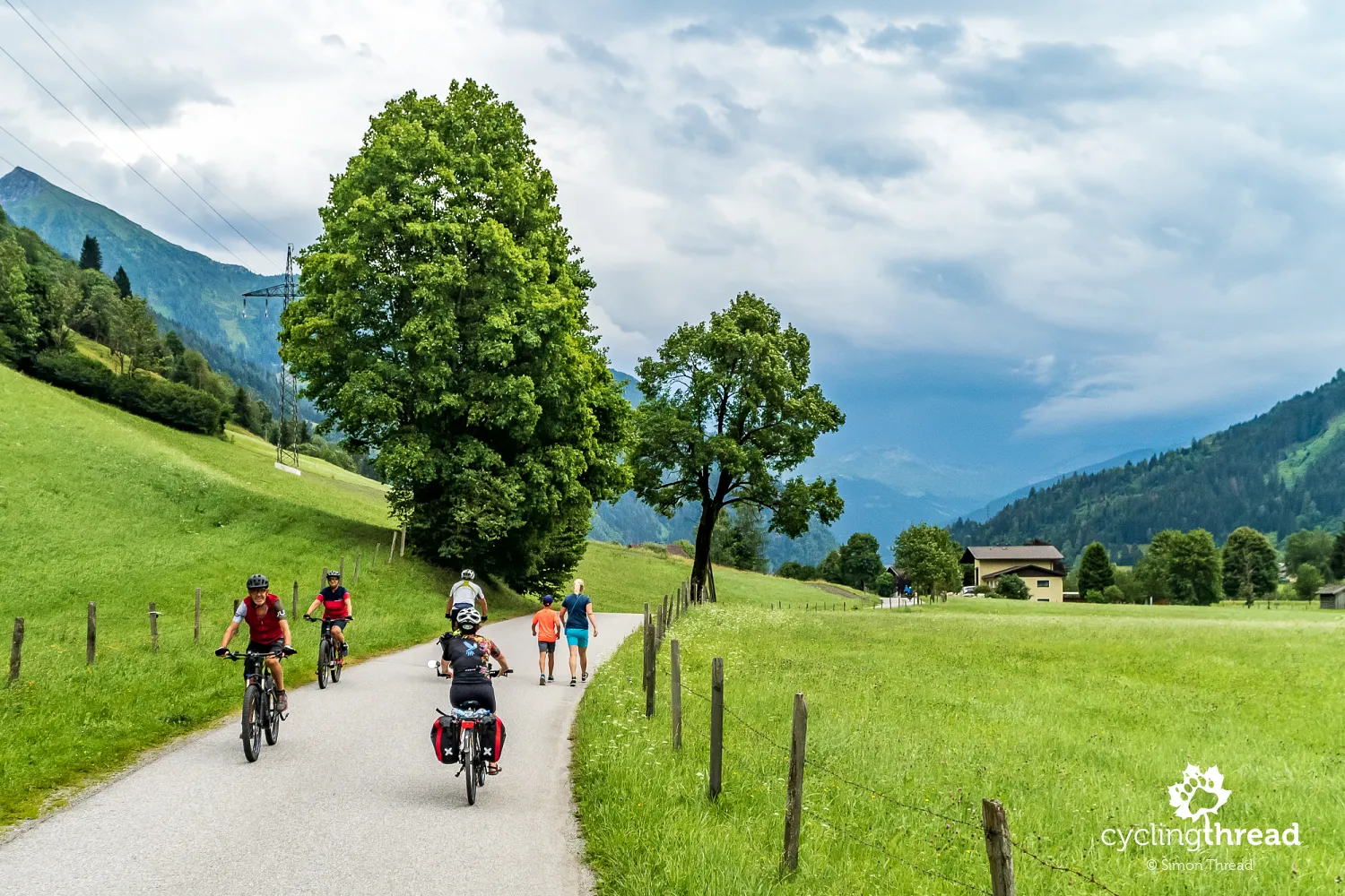
Walking and biking through the Gastein Valley
After passing through two tunnels, one of which is shared with car traffic, we enter the Gastein Valley (Gasteinertal), one of Austria's most popular tourist destinations, attracting thousands of visitors both in summer and winter. The image of the Gastein Valley is shaped by three main towns - Dorfgastein, Bad Hofgastein and Bad Gastein, each with a distinct character and catering to different tourist groups. In the Gastein Valley, I noticed a common feature of such places in tourist regions in Europe - a simple, yet multifunctional and practical tourist thoroughfare connecting the towns in the valley. Along the wide, car-free road, pedestrians and hikers walked, while cyclists rode their bikes.
An exceptionally easy bike route through the Alps
Riding the first part of the Alpe-Adria bike route turned out to be surprisingly easy. The minimal difficulty of the route is due to the Salzach and Gasteiner Ache valleys it follows, which gently rise towards the High Tauern. Over the first two days, covering approximately 120 kilometers, there are only two significant climbs - one just after Schwarzach im Pongau and the other before and in Bad Gastein itself. The steepest section of the first climb is between 10-15% and in Bad Gastein, near the Church of Saints Primus and Felician, the incline reaches over 16%. However, both are quite short, only about 2-3 kilometers long, so a brief walk won't take much time for less experienced cyclists.
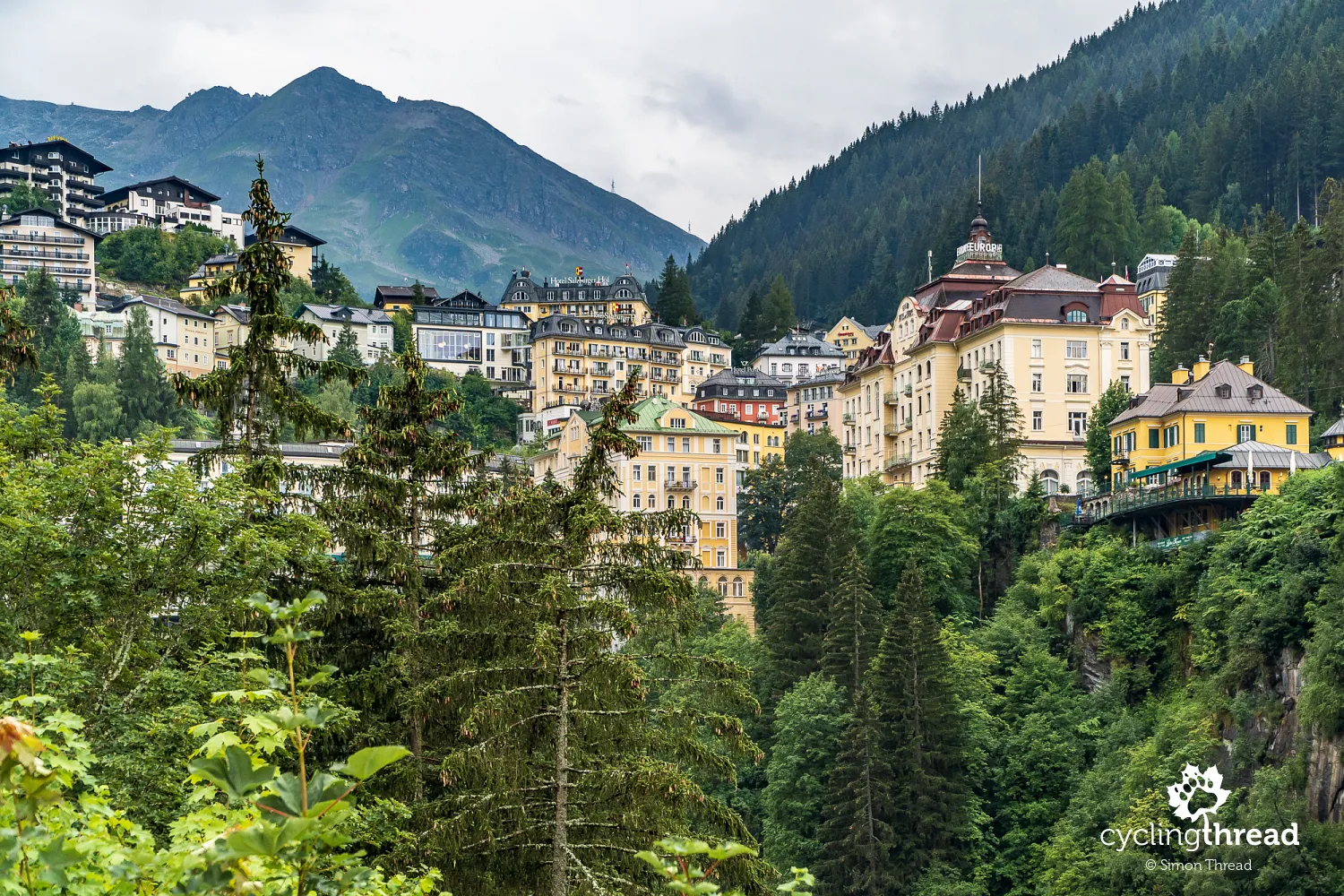
A challenging climb to Bad Gastein
The few kilometers before Bad Gastein are perhaps, after the excellent former railway bike paths in Italy, the most frequently mentioned section of the entire route. To reach the cliff-hanging hotels and spas of Bad Gastein, one really needs to pedal hard. The reward is a break under the famous waterfall, where the Gasteiner Ache River thunders almost in the center of Bad Gastein. The subsequent ride through the town reveals some of Bad Gastein's uniqueness - dozens of multi-story hotels and spa houses built on the steep slopes of the valley. One of them is the Grand Hotel de l'Europe, built in the early 20th century with ten floors, being one of the most modern hotels in Europe at the time. By the way, the same spa charm can be experienced in Krynica-Zdrój on the excellent Poprad Valley bike route.
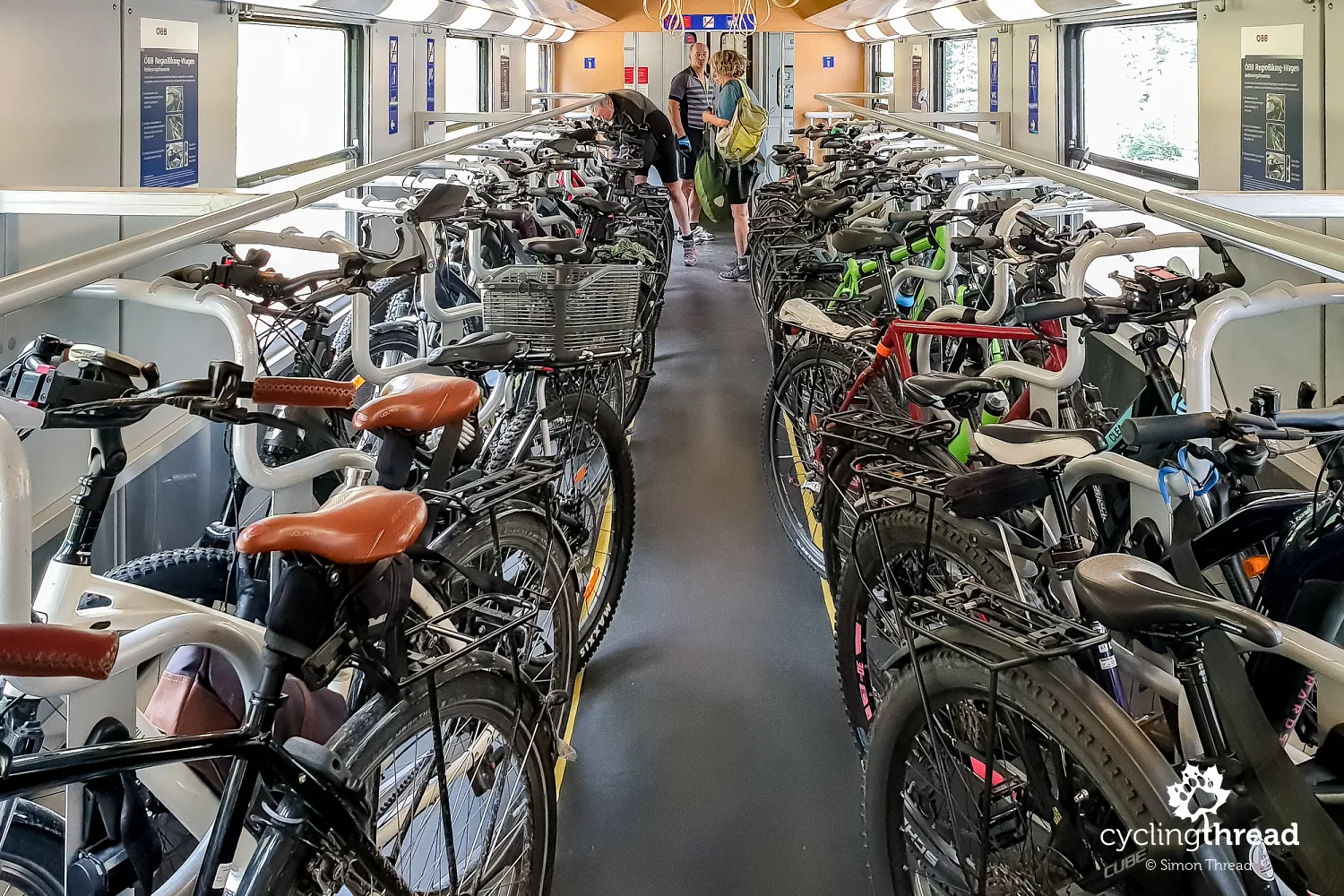
Bicycle carriage through the tunnel beneath the Alps
Among the stages of the cycling journey from Salzburg to Grado is a mere 11-minute train ride through a tunnel carved in the High Tauern. Route designers left no room for maneuver - taking the train through the Böckstein-Mallnitz railway sluice is mandatory, as there are no roads through the mountains in this area. Both drivers and cyclists first line up at a common ticket booth, then the former drive onto special platforms for car transport, while the latter head to the platform where a special bicycle carriage awaits. To accommodate all cyclists on the Alpe-Adria route, the carriage has been remodeled and fully adapted to our needs. All the bike racks occupied during our trip are one of the best scenes of cyclist-friendly facilities we’ve seen this summer. In this linked article we present other bicycle transport facilities in trains from our trips.
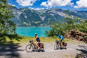
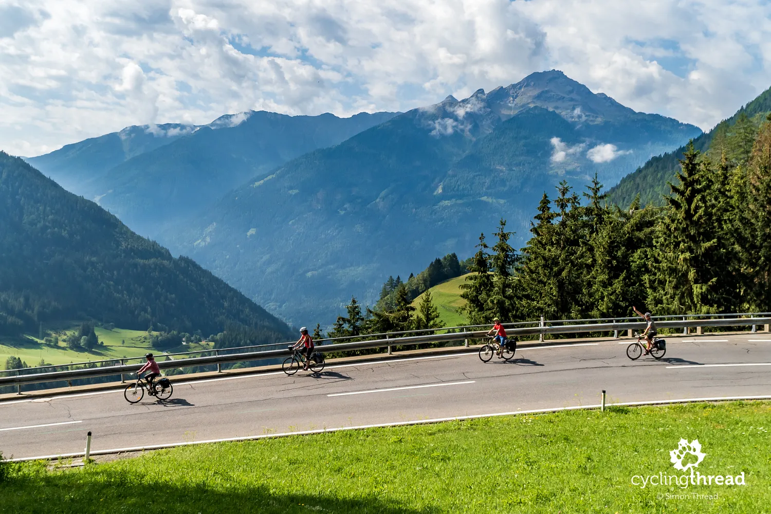
Another year in Carinthia
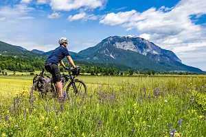
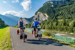
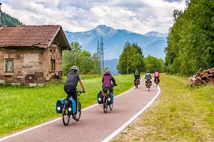
We disembarked from the train carrying us through the tunnel under the High Tauern already in Carinthia. This is the third consecutive year we've visited this picturesque region of Austria, thriving in bicycle tourism like few others in Europe. First, there was the Carinthian Lake Loop - a bike "bow" tied between the largest lakes of Carinthia starting in Villach. The next year, we rode the Drava Bicycle route, one of the best-rated in Europe, whose middle, longest section runs through Carinthia. This year, riding the Alpe-Adria route, we reached new corners of cyclist-friendly Carinthia - first, we rode a section of the Möll River valley, emanating from the famous Grossglockner massif and then rode several kilometers in the southern part of Carinthia, during the first climbs towards the Julian Alps.
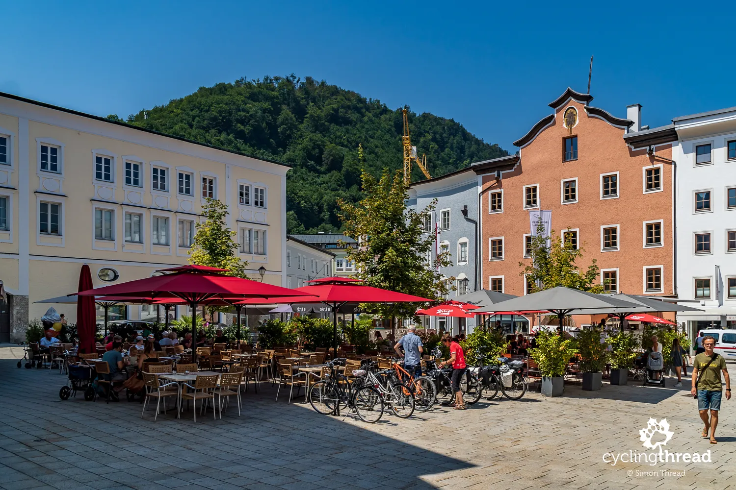
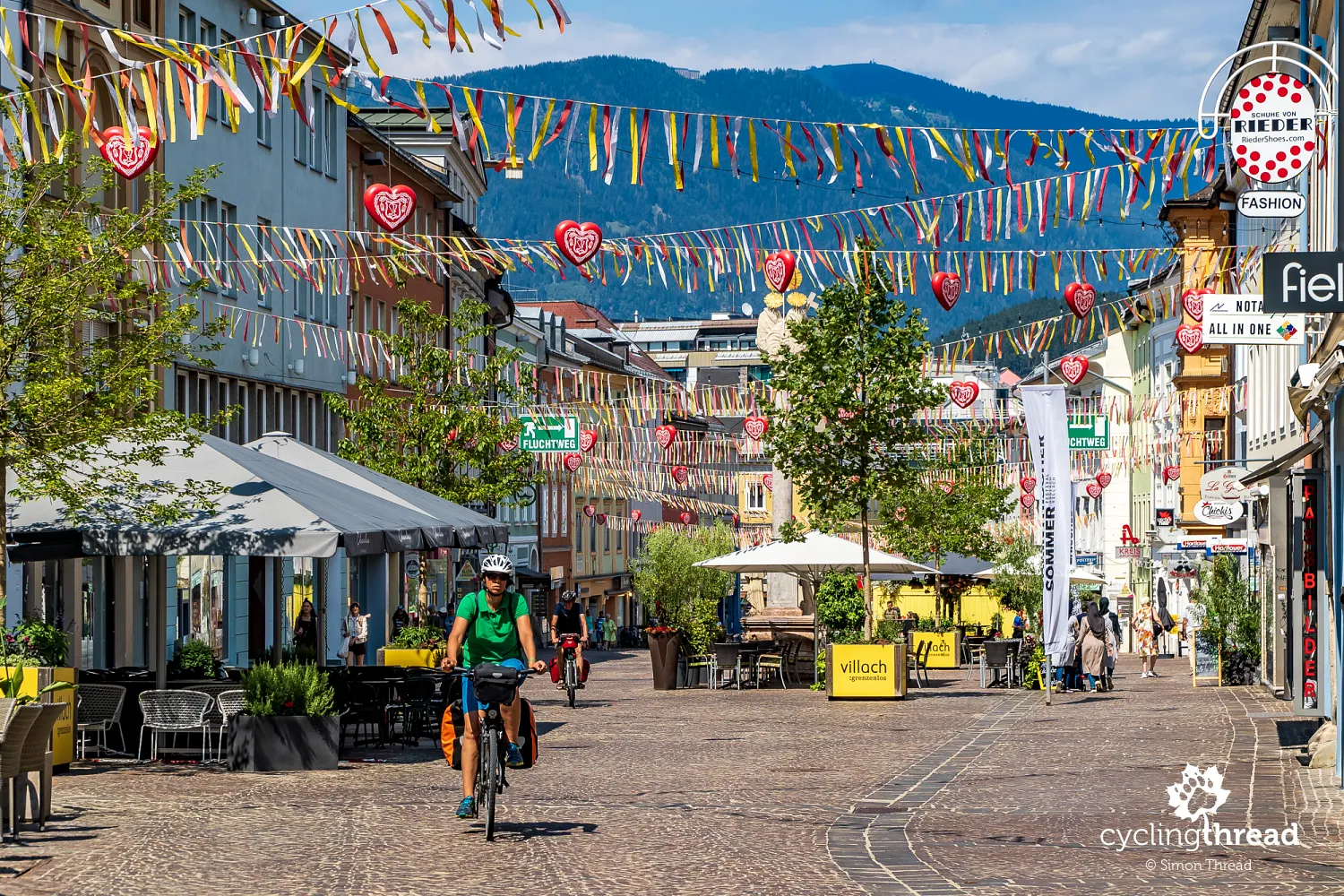
One more sunny afternoon in Villach
If your travel plan includes a day off from cycling for some lazy rest or exploring a city on foot, Villach is the best place for this on the Alpe-Adria route. As the tourist center of Carinthia, it can also serve as a base for local excursions. From our first trip around the Great Carinthia Lake Loop, we remember the beautifully located Landskron Castle with arguably the best view of the entire Villach basin and impressive falconry shows set against an Alpine backdrop. Stopping here during our Drava route expedition, we saw a massive model of the region, which provided additional orientation. When arriving in Villach by bike, don't forget about the unique Radbutler, or "bike butler" - a testament to the city's friendliness towards cyclists. It's a spot in the city center, by the Drava River, where you can leave your bikes for free while exploring the city, dining or even overnight.
Continuously captivating bicycle Carinthia
Departing from Villach in the morning, our thoughts were already on the expected sections of the route along former railway lines in the Alps. But Carinthia quickly reminded us of its allure, leading us through excellent bike paths beyond Villach, long before reaching the Italian railway part of the route. Both the entrance and exit from Villach serve as excellent examples for European bike route builders on how to seamlessly lead a cyclist into the center of a sizable city and then elegantly guide them out. This southern Carinthian segment of the Alpe-Adria route utilizes narrow, forested bike asphalt paths, occasionally changing into fine, hard gravel paths following the Gail River. Although a highway buzzed nearby, railway lines crossed a bit further and the next Carinthian towns lived their lives around us, we safely cycled through tranquil, green areas towards Italy.
Friendly Czech cyclists at the Austria-Italy border
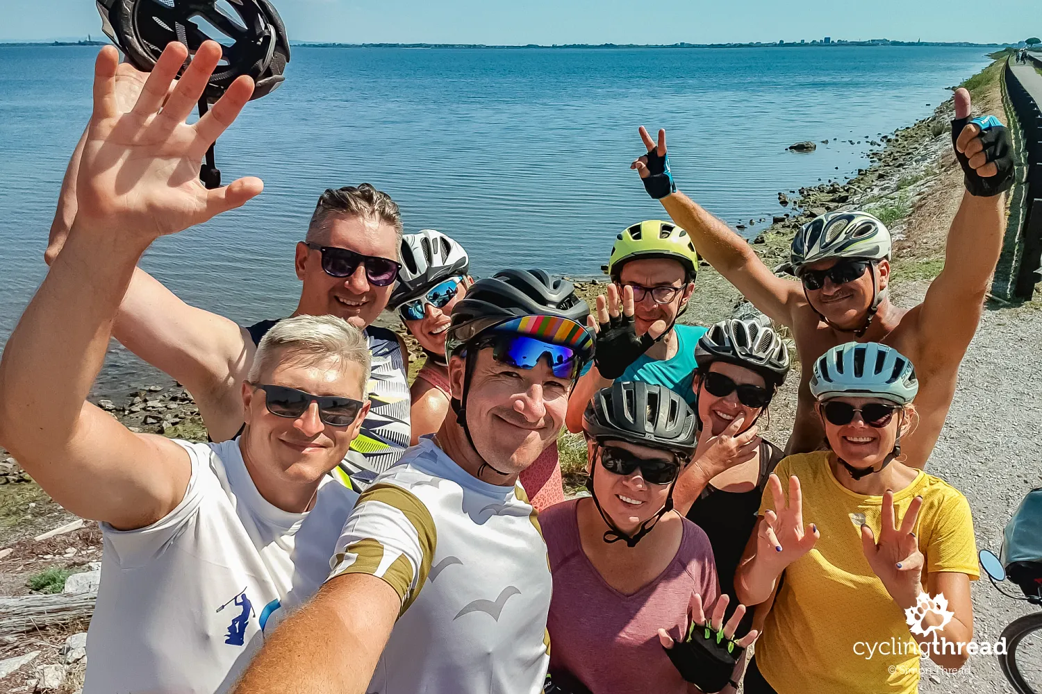
At the former Austrian-Italian border crossing in Coccau, while taking a commemorative photo under the "Italia" sign, we met a group of friendly Czech women cycling the Alpe-Adria route in the same direction. We took photos of them, they took photo of us and over the next few days, we bumped into each other several times, even surprising them while they were skinny-dipping in the waters of the Cadramazzo waterfall. Such encounters on the trail are the spice of long cycling journeys. Many who travel long-distance bike routes know the feeling when an invisible bond connects us with previously unknown people traveling the same route, experiencing the same joys and facing the same challenges. Sometimes such fleeting acquaintances from the trail turn into long-lasting friendships based on shared travel passions. Unfortunately, we didn't exchange contacts with our Czech acquaintances, so I don't even know who to send the few photos where the girls play the main roles.
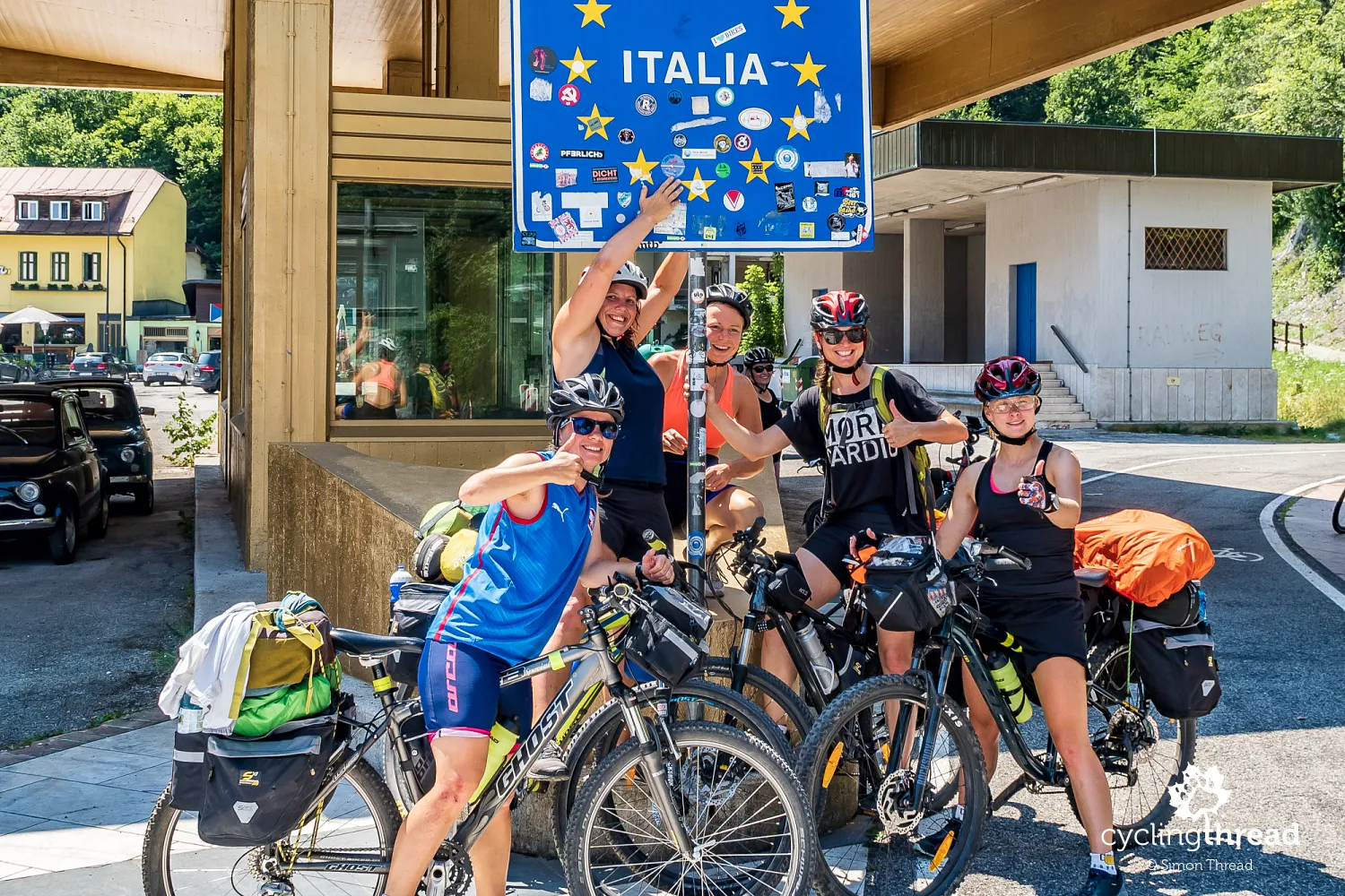
Coccau: a historical border village
While writing this text, I learned that the name of the unassuming village of Coccau is well known to older Italians from the days when media regularly reported long traffic jams at this border crossing. Following Austria and Italy's accession to the Schengen Agreement and the abolition of border controls in 1998, the traffic jams ceased and now the only ones stopping at the border are cyclists taking commemorative photos. Today, there are no cars or trains passing through the village, which are diverted through tunnels carved into the rocks on the other side of the valley. Interestingly, the Val Canale (German: Kanaltal), where Coccau (Goggau) is located, along with Tarvisio, was part of the Austro-Hungarian Empire until the end of World War I, with the border with Italy then located further at Pontebba. The peace treaty of Saint-Germain-en-Laye in 1919 rearranged this and other territorial matters of the Duchy of German Austria, which was briefly formed after the war's end.
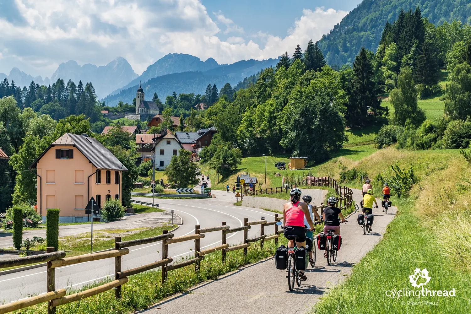
Stunning views of the Julian Alps
Still in Coccau, after a short climb towards the church of Saint Nicholas of Coccau, a striking view of the Julian Alps opens up on the left. The highest, somewhat rounded peak is Mangart (2679 meters above sea level), the fourth highest in the Julian Alps. The distinct "ridge" of sharply pointed peaks to the right is Cinque Punte (1909 meters above sea level). Beyond these peaks lies Slovenia. The Julian Alps accompany the Alpe-Adria route for nearly 100 kilometers through the valleys of the Gail, Fiume Fella and Tagliamento rivers, separating the Julian Alps from the Gailtal Alps and the Carnic Alps, which the cyclist has on their right hand. The Julian Alps themselves are yet another gracious destination for cycling in the Alps, with the long ascent up the Mangart Road being one of its most attractive segments.
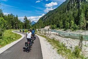
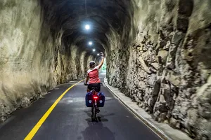
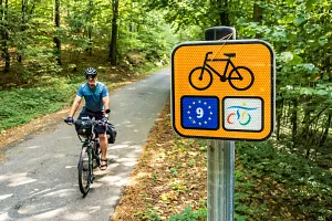
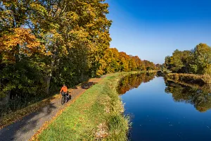
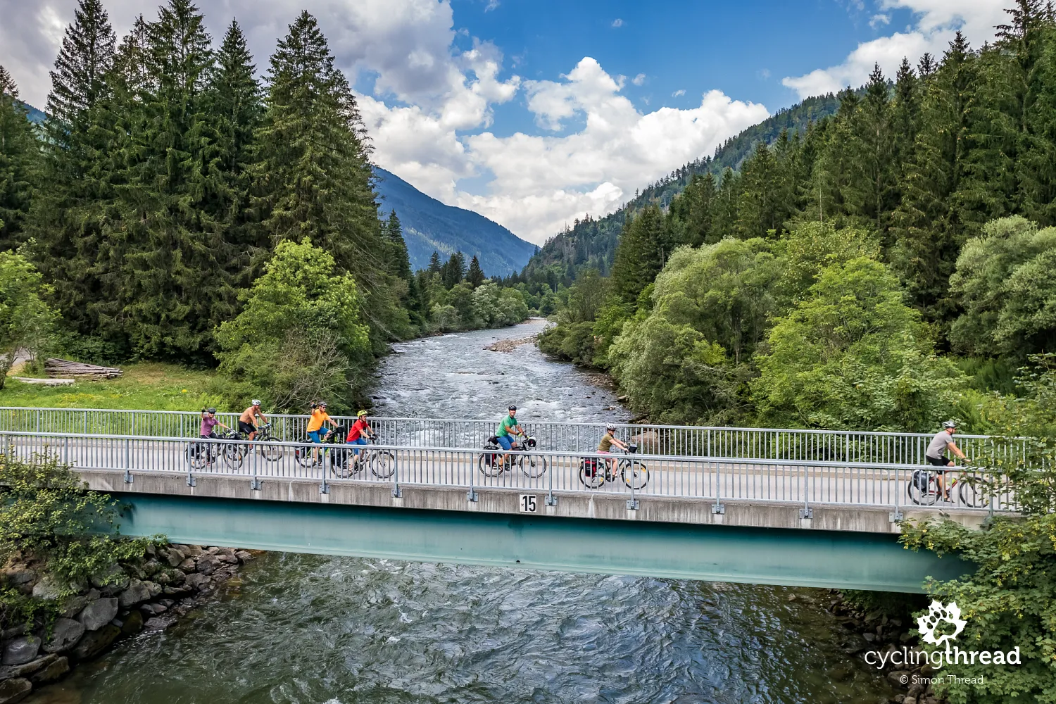
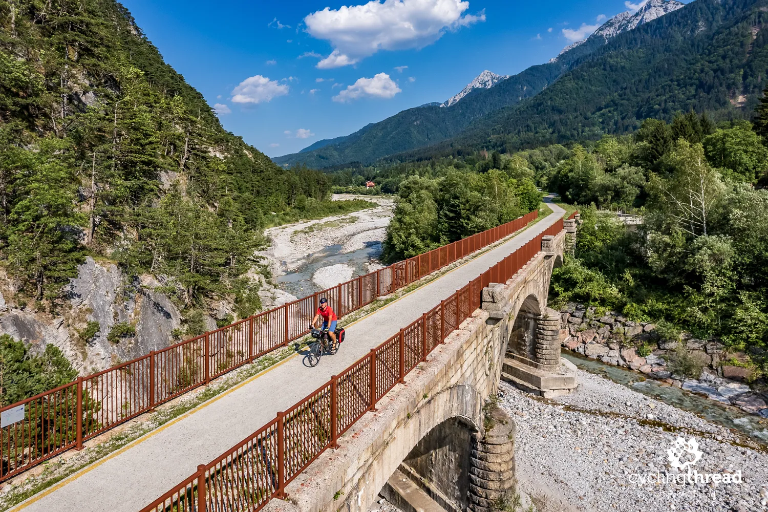
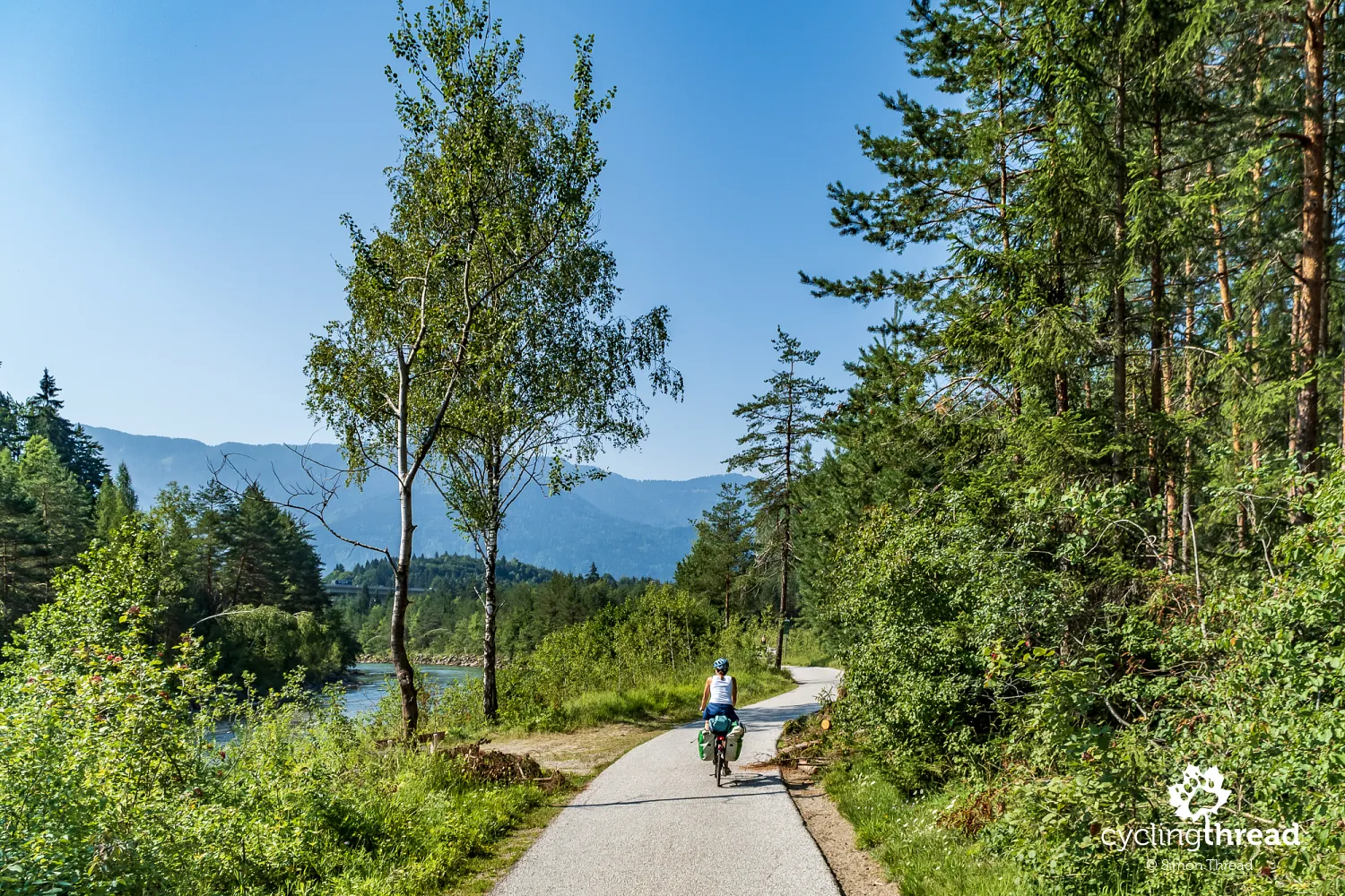
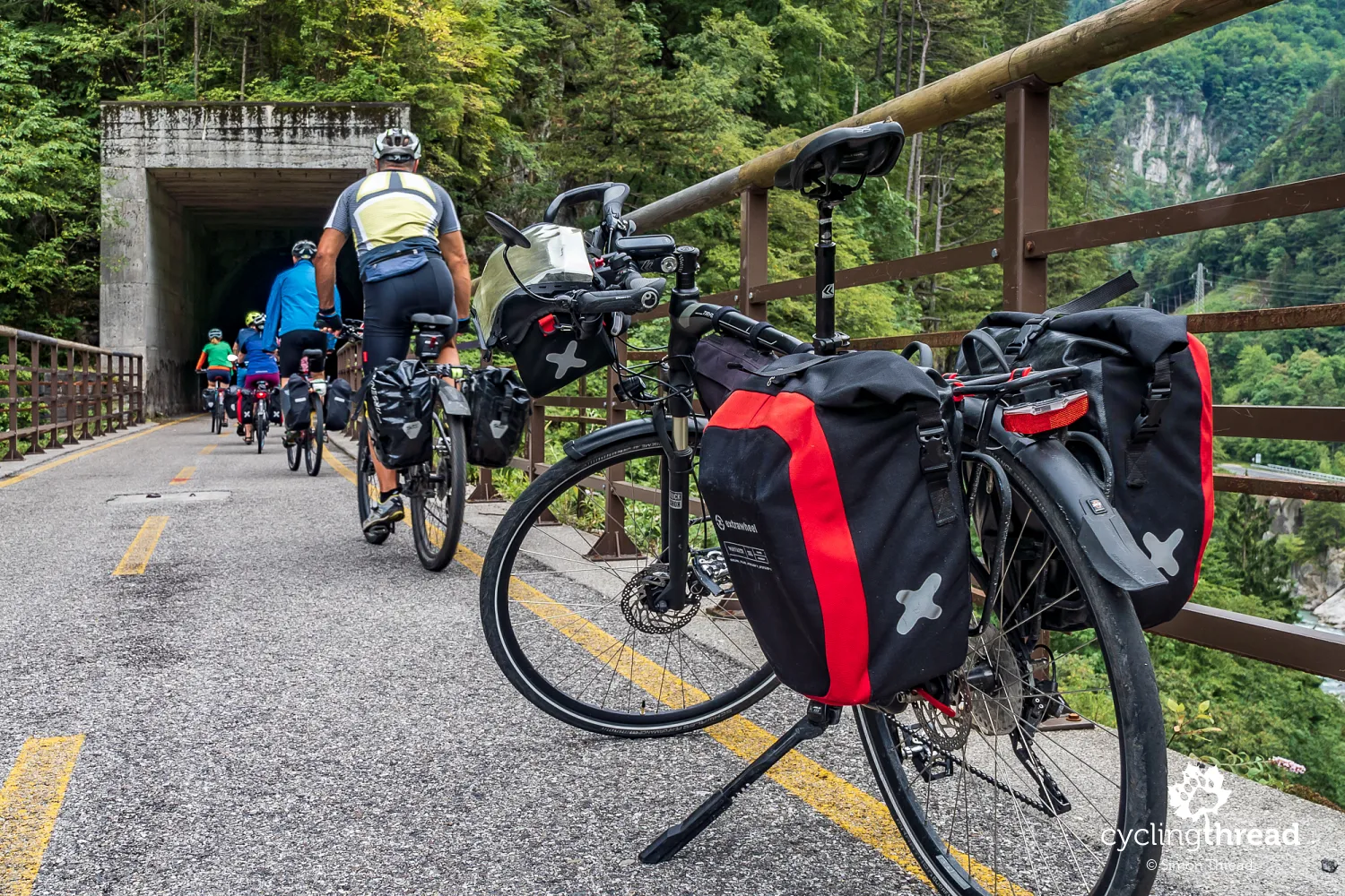
Former railway line from Tarvisio to Udine
Before Tarvisio, we enter a bike path that turns out to be the anticipated route along the former railway line, also known as the Pontebbana Railway, named after the town of Pontebba, where the Austro-Italian border once was. The last trains traveled this route at the end of the 20th century and between 1985-2000, a new, double-track railway line was built, including new parallel tunnels drilled through the Alpine rocks. After being abandoned by the railway, the unused tracks were revitalized by removing old ties and laying comfortable asphalt bike paths in their place. Cyclists soon followed, enjoying one of the fundamental features of railway lines - a gentle incline, not exceeding 2.2% and the delightful separation from motor traffic in the incredibly attractive river-Alpine scenery. And so it goes for about 60 kilometers between Tarvisio and Gemona del Friuli.
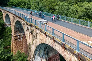
Numerous former railway bridges and...
Among the remnants of the old railway infrastructure that remained after the relocation of train traffic to new tunnels, the most impressive are undoubtedly the old railway bridges. The largest is the Ponte di Muro over the Fella River, with four stone arches and a central iron span of 70 meters, suspended high above the valley floor. Another is the Ponte di Ferro, located 7 kilometers further, near Chiusaforte. The Ponte di Ferro is shorter but equally striking with its closed iron lattice connecting abutments on both sides of the river. Both were built - note - in 1879, that's 144 years ago! All revitalized former railway bridges made accessible to cycling tourists are not only crossings over another Alpine river but also excellent vantage points and beautiful symbols of the post-railway route, contributing to its attractive image. In Poland, a similar story is seen with the beautifully renovated bridge in Siekierki over the Oder River.
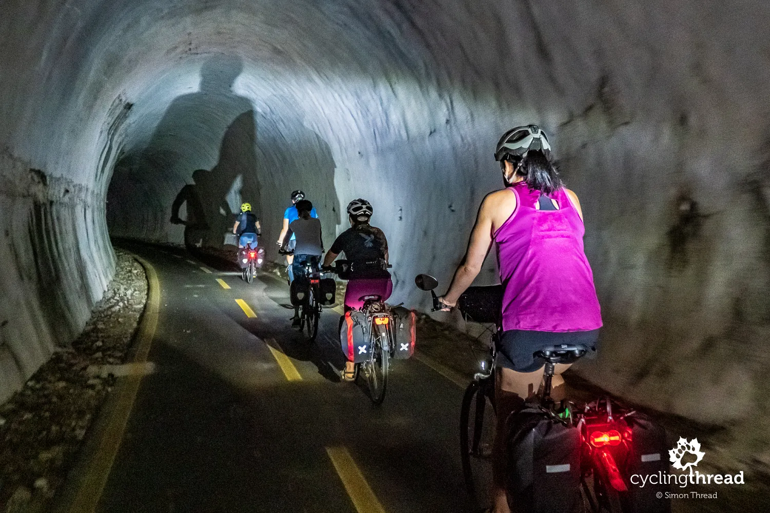
... several old tunnels on the Alpe-Adria route
I can't say exactly how many tunnels the Alpe-Adria route passes through, but there were at least a dozen. The first, quite short, appears just past Golling an der Salzach on the first day. Two more the next day, shared with car traffic, before climbing to Bad Gastein. The next railway tunnels we rode through one after another on the Italian stretch near Tarvisio, Pontebba, Chiusaforte and Venzone. They range from a few dozen meters to over a kilometer in length. Some are well lit with automatic systems, while others require personal lights. A tunnel on a bike route is not just a spectacularly routed path and a variation in the ride, but also a year-round shelter from rain and a summer escape from the scorching sun. On the Alpe-Adria, some tunnels lead directly to old railway bridges, as shown in the photo above. I describe other railway bicycle routes in Europe in this article.
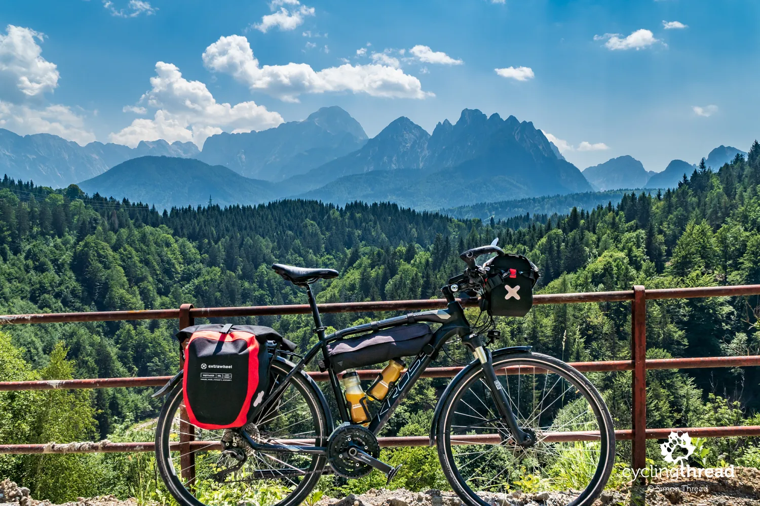
With Extrawheel panniers across Europe's cycling routes
I took a photo of my bike with Extrawheel panniers while our group was departing from a stop on one of the historic bridges. I thought with satisfaction that the Extrawheel bike panniers perform as well as the renowned German Ortlieb ones we used the previous year. The opportunity to return to the panniers from the Małopolska manufacturer came with the introduction of an excellent handlebar bag, which I had already tested during earlier trips. Made of Cordura, it ensures durability and safe storage of items even in the rain and the KlickFix mounting is compatible with Ortlieb's. It's worth noting that due to a different design, the Extrawheel handlebar bag Handy XL has a much stiffer, more robust structure than its German counterpart. The Handy XL handlebar bag also perfectly matches Extrawheel's signature black and red line of bike panniers, although the company plans to introduce new models in different color variants in 2023.
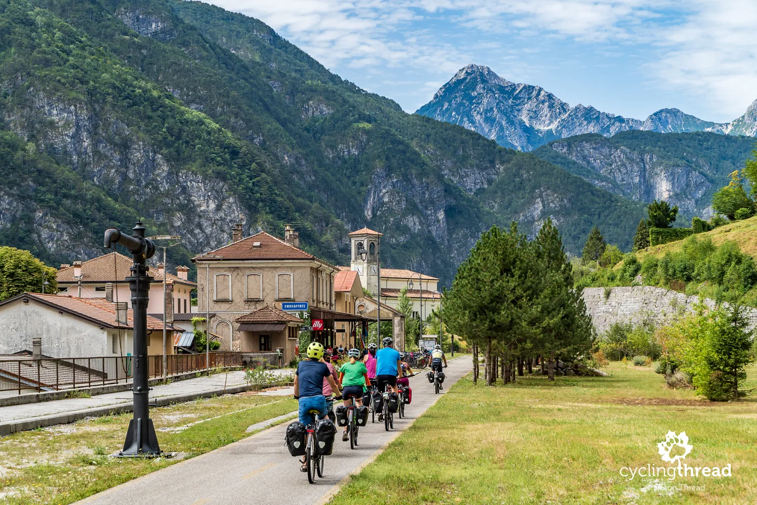
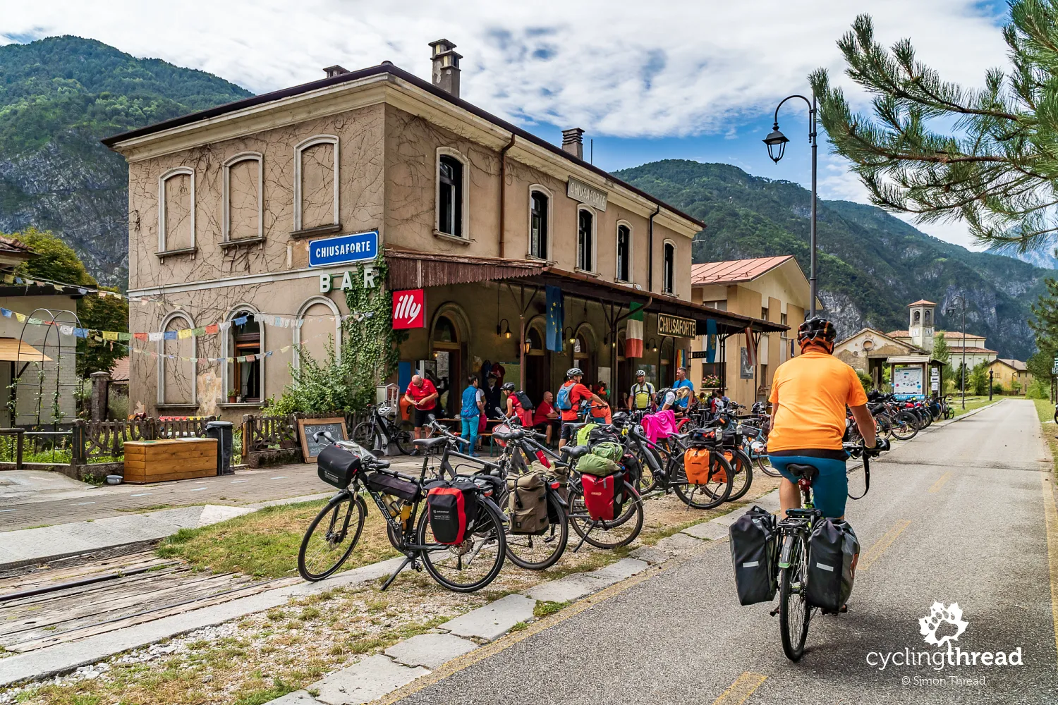
Café in the old Chiusaforte train station
Part of the former railway line between Tarvisio and Udine included various types of buildings - from technical facilities and signalmen's posts to maintenance halls for railway rolling stock, as well as stops and train stations. In the latter category, the most characteristic and frequently mentioned on the Alpe-Adria route is the old train station in Chiusaforte, now converted into a café and a small inn, Stazione di Chiusaforte. Offering restaurant and accommodation services, it's also a bike rental and repair spot, making it a true cyclist-friendly location. It's probably the most popular spot on the entire route, as numerous bikes parked at the station at any given time can be seen in various photos. So many cyclists enjoy the brilliant cycling atmosphere and great infrastructure of the transalpine route. Another revitalized old station can be seen in Ugovizza, about 25 kilometers back.
Abandoned settlements in the Carnic Alps
An interesting place, located across the Fella River and thus off the route, is the small town of Moggio Udinese with the Abbey of Saint Gall. It's clearly visible from the bike path. In winter, the town's shop windows come alive with Christmas cribs created by local artists, brightening up the town far from popular routes. Unique are the three mountain settlements of Moggessa di Quà, Moggessa di Là and Stavoli in the Carnic Alps around Moggio Udinese. Accessible only by footpaths and, in one case, a cable car, these settlements have been gradually abandoned since most of their houses were damaged in the 1976 earthquake, now forming a picturesque yet somewhat peculiar attraction. A few hours' hike to these areas can be a perfect diversion during a journey on the Alpe-Adria route.
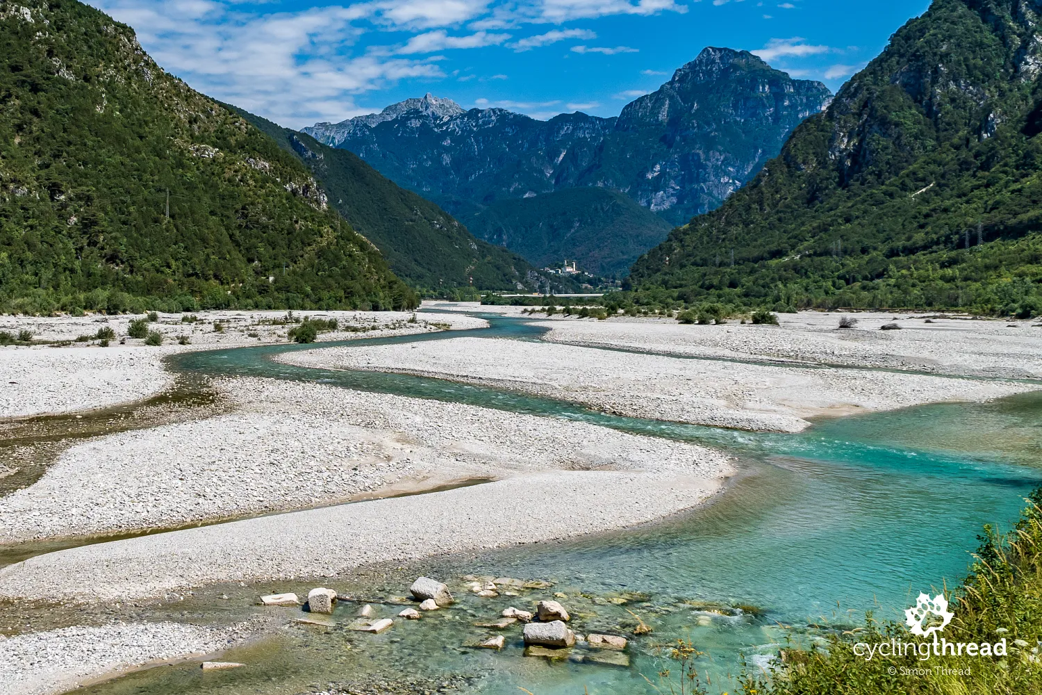
Fella and Tagliamento as examples of braided rivers
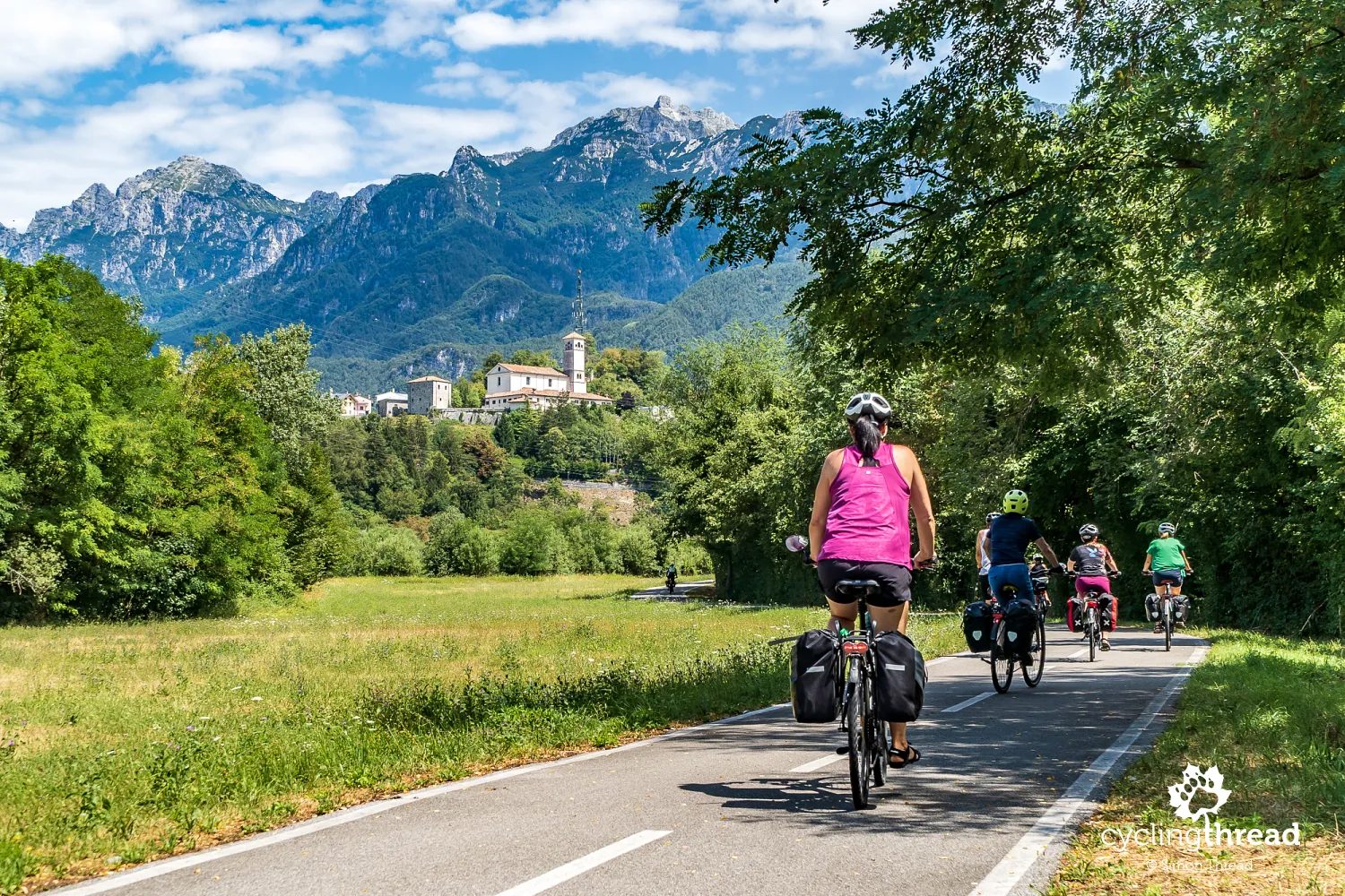
Observing the Abbey in Moggio Udinese against the backdrop of the Carnic Alps and Monte Pisimoni, I realized that the Fiume River at this section and the Tagliamento River it soon flows into, are perfect examples of braided rivers. The vast sandy areas are not a result of the river drying up due to climate change, as one might first think. These gravelly, extensive shoals are masses of mountain sediments deposited by the river, among which shallow river channels flow. It is in this area that the excellent former railway bike paths end and the Alpe-Adria cycling route leads along a wide, continuously lined shoulder of a public road towards Carnia and Venzone.
Venzone: the most beautiful town in all of Italy
The medieval town of Venzone captivated us the moment we crossed its preserved walls enclosing the historic part of the town. The town seems as if time has stood still, but this is an illusion - a stroke of luck in misfortune. Venzone was destroyed by two earthquakes in May and September 1976, a fact remembered by scattered images and galleries throughout the town. The residents rebuilt Venzone stone by stone, brick by brick, using original materials to restore its former glory and atmosphere. In 2017, Venzone even won the annual RAI television contest for Italy's most beautiful town. The rebuilt Cathedral of Saint Andrew the Apostle is worth a visit, where in the chapel of Saint Michael, one can see five of the several naturally mummified bodies from the 17th century, which once even caught Napoleon's interest. Behind the town hall, standing in the main square, are the ruins of the Church of Saint John the Baptist, serving as a reminder of the 1976 city apocalypse.
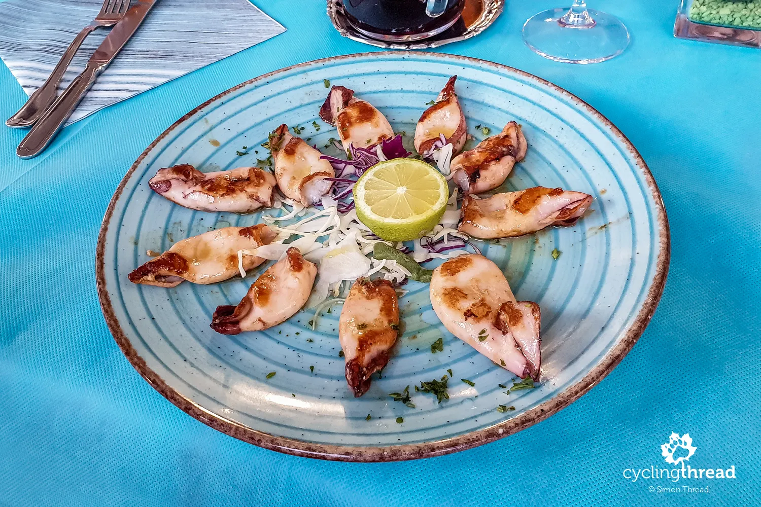
Adriatic seafood on our plates
A daily highlight was our Italian meals, as Italian cuisine is undoubtedly one of the attractions that draw people to the Alpe-Adria route. In Italy, everything tastes better and Italian restaurateurs seem to have a greater commitment to the freshness and origin of ingredients. What did we eat? Perhaps only during our first meal in Tarvisio, at the rather average restaurant da Meggy, were there more pizzas and pastas on our table. In the following days, our plates were filled with seafood and even those among us who had not previously been fans of seafood specialties made that choice. We had a delicious lunch at Locanda al Municipio in beautiful Venzone, next to the city hall, where we could even bring our bikes into the inner courtyard. Our dishes included spaghetti frutti di mare from the photo below and the meal concluded with tiramisu, ordered by everyone.
The patron saint of travelers from Gemona del Friuli
An evening stroll to the center of Gemona del Friuli, where we stayed that night, led us to the patron saint of travelers, Saint Christopher. The seven-meter statue of the saint is embedded in the façade of the Cathedral of the Assumption of the Blessed Virgin Mary, one of the most valuable monuments in Friuli-Venezia Giulia. The 1976 earthquake destroyed almost the entire right nave of the church but spared the façade with Saint Christopher, the original Gallery of the Three Kings in the central part and three striking rosettes, including the largest one crafted by the 14th-century stonemason Maestro Buzeta. Inside the cathedral, it's hard not to notice the leaning columns, another reminder of the tragic year of 1976. Opposite the entrance stands the Dante bell from 1423, which was the only one saved from confiscation by the Austro-Hungarian army in 1918 for military purposes.
Gemona del Friuli before and after the earthquake
Memories of the 1976 earthquake can also be found in a small gallery-museum located along the main street of the old town, about 100 meters from the historic church. Open in the evening, this place showcases how the town looked before and after the catastrophe, adding a reflective tone to our journey. It's notable that despite such an interesting history, the Alpe-Adria route, as shown on the OSM map, does not pass through the historic part of Gemona del Friuli. Even more surprising is the route shown on the official Alpe-Adria website, which I mentioned earlier, practically bypasses Gemona del Friuli entirely, not just its historical center. Yet, this is surely one of the most worth-seeing places on the route and missing it would be a significant loss for the overall cultural value of your trip.
The Alpe-Adria route after leaving the Alps
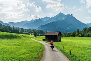
The Alpine and alpine landscapes on the Alpe-Adria route end as abruptly as if they were cut off by a knife. After leaving the pleasant Gemona del Friuli, the terrain becomes flat and tranquil and after several kilometers spent on gentle descents, more effort is required to move towards the Adriatic. The route again features fields, meadows and green protected areas. Before reaching Udine, notable sights include the beautiful church in Vendoglio, part of larger Treppo Grande; the pleasant Cassacco with its 13th-century palace, unfortunately private and not open to visitors; or simply the increasingly warm gusts of wind signaling the approaching Adriatic Sea. The roads on this stretch vary - from asphalt bike paths and local gravel roads to almost field paths and short sections on quiet public roads.
Not nearly enough time in Udine
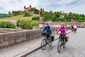
Udine is the largest city on the Italian section of the Alpe-Adria and the second-largest city in the Friuli-Venezia Giulia region after Trieste, with nearly 100,000 inhabitants. However, Udine was also one of those moments where - unfortunately - arriving in the city made me realize that late afternoon and morning are far too little time to leave with a sense of understanding its character and attractions. We reached the beautiful Venetian Piazza Libertà via the equally atmospheric Via Mercatovecchio, full of shops and cafes hidden behind medieval arcades. At the end, at Piazza Libertà, stands the Loggia del Lionello, characteristic of Italian architecture, built with stripes of white and pink stone. Opposite it shines another beautiful structure in Udine - the Loggia San Giovanni with its distinctive clock tower. Higher up is the castle hill with the former castle, now no longer serving military functions. A little further, one can view the façade of the Udine Cathedral - Santa Maria Maggiore. And these are just a few of the buildings located in the city center...
Best moments at the table on the Alpe-Adria
I'm not sure if my team shared my opinion, but the dinner at Bella Napoli in Udine, discovered by Emil, was for me the best meal of our trip. Another great day on the Alpe-Adria and our entire journey (which previously included the Loire Valley in France and the Lakes Route), the beautiful Udine, that pleasant, cycling fatigue and the great atmosphere among us - all friendly people sharing passions and enjoying each other's company. And again, wonderful dishes on our plates, with another "seafood story" where this time calamari took the lead. And the nice gesture of the Italian restaurateur at the end, who thanked us for choosing his restaurant and offered our entire team a shot of limoncello, was the perfect conclusion to a good day on a beautiful route.
Cycling amenities on the Alpe-Adria route
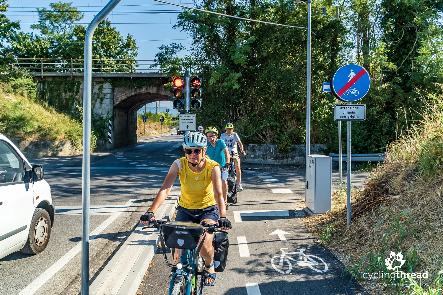
You might think that after the previous days filled with spectacular post-railway cycling infrastructure surrounded by alpine scenes, the last kilometers of the Alpe-Adria bike route would just be a lazy roll to the finish. I was pleasantly surprised when, suspecting such a development, it turned out that the last day was full of interesting happenings. Before I mention the uniquely special places on the trail, let's talk about another pro-cycling solution demonstrating the importance of cyclists here and how comfortable and safe this route is. Shortly after leaving Udine, cyclists are suddenly stopped by red lights, which, after pressing a button, turn green, allowing a collision-free crossing under a small railway viaduct along the specially designated bike lane shown in the photo. This is how cycling tourism is done in Europe, with a focus on safety and bold initiatives.
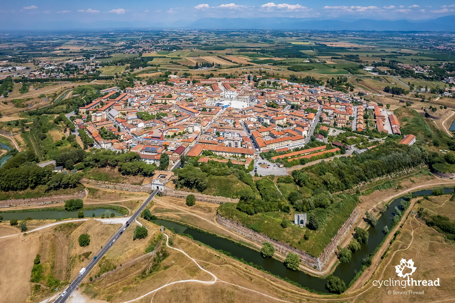
Venetian fortress like a nine-pointed snowflake
Shortly after, following a series of various types of bike paths, including several gravel sections surrounded by vineyards, we arrived at another and not the last tourist gem of the route. It's the absolutely unique city of Palmanova, built in the shape of a nine-pointed star. Beautiful Palmanova was constructed in the 16th-17th centuries by the Venetians as their main land base and fortress to protect the Venetian Republic from invasions by the Turks from the east. The city is accessed through three gates in the walls with ravelins, surrounded by a moat and additional defensive embankments. The central Piazza Grande with its snow-white cathedral was a pleasant spot for a short break, though its size makes it hard to call it intimate. Looking at Palmanova from above reminded me of my cycling trip in Latvia and the fortress in Daugavpils.
Aquileia on the UNESCO World Heritage List
Just twenty kilometers from Palmanova lies another stop worth exploring - Aquileia. This town was founded in the 2nd century BC by the Romans as a fortress in the north of their empire. In the 4th century, a temple was built here, the original, restored mosaics of which can now be seen inside the 11th-century basilica, built on the footprint of the previous temple. Earlier, on the left side of the Alpe-Adria route, are the remains of the port that was part of ancient Roman Aquileia. Nearby are also the Museum of Early Christianity and the National Archaeological Museum of Aquileia. All this makes Aquileia perhaps the most valuable site on the trail in terms of historical, cultural and architectural significance. This fact contrasts with Aquileia's placement on the route, as this beautiful town, worthy of spending even a few hours exploring, appears just about 10 kilometers before the end of the journey in Grado.
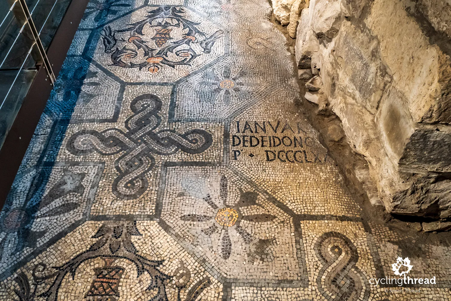
4th-century mosaics in the basilica of Aquileia
The large original mosaic has survived about 1600 years thanks to being covered with a layer of rock and a new stone floor during the construction of the modern church. The renovation of the basilica in Aquileia, including the mosaics, was overseen in the late 19th century by Polish historian Count Karol Lanckoroński, who also financed the work. The grateful city authorities made Lanckoroński an honorary citizen and in 1998 UNESCO listed the Basilica of Santa Maria Assunta in Aquileia as a World Heritage Site. It's worth noting the difference in height between the original mosaics and the later floor level in the medieval cathedral. Many visitors also notice the unique motifs depicted in the mosaics, featuring both human and animal figures, such as a rooster, turtle and even a mongoose sitting on a palm tree.
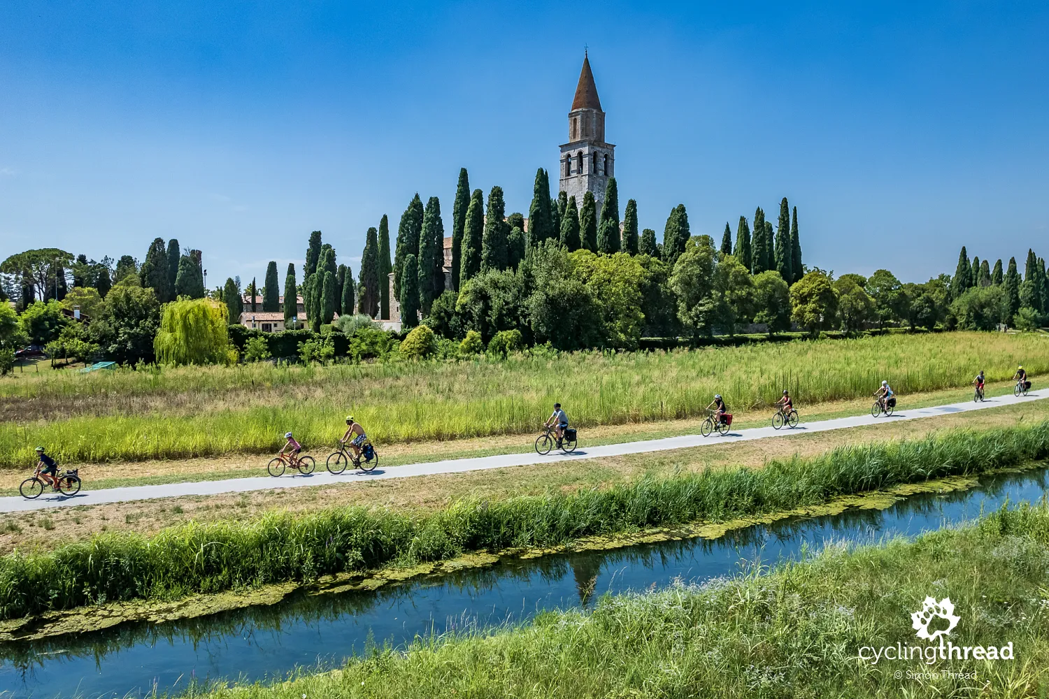
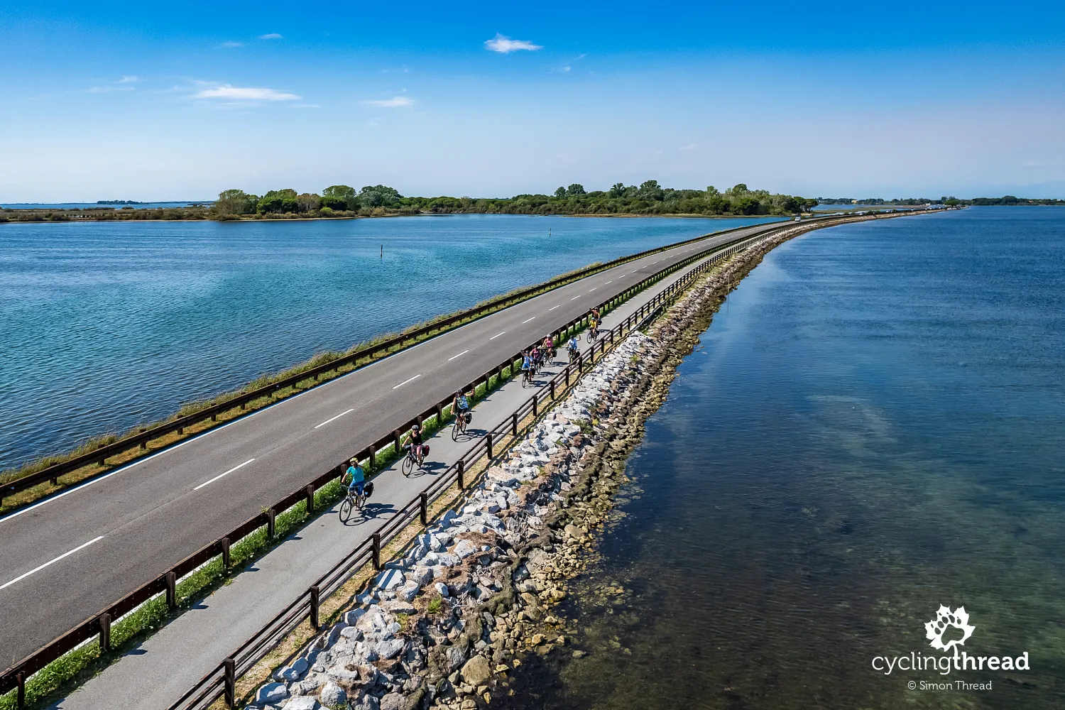
The final five-kilometer causeway to the destination
After a longer stay in Aquileia, the Alpe-Adria cycling route leads to another original feature - a five-kilometer-long causeway cutting across the Adriatic lagoons and ending in Grado. These fifteen minutes of riding are also a great opportunity to quickly recall the immense landscape diversity that accompanied our cycling route over the past few days. First, the Austrian Alps near Salzburg, viewed from the valleys of the Salzach and Gasteiner Ache rivers, then the ascent to the alpine peaks in the High Tauern, followed by the valleys of the Möll and Drava rivers, the Villach basin, the ride between the Julian Alps and the Carnic Alps, a brief presence in the alluvial plains of the Fella and Tagliamento rivers and finally the eastern fringes of the Venetian Plain and the Adriatic coast. We used this extraordinary scenery for commemorative photos - ahead we could see Grado and behind us, far in the depth of the frame, lay Aquileia, Palmanova and Udine.
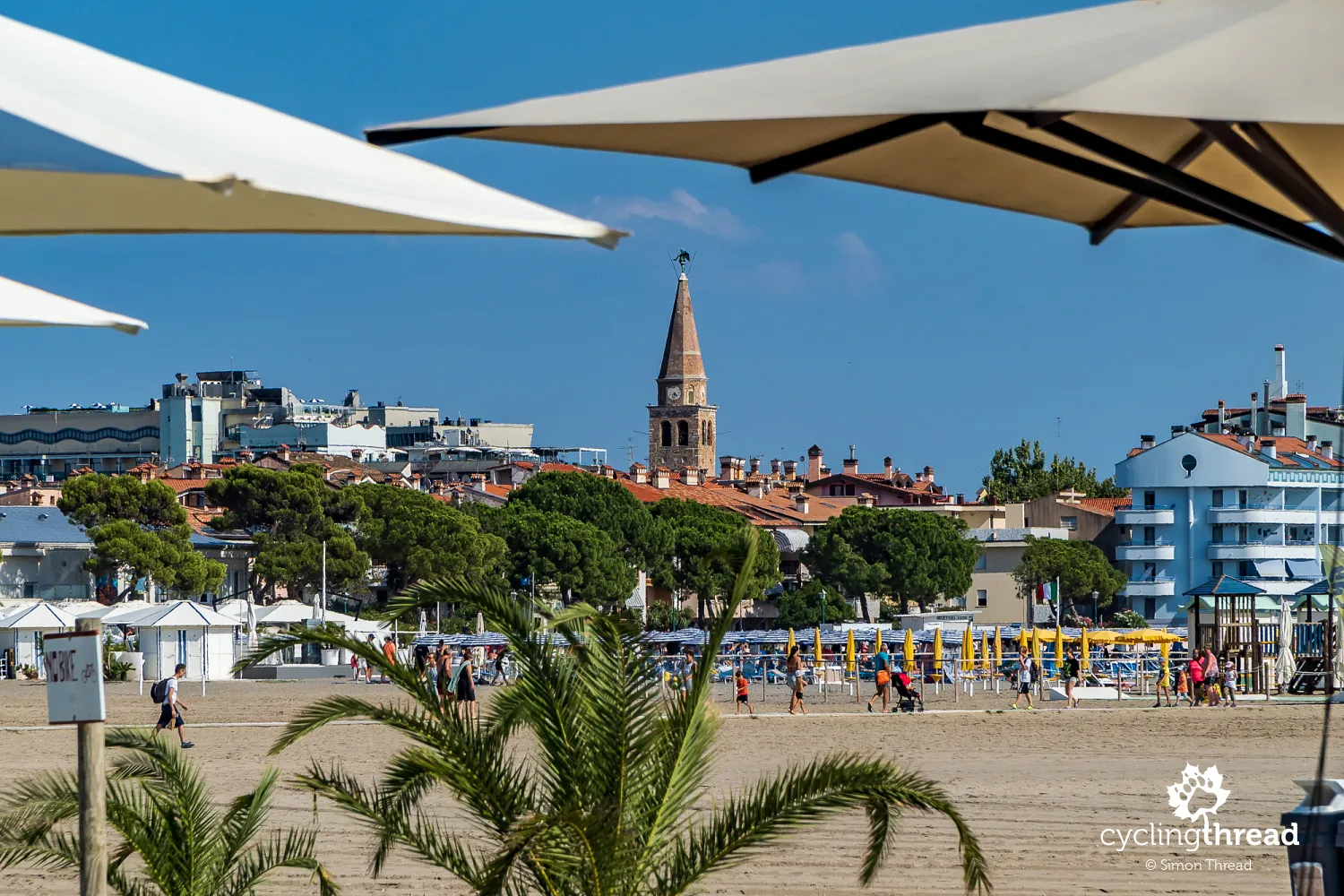
Several centuries of history in Grado
The week-long cycling journey along the Alpe-Adria route ends in Grado, the Italian resort on the Adriatic Sea. However, it's not just an extremely popular summer vacation spot favored by tourists from Germany and Austria, but also an ancient Roman city, founded in the 2nd century BC. Grado served as a port for the then distant Aquileia and as a recipient of goods transported from Ravenna through the Adriatic lagoons. It is believed that the inhabitants of Aquileia moved to Grado after the Hun invasion in the 5th century and remnants of buildings from this period can be seen in the old town of Grado. The town is dominated by the tower of the Basilica of Sant'Eufemia from the same period. Along the town stretch kilometers of mostly paid beaches, bordered by a pedestrian promenade, unfortunately with a ban on cycling. And here, amidst the bustling beach atmosphere and on the narrow streets of Grado, remembering several centuries of history, ends the beautiful journey along the Alpe-Adria cycling route.
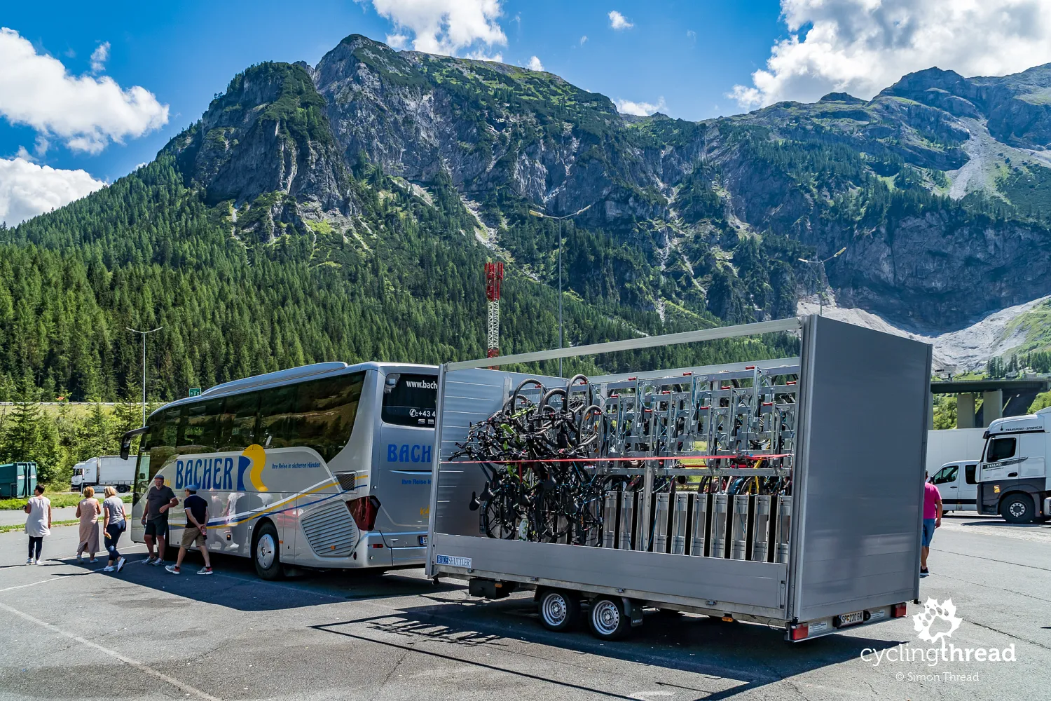
Bus service for cyclists from Grado to Salzburg
We arrived in Salzburg by car, so after reaching the end of our cycling route in Grado, we still had to return to Mozart's city. Initially, we planned to use the seasonal Micotra train, which runs on weekends from Trieste directly to Villach and then transfer to a train to Salzburg. Unfortunately, we encountered renovations in the Italian railway network and suspended services from Trieste to Villach, including the replacement bus service. Consequently, we took a convenient, direct bus connection from Grado through Villach to Salzburg. This is the fastest way to travel between these cities, designed specifically for cycling tourists on the Alpe-Adria route. Our bikes were transported on a specially prepared trailer and sitting in the air-conditioned coach, we had the opportunity to reminisce about the places we had just cycled through. Information about the bus service - prices, schedule - is available on the Alps2Adria website, whose services we used.
Alpe-Adria offered by a cycling travel agency
For those who are not confident in organizing their own cycling trip through the Alps to the Adriatic, it is worth considering the services of specialized operators offering bike tours in Europe. Such companies organize ready-made cycling holidays along the entire official Alpe-Adria route from Salzburg to Grado in different time variants, as well as shorter sections, for example from Salzburg to Villach, from Villach to Grado, or from Villach to Trieste - which was initially our plan. As we found out during our stay, the shorter southern sections are particularly popular. Many passengers on our return transfer bus from Grado to Salzburg were using organized tour packages and got off in Villach, at the official tourist parking area mentioned earlier in our reports from Carinthia.
Cycling tourism at its best
The Alpe-Adria bike route is one of those initiatives that build an excellent image of cycling tourism. Revitalizing old, unused infrastructure, organizing a network of cyclist-friendly accommodations, restaurants, and even special transport services for cyclists, all set in spectacular surroundings among some of Europe's most beautiful landscapes, accompanied by interesting cultural, historical, and natural attractions. This thoughtful integration of convenience and charm makes it a benchmark for similar projects, showing how cycling routes can revitalize regions and attract visitors. All these factors combine to create the excellent effect seen in the almost idyllic cycling scenes at the old station in Chiusaforte.
First place among Europe's bike routes
What can be said in summary of a journey along one of the most beautiful bike routes in Europe? I hope our impressions and photos speak volumes. You don't need to read between the lines to see that our trip along the Alpe-Adria bike route was a tremendous dose of fantastic cycling experiences and when talking about the best places for cycling holidays in Europe, Alpe-Adria is mentioned alongside the bike routes of the Rhine, Loire and Danube. It lands in first place on our list of the best bicycle routes in Europe we've cycled, replacing the equally beautiful Rhine bike route in Switzerland. And I certainly don't rule out returning to Alpe-Adria someday.
Back to topHave a safe ride! 💚
Simon Thread
(Szymon Nitka)
I'm a passionate cycling traveler and the voice behind Cycling Thread. I explore Europe on two wheels, documenting the most scenic routes, inspiring places and cyclist-friendly practices. My writing blends personal experience with practical insights and a deep love of travel. I'm also a contributor to National Geographic Traveler magazine.