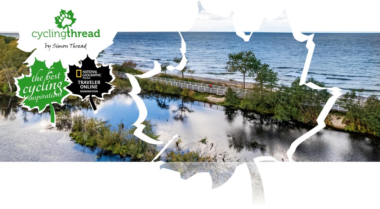
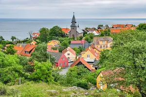
EuroVelo 10 bicycle route in Poland: Velo Baltica in Western Pomerania
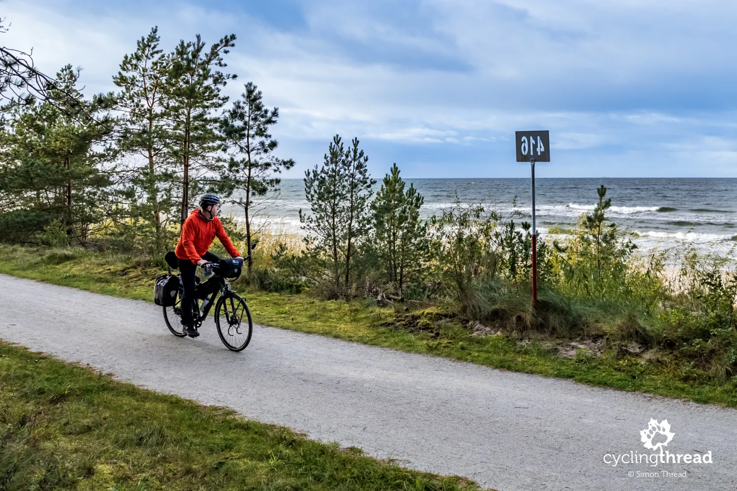
EuroVelo 10, the international cycling route circling the Baltic Sea, is the most renowned bike route in Poland. Western Pomerania is one of two regions in Poland sharing the responsibility for its organization and maintenance. Thanks to the expertise of West Pomeranian cycling officials and support from the European Union, the EuroVelo 10 route in Western Pomerania has been enhanced with numerous kilometers of new tourist cycling paths, rest areas, fresh informational materials and a handy mobile app. I took advantage of a few sunny, autumn days to explore how the former R10 cycling route is transforming into the modern EuroVelo 10, inviting travelers to pedal through its scenic landscapes.
Cycling Partners
Route on the map
GPX file (GPS track): cyclingthread.com-western-pomerania-2023.gpx
EuroVelo 10 - table of contents
- Once R10, now EuroVelo 10 or Velo Baltica
- EuroVelo 10 for a holiday or a weekend
- On the train, only six places for bikes
- The start of the Polish part of EuroVelo 10 in Świnoujście
- "Kilometer zero" at the Polish-German border
- The impressive Prussian forts of the Świnoujście fortress
- The tallest lighthouse on the Baltic Sea
- The LNG terminal construction changes the route
- The first scenic section before Międzyzdroje
- Cyclist-friendly places in Western Pomerania
- Stalls instead of a capsule in Międzyzdroje
- Pleasant gloom in the Wolin National Park
- New cycling roads for tourists
- The forgotten house of Adolf Hitler’s lover
- Seaside towns losing their traditions
- The sea was once two kilometers further away
- Under the beautiful lighthouse in Niechorze
- Cycling path along the railway line
- Shelter with electricity and bike boxes in Mrzeżyno
- The closed aviation museum in Rogowo
- Cycling footbridge along the Dźwirzyńska Fryer
- Kołobrzeg: the cycling capital of the Polish Coast
- The second most interesting city on the Baltic?
- My favorite spot along the EuroVelo 10 route
- The largest board with a bicycle detour
- Another good bicycle road beyond Gąski
- Receipts of horror do exist
- Chłopy enchants at any time of the year
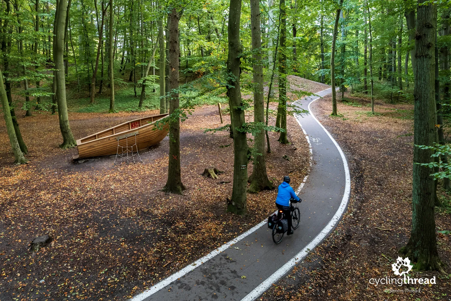
- The mysterious boat in the middle of the forest near Mielno
- In Mielno, the sea turns into a lake
- Underground mysteries of World War II
- Beautiful gothic churches of Central Pomerania
- Darłówko a bit like Danish Bornholm
- Eric I founded St. Gertrude's chapel
- Pleasant, atmospheric Darłówko at the end of the day
- The last of the beautiful seaside sceneries
- Dubai beach on the Baltic Sea
- Another fishing harbor at the end
- EuroVelo 10 like Dr. Jekyll and Mr. Hyde
- Take and ride, make use of the cycling facilities
Once R10, now EuroVelo 10 or Velo Baltica
Among the changes introduced by Western Pomerania is also a new name for the route - Velo Baltica. Thus, the coastal cycling route in Western Pomerania currently operates under three names. The oldest name, or perhaps symbol, deeply etched in the consciousness of Polish cycling tourists, is R10, which can still be found in a few places along the Baltic. The new, current name for the entire Polish section of the route, including in the Pomeranian Voivodeship, is EuroVelo 10, signifying its inclusion in the EuroVelo network of cycling routes overseen by the European Cyclists' Federation. It is precisely because of being part of this larger European entity that Western Pomerania received a European Union grant to rebuild the route. And then there's the third, newest name - Velo Baltica - beautifully resonant, evocative and fitting into the trend of adding the "velo" prefix to cycling route names.
EuroVelo 10 for a holiday or a weekend
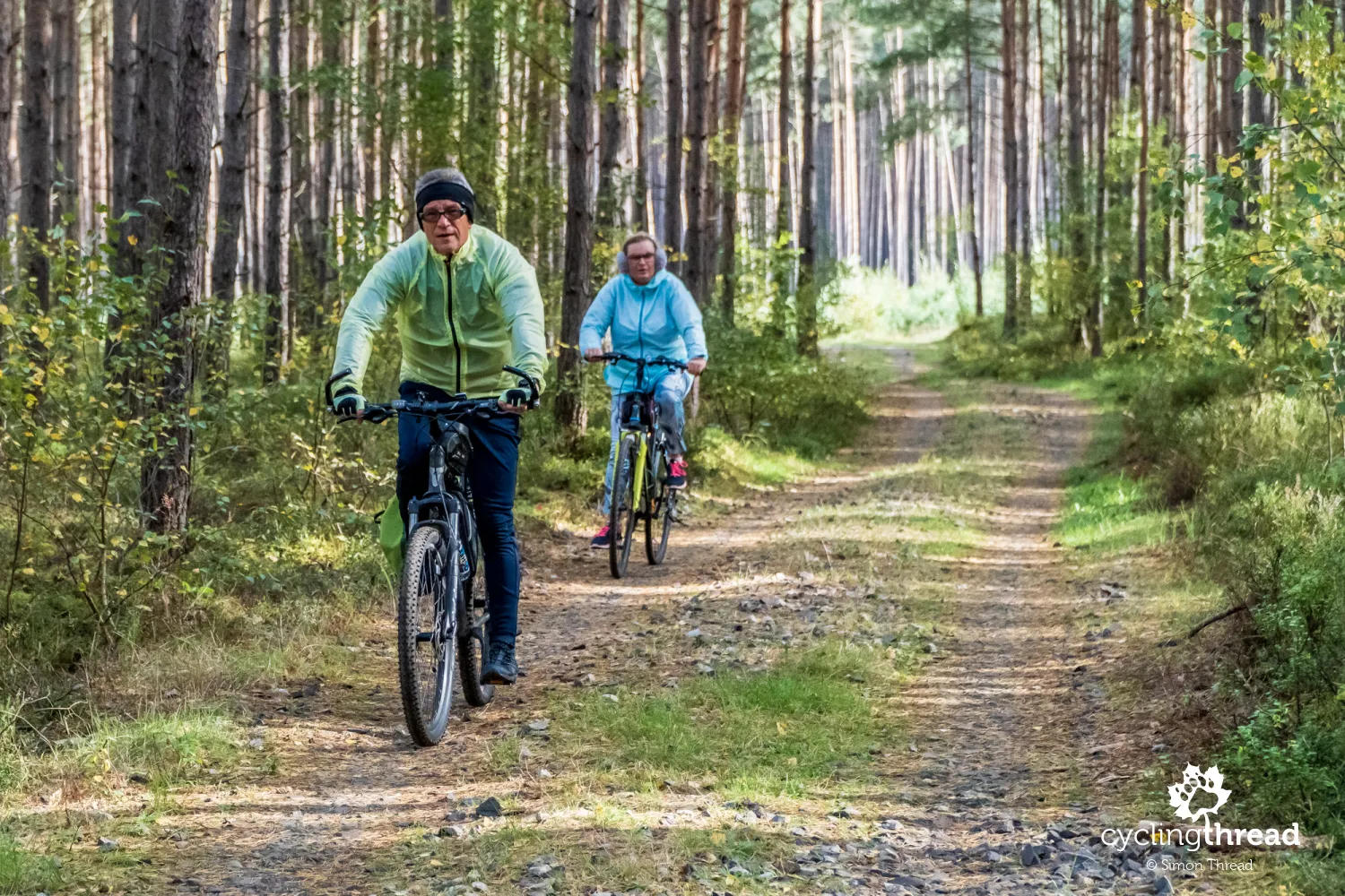
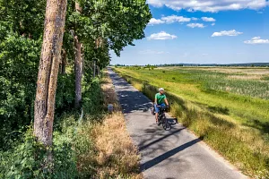
The entire length of Poland's EuroVelo 10 from Świnoujście to Elbląg is about 540 kilometers, with the segment running through Western Pomerania measuring about 240 kilometers. An average cycling tourist would need 3-4 days to cover it, assuming that they explore attractions along the way and delve into interesting places. Naturally, the route sees the most cyclists during summer - according to several counters installed along the route, thousands of people ride on Western Pomerania's EuroVelo 10 each day. But Velo Baltica can also be a perfect inspiration for a long weekend in spring or autumn, or even for two ordinary, two-day weekends throughout the year. Here, excellent train connections make it convenient to divide the route into two two-day stages: from Świnoujście to Kołobrzeg and from Kołobrzeg to Ustka.
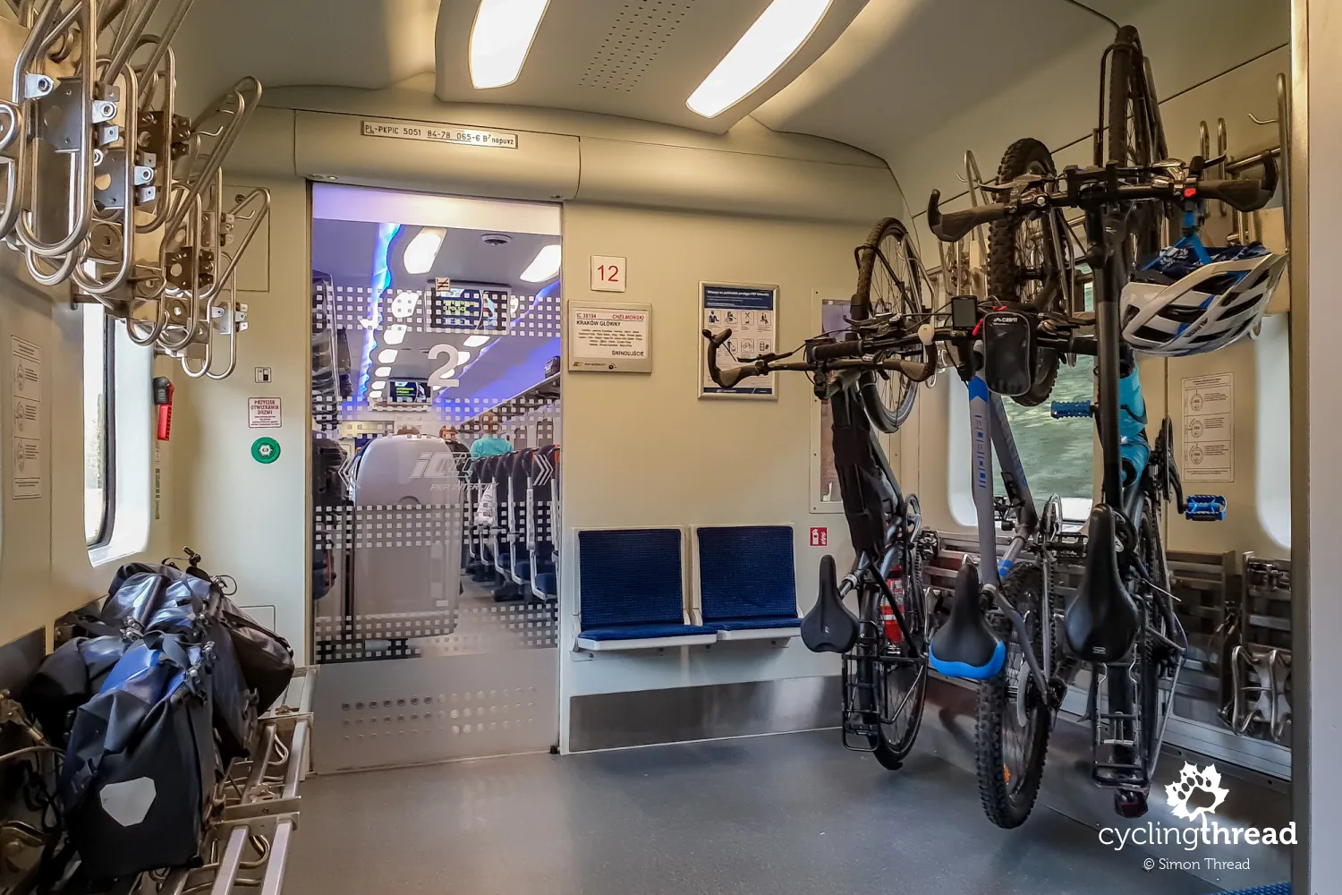
On the train, only six places for bikes
Touring EuroVelo 10 in Western Pomerania was also an opportunity for me to see what bike transport by train looks like on such a popular cycling route today. It turns out that in the afternoon trains from the Gdańsk area to Kołobrzeg and Świnoujście (from a large, nearby agglomeration to the two main starting points of the route) there are only 18 bike spots available (3 trains with 6 bike spots each). And while this may suffice off-season, in summer, when thousands of cyclists use the route daily, such a small number of bike spots in trains must be one of the "bottlenecks" in accessing the seaside cycling route. The situation looks somewhat better with trains coming to the sea from the south of Poland. In the Intercity train from Kraków to Świnoujście, which I boarded in Szczecin-Dąbie, there were 12 bike spots.
The start of the Polish part of EuroVelo 10 in Świnoujście
I arrived in Świnoujście just before sunset. From the railway station platform to the ferry terminal, where four ferries named Bielik alternately cross to the other side of the Świna, is just a few dozen meters. Most passengers are pedestrians and cyclists, but until June 2023, the Bieliks also carried hundreds of cars of city residents. Since June, car traffic has moved to a new tunnel under the Świna, which pedestrians and cyclists cannot use. Interestingly, plans to build a tunnel between the two parts of Swinemünde existed already in the 1930s. A contractor for the tunnel was even selected and work began, but it was interrupted and abandoned a few months later due to the outbreak of World War II.
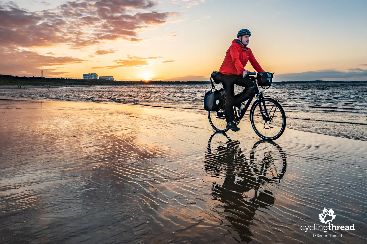
I headed straight for the beach on the northeastern tip of the Usedom island, adorned with Świnoujście's symbol - Stawa Młyny. Some mistake Stawa Młyny for a lighthouse, others for a small wind turbine. Yet, it is merely and uniquely a maritime navigation mark, indicating the waterway to the port in Świnoujście. It was built - note - exactly 150 years ago and at the end of each day attracts tourists waiting for the spectacular lighting of the mill by the setting sun and for a memorable selfie from their stay by the Baltic Sea. That day, I was among this group and, in the low-shining, autumn sun, which additionally reflected beautifully in the wet sand, I managed to quickly take a few photos. In summer, with more tourists, this would definitely be much harder, if not impossible?
"Kilometer zero" at the Polish-German border
The next morning, I start my ride at the "kilometer zero" of the Velo Baltica route, right on the border between Poland and Germany. The former border crossing, repurposed years ago as a meeting spot, sees many cyclists taking photos under symbolic flags, with some venturing along the border on wooden piers to the beach. I hope those who have already traversed the Polish coast will, in their future cycling seasons, head west from here towards Stralsund, Rostock or Lübeck to ride the Ostseeküsten-Radweg, the German part of the Baltic Sea cycling route. It's equally beautiful and interesting, boasting excellent German cycling infrastructure.
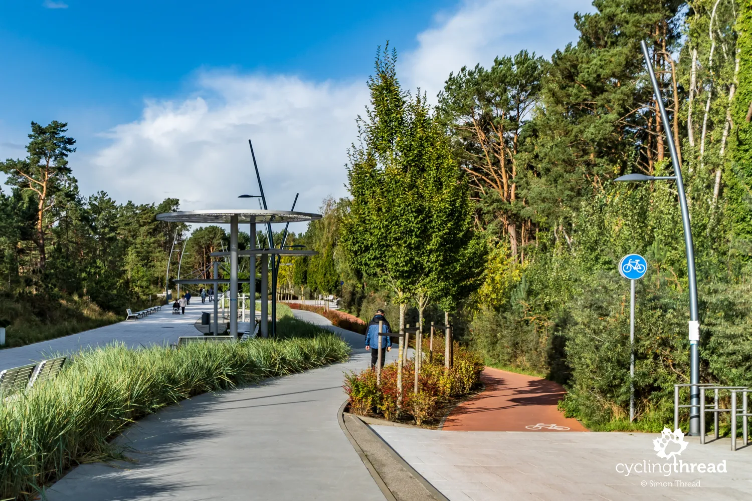
From the zero kilometer of Poland's EuroVelo 10, I head east. I pass the brine graduation tower in Świnoujście, enter the seaside district and ponder how Poland appears to cycling travelers, for whom this is likely their first encounter with our country. I would certainly shield them from the terrible advertisements and tacky signs that flood exactly all Baltic cities. And I would replace the not-so-comfortable pedestrian-bike path, which leads cyclists through Świnoujście for the first few hundred meters, with a ride through the impressive Health Promenade - a multi-functional, recreational pedestrian-bike space running parallel to the current route. This kilometer-long promenade was built in 2019 and among its awards and recognitions is the title of Best Public Space of the West Pomeranian Voivodeship.
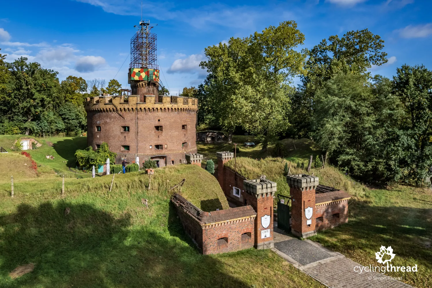
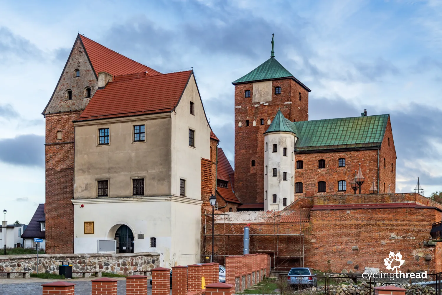
The impressive Prussian forts of the Świnoujście fortress
When planning a morning departure from Świnoujście, it's worth considering that the impressive Prussian forts of the Świnoujście Fortress, for which the city is known, might detain cyclists for a longer while. Two of the four forts are open for tours - the expansive Fort West and the much smaller Fort Angel, both directly along the EuroVelo 10 cycling route. The others - Fort I in Warszów was dismantled in the 1970s and Fort Gerhard has been inaccessible since April 2023 due to a ban on entering the area around the under-construction LNG terminal in Świnoujście, imposed by the West Pomeranian Voivode. All forts were built in the mid-19th century during the wars of Prussia with Denmark and France, although the first Prussian fortifications here started in the 17th century during Danish and Swedish invasions of Prussia. Before and during World War II, the forts were expanded and used for military purposes, as Swinemünde was then the largest port of the Nazi Kriegsmarine on the Baltic Sea.
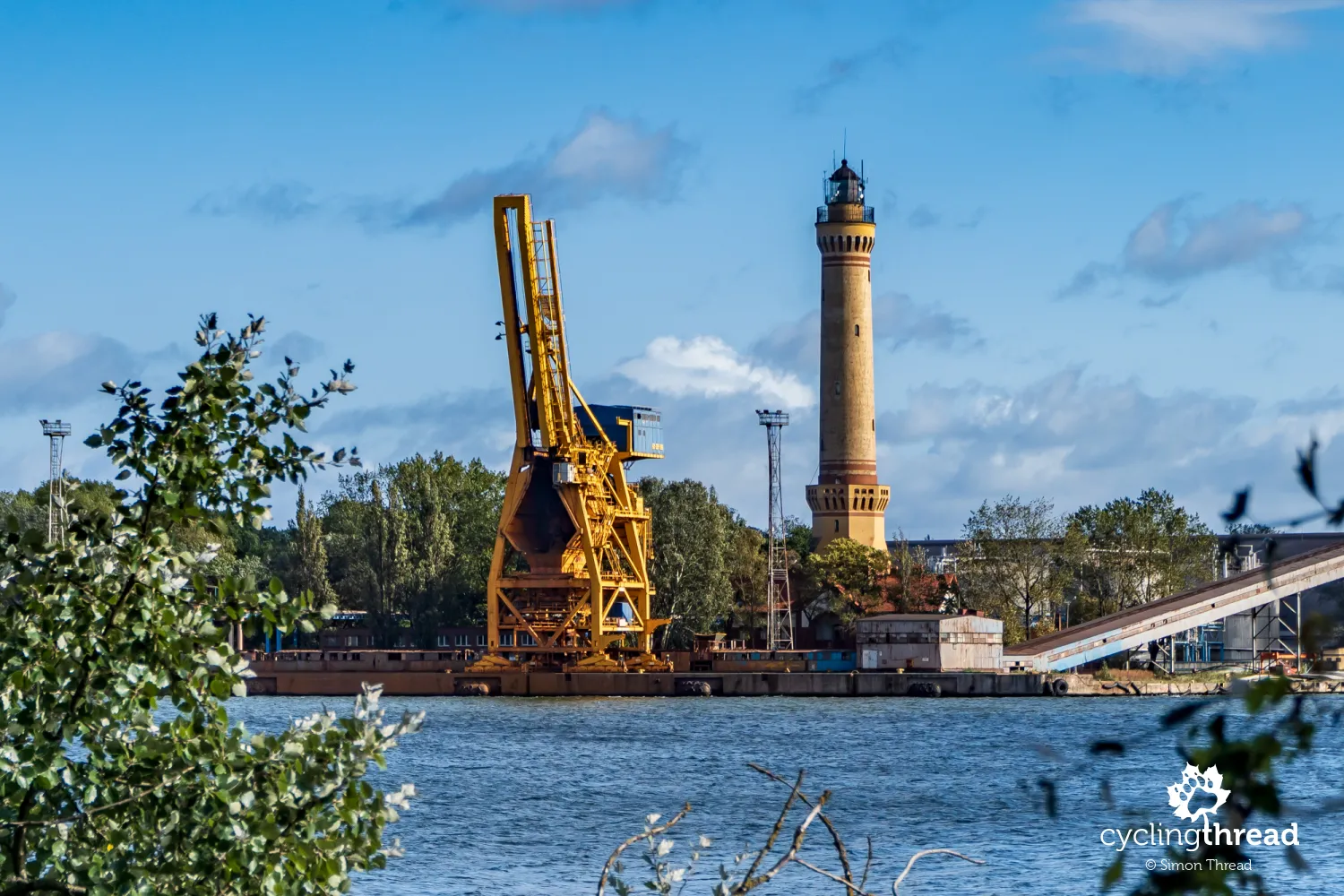
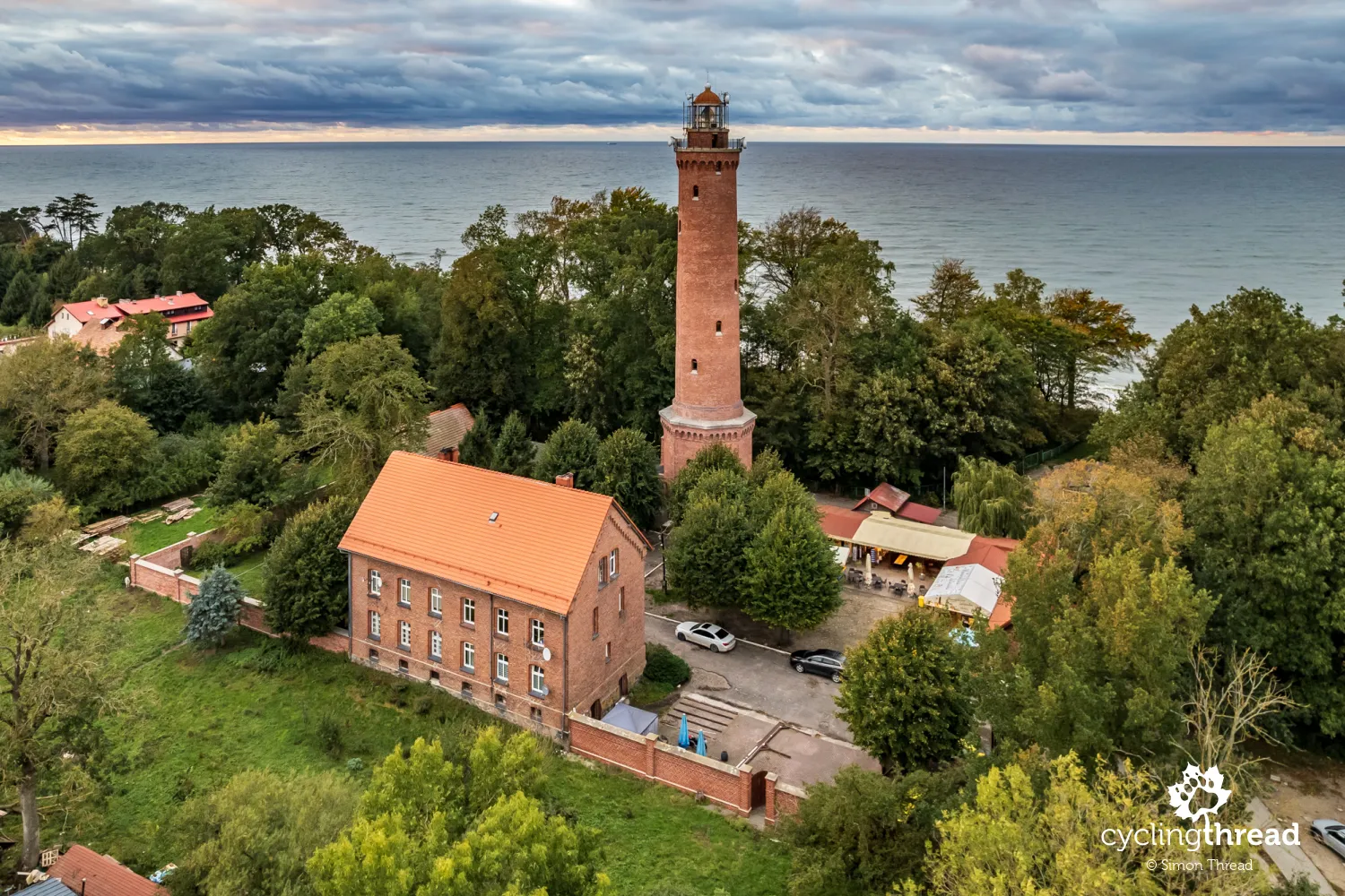
The tallest lighthouse on the Baltic Sea
Riding the bike path along the Świna towards the ferry crossing, especially near Fort West and Fort Angel, it's worth keeping an eye on the other side of the river. There, amidst tall, modern port cranes, somewhat obscured by them, stands the Świnoujście lighthouse. Built in the same period as the forts, from 1854 to 1857, the Świnoujście lighthouse reaches a height of 68 meters, making it the tallest lighthouse on the Baltic Sea and placing it among the top 20 tallest in the world. It is the first in a series of several objects that create the popular route of lighthouses on the Polish coast. Unfortunately, as long as Russia's aggression against Ukraine continues, closing the area around the LNG terminal, the view from the other bank will be the only way to see the Świnoujście lighthouse.
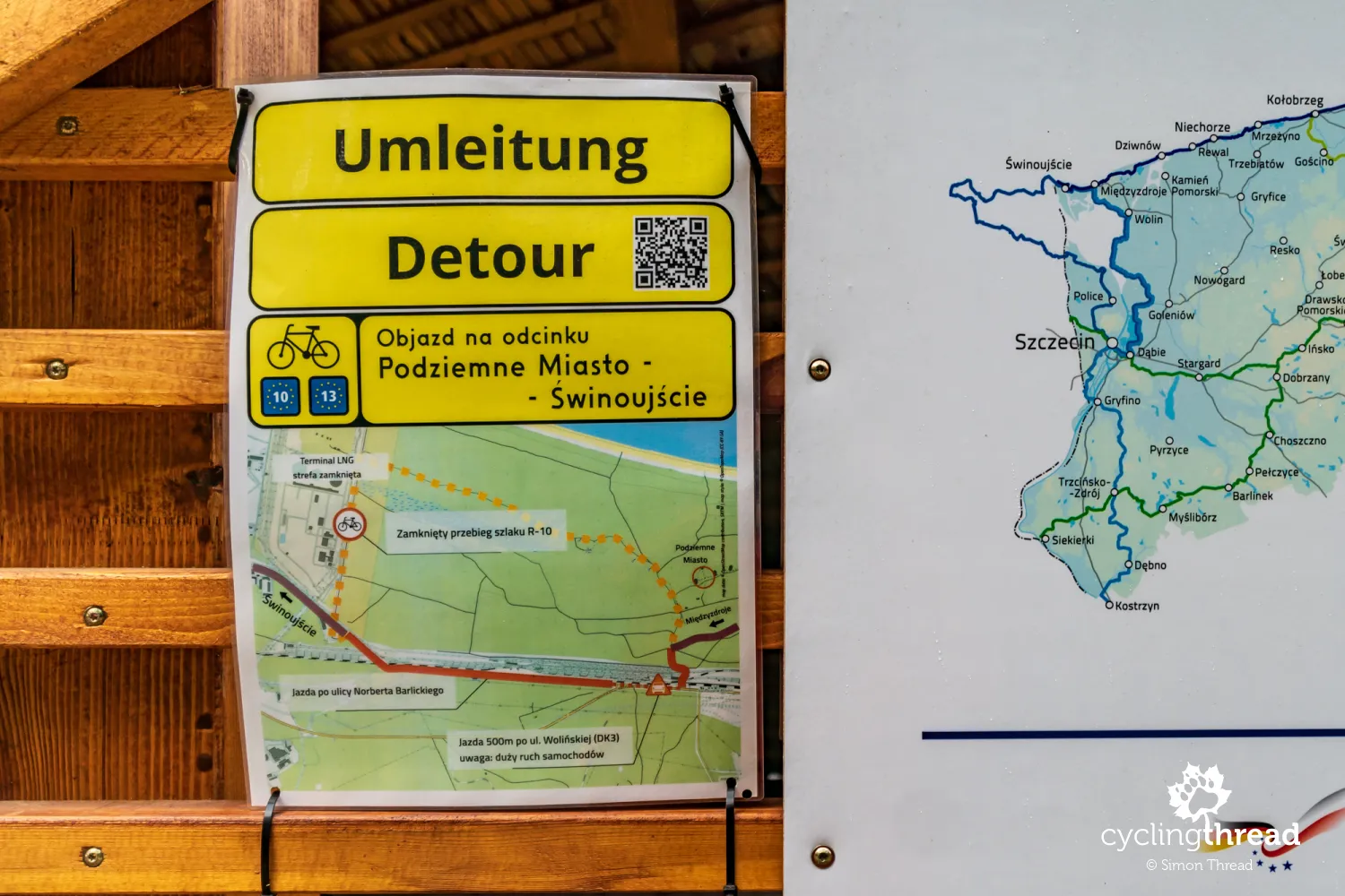
The LNG terminal construction changes the route
At the gates of Świnoujście, I find information about a detour and a new route for EuroVelo 10 - all due to the aforementioned construction of the LNG terminal, a maritime facility for liquefied natural gas unloading. Near the construction site, the path is barricaded, with the Railway Protection Service and police officers standing guard. The alternative section from Świnoujście to the Underground City is probably the worst along the entire route - it leads through forest roads, sometimes quite uneven and a bit rocky, places seemingly hastily solidified to provide cyclists with at least minimal conditions for an emergency passage. It's not great, but not a disaster either. However, one can feel that it's a forced, temporary detour far from the proper, intended character of West Pomeranian EuroVelo 10. As a consolation and to distract, I spot a characteristic white tail on a large bird circling above me - it's a white-tailed eagle!
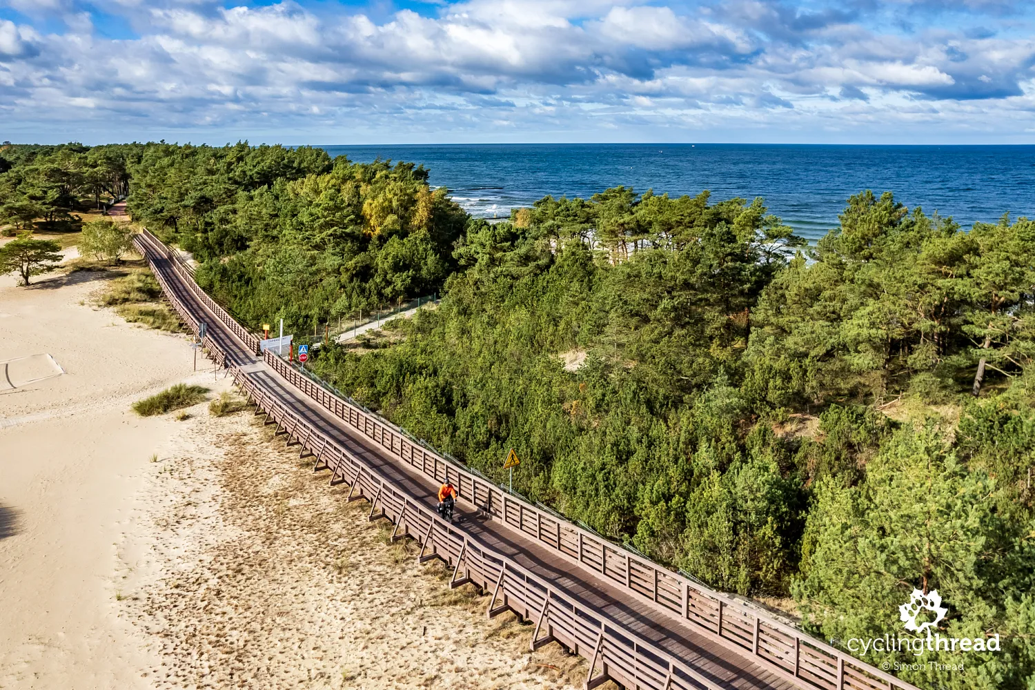
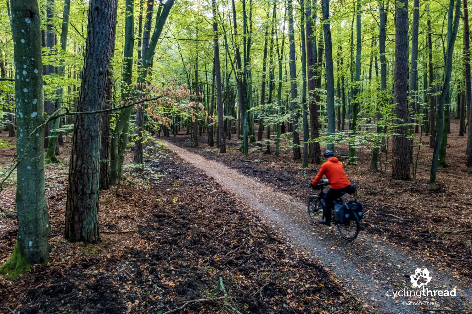
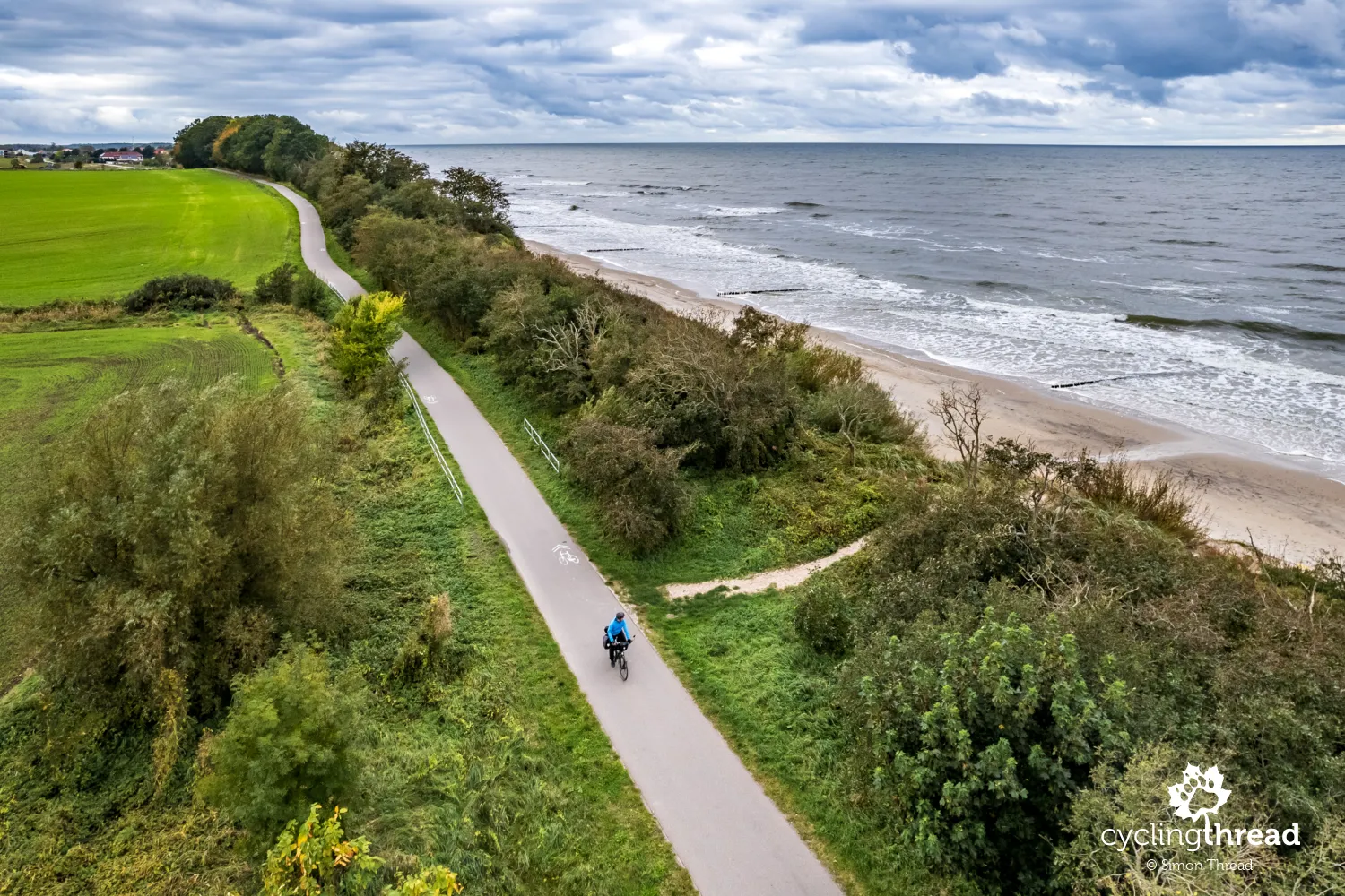
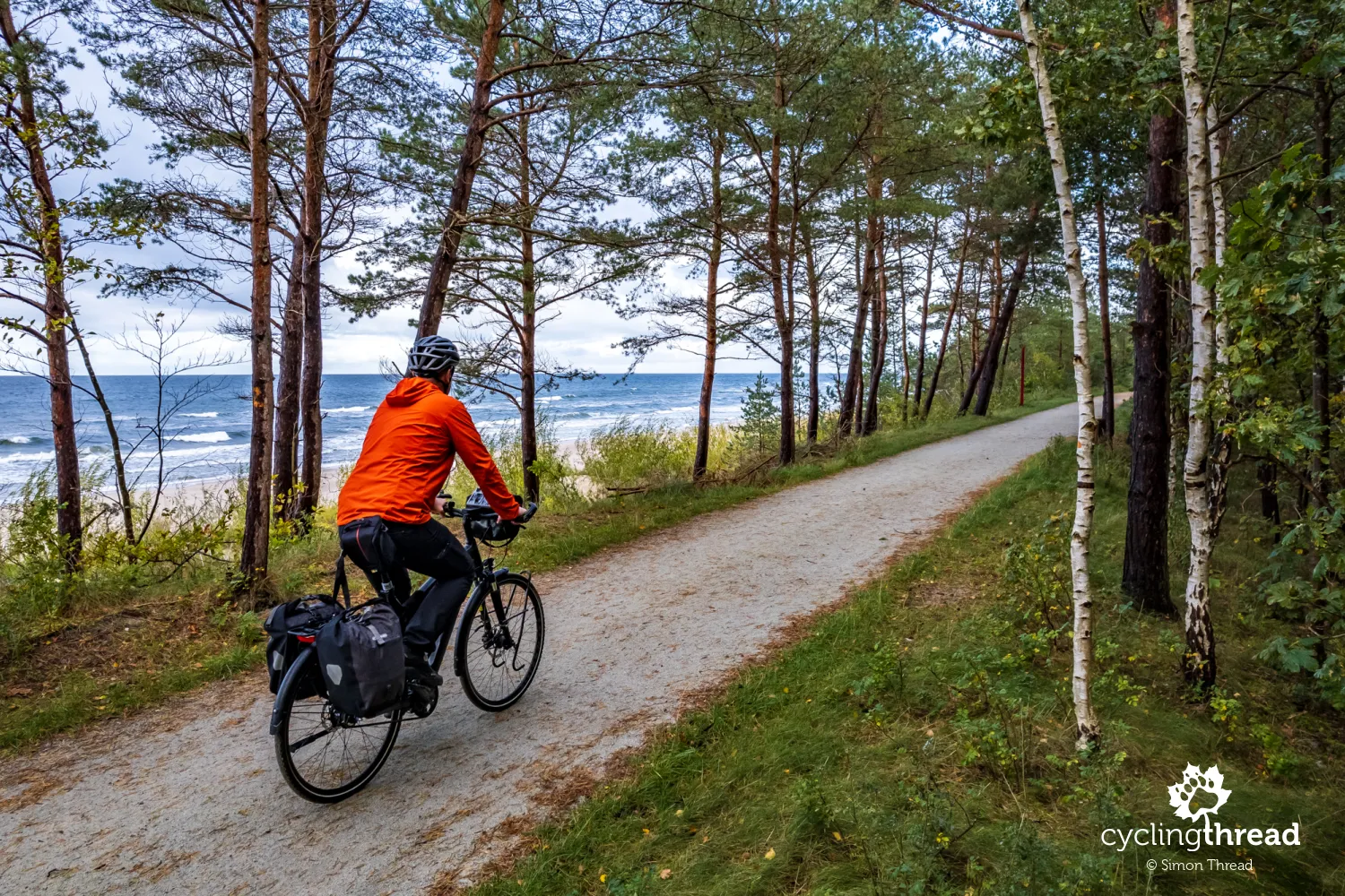
The first scenic section before Międzyzdroje
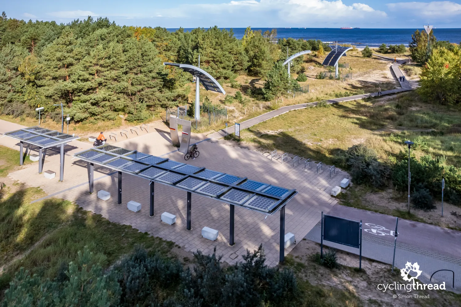
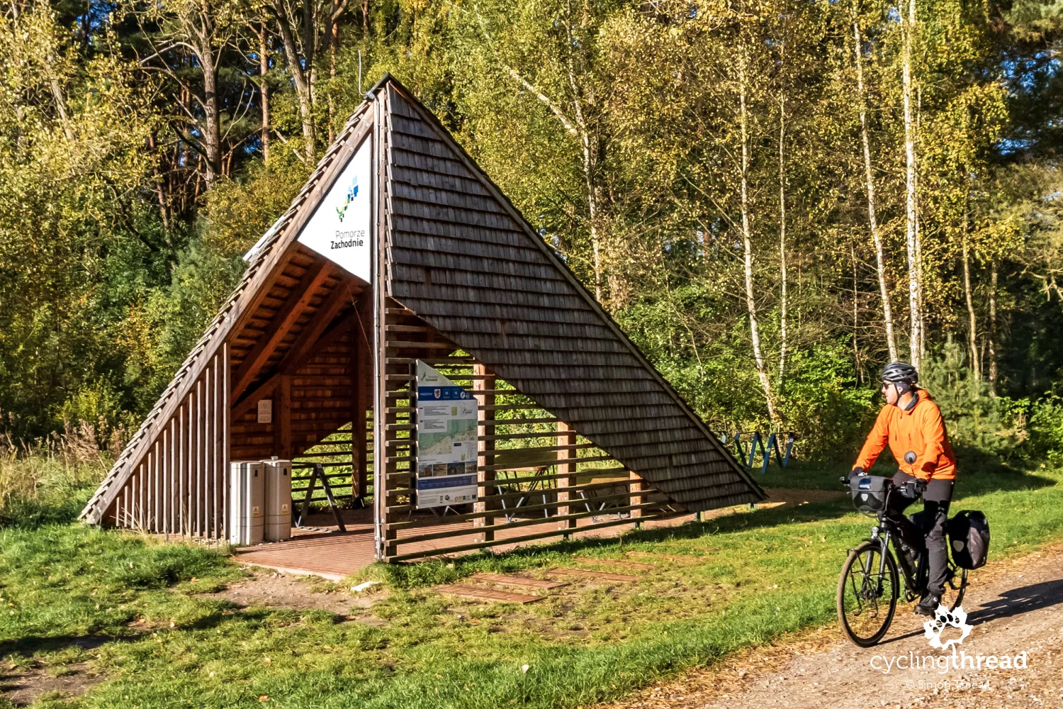
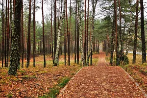
I encountered the first of the newly built sections of the Baltic Sea cycling route just before Międzyzdroje. To enter it, one must turn left at the signpost and push through the sand over a steep dune embankment. First, a short, though steep and sandy climb, then a similar descent, unfortunately with dangerous roots acting as thresholds and I emerge onto a more than 2-kilometer stretch of gravel bike path by the sea. Riding here is excellent - it's precisely these sections of the Baltic route that draw tourists. And although the bike path is mostly separated from the beach by a thin curtain of seaside forest, even though I was chased away by a sudden downpour on my first visit, I think that riding it will be one of the most frequently recalled experiences from a trip along the Baltic coast. Many cyclists will surely compare it to the spectacular section of the R10 cycling route on the Vistula Spit. Roughly halfway through this segment, Western Pomerania has placed one of its new cyclist shelters, where we can effectively shelter from rain and wind.
On the wall of the cyclist shelter, I once again come across route information about a cycling detour. This time it's for those heading towards Świnoujście, informing about the detour around the LNG terminal I've already passed. The emergency yellow signs, instead of the traditional orange, and the English and German words draw attention to the important message. While a legend explaining the various colors and types of lines would enhance clarity, the mere presence of such aesthetic communications on the route must testify to Western Pomerania's maturity in organizing bicycle tourism. By the way, printing the message to look like a route board is a great idea - it's aesthetic, understandable and very coherent. However, only after returning do I check the QR code, watch the video it directs to, and... see that the forest variant I instinctively took is not the recommended one. Still, I believe... "my" forest variant is better and much safer than the officially proposed one.
Cyclist-friendly places in Western Pomerania
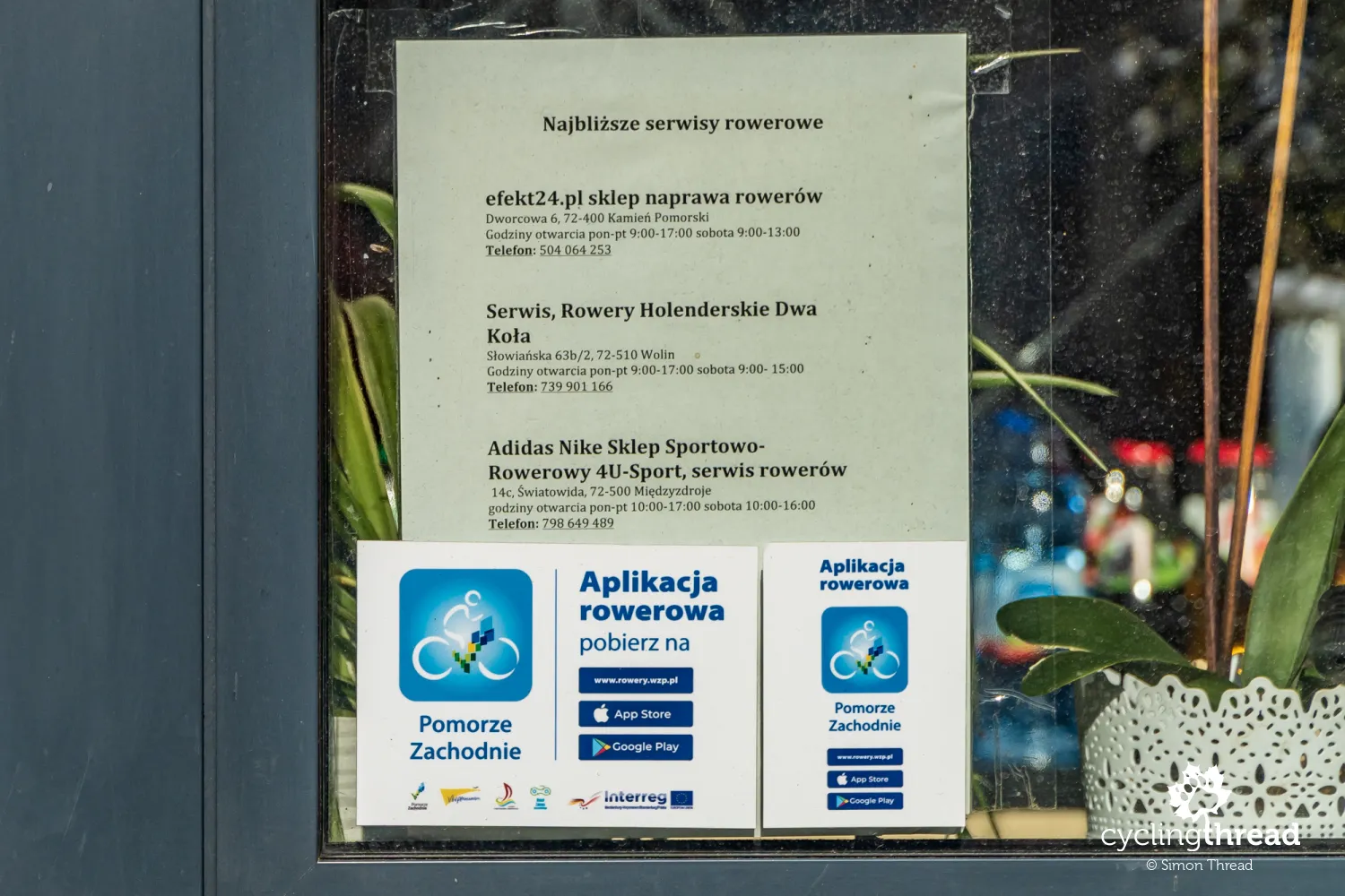
Another element that speaks to the seriousness with which Western Pomerania treats cycling tourism is the network of Cyclist-Friendly Places. These are businesses and institutions offering various services, most of which are accommodation facilities - campgrounds, youth hostels, hostels, guesthouses and hotels, whose most important commitment to cyclists is providing overnight accommodation for one night, which can be challenging to find by the sea during summer. Each of these places should also offer a locked, secure room for bicycles. The list of Cyclist-Friendly Places also includes dining establishments, shops and bicycle services, with the full list available on the official Cycling the Western Pomerania project website and in the new app, including on the map. It's also important to know that every Cyclist-Friendly Place must display a visible list of the nearest bicycle services with a phone number, like this list posted by the Port restaurant in Międzywodzie. Such information sometimes saves a cyclist's life.
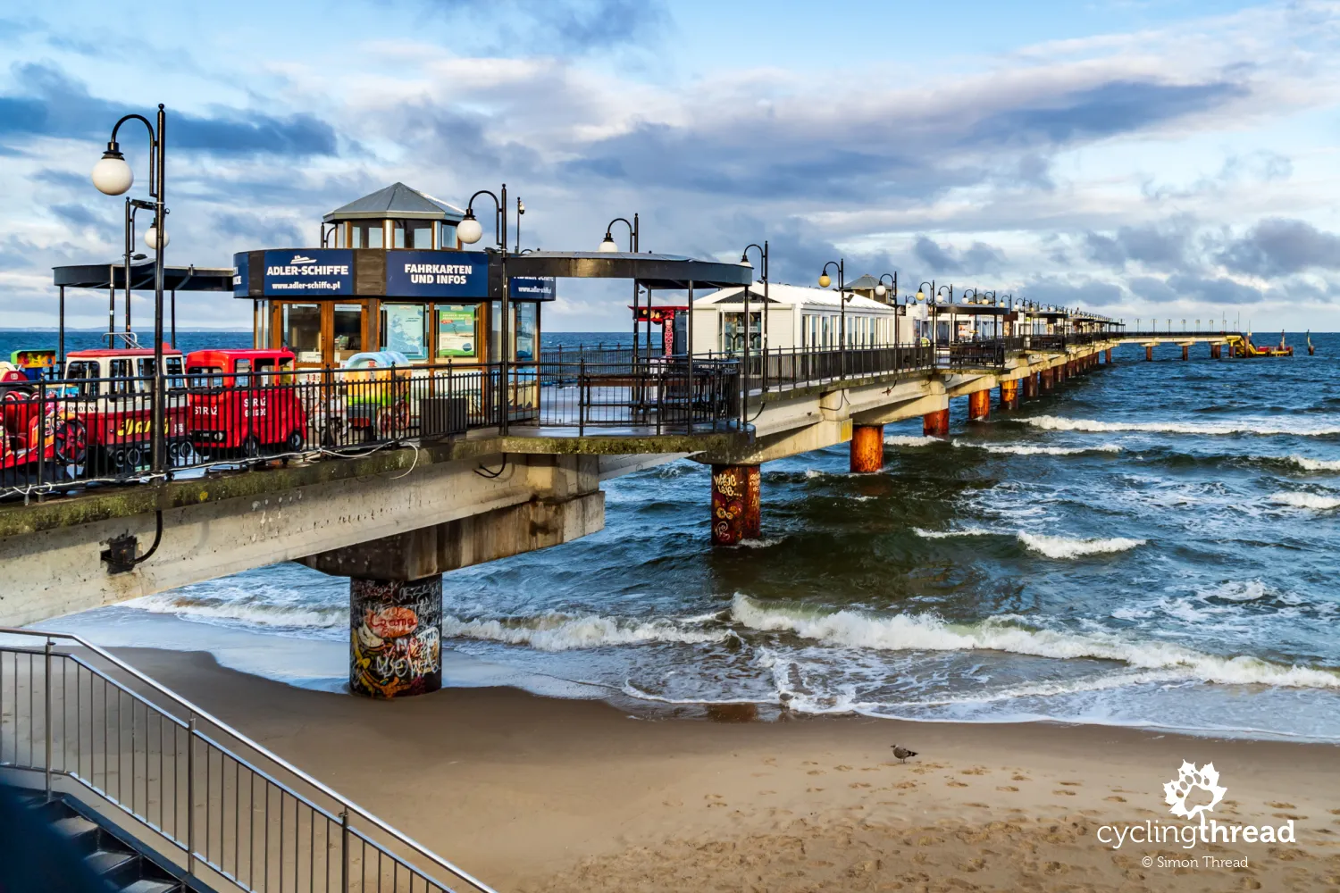
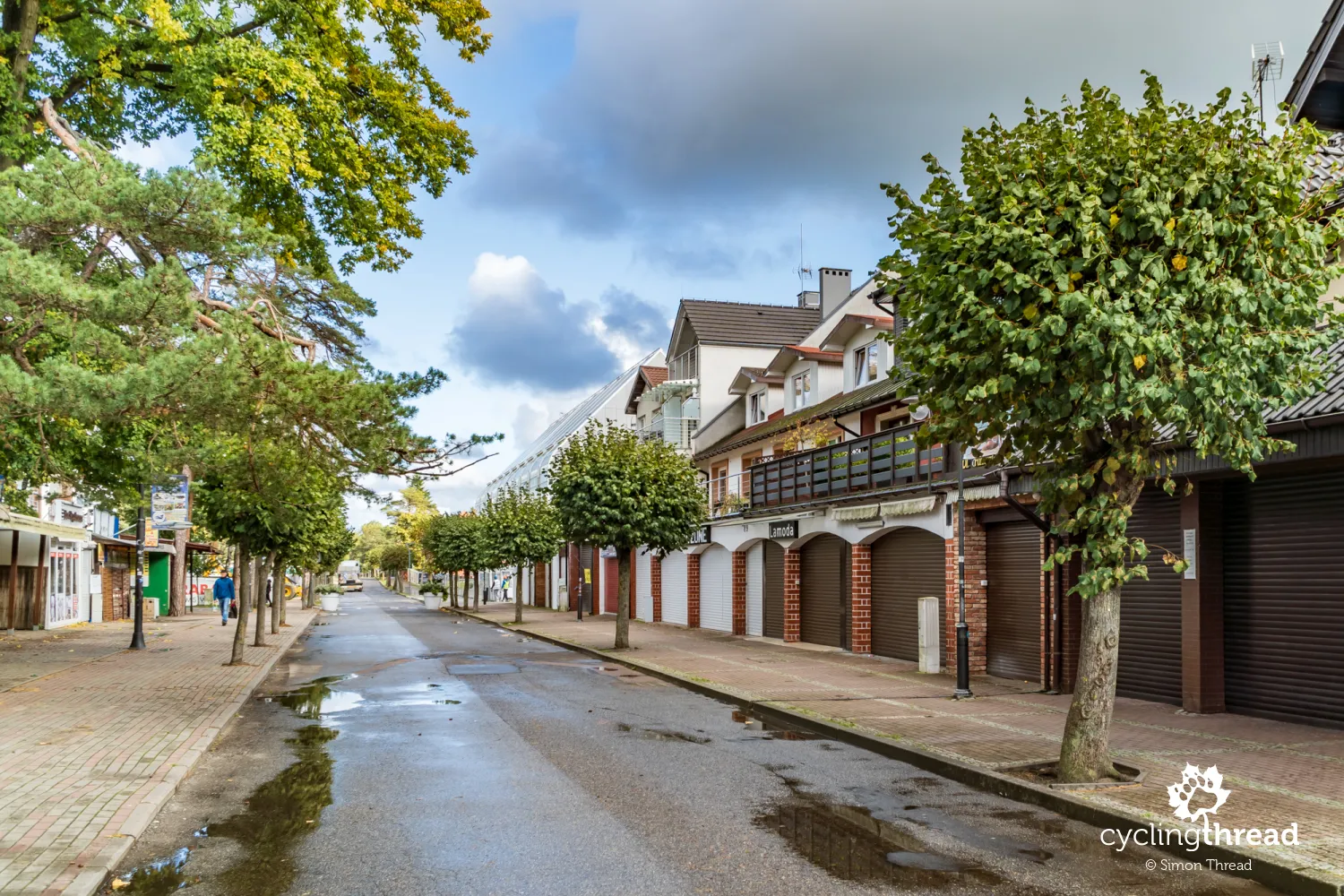
Stalls instead of a capsule in Międzyzdroje
Entering Międzyzdroje, I wondered if a submersible capsule had already been built at the Międzyzdroje pier, which would allow visitors to descend to the bottom of the Baltic Sea - I read about such plans from a German lessee a few years ago. However, the capsule is still not there, and Międzyzdroje, which once seemed elegant to me, now looks the same as other seaside "resorts." In the square in front of the pier, food outlets compete to attract customers with the largest signs, a perfect illustration being the surroundings of the Aurora hotel. The elegant building is engulfed by dining establishments and "spiral ice cream" (naturally paired with waffles) has even overshadowed the stylish hotel sign. To walk on the Międzyzdroje pier, one first has to navigate through a commercial passage full of cheap imports, second-hand stores and blaring disco polo music, then similar pavilions are to be avoided on the pier itself. I'm convinced that the mayor and officials responsible for the aesthetics of once-elegant Międzyzdroje do not visit their own pier. And I don't blame them.
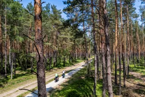
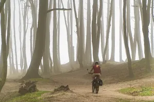
Pleasant gloom in the Wolin National Park
A large, wooden gate on the route at the edge of Międzyzdroje signifies that the route is now entering the Wolin National Park area. The dense forest through which the road runs is surely a blessing during the summer heat. Early autumn here brings a pleasantly gloomy atmosphere and the slightly yellowed underbrush nicely complements the still-green leaves on the trees. Unfortunately, I forget one of the basic rules of planning trips and arrive in Wolin on a Monday. This means that both the Wolin National Park museum in Międzyzdroje and the bison show farm, one of the biggest attractions on the route, are unfortunately closed. I am left with a solitary, quiet ride through the beautifully wild national park - on a Monday morning, it is wonderfully, unnaturally quiet. And the natural character of the road does not bother me at all. By the way, this customary Monday closure at the Wolin National Park facilities is exceptionally inconvenient. After all, most cyclists who, like me, arrive at the start of the route in Świnoujście for the weekend, will reach the Wolin National Park exactly on Monday and find these very attractive places closed. Could Monday in Wolin possibly be on Friday?
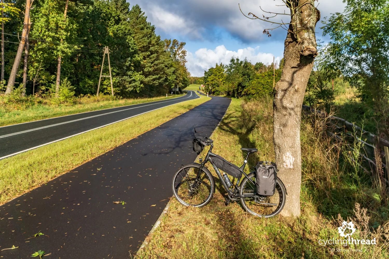
New cycling roads for tourists
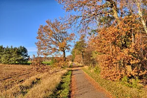
Between Wisełka, Kołczewo and Międzywodzie, the EuroVelo 10 route in Western Pomerania enters new asphalt cycling paths for the first time, running alongside local public roads. I am not a fan of such cycling paths for bike tourism, as they don't provide the tranquility and close contact with nature cyclists expect. Instead, they often force us to ride alongside busy car roads, amidst noise and exhaust fumes. However, I appreciate that these new cycling paths often replace parallel sandy forest roads, which the popular R10 route was once famous for. Secondly, where bike traffic previously mingled with general traffic, new cycling paths free cyclists from the necessity of dangerously sharing the road with substantial holiday car traffic. In summary, such initiatives increase the accessibility of cycling routes among more demanding social groups like families with children, older people, or those with disabilities, and the Velo Baltica does not run on roads of this type too often.
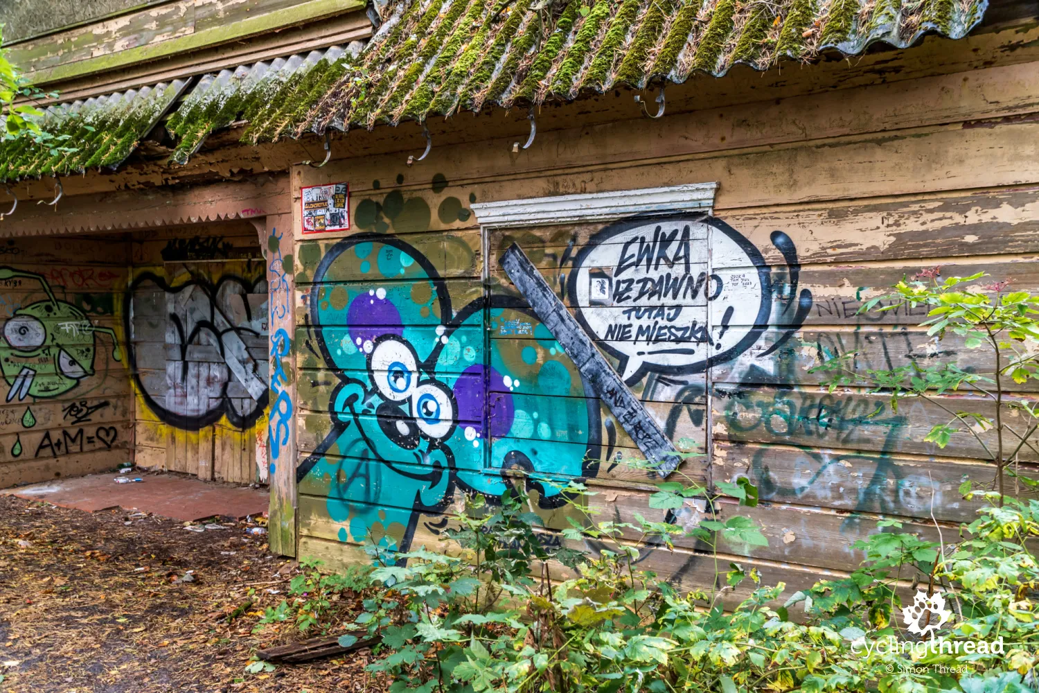
The forgotten house of Adolf Hitler’s lover
Entering Pobierowo, I veered off the route for a moment and soon stood in front of a rather unusual and - due to its nature - rather informal attraction. It's the house of Eva Braun, the lover and wife of Adolf Hitler, now a neglected building located in a dense forest near the cliff edge. The informality of the attraction means there are no signs leading to the chancellor of the Third Reich's lover's house, making it best navigated by Google Maps location pointers. Alternatively, you can turn left at the end of Bałtycka Street and follow a sandy forest path for about 100 meters. There's no evidence Hitler ever visited, but visits by another Nazi criminal - Hermann Göring, commander of the Luftwaffe - are confirmed.
Seaside towns losing their traditions
And Pobierowo… In a report like this, I wish I could only marvel at the atmosphere of seaside towns, but when there’s nothing to marvel at, I feel a journalistic duty to write about it too. Perhaps it was in Pobierowo where I felt the most discomfort seeing how the streets of seaside towns are "arranged." Here, almost everything is subordinate to the short summer season, effectively excluding main streets from use during the rest of the year. Among other places, it is in Pobierowo where you ride along streets past successive closed-up bars, shops and stalls, which until May or June will only be visited by the wind and workers, building another multi-story apartment building nearby. Coastal towns en masse, right before our eyes, are losing their original character, their traditions and with thoughtless and plan-ignoring constructions, they all merge into one architectural chaos. What a pity we do not care for our coast as our neighbors - the Germans and Danes - do.
The sea was once two kilometers further away
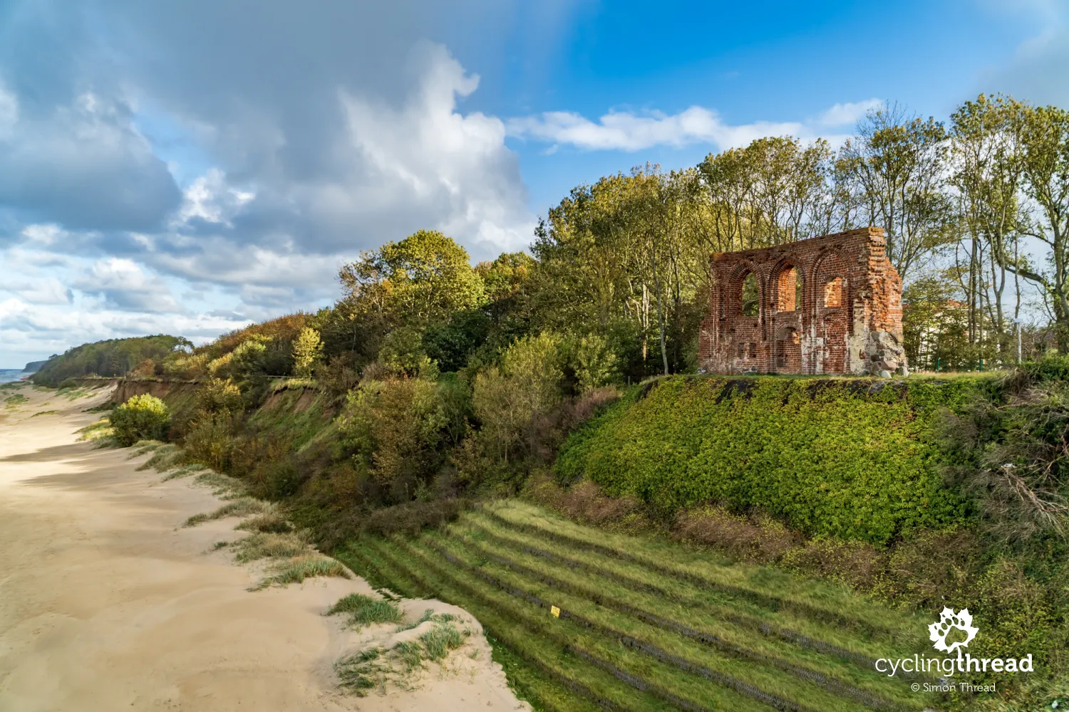
Soon after Pobierowo, the EuroVelo 10 crosses Trzęsacz with surely the most famous, enduring church ruin in Poland. However, not everyone visiting this place realizes that when it was built - at the beginning of the 15th century, 500 years ago - the sea shore was as far as 2 kilometers away from the church in Trzęsacz! Over the first 250 years of the church’s existence, the elements took as much as 150 meters of land - by 1750, the distance to the shore had shrunk to merely 58 meters. In 1874, only 1 meter remained and the last service was held, waiting another 27 years for the moment when the first wall of the church would fall into the sea. By 1930, only the southern wall stood on the cliff, whose small part, for the last time, fell off the cliff in 1994. It seems that the small surviving part of the church in Trzęsacz, protected by special terraces, now truly marks the last chapter of this extraordinary story.
Under the beautiful lighthouse in Niechorze
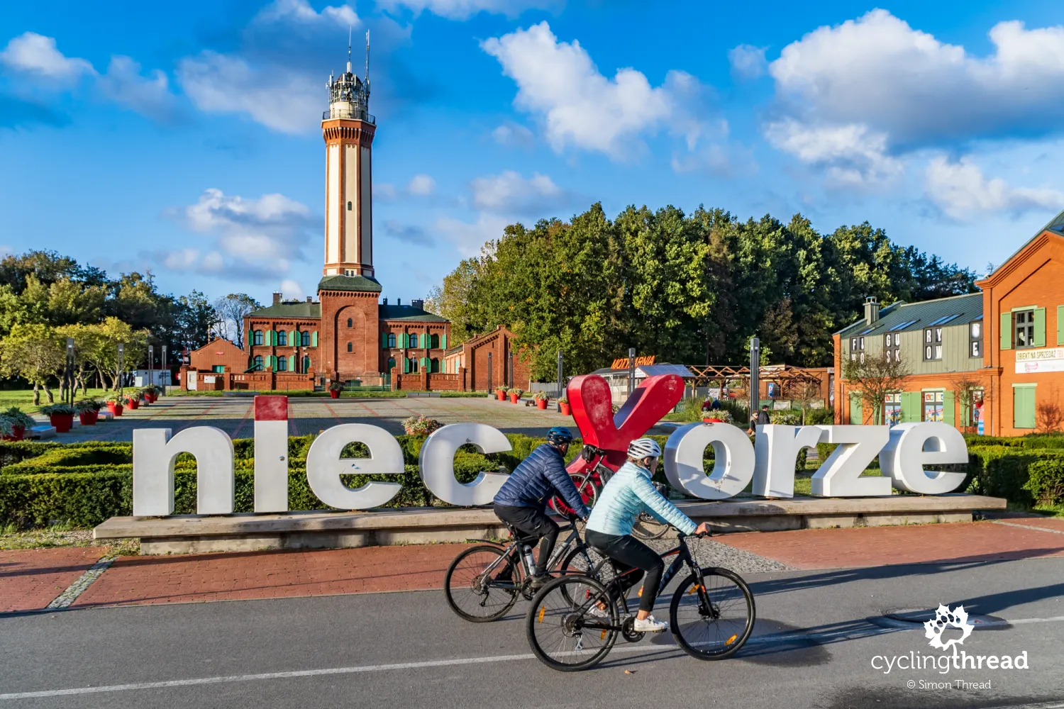
After quickly passing through Rewal, I gladly stop under the beautiful lighthouse in Niechorze. Built in 1866, it has stood here for over 150 years, fortunately surviving World War II, though it nearly was destroyed by mines left by retreating Germans. Well-maintained, it underwent renovation this year, which included painting and replacing window frames in the original green color. An interesting fact is that the lighthouse's rotating light mechanism comes from a German submarine and still serves reliably today. Can it be seen from the viewing terrace available to visitors? Among the eye-pleasing things around the lighthouse are also the private service pavilions standing nearby - it's noticeable that they were built to match the lighthouse's appearance, with brick facades and green shutters. So... it can be done! The huge sign with the town's name for a souvenir photo was also thoughtfully placed - just a few steps back allow you to also include the charming lighthouse in the frame.
Cycling path along the railway line
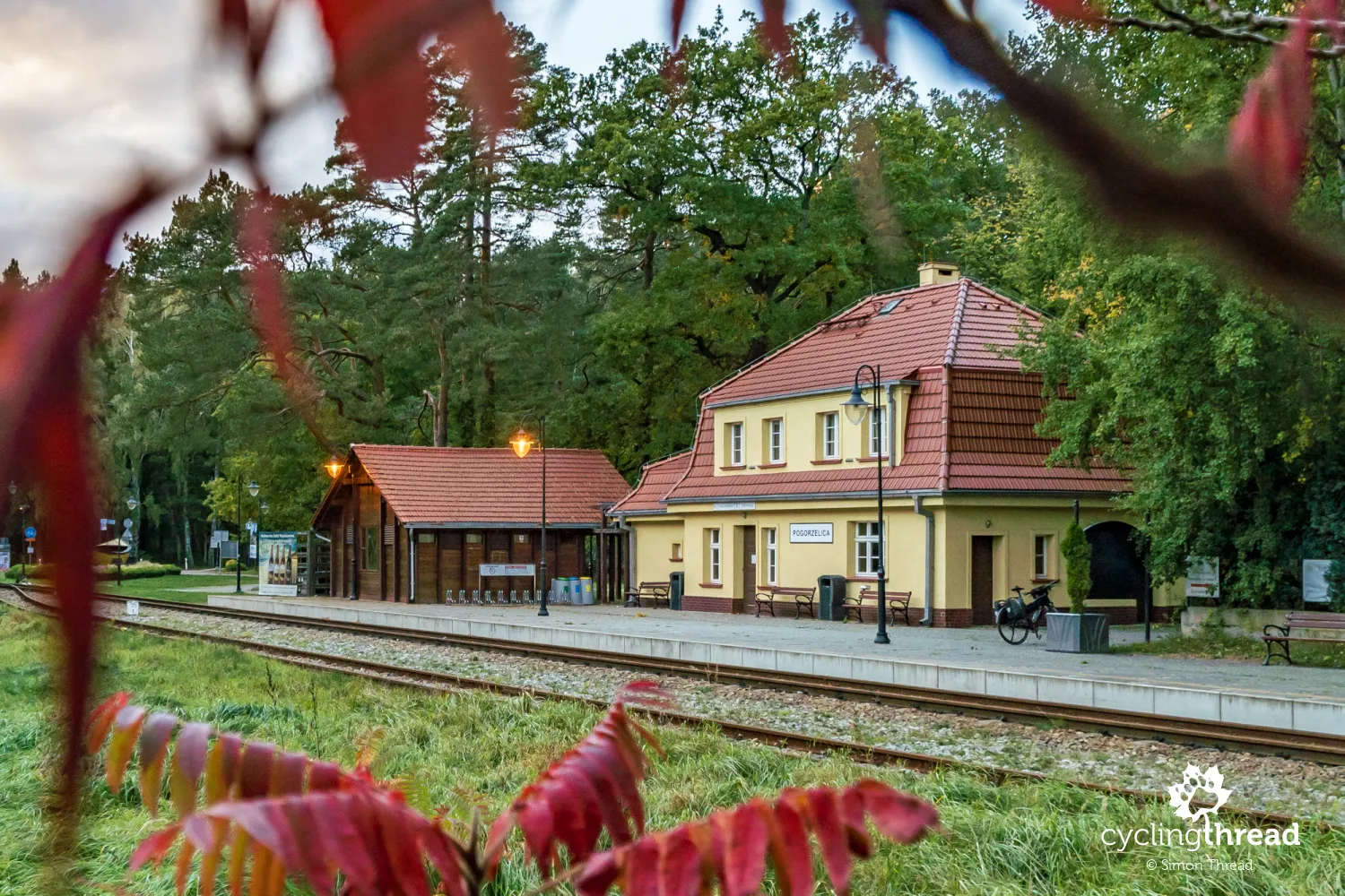
A kilometer and a half from the lighthouse in Niechorze begins another "special" segment - this time, the path runs alongside the tracks of the seaside narrow-gauge railway. The asphalt bike path connects the station of the Seaside Narrow-Gauge Railway in Niechorze with the historic, over 100-year-old railway station in Pogorzelica. It's a pleasant, fast, 10-kilometer section along the shores of Lake Liwia Łuża, with two piers that offer a nice break along the way. The break can be even longer if you hop on the small train car with your bike. After Pogorzelica, another gravel section begins through the seaside pine forest, which I find myself traversing after dark. Although it's only early autumn, the days are noticeably shorter and there are still just as many attractions to see - unfortunately, I don't have enough time to enjoy all the features of the Velo Baltica route.
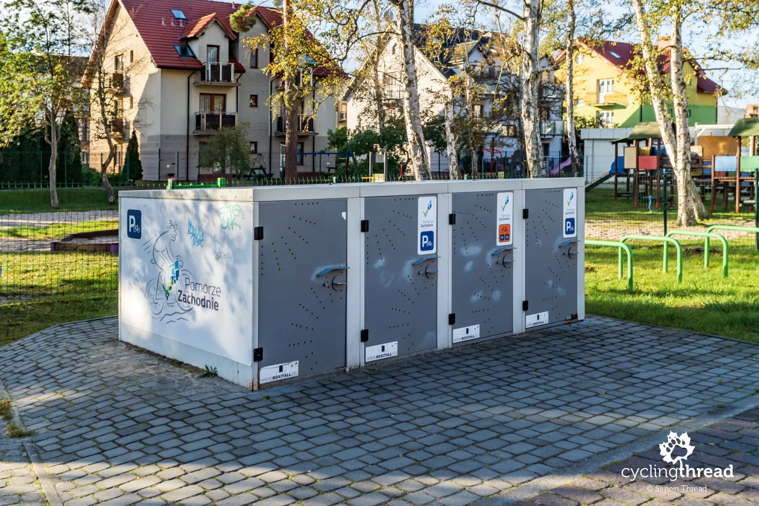
Shelter with electricity and bike boxes in Mrzeżyno
Just before Mrzeżyno, near a military unit's territory, I notice another characteristic feature of the cycling paths in Western Pomerania, a rest shelter. The hosts of West Pomerania even call it a model rest place, due to the fact that it offers tourists free access to electrical power. Just bring a USB cable or a regular one to charge your phone, drone, or bike navigation battery - power is available from May to September and is turned off for the rest of the year due to weather conditions. However, the shelter's almost open structure, practically lacking side walls, means it likely won't offer much protection from the wind.
In Mrzeżyno itself, opposite the hilltop Church of the Apostles Peter and Paul, I notice special bike boxes. Installed by the region, they are meant to facilitate cyclists who can safely park their bikes here, then head to the beach with just sunscreen and a towel. Or for an overnight stay - just with a pannier, without worrying that the hotel or guesthouse hasn't provided a secure room for bikes. The idea is excellent, as we've seen identical solutions in places like the Oder-Neisse cycle route in Frankfurt an der Oder or the Loire Valley castles route in Angers. However, four boxes are definitely not enough, not only for the entire route but even for a single town. I'm also not sure if the boxes can accommodate any bike, as at first glance the width of the box seemed clearly smaller than the width of my trekking handlebars. Unfortunately, I couldn't check this as there was no information available on how to gain access to the boxes. My inquiry through the app was answered with information that the keys are managed by the Mrzeżyno Sports Centre.
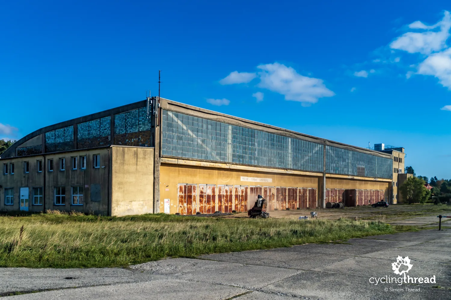
The closed aviation museum in Rogowo
Looking up information about attractions along the Baltic Sea cycling route, it's hard not to come across details about the Aviation and Military Technology Museum in Rogowo. The museum is housed in an airport hangar, a remnant of the German military airport established here in the 1930s. The airport in Rogowo even serviced seaplanes, which landed on Lake Resko Pomorskie, located a few hundred meters away. Before reaching the town, I turned into the marked spot on the map and... found a huge hangar closed. Fortunately, I managed to talk to the caretaker passing by, who let me in for a moment, asking not to take photos. It's a shame because the interior is impressive - it houses military aircraft from various periods, military vehicles of various types, WWII wrecks, even cars. Some of these exhibits belong to the Polish Arms Museum in Kołobrzeg. I learned that the German hangar requires renovation and until it's completed, this military open-air museum will remain closed.
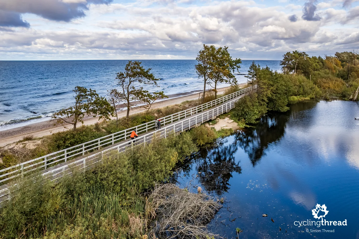
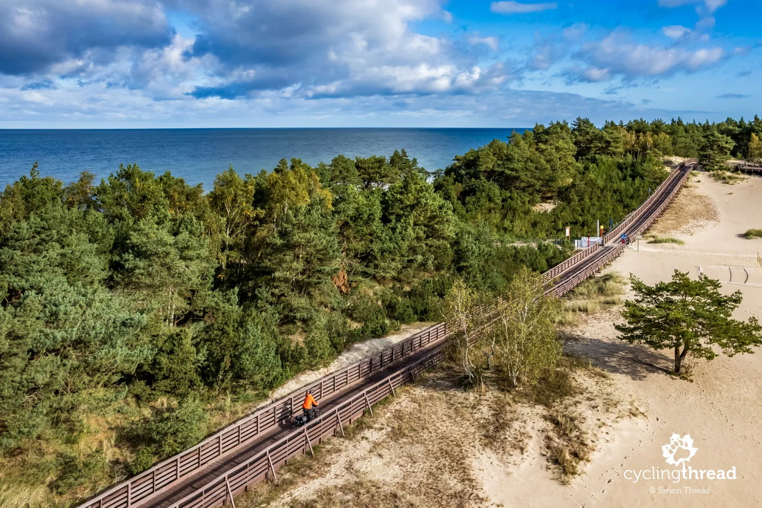
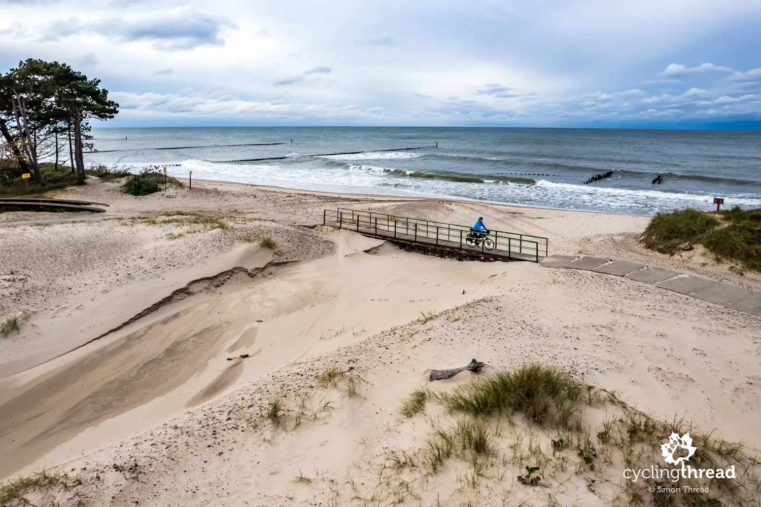
Cycling footbridge along the Dźwirzyńska Fryer
At the end of my ride through Dźwirzyno, despite the lack of signposts for the EuroVelo 10 turn, navigation suddenly directed me left, between holiday resorts, and soon I found myself on the Dźwirzyńska Fryer, a roughly 300-meter-long dune area on the edge of the town. Between it and the Baltic Sea runs a 200-meter wooden footbridge, another impressive feature of the route. Its end is crowned with a wooden viewing platform, from which you can admire the Fryer area, and a bit further there's another, glass-enclosed viewpoint overlooking the sea. I forgot about it during my ride - what was I thinking? Maybe about whether the absence of cycling signposts at the main street is intentional, possibly due to the narrow width and conflicts with pedestrians, or maybe because the surface is supposedly dangerous for cyclists during rainfall - intentionally limiting bike traffic on the footbridge? Be aware not to miss this original spot and to navigate through it carefully.
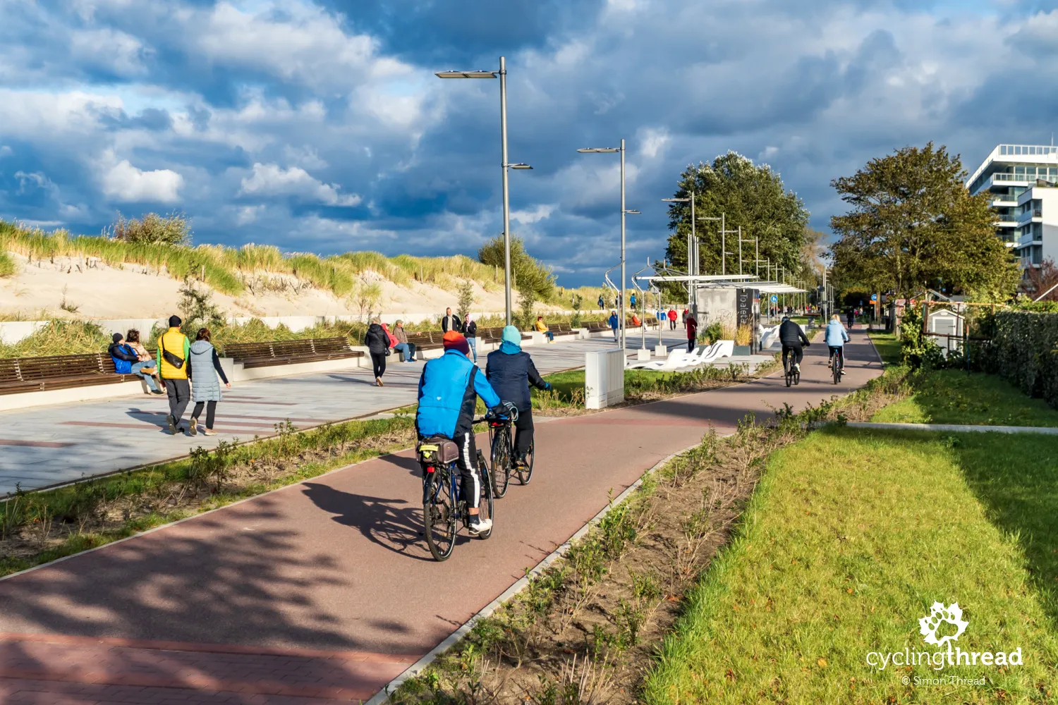
Kołobrzeg: the cycling capital of the Polish Coast
Despite a certain functional mishap regarding the summer organization of pedestrian and bicycle traffic on the Kołobrzeg seaside promenade, I look favorably upon the overall bike-friendliness of Kołobrzeg and its surroundings. The city provides a decent ride through - with four segments of cycling paths that EuroVelo 10 traverses through the city. Among these is a segment of a former railway line converted into a neighborhood cycling highway, a pleasant bike path through Stefan Żeromski Park and, of course, the several kilometers long seaside promenade. With its location right in the middle of the West Pomeranian section of EuroVelo 10, good cycling roads stretching east and west, the Old Railway Route reaching Kołobrzeg from the south, and finally, its historical and touristic appeal along with excellent railway and road connections, Kołobrzeg successfully serves as the cycling capital of the coast. The city also operates the Kołobrzeg City Bike, often used for tourist activities.
The second most interesting city on the Baltic?
Kołobrzeg could be a good place to spend an entire day during a cycling trip - apart from the Tri-City area, it's probably the most interesting of the cities on the Polish Baltic coast. Kołobrzeg owes its beginnings to the production of salt from seawater. In the 17th century, Brandenburg, to which it belonged, decided to turn the city into a fortress, which survived, among others, the siege of Napoleon's troops. In the 19th century, the fortress city transformed into a spa, and during World War I into a Prussian military hospital and the headquarters of the German army's chief commander, Field Marshal Paul von Hindenburg. Converted again into a fortress during World War II, Kołobrzeg was destroyed up to 95%. Today, isolated structures remind of the city's glory in past centuries, including two well-preserved forts located along the EuroVelo 10 route, including the Reduta Solna with the Kołobrzeg Sea Fortress Museum.
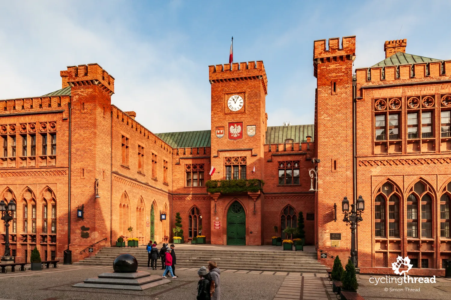
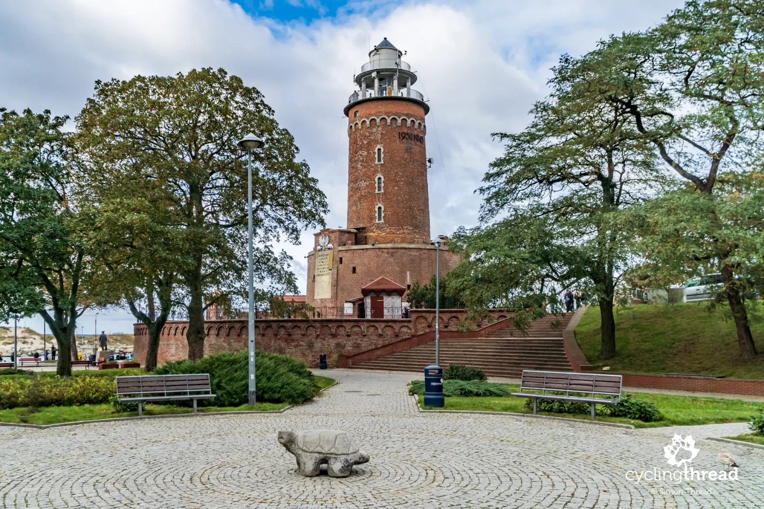
The symbol of Kołobrzeg is the lighthouse, which - to the surprise of some - is not a historic monument. It was entirely built after World War II, in the central part of Fort Ujście, replacing the previous one that stood in front of the fort and was blown up by Nazi soldiers to eliminate an easy target for Polish-Soviet artillery in March 1945. More valuable than the lighthouse are the preserved, though modified by reconstruction, foundations of the 18th-century fort - the last object to defend itself in Kołobrzeg against the Soviet offensive. Besides it, the city retains several other buildings of the former Kołobrzeg Fortress, which can inspire a walk or bike ride around the city. The Polish Arms Museum is a frequently visited place, holding, among other things, the largest collection of Polish military uniforms from World War I and II. The museum includes the 15th-century Merchant's House, the only one to survive World War II.
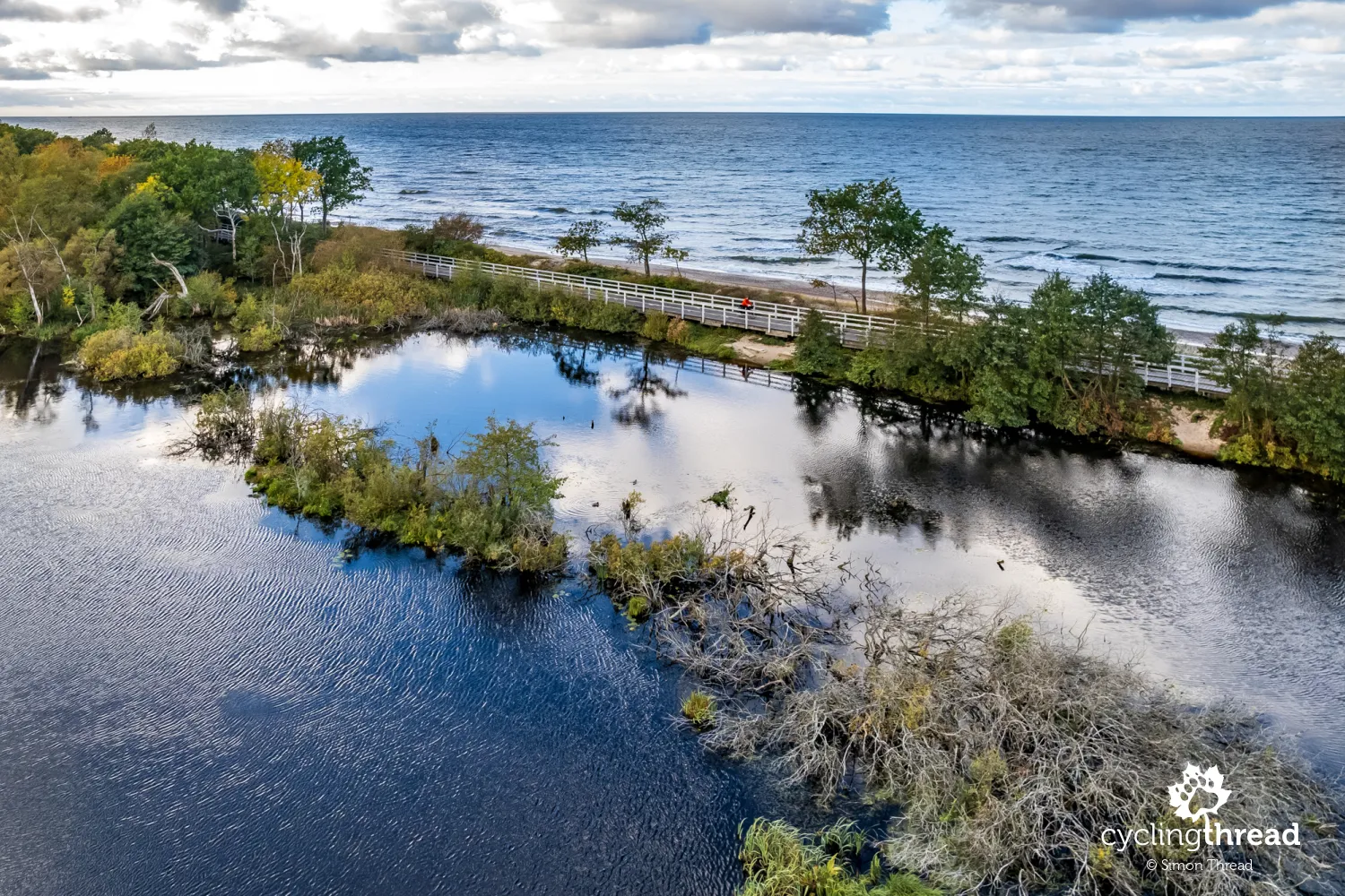
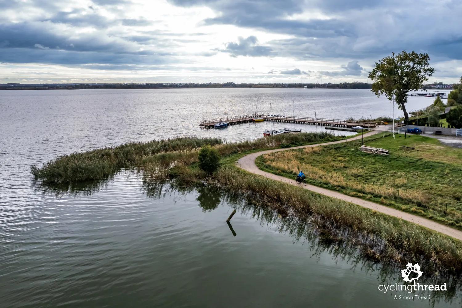
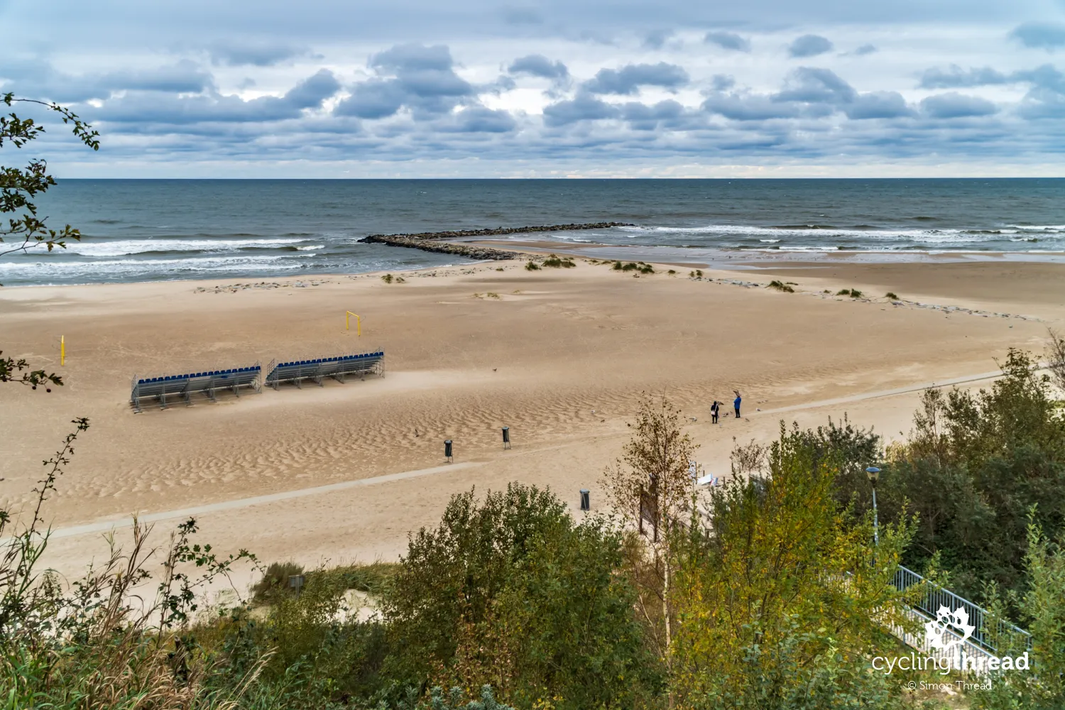
My favorite spot along the EuroVelo 10 route
My favorite part of the Baltic cycling route is the one running between the beach and the area of the Eastern Ecopark, a wetland protected area just beyond Kołobrzeg. The protected area is home to up to 80 species of birds, and in autumn, even a flock of cranes stops here for rest during their longer migration. The highlight of this section is about a 200-meter wooden footbridge, separating the Baltic Sea from the Salt Marsh, part of the Eastern Ecopark. In 2010, the waters of the reservoir broke through the sandy embankment separating the reservoir from the sea and flowed into the Baltic, destroying the habitats of many birds and at the same time disturbing the long-standing natural balance. Stopping here for a while allows us to admire both the turbulent sea waters and the calm, freshwater area with lush vegetation. And it's probably the only place of its kind on the Polish and perhaps the entire Baltic coast.
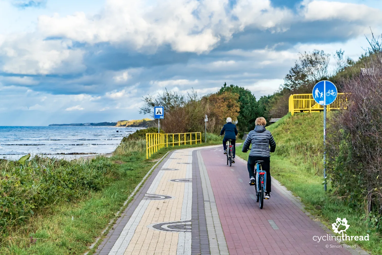
The path to the Eastern Ecopark and further towards Ustronie Morskie features a cycling path with a quite original surface - colorful bricks in distinctive patterns. Although cyclists are supposed to have most of its surface in a burgundy color, comfortable riding on this section can be impossible during the summer season. Pedestrians often do not fit within their designated area and, due to the lack of clear separation, move onto the bike part, causing unnecessary conflicts. Fortunately, the whimsical surface made of the unfortunately chosen bricks, already several years old, still holds up well and riding here off-season is a real pleasure. A bit beyond the Salt Marsh, unfortunately, there are the dreaded yellow barriers, which, however, highlight one of the most beautiful rest spots on the Polish coast.
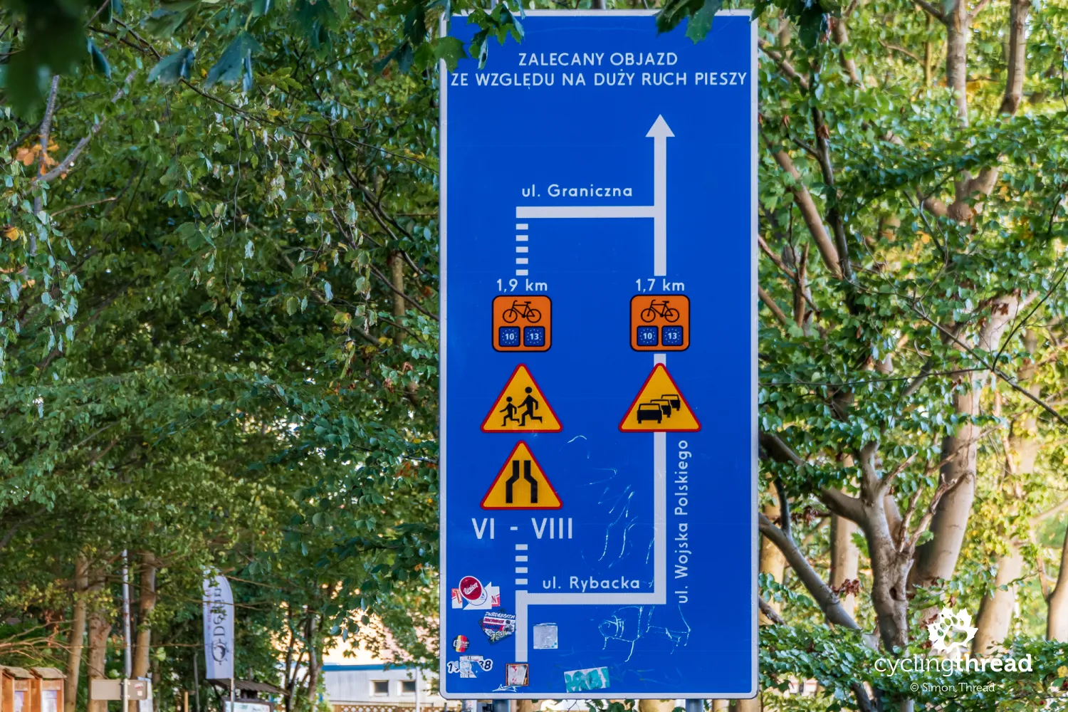
The largest board with a bicycle detour
At the entrance to Ustronie Morskie, I come across a huge sign informing about a seasonal detour through another coastal resort village. The detour was necessitated by the construction of long, high apartment buildings on the cliff in Ustronie Morskie, leaving no room for a comfortable coastal route. Squeezing through there in the season, with a bike, past crowds of leisurely strolling beachgoers, is quite the feat, and this useful sign warns of that prospect. It's better not to miss it in summer and take the indicated detour at the right moment; there will be fewer troubles with a peaceful passage in autumn. By the way, this is yet another thing that West Pomerania does with the cyclist's convenience in mind.
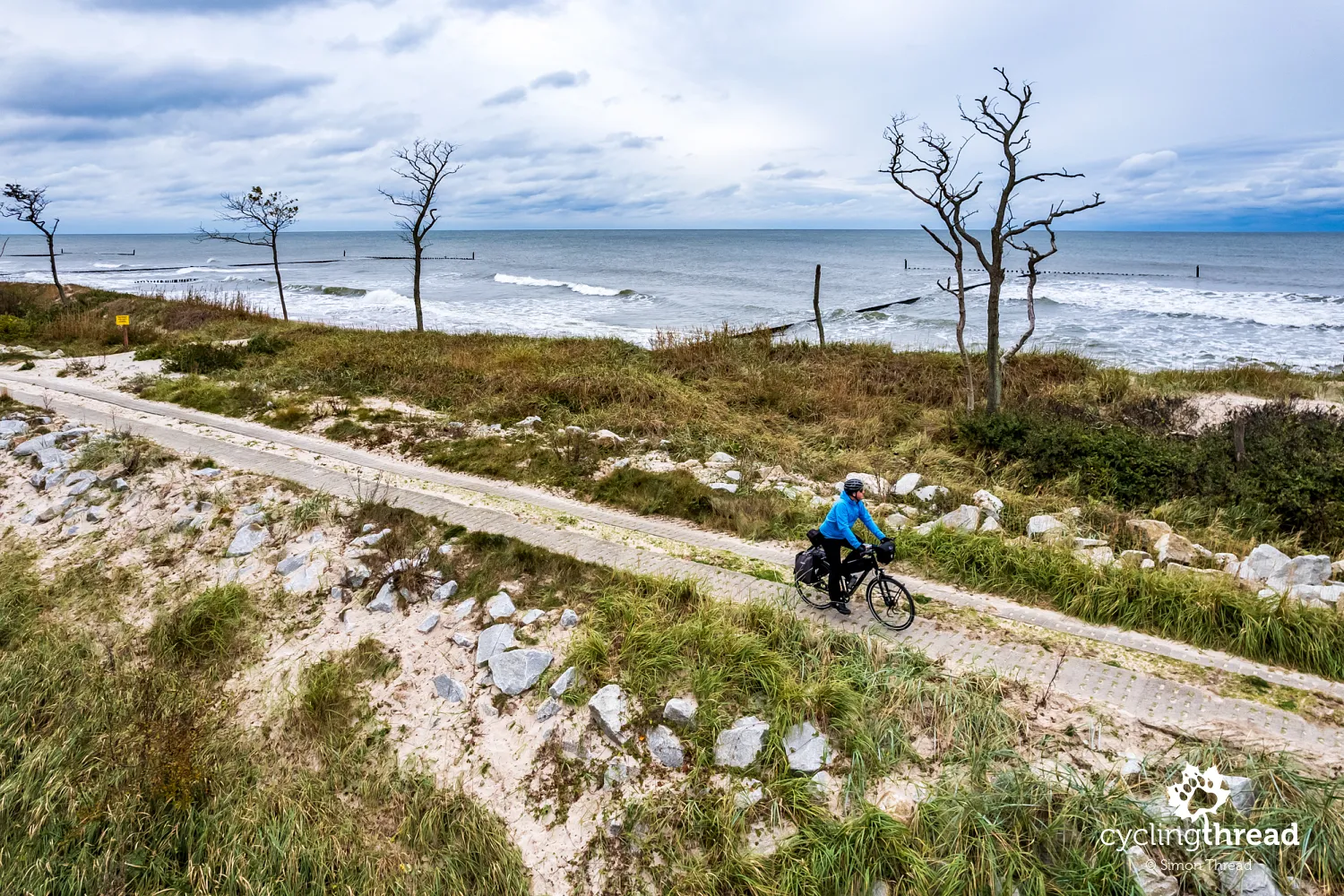
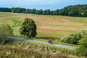
Another good bicycle road beyond Gąski
After Gąski, another good cycling road awaits. At the end of the day, I visit Gąski with its historic lighthouse complex. The Gąski lighthouse, built between 1876–1878, is the second tallest lighthouse in Poland and another monument to former Prussian architectural artistry. The original lighthouse complex setup has been preserved to this day, with the lighthouse keeper's house and outbuildings, part of which now host dining facilities. Just beyond Gąski, the route follows a short but excellent section of the cycling road which, despite formal restrictions, is unfortunately used by local car drivers to cut between Gąski and Sarbinowo. In such situations, it's important to respond and firmly but safely inform drivers that they are on a bike path, not a public road.
Receipts of horror do exist
That day in Sarbinowo, I discovered that the mythical "receipts of horror" really do exist, or rather, there are dishonest swindlers. At U Kapitana Dianthusa, I paid nearly 140 PLN for an undercooked pork chop with fries, salad, tea and mulled wine. The dishonest owner did not include expensive fries in the menu, served a Greek salad as the side, priced the tea at almost 20 PLN and charged 10 PLN for a slice of orange in the mulled wine, listed on the receipt as "fruit for wine". I therefore warn against Kapitan Dianthus in Sarbinowo, which - coincidence? - doesn't even have a listing on Google Maps, so one set of customers cannot warn others about the place. At the same time, I encourage visits to places where restaurateurs care about their customers - to the charming Summer Restaurant in Mrzeżyno, the Italian Casa Nostra in Darłówko, or Verde Rucola in Ustka. All open off-season, all with delicious food and friendly service. And normal prices.
Chłopy enchants at any time of the year
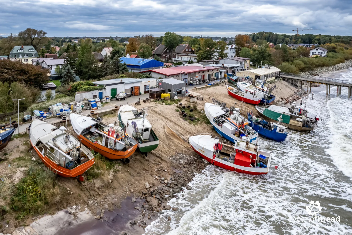
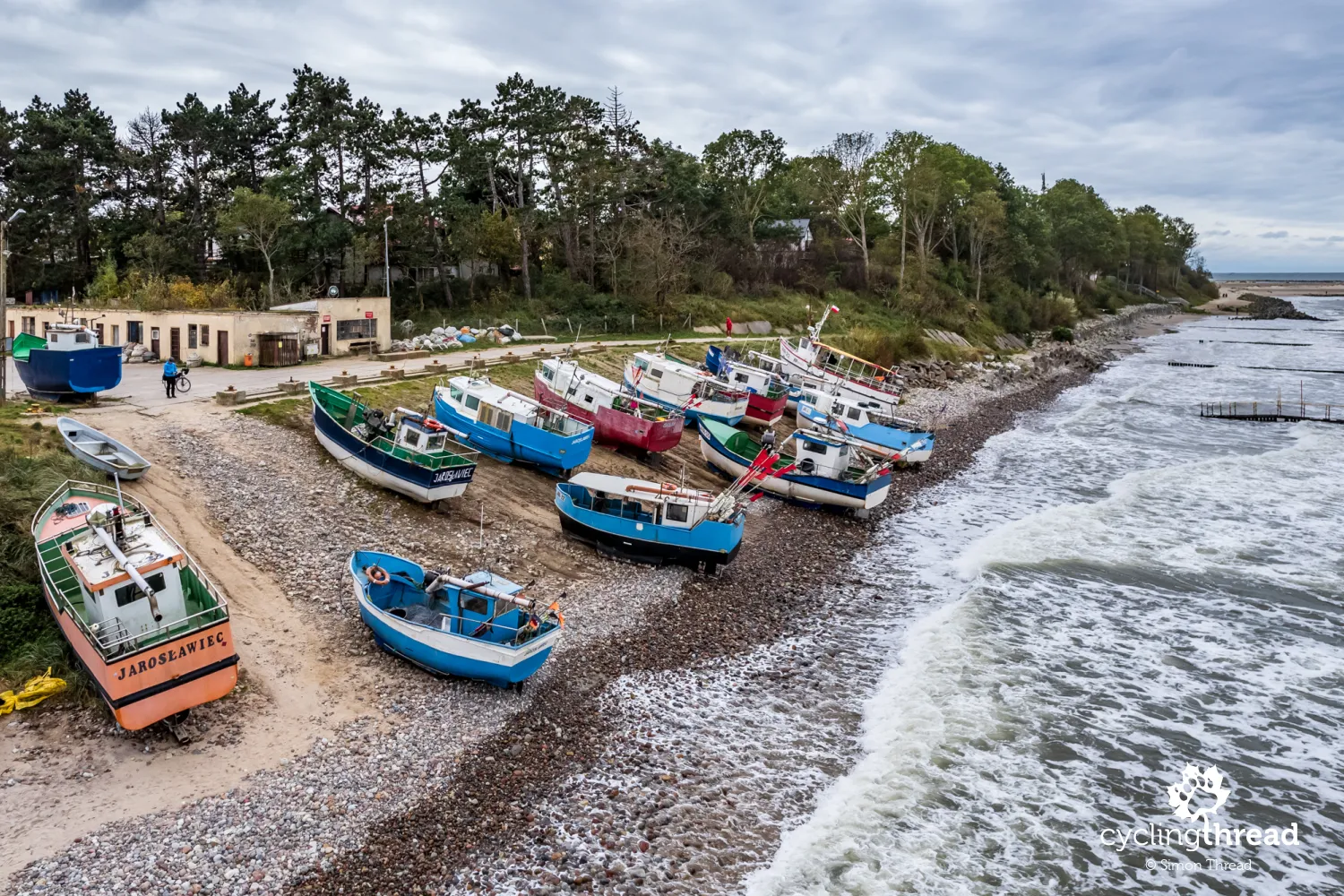
The next day begins with a visit to Chłopy, one of the last towns on the Polish coast not yet marred by an unsightly apartment building, thanks to being listed as a historic site due to its preserved urban layout, where several farms and individual buildings remind of former traditions. The Chłopy museum - Treasure Chest of the Fishing Village - speaks of these. However, the heart of the village is the small beach fishing harbor with a so-called slip, accompanied by a short pier and a row of utility buildings. Among them, you can find a fish shop and a fry shop, where the worn-out phrase "fish straight from the cutter" rarely proves to be true. I highly recommend a stop in Chłopy on a journey along the Baltic EuroVelo; it's absolutely mandatory.
The mysterious boat in the middle of the forest near Mielno
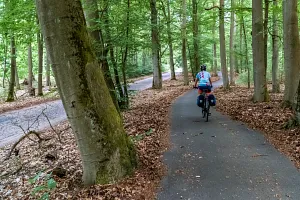
The forest before Mielno, through which a comfortable, wide pedestrian-cycling path built in cooperation with the Maritime Office (formally its territory) runs, always elicits positive emotions in me. The forest itself, with its density and intensity, sets a great mood, enhanced by excellent conditions for riding on the gently winding bike path. And I always remember a conversation with a cheerful, kind nun I met here a few years ago. This time, I stop at its end, at a fork in the route, next to which stands a wooden boat. It's one of several different objects along the Forest Loop of Adventures and Mysteries - a nature route that runs through forest paths in the area. Among them are also two German bunkers from World War II, standing close to the cycling path.
In Mielno, the sea turns into a lake
In Mielno, the sea turns into a lake. The West Pomeranian EuroVelo 10 briefly visits the well-known Mielno. A trip towards the beach - to the Mielno promenade to see the famous walrus monument - can be made as part of a short, several hundred meters detour from the main course. The official route in Mielno heads for a few kilometers along Lake Jamno - I always emphasize that it's worth not to miss this section by taking the main road through the city. It's an attractive and rather unexpected section of the Velo Baltica route, where much of the time it runs directly above the water, transforming the seaside landscape into a lakeside one. The gravel road the route follows will soon be rebuilt and the surface will also change, which in some places has evidently reached the end of its lifespan. Pay attention to the marinas along the way - the water tram Julek, connecting Koszalin with Unieście and Mielno across Lake Jamno, docks here. Bikes can be brought on board - a great alternative to the cycling road connecting Koszalin with Mielno.
Underground mysteries of World War II
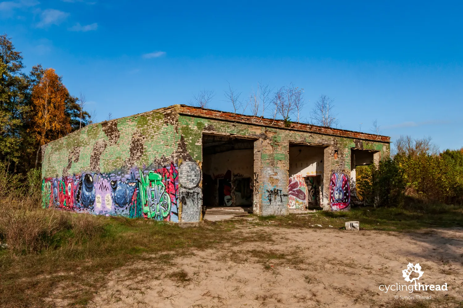
The Baltic Coast harbors many remnants of World War II. Even before the end of the "decorative" cycling path from Kołobrzeg, on the right side beyond the forest, we pass the Bagicz airport, which served as a German air force base before and during World War II. Beyond Ustronie Morskie, in the forest, one can find remnants of the 31st Permanent Artillery Battery - large signs along the EuroVelo 10 route point the way. Also interesting is the history of the former seaplane base, located between Unieście and Łazy. According to local residents, the base had an extensive underground part and some even speak of underground fuel tanks or corridors connecting the base with Unieście. Today, individual hangars, some standing just a few dozen meters from the cycling road, are easily accessible. Others are in a second road parallel to the first, heading towards the sea.
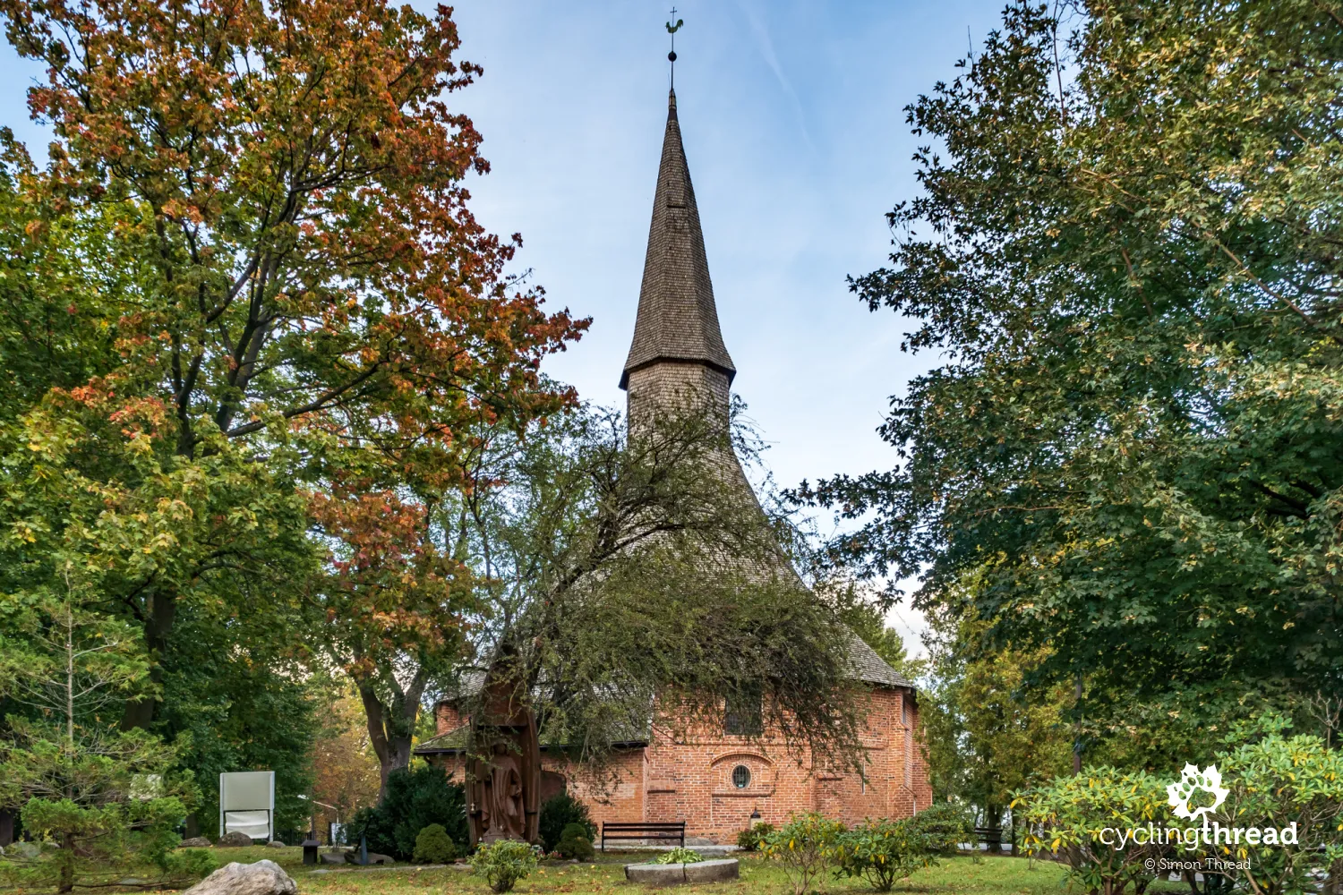
Beautiful gothic churches of Central Pomerania
Beyond Łazy, the EuroVelo 10 route changes its character - both the Baltic Sea and the coastal lakes disappear from view, replaced by typical inland landscapes. Almost the entire section is ridden on another decent cycling path that accompanies a local road. Here, it's worth paying attention to the beautiful Gothic churches, many of which have survived in Central Pomerania. The first in Osieki, the second in Iwięcino, the third in Bukowo Morskie - all are interesting diversions in the less visually stimulating part of the journey along the Baltic Coast. In Iwięcino, a banner on a fence announcing the Aleksander Doba primary school and the Kazimierz Nowak youth hostel is interesting - one wonders how many future travelers will be inspired by an institution with such great explorers as patrons.
Darłówko a bit like Danish Bornholm
Darłowo and Darłówko, soon reached by the cycling route around the Baltic Sea, remind me of our trip to Bornholm when hydrofoils of the Gdańsk Shipping Company used to sail from Darłowo to Bornholm. Then, on the way back, a storm stranded our hydrofoil in the Nexø port and we were forced to return via a detour through Kołobrzeg. In Darłowo, it's worth visiting the large, sloping market square, walking around the fisherman's fountain and the fish gallery embedded in the market square's pavement. Through the streets of the preserved 14th-century urban layout of the city, one can ride up to the Castle of the Pomeranian Dukes, where in the 15th century lived Eric I, previously king of Denmark, Sweden and Norway, who according to historical accounts hid treasures obtained during pirate expeditions on the Baltic in Darłowo.
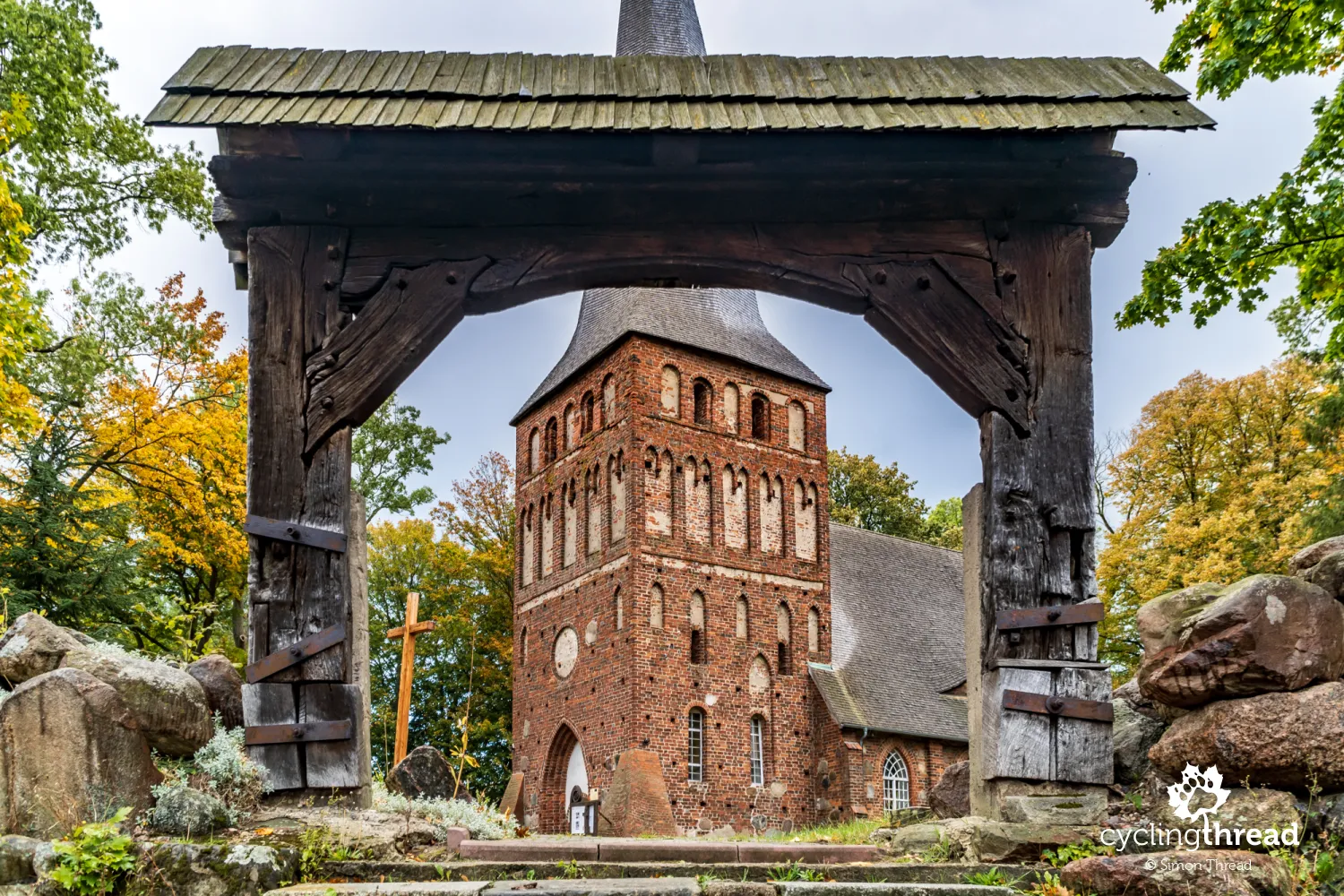
Eric I founded St. Gertrude's chapel
Equally interesting as the castle is St. Gertrude's Church, standing on a hill just a few hundred meters from Darłowo's market square. Founded by Eric I after his pilgrimage to the Holy Land, it was modeled on churches built at the time by English Templars and initially served as a hospital chapel and shelter for the poor, pilgrims and travelers. St. Gertrude's Church in Darłowo was built during King Eric's stay in Darłowo, around 1450. The building initially had two usable floors, the upper for the church and the lower for hospital and shelter purposes, which over the years turned into an ossuary. However, the problem remains the same as when trying to visit most interesting sacred buildings - it's difficult to find them open and getting information on who holds the keys can sometimes be challenging.
Pleasant, atmospheric Darłówko at the end of the day
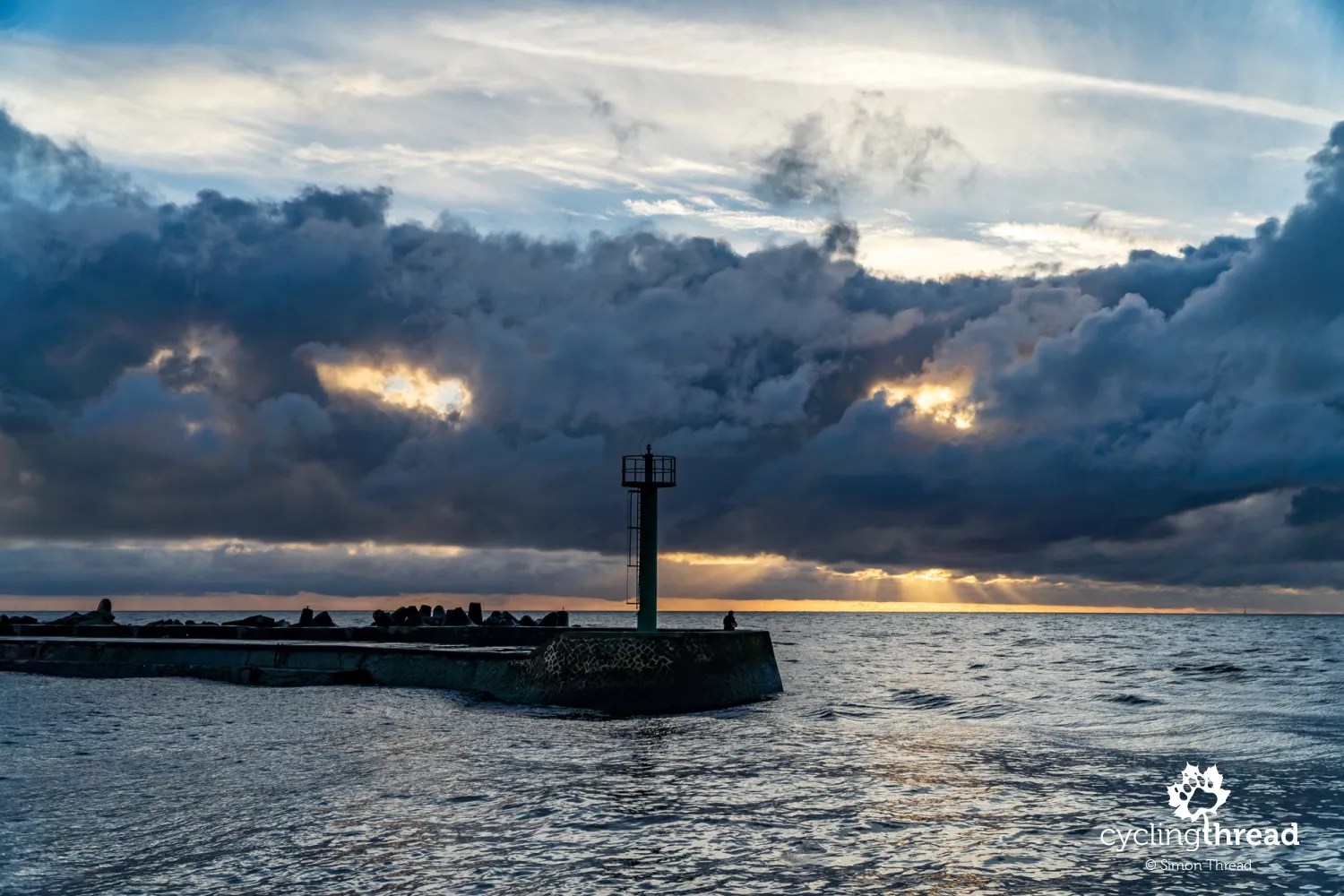
Darłówko, an administratively part of Darłowo, is probably best known for its unique, though not the prettiest, retractable bridge over the Wieprza River. Biking along the Baltic Sea, it's worth taking a ride along the port embankments in Darłówko, taking a look at the fishing vibes, where it's easy to find a fishing cutter unloading its catch, part of which will soon end up at the surrounding stands and fish shops. Tourists following the Baltic Sea lighthouses route will find in Darłówko one of the objects of their geographical desire - a lighthouse from the end of the 19th century. And walkers will surely appreciate the long breakwaters protecting the entrance to the port in Darłowo, over which I could watch the sunset through breaks in the clouds, looking like huge, ominous eyes watching the world.
The last of the beautiful seaside sceneries
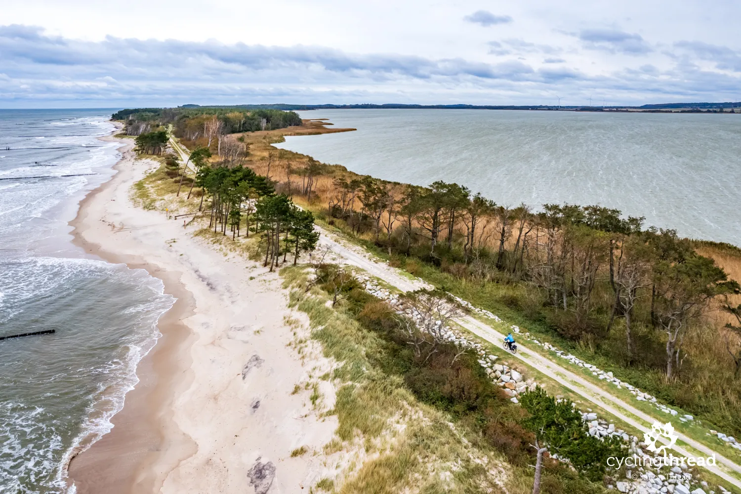
The last of the beautiful coastal sceneries on the route is found just beyond Darłówko. A roughly 5-kilometer section of the Velo Baltica route here runs along a sandy spit, in a wonderful, natural environment with the Baltic Sea on one side and Lake Kopań on the other. There's no other place as impressive either in West Pomerania or in the other part of the EuroVelo 10 route in Pomerania. The path's less-than-ideal slab surface, part of which was created on a flood embankment constructed by the military in 1987 after the sea breached the spit over a length of nearly 600 meters, might be controversial among some cyclists. However, the unique landscape conditions seem to overshadow the temporary inconveniences. I can only assume that an asphalt cycling path wasn't built here due to the exceptionally difficult terrain conditions and the unpredictability of the sea, which could destroy a multimillion investment over the course of one stormy winter.
Dubai beach on the Baltic Sea
One of the few ascents encountered by cyclists on the Baltic Sea route is found just before Jarosławiec. Right after it, the route turns off the main road towards the cliff edge. Here lies an unassuming turnoff to a viewpoint, from which it's worth looking at the beach dubbed Dubai, a wide, newly created beach bordered by stone groynes. The Jarosławiec Dubai was created in 2018 to protect the village located on a 30-meter cliff and its creation was the most expensive action in the history of protecting Polish coasts. Yet, it's nothing compared to the width of the beach in Jarosławiec before World War II, which was a kilometer wide. The village itself lost about 200 meters of land over approximately 250 years, making it easy to imagine what might one day happen to the new, multi-story guesthouse now being audaciously built almost on the edge of the high cliff in Jarosławiec.
Another fishing harbor at the end
As a farewell to the EuroVelo 10 route in West Pomerania, Jarosławiec presents two beautiful places with a very maritime character. The first is a traditional fishing port located a bit off the beaten path, where - as in Chłopy - we can admire the bravery of fishermen who head out to sea on small cutters to catch fish. The boats stand on the sand, with fishermen having a slipway at their disposal for launching and hauling out the ships. Right next to the port is the second place - the Jarosławiec lighthouse, built in 1835 after the previous one proved too low and its light was obstructed by trees. The Jarosławiec lighthouse can, of course, be visited and then you can take a souvenir photo under the large sign with the name of the village.
EuroVelo 10 like Dr. Jekyll and Mr. Hyde
Returning from the seaside trip, I reflected on the route having two faces. The first, beautifully scenic, consists of truly spectacular, natural sections that make up a significant part of the distance along the Baltic coast. This is the face desired by tourists, a natural magnet attracting throngs of cyclists to the sea. The second face of Poland's EuroVelo 10 is its commercial, retail image. It's thousands of shouting signs, whole streets built up with stalls offering unrefined trinkets, transforming seaside towns into cheap shopping centers. Few of the coastal towns seem to care about the aesthetics of their streets; in seaside "resorts," there's a total disregard for external order. The Baltic coast has been flooded with waves of artificial tackiness, a culture of unnecessary, holiday shopping and fake souvenirs, often identical from the sea to the mountains, which end up in the trash after being brought home, as they're good for nothing else.
This iconic cycling route is evolving. It's no longer just a summer challenge for physically strong cyclists but is becoming a modern bike route that, with ambitious solutions, is catching up with the best cycling routes in Europe. Among the young, strong cyclists, there's an increasing number of cycling seniors and cycling families with children who now have the opportunity to ride the Velo Baltica thanks to investments in new cycling roads and the informational layer of the route. Additionally, we're all beginning to realize that summer isn't the only good time for cycling. That autumn can also be beautiful. That it's easier to find accommodation, which is also cheaper and better suited to our expectations. That restaurants have free tables waiting for us, not the other way around. And that passing through Baltic towns, we don't have to worry about crowds on the sidewalks or traffic jams on the streets. The Baltic Sea off-season can be very likable indeed.
Take and ride, make use of the cycling facilities
I strongly encourage you to make use of all the amenities on EuroVelo 10 that I mention in the text. Be vigilant and pay attention to notifications about detours and other difficulties on the route. For accommodations, choose facilities from the list of Cyclist-Friendly Places to ensure your bikes sleep safely. Use the bike boxes in Mrzeżyno - hopefully, soon also in other towns. Charge your phones and navigations in the Mrzeżyno shelter. Download the app and check the route, search for attractions, accommodations and restaurants. Report problems and malfunctions to make the route even better. Do all this because these things are created with us in mind, for our comfort and satisfaction.
Back to top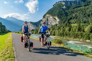
Your Comments
Add new comment