Ruhr Valley Cycle Route - North Rhine-Westphalia by bicycle
RuhrtalRadweg, or Ruhr Valley Cycle Route, runs through North Rhine-Westphalia from the river's source near Winterberg to its confluence with the Rhine in Duisburg. Over around 240 kilometres, it connects the mountain landscapes of Sauerland, small towns in the Ruhr valley and the industrial heritage of the Ruhr Area. It is one of Germany's Top River Routes, and one of those cycle routes in Germany where the history and character of the places along the way change as much as the landscapes. We cycled the Ruhr route in July, staying in Winterberg, Arnsberg, Herdecke, Essen and Duisburg.
Join us on our new 🟢 Komoot account!
Cycling Partners



Route on the map
GPX file (GPS track): cyclingthread.com-ruhr-2026.gpx
The Ruhr Valley Cycle Route - table of contents
- Twenty years of the Ruhr Valley Cycle Route
- Two sides of North Rhine-Westphalia
- Radrevier.Ruhr and the regional cycling network
- Winterberg and the mountain start of our journey
- The Ruhr's source in the forests near Winterberg
- A memorable diversion near Winterberg
- Assinghausen and the first villages of Sauerland
- Olsberg beside a small Ruhr reservoir
- Comfortable cycle paths in the Ruhr valley
- Meschede and its stark abbey church
- Schloss Laer in the Ruhr valley
- Oeventrop, route-side art and an old bridge
- Arnsberg and the history of Sauerland
- Victims' portraits beneath a viaduct in Neheim
- Fairness Zone on the Ruhr Route
- An easy ride beside the wide Ruhr
- Schwerte - the old centre and Rohrmeisterei
- A special offer for cycling tourists
- Haus Ruhr and art education
- Comfortable travel on the Ruhr cycle route
- Koepchenwerk - a former pumped-storage power station
- Hengstey power station and an old railway crossing
- Herdecke between the Ruhr and local history
- Beneath the great viaduct over the Ruhr
- Wetter and the beginnings of industrialisation
- Nachtigall mine and the beginnings of coal mining
- The Hardenstein ferry on the Ruhr route
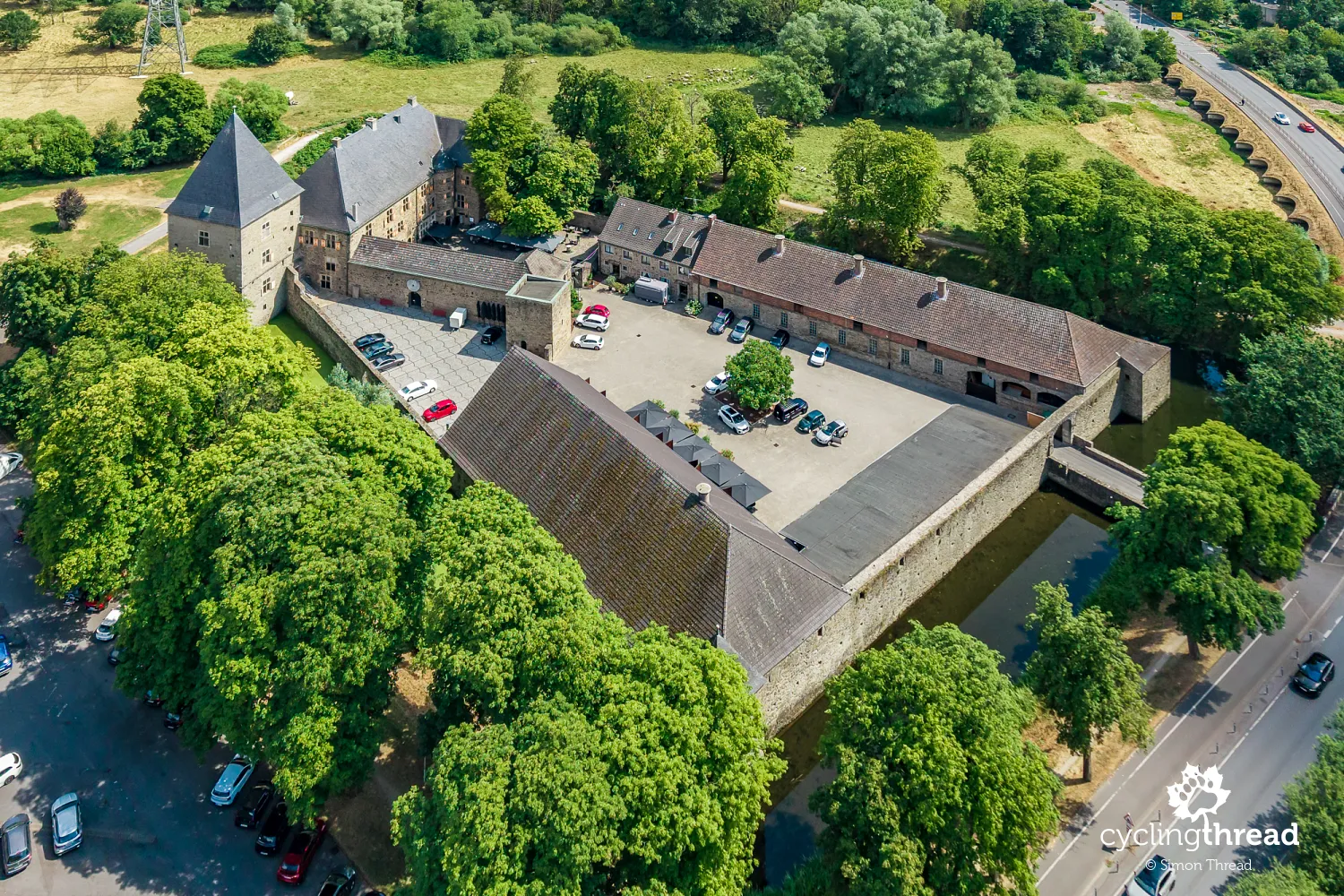
- The moated castle of Haus Kemnade
- Cycle paths accessible to everyone
- Henrichshütte - the former ironworks in Hattingen
- Hattingen's old town between ironworks and river
- The railway museum in Bochum-Dahlhausen
- Through Steele to central Essen
- A whole day without bikes in Essen
- Zollverein - Ruhr Museum and Red Dot
- From industry to Museum Folkwang
- Leaving Essen and returning to the Ruhr
- A railway bridge suddenly overhead
- The former water tower in Styrum
- Duisburg where the Ruhr meets the Rhine
- Bike-friendly hotels along the Ruhr
- Getting to Winterberg by train and bus
- Parking in Winterberg and collecting the car
- The official RuhrtalRadweg website
- Germany's Top River Routes
- Cycling from the Ruhr's source to the Rhine
Twenty years of the Ruhr Valley Cycle Route
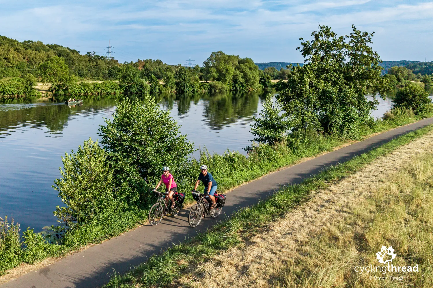
The Ruhr route starts in Winterberg in the Rothaargebirge mountains, in the eastern part of Sauerland, and ends where the Ruhr flows into the Rhine in Duisburg. Following the river downstream makes the cycling journey easier, although it does not mean the road runs downhill all the way. Even in the first few kilometres, and again on later days, there are noticeable climbs, though they are always short. According to the route's organisers, around half of the journey follows dedicated cycle paths. Much of the rest uses quiet local roads, forest tracks and former towpaths running right beside the water.
Our journey took place at a special time, as in 2026 the Ruhr Valley Cycle Route celebrates its 20th anniversary. The route opened in 2006 and over two decades has become one of the best-known cycle routes in Germany and one of the most distinctive in Europe. These 20 years of experience can be seen not only in the infrastructure itself, but also in how well the entire route is organised. The Ruhr route has a well-developed network of accommodation, restaurants, bicycle services and other partners, while cyclists can also rely on clear and well-prepared information. This includes route signage and practical information along the way, up-to-date notices about disruptions and diversions, as well as a very useful website where it is easy to find the information needed both before and during a cycling trip.
Two sides of North Rhine-Westphalia
The entire journey along the Ruhr takes place within one German federal state - North Rhine-Westphalia - yet it is hard to describe it through a single type of landscape. We begin in Sauerland, a region of hills, forests, smaller towns and holiday resorts. Gradually, the valley widens, and lakes, locks, former mines, steelworks and the increasingly dense development of the Ruhr Area appear along the route. The boundary between these parts of the journey is not a clear line on the map. The changes become visible gradually, day by day, as Sauerland's traditional buildings give way to a landscape shaped by industry.
This does not mean that the first part has no traces of human activity, or that nature disappears towards the end. A railway runs through Sauerland, old estates and water management structures stand beside the river, and the history of the towns we pass is linked to mining. In the Ruhr Area, meanwhile, we spent long stretches riding among trees, riverside meadows and green recreation areas. We found this mix very interesting. Watching the region change without having to leave the valley of a single river is certainly one of the greatest strengths of cycling along the Ruhr.
Radrevier.Ruhr and the regional cycling network
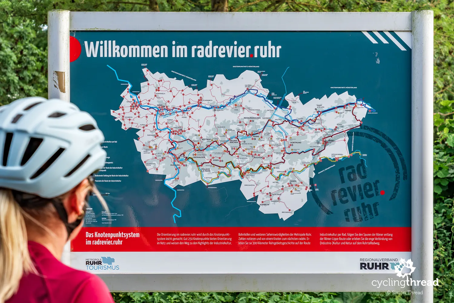
The Ruhr Valley Cycle Route is part of the region's wider cycling tourism offer. Radrevier.Ruhr is a network of cycle routes across the Ruhr Area, using former railway lines, paths along canals and rivers, and old towpaths. Cyclists can also use a numbered junction network covering more than 1,200 kilometres of routes. With such extensive infrastructure, a journey along the Ruhr is easy to combine with short detours to places and attractions that the main route does not reach directly. Essen, towards the end of the journey, is a good example: the route follows the river through the southern part of the city, while visiting its museums and industrial attractions requires a separate trip using the rest of the cycling network.
Winterberg and the mountain start of our journey
Winterberg has more than 700 years of history, although at first glance it is hard to recognise a typical medieval town. It received town rights in the 13th century, and important trade routes connecting Cologne, Kassel, Frankfurt and Soest passed through it. St. James' Church also dates from that century and stands beside one of the pilgrimage routes leading to Santiago de Compostela. Two major fires devastated the town in the 18th century, and after the fire of 1791, only a few houses remained from its earlier buildings. Wide streets were laid out at that time to reduce the risk of further fires, although the layout of the oldest part still recalls its medieval origins.
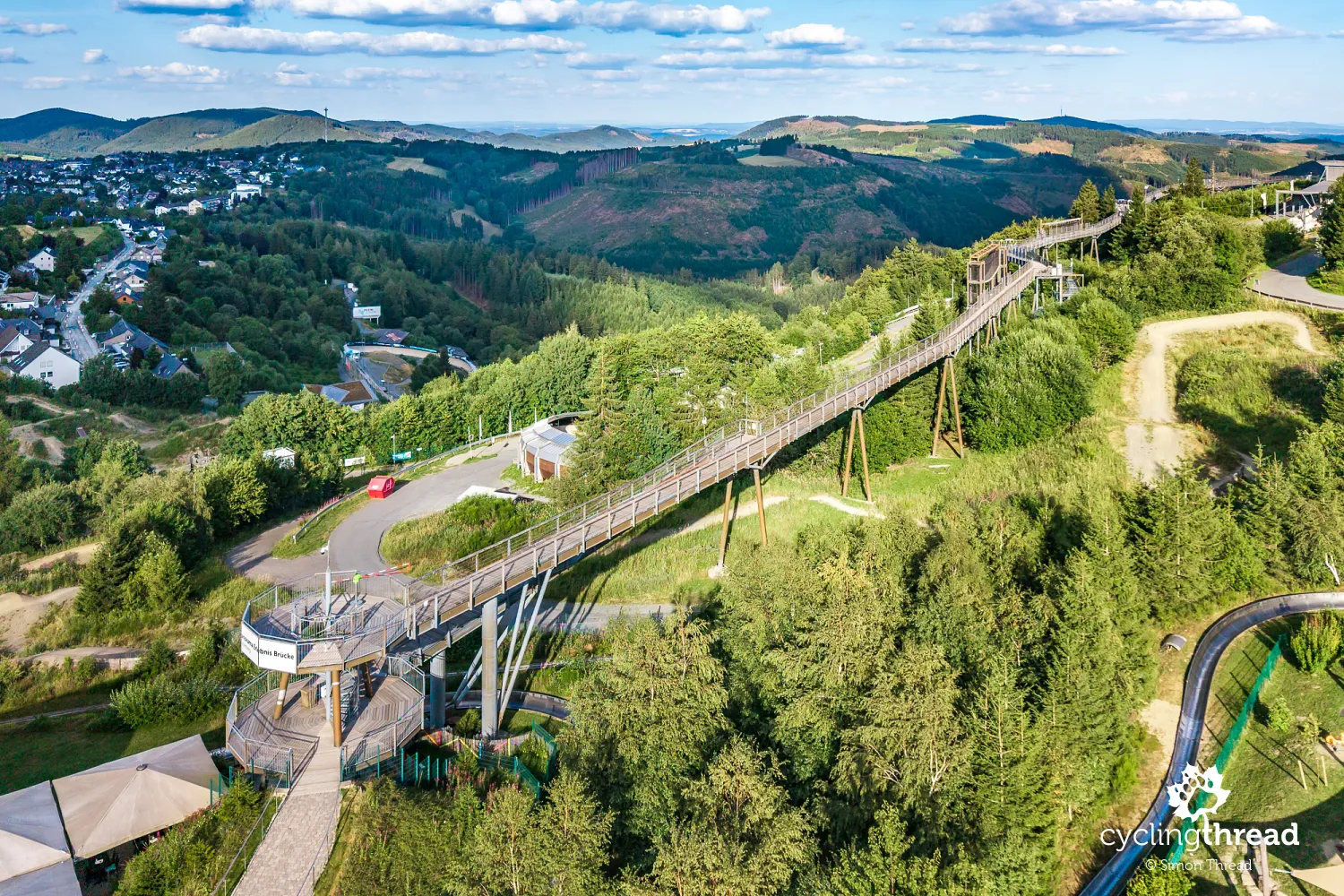
Today, Winterberg is mainly associated with winter sports, but there are also several reasons to spend time here in summer before starting the ride, rather than treating it only as a starting point. In winter, its ski jumps, bobsleigh track and skiing facilities are busy; in summer, mountain bike routes, walking routes and other attractions on the surrounding slopes take over. We spent part of our first afternoon in Sauerland on Panorama Erlebnis Brücke, a 435-metre viewing walkway at Erlebnisberg Kappe. From it, there are clear views of the wooded ridges of the Rothaargebirge and the deep valleys around Winterberg. The start of the Ruhr route really does have a strong mountain character, and only later do the kilometres beside the Ruhr begin to feel like an easy river route.
The Ruhr's source in the forests near Winterberg
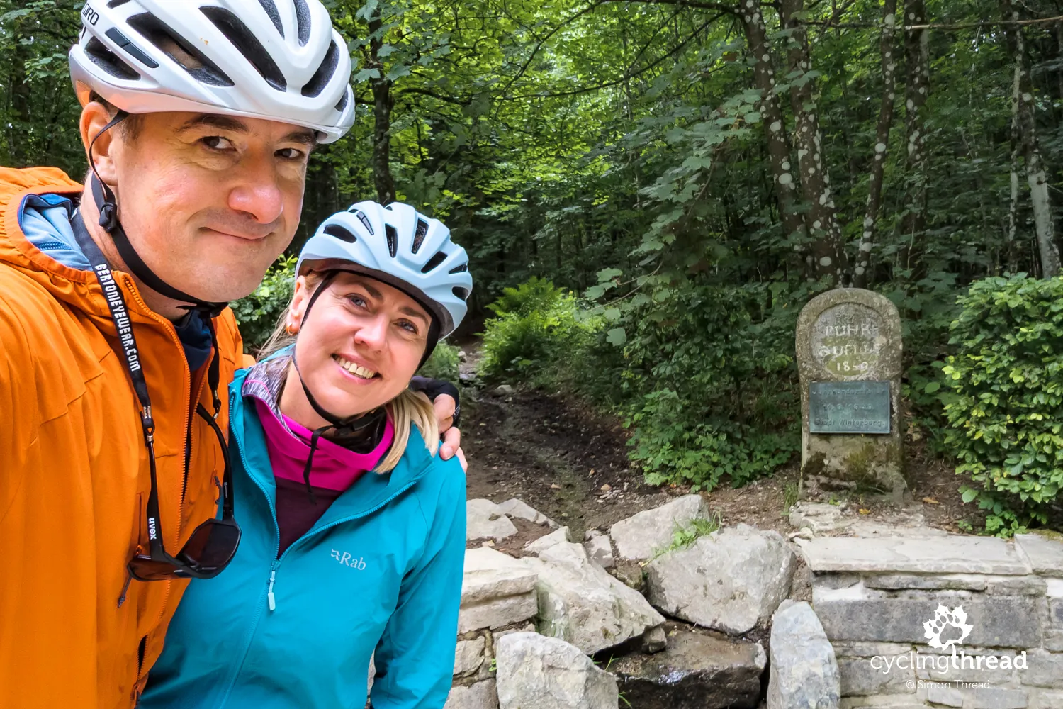
Soon after leaving the town, we reached the source of the Ruhr. Standing here, it is still hard to imagine the wide river we would see a few days later near Essen and Duisburg. The Ruhr rises in a small, wet area of forest at the foot of Ruhrkopf, and its source has been arranged and rebuilt several times since the mid-19th century. Today, a narrow stream flows through a circular stone structure and a small forest rest area with comfortable seats and information boards. Here, you can see the first stretch of the river that the route follows for the next 240 kilometres.
A memorable diversion near Winterberg
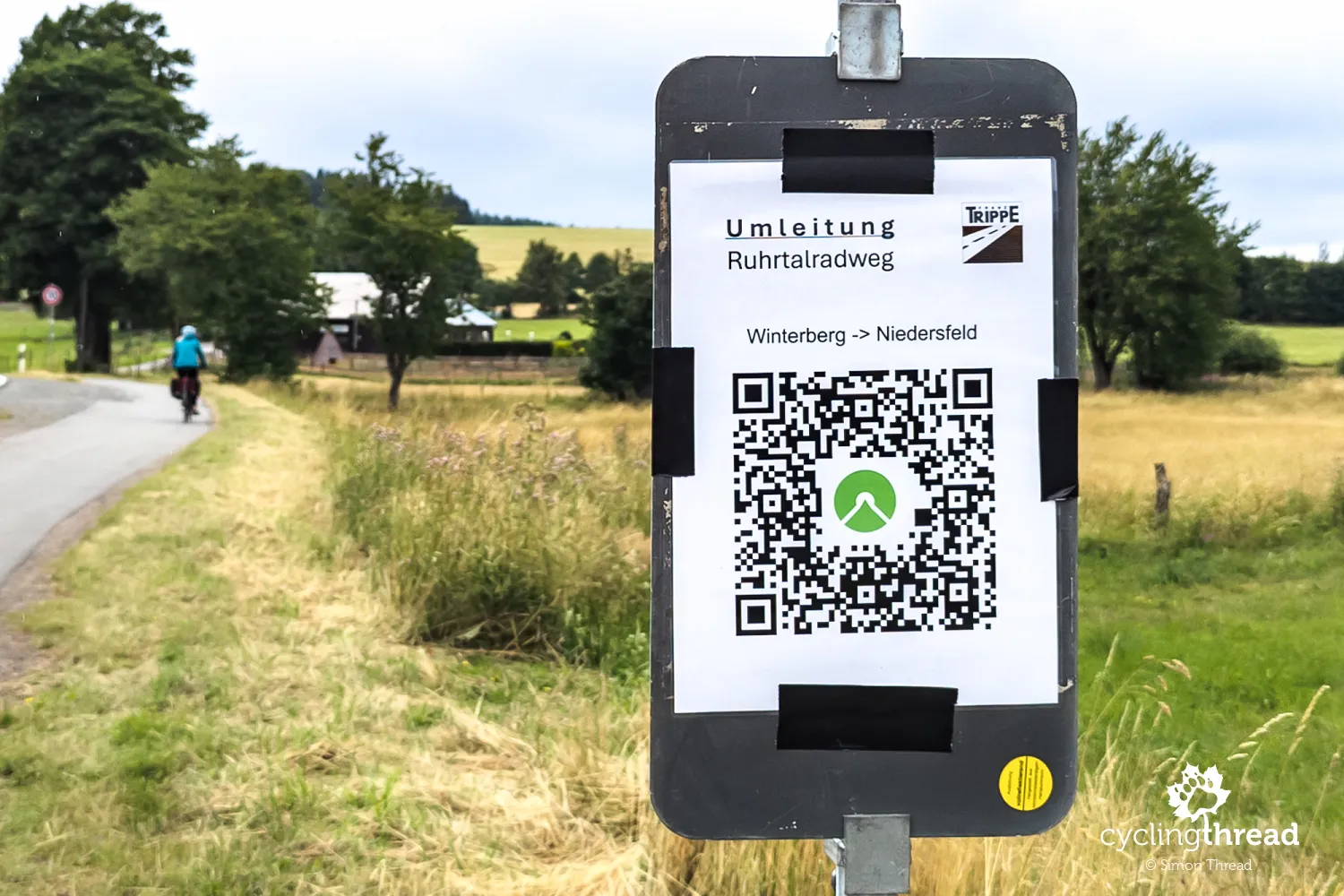
We came to the route as ordinary tourists - without planning our own version of every kilometre, relying instead on local signs and information. This lets us experience it as most cyclists do, and give an honest picture of how it is organised. Just beyond the Ruhr's source near Winterberg, we encountered two diversions caused by resurfacing work on forest sections of the route. The first signed alternative took us uphill - unfortunately, back towards Winterberg, although sending cyclists along the parallel public road seemed far more practical. The diversion was a little tiring, and its stony sections were not pleasant on touring bikes with panniers. But these things happen - sometimes a few people have to put up with some inconvenience so that thousands of visitors can enjoy a new, well-maintained surface in the years ahead.
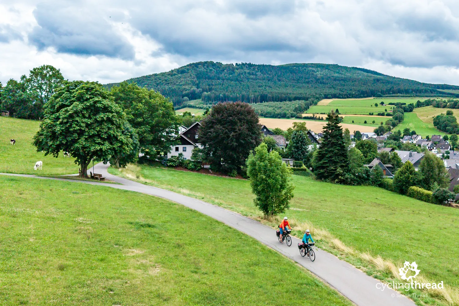
Beyond the two diversions, the ride became calmer and more pleasant. The Ruhr Valley Cycle Route took us along quiet local roads and cycle paths, away from heavy traffic. The river was still small, and the slopes and forests around us were reminders that we were still in the upper part of its valley. Signs appeared regularly at junctions and changes of direction, so for most of the time we hardly needed navigation. In places, we could simply ride and watch the surroundings change without constantly checking the map. This was the first stretch where we felt how comfortable travelling along a marked route could be.
Assinghausen and the first villages of Sauerland
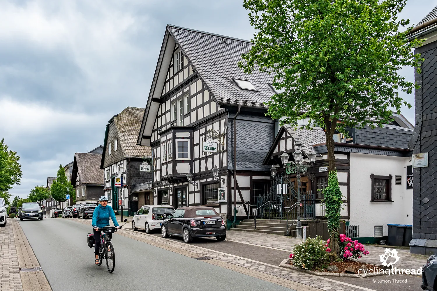
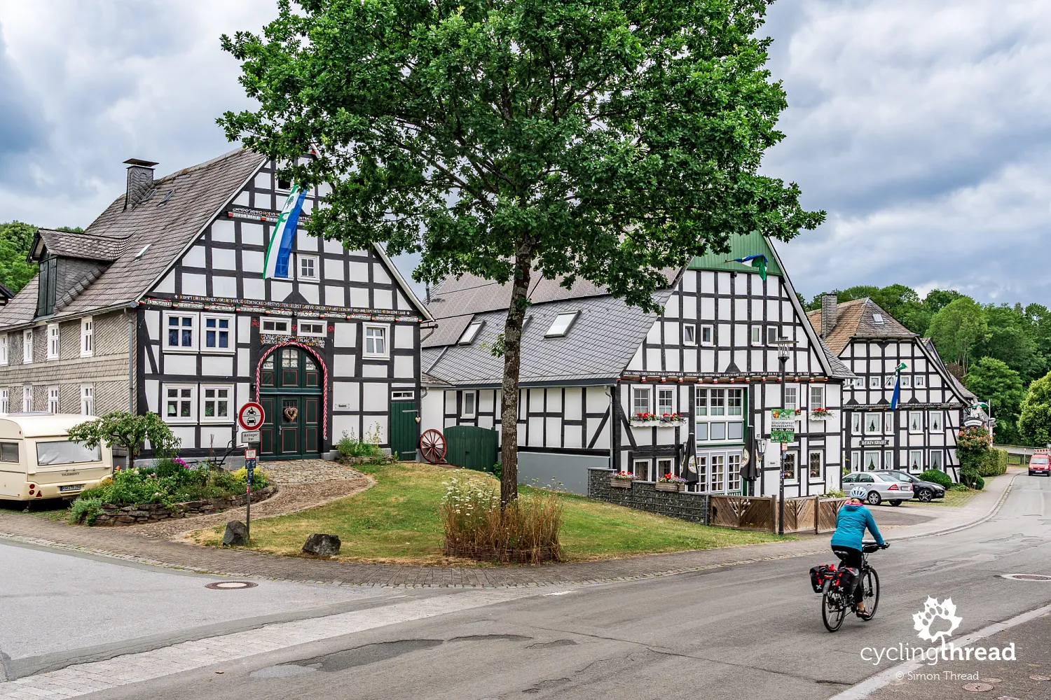
Assinghausen is one of the places worth slowing down for. This small village stands out for its well-preserved traditional Sauerland buildings, with half-timbered houses, dark beams, light walls and slate roofs. The oldest part of the village is gathered around St. Catherine's Church, and many historic buildings stand directly beside the narrow streets through the centre. The first written mention of Assinghausen dates from the 13th century. Over the centuries that followed, it retained the character of a small village, clearly different from the larger towns further down the Ruhr valley. Assinghausen is also known as Rosendorf, or the rose village, with roses planted by residents in gardens, public spaces and around the Rosenkranz chapel above the village.
Olsberg beside a small Ruhr reservoir
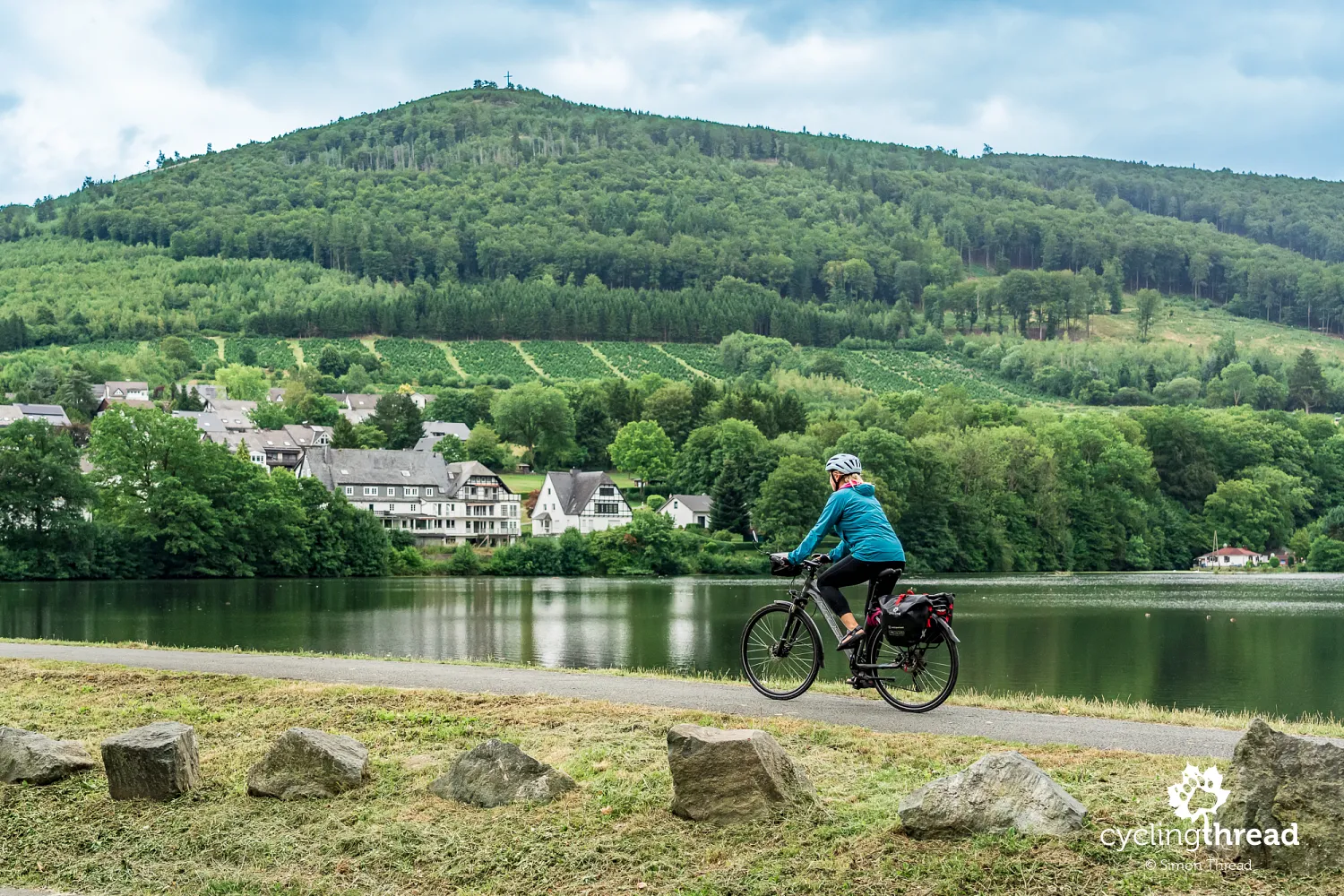
In Olsberg, the Ruhr is held back by a small reservoir close to the town centre. The river is already noticeably larger than near Winterberg, although it still flows through a typical Sauerland landscape, in a valley surrounded by wooded hills. For centuries, Olsberg's history was linked to iron ore mined in nearby Eisenberg - the first written records of mining date from 1271. In the 18th century, four tunnels were driven into the mountainside, and the ore went to the local ironworks, which later switched to making cast-iron products. Eisenberg was one of the most important iron ore mining areas in this part of Sauerland, and mining continued here for several centuries. One of the tunnels, the roughly one-kilometre-long Philippstollen, is now open to visitors, offering a look inside the former iron mine.
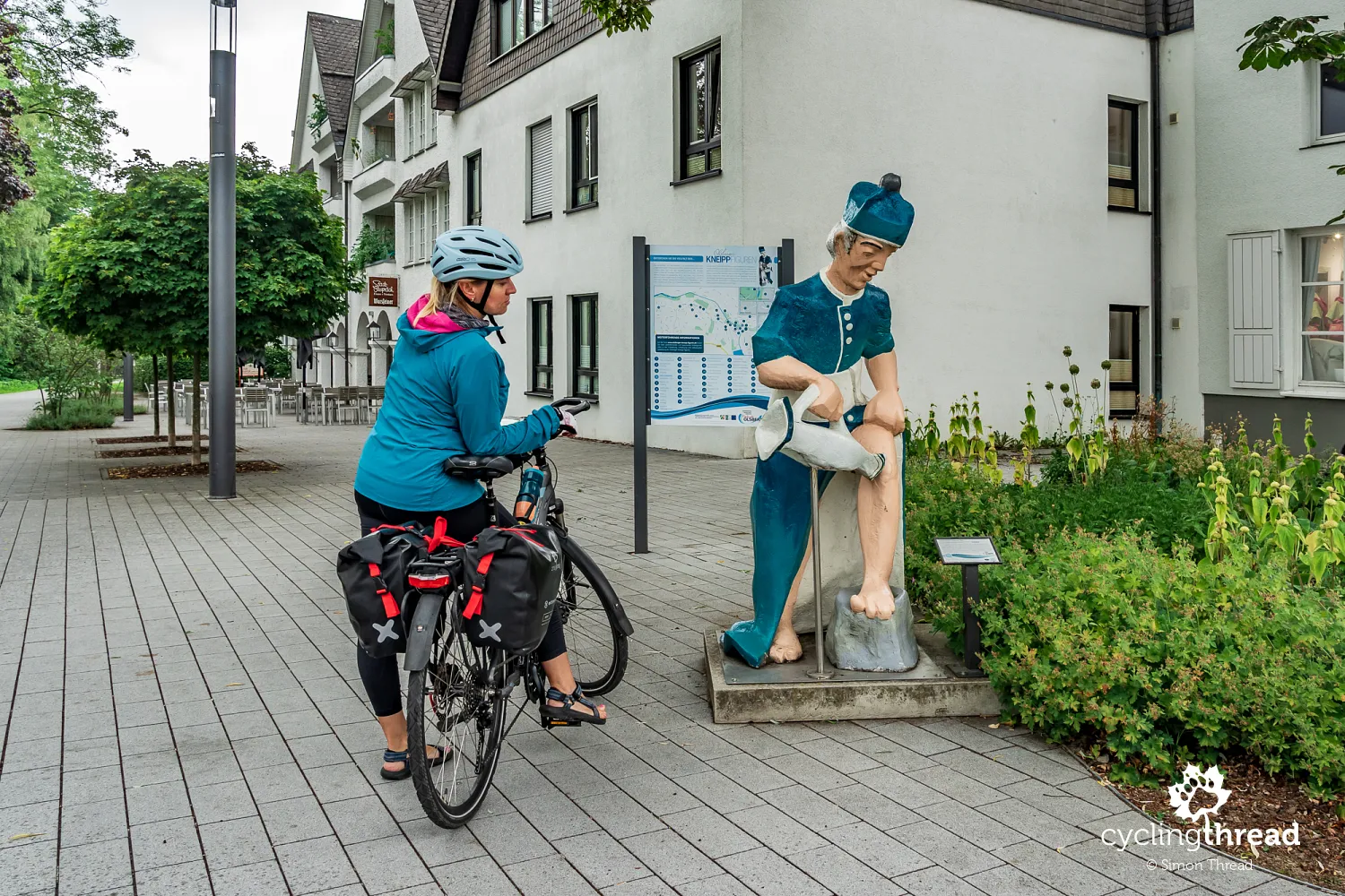
Spa treatments became another important chapter in Olsberg's history. In 1894, Dr Grüne, a student of Sebastian Kneipp, opened a sanatorium here using his methods, and in 1961 Olsberg gained Kneipp spa status. Kneipp's approach focused mainly on water treatments, but also combined them with exercise, suitable nutrition, herbal medicine and an orderly way of life. Colourful figures of Sebastian Kneipp himself - a 19th-century Bavarian priest and promoter of hydrotherapy - recall this history today. Each figure has been painted differently, and they can be found in various parts of the town. Olsberg still draws on its Kneipp tradition and holds the status of a state-recognised Kneipp-Heilbad.
Comfortable cycle paths in the Ruhr valley
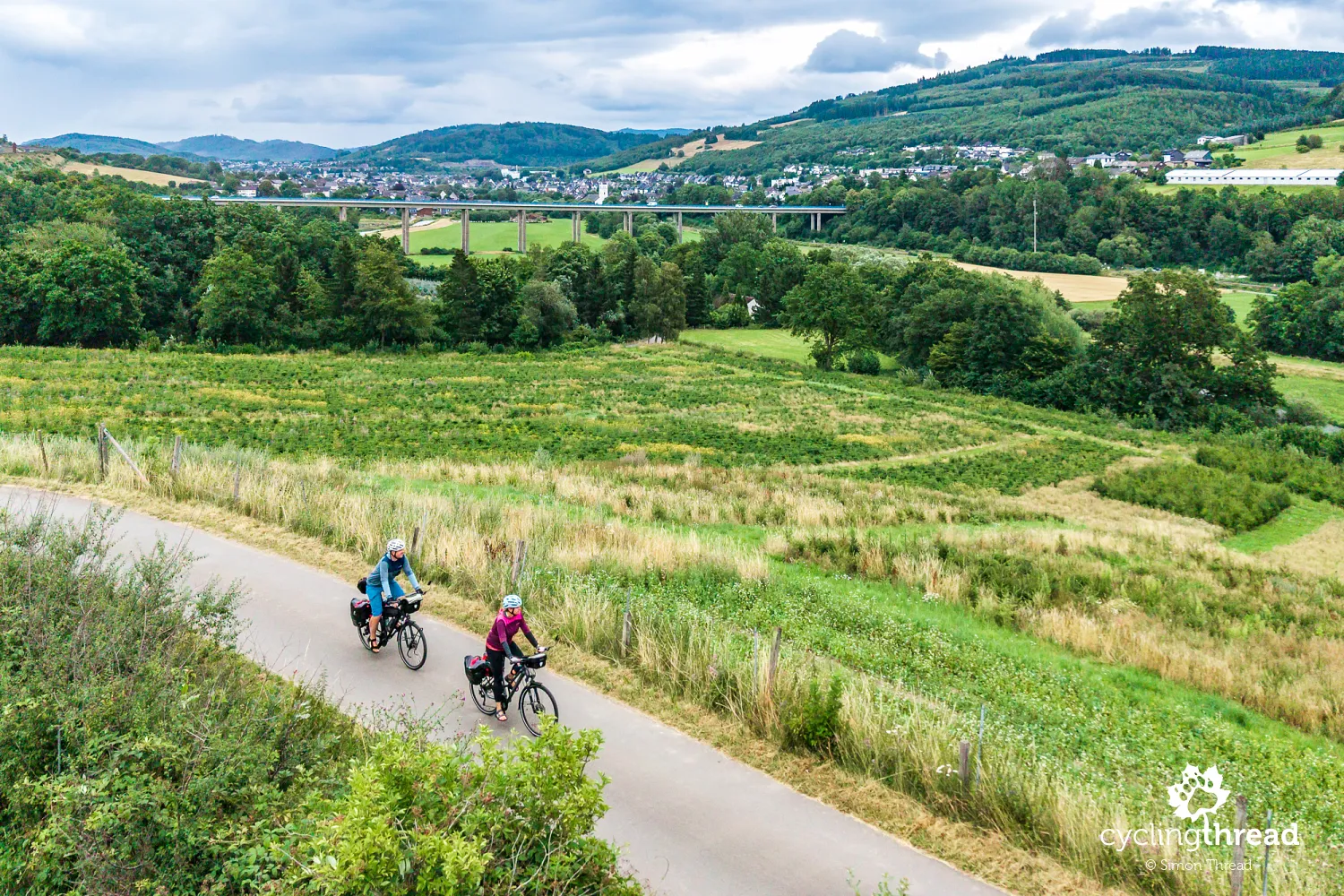
Further on, the valley becomes noticeably wider. We ride comfortably, often on cycle paths, with room to watch the river and the towns on either side. The route's profile can still come as a surprise: rather than staying on the flat valley floor, the path sometimes climbs briefly up the slope. These climbs are not long, but with panniers they feel harder than the description of a route following a river downstream might suggest. In return, views often open up over the Ruhr valley from higher ground, hidden from the paths right beside the water. On the first stage, it is therefore best not to judge riding time by distance alone, and when another climb appears, there is always the comforting thought of a pleasant descent on the other side.
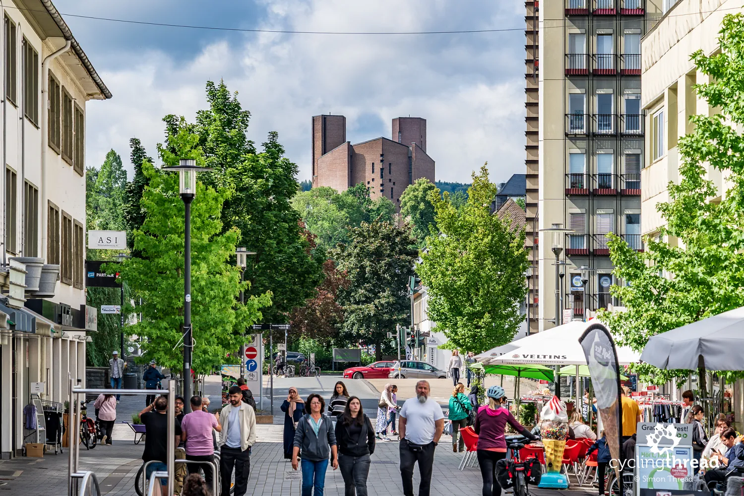
Meschede and its stark abbey church
Above Meschede stands the large, stark outline of the church of Königsmünster Abbey. This Benedictine monastery was founded in the 20th century, and its modern architecture stands out against the town's contemporary buildings. Meschede itself has a much longer history, reaching back at least to the 9th century, but you should not expect a large historic old town here. Allied air raids in February 1945 destroyed much of the centre, including many half-timbered houses; local industrial facilities and railway infrastructure were among the targets. Much of the town centre's present appearance is therefore the result of post-war rebuilding.
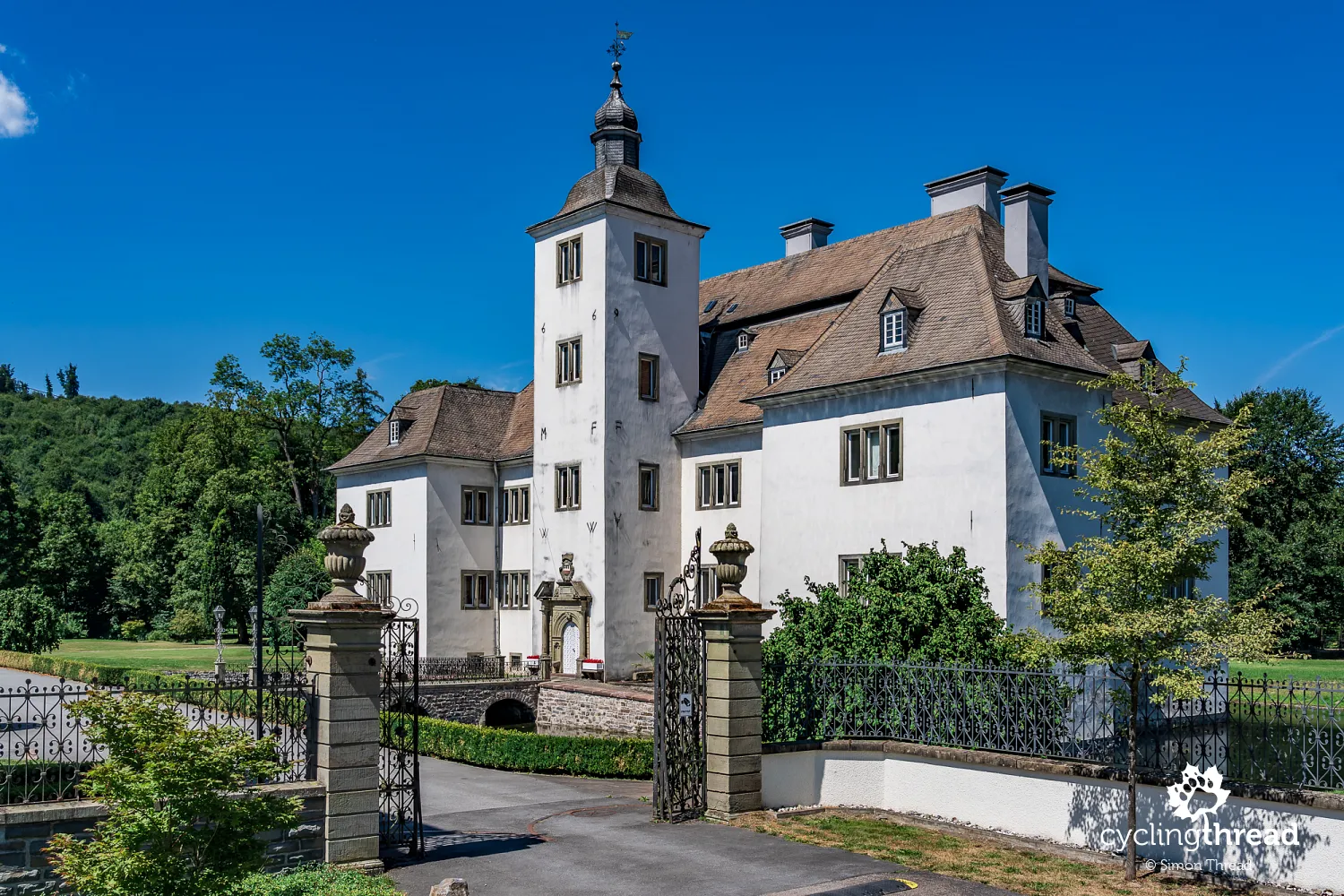
Schloss Laer in the Ruhr valley
Soon afterwards, we pass Schloss Laer, a former residence beside the Ruhr. The earliest mention of the estate dates from the 13th century, although its appearance today is the result of later changes. In the early 17th century, the earlier residence was rebuilt as a Renaissance manor house, with further sections added in the centuries that followed. The estate was linked to the von Westphalen family for several centuries. Its setting is worth noticing: the river, park and road create a scene very different from the one most people imagine when they hear the name Ruhr Area. Views like these still dominate this stage of our journey along the Ruhr Valley Cycle Route. Large industrial sites and the landscapes left behind by them will only appear several dozen kilometres later.
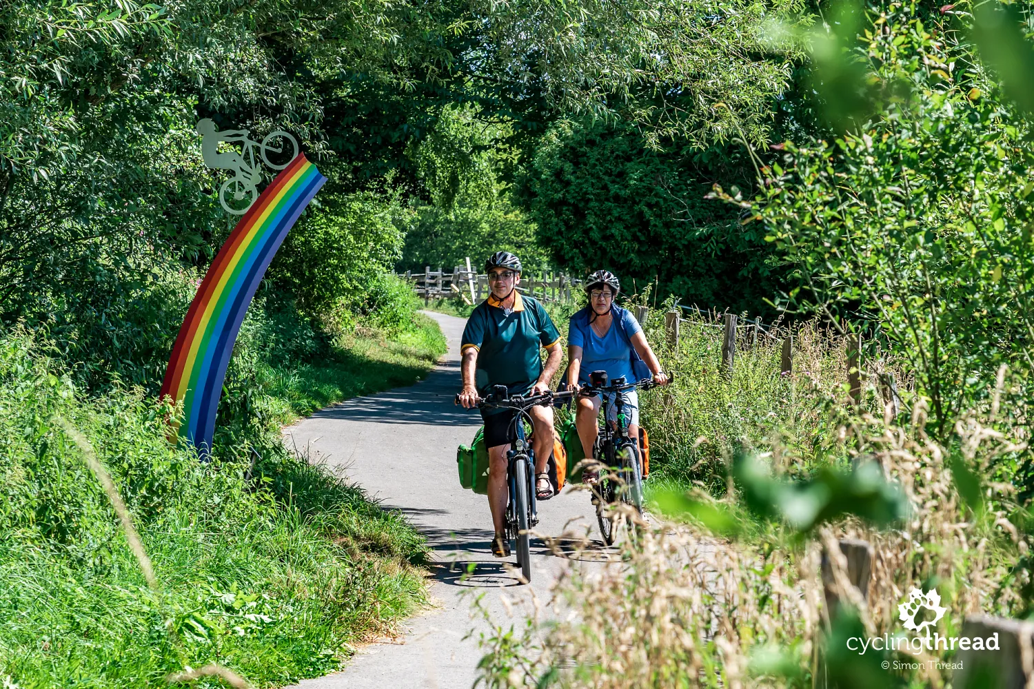
Oeventrop, route-side art and an old bridge
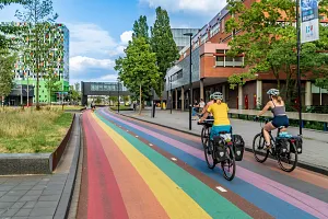
Before Arnsberg, we ride through Oeventrop, where several small art installations clearly refer to the cycle route. Among the works that caught our eye was "Kein Abfall", meaning "no rubbish", placed directly beside the cycle path, followed a little later by a colourful rainbow with the silhouette of a cyclist. Earlier, a short passage beneath the railway had been decorated with colourful graffiti and a large "RuhrtalRadweg" inscription. These small details show that the route is also present in local public spaces and has become part of their visual landscape. For cyclists passing through, they add some pleasant variety to the kilometres beside the Ruhr.
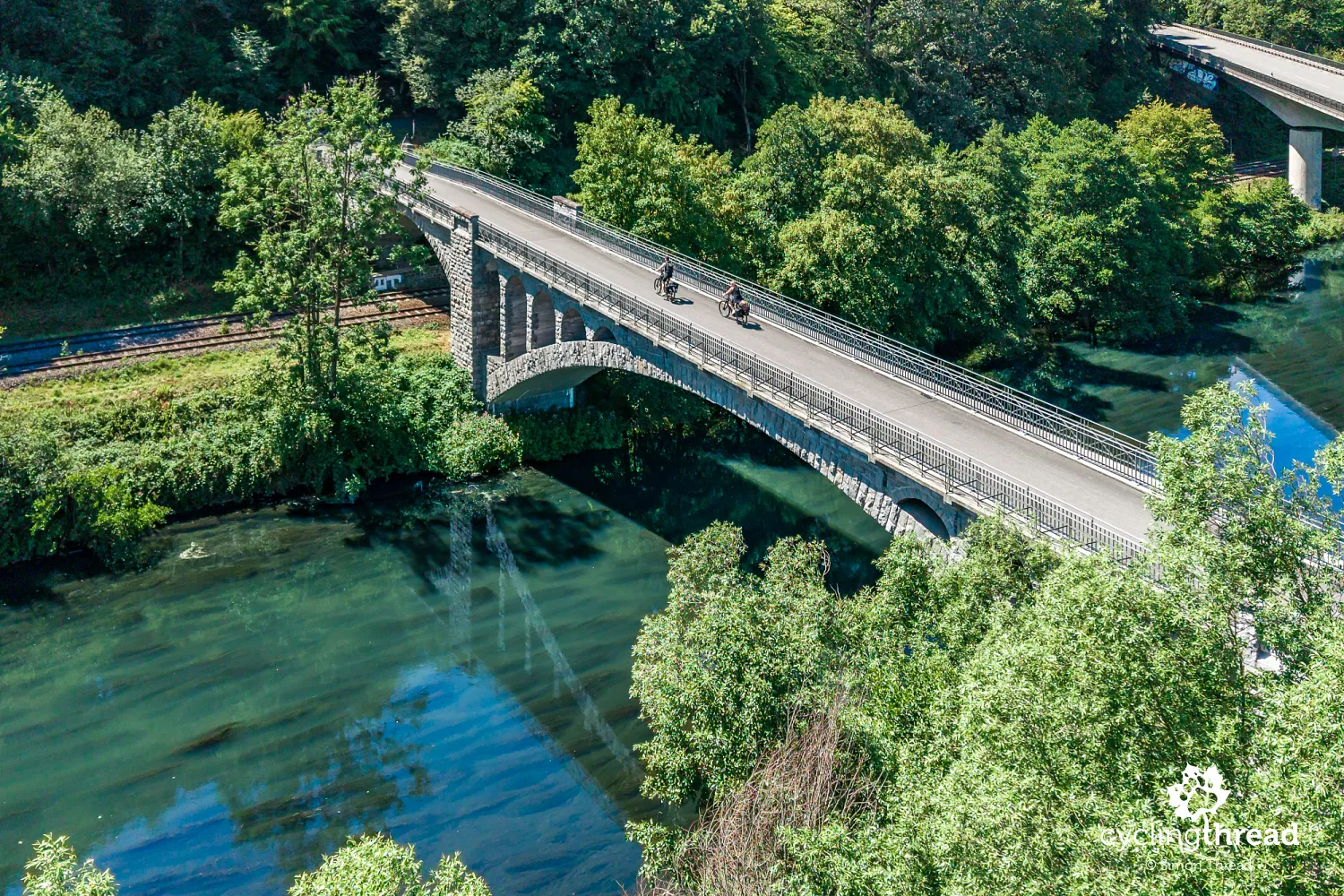
Near Rumbeck, we cross the Ruhr on the old Kaiser-Wilhelm-Brücke. Built for road traffic in the early 20th century, the bridge has served pedestrians and cyclists since a newer crossing was built. It spans both the river and the railway, a reminder that the valley has long been an important transport corridor. The stone structure also has a difficult history of its own: its central span was destroyed towards the end of the Second World War and rebuilt afterwards. Today, the bridge is a piece of infrastructure worth pausing on - it is also a pleasant viewpoint.
Arnsberg and the history of Sauerland
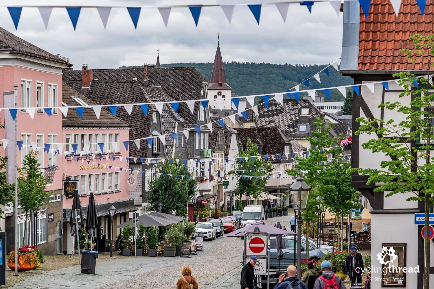
Arnsberg proved an excellent place to end our first stage. Its old town occupies a long ridge surrounded on three sides by a bend in the Ruhr, with the ruins of the medieval castle at its highest point. The town developed below the castle, once the seat of the Counts of Arnsberg, and much of its historic layout can still be followed on foot today. From the castle ruins, narrow streets descend towards Alter Markt, passing half-timbered houses, old stone buildings and remains of the town's former fortifications. This compact setting, high above the river, gives Arnsberg a very different character from the towns we had passed earlier that day.
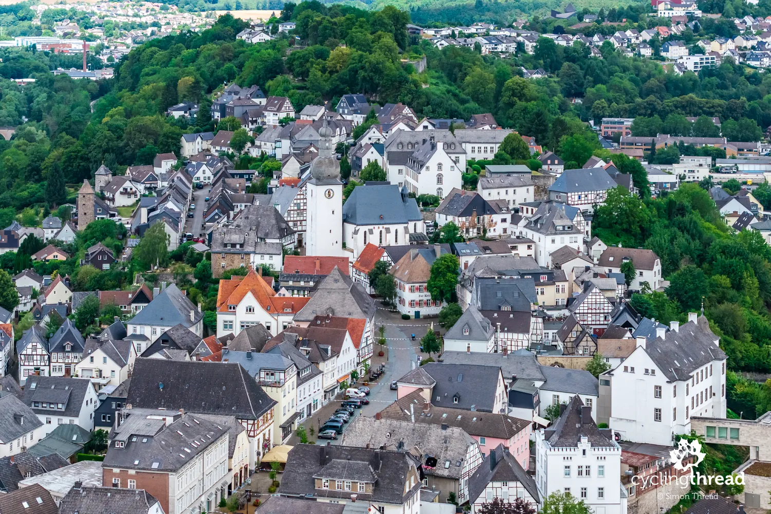
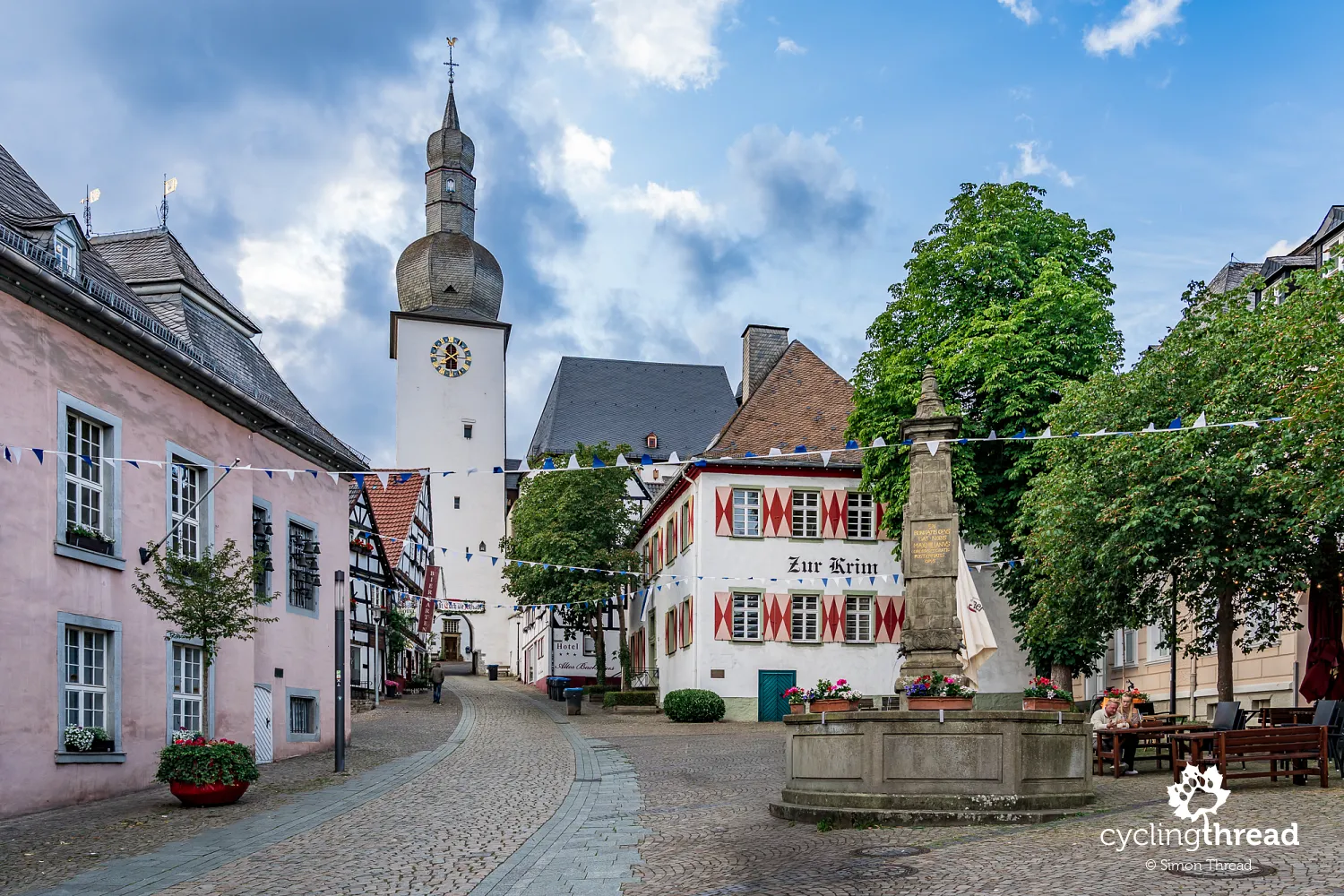
Alter Markt forms the heart of this historic part of Arnsberg. The elongated square is lined with old town houses and dominated by the Maximilian Fountain, while at its eastern end stands the striking Glockenturm, a former town gate and one of the most recognisable landmarks of the old town. Passing beneath the tower, the route continues along Steinweg towards Neumarkt, where the architecture gradually changes. Medieval and half-timbered buildings give way to more formal structures from the period when Arnsberg became an important Prussian administrative centre. An evening walk from the castle through Alter Markt and Steinweg, with dinner on the way, was a pleasant end to our first day beside the Ruhr.
You should not leave Arnsberg without visiting the regional Sauerland-Museum beside Alter Markt. Its main exhibition occupies the historic Landsberger Hof building and traces the history of Sauerland from its earliest settlements through the Middle Ages and the period of the Duchy of Westphalia to modern times. The exhibition combines archaeological finds, historical objects and multimedia displays, showing how everyday life, society and the region itself changed over the centuries. The 20th century is also covered, including the National Socialist period and the Second World War, presented from the perspective of Sauerland and its residents. A modern, multi-storey extension descends down the slope towards the Ruhr, making use of the old town's unusual location.
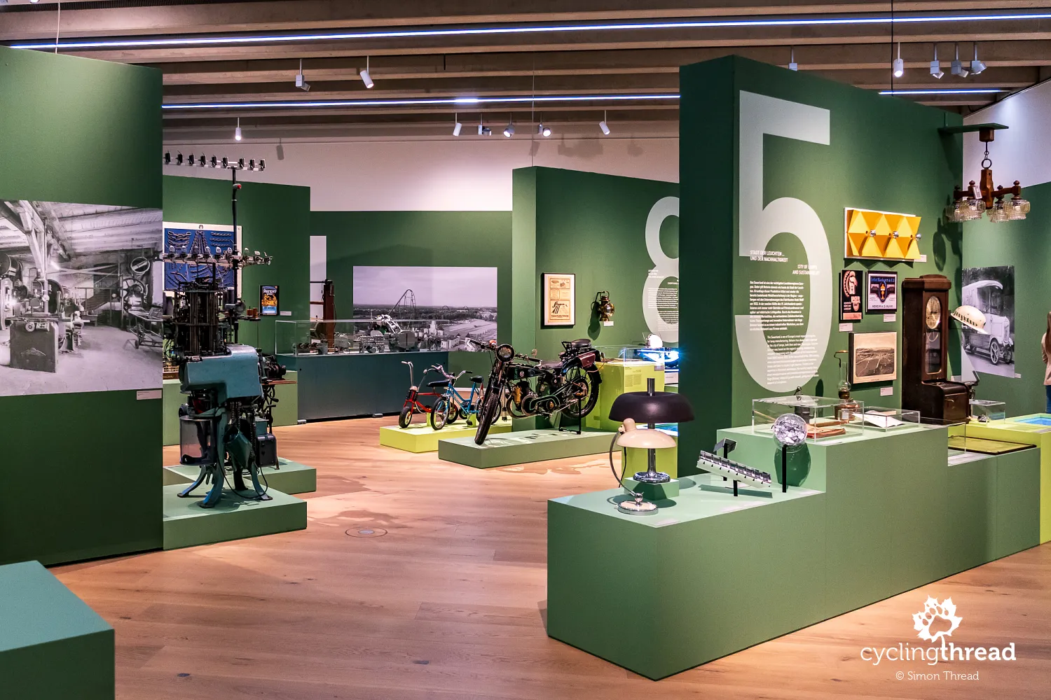
During our visit, there was also a temporary exhibition called "Macherland", devoted to 200 years of industry in Sauerland. It gave a particularly interesting picture of the region's post-war development, driven by small and medium-sized businesses, often family-owned, making a wide range of products. Their number and the range of their production gave the impression of an almost economically self-sufficient Sauerland - from simple everyday objects to machinery and more advanced industrial products. Many of these companies eventually reached far beyond the local market, and some still operate today. One symbol of this post-war enterprise is the Kleinschnittger, a small car produced in Arnsberg between 1949 and 1957. Südwestfalen remains one of the most industrialised regions of North Rhine-Westphalia today.
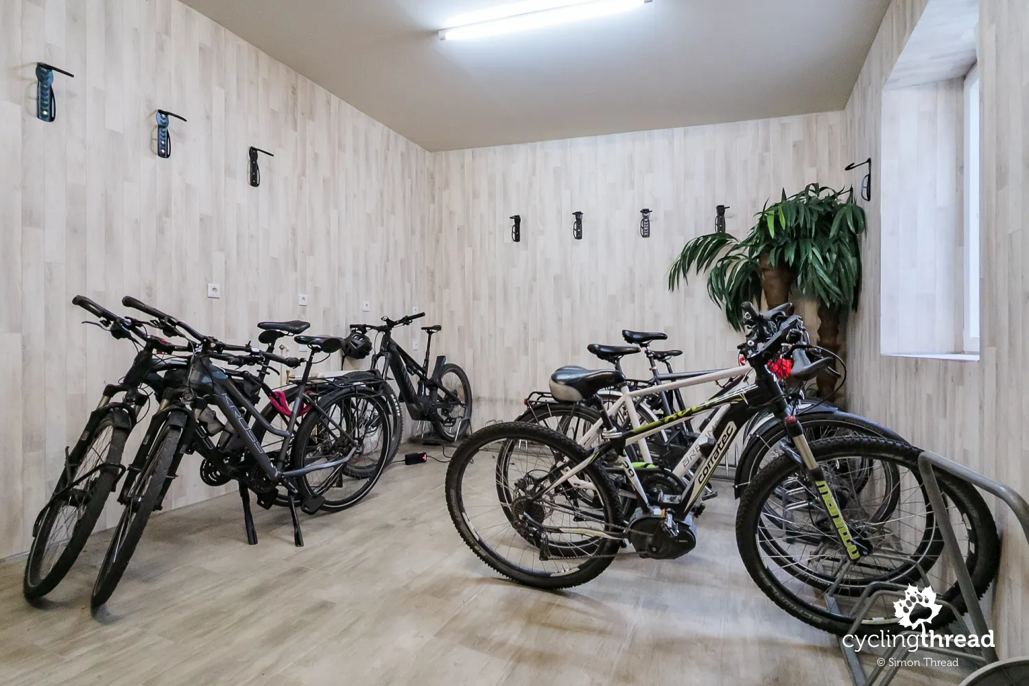
We also remember Arnsberg for an unusual arrangement for cyclists. Our hotel occupied a beautiful historic house without its own bike room, so a separate, lockable room had been provided a few dozen metres away, across the street. We received our own key, giving us free access to the bikes and somewhere safe to leave them overnight. Inside were hooks for hanging bicycles and sockets for charging electric bikes. The hotel was, of course, part of Bett+Bike, Germany's network of certified bike-friendly accommodation.
Victims' portraits beneath a viaduct in Neheim
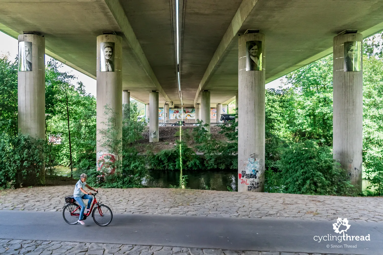
Beneath a road viaduct in Neheim, we find a place recalling one of the greatest tragedies in the history of the Ruhr valley. On the night of 16-17 May 1943, during Operation Chastise, British bombers from RAF No. 617 Squadron attacked the Möhne, Eder and Sorpe dams. The destruction of the dam at Möhnesee sent a huge flood wave down the Möhne valley towards the Ruhr. In Neheim, it flooded the Möhnewiesen camp, among other places, where female forced labourers brought to work in local industry were housed. Hundreds of them died. Today, 17 large black-and-white portraits on the viaduct's pillars commemorate the victims. Artist Astrid Breuer created them from photographs on surviving personnel records of the forced labourers. The installation was part of the "Opfer der Möhnewiesen" project, carried out with students from St. Ursula-Gymnasium in Neheim to restore the memory of the disaster's victims.
Fairness Zone on the Ruhr Route
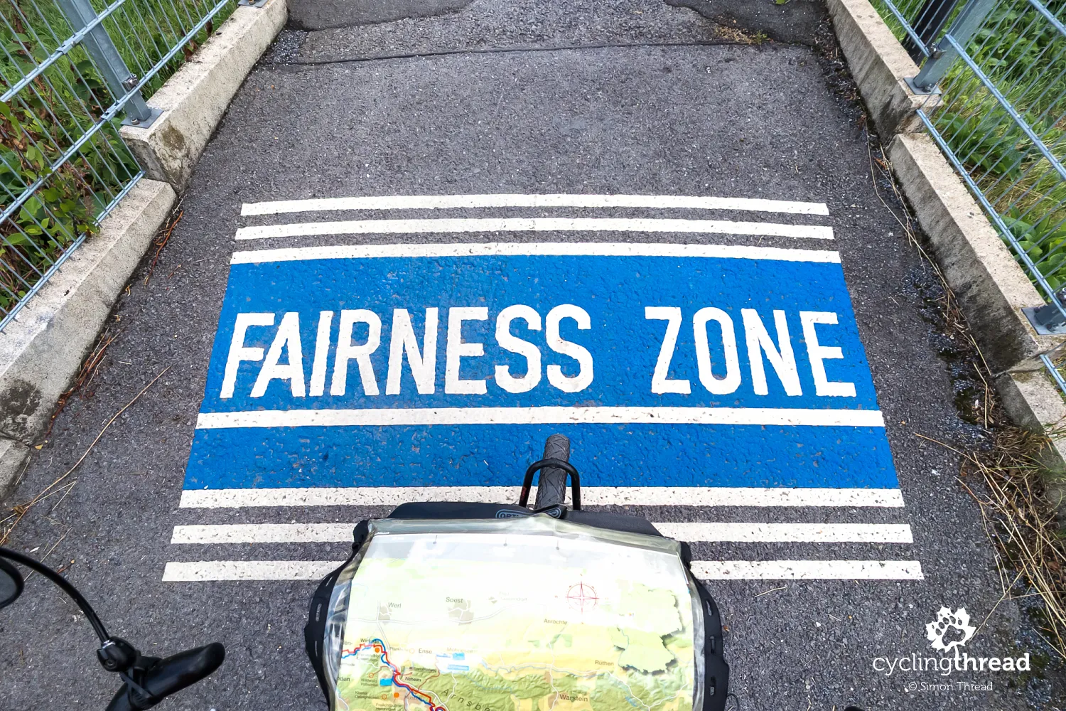
Shortly after Arnsberg, we also came across a sign marking a Fairness Zone. It is a shared section of the route where cyclists and pedestrians are reminded to be considerate of each other, reduce speed when necessary and leave enough space for other users. The idea is simple, but the sign fits well with the way the Ruhr Valley Cycle Route is organised: instead of separating every type of traffic, it also uses clear communication to encourage appropriate behaviour where different users share the same space.
An easy ride beside the wide Ruhr
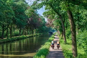
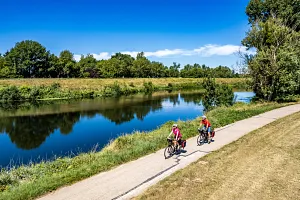
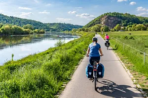
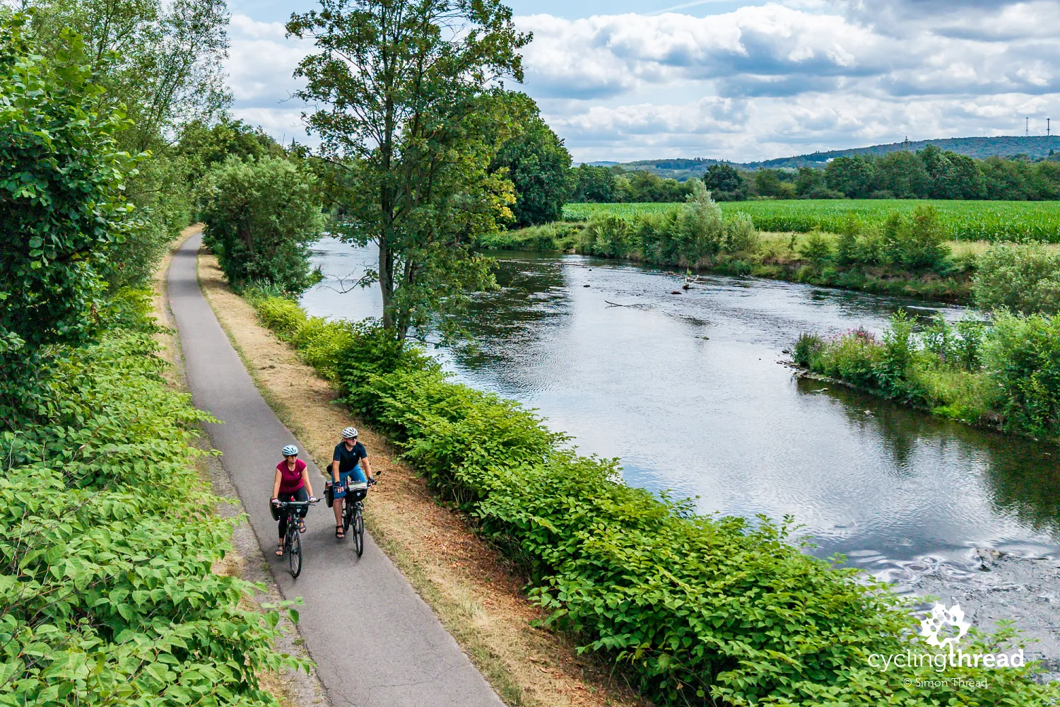
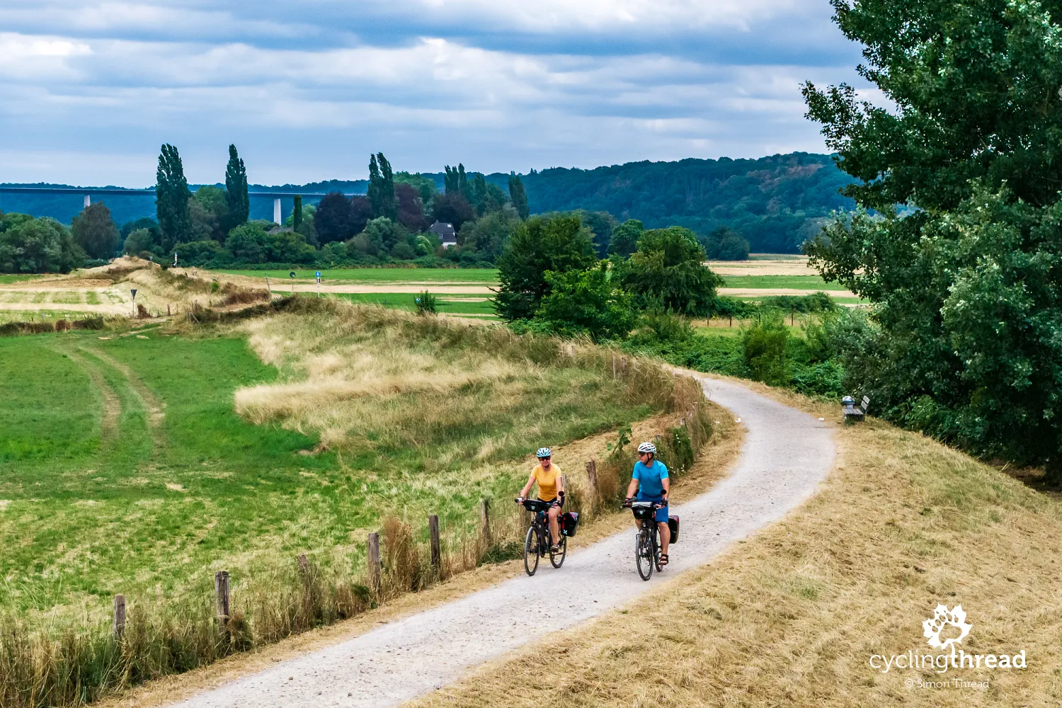
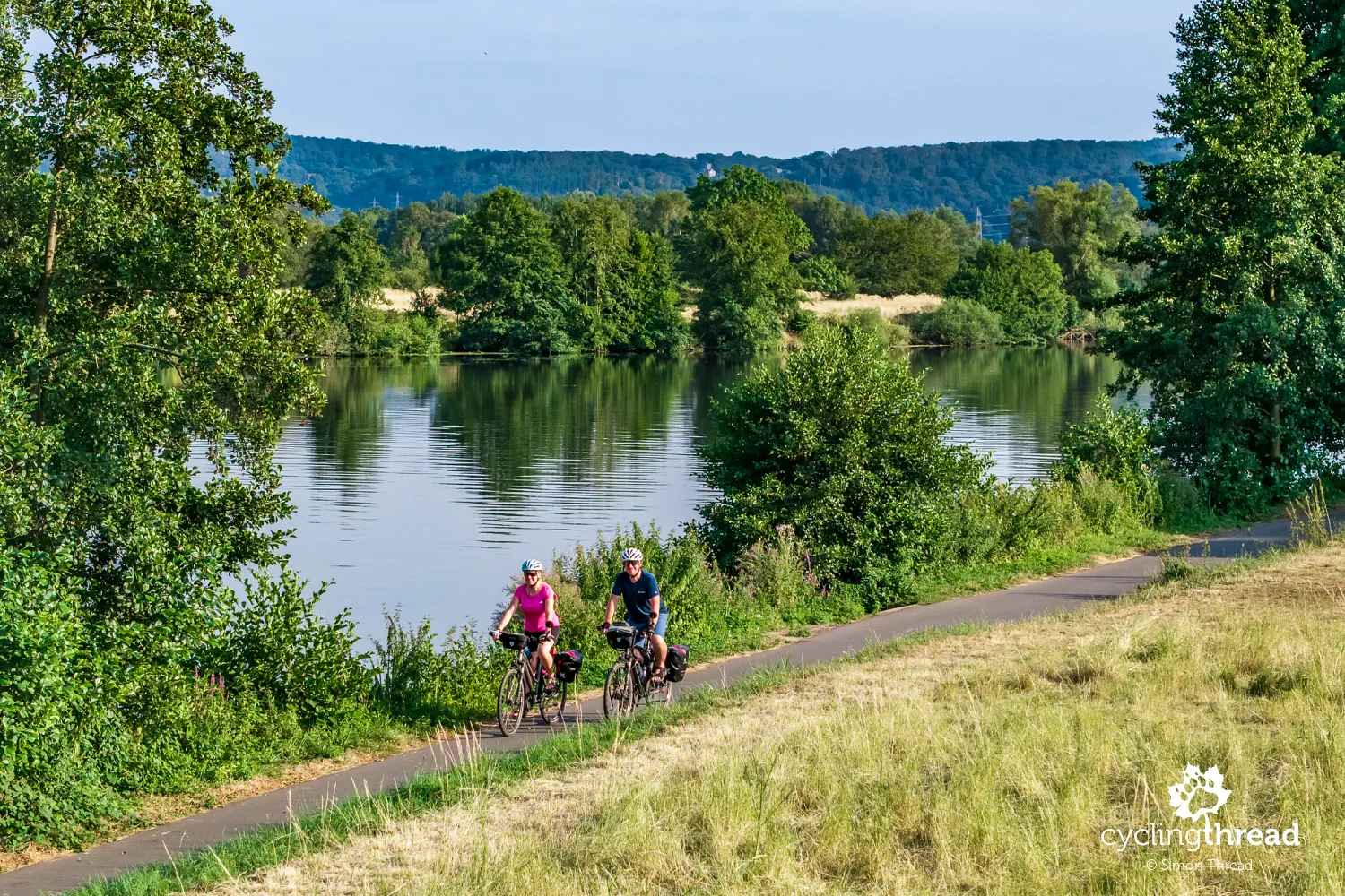
Beyond Neheim, we reach the sort of stretch that draws people to long river routes. The asphalt cycle path runs close to the Ruhr, which stays beside us for long stretches, and its smooth surface lets us keep our own pace without constantly stopping at junctions. We can ride side by side and talk, then slow down for a view that catches our eye without having to find a safe place off the road. With panniers, we also appreciate the lack of sudden surface changes: the bike rolls along steadily, leaving our attention on the river and the landscape. A dozen or more kilometres of riding like this matters more to the quality of the whole day than one spectacular attraction.
Schwerte - the old centre and Rohrmeisterei
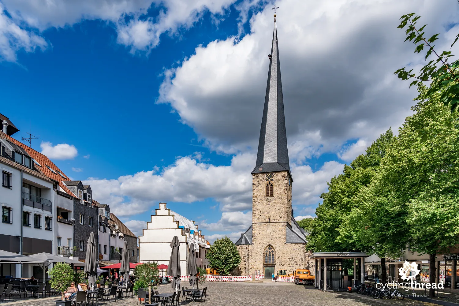
In Schwerte, we take a break from riding beside the river and head to the market square. The town was first mentioned in 962 and received town rights in 1397. In the late Middle Ages, Schwerte belonged to the Hanseatic League, with crafts and metalworking playing an important role in its economy; another period of growth began with the arrival of the railway in 1867 and the development of industrial plants. St. Victor's Church rises above the square, its slightly crooked spire hard to mistake for any other. The old town hall of 1547 stands beside it, and several nearby streets retain the scale of the earlier town. Inside the church, the late Gothic Golden Altar of 1523 is worth a closer look.
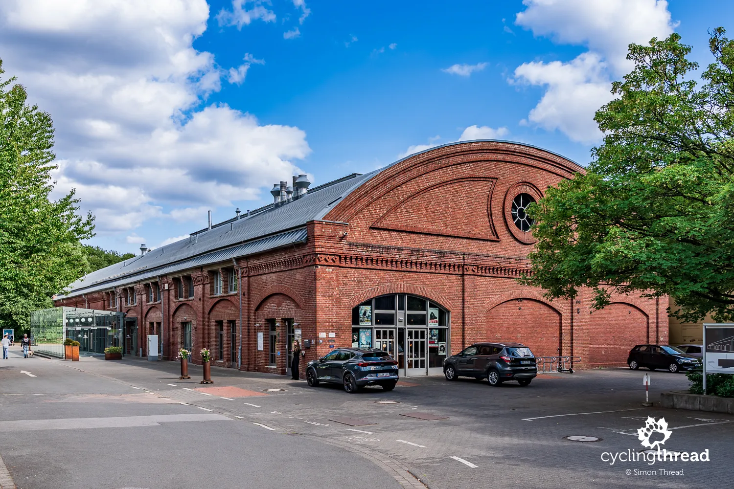
Returning towards the Ruhr, we reach Rohrmeisterei, another reminder of the growth of industrial infrastructure in the river valley. The brick complex was built in 1890 as a pumping station, taking water from the Ruhr, cleaning it through gravel filters and pumping it north to supply the growing eastern part of the Ruhr Area. Pumping ended in 1920, and the site began to serve the maintenance of Dortmund's water supply network - the function from which the name Rohrmeisterei came. Today, the former technical halls house cultural venues and restaurants. The brick complex stands between Schwerte's centre and its riverside recreation areas.
A special offer for cycling tourists
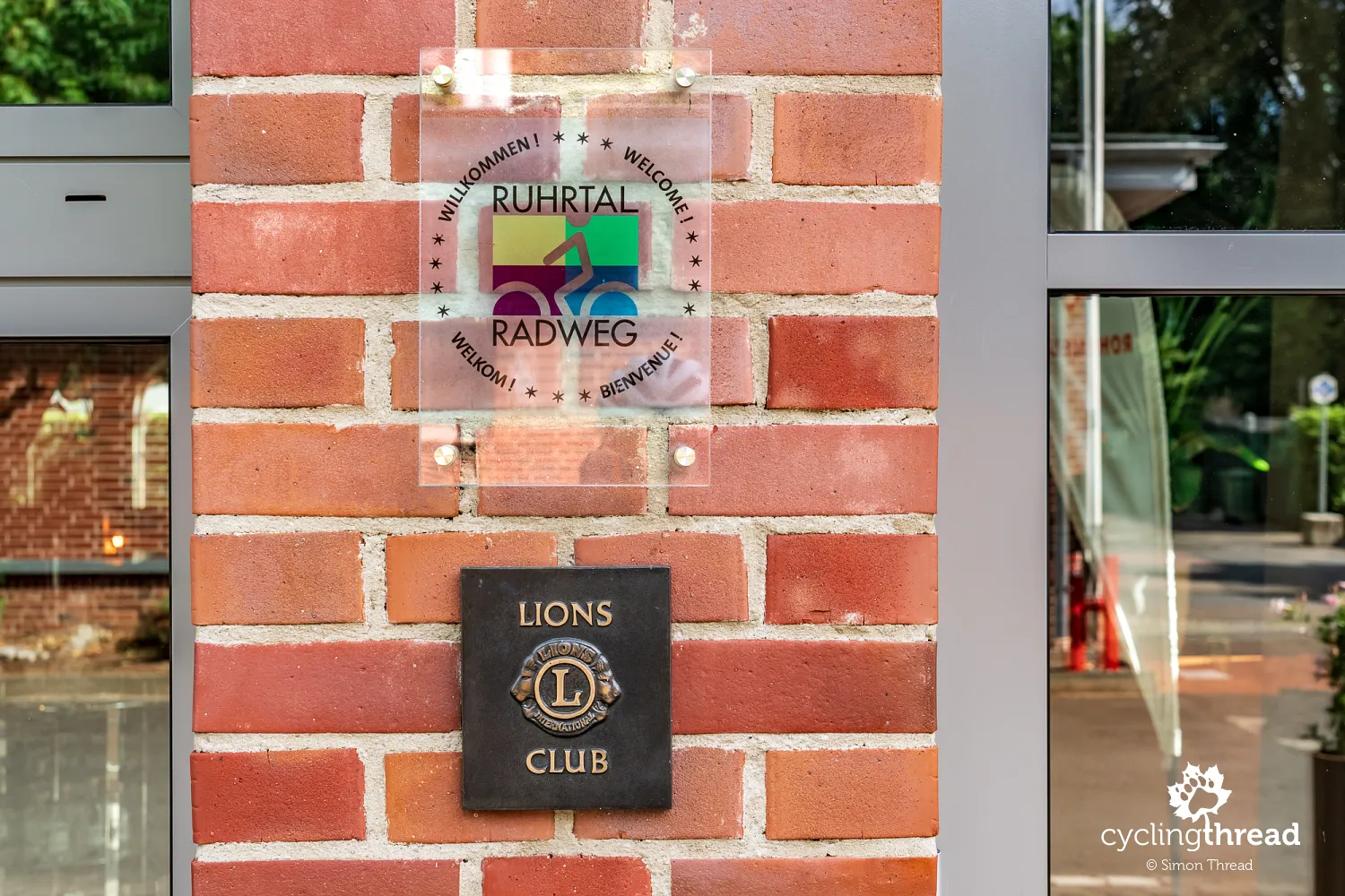
On the building, we notice a plaque bearing the name of the Ruhr Valley Cycle Route. Behind this simple sign is cooperation between businesses and the organisation managing the route, making it easier to recognise places ready to welcome visitors arriving by bike. Interestingly, in 2026 the organisers are also running a "3-Gänge-Menü" campaign: at various restaurants, you can order dishes included in the route's offer and put together your own three-course meal over one or several days. Rohrmeisterei is one of the participants, and the list also includes restaurants in other towns on our journey. It is a small but clever way of connecting food with a route passing through many towns.
Haus Ruhr and art education
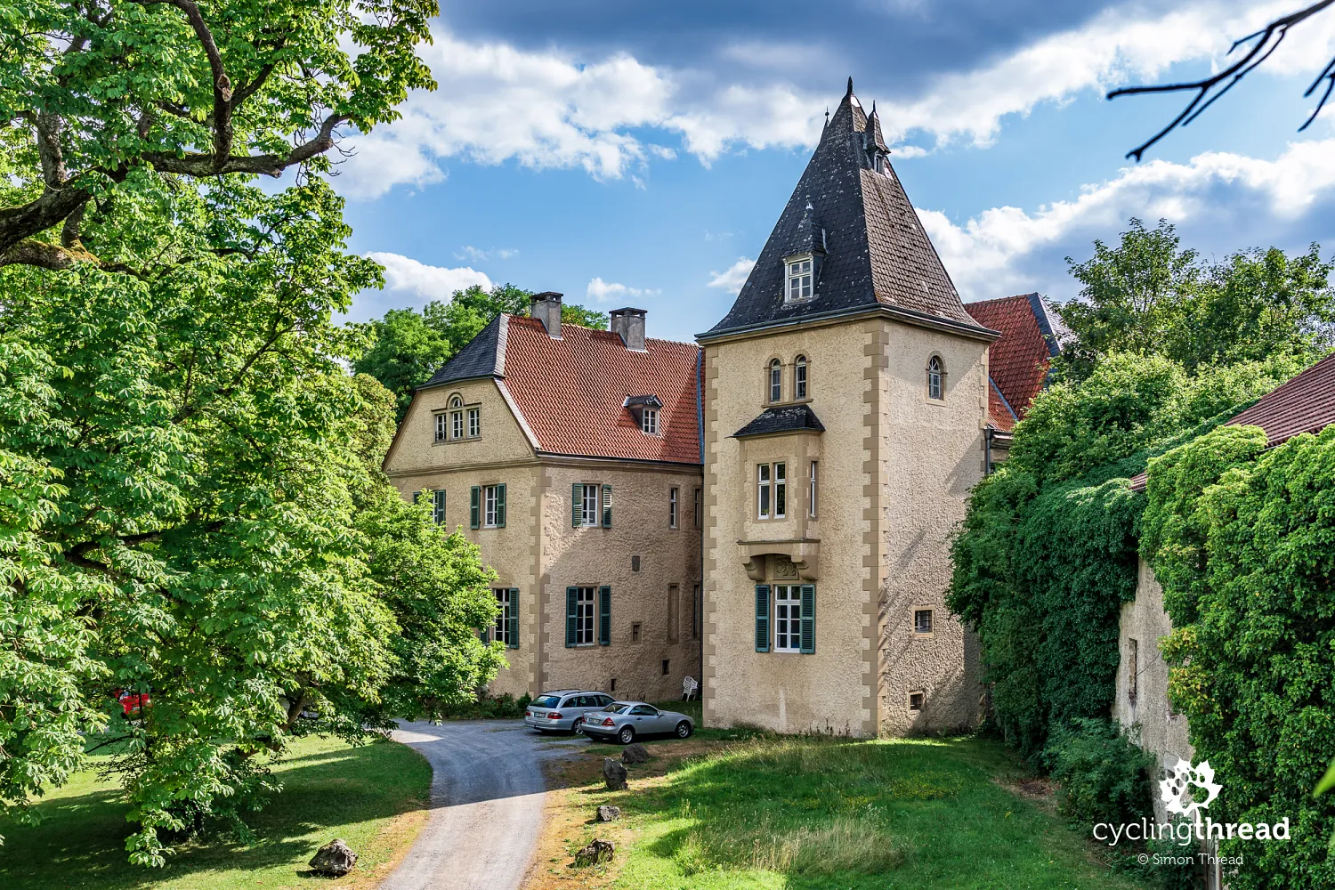
Further on, we pass Haus Ruhr in Wandhofen, a former moated stronghold built in 1455. The present complex is the result of later rebuilding, and its surviving buildings mainly date from the 17th and 19th centuries. In the 19th century, an English-style landscape park was created around the residence, while an old horse chestnut tree in the courtyard is among the oldest in the region. Since the late 1980s, Haus Ruhr has served art education. Following restoration, it became home to Ruhrakademie, a private school training graphic designers and artists, among others.
Comfortable travel on the Ruhr cycle route
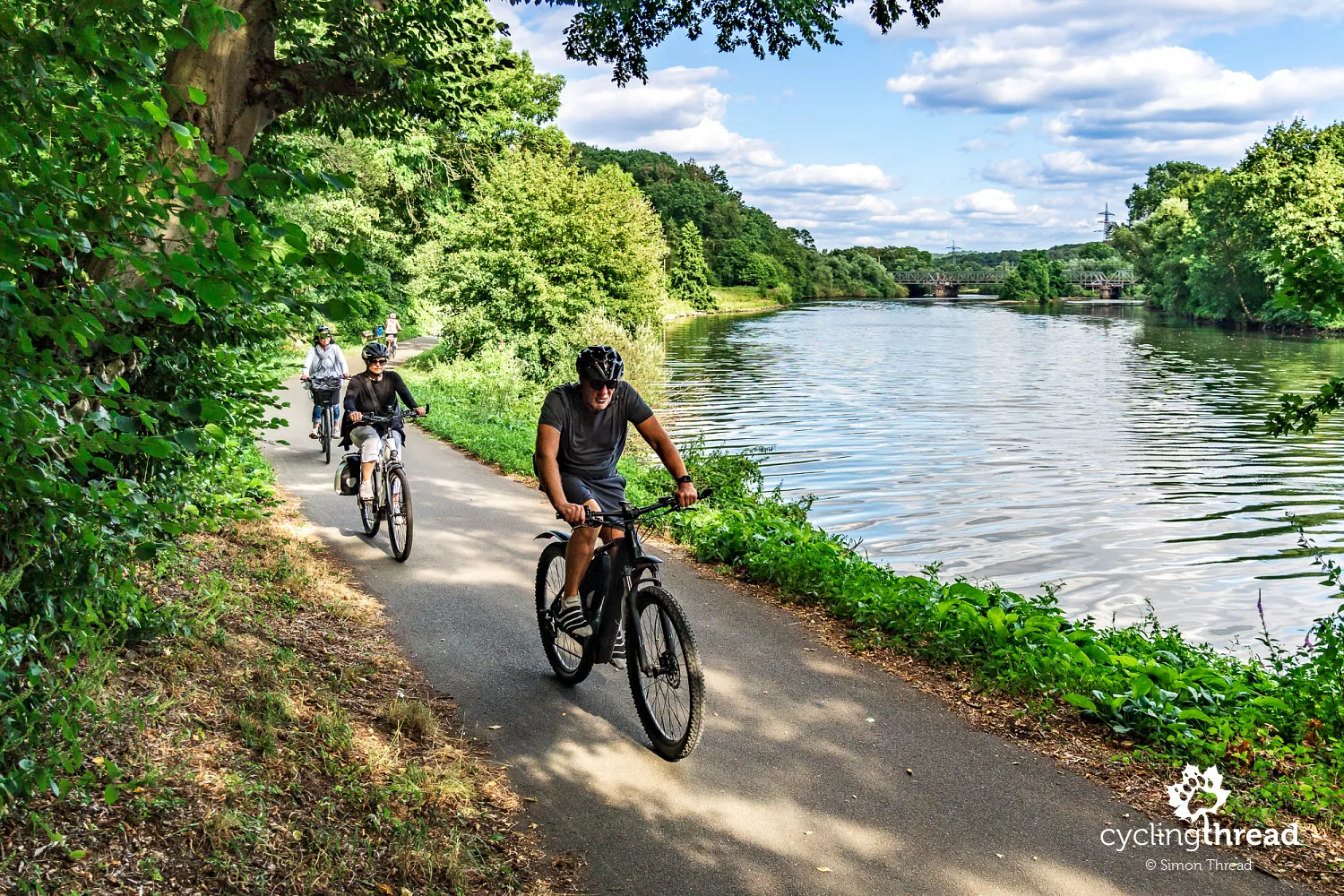
Beyond Schwerte, we find more very comfortable cycling stretches. This time, we notice how well the route takes us between towns without forcing us through their busiest streets. Sometimes the Ruhr is close, and sometimes it is further away behind the trees, while local connections used by residents cross our path. The Ruhr route therefore does not feel like a separate strip created only for tourists. It is part of the everyday network of paths that we can use to travel through the region with our panniers.
Koepchenwerk - a former pumped-storage power station
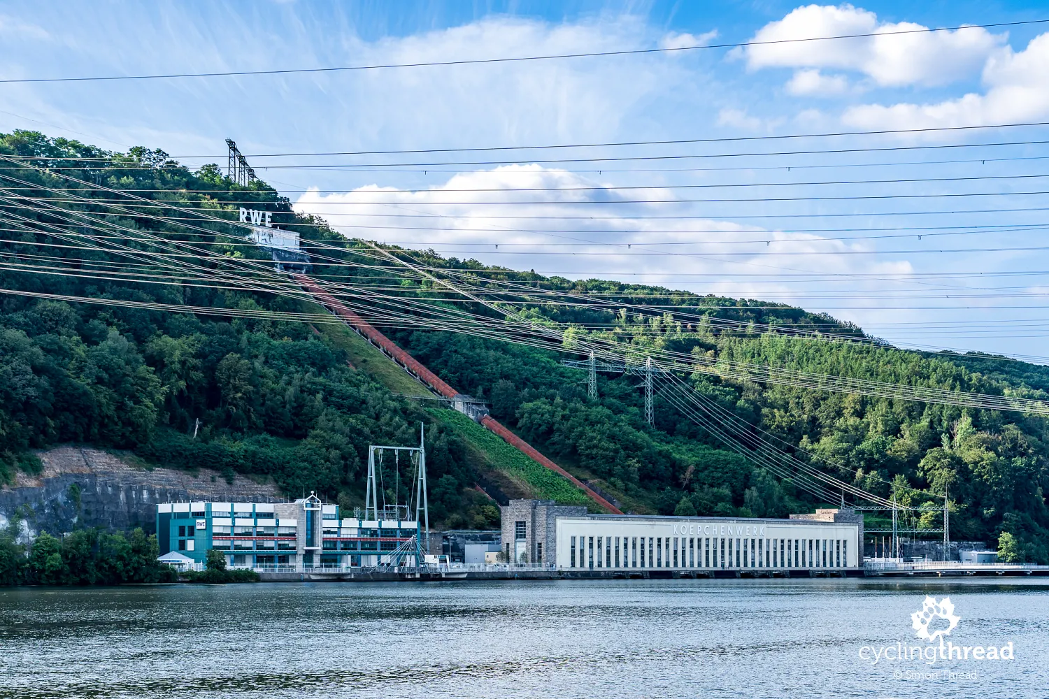
On the northern shore of Hengsteysee - one of the reservoirs created on the river - stands Koepchenwerk, a former pumped-storage power station opened in 1930. Water was pumped from the reservoir in the valley to a basin high above it, then flowed back through turbines when electricity demand increased. This allowed energy to be stored for the hours when the region needed it most. The historic plant no longer performs its original function, but has been preserved as an industrial monument; a newer power station nearby uses the same principle. Koepchenwerk is another place along the route where a lakeside view also tells a story about the industrial region's demand for water and energy.
Hengstey power station and an old railway crossing
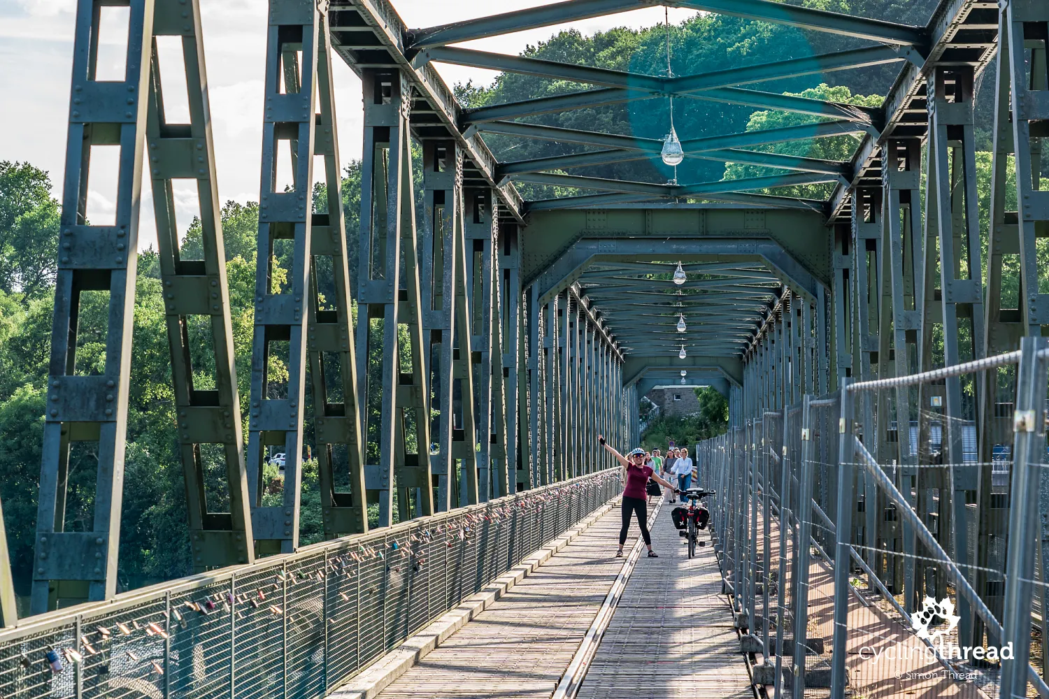
Hengsteysee ends at Laufwasserkraftwerk Hengstey, a hydroelectric power station built with the weir in the 1920s. Damming the Ruhr here created the lake, and the power station still uses a water-level difference of around 4.6 metres and three Kaplan turbines. For cyclists, the steel crossing beside the power station is just as interesting. It once carried, among other traffic, an industrial railway connected with Koepchenwerk, as the rails preserved in its surface still show. Today, it allows walkers and cyclists to reach the other bank of the Ruhr. Bikes must be pushed here, which also gives us more time to look at the power station, the weir and the old bridge structure.
Herdecke between the Ruhr and local history
Herdecke lies between Hengsteysee and Harkortsee, but it is worth leaving the riverbanks for a moment and heading into the centre. The older streets feel more intimate than you might expect in a town so close to Dortmund and Hagen. On Hauptstraße stands Frederunabrunnen, a fountain commemorating Frederuna, whom local tradition credits with founding the former convent. The most important reminder of the town's earliest history is the nearby Stiftskirche, associated with the convent around which the medieval settlement developed. It is a good place to end the day: in the morning, we were still around Arnsberg and Sauerland, and by evening we are beside lakes, former power stations and the edge of the Ruhr Area.
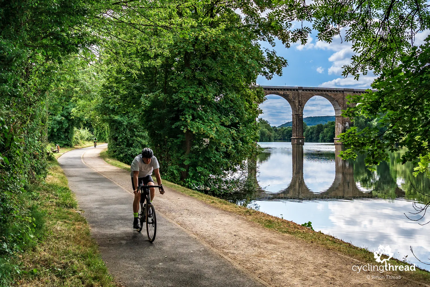
Beneath the great viaduct over the Ruhr
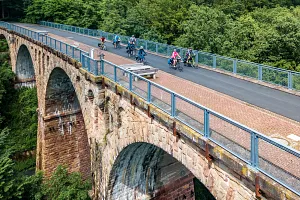
Leaving Herdecke, we almost immediately pass Ruhrviadukt, one of the most distinctive engineering structures in this part of the valley. The railway viaduct opened in 1879 as part of the Rheinische Eisenbahn route towards Dortmund, and its construction was among the more difficult and expensive projects on that line. The sandstone structure is 313 metres long, almost 30 metres high, and consists of 12 semicircular arches spanning 20 metres each. Interestingly, we encounter the story of the Möhne disaster again here - in May 1943, the flood wave from the destroyed dam undermined and swept away one of the viaduct's pillars, and the structure was badly damaged again towards the end of the war. Trains still cross it today, while RuhrtalRadweg runs beneath it at the beginning of Harkortsee. Soon afterwards, we are riding beside the lake, with water on one side and a steep, wooded slope on the other.
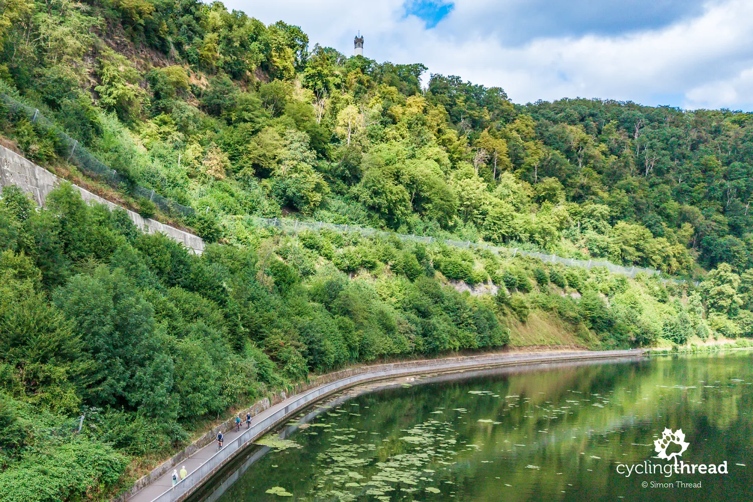
The path along Harkortsee sometimes resembles a wide pavement, and sometimes follows a narrow strip at the foot of a steep, wooded slope. This is not a stretch for fast riding, as walkers and other cyclists share the same space. Above us, on the hill on the Wetter side, stands the 35-metre Harkortturm, built in 1884 in memory of Friedrich Harkort. He was one of the pioneers of the region's industrialisation, developing machine manufacturing and taking an interest in railways and transport, with some of his industrial work linked to Wetter itself. Harkortsee also bears his name, so it appears particularly often on this short stretch. From the cycle route, the tower remains high above us, while the path between Herdecke and Wetter follows the lake almost continuously for several kilometres.
Wetter and the beginnings of industrialisation
In Wetter, we can say that we have entered the Ruhr Area, although the surroundings of Harkortsee are nothing like its industrial stereotype. It is also a good place for a closer first encounter with the history of the region's industrialisation. As early as 1819, Friedrich Harkort founded Mechanische Werkstätten in Wetter, one of Prussia's first modern machine factories, which built steam engines among other products. He was also one of Germany's early supporters of railways and recognised their importance for transporting coal and developing industry. In the following decades, the combination of mines, ironworks, factories and railways would completely transform the region's landscape.
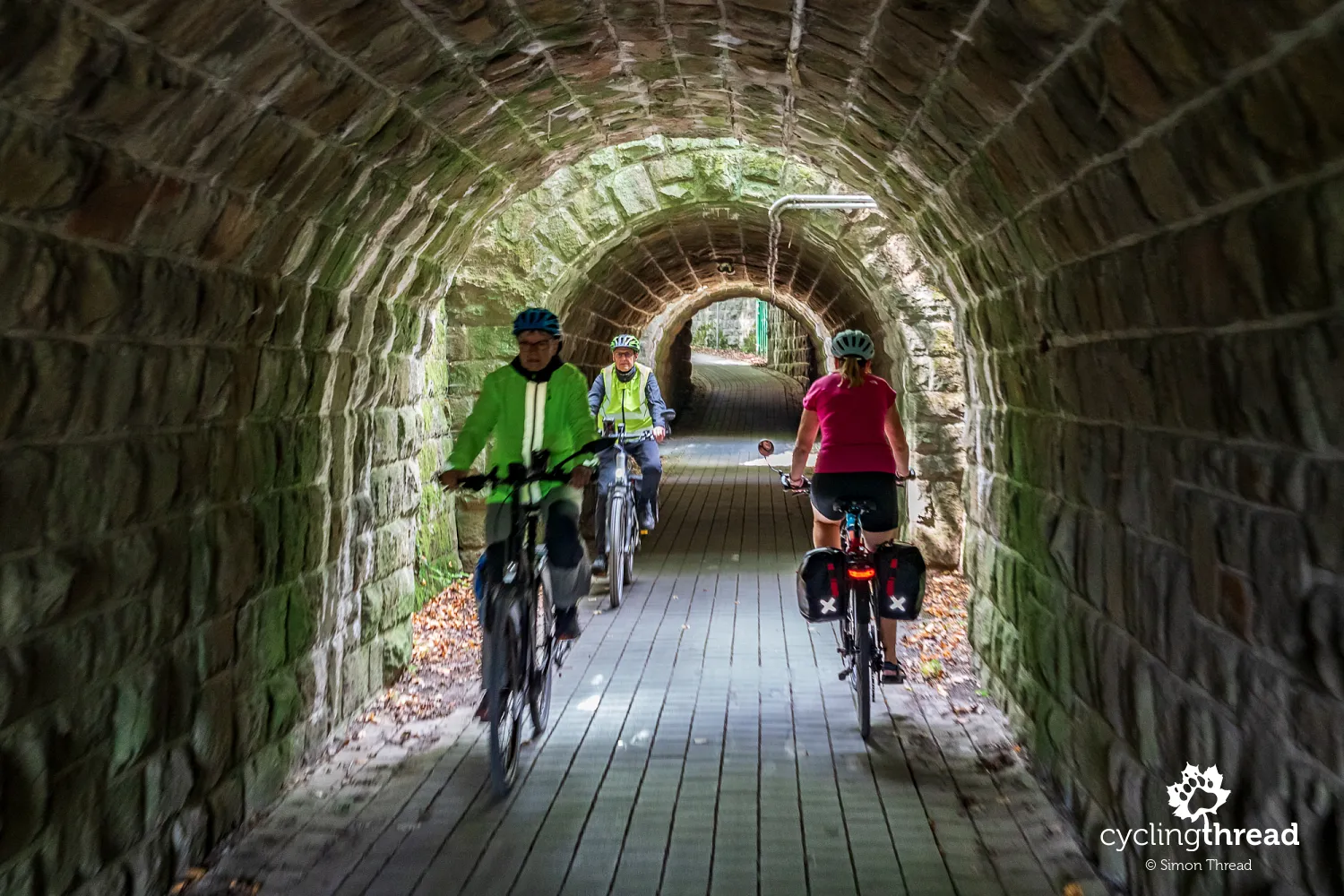
Around Witten, we increasingly ride along traces of infrastructure created for the industrial Ruhr. One is the former Elbschetalbahn, a railway built in the early 20th century to connect Witten with the Schwelm area. Taking it through rolling terrain required tunnels, embankments and large stone viaducts. RuhrtalRadweg passes through a short tunnel on the former line, and soon afterwards offers a view of the five-arched viaduct over the Elbsche valley. Trains stopped running here long ago, but part of the former track bed now serves walkers and cyclists, retaining the gentle gradients once needed by the railway. Bridges, tunnels and embankments still help overcome the same changes in elevation, with bicycles now their main users instead of trains.
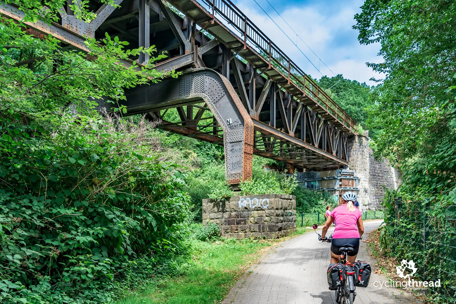
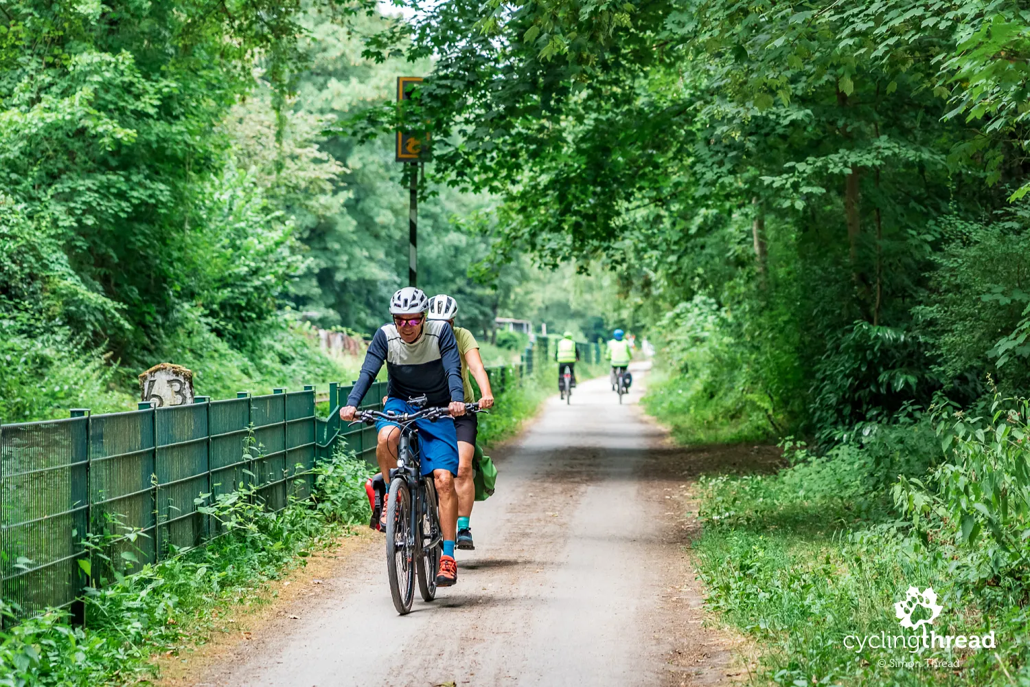
Further on, we use a route connected with the former Ruhrtalbahn. The railway between Hattingen and Hagen-Vorhalle opened in 1874 to serve mines and industrial plants in the Ruhr valley. Its arrival changed coal transport - shipping on the Ruhr had previously been one of the main ways of moving it out, but coal could now be loaded directly into wagons and sent by rail. Nachtigall mine, which we will soon pass, was among the sites connected in 1874. A section of the former track bed between the Hardenstein ruins area and the mine opened to cyclists in December 2005, followed by another section near Bommern in spring 2006, just before the Ruhr route was inaugurated. We are riding on infrastructure that first helped rail replace river transport, then found another use as a cycle path more than a century later.
Nachtigall mine and the beginnings of coal mining
Zeche Nachtigall is the first major industrial museum on our route, and it is worth allowing time for a longer stop. Coal mining in the Muttental valley goes back around 300 years, but the real turning point came in the 19th century, when small-scale tunnel mining began to give way to a deep mine. A steam engine was put into operation at the Hercules shaft in 1832, and in the mid-19th century Nachtigall was, for a time, one of the largest coal mines in the entire Ruhr Area. After mining ended in 1892, a brickworks operated on the site, so today's museum presents several successive stages of its industrial history. The exhibitions also cover coal transport and former shipping on the Ruhr. A particularly memorable experience is entering the Nachtigallstollen tunnel, where you can see a real coal seam.
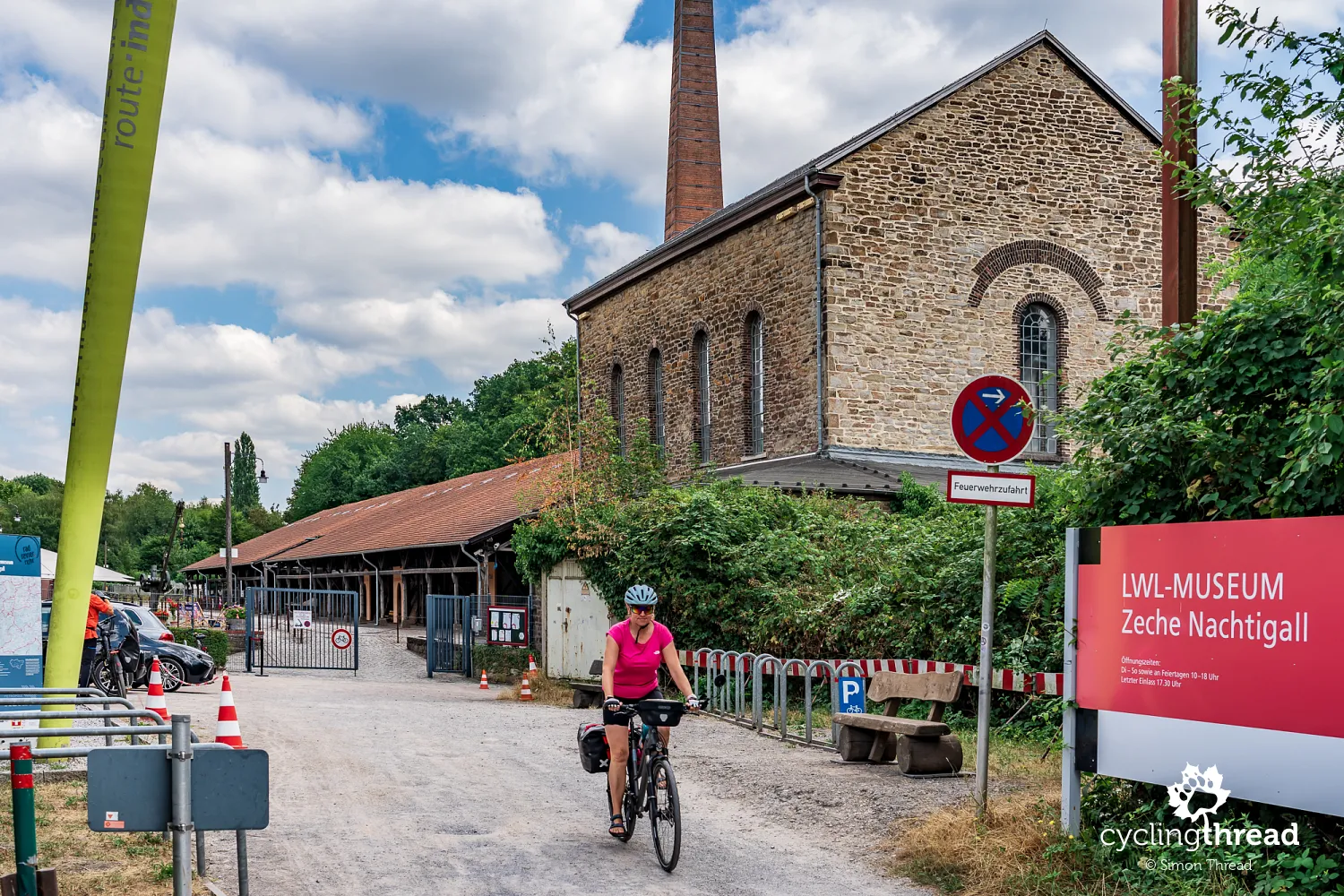
The historic steam engine is also worth noticing, as it is started up and shown in motion during demonstrations. You can watch the piston, large flywheel and drive mechanism working at close range - parts that usually remain static objects in industrial exhibitions. The engine was once part of the machinery that powered the mine's operations, showing how steam technology supported industrial work before electric drives became standard. The whole site still has the character of a former industrial plant, with brick buildings, a chimney and equipment arranged around the old mine. After the visit, you can stop at a small café inside former railway carriages standing right beside the route.

The Hardenstein ferry on the Ruhr route
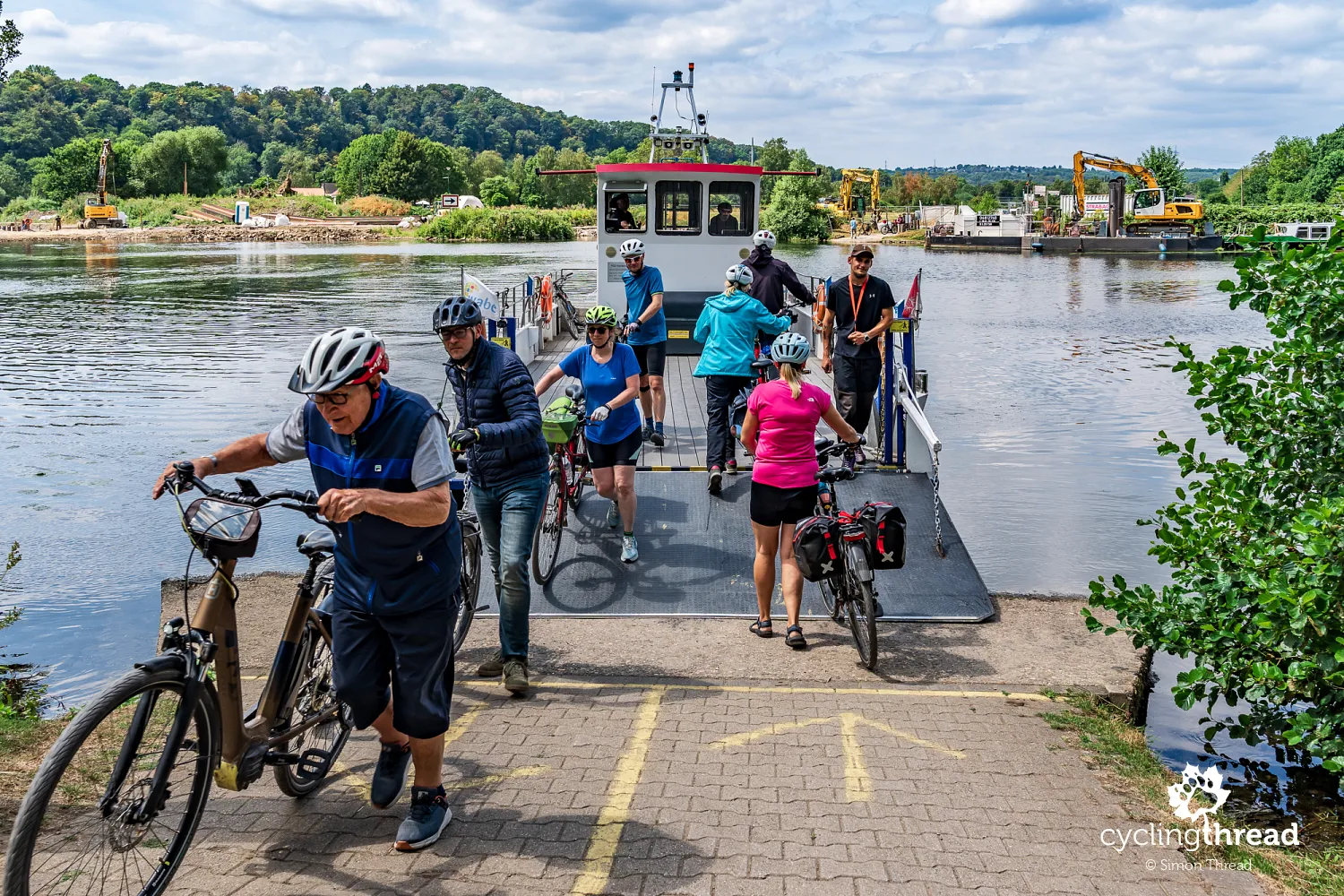
Near the ruins of Hardenstein Castle, the Ruhr cycle route brings us to the small Hardenstein ferry. This free crossing for walkers and cyclists connects the two banks of the Ruhr and forms part of the route. The journey takes only a few minutes, and on arrival the ferry picks up the next waiting passengers, so there is no need to organise the day around a single sailing. Before setting out, however, it is worth checking whether it is running - high water or other unfavourable conditions can stop the service. A cyclist barely has time to look around the river before it is time to wheel the bike ashore again. Despite the short journey, the Hardenstein crossing adds some pleasant variety to the kilometres along the Ruhr.
The moated castle of Haus Kemnade
On the other side of the river, it is worth making time for Haus Kemnade. The history of this moated residence goes back to the 12th century, although its present appearance mainly comes from rebuilding and extensions beginning in the late 16th century. The castle also has an interesting connection with the Ruhr itself: it originally stood north of the river, but during a major flood in 1486, the Ruhr changed its course, leaving Haus Kemnade on its southern side. The roughly one-kilometre detour from RuhrtalRadweg does not require a major change to the day's plans. After Nachtigall mine, the old railway line and the ferry crossing, we arrive at a place whose history began many centuries before the Ruhr valley's industrialisation.
Cycle paths accessible to everyone
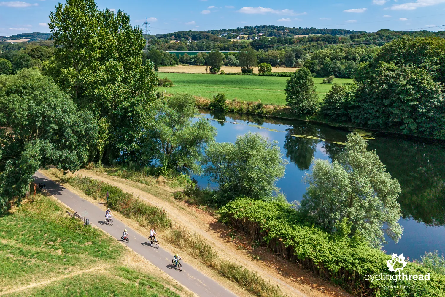
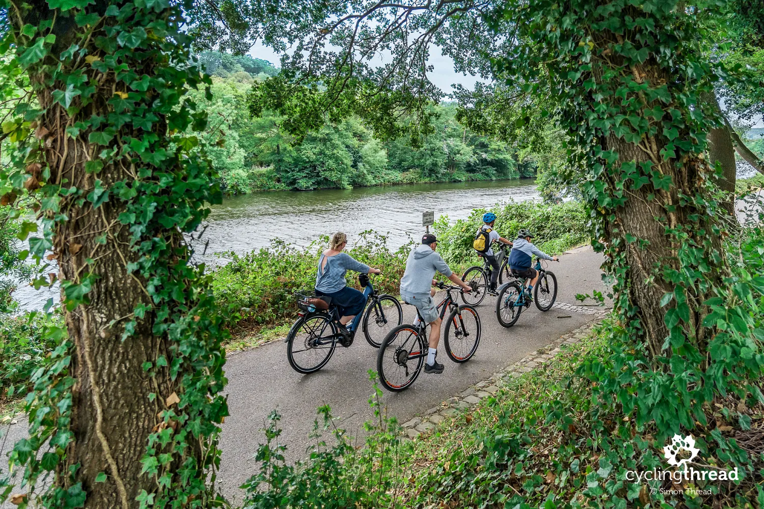
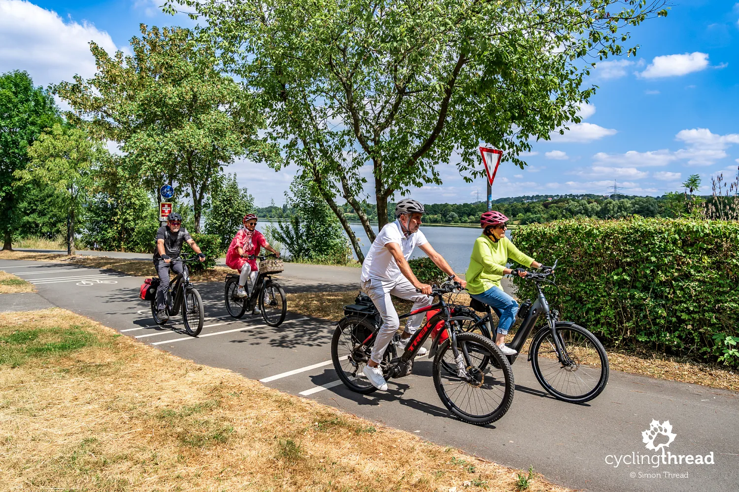
Before reaching Hattingen, we are once again impressed by the cycle paths beside the Ruhr. Comfortable, wide paths follow the river, revealing how many different people use them. We see every kind of bicycle - city, touring, electric and road bikes - with families and children and older people riding alongside experienced cyclists. The width of the paths, good surfaces and gentle gradients let everyone travel at their own pace without having to adapt to one style of riding. This accessibility is what catches our attention: the Ruhr Valley Cycle Route is not designed only for visitors on long-distance cycling trips, but is a shared space used for travel, recreation and everyday journeys.
Henrichshütte - the former ironworks in Hattingen
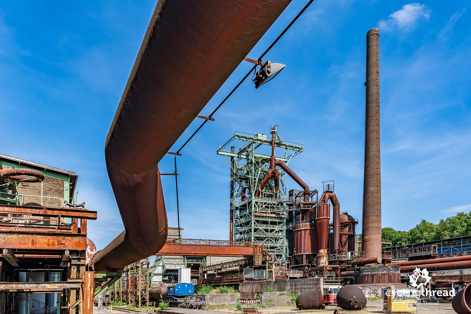
Henrichshütte in Hattingen made a very strong impression on us. Count Henrich zu Stolberg-Wernigerode founded the ironworks in 1854, and its first blast furnace began operating the following year. Over the following decades, the plant grew into a huge metallurgical complex, including blast furnaces, a steelworks, rolling mills and foundries. At its peak, around 10,000 people worked here, making it one of Hattingen's most important employers. Pig iron production ended in 1987, leaving an extensive industrial site, part of which has been preserved as today's LWL-Museum Henrichshütte.
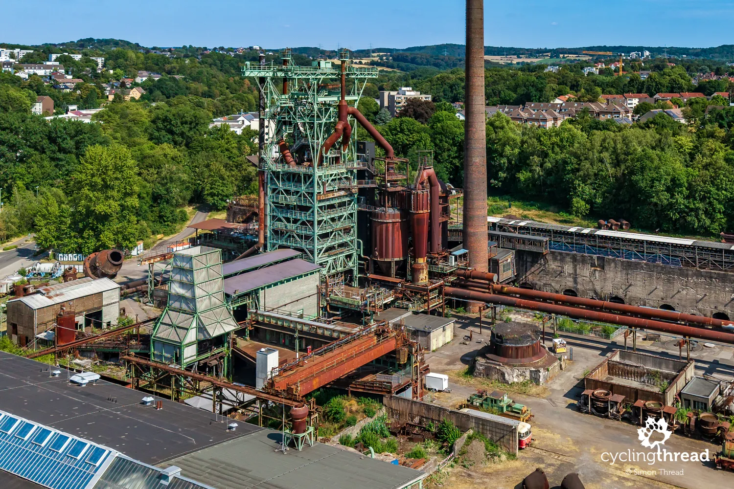
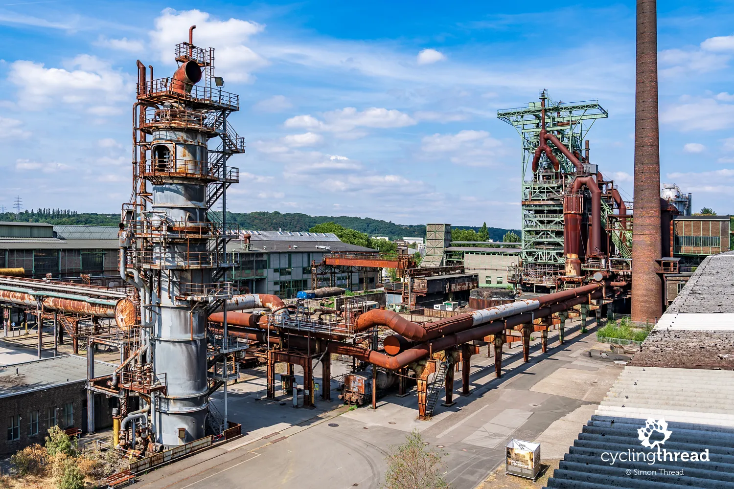
What impresses us most is the scale of the surviving equipment, which photographs seen before the visit cannot convey. You can walk among the installations and buildings of the former plant, looking inside them and viewing the complex from outside. Its main landmark is the surviving blast furnace No. 3, whose structure you can climb to look down over the former ironworks. Standing among the maze of pipes, platforms, tanks and transport equipment makes the scale and complexity of iron production easier to understand. Henrichshütte complements our earlier visit to Zeche Nachtigall very well: there, we learnt about coal mining and the beginnings of the industrial Ruhr; here, we see heavy industry on the scale the region reached in the decades that followed.
Hattingen's old town between ironworks and river
A few minutes later, Hattingen shows us a completely different side. From the vast, stark grounds of Henrichshütte, we enter narrow streets, small squares and dozens of surviving half-timbered houses, overlooked by the distinctive leaning spire of St. George's Church. Beside one of the lanes stands Bügeleisenhaus, or the "Flatiron House", named after its unusual tapering shape. The change in scale is striking: only moments earlier, we were walking beneath a blast furnace and industrial installations; now, we are making our way between houses several hundred years old. Hattingen shows particularly clearly how close together the traces of very different periods lie along the Ruhr - the medieval town, later merchants' houses and the large industries of the 19th and 20th centuries.
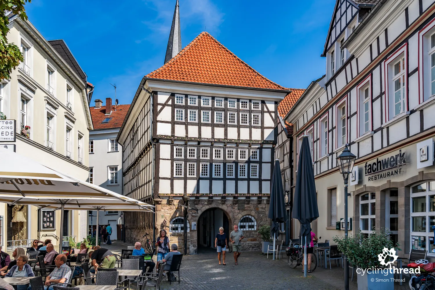
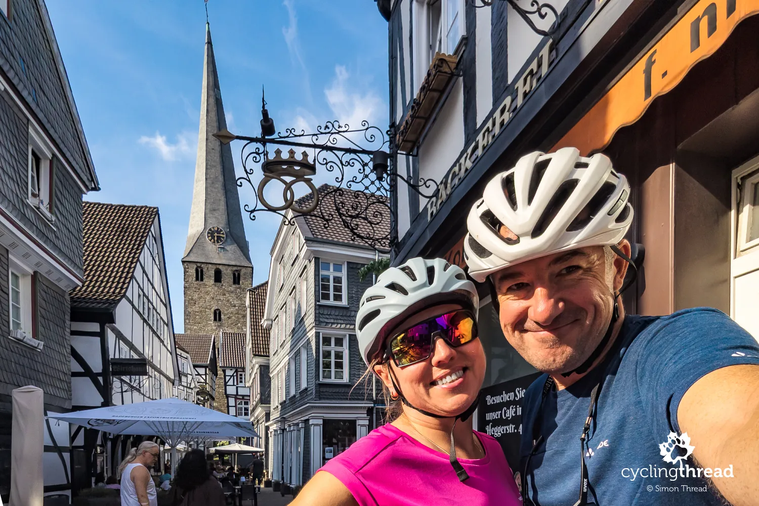
As we stood in the shade of St. George's Church, looking on Google for somewhere to have lunch, an elegant older man approached and asked if he could help. A moment later, he pointed us towards Zur alten Krone, where we were soon sitting at a table waiting for our food. It would have been hard to find a better place by chance - the tables stood in the shade beside a narrow old-town street, with the tall church tower rising above the roofs and façades. After several hours among a mine, an old railway and an ironworks, this was a very different side of the Ruhr valley. Instead of another museum or monument, we had a quiet lunch in the middle of old Hattingen, found through a chance meeting in the street.
Beyond Hattingen, we return to the Ruhr itself. The route gives us another pleasant stretch beside the water, with views of a broad bend and the opposite bank. At one point, the river flows over two low, wide weirs, marked on maps and in descriptions as Ruhrwasserfälle - the Ruhr waterfalls. The name sounds grander than their height suggests, but the falling water stretching across the full width of the river looks impressive. It is also a good place to see how the valley's apparently natural landscape has been shaped for centuries by water management structures and people's needs.

The railway museum in Bochum-Dahlhausen
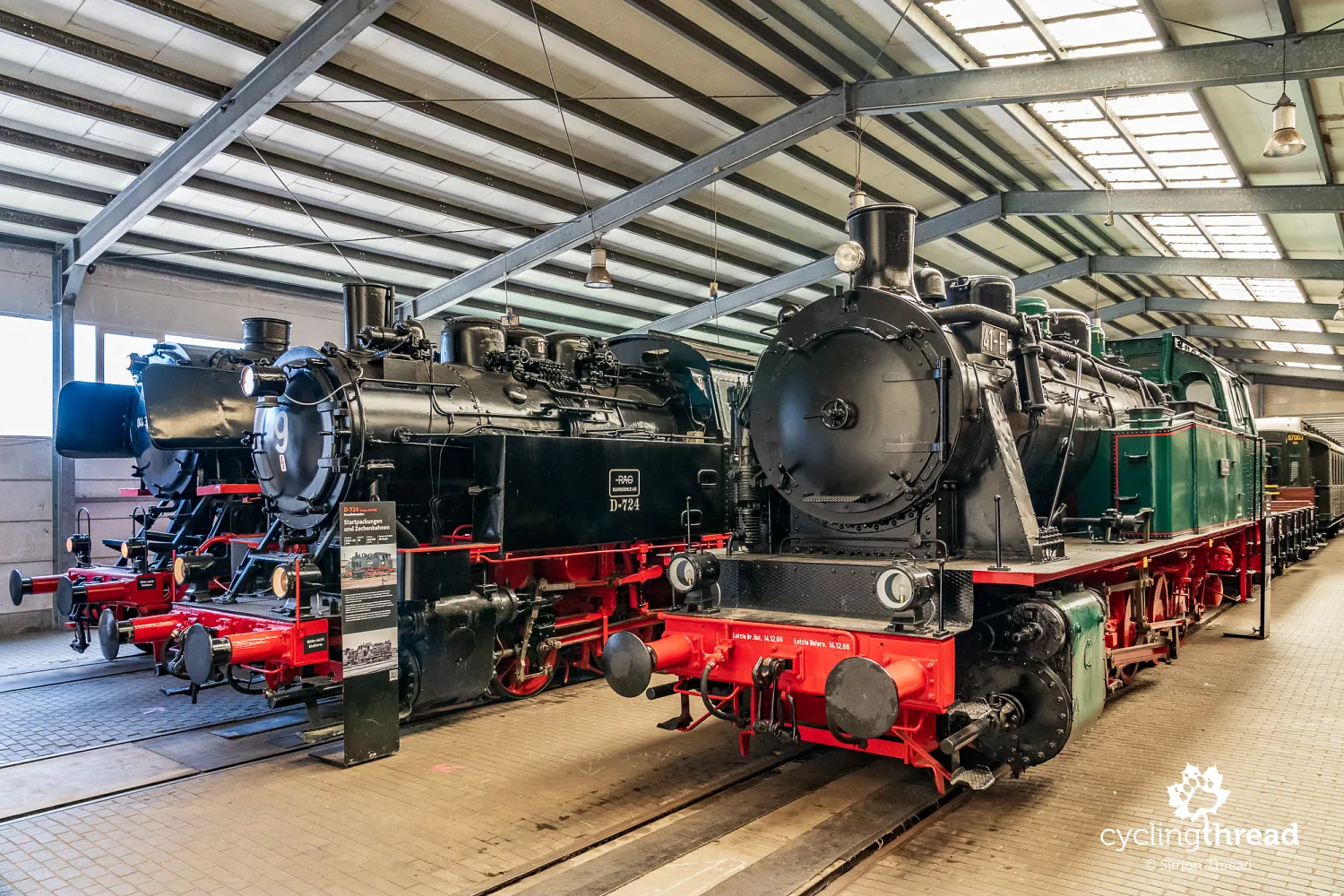
Riding towards Essen, we pass Eisenbahnmuseum Bochum-Dahlhausen. The museum occupies a former railway depot almost beside the Ruhr and has a large collection of locomotives and other railway vehicles. Its location is no coincidence - Dahlhausen was an important centre for freight traffic in the valley, where the railway took over much of the coal transport previously carried on the Ruhr in the second half of the 19th century. The extensive depot, with its engine shed, turntable and locomotive servicing equipment, recalls the scale of that traffic and the railway's importance to local mines and industrial plants. We stop here too, although this time only for a short visit. We walk between rows of locomotives and carriages, look at the old engine shed and turntable, and after a little under an hour return to our bikes and continue towards Essen.
Through Steele to central Essen
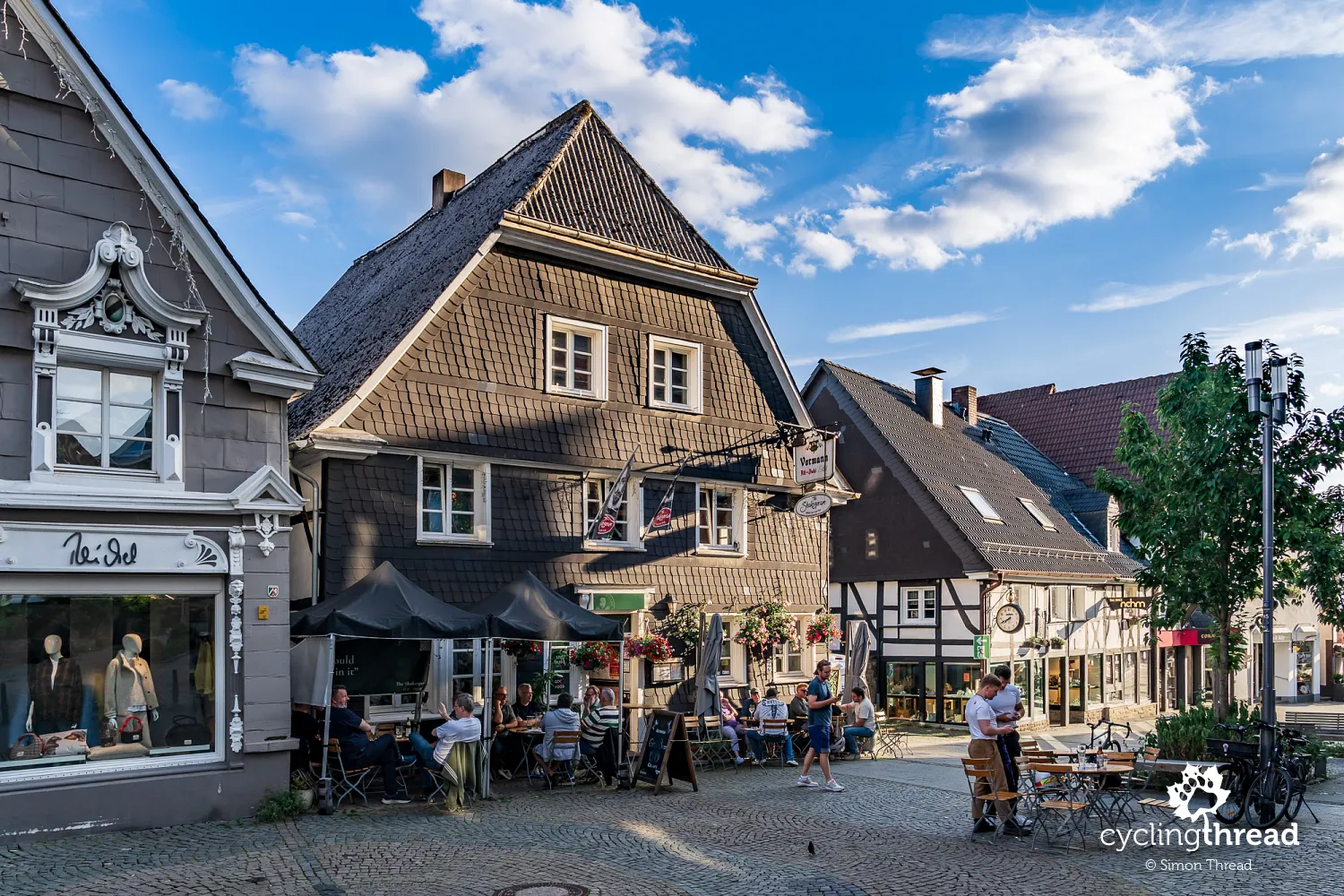
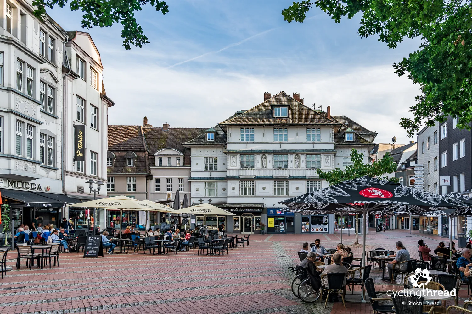
We enter Essen through Steele, which developed as a separate town for centuries and was only incorporated into Essen in 1929. Its position beside the Ruhr encouraged industry: coal mines, metalworking plants and glassworks operated nearby, while the river, and later the railway, connected it with the rest of the region. At Kaiser-Otto-Platz, we stop briefly to look at the buildings of the former town centre. Around the square and Westfalenstraße, buildings from the turn of the 20th century survive, with Art Nouveau details and forms inspired by classical architecture. Steele also illustrates the character of present-day Essen - the large city grew from the merger of many towns and neighbourhoods that had previously developed around their own centres, mines and industrial plants.
Before leaving the Ruhr, we pass old railway bridges over its tributaries. They are further traces of the transport network that connected local mines and factories with the rest of the Ruhr Area during industrialisation, gradually taking over the role previously played by river transport. Soon afterwards, we leave RuhrtalRadweg and head through Siepental towards our accommodation in central Essen. This green corridor in Bergerhausen is around one and a half kilometres long and open to walkers and cyclists, while cars cannot use it as a through route. After a whole day among lakes, a mine, an ironworks and riverside paths, such a quiet, green approach to a large city is especially pleasant. The Ruhr cycle route stays to the south, beside the river, while we head into central Essen for two nights, setting aside the next day to explore the city.
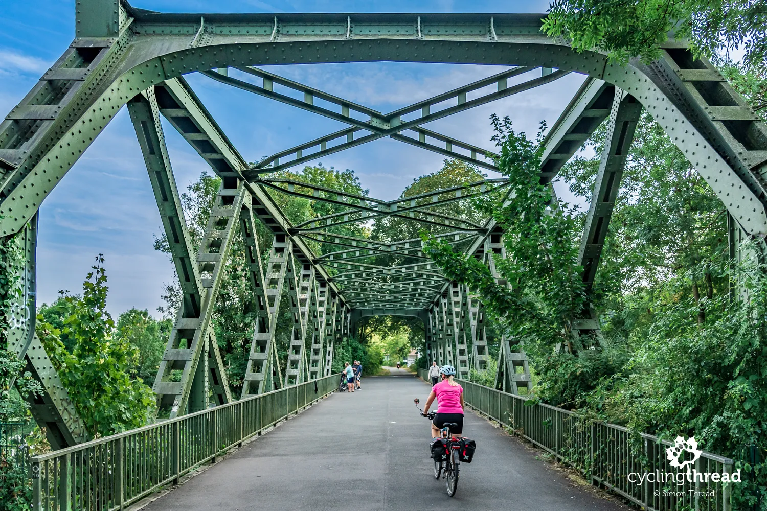
A whole day without bikes in Essen
After three days of riding, we stay in Essen for a day. The city grew around a medieval abbey, but its present scale and layout were shaped mainly by rapid industrial development in the 19th and 20th centuries. Mines, the Krupp works, the railway and an influx of residents turned what had been a small town into one of the Ruhr Area's main centres, gradually absorbing neighbouring towns as well. In the centre, there is no compact old town like those we saw in Arnsberg or Hattingen. Much of the historic fabric was destroyed during the Second World War, and post-war rebuilding gave the centre a very different character. Older landmarks do survive, including the cathedral, while the most important traces of Essen's industrial history occupy a much larger area than the city centre alone.

Zollverein - Ruhr Museum and Red Dot
We therefore devote a large part of the day to exploring Zollverein. Mining began here in the mid-19th century, but the best-known part of the complex - Shaft XII - was built between 1928 and 1932 as a modern, centralised mining facility. Its regular layout of brick and steel buildings followed the successive stages of the mine's work, while creating one of the most distinctive industrial architectural complexes of its era. Today, the former mine and coking plant cover around 100 hectares, so simply walking between the buildings gives a sense of the scale of the whole undertaking. The distinctive headframe above Shaft XII is the site's most recognisable image, but it is worth walking beyond it towards the other halls, tracks and former coking plant. The whole complex has been on the UNESCO World Heritage List since 2001.
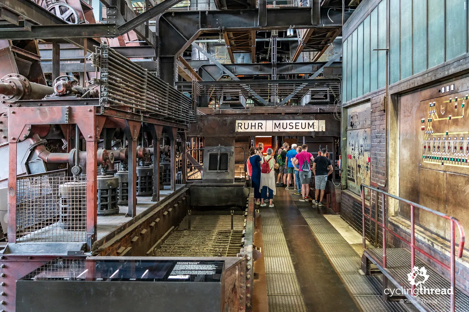
What impresses us is the second life of these industrial buildings. The former coal washery houses the visitor centre and Ruhr Museum, the boiler house contains a design museum, and other buildings host exhibitions, events, restaurants and workplaces. You can move freely between them across the open grounds, where greenery has appeared alongside steel and brick. Their functions have changed, but the plant's original layout remains easy to read: the buildings still show how extensive and complex the mine was. Zollverein has therefore become more than an enclosed open-air industrial museum. It also reflects the transformation of the whole Ruhr Area after its mines and ironworks closed.
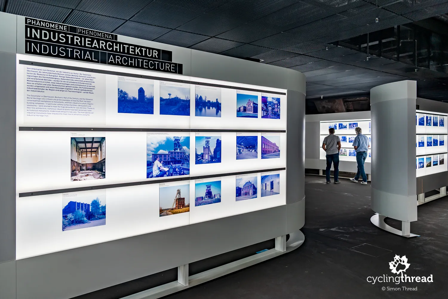
Ruhr Museum proved to be one of the best regional museums we have seen. Even the entrance is part of the experience: a long escalator lit in orange carries visitors high into the former coal washery. You then descend through the exhibition's successive levels, exploring the nature, culture and history of the Ruhr Area. Geology and coal deposits lead into mining, the growth of railways and industry into the rapid expansion of towns, and later sections explore migration, work and the lives of the region's residents. Many of the places we have seen over the past few days begin to fit into a single picture. The museum does not limit the Ruhr's history to mine shafts and ironworks, but also presents the landscape and society that changed alongside industry over two centuries.
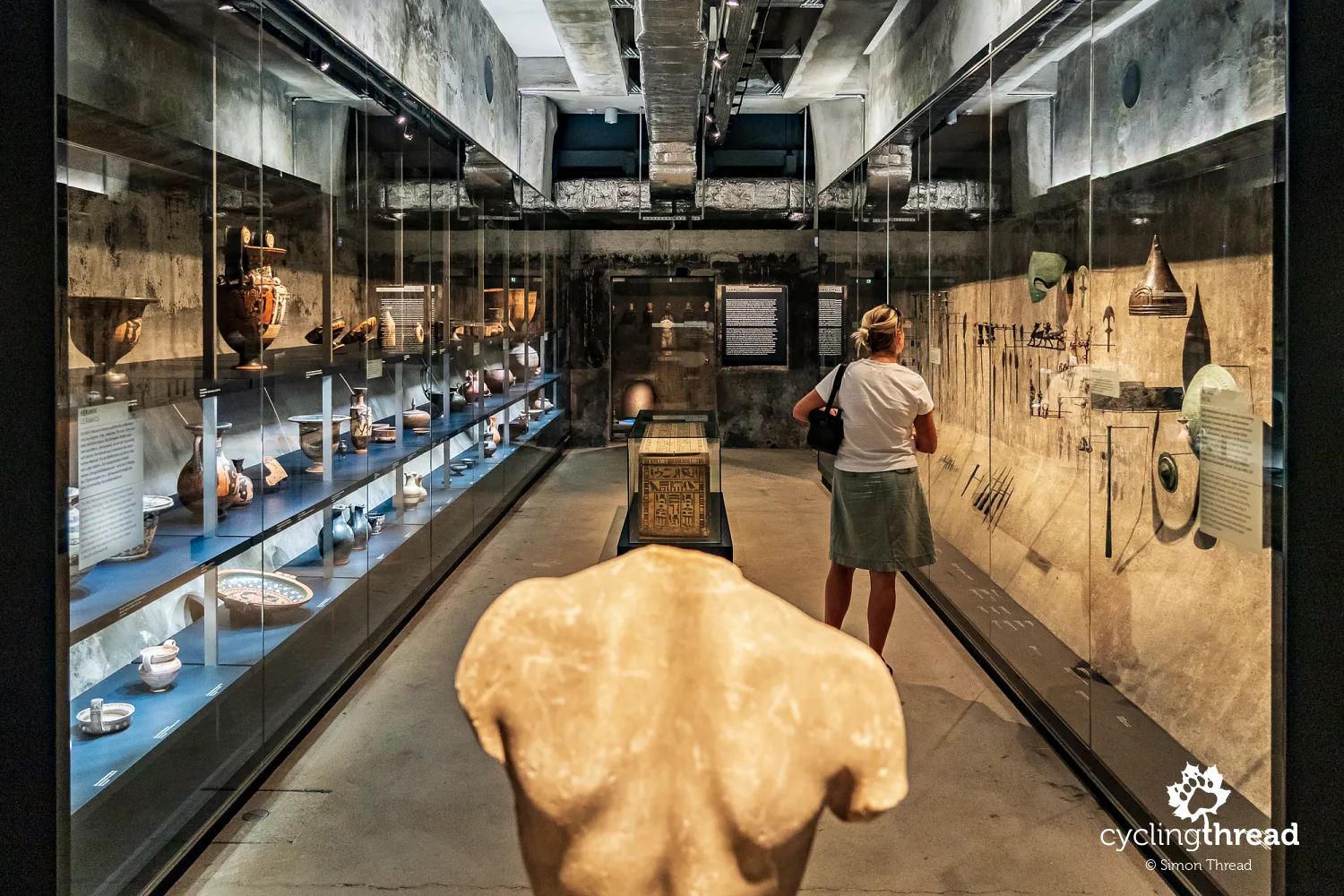
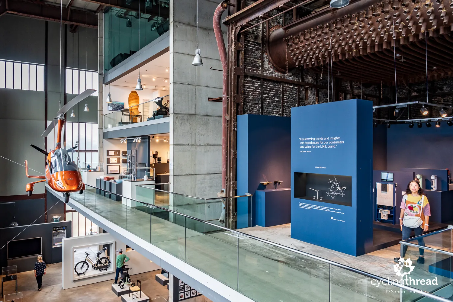
Not far from the coal washery, we enter Red Dot Design Museum. The former boiler house has been converted into exhibition space, but its industrial interior remains one of the main reasons to visit. Among more than 2,000 award-winning designs are everyday objects, furniture, appliances, cars and, of course, bicycles. Modern products stand between steel structures, installations and the remains of the old boiler house equipment. You can view contemporary design in a place that was part of a working mine for decades. The combination of the exhibits and the huge industrial interior is almost as impressive as the collection itself.
From industry to Museum Folkwang
At the end of the day, we find time for Museum Folkwang. This is a very different encounter with Essen: instead of a story about coal mining and the conversion of old industrial plants, we visit one of Germany's important collections of modern art. It includes 19th- and 20th-century painting and sculpture, contemporary art, photography and posters. The collection's history began not in Essen, however, but in nearby Hagen, where Karl Ernst Osthaus opened Museum Folkwang in 1902. After his death, the collection was bought by an association in Essen and merged with the city's art museum in 1922. After many hours at Zollverein, we end the day in a place that recalls another side of the city's history - the cultural ambitions that developed alongside its industrial power.

Leaving Essen and returning to the Ruhr
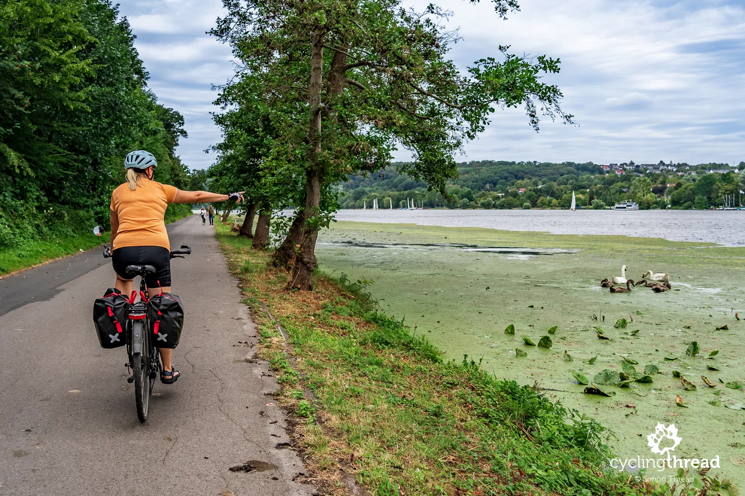
The next day, we leave central Essen and return to RuhrtalRadweg. At Baldeneysee, the river spreads so widely that at times we feel we are riding along a lakeshore rather than a river channel. Cycle paths make it easy to leave the city, and beside the water, visitors mix with residents enjoying their everyday recreation. After a day in museums, we can once again observe the region from the saddle: boats, marinas, walkers and buildings on the opposite shore. Essen, which yesterday we explored through Zollverein, proves surprisingly green when seen from the Ruhr.
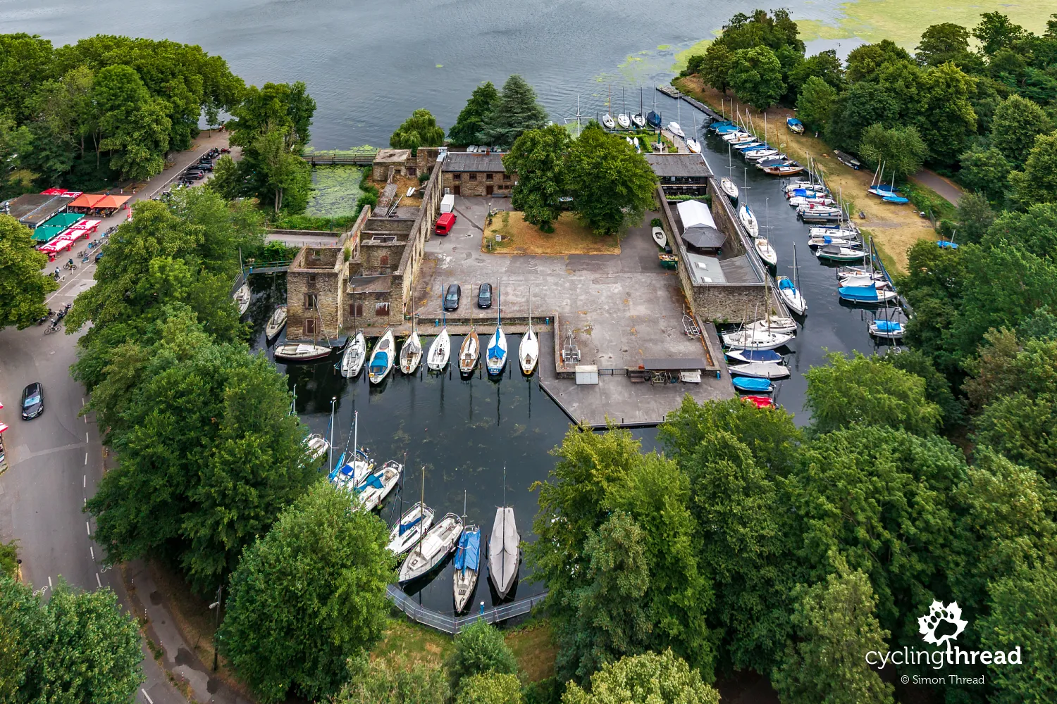
On the southern shore of Baldeneysee, we pass Haus Scheppen. This former riverside estate is now mainly known as a lakeside meeting and stopping point, also popular with motorcyclists. Cyclists have a good reason to pause here and watch the activity around the water for a while. Places like this remind us again that the Ruhr cycle route does not run through an empty corridor intended only for people travelling from source to mouth. It is also used by people who have come to the lake for an hour, a walk or an afternoon meal.
A railway bridge suddenly overhead
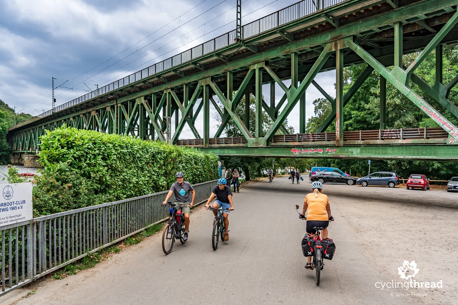
One of the attractions that appears almost without warning along the RuhrtalRadweg is the impressive railway bridge in Kettwig. The cycle route follows the bank of the Ruhr here, while the steel structure of the bridge rises high overhead, extended on its southern side by a distinctive five-arch viaduct. The first crossing was built between 1869 and 1871 for the Düsseldorf-Kettwig-Kupferdreh railway, part of the historic Ruhrtalbahn, with regular passenger and freight services starting in 1872. Over time, two more bridges were built alongside it, serving connections towards Mülheim and the later railway via Heiligenhaus to Velbert, turning Kettwig into an important railway junction. All three crossings were blown up by German troops in April 1945, but only the oldest, double-track bridge was rebuilt and reopened in 1951. Trains still use it today, including S-Bahn line S6, while traces of the other bridges can still be seen beside the surviving crossing.
The former water tower in Styrum
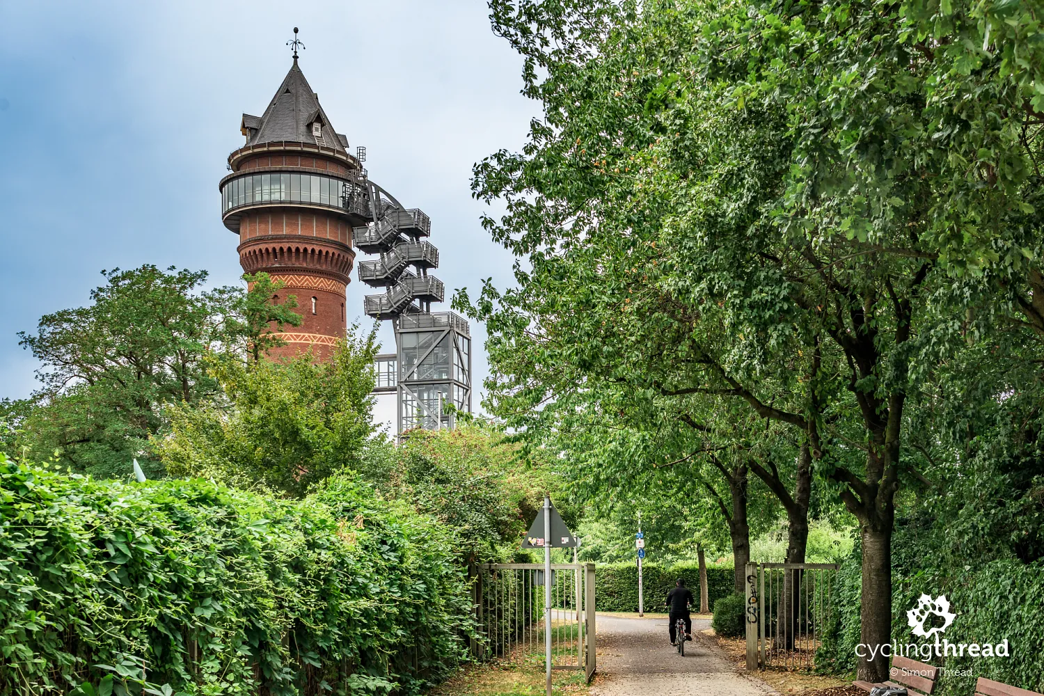
In the Styrum district of Mülheim an der Ruhr, a tall brick water tower catches our attention. August Thyssen built it in the late 19th century to supply water to a nearby industrial plant. When the tower ceased to serve that purpose, it was converted into Aquarius Wassermuseum, devoted to water and its importance to the region. It is another place along our route where an old technical building has found a new role while keeping its distinctive form. After visiting a mine, an ironworks and Zollverein, it is easier to notice how important well-organised water management also was to industrial development along the Ruhr.
Duisburg where the Ruhr meets the Rhine
Duisburg ends our journey where the Ruhr meets the Rhine. Along the way, we have followed it from a small source in Sauerland, and here its water becomes part of a much larger system of rivers, port basins and canals. Its position beside both rivers mattered to the city long before the ironworks and the modern port appeared. Duisburg has a medieval history linked to the area around the town hall and Salvatorkirche, and the cartographer Gerhard Mercator lived here in the 16th century. Today, it is both one of the Ruhr Area's largest cities and an important centre for inland shipping.
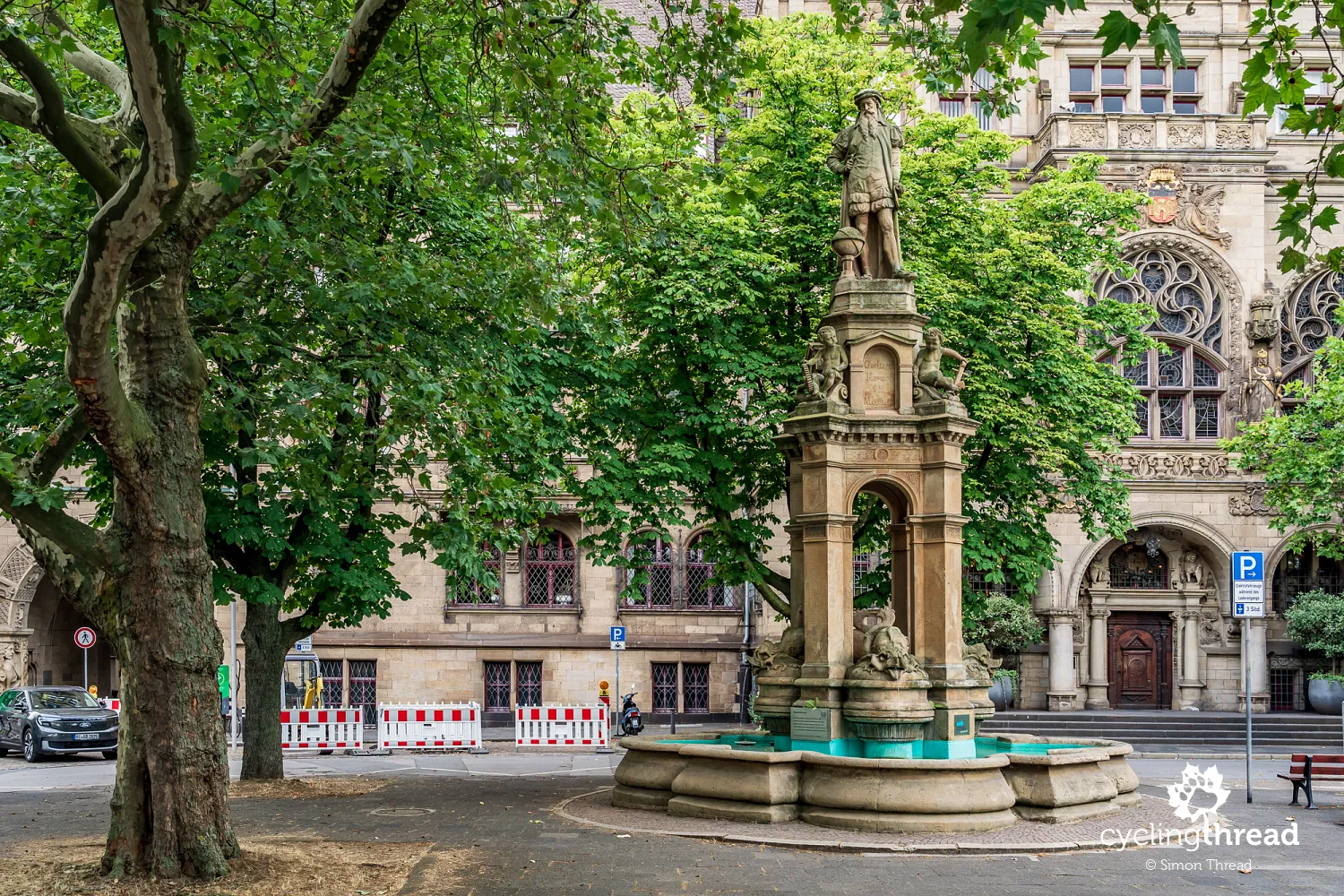
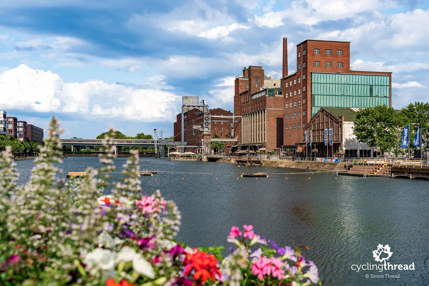
We allowed two nights in Duisburg, as simply reaching the end of the route would not have given us enough time to get to know the city. The main stop on our first walk is Innenhafen - the former inner harbour with its grain warehouses, transformed into a district of restaurants, offices, homes and culture. New buildings stand among the old ones, and a former mill houses Museum Küppersmühle with its collection of modern art. From here, it is worth walking to the historic centre to see the town hall and Salvatorkirche, rather than reducing Duisburg to its port and industry. Such a walk reveals several stages of the city's development within a small area.
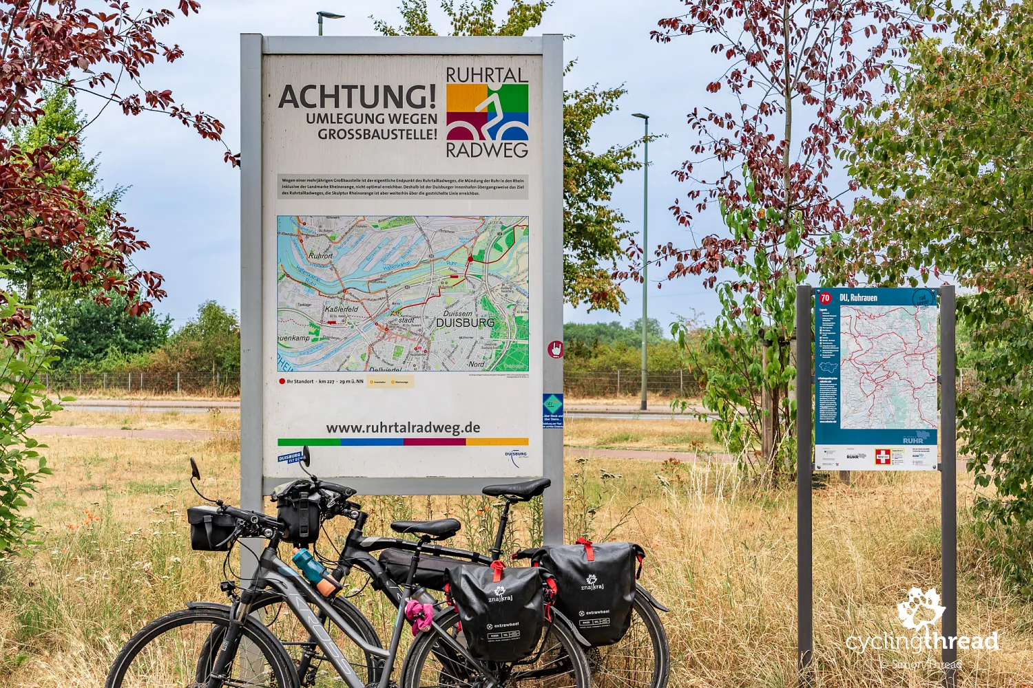
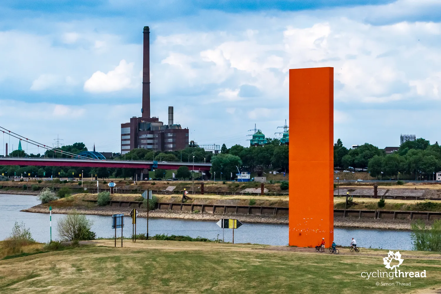
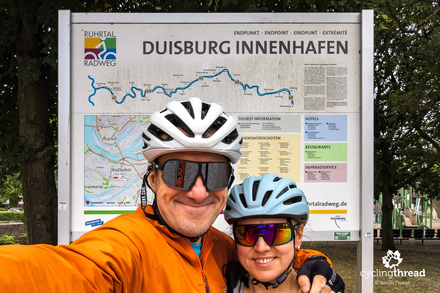
At the confluence of the Ruhr and Rhine stands the 25-metre Rheinorange sculpture, the symbolic endpoint of a journey begun more than 200 kilometres earlier at the river's source near Winterberg. The simple, bright orange structure by Lutz Fritsch was installed in 1992 exactly where the two rivers meet, and has become one of RuhrtalRadweg's most recognisable landmarks. In 2026, however, reaching it is more complicated: because of long-term work on the bridge and weir, the signed RuhrtalRadweg temporarily ends at Innenhafen. From there, Rheinorange can be reached by a separate alternative route, which does not carry the route's distinctive logo. Luggage storage in central Duisburg is also useful, allowing the final part of the city visit and the ride to the Rhine to be planned without all the touring equipment.
Bike-friendly hotels along the Ruhr
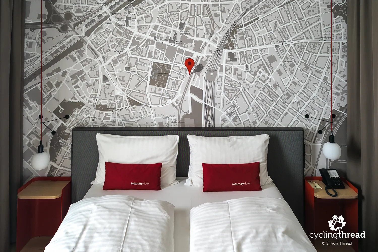
I would also like to mention the design of our hotel room in Duisburg. We are both geographers, so we were very happy to find a huge city map covering one of the walls, with the location of our hotel clearly marked. Such a simple idea, yet so practical - after returning from our evening walk, we stood in front of our wall map and followed the route we had just walked through the streets of Duisburg. We could also immediately see which parts of the city we had not visited yet and how its different districts were located in relation to the Rhine and the Ruhr. And, of course, this was another bike-friendly hotel on our journey, certified by Bett+Bike and included among the recommended accommodation options on the official Ruhr Valley Cycle Route website.
Getting to Winterberg by train and bus
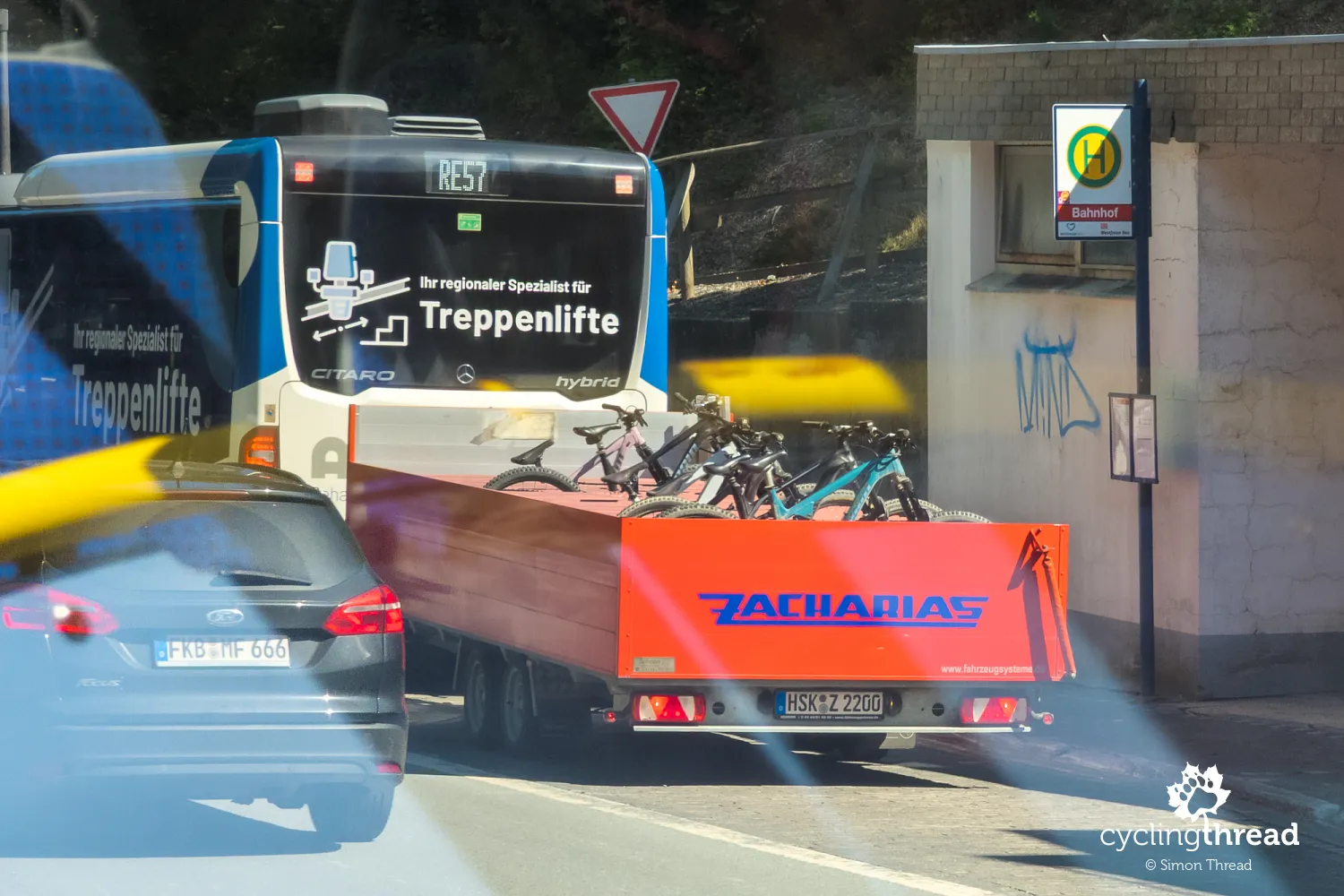
Returning to practical matters, travelling to Winterberg with a bicycle requires a little more attention in 2026. Normally, the RE57 train connects Dortmund directly with the start of RuhrtalRadweg in Winterberg, but railway work means the service is sometimes shortened to Bestwig or Olsberg. Replacement transport operates on the closed section, and cycling tourists have also been considered: buses with bike trailers run between Bestwig or Olsberg and Winterberg, hourly according to the route's organisers, although spaces are limited. Additional bike buses also run during particularly busy periods, and the Ruhr route's organisers recommend checking the current connections before every journey. During major disruption, starting in Olsberg instead of Winterberg may be the simplest solution, although from our point of view, the whole route is worth riding.
Parking in Winterberg and collecting the car
During our trip, we left the car in Winterberg at one of two large, free visitor car parks. After completing the route, I returned to collect it - first by train from Duisburg, then by replacement bus along the section under repair to Winterberg. Meanwhile, Ola waited in Duisburg with our bikes and luggage. I soon returned for her, and we could continue our journey together, this time to the Moselle cycle route. This may sound a little complicated, but we have used this arrangement for linear cycle routes for years and have yet to find a more convenient one.
The official RuhrtalRadweg website
Finally, the official RuhrtalRadweg website deserves a mention, as it is one of the most comprehensive cycle route websites we have used on our travels. Alongside the map and GPX file, it provides detailed information about access, current diversions and closures, signs, accommodation and restaurants, as well as repair stations, electric bike charging points, public toilets and places to refill water bottles for free. Separate pages cover towns along the route, the Hardenstein ferry, connections with other cycle paths and travelling by train with a bicycle. You can also download guides and brochures, find certified Bett+Bike accommodation and check suggested itineraries. The site is actively updated - during our trip, we used its information about repairs, diversions and replacement rail services. It is worth spending a little time browsing the website before setting off.
Germany's Top River Routes
The Ruhr Valley Cycle Route also belongs to Germany's Top River Routes, an initiative that has jointly promoted Germany's leading long-distance river routes since 2016. All are at least 200 kilometres long, with their own signs and developed tourism infrastructure, and the cooperation also includes joint promotion outside Germany. Alongside RuhrtalRadweg, the members include the Rhine Cycle Route and the Elbe Cycle Route, as well as the Moselle, which we know from earlier journeys. Together, the routes form a network of almost 5,800 kilometres. The shared River Routes website allows you to compare them by length, character and attractions, among other features, and use route planners and information materials.
Cycling from the Ruhr's source to the Rhine
After five days and around 240 kilometres, what we will remember most about RuhrtalRadweg is how much the surroundings change. We began among the hills and small towns of Sauerland, then rode through an increasingly wide valley, passing old railway lines, mines and the first large industrial plants, before finding ourselves in the heart of the Ruhr Area. Along the way were quiet riverside paths, old towns such as Arnsberg and Hattingen, the industrial spaces of Henrichshütte and Zollverein, and the thoroughly modern cities of Essen and Duisburg. Industry never dominated the ride itself - for the great majority of the journey, the Ruhr remained a green river surrounded by forests, lakes and recreation areas. Perhaps this contrast was the route's greatest strength: over several days, we watched a single river connect the landscape of Sauerland with the history and present-day life of one of Europe's largest industrial regions.
Back to topHave a safe ride! 💚
Simon Thread
(Szymon Nitka)
I'm a passionate cycling traveler and the voice behind Cycling Thread. I explore Europe on two wheels, documenting the most scenic routes, inspiring places and cyclist-friendly practices. My writing blends personal experience with practical insights and a deep love of travel. I'm also a contributor to National Geographic Traveler magazine.