Iconic Cycle Routes in Flanders: cycling the Kempen Route
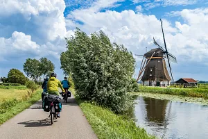
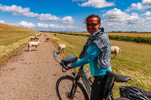
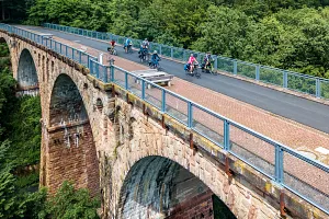
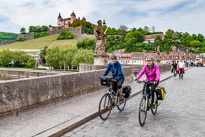
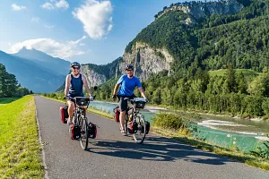
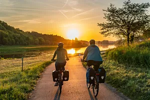
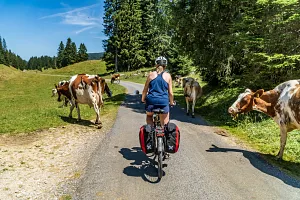
"Iconic Cycle Routes" - this is how Flanders named its system of long-distance cycle routes running across the entire region. One of them is the Kempen Route, which probably stands out for having some of the most attractive and unusual cycling infrastructure in Europe. The Kempen Route is also one of several shorter routes combined into the flagship Flanders Route - an almost 1,000-kilometre loop around the entire region. Following the signs of these two routes, we spent several days cycling through Flanders at the end of June.
Join us on our new 🟢 Komoot account!
Cycling Partners



Route on the map
GPX file (GPS track): cyclingthread.com-flanders-2026.gpx
The Kempen Route in Flanders - table of contents
- Discovering the landscapes of northern Flanders
- Nine long-distance Iconic Cycle Routes
- How the Flemish cycle node network works
- Planning a journey on the Kempen Route
- Understanding the historic Kempen region
- Exploring Limburg's rich coal mining heritage
- Cycling infrastructure as a tourist attraction
- Cycling between Terrils near Maasmechelen
- Entering Hoge Kempen National Park
- Views across Vallei van de Kikbeekbron
- Cycling through the Heath in Limburg
- The former railway station As
- Safer cycling infrastructure across Flanders
- Discovering the former Waterschei coal mine
- Exploring C-mine and the Winterslag mine
- Crossing the Kuilenstraat cycle bridge
- Why Genk makes a good cycling base
- Finding cyclist-friendly hotels across Limburg
- Cycling through Water at Bokrijk
- Making cycling in Flanders more accessible
- Kolenspoor - the F75 cycle highway
- Cycling across the Kamp Beverlo training ground
- Exploring the historic be-MINE in Beringen
- Exploring the military history of Leopoldsburg
- Liberation Garden and Operation Market Garden
- The military cemeteries of Leopoldsburg
- Kamp van Beverlo royal military museum
- Cycling through the Trees near Lommel
- Visiting Lommel German war cemetery
- The Nyrstar zinc smelter in Balen
- Cycling beside the historic Kempen canals
- Where three canals meet in Dessel
- Trying traditional Belgian mussels on route
- The curious story of Dessel's cannon
- Cycling the winding paths of Prinsenpark
- Finding the giant sculpture near Kasterlee
- Quiet rural cycling around Gierle
- Visiting the historic In Stormen Sterk windmill
- How Belgian Fietsstraten and Fietszones work
- Visiting the historic Zoerselhof estate
- Exploring Fort van Oelegem and Antitankgracht
- Cycling along Belgium's important Albert Canal
- Cycling into Antwerp through Rivierenhof park
- Exploring Grote Markt and Cathedral of Our Lady
- Impressive museums in Antwerp
- Cycling beneath the Scheldt in Antwerp
- Travelling with bikes from Antwerpen-Centraal
- Discovering Roman history in Tongeren
- Exploring Tongeren's basilica and beguinage
- Cycling the Hill Route across Flanders
- Following the Meuse Route and EuroVelo 19
- Inclusive cycle rickshaw rides near Kanne
- Cycling through the Albert Canal cutting
- Belgian and Dutch food beside the Meuse
- Cycling beside the Zuid-Willemsvaart canal
- Taking bicycles on trains across Belgium
- Six days of cycling across Flanders
- Why the Kempen Route ranks so highly
Discovering the landscapes of northern Flanders
Flanders occupies the northern part of Belgium and is the most populous of the country's three regions, alongside Wallonia in the south and the Brussels-Capital Region. Its landscape has been shaped for centuries by cities, trade and crafts, and later also by industry, traces of which can still be found in many parts of the region. Antwerp, Ghent, Bruges, Leuven and Mechelen are all located here - cities that rank among the most important historic centres not only in Belgium, but also in Western Europe. Beyond them, however, Flanders is surprisingly peaceful and green, particularly in the east, where the urban landscape gives way to forests, heathlands, canals and small towns in Belgian Limburg. Rivers and an extensive network of waterways are also an important part of the landscape, having supported transport and the economic development of Flanders for centuries. Most of our cycling route took us through this less urbanised side of the region.
Nine long-distance Iconic Cycle Routes
In the world of cycling tourism, Belgium is not one of the destinations that immediately comes to mind for a cycle traveller. For the average cyclist, the country is associated with road racing, cobbled climbs, spring classics and the enormous popularity of cycling as a sport. Yet in Flanders, you can discover an almost exemplary approach to cycling tourism that goes far beyond the cycle paths familiar from its cities. The region has very good cycling infrastructure outside urban areas, along with many interesting solutions that improve cyclists' comfort and safety. It was in Flanders that the first cycle node network was created, a system that later spread to other countries and regions. There is also a dedicated network of cyclist-friendly places and good information for visitors, making it easier to plan a cycling trip across Flanders. One of the most important parts of this offer is the Iconic Cycle Routes network, combining the best cycling infrastructure with some of the region's most interesting landscapes and attractions.
The Iconic Cycle Routes are nine long-distance routes, each with its own theme and character. All of them follow existing cycling infrastructure and are signposted in both directions. The network includes the Coastal Route (Kustroute) along the North Sea coast, the historic Front Route 14-18, the Scheldt Route (Schelderoute), the Meuse Route (Maasroute), the Kempen Route which we followed, the Hill Route (Heuvelroute), the Green Belt Route (Groene Gordelroute) around Brussels and the Art Cities Route (Kunststedenroute). The ninth is the almost 1,000-kilometre Flanders Route (Vlaanderenroute) - a large loop that serves as a kind of synthesis of the entire network, using sections of the other routes. Some of them overlap with the EuroVelo network, and together the Iconic Cycle Routes cover around 2,500 kilometres. The routes can be combined, allowing cyclists to plan anything from short weekend trips to much longer journeys across Flanders.
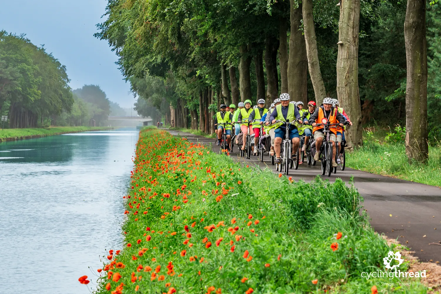
How the Flemish cycle node network works
Cycle routes in Flanders make use of another characteristic element of Flemish cycling infrastructure - the cycle node network, known as fietsknooppunten. The idea originated here in Belgian Limburg, where Hugo Bollen created the first network based on numbered points in 1995. Each node has its own number, while signs at the node show the direction and distance to the next ones, meaning that you can plan and save your own route simply as a sequence of several or a dozen numbers. The system quickly spread throughout Flanders and later to the Netherlands and other parts of Europe - most recently to Funen in Denmark. Today, it forms a dense network of local connections also used by the Iconic Cycle Routes, making it easy to leave the main route, visit an additional attraction or plan your own variation of the journey.
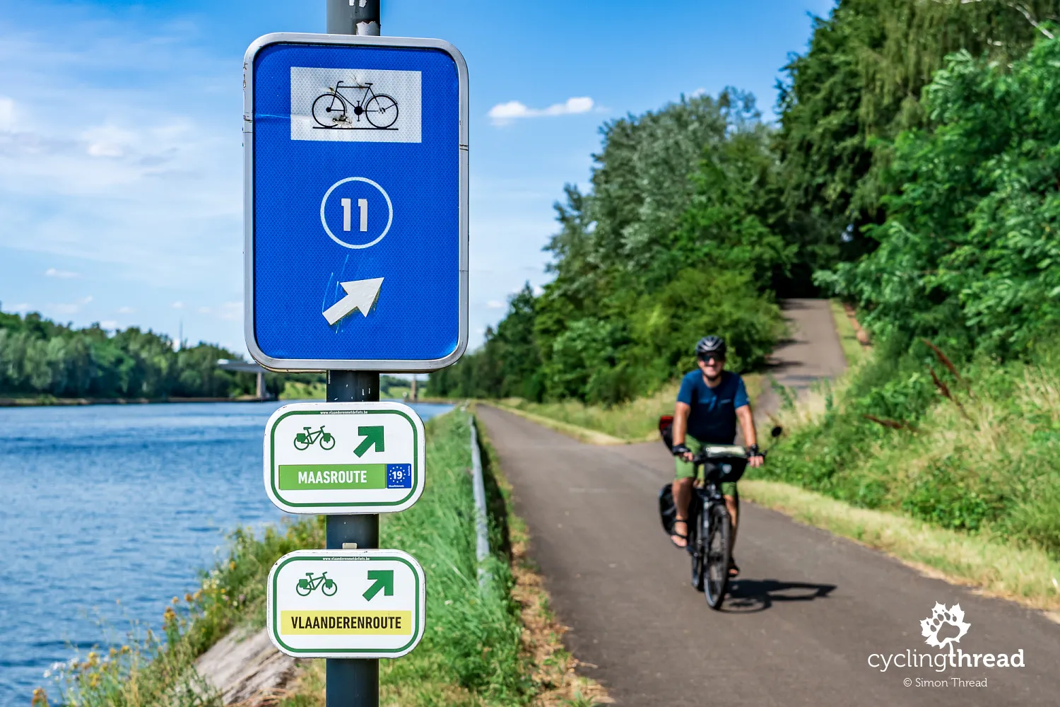
Planning a journey on the Kempen Route
The Kempen Route is around 215 kilometres long. This is a great distance for three or four days of cycling, but to make the most of the full week we had available, we added short sections of the Hill Route and the popular Meuse Route, which is also EuroVelo 19. In total, from Tongeren through Maasmechelen, where we joined the Kempen Route, and then via Genk, Leopoldsburg and Kasterlee to Antwerp, we cycled around 300 kilometres over five days. We spent one more day exploring Antwerp. The course of our trip and all the cycle routes in Flanders can easily be followed on our map above and in the route planner on the official Iconic Cycle Routes website.
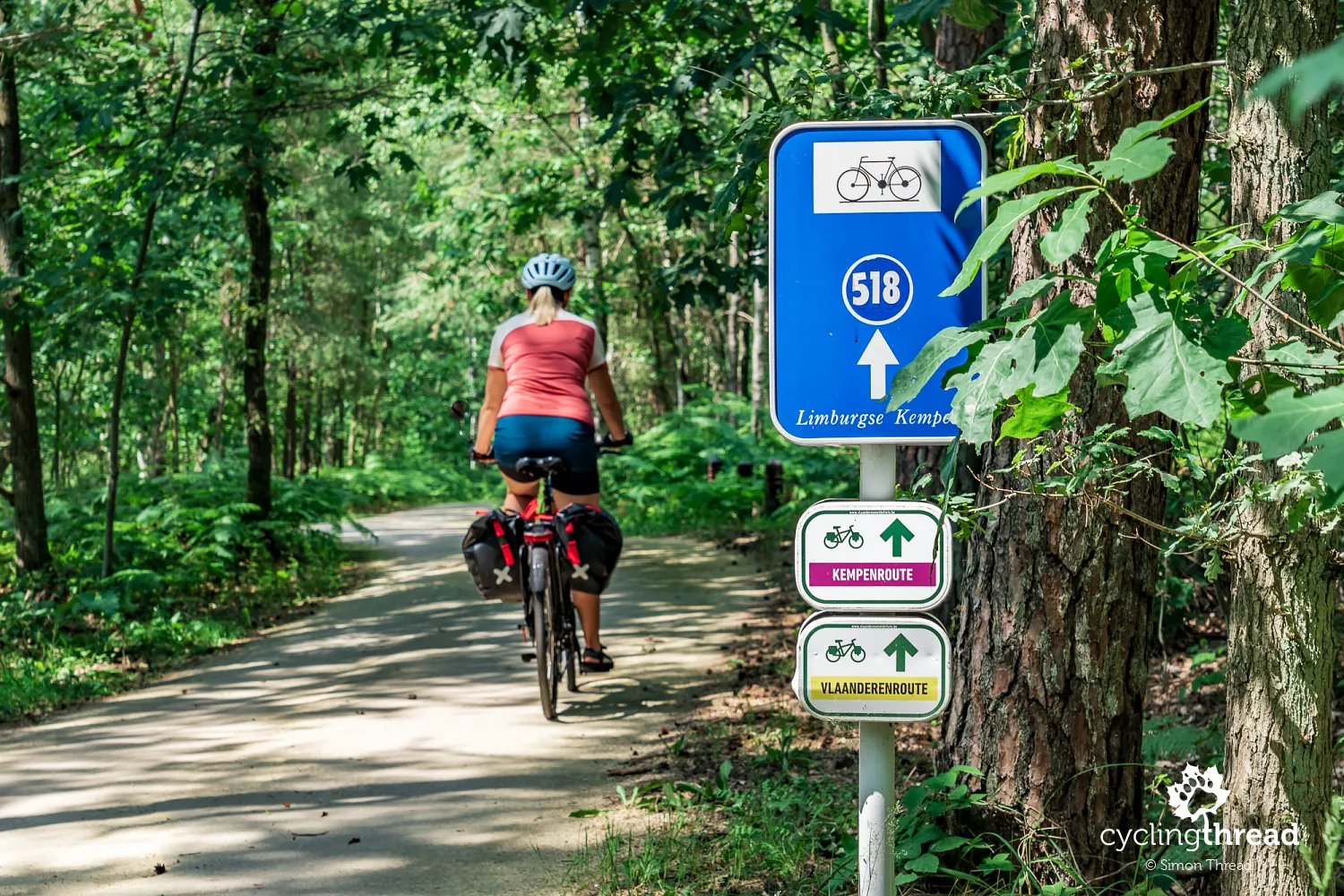
Navigating the Kempen Route does not require constantly checking the screen of your phone or bike computer. Small signs with arrows and route names - or the names of several routes where they overlap - are placed along the entire route, guiding cyclists through successive junctions and turns. In practice, this means you can spend most of the day riding without looking at your navigation, although it is still worth keeping a GPX track with you just in case. This is particularly important on the Kempen Route because its course has recently been changed, and older tracks available online may follow a different route from the current signposting. Before setting off, it is therefore best to download the latest GPX file directly from the route's official website.
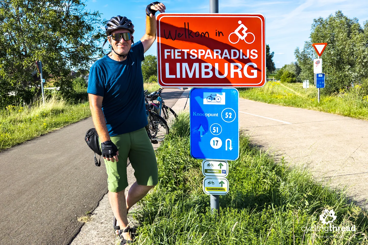
Understanding the historic Kempen region
And where does the name Kempen Route come from? It takes its name from the region through which a large part of the route runs. Kempen is a historical and geographical region covering north-eastern Belgium, primarily parts of the provinces of Antwerp and Limburg, as well as an adjacent area of the Netherlands. The name itself derives from the medieval Latin term "campinia", meaning open fields - a good reflection of the area's former character. For centuries, poor sandy soils, extensive heathlands, forests and sparsely populated open spaces dominated the landscape and were not well suited to intensive agriculture. The modern landscape of Kempen is much more varied, but forests, heathlands and sandy terrain remain among the region's most characteristic features.
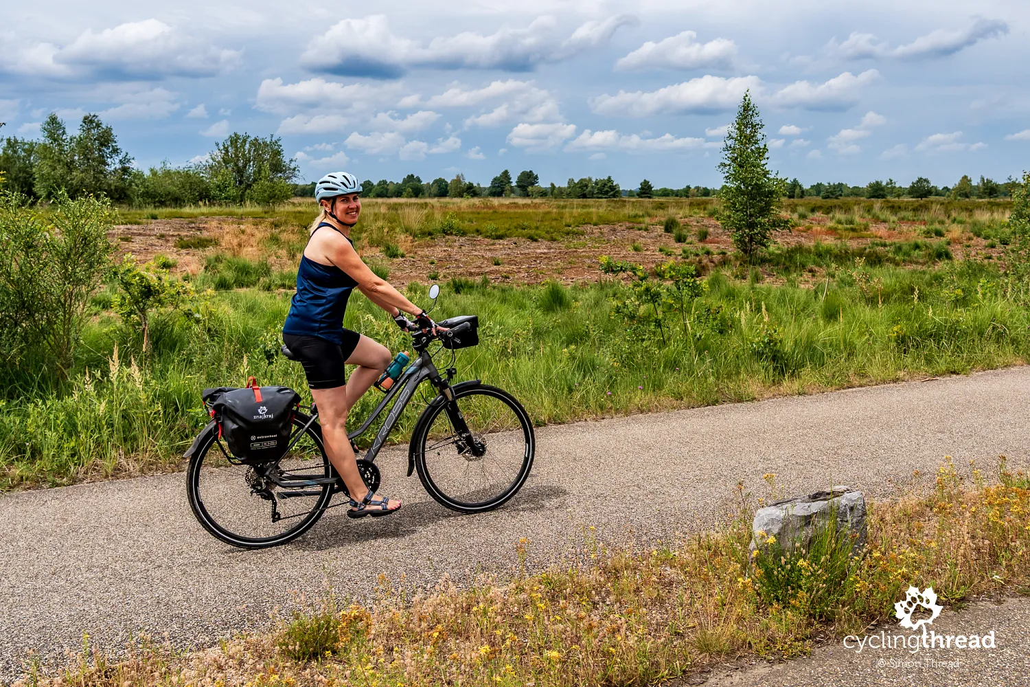
Exploring Limburg's rich coal mining heritage
An important backdrop to our cycling journey was the mining heritage of Belgian Limburg, which still has a strong presence in the landscape of this part of Flanders. Coal mining began here in the early 20th century and within a few decades completely transformed the region's economy, landscape and social structure. Workers' settlements, industrial infrastructure and new towns developed around successive mines, while people arrived to work here from many European countries, including Italy, Poland and Turkey. The last mines closed towards the end of the 20th century, leaving behind distinctive headframes, spoil heaps and enormous industrial complexes. Many were later given new functions, becoming cultural centres, museums, recreational areas or spaces for new businesses. The Kempen Route passes through several such places, which became some of the most interesting themes of our journey.
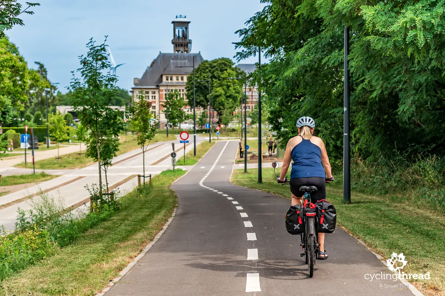
Cycling infrastructure as a tourist attraction
One way of making the landscapes of Belgian Limburg more attractive has been a series of unusual cycling projects that draw on both the region's post-industrial character and its natural assets. Behind them lies an approach that can be described as "infrastructure as an attraction" - cycling infrastructure is no longer merely a technical element of a route, but becomes a tourist attraction and part of the travel experience in its own right. Such projects are designed not only to provide a safe and comfortable ride, but also to attract cyclists and make the region more recognisable. Each one makes strong use of the character of its particular location and fits into the surrounding landscape. Infrastructure does not simply lead to an attraction here - it becomes one of the reasons to visit Limburg by bike.
Cycling between Terrils near Maasmechelen
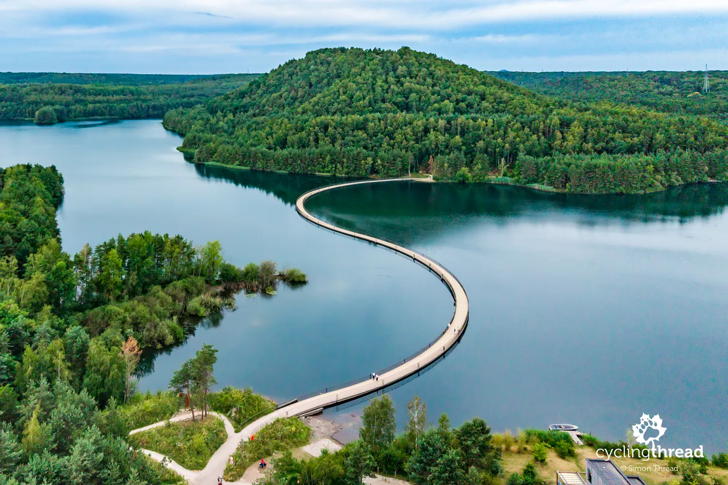
The very beginning of the Kempen Route makes a huge impression. Just four kilometres from Maasmechelen lies the first of Flanders' four unusual cycling projects - Cycling between Terrils (Fietsen tussen de Mijnterrils). Opened in 2024, this 380-metre floating bridge crosses an artificial lake between two spoil heaps of the former Eisden mine. The structure was built from connected pontoons, so its gently undulating line runs just above the surface of the water, while transparent railings barely obstruct the view. The bridge connects the Lange Terril and Tweelingterril spoil heaps, taking cyclists through the middle of a landscape that only a few decades ago formed part of a large industrial complex.
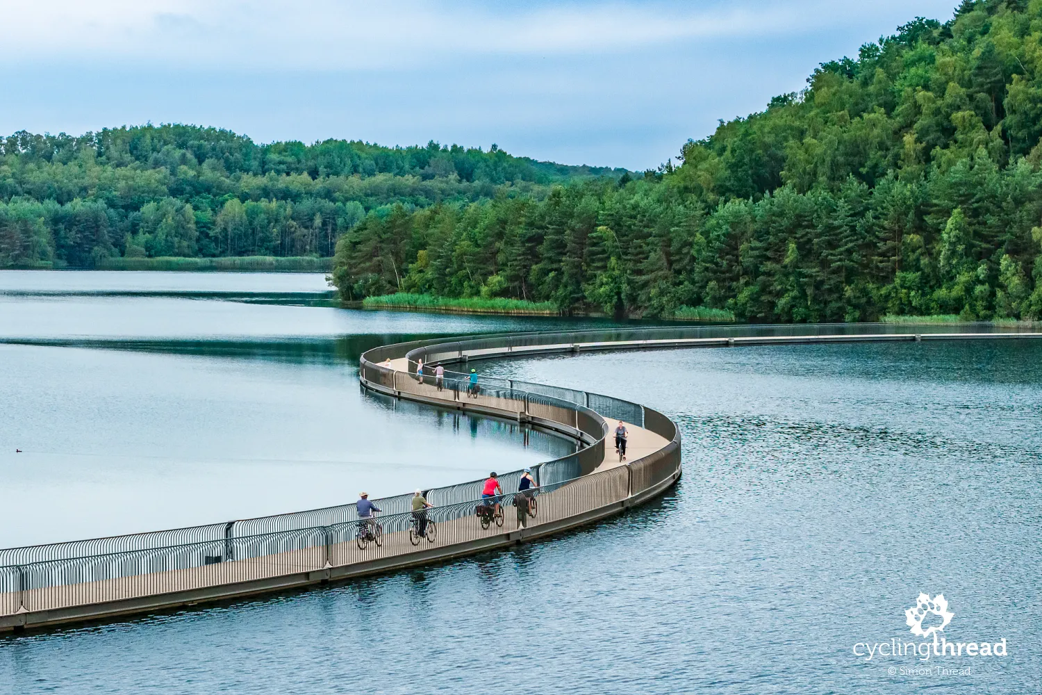
The Eisden mine operated for most of the 20th century, leaving behind enormous spoil heaps, excavations and bodies of water when mining ended. Nature gradually began to reclaim the area, and part of the former mining site was incorporated into Hoge Kempen National Park. Today, Terhills is one of the most distinctive examples of the transformation of Belgian Limburg: forest-covered spoil heaps resemble hills, former pits have filled with water, and walking and cycling routes run between them. Cycling between Terrils does not try to conceal the site's industrial past, but consciously uses it as part of the contemporary landscape. This is precisely why the first of Limburg's unusual cycling projects embodies so well the idea of infrastructure becoming an attraction in its own right.
Entering Hoge Kempen National Park
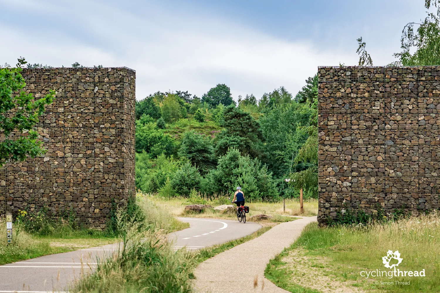
Hoge Kempen National Park is the largest continuous forest and nature area in Flanders and, since 2006, has also been Belgium's first national park. Today it covers more than 12,000 hectares and protects the characteristic landscape of the Kempen Plateau, raised around 50 metres above the surrounding land. Extensive pine forests dominate, but there are also heathlands, inland dunes, peat bogs and large bodies of water. For cyclists, this means above all long stretches through greenery, far from buildings and heavier motor traffic. The Kempen Route makes excellent use of this space, crossing one of the most natural and peaceful sections of our journey through Flanders.
Views across Vallei van de Kikbeekbron
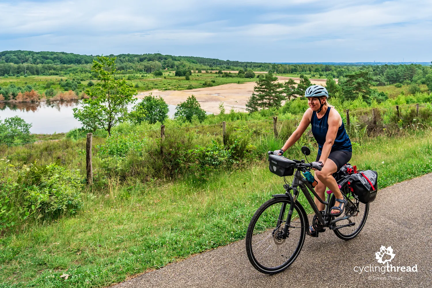
One of the few climbs on our route leads to a viewpoint overlooking the broad Vallei van de Kikbeekbron. This is one of the most distinctive landscapes in Hoge Kempen National Park - an extensive valley of heathland, bodies of water and sandy slopes, surrounded by dense forests. Its present appearance is not solely the work of nature, however, as sand and gravel were extracted here for many years. Once quarrying ended, the site was restored and the former excavation gradually developed into a valuable natural area. From the viewpoint, you can clearly appreciate both the scale of the landscape and the interweaving of open terrain and extensive forest so characteristic of Hoge Kempen.
Cycling through the Heath in Limburg
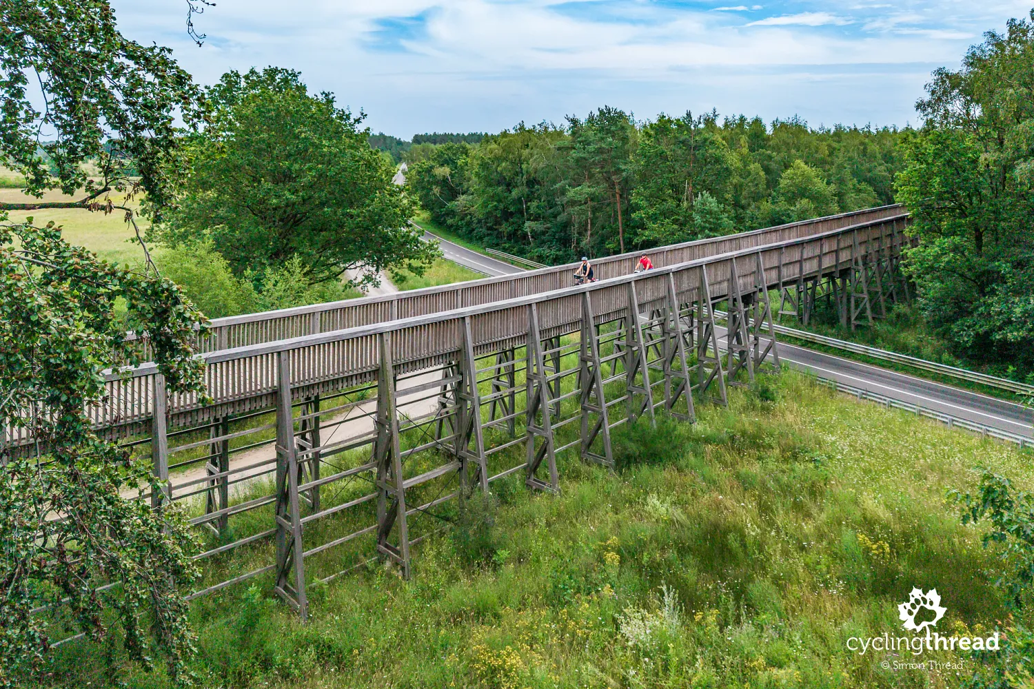
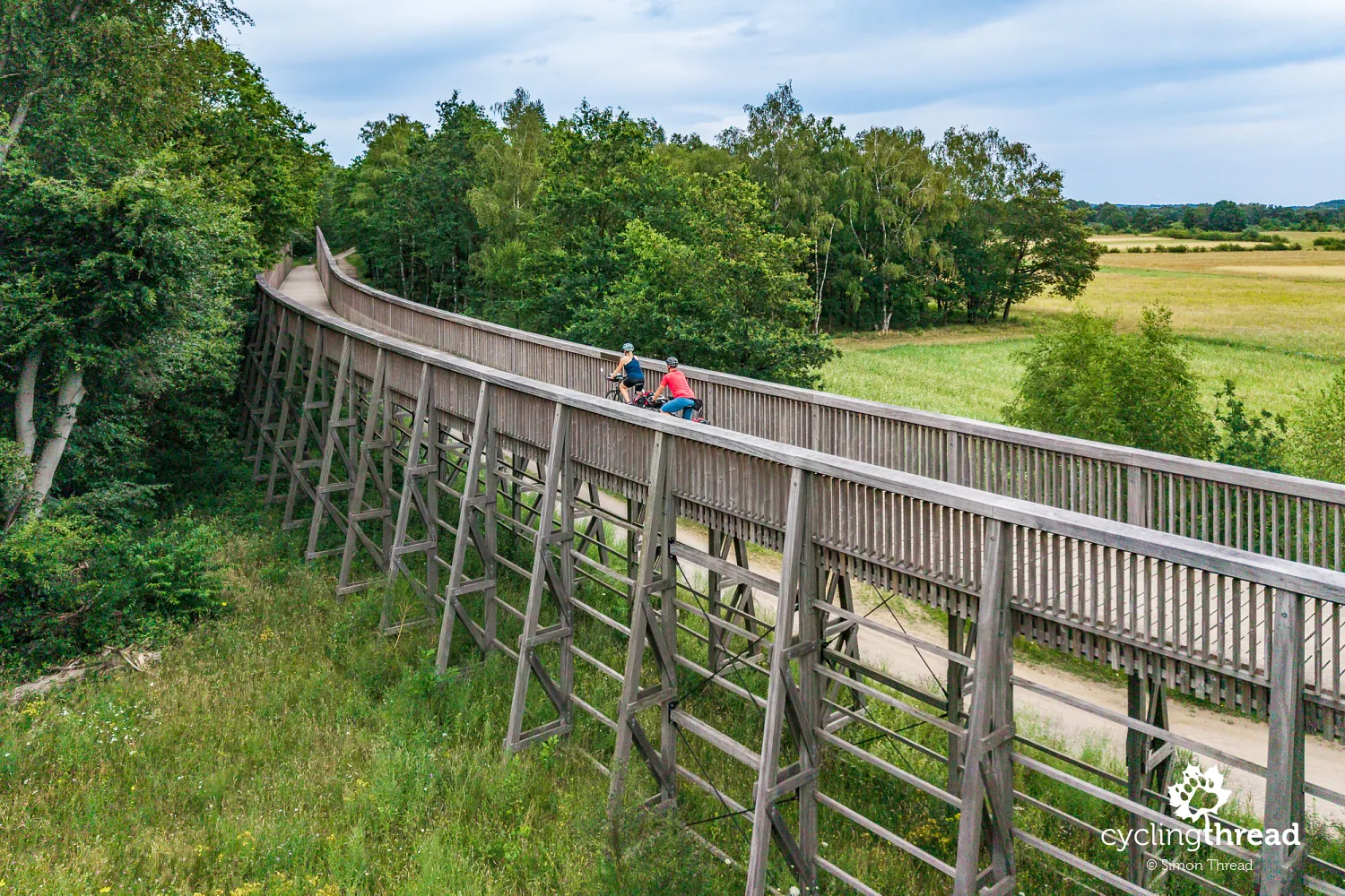
Soon afterwards, the Kempen Route signs direct us onto a wooden structure - Cycling through the Heath (Fietsen door de Heide), another of Limburg's unusual cycling projects. Opened in 2021, the route is around 700 metres long and follows a wooden bridge over the busy N75 road. The structure rises gently above the nearby heathland, reaching a height of around 6.5 metres at its highest point, while its easy gradient makes the crossing effortless. The timber elements and calm line of the bridge fit well into the open landscape of Hoge Kempen. It is the second example on our route of the "infrastructure as an attraction" idea, this time drawing not on industrial heritage but on the region's natural character.
The former railway station As
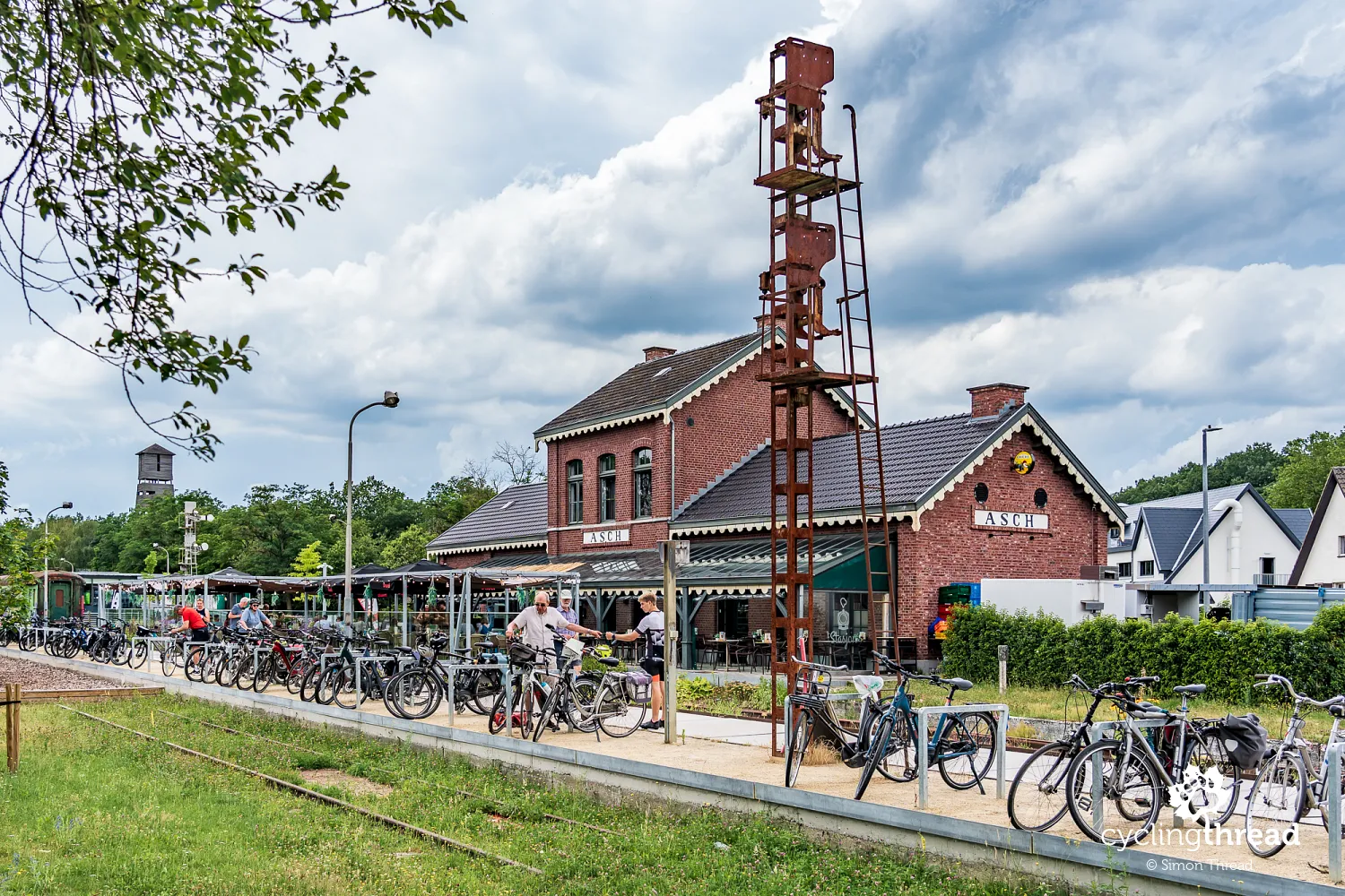
Not long after leaving Cycling through the Heath, the former As railway station appears beside the route, another reminder of Limburg's industrial past. The station was built in the early 20th century, when railway development coincided with the discovery and exploitation of coal deposits in the region. Regular trains no longer run here, but the station building, tracks, parts of the old railway infrastructure and even some rather dilapidated rolling stock have survived. The long platform now serves as parking for dozens of bicycles, and the number left there shows better than anything how popular a stopping place the former station has become. For us, As was a short break at the station restaurant, which fits neatly into the new life of the site.
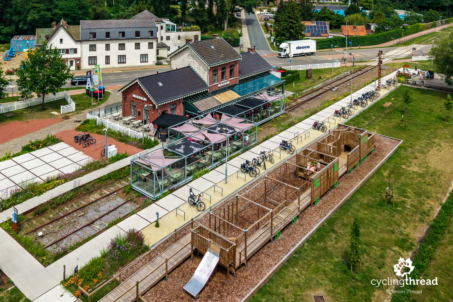
Converting former railway stations and stops into restaurants, cafés and other tourist facilities fits well with the way Limburg uses its industrial heritage. Rather than removing traces of the former railway, they are retained in the landscape and given new functions, readily used by cyclists among others. We have encountered similar solutions on previous journeys - along the famous Alpe-Adria Cycle Route in Italy, and on the Route around the Tatras and the Old Railway Route in Poland. Here, however, such places form part of a much broader transformation of the former mining region, whose effects we have observed almost from the moment we joined the Kempen Route.
Safer cycling infrastructure across Flanders
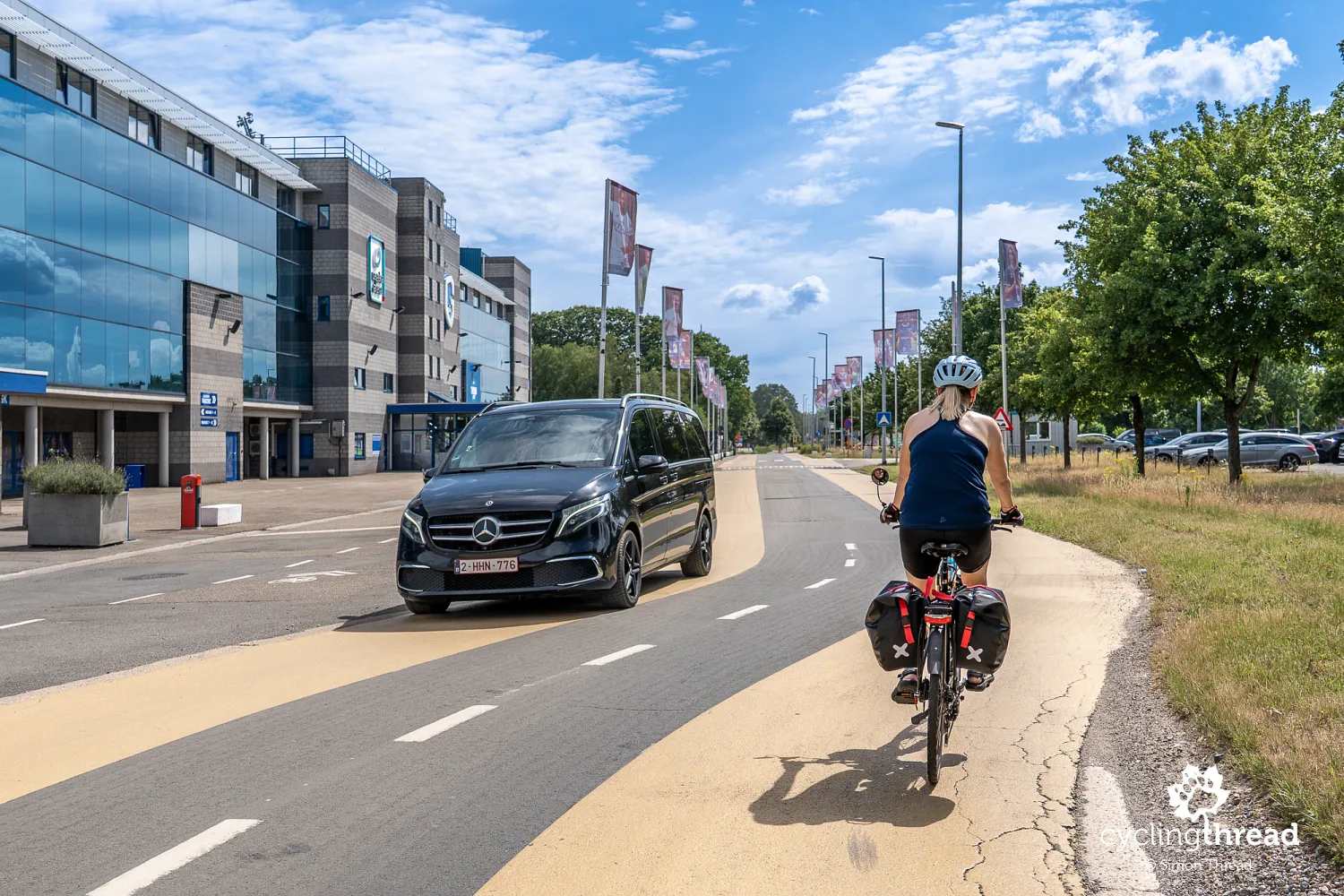
While travelling through Flanders, we repeatedly encountered various cycling solutions designed to improve safety, many of them with a distinctly local character. Here, at the entrance to Waterschei, a district of Genk, the route led us along broad, pale-yellow cycle lanes that marked the space intended for cyclists very clearly. At the same time, they visually narrowed the carriageway available to cars, encouraging drivers to pay more attention and travel more slowly. This was not a physically separated cycle path, but a way of organising shared space in which cyclists were difficult to overlook. We encountered many more small but thoughtful solutions like this while riding through Flanders.
Discovering the former Waterschei coal mine
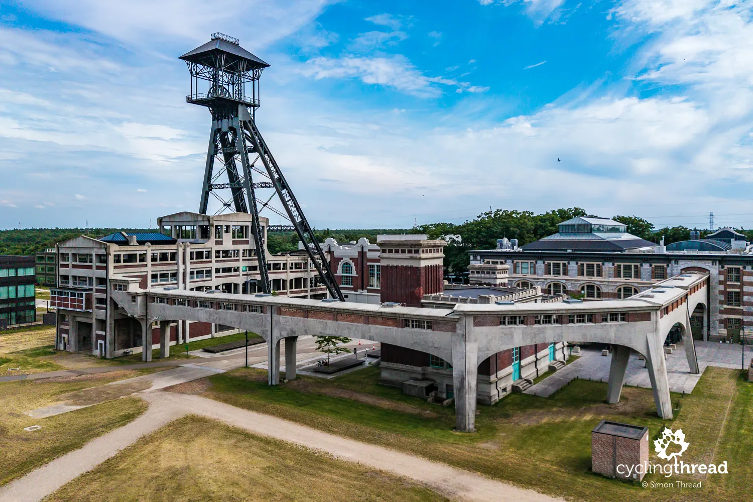
Waterschei is best known, however, for its former coal mine, one of seven that operated in the Belgian Kempen. Mining began in 1924 and continued until 1987, with around 6,800 people employed here at its peak. Part of the huge complex has survived, including a distinctive headframe that reveals the site's industrial past from afar. The most impressive feature, however, is the monumental main mine building - once the administrative centre of the colliery and now known as Thor Central. Together with the remaining structures, it forms a striking ensemble of industrial architecture that clearly sets Waterschei apart from an ordinary urban district.
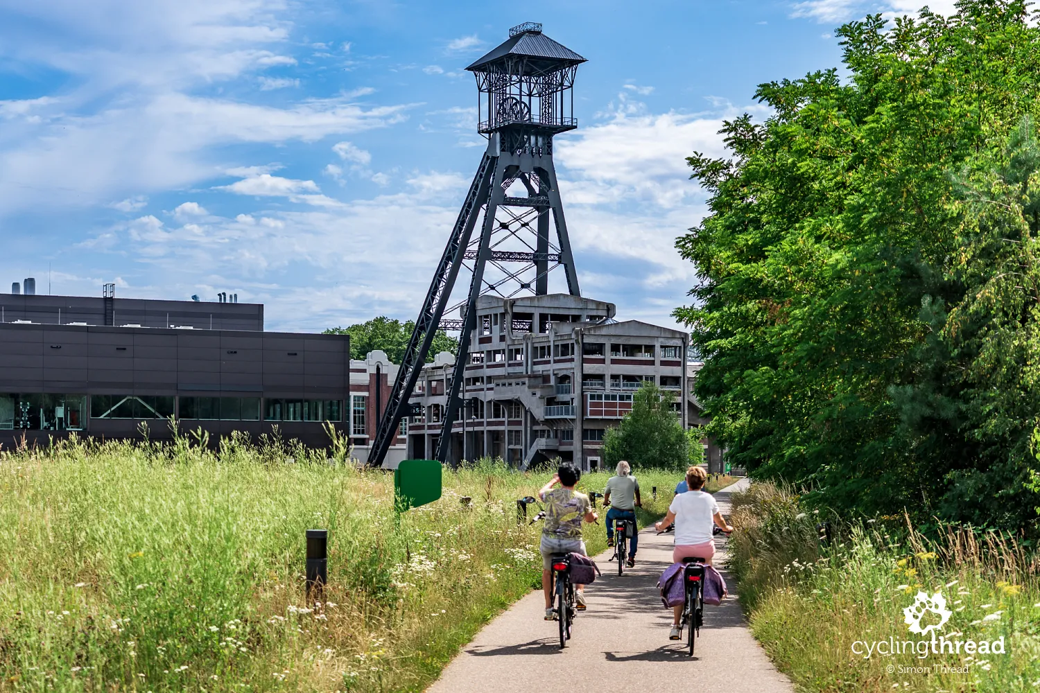
The former mine site now operates as Thor Park and is another example along our route of new life being given to Limburg's mining heritage. Thor Central has been restored and now houses conference, business and dining facilities, while a large technology and science park is developing around it, focused primarily on energy, new technologies and smart industry. The symbolism of this transformation could hardly be clearer - a place whose growth was powered by coal for decades is now home to research into renewable energy and the energy transition. At the same time, the preserved buildings, mine shaft and spoil heap ensure that the history of Waterschei remains clearly visible in the landscape.
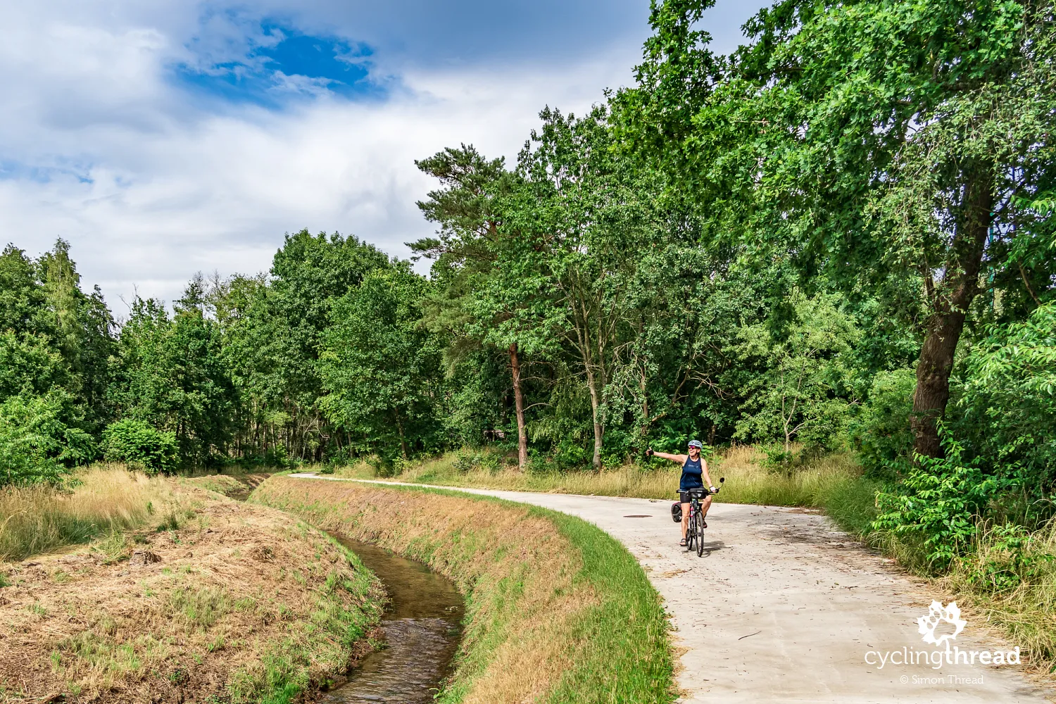
We cross Genk's former industrial and residential areas on a series of excellent, fast cycle paths running through small green spaces and alongside local rivers and canals. This relatively short section takes us towards C-mine, another former industrial complex on the Kempen Route. Yet it stayed in my memory as a very good example of how a cycle route can be guided through a more densely built-up area with almost no contact with motor traffic. Instead of main streets, the route uses green corridors, the banks of waterways, side roads and dedicated cycling infrastructure. This allows us to ride quickly and freely for several kilometres, barely noticing that we are travelling through part of a city with more than 60,000 residents.
Exploring C-mine and the Winterslag mine
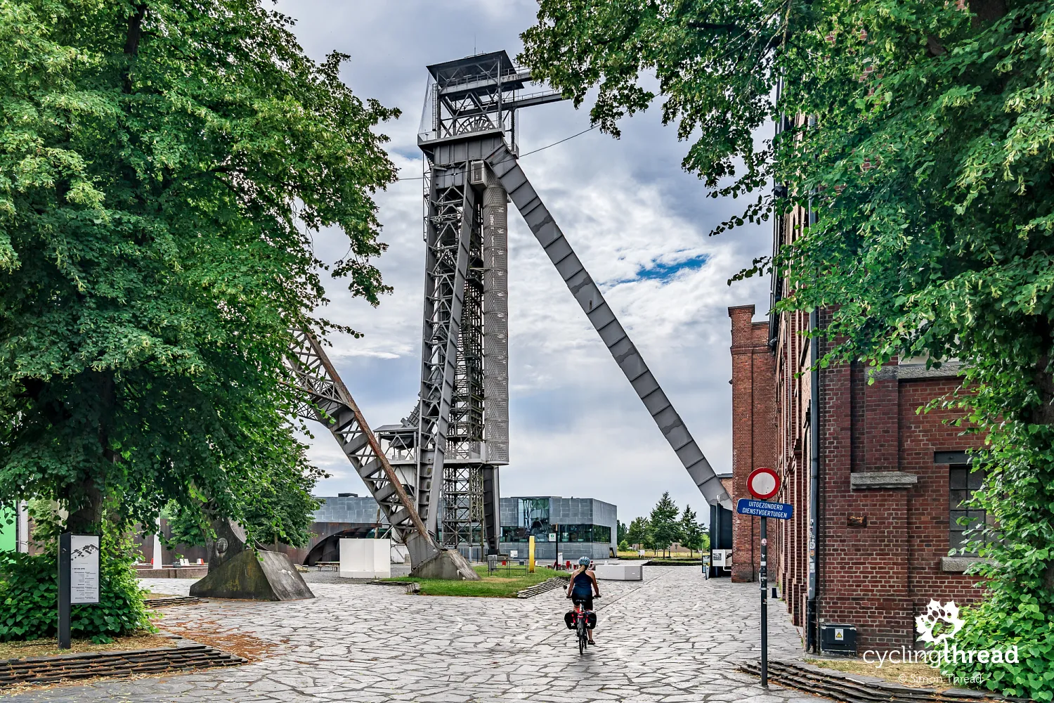
C-mine occupies the former Winterslag mine, one of three major coal mines established in Genk in the early 20th century. The first coal in the Kempen coalfield was extracted here in 1914, although regular mining began three years later and continued until the mine closed in 1988. Much of the huge complex's most important buildings have survived, including former engine houses, baths and lamp room, warehouses, stables and two distinctive headframes. The taller one rises more than 70 metres, while the smaller structure, dating from 1915-1916, is the oldest surviving example of its kind in the entire Kempen coalfield. Together with the brick industrial buildings, they form one of the most impressive post-mining complexes we see along the route.
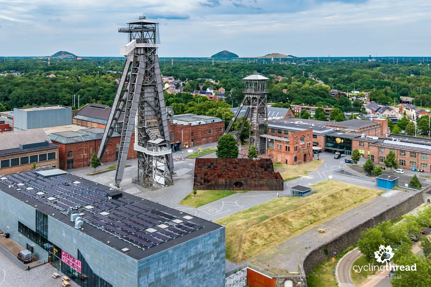
After the mine closed, however, Winterslag did not become a conventional industrial museum. Under the name C-mine, the former complex was transformed into a major centre for culture and the creative industries, now housing a design centre, galleries, theatres, a cinema, artists' studios, businesses, restaurants and a campus of LUCA School of Arts. Its mining past can be explored on the C-mine Expedition - a route of around 1.5 kilometres through underground spaces and former installations, with an audio guide and a VR experience showing miners at work in the 1950s. The route ends with a climb up the tall headframe, offering a view over the entire complex and Genk.
Crossing the Kuilenstraat cycle bridge
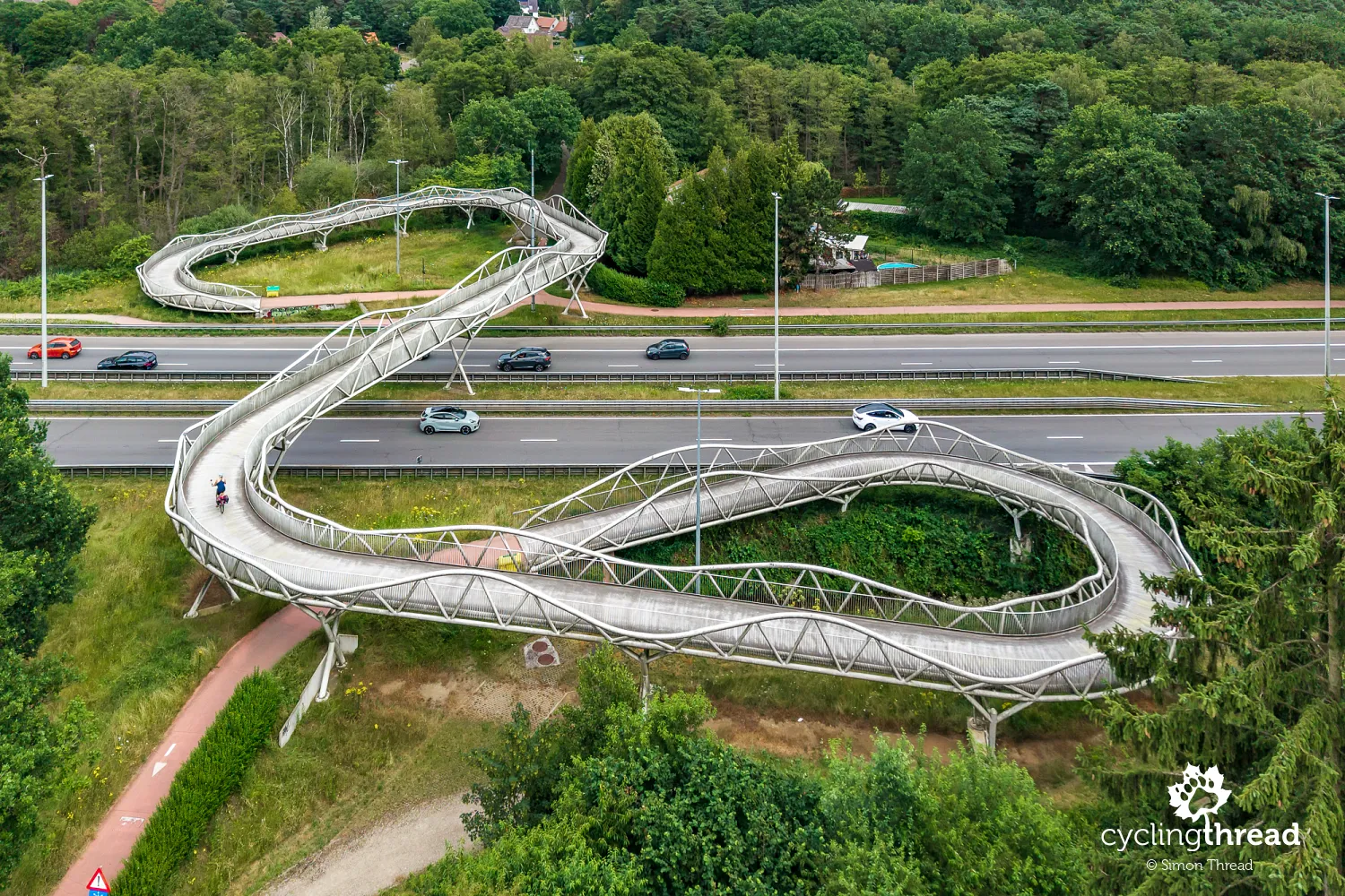
From here, the Kempen Route continued west, but we had planned to stay overnight in Genk and visit one of Bokrijk's famous cycling projects the following day. Before reaching the hotel, we crossed the unusual cycle bridge at Kuilenstraat, spanning the busy Westerring. The steel structure was built in 2014 to create a traffic-free connection between central Genk and the Winterslag district, previously divided by a broad four-lane road. Its winding form is particularly distinctive - gentle curves and ramps make the bridge look a little like a roller coaster. The shape was primarily dictated by the limited space available for construction, but it also turned an ordinary crossing over a busy road into another striking piece of Genk's cycling infrastructure.
Why Genk makes a good cycling base
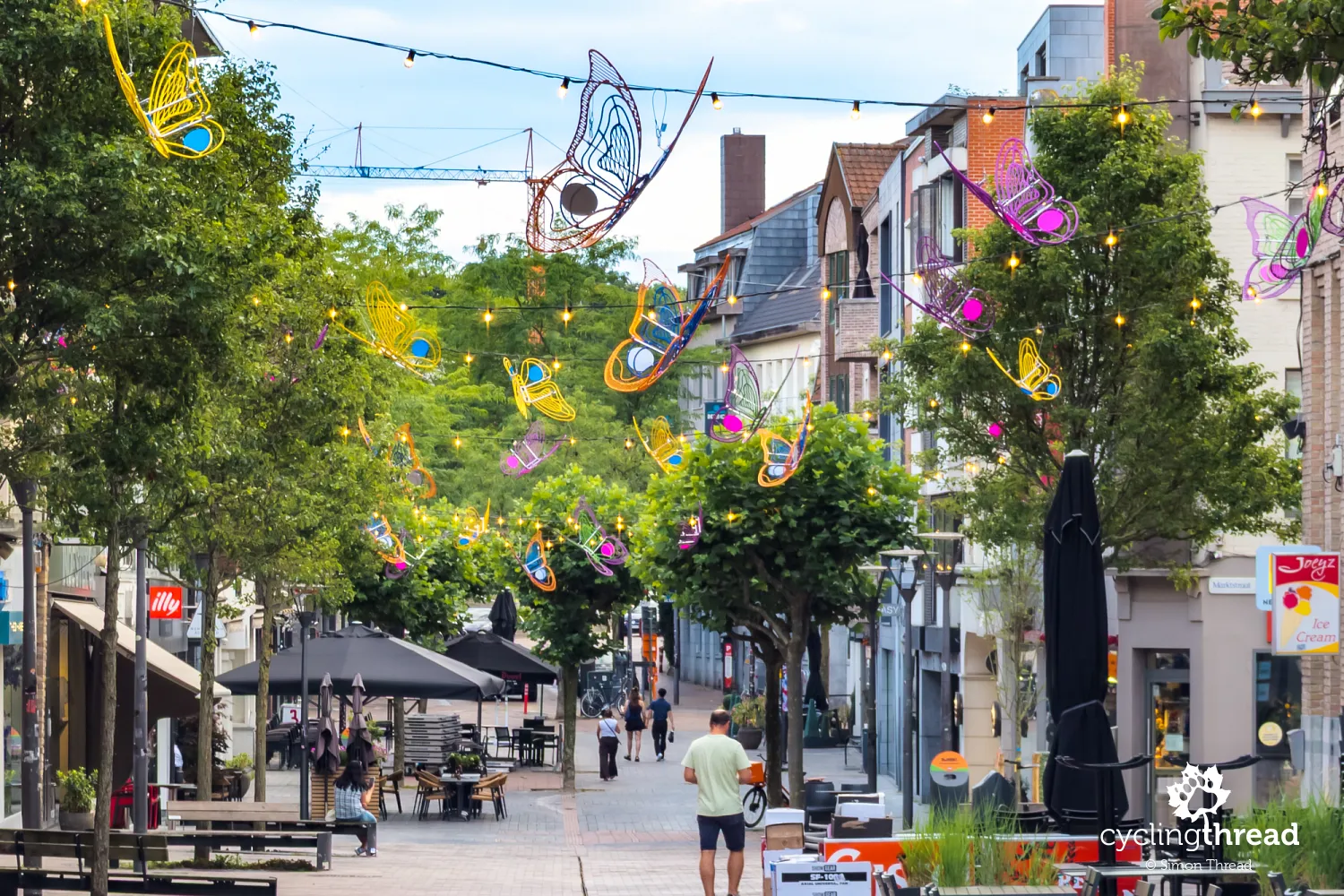
Unlike many of Flanders' best-known cities, Genk has no medieval centre or compact historic district. Its rapid growth did not begin until the 20th century, with the expansion of mining. The arrival of workers from Italy, Turkey, Greece, Poland and other countries made modern Genk one of Belgium's most multicultural cities, something visible, for example, in its local food scene. The centre is small and quiet, with a large square, shops, restaurants and hotels concentrated in a relatively limited area. For cycle travellers, the city's location is particularly important - it lies between Limburg's most interesting sites and at the heart of a very dense cycle route network, making Genk a convenient base for several days of riding.
Finding cyclist-friendly hotels across Limburg
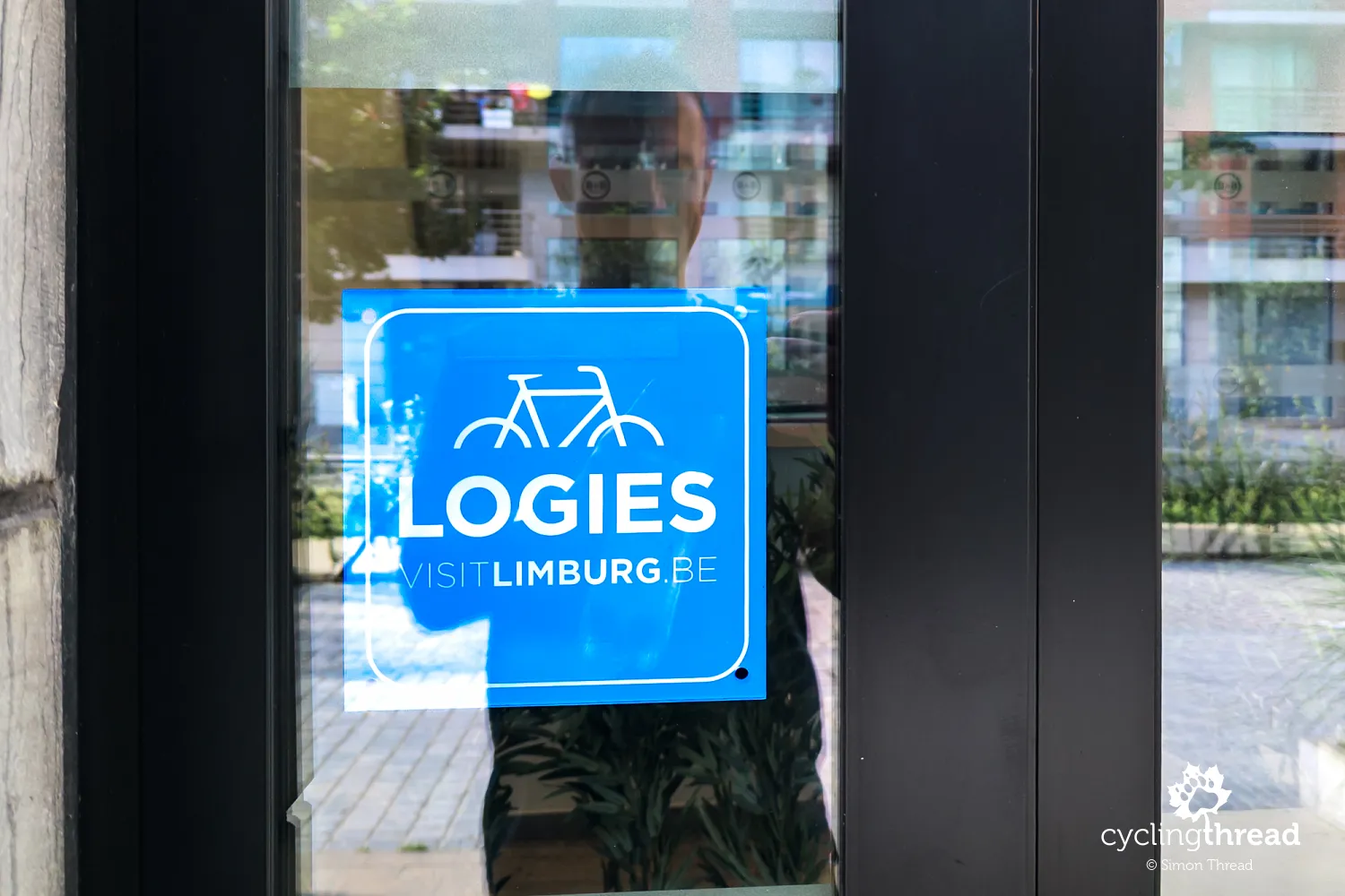
When looking for accommodation in Limburg, it is worth starting with properties displaying the blue Fietslogies logo, the official mark awarded by the local tourist organisation Visit Limburg to cyclist-friendly accommodation. To qualify, a hotel, guesthouse or campsite must be located no more than five kilometres from the cycle route network and provide guests with a covered, lockable place to store their bikes. The label therefore makes it easy to find accommodation prepared for people travelling by bicycle, and some properties also offer additional facilities such as somewhere to dry clothes, basic tools or information about nearby routes. A list is available on Limburg's official tourism website, where Fietslogies appears as a separate property feature. Cyclist-friendly accommodation is also shown on route maps on the official Iconic Cycle Routes website.
Cycling through Water at Bokrijk
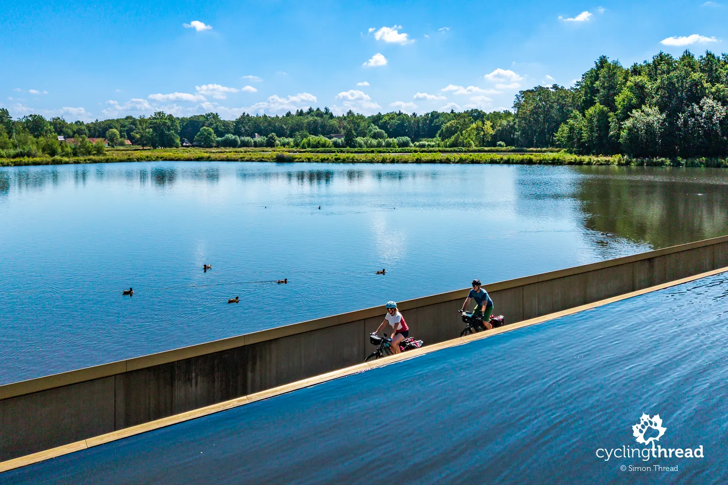
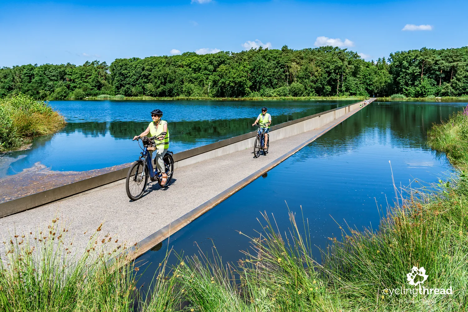
We begin the next day with a quick ride from Genk to Bokrijk, where the third of Limburg's unusual cycling projects awaits us - Cycling through Water (Fietsen door het Water). Bokrijk is an extensive recreational area, best known for its open-air museum presenting the historic architecture and everyday life of Flanders. It is surrounded by forests, ponds and green spaces, includes a large arboretum, and is crossed by a dense network of cycle paths. In 2016, an unusual cycle path was built through one of the ponds: instead of crossing above the water on a bridge, it descends into its surface. The idea quickly became one of the most recognisable symbols of cycling in Limburg.
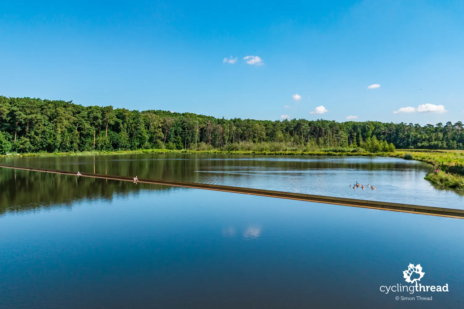
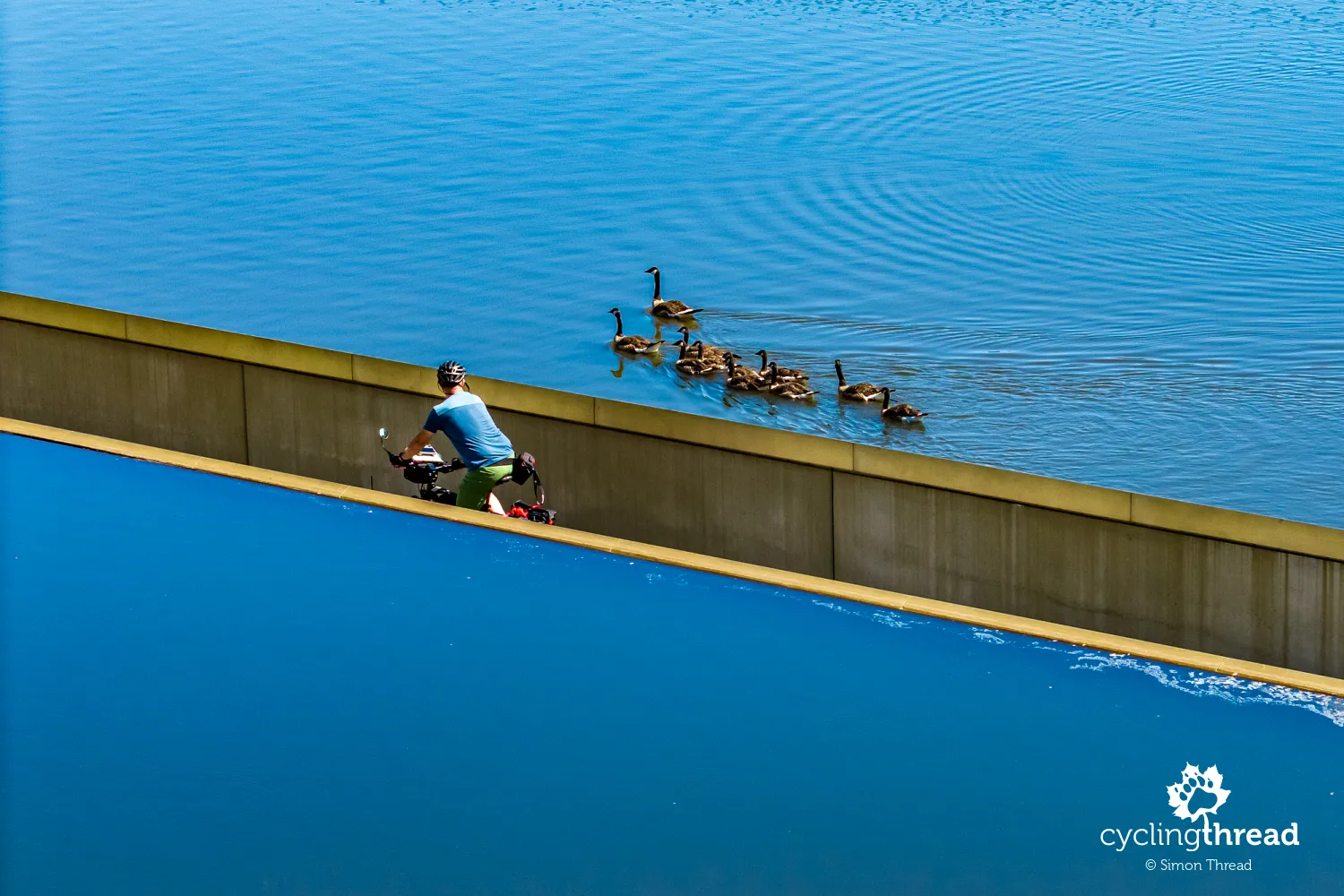
Cycling through Water is around 200 metres long and runs through a concrete corridor whose surface lies below the water level. Only low concrete walls separate cyclists from the pond on either side, so the surface of the water is almost at eye level as you ride. The passage is gently graded, with no significant height difference, and the entire structure was integrated into the existing pond. Canada geese have taken a liking to the place, resting on the banks and swimming close to passing cyclists. This is perhaps the most literal interpretation of the "infrastructure as an attraction" idea mentioned earlier - for a moment, you really do ride between two walls of water.
Making cycling in Flanders more accessible
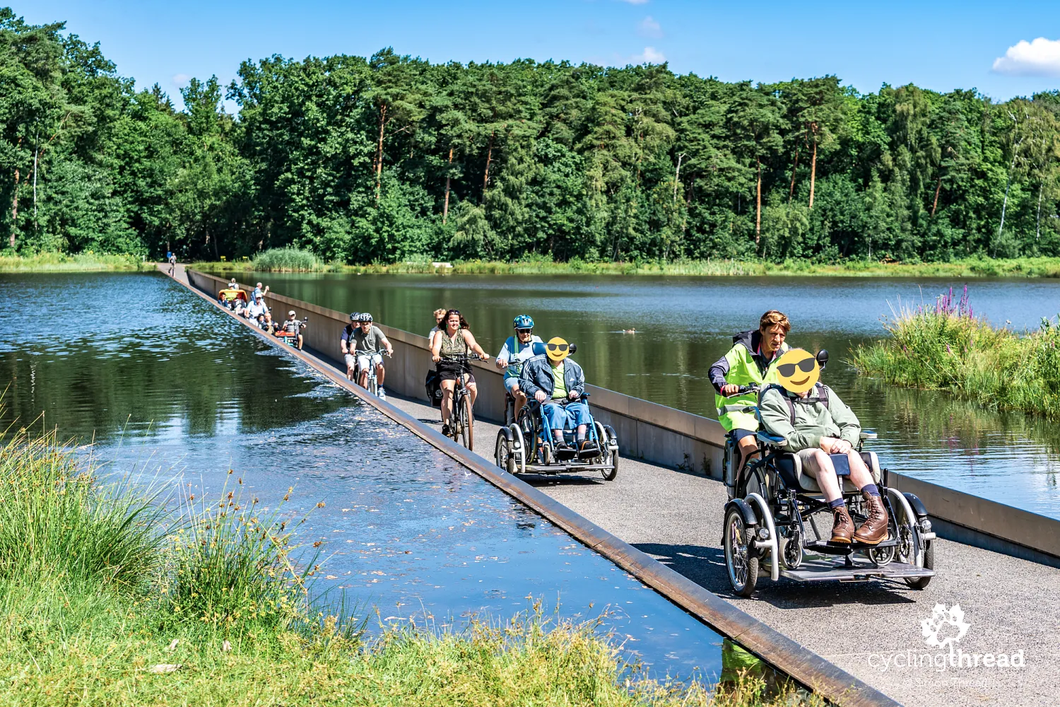
During our visit to Bokrijk, a group of cycle rickshaws carrying people with disabilities appeared on the famous cycle path. The passengers came from Ter Heide, a Limburg organisation that supports people with disabilities, working in part with families and volunteers. Group rides on these cycles help people who cannot ride independently to stay active and take part in cycling excursions. The unusual sight of the whole group on Cycling through Water was a perfect illustration of a theme present along the Kempen Route - making cycling tourism accessible to people with different abilities and needs. Flanders is implementing practical solutions here, several of which we also encountered later in the journey. The scene in Bokrijk was also a valuable reminder that well-designed cycling infrastructure can serve a far broader group of users than people riding conventional bicycles.
Kolenspoor - the F75 cycle highway
Soon after Bokrijk, and naturally after another section of excellent forest cycle path, we reached one of the region's cycling backbones - Kolenspoor, a cycle route following the former coal railway. The old Kolenspoor was a true artery of the coalfield, extending for around 70 kilometres and connecting seven mining communities in Limburg. Today, a much larger cycling project is being developed along its course, ultimately intended to create a 77-kilometre link between Beringen and Maasmechelen. One of its key points is the former station at As, where we stopped the previous day. The first new 12-kilometre section between Genk and As station opened in June 2025, restoring the former railway's transport role - this time for cyclists.
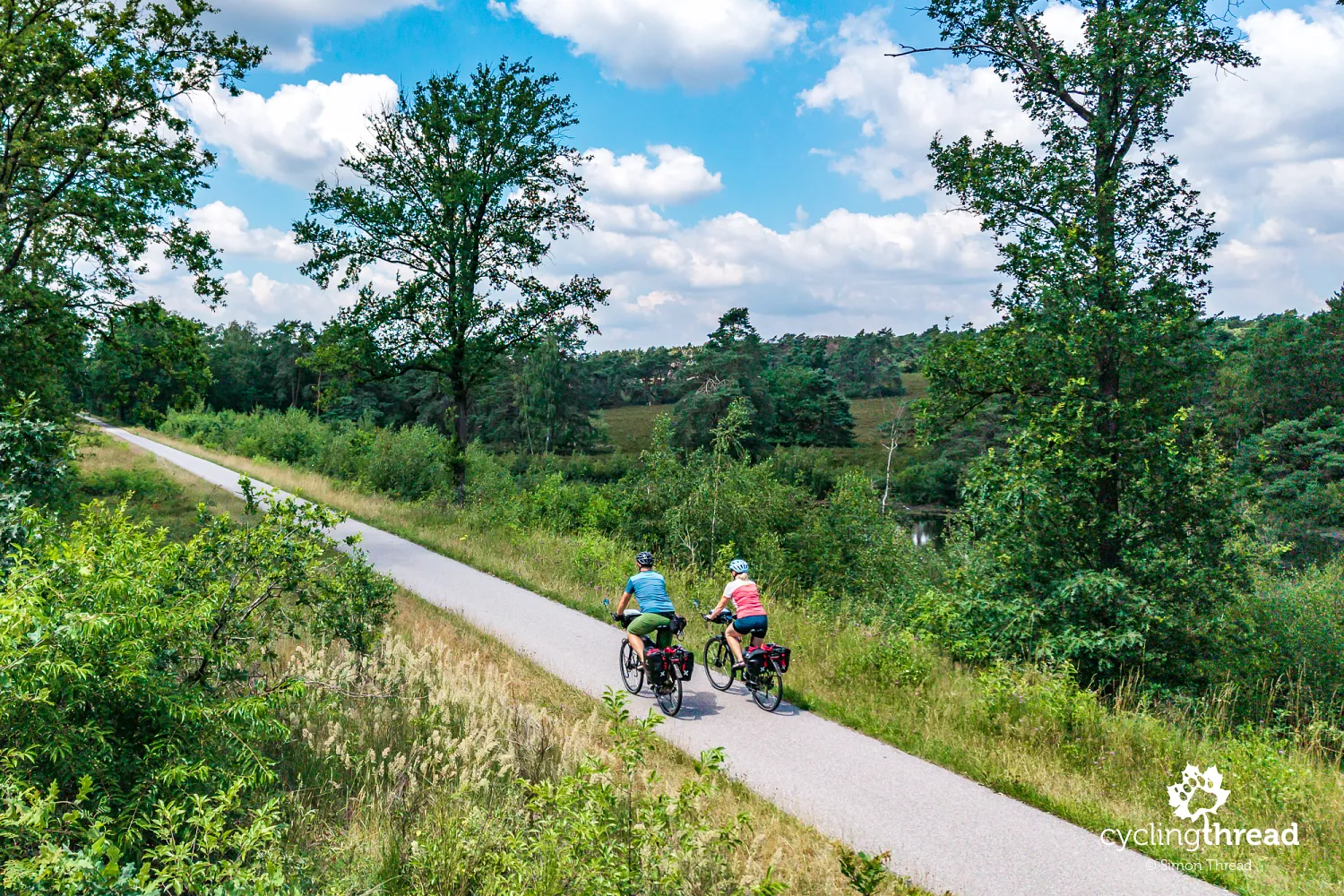
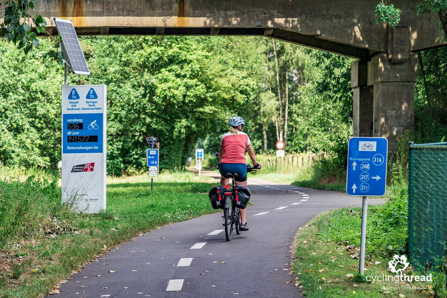
The main axis of Kolenspoor is the F75, one of the Flemish fietssnelwegen, or cycle highways, whose planned network in Flanders and Brussels already extends to more than 2,800 kilometres. The F75 itself currently covers around 30 kilometres from As through Genk and Zonhoven to Houthalen, supplemented by several branches. Ultimately, however, Kolenspoor is intended to be more than a fast transport connection: it will once again link seven former mining communities and the most important places associated with the region's industrial history. Along this axis are Terhills in Maasmechelen, the former station at As, C-mine and Thor Park in Genk, Luchtfabriek in Heusden-Zolder and be-MINE in Beringen, which we will reach the following day. The railway once built primarily to serve the mines is thus becoming a modern corridor for everyday transport, recreation and cycling tourism.
The solutions used to build the new sections of Kolenspoor are particularly interesting, although cyclists will probably not notice most of them. The old railway ballast beneath the tracks was left in place and, after suitable processing, reused as the foundation for the new cycle path. A special machine processed the material without it having to be removed from the site, reducing the consumption of new raw materials and avoiding around 800 lorry journeys. Efforts were also made to preserve remnants of the former railway infrastructure, while timber removed from the route corridor during construction was used, among other things, to make benches for cyclists. These details are almost invisible as you ride, but they show how much attention was devoted to reusing materials during the project.
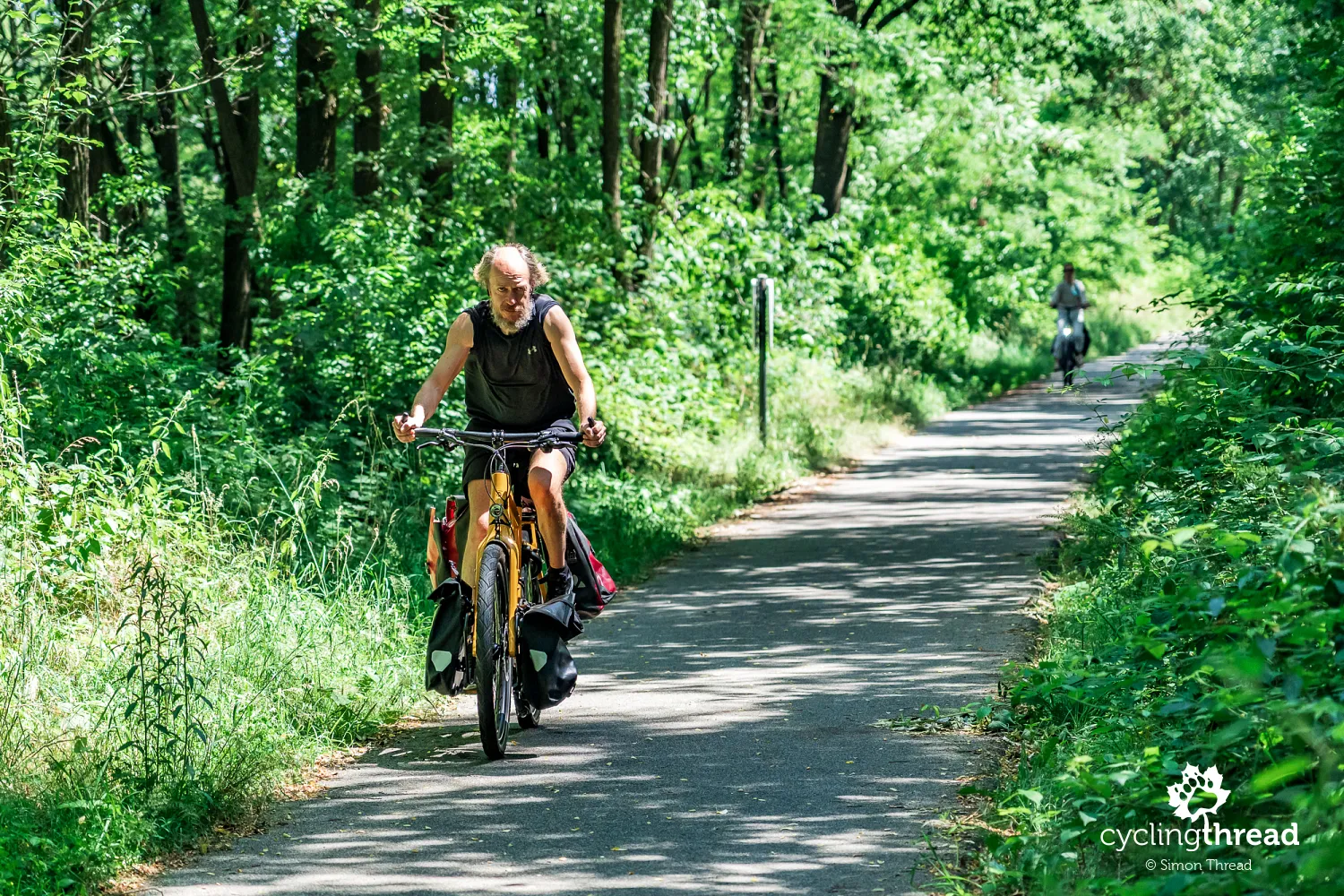
The project's ecological dimension is equally impressive. The new section has 229 lights whose colour, height and beam have been adapted partly to the needs of bats and moths, and the lighting can be dimmed or switched off at night. Beneath the path, 217 metres of small passages for reptiles and amphibians have been installed at intervals of roughly 500 metres, with around 10 kilometres of special fencing guiding animals towards them. In the Klaverberg area, a tunnel was even built to allow sheep to move safely between pastures on either side of the route - wild animals use the crossing as well. These measures were developed in consultation with the Provincial Nature Centre because Kolenspoor crosses habitats used by bats, smooth snakes and natterjack toads, among other species. Wow!
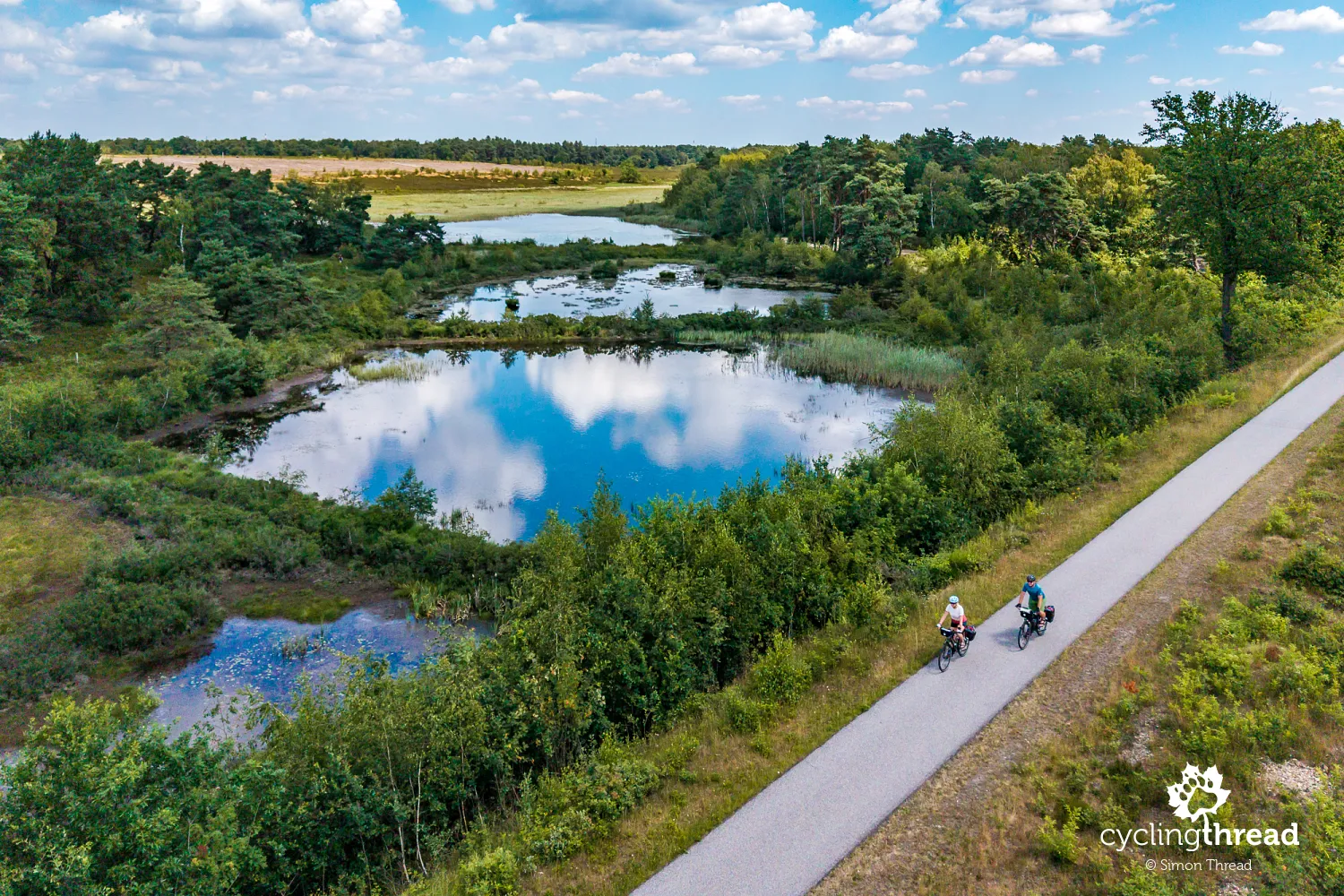
Cycling across the Kamp Beverlo training ground
The end of the fast F75 cycle highway did not mean the end of the day's attractions. Soon afterwards, the Kempen Route took us onto... the Kamp Beverlo military training ground and Grauwe Steenstraat, a road closed to ordinary traffic but open to cyclists. Even the entrance looked rather surprising, with a metal gate indicating the maximum dimensions of bicycle and rider. Beyond it lay one of the most enjoyable stretches of the day: a quiet road through military land with an excellent surface of very fine, even gravel. It was so smooth and fresh that it almost looked as though someone had prepared it especially for our arrival.
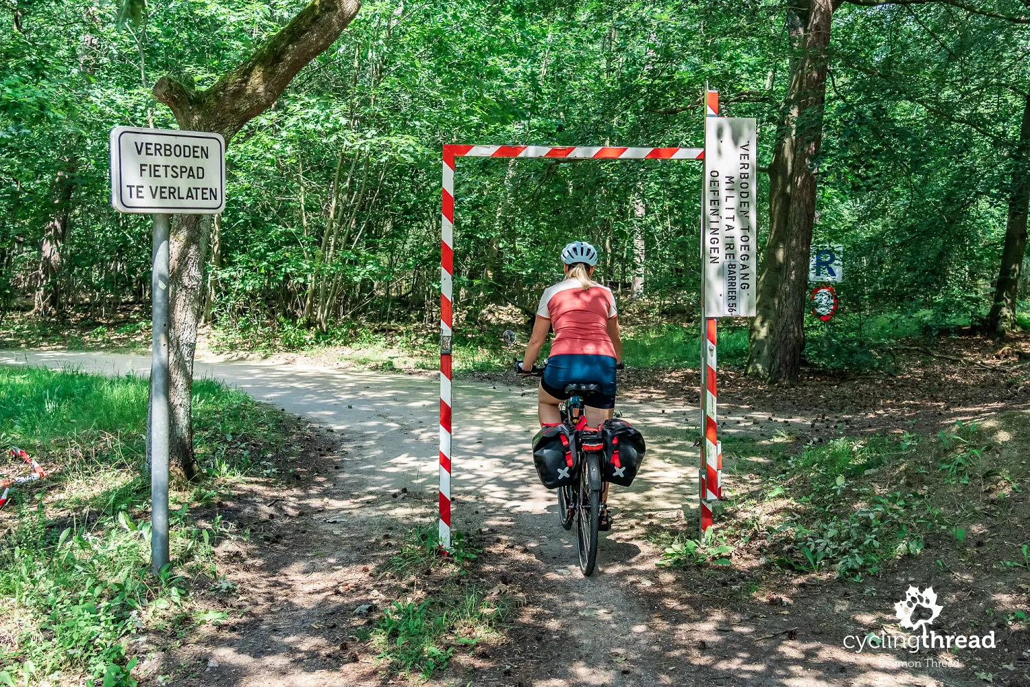
The military character of this area meets a highly valuable natural environment - Kamp Beverlo contains the largest continuous heathland in Flanders, and the Kempen Route passes close to the Valley of the Black Brook (Vallei van de Zwarte Beek). Parts of the old Kempen landscape survive here, with wetlands, peat bogs, meadows, forests and heathlands, while some walking routes through the military area are open only at weekends and on public holidays. The De Watersnip nature centre also operates beside Grauwe Steenstraat, providing a starting point for several routes into the valley and introducing visitors to its natural environment. We passed it by bike and continued along the Kempen Route towards Beringen.
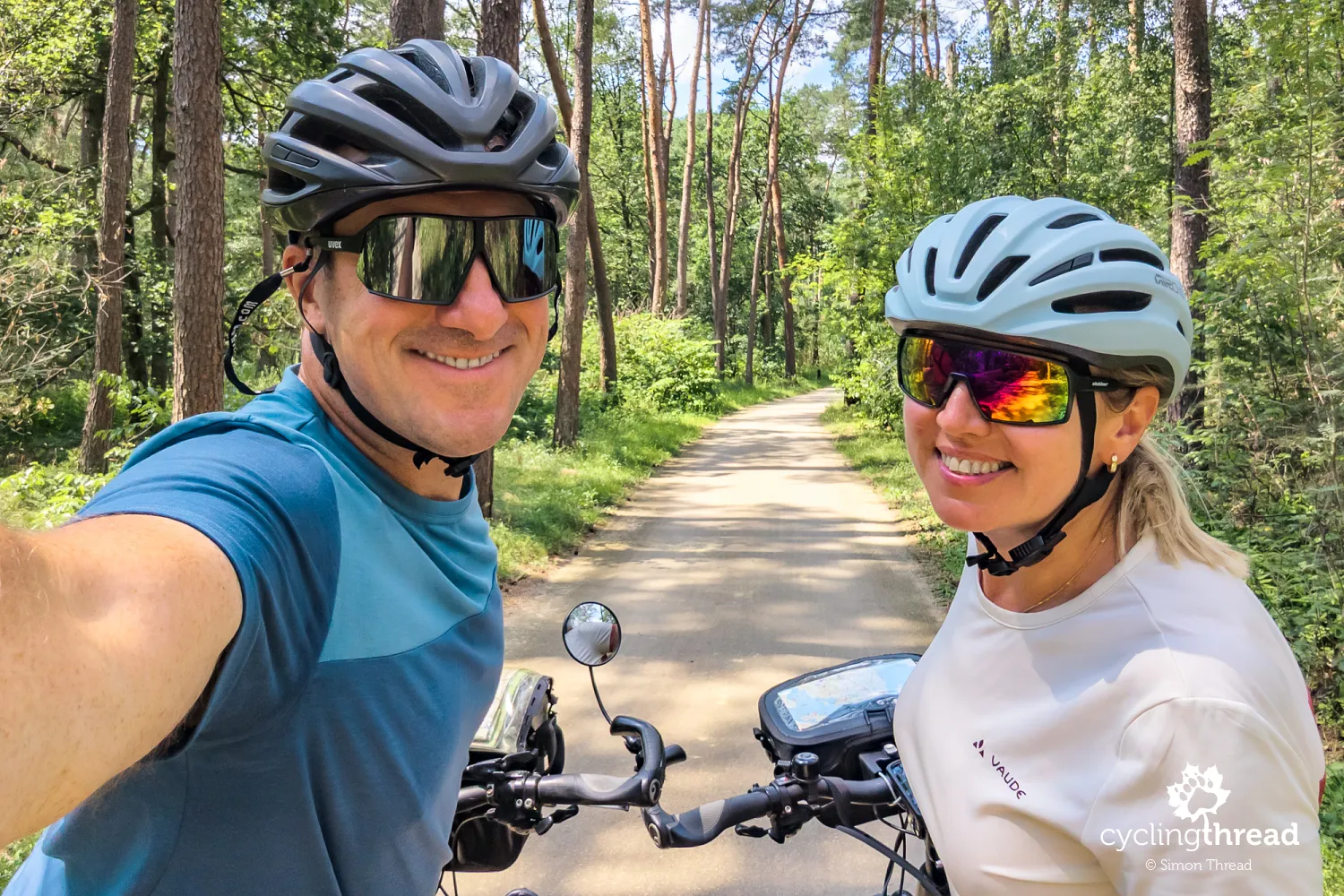
Exploring the historic be-MINE in Beringen
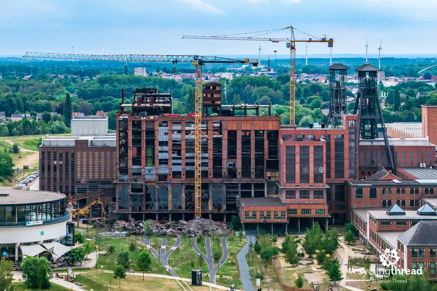
The Kempen Route later reaches another important place associated with the region's mining identity - be-MINE in Beringen. It is the largest preserved industrial heritage complex in Flanders, encompassing around 100,000 square metres of historic buildings, and the only former mine in Limburg whose industrial heart has survived almost intact. Headframes still tower above the enormous brick halls, alongside former coal-washing buildings, the power station and distinctive cooling towers. The Mijnmuseum presents the site's mining history; a visit includes a reconstruction of an underground mine, while former miners tell visitors about working below ground. The sheer scale of the complex makes Beringen perhaps the most impressive of all the former mines we saw during our journey through Limburg.
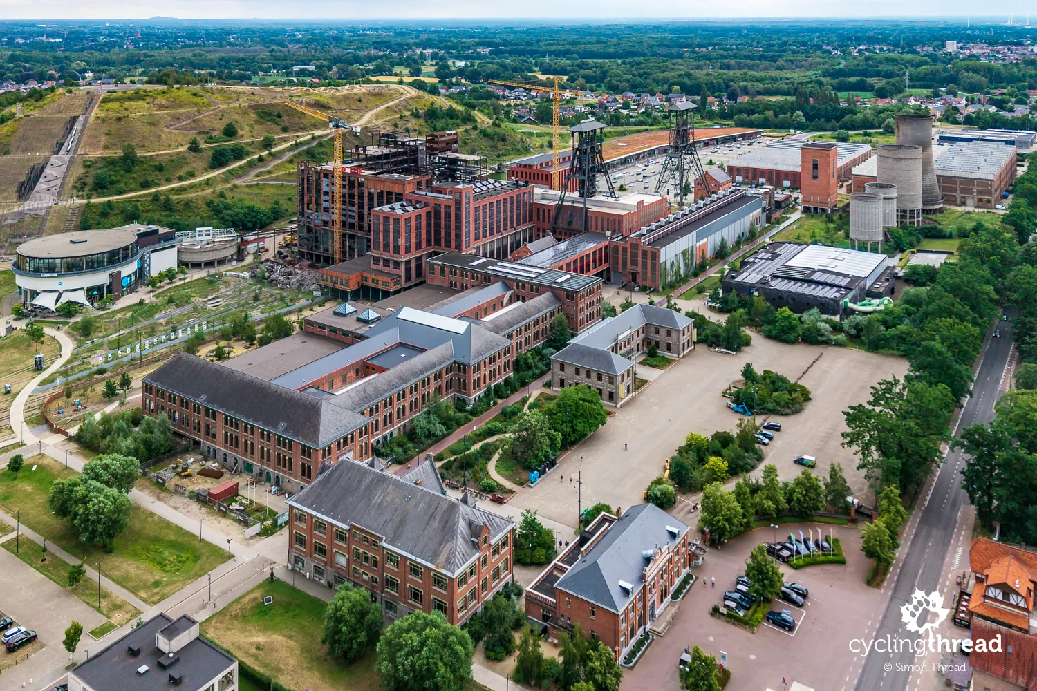
As in Genk, however, the old buildings have been given entirely new uses, and the whole area is being transformed into a large district combining culture, sport, recreation, retail, dining, housing and workplaces. One of the most interesting new projects is be-NATURE, currently under development in two enormous former coal-washing buildings and intended to combine industrial heritage with nature. Other parts of the complex already house TODI - Europe's first indoor diving and snorkelling centre of its kind, where visitors can swim among tropical fish - and the Alpamayo climbing centre, with around 1,300 square metres of climbing walls. Shops, sports facilities, offices and homes have also been built beside the former mine buildings. The revitalisation of be-MINE is therefore not about creating a single museum, but about gradually introducing new functions throughout the entire former complex.
Exploring the military history of Leopoldsburg
Our next stop on the Kempen Route was Leopoldsburg, a town whose history has been linked to the military from the very beginning. Kamp van Beverlo, a huge training ground and military camp, was established here in 1835 on the initiative of King Leopold I. A settlement began to grow around it, becoming an independent municipality in 1850. This origin remains clearly visible in the townscape today - in the former barracks, officers' villas, military monuments and street names - while the active training ground still occupies extensive land on the outskirts. Leopoldsburg is therefore a very different stop from the mining towns of Limburg visited earlier. Instead of shafts, spoil heaps and mine buildings, the key layers of local history are the military and the events of the two world wars.
Liberation Garden and Operation Market Garden
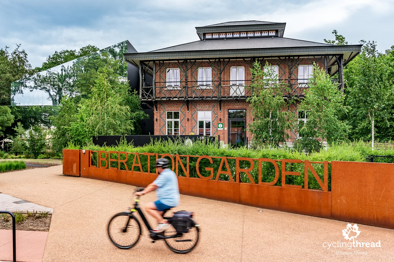
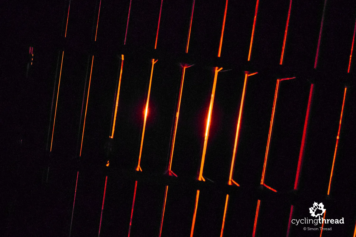
The main site devoted to the Second World War is Liberation Garden, a modern museum opened in 2023 in the historic Chinese Pavilion, a former officers' villa dating from the mid-19th century. The exhibition focuses not only on military operations, but above all on the experiences of residents, soldiers, resistance members and prisoners during the occupation and liberation. Operation Market Garden receives particular attention: in September 1944 it began here in the Leopoldsburg area, where one of the largest Allied airborne operations of the war was prepared. The stories of ordinary people form an important part of the narrative, so Liberation Garden is not a typical museum filled solely with military exhibits.
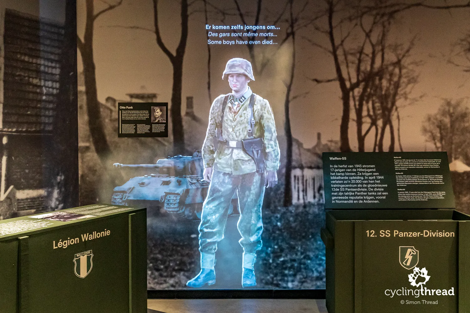
The museum has a strongly multimedia character. During the visit, you can experience a bombing raid inside a reconstructed shelter, something that has taken on particularly poignant meaning today in the context of Russia's attack on Ukraine. Another unusual experience is a simulated flight in a Spitfire - simply sit in a suspended seat and put on a VR headset to spend several minutes inside a fighter cockpit. Add holograms of people describing their wartime experiences and the exceptional commitment of the museum guides, and the result is one of the best museums we have visited during our cycling journeys. It really is worth visiting.
The military cemeteries of Leopoldsburg
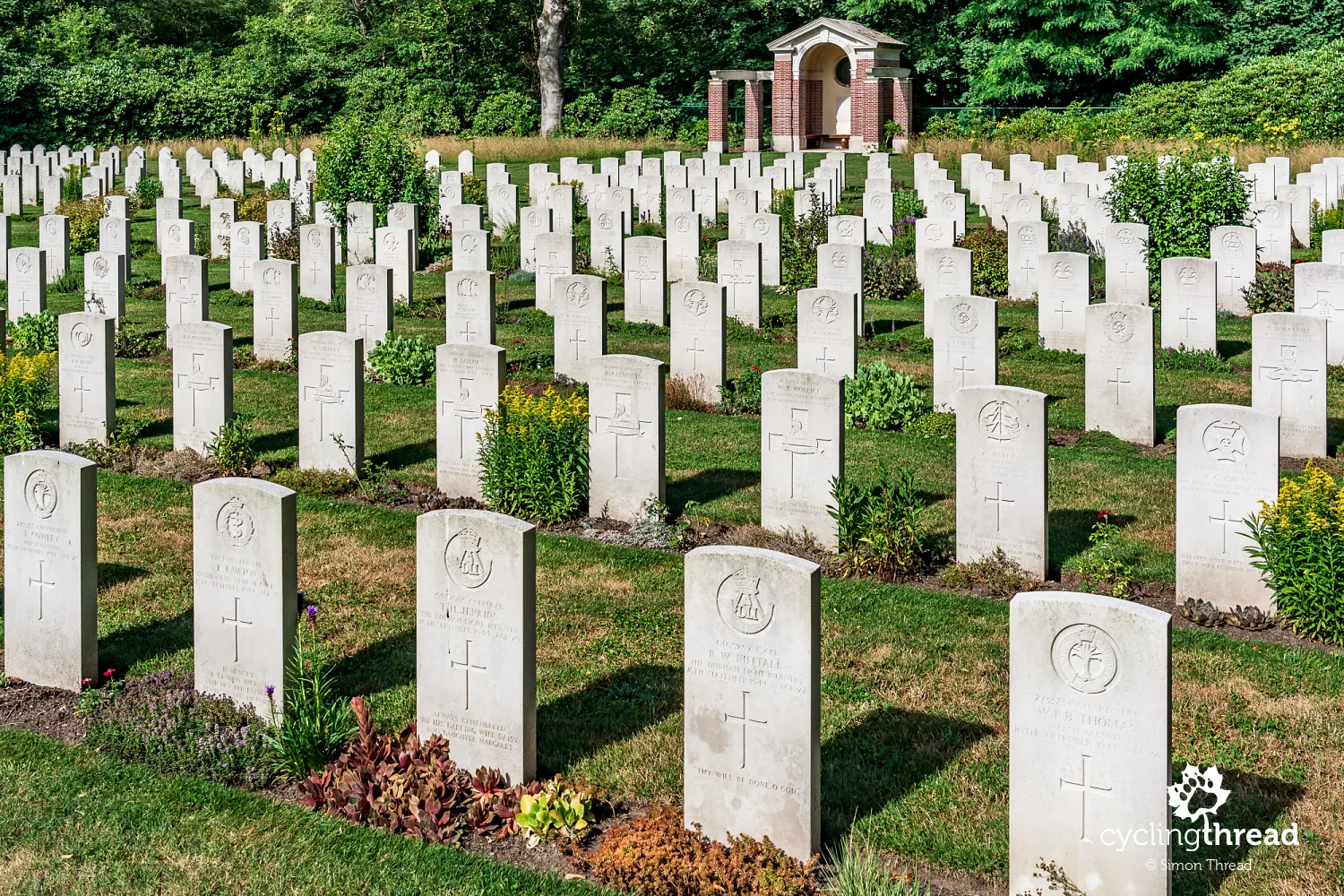
Leopoldsburg's wartime history is also reflected in two neighbouring military cemeteries, one Belgian and one British. The first contains more than 1,300 graves from both world wars, including those of soldiers, prisoners of war, deportees and political prisoners, with two mausoleums dedicated to unknown prisoners of war and political prisoners forming a particularly important part of the cemetery. The British Leopoldsburg War Cemetery was established after the Second World War and is primarily the burial place of soldiers killed in fighting connected with the liberation of this part of Belgium. Both sites are reminders of how important the town and the surrounding Kamp van Beverlo were on the region's wartime map. Interestingly, the German graves formerly located in Leopoldsburg were moved after the war to the vast cemetery in nearby Lommel.
Kamp van Beverlo royal military museum
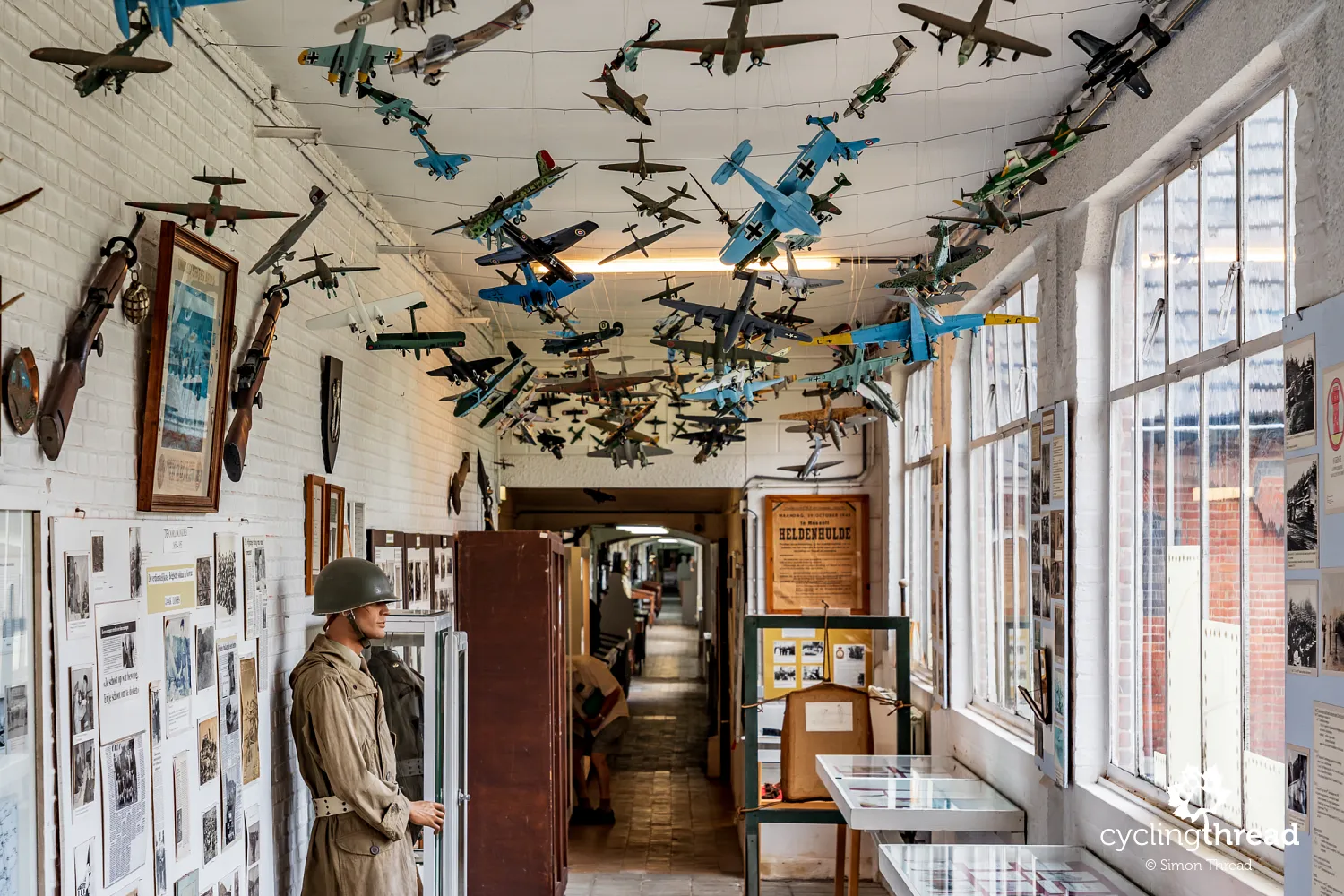
The much longer military history of the town is presented in the Koninklijk Museum Kamp van Beverlo, housed in a former military hospital dating from 1850. The museum recounts the creation and development of the training ground while also showing how the military presence shaped Leopoldsburg over almost two centuries. The collection occupies four former hospital wards connected by an impressive 175-metre corridor and includes uniforms, weapons, photographs, documents, models and everyday objects. The story does not end with the Second World War - the exhibition also covers the Cold War and post-war operations of the Belgian armed forces. It complements Liberation Garden well: one museum concentrates on the experience of the Second World War, while the other presents the much broader history of military Leopoldsburg.
Cycling through the Trees near Lommel
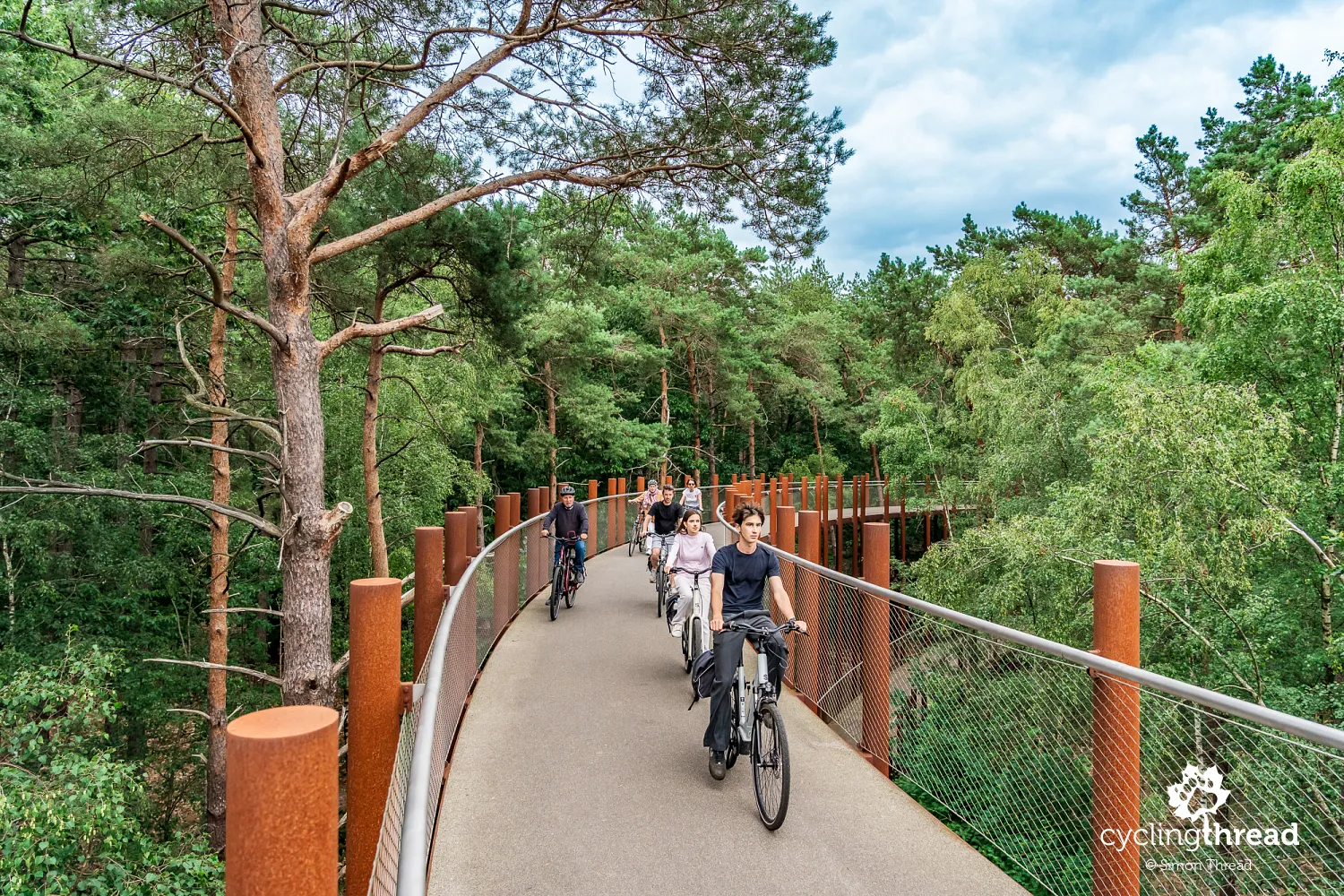
From Leopoldsburg, the Kempen Route continues through extensive forests towards Lommel, where the last of Limburg's four remarkable cycling projects awaits - Cycling through the Trees (Fietsen door de Bomen). Opened in 2019, the 700-metre structure is located in Pijnven, now part of Bosland National Park. The cycle path forms a huge double spiral around 100 metres in diameter, rising very gently between the pine trees to a height of 10 metres before bringing cyclists back down to forest level. The structure is supported by hundreds of slender Corten steel columns resembling the straight trunks of the surrounding trees. The gradient is only around 3-4 per cent, so despite the height, the climb is barely noticeable and the entire spiral is very easy to ride. The forest itself also has links to Limburg's industrial history - the pine trees were planted partly to provide timber for the mines.
Visiting Lommel German war cemetery
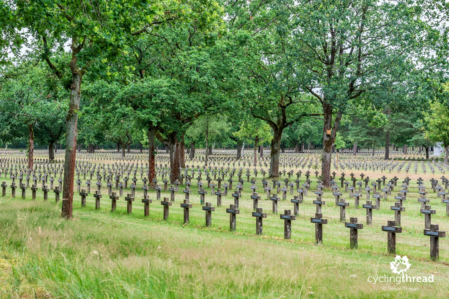
A dozen or so kilometres farther on, near Lommel, lies the largest German military cemetery from the Second World War in Western Europe. More than 39,000 people are buried across its 16 hectares, and almost 20,000 stone crosses arranged in long, regular rows create one of the most moving landscapes of remembrance in this part of Belgium. Most of those buried here died in fighting in Belgium and western Germany, including around Aachen, the Hürtgen Forest and the Remagen bridgehead. The cemetery also contains the graves of more than 500 German soldiers from the First World War, transferred from the former military cemetery in Leopoldsburg. The scale of the cemetery in Lommel helps explain why wartime heritage is so prominent along this section of the Kempen Route.
The Nyrstar zinc smelter in Balen
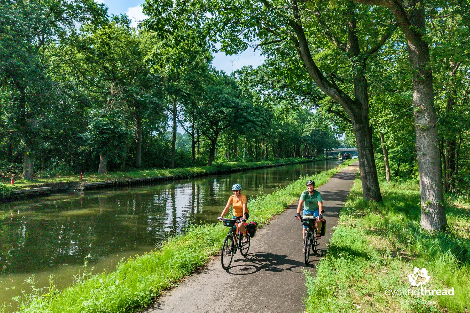
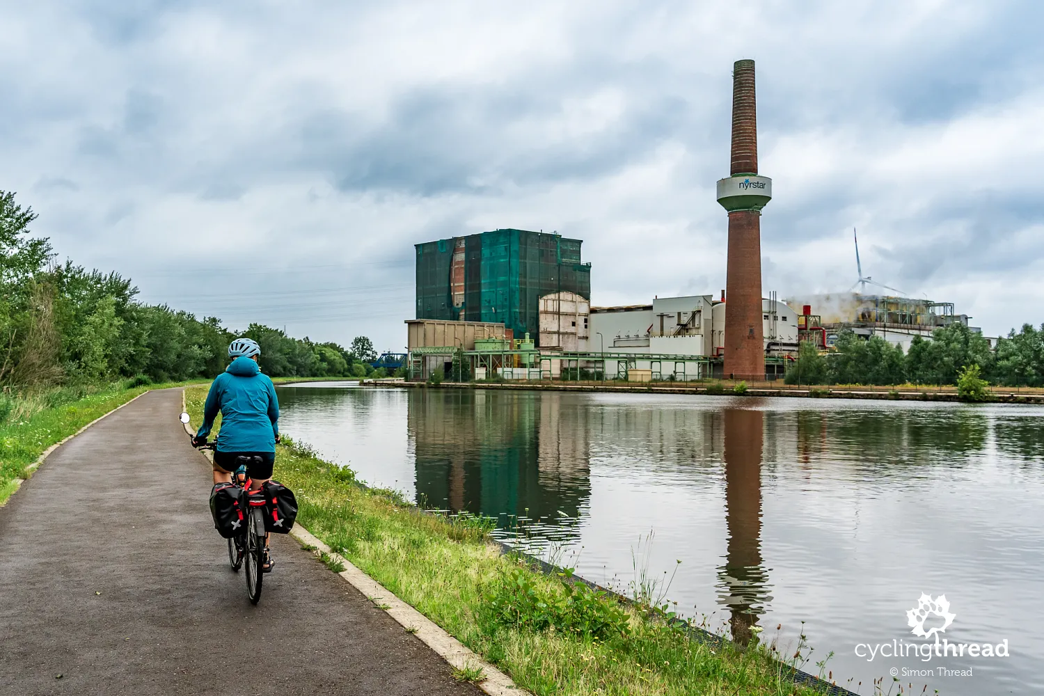
Among the very contemporary scenes encountered by cyclists on the Kempen Route is another, completely different face of the region - the vast Nyrstar industrial plant in Balen. The route follows an excellent asphalt cycle path directly alongside the canal, while enormous halls, industrial installations and the tall brick chimney of a zinc smelter rise on the opposite bank. The plant dates back to the late 19th century: the production of roasted zinc ore began here in 1888, followed by zinc production two years later. Today, Balen ranks among the world's largest zinc smelters by production volume, with raw materials arriving here partly by rail from the port of Antwerp. This industrial landscape forms an interesting contrast with the forests, heathlands and natural areas that dominate much of the Kempen Route.
Cycling beside the historic Kempen canals
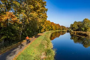
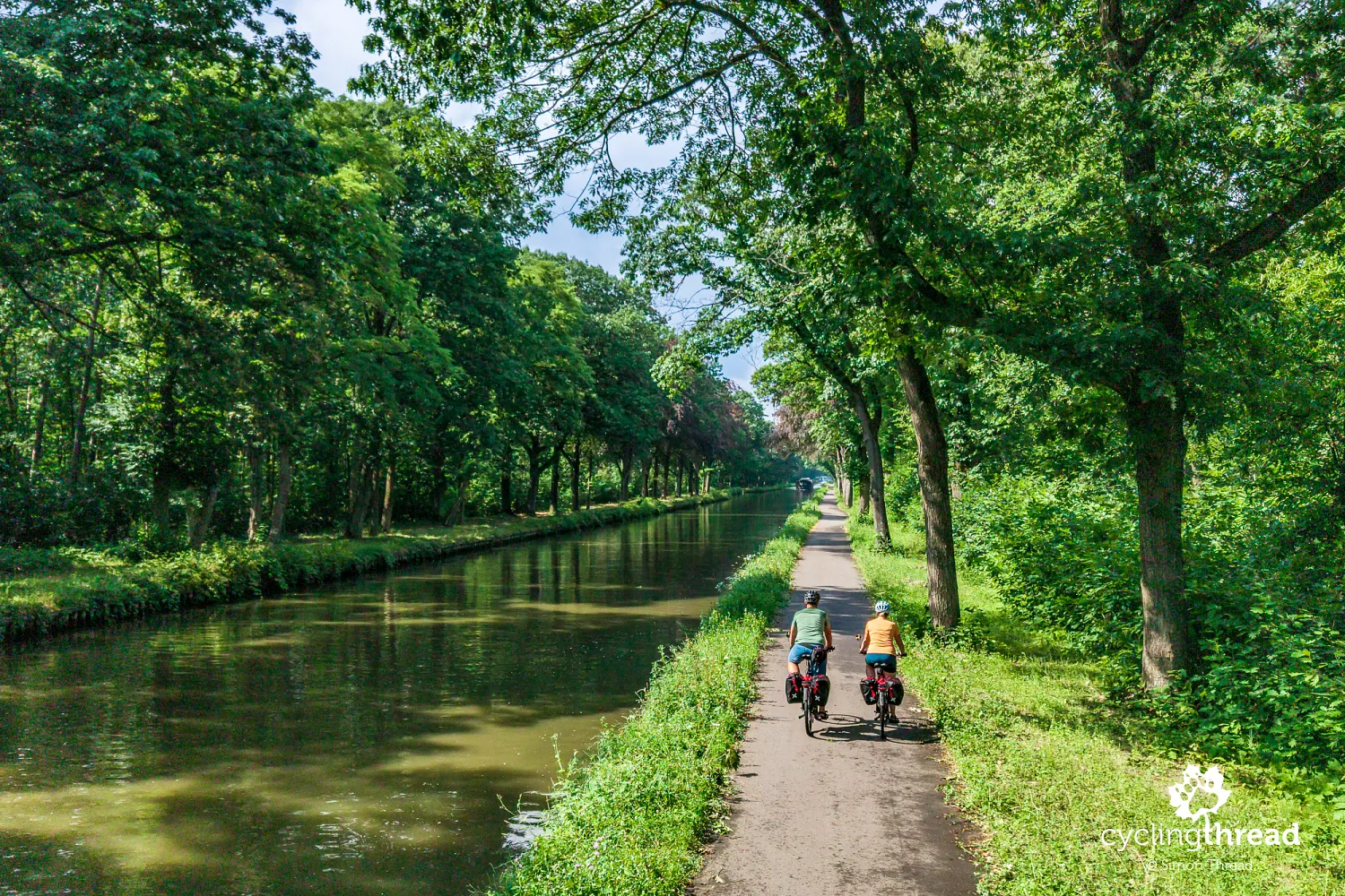
This part of the route consists of long stretches of cycle path alongside canals, one of the most characteristic features of the Kempen landscape. Their network began to develop in the 19th century, when the young Belgian state sought to make use of the poorly developed sandy lands of north-eastern Flanders. The canals were intended for transport, but also to bring in water from the Meuse for irrigating and fertilising the local soil. Their importance later increased with the growth of industry, including the extraction of exceptionally pure quartz sand around Mol and Dessel. Numerous large bodies of water remain from this activity, and together with the canals they make today's Kempen landscape surprisingly rich in water.
Where three canals meet in Dessel
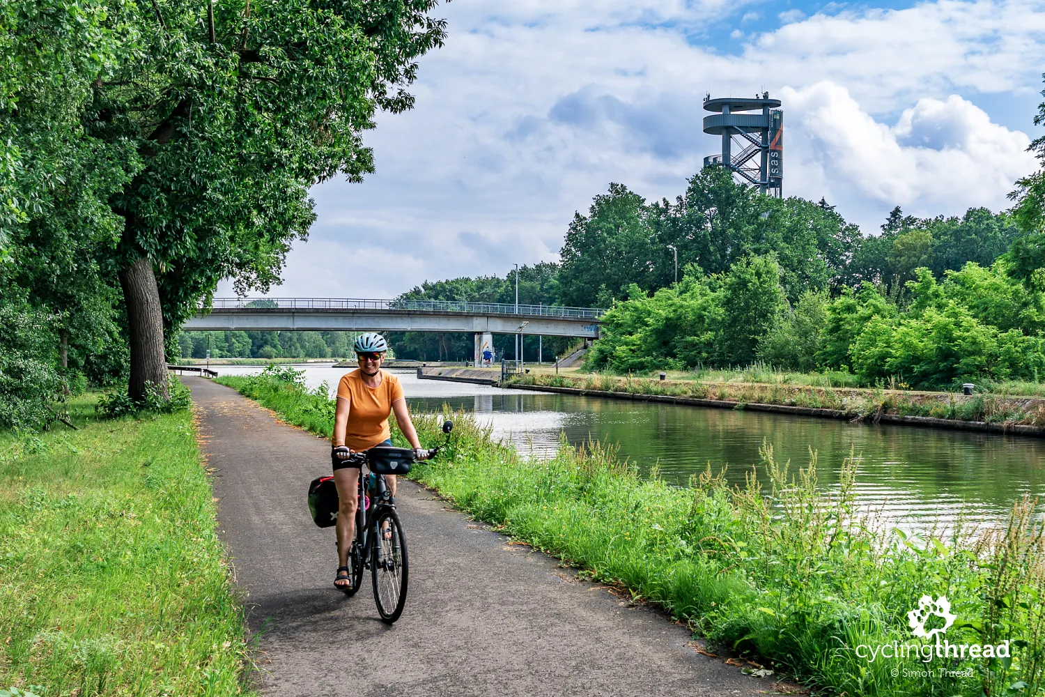
The most distinctive place in this area is the junction of three canals in Dessel, where the Bocholt-Herentals, Dessel-Schoten and Dessel-Kwaadmechelen canals meet. Beside them stands Sas4-Toren, a 37-metre observation tower offering a view over this unusual arrangement of waterways. The name Sas4 comes from Lock No. 4, one of the structures regulating water-level differences across the extensive canal network. From the viewing platform, you can also see broad forests and bodies of water created by quartz-sand extraction. It is one of those points on the Kempen Route where the region's industrial and economic infrastructure also becomes a landscape attraction.
Trying traditional Belgian mussels on route
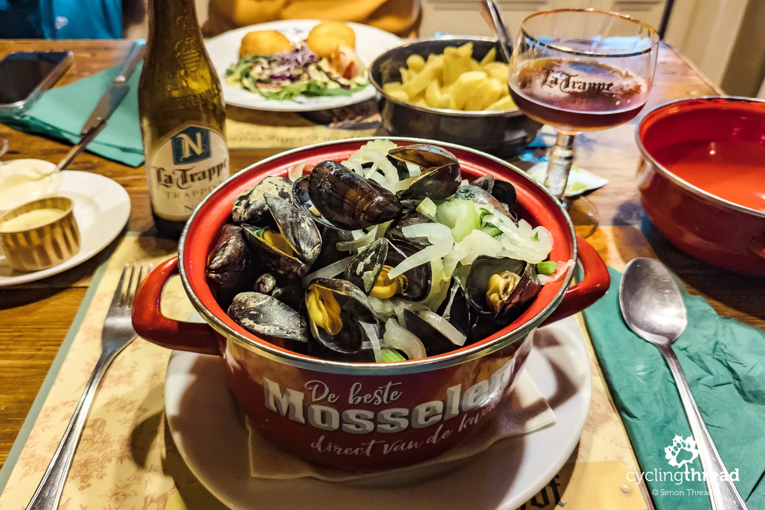
A passing downpour forces us to seek temporary shelter on this section, and because it happens around lunchtime, we find ourselves in a restaurant beside the route. As we had already come to expect, mussels were one of the main items on the menu. This time, unlike at our first dinner in Limburg, they arrived in a slightly more "au naturel" version, mainly with onion and leek, without the distinctive sauce that gives them more character. It was an interesting experience and another opportunity to try one of Belgian cuisine's most characteristic dishes, although this particular version did not become our finest culinary memory of Belgium.
The curious story of Dessel's cannon
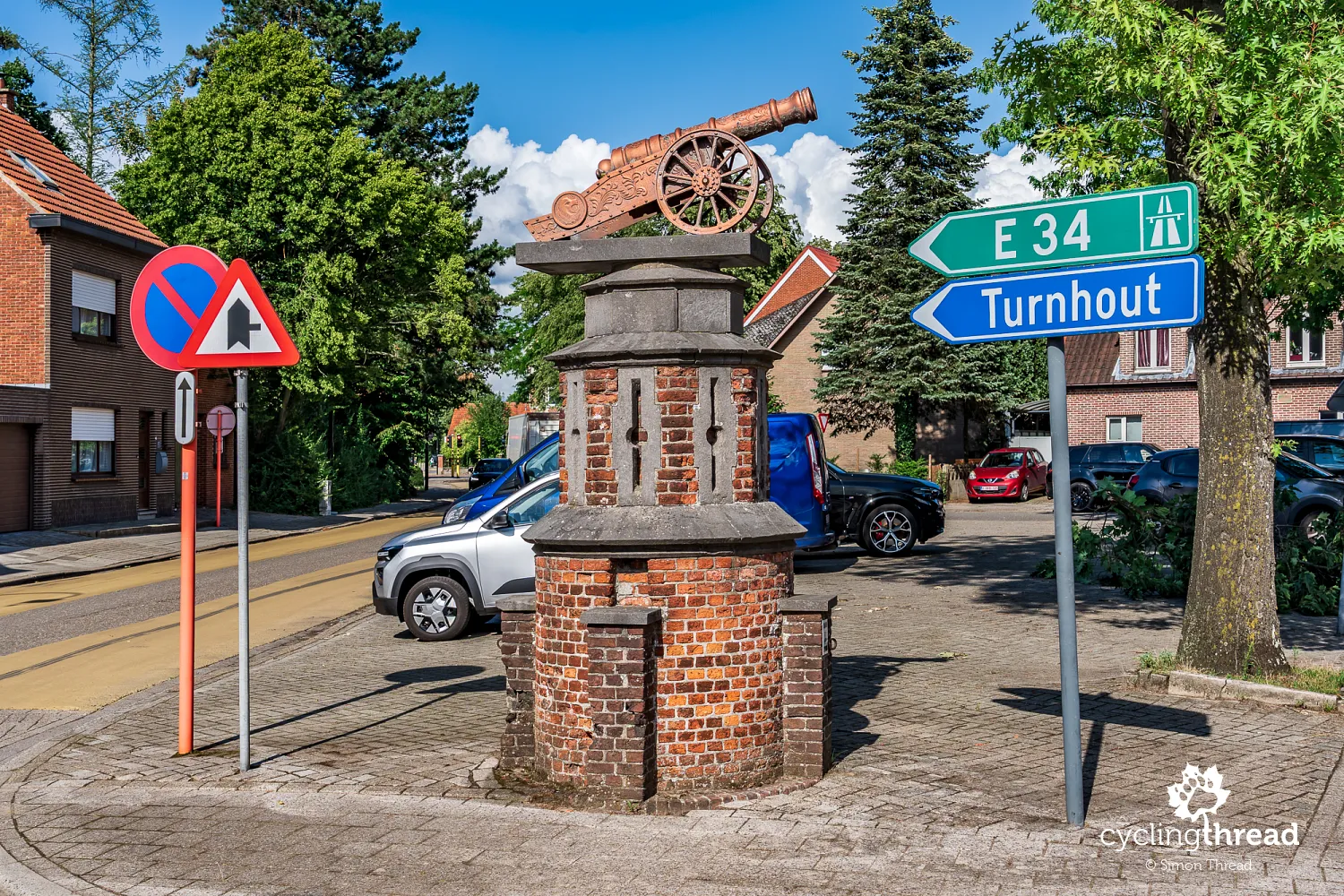
On Hamerplein in Dessel, a miniature cannon standing beside one of the small streets catches the eye, although contrary to the first impression, it is not a wartime memorial. Its story began in 1865, when local blacksmith Antoon Verdonck made the cannon especially for the ceremonial welcome of the young painter Karel Ooms, a graduate of the Royal Academy of Fine Arts in Antwerp. In subsequent years, it was used to fire salutes during local celebrations until it was loaned to neighbouring Retie in 1886. Too much gunpowder was used there and the cannon was destroyed, after which the people of Retie promised to provide Dessel with a replacement. The promise took 125 years to fulfil - only in 2011 was a new cannon ceremonially carried from Retie to Dessel and placed on Hamerplein.
Cycling the winding paths of Prinsenpark
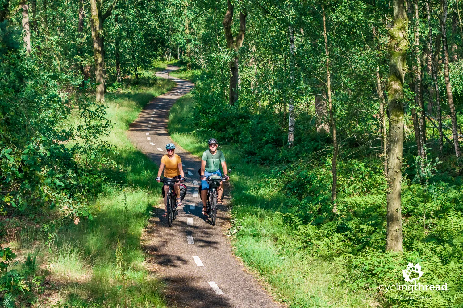
Beyond Dessel, the route takes us through the area around Prinsenpark, where an intimate cycle path begins winding between the trees. This unusual layout may be a remnant of 19th-century plans made by the Belgian royal family. In 1853, King Leopold I began buying up the local heathlands, and the royal estate eventually expanded to around 4,500 hectares across several present-day municipalities. A park with winding and circular avenues was planned at its centre, surrounding a future royal residence - but the palace was never built. The former heathlands were instead afforested and irrigated, with ponds supplied from the Kempen canal by a system of ditches. Today's Prinsenpark covers 215 hectares and combines forest, meadows, small areas of heathland and ponds, while preserving part of the old park's road layout.
Finding the giant sculpture near Kasterlee
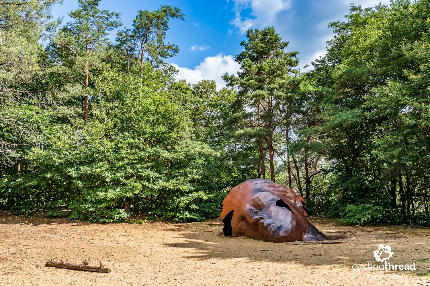
The final day of our journey along the Kempen Route to Antwerp brings several smaller but still interesting attractions. It begins with a giant head hidden in the forest beyond Kasterlee. This is A Giant Sculpture, a monumental steel work by the duo Gijs Van Vaerenbergh, installed on Hoge Mouw, one of the highest dunes of the Kempense Heuvelrug. The head is around six metres long, five metres wide and three metres high, weighs approximately two tonnes and was built from 2,115 welded steel triangles. It looks like the only exposed part of a vast statue buried beneath the dune, and visitors can enter its hollow interior. The sculpture forms part of the local story of the Sleeping Giant (Slapende Reus), inspired by the distinctive hills, forests and sandy dunes around Kasterlee. A sandy path leads to the sculpture, and bicycles can be left in the forest several dozen metres before it.
Quiet rural cycling around Gierle
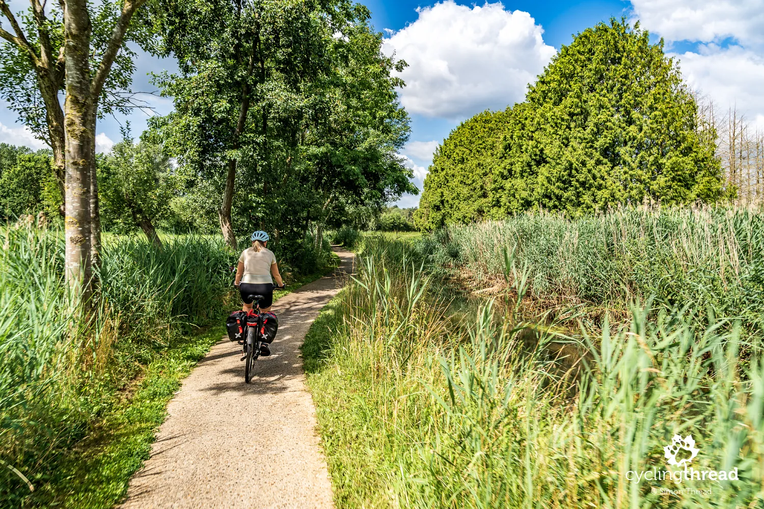
The road ahead again demonstrates one of the greatest strengths of cycling in Flanders - the ability to guide routes away from the most urbanised spaces. Around Gierle, we follow narrow roads beside canals and small waterways, through little woods, between fields and past individual houses. From time to time, we approach a town or larger road, but the route soon escapes once more into a quieter landscape. There is no need here for spectacular scenery or one major attraction - the pleasure comes from the continuity of the ride and the very limited contact with motor traffic. Sections like these best demonstrate that a good cycle route does not have to make a wide detour around a densely populated region if it can make effective use of local roads, canals, forests and farmland.
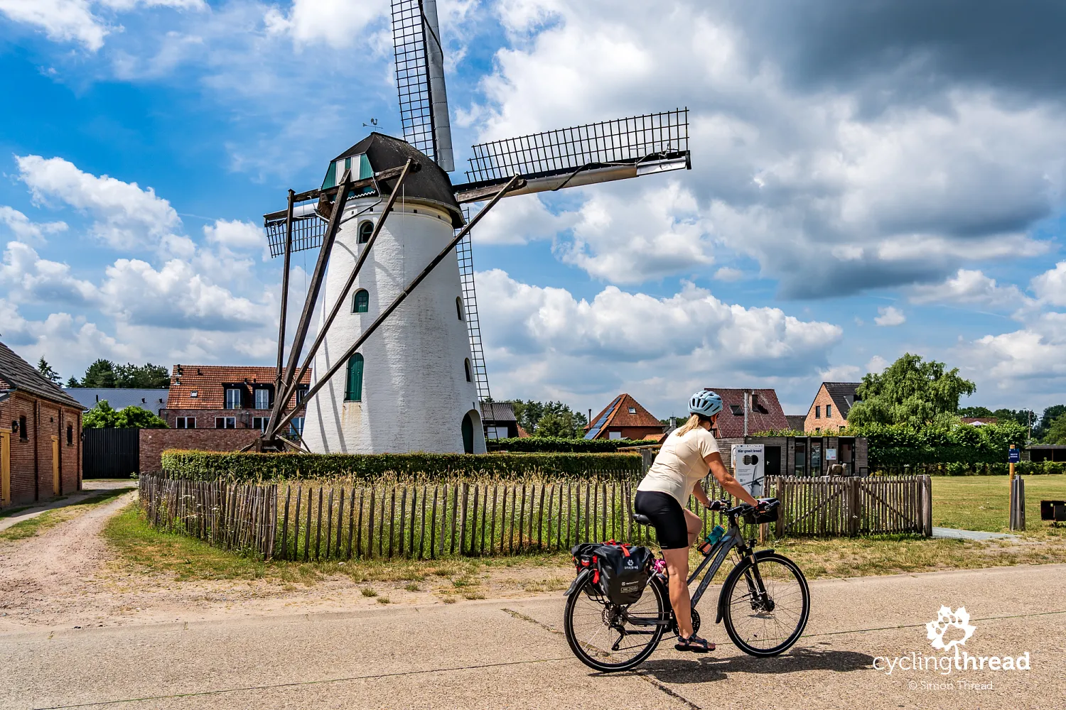
Visiting the historic In Stormen Sterk windmill
One of Gierle's distinctive landmarks is the In Stormen Sterk windmill, whose history dates back to the late 15th century. The first wooden mill was erected here in 1499 and began operating at Christmas in 1500. Successive structures were destroyed by fires and storms, until a hurricane toppled the mill in 1836 and it was replaced by the brick building that survives today. Its sails have an impressive span of 26.5 metres, and after thorough restoration the mill is once again operational. Its mechanism of wooden gears has survived inside, transferring power from the sails to the millstones and allowing grain still to be milled. On selected days, local volunteer millers set it in motion, giving visitors a practical demonstration of how such a structure worked.
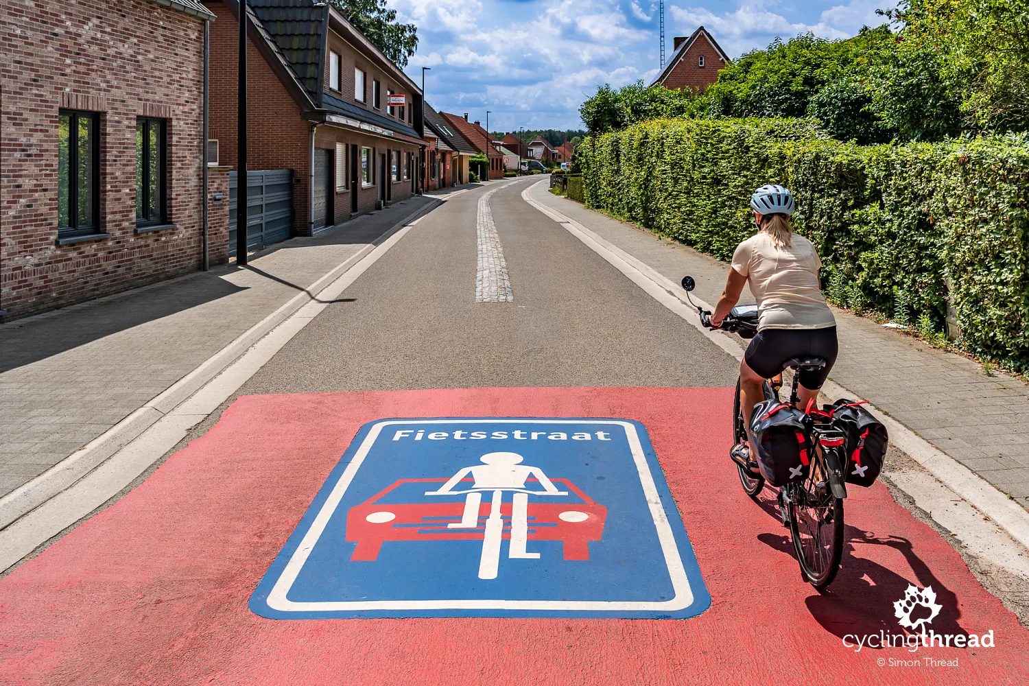
How Belgian Fietsstraten and Fietszones work
Throughout our route in Belgium, we encountered fietsstraten - streets where cars are allowed, but cyclists have priority in the use of the space. Since 2023, Belgian regulations have defined such places as fietszones, although older signs reading "Fietsstraat" remain widespread and may stay on the roads for several more years. A car may travel behind a cyclist but is not allowed to overtake, and the speed limit for all users is 30 km/h. On a one-way street, cyclists may use the entire width of the carriageway; where traffic travels in both directions, they may use the whole right-hand half. It is a very simple solution that creates comfortable cycling connections in places where there is neither room nor a need for a separate cycle path.
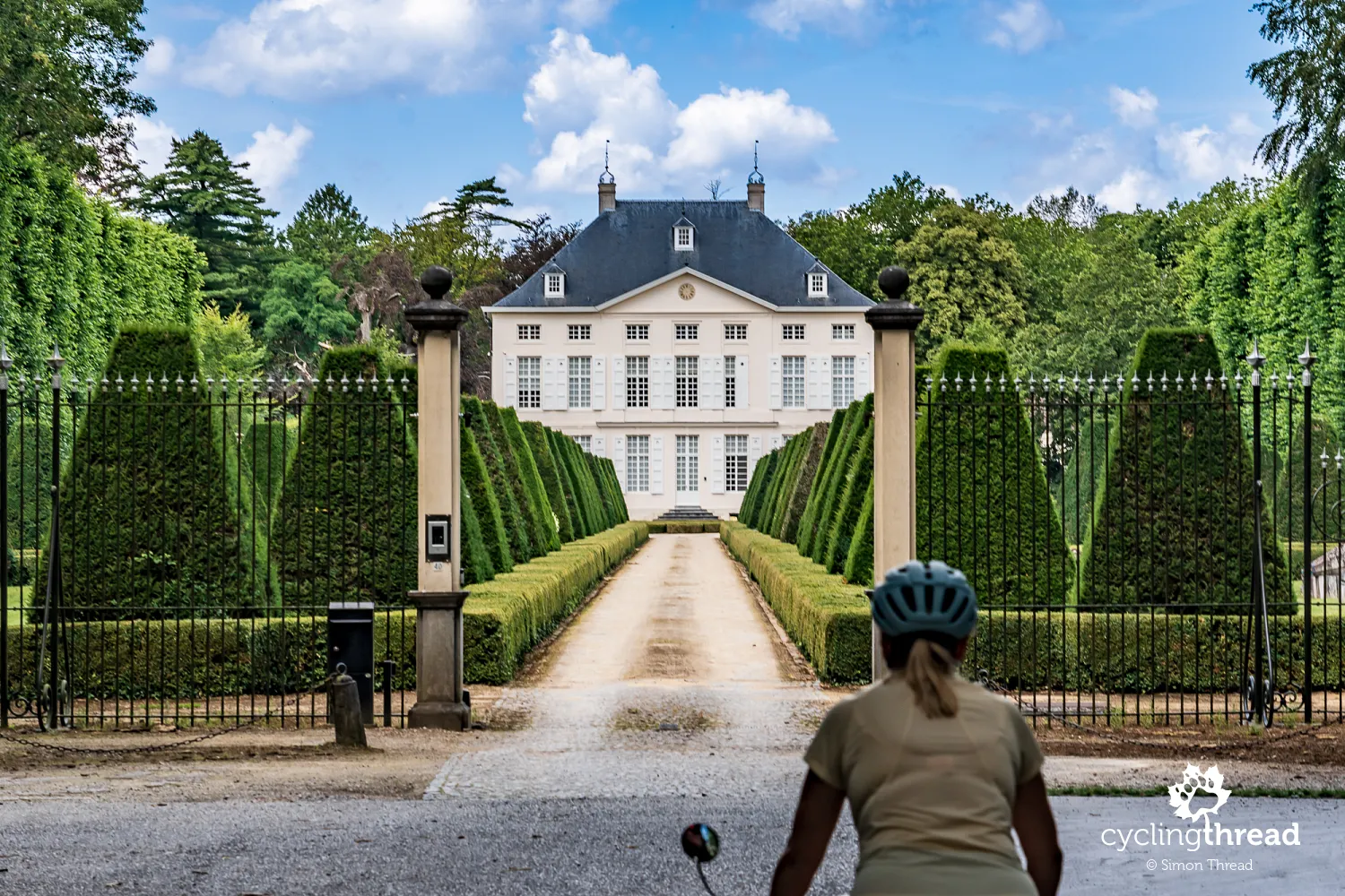
Visiting the historic Zoerselhof estate
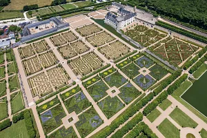
Along the way, we also stop at the gates of Zoerselhof, an elegant residence hidden among greenery near Zoersel. The estate's history dates back to the Middle Ages, when the land belonged to St Bernard's Abbey in Hemiksem, while the present Neoclassical palace was built in 1787. The residence is surrounded by a broad landscape park with ponds, avenues and mature trees, forming part of the historic estate. The long, geometrically clipped avenue leading directly to the pale façade is perhaps more impressive than the size of the building itself and briefly changes the character of our route completely. Forests and waterways soon return, and with them another theme becomes increasingly prominent in the landscape around Antwerp - its former fortifications.
Exploring Fort van Oelegem and Antitankgracht
One of the most important remnants of Antwerp's former defensive system is Fort van Oelegem, built between 1909 and 1914 as part of the outer ring of forts surrounding the city. When the First World War began, it was not yet entirely complete, but during the German attack on Antwerp it lay outside the main combat zone and escaped shelling. In the late 1930s, it was incorporated into a new defensive system based on the Antitankgracht, and during the Second World War it performed only limited military functions. After liberation, it was used in part as an Allied communications centre connected with Antwerp's defence against V1 missiles. Today, the fort is primarily a bat reserve, its dark and damp interior offering excellent conditions for hibernation.
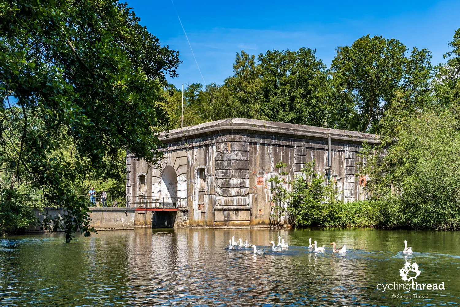
At first glance, the Antitankgracht looks like yet another Belgian canal, but its origins are entirely different. This anti-tank ditch, more than 30 kilometres long, was excavated between 1937 and 1939 from Oelegem to Antwerp's northern suburbs, linking existing forts, bunkers and other fortifications into a single system. It is worth making a short detour from the route to ride along its bank, because small concrete bunkers appear at intervals in the forest - we pass one of them in the photograph. They included flanking bunkers and shelters protecting locks, since control of the water level was an important part of the entire defensive system. Today, nature has almost completely reclaimed this military landscape: forest covers the banks, the bunkers disappear into the greenery, and the Antitankgracht itself is a protected landscape and an important wildlife corridor.
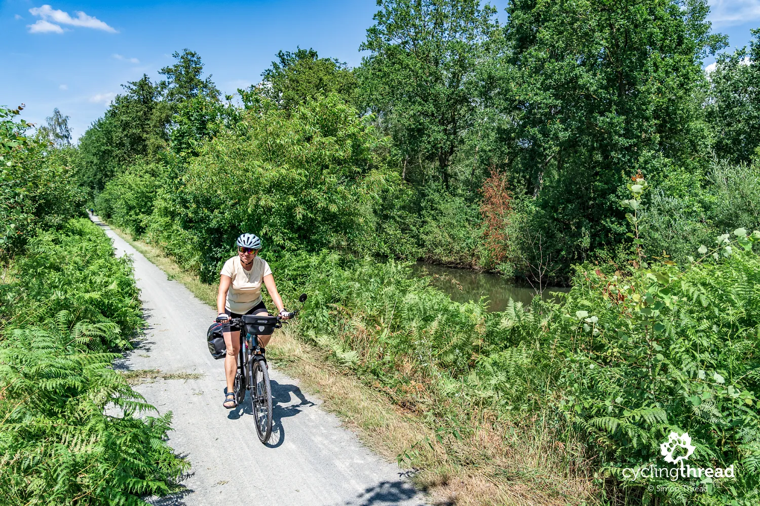
Cycling along Belgium's important Albert Canal
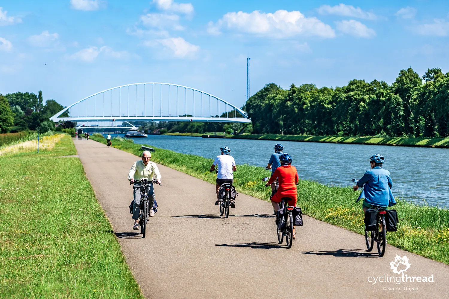
Just before Antwerp, we return to the Albert Canal, beside which we had already ridden for several kilometres on our approach to the Kempen Route four days earlier. Opened in 1939, the canal runs for around 130 kilometres between Antwerp, industrial Liège and the Meuse valley and remains one of Belgium's most important freight arteries, carrying around 40 million tonnes of cargo each year. Its banks are lined with inland ports, container terminals and industrial plants, but they also provide a convenient corridor for cyclists. The heavy bicycle traffic here is no coincidence: the canal is followed by the F5 cycle highway, one of the Belgian Fietssnelwegen, connecting Antwerp with Hasselt over a largely straight and flat route of around 80 kilometres.
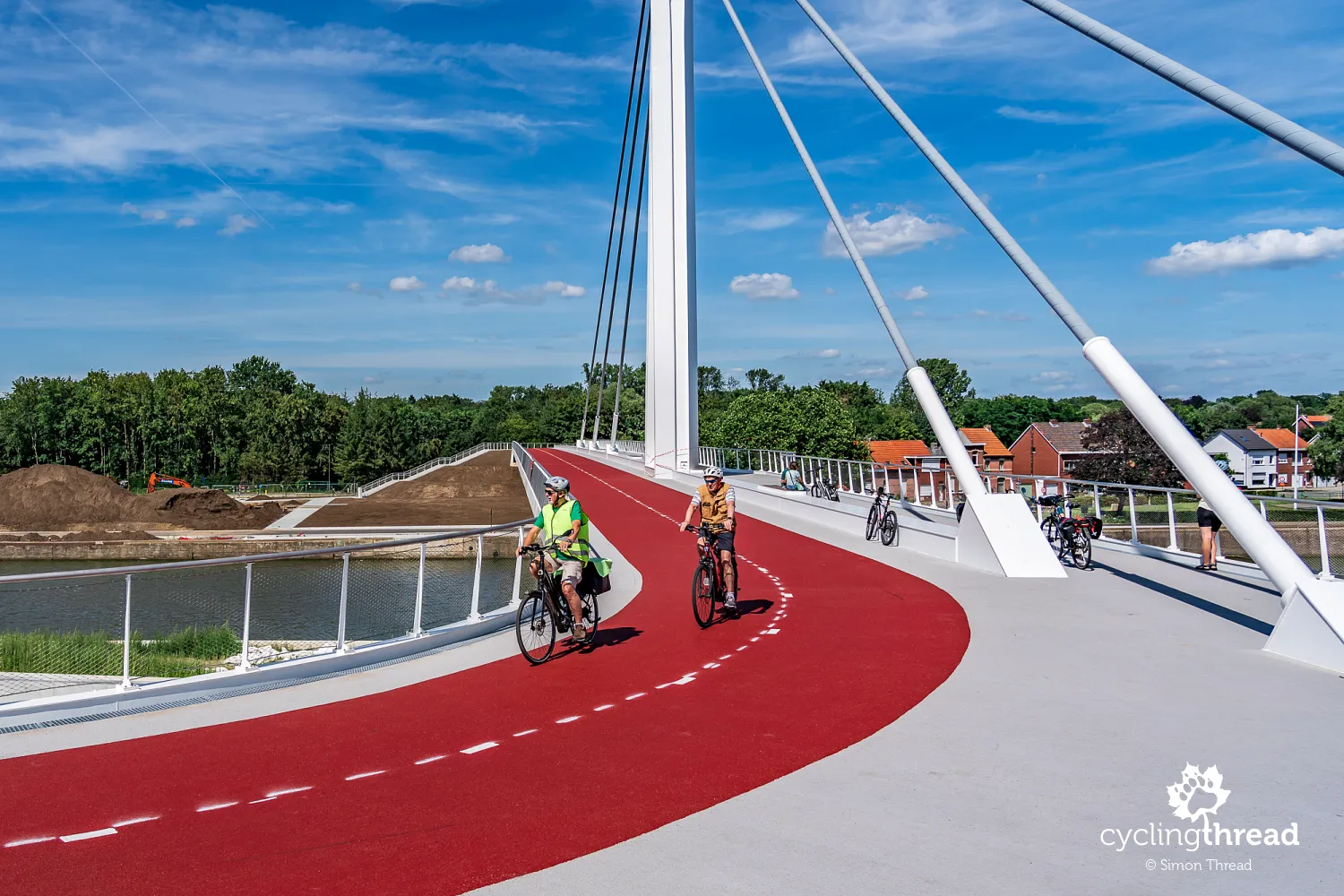
Our welcome to Antwerp was spectacular: a pedestrian and cycle bridge across the Albert Canal at Wijnegem, still gleaming with newness. And it really was new - the first cyclists had been allowed onto it only a few weeks before our arrival, in June 2026. The steel cable-stayed structure is 171 metres long, with a separate four-metre cycle path and three metres of space for pedestrians, while its central pylon rises to around 44 metres. The bridge was constructed as part of a major upgrade of the Albert Canal and replaced the former Bananenbrug, which was too low and restricted container transport. The new crossing provides greater clearance above the water as part of improvements allowing ships to carry containers stacked four layers high.
Cycling into Antwerp through Rivierenhof park
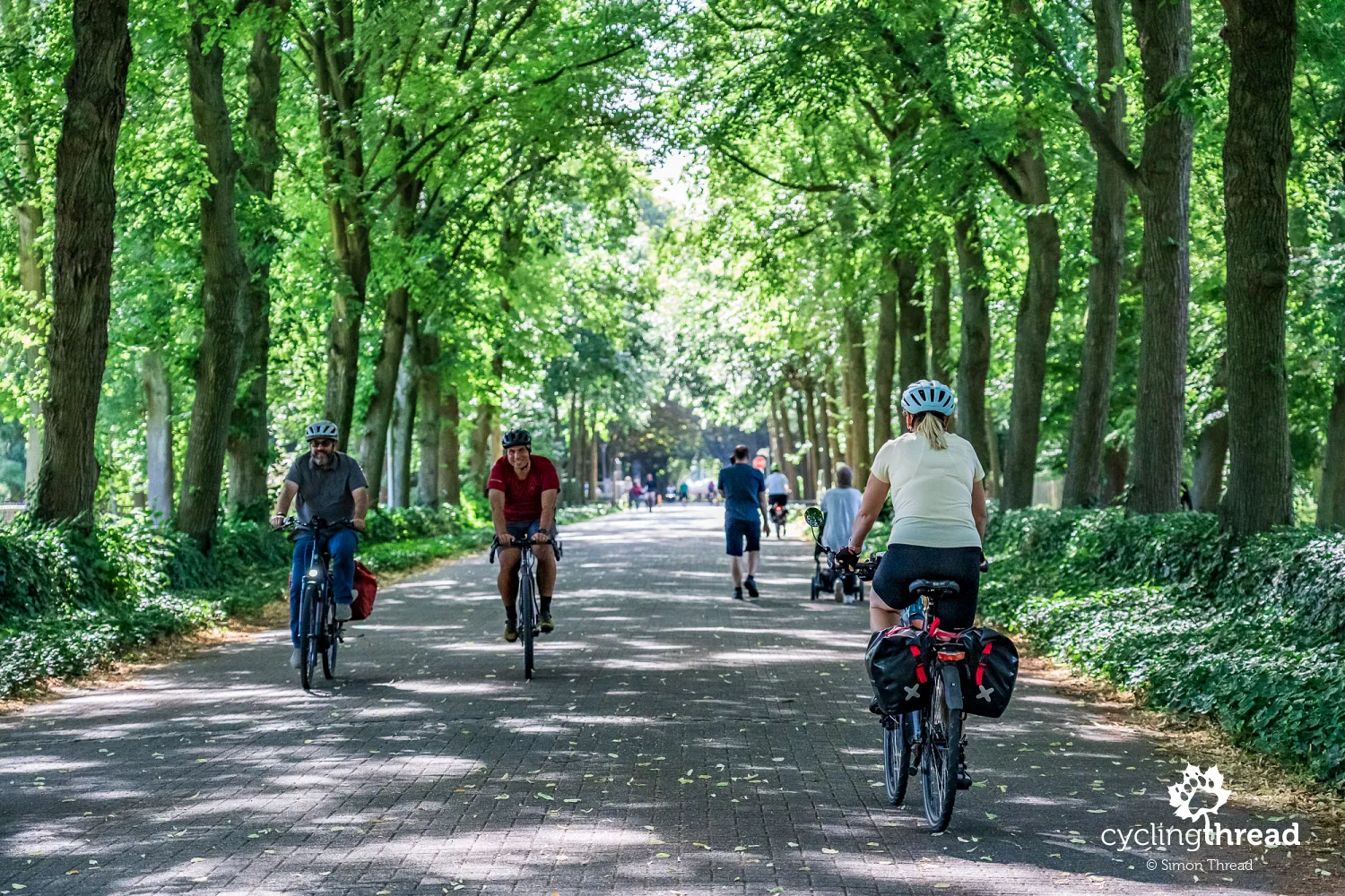
The approach to Antwerp proves surprisingly peaceful for Belgium's second-largest city. Instead of immediately entering dense development and busy streets, we ride through Rivierenhof, an enormous urban park in the Deurne district. Covering around 130 hectares, it is Belgium's oldest provincial park and opened to residents in 1923. It contains ponds, extensive lawns, gardens, walking avenues and the small Sterckshof castle, while the Groot Schijn river flows through the grounds. Most importantly for us, the park creates a very smooth transition from the green suburbs into Antwerp's urban landscape - for the next few kilometres, we still ride largely among trees and away from cars.
Exploring Grote Markt and Cathedral of Our Lady
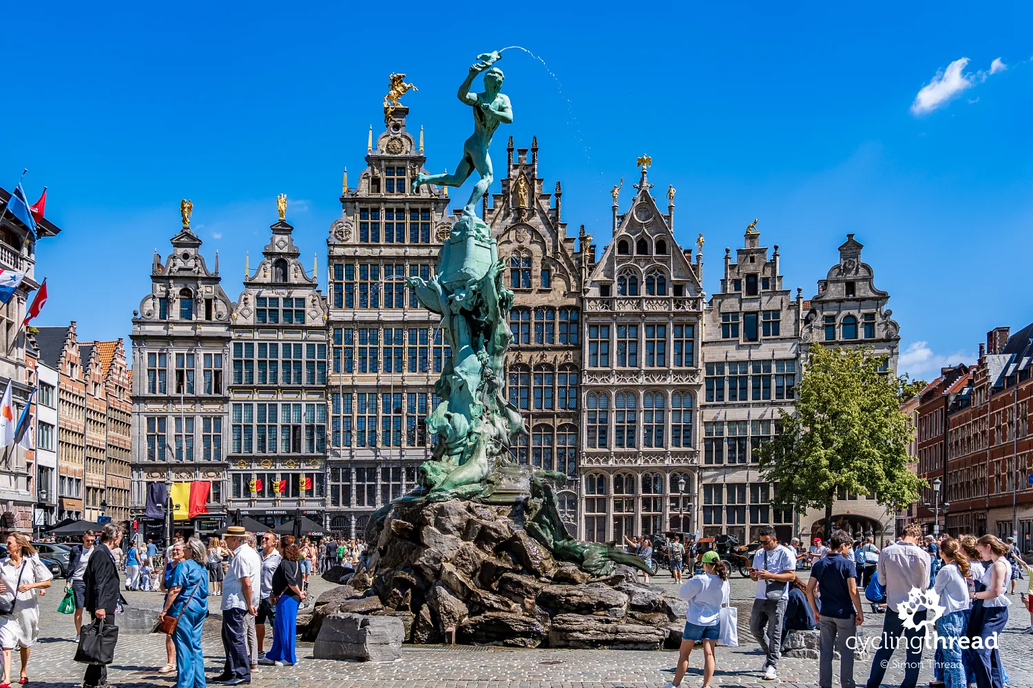
The next day, the bikes rest while we set off to explore Antwerp for the entire day. A natural starting point is Grote Markt, the city's grand main square, surrounded by richly decorated 16th- and 17th-century guild houses. Its most important building is the Renaissance town hall, built between 1561 and 1565, whose architecture combines Netherlandish tradition with influences from the Italian Renaissance. In the middle of the square stands the striking Brabo Fountain, depicting the Roman soldier Silvius Brabo throwing the severed hand of the giant Antigoon into the Scheldt. According to a popular legend, Antwerpen took its name from this gesture - hand werpen - to throw a hand - although linguists trace the name to a different source.
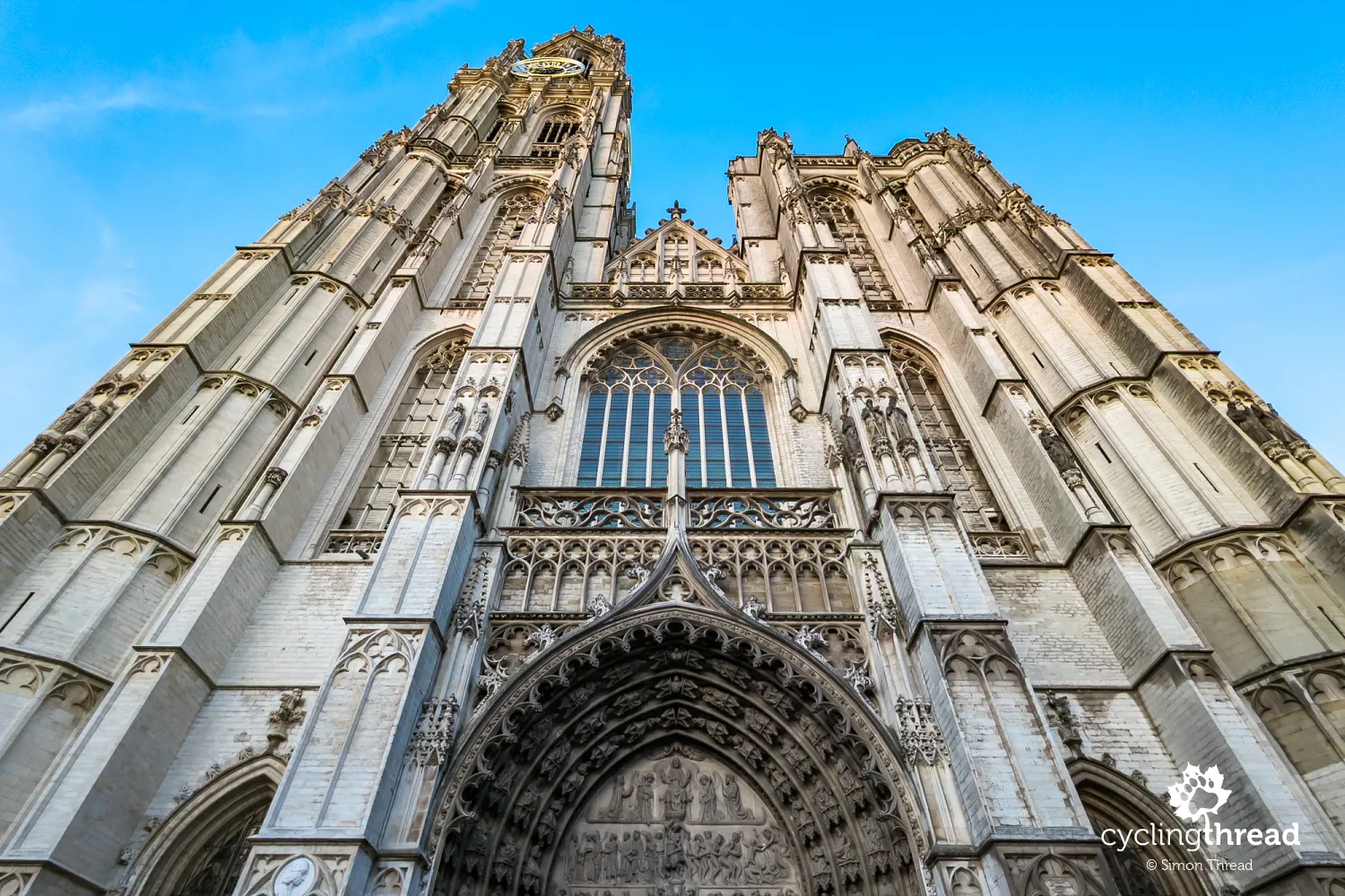
A few steps away, the Gothic Cathedral of Our Lady rises above the roofs of the Old Town, its 123-metre tower one of the defining points of Antwerp's skyline for centuries. Construction began in the 14th century, and the vast, bright interior impresses with the scale of its seven aisles, high vaults and dozens of chapels. The cathedral's greatest treasures, however, are works by Peter Paul Rubens, the most famous artist associated with Antwerp. They include the monumental triptychs The Elevation of the Cross and The Descent from the Cross, created specifically for the city's sacred interiors, as well as The Assumption of the Virgin Mary. These works make the cathedral not only one of Antwerp's most important monuments, but also a place where Rubens's art can be seen in a setting very close to that for which it was created. Outside, narrow streets and alleys surround the church, including the 16th-century Vlaeykensgang hidden between town houses.
Impressive museums in Antwerp
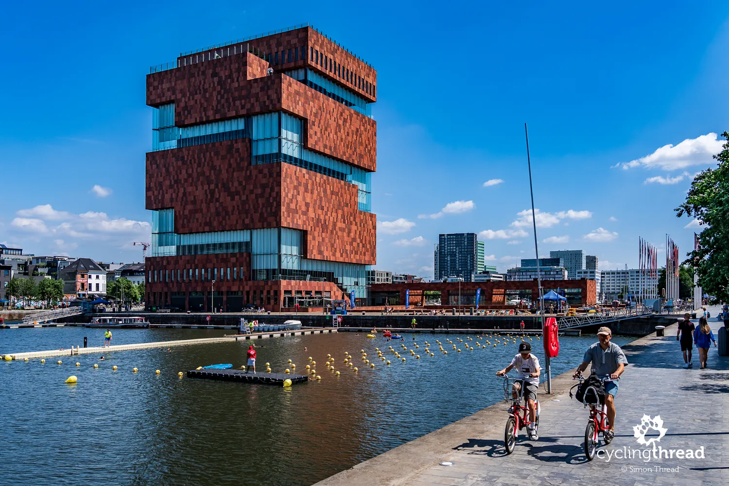
Antwerp also has an impressive selection of museums, but with only one day, choices have to be made. We begin with Museum aan de Stroom, or MAS, a modern museum opened in 2011 in the former port district of Het Eilandje. The distinctive building, around 60 metres high and made of red sandstone and rippling sheets of glass, is itself one of the city's contemporary icons. The exhibitions focus mainly on Antwerp as a port city, its connections with the world, trade, migration and the history of people who have arrived here over the centuries. Escalators lead to the successive floors, and a free viewpoint on the roof offers a panorama of the port, the Scheldt and the city centre. It is an interesting place, although at times we felt that some exhibitions merely touched on their subjects and left us wanting more.
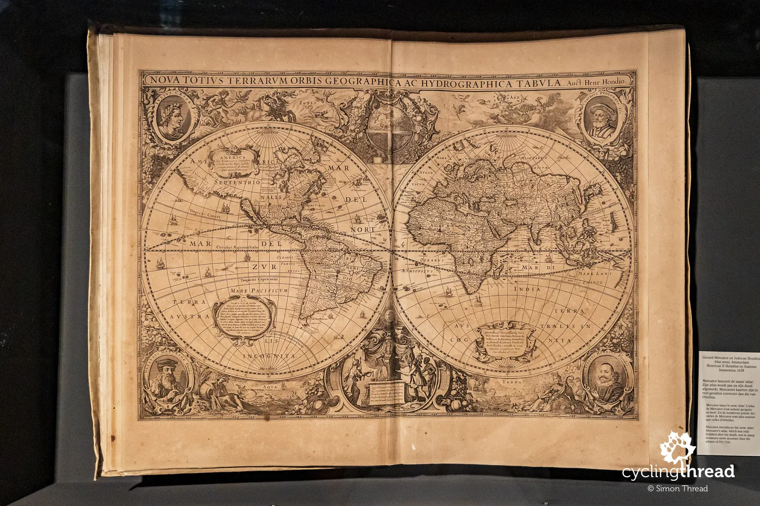
Museum Plantin-Moretus offers a completely different journey through time, housed in the former printing works and home of the Plantin-Moretus family. Christophe Plantin, one of the most important printers in 16th-century Europe, worked here, publishing books in many languages and maintaining contacts with scholars across the continent. The historic interiors preserve the world's two oldest printing presses, vast collections of type, manuscripts, books and maps, including editions of the famous Atlas Novus by Mercator and Hondius, as well as the original living quarters and paintings by Rubens. Much of the experience lies in the atmosphere itself - dark wood everywhere, floors creaking underfoot, small rooms, old bookcases filled with volumes and printing workshops that seem as if their users had stepped out only a moment earlier. The museum and its archive were inscribed on the UNESCO World Heritage List as the first museum site in the world.
Cycling beneath the Scheldt in Antwerp
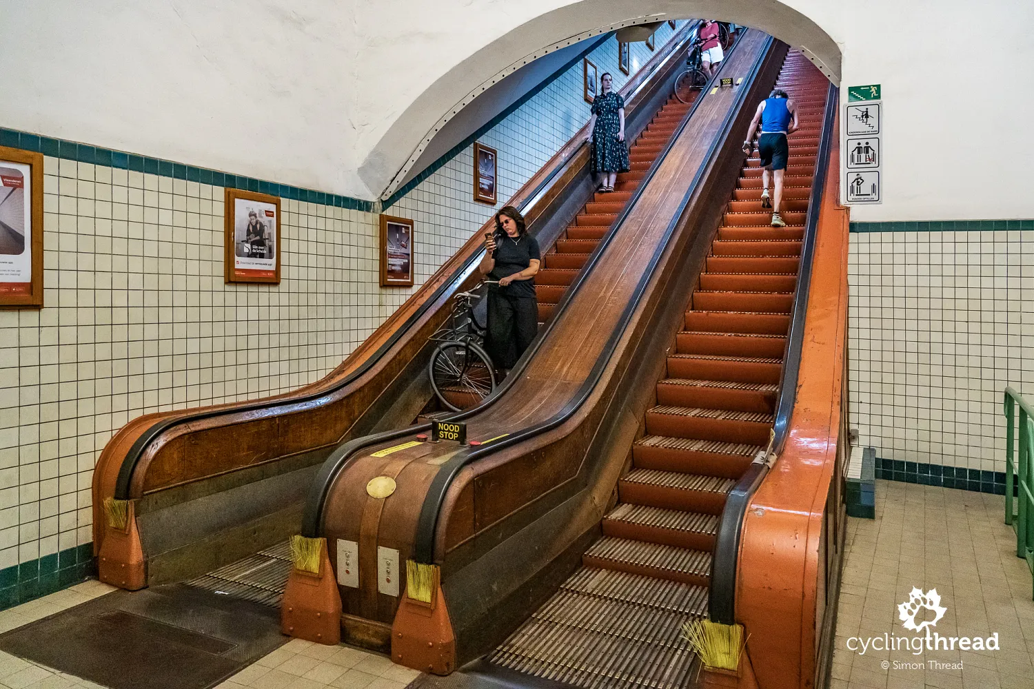
We end our full day of sightseeing beneath... the river. An unusual attraction used daily by Antwerp's residents is Sint-Annatunnel, a pedestrian and cycle tunnel under the Scheldt connecting the city centre with Linkeroever on the opposite bank. Opened in 1933, it is around 572 metres long, with its deepest point about 31 metres below ground level. Large lifts or historic wooden escalators provide access; together with the characteristic ceramic wall tiles, the escalators preserve the atmosphere of the 1930s. Interestingly, bicycles are not merely allowed on them - instructions at the entrance even show riders how to position their bikes for the descent. Simply turn the front wheel sideways, rest the bicycle on the step and... that is all. Riding through a tunnel more than half a kilometre long beneath the Scheldt is unusual enough to count as yet another infrastructure attraction of cycling in Flanders.
Travelling with bikes from Antwerpen-Centraal
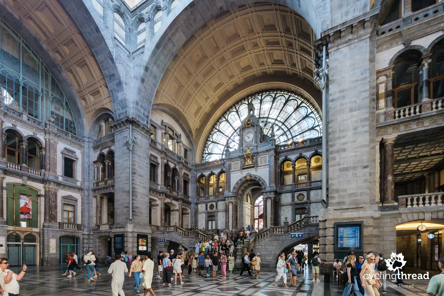
Antwerp is also one of Belgium's most important transport hubs, offering cycle travellers plenty of options for arranging their journey to or from a route. Antwerpen-Centraal, the main railway station, is itself one of the city's greatest attractions - a monumental building with a stone façade, a huge dome over the entrance hall and a steel-and-glass roof above the platforms, all dating from the early 20th century. During a later reconstruction, the terminus was converted into a through station by running new tracks through a tunnel beneath the city and arranging platforms on several levels. The historic architecture therefore continues to perform its original function, while Antwerpen-Centraal provides a striking beginning or end to a cycling journey through Flanders.
Discovering Roman history in Tongeren
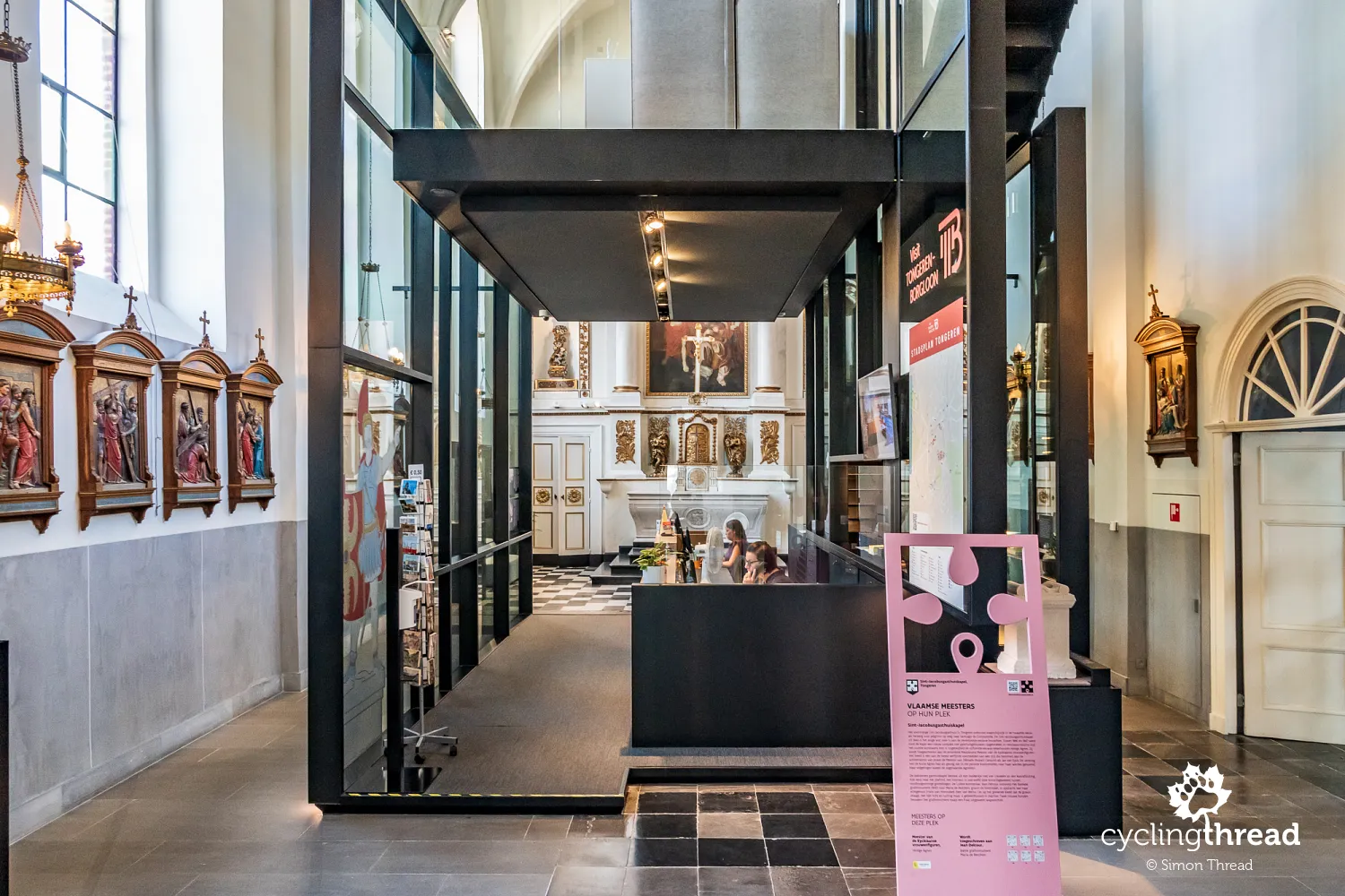
A few words remain to be said about our introduction to the Kempen Route: a day spent partly on the Hill Route between Tongeren and Kanne, and partly on the Meuse Route between Kanne and Maasmechelen. We started in Tongeren, considered Belgium's oldest city, whose history reaches back to Roman times. Atuatuca Tungrorum was an important Roman centre, and traces of this period can still be seen around the city, including sections of defensive walls and remains of the ancient water-supply system. The city's Roman past is presented in the Gallo-Roman Museum through thousands of artefacts, models and reconstructions. Another unusual place worth visiting is the tourist information centre, housed in a former chapel in the historic centre. Roman history also accompanied us this year in Trier on the Moselle Cycle Route and in Franconia on the GeoRoute Altmühl Valley.
Exploring Tongeren's basilica and beguinage
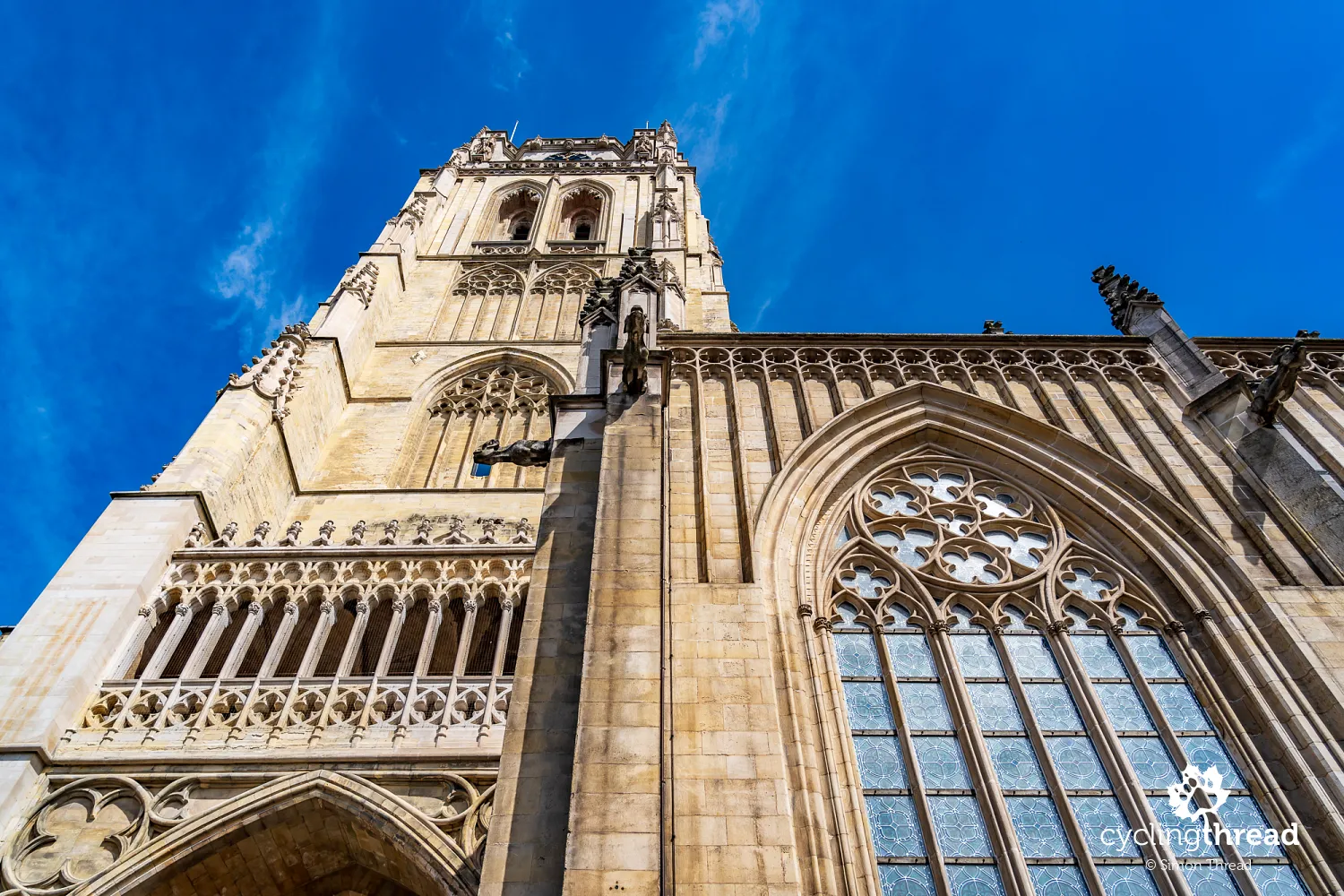
The most distinctive building in central Tongeren is the Gothic Basilica of Our Lady, whose tall tower dominates Grote Markt. The church developed in stages over several centuries, and remains of earlier sacred buildings discovered beneath its floor can now be viewed as part of the Teseum museum. The basilica tower belongs to the group of Belgian and French belfries inscribed on the UNESCO World Heritage List. A few minutes' walk away lies a very different part of historic Tongeren - the former beguinage, with small houses, narrow streets and St Catherine's Church. It is one of thirteen Flemish beguinages covered by a joint UNESCO listing and a very well-preserved example of the communities once inhabited by beguines in the Low Countries. A walk through its quiet streets offers a pleasant contrast with the grander surroundings of Grote Markt.
Cycling the Hill Route across Flanders
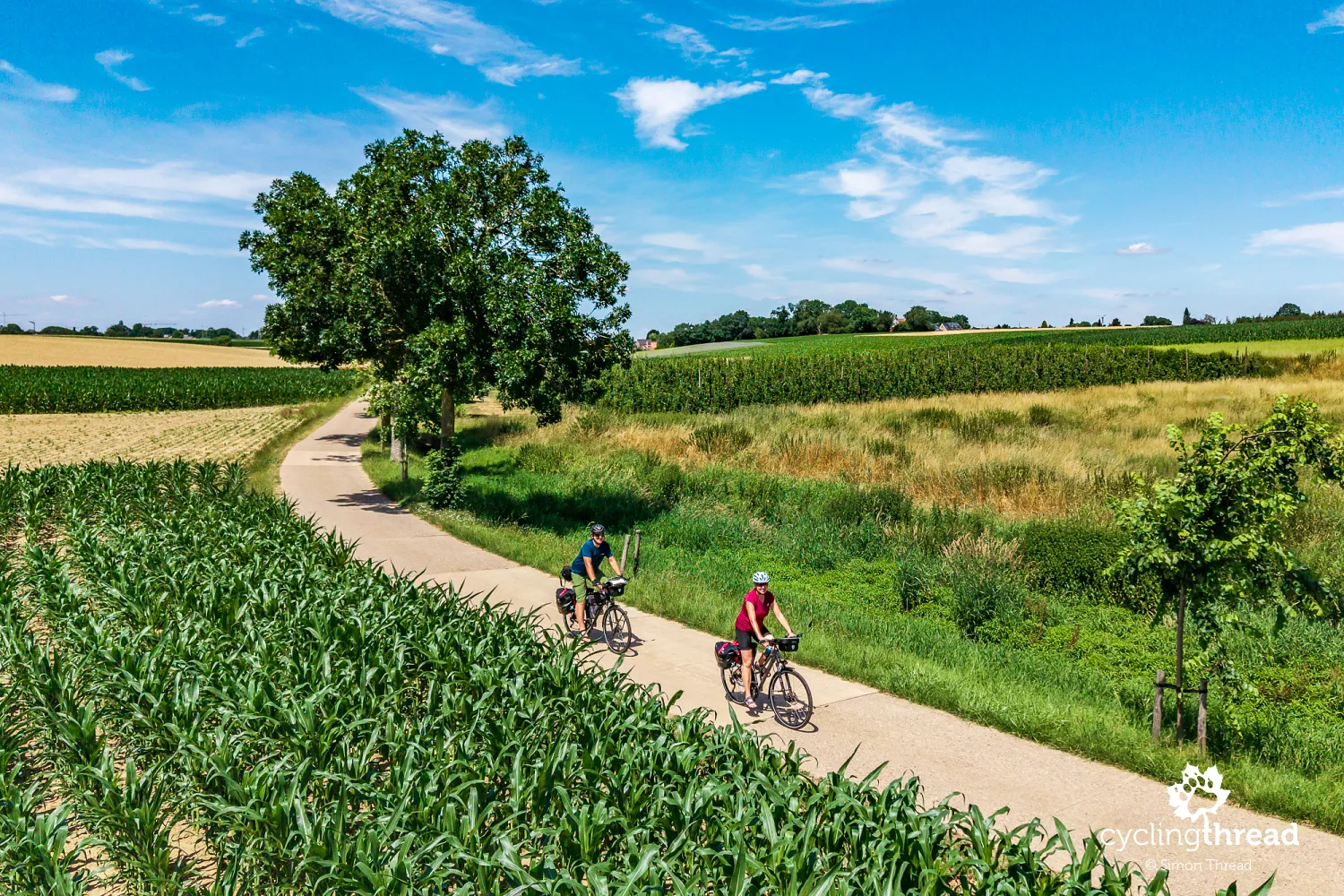
The name Hill Route perfectly reflects the character of our short journey along it - brief, usually fairly gentle descents and climbs occur along almost the entire section towards the Meuse valley and the Albert Canal. Here, the route uses a mixture of cycle paths and quiet local roads, passing through small villages, fields and orchards typical of southern Limburg. The complete Heuvelroute is around 450 kilometres long and crosses Flanders from west to east, running from the Poperinge area through the rolling landscapes of the Vlaamse Ardennen, Brabant and Haspengouw to Voeren near the Dutch border. It is by far the hilliest of the Iconic Cycle Routes and passes through terrain familiar from Belgium's classic cycle races. We experience only its short eastern section, which quickly carries us down from the Tongeren area towards the flat landscape of the Meuse valley.
Following the Meuse Route and EuroVelo 19
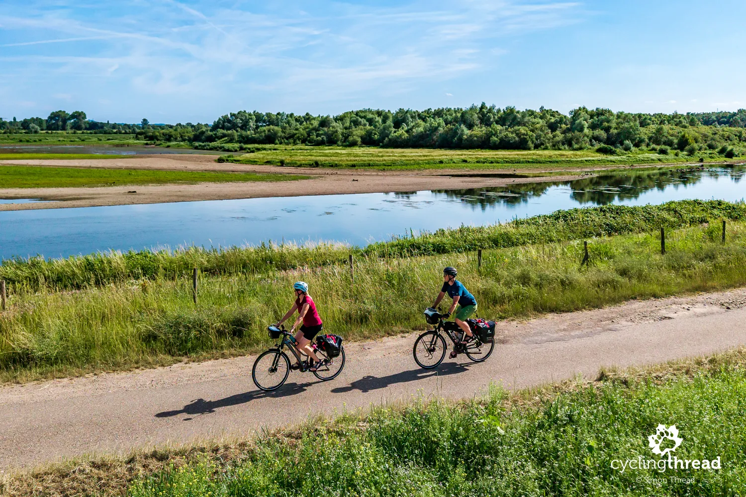
At the Albert Canal, we joined the Meuse Route, which here near Maastricht moves away from the river's main channel and follows the canal for a while. It is the same canal that will accompany us four days later on the final kilometres of the Kempen Route before Antwerp. The section of the Meuse Route we followed is only a small part of the route in Belgium and also belongs to EuroVelo 19 - currently the newest route in the European EuroVelo network. The complete EuroVelo 19 extends for more than 1,000 kilometres and follows the Meuse through three countries: from its source in France, across Belgium through Wallonia and Flanders, and into the Netherlands, where the river reaches the North Sea through the extensive Rhine-Meuse delta. We rode through that area on the Waterline Route, which follows the historic system of Dutch water defences.
Inclusive cycle rickshaw rides near Kanne
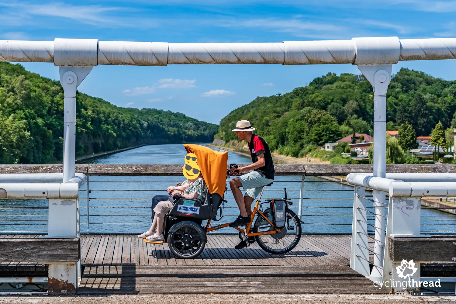
On the bridge in Kanne, we witness a very special scene: older people being carried in a purpose-built cycle rickshaw by a volunteer from Fietsen Alle Jaren in Maastricht. The initiative allows older and less mobile people who can no longer cycle independently to experience bicycle trips again. Passengers sit comfortably at the front, with a trained volunteer behind the handlebars. The rides are free and can take place both in the city and the surrounding area, sometimes visiting places connected with the passengers' memories. A few days later, we will see a similar scene in Bokrijk, where people with disabilities from the Ter Heide centre travel in cycle rickshaws. Both encounters show us a similar socially inclusive approach present in Belgium and the Netherlands - here, the bicycle is a tool for engaging people who are unable to ride independently.
Cycling through the Albert Canal cutting
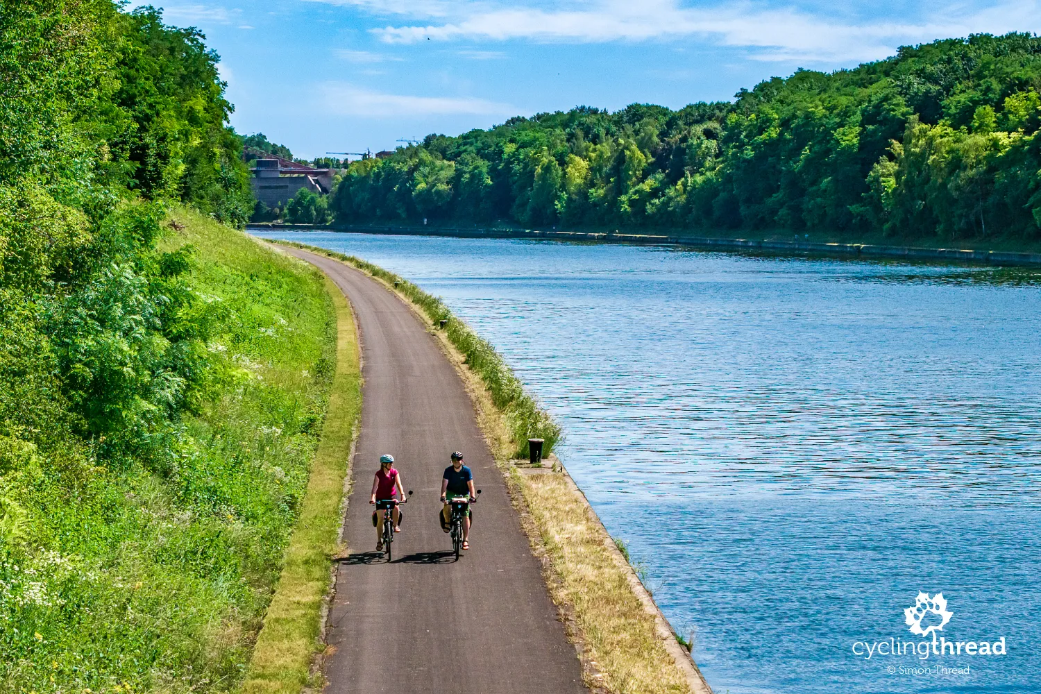
The course of the Albert Canal in this area is impressive in itself. It does not follow a natural valley here, but passes through a huge cutting excavated during the canal's construction between 1930 and 1934. This section, resembling a natural canyon, was the result of one of Belgium's largest hydraulic-engineering projects of the 20th century. Near Kanne, builders cut through limestone hills and the plateau surrounding the Jeker valley, creating an artificial gorge that is around 40-50 metres deep in places. The steep slopes expose layers of chalk rock typical of the Maastricht area, the same formations into which vast underground quarries were cut over the centuries. Riding the cycle path directly beside the water, we therefore have the broad canal on one side and a high slope, now covered in dense greenery, on the other.
Belgian and Dutch food beside the Meuse
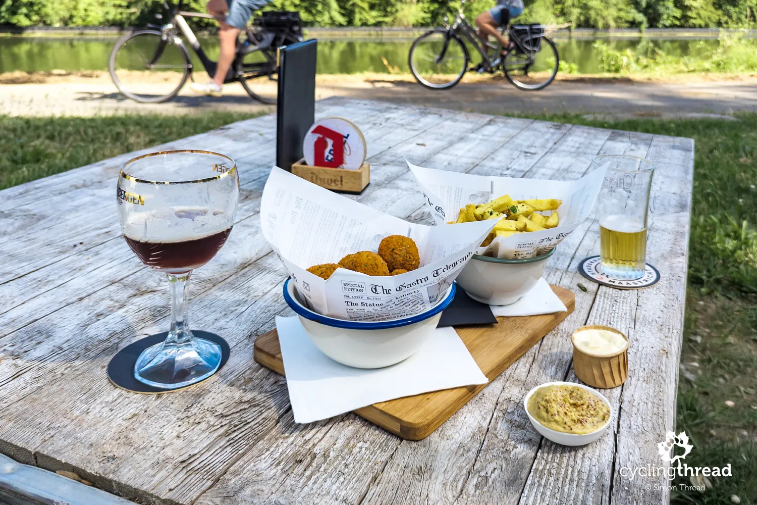
Along the way, we make a pleasant stop at a small restaurant beside the Meuse, where culinary specialities from both sides of the river meet on our table. The Netherlands is represented by bitterballen - small, crisp balls with a thick meat filling, usually served with mustard and very popular as a snack with beer. Belgium naturally contributes fries - thicker, traditionally fried twice and served with one of many sauces. We are only a few kilometres from the border, so this Dutch-Belgian combination suits the character of our route perfectly. We will approach the Netherlands several more times that day, although we remain on the Belgian side of the Meuse throughout.
Cycling beside the Zuid-Willemsvaart canal
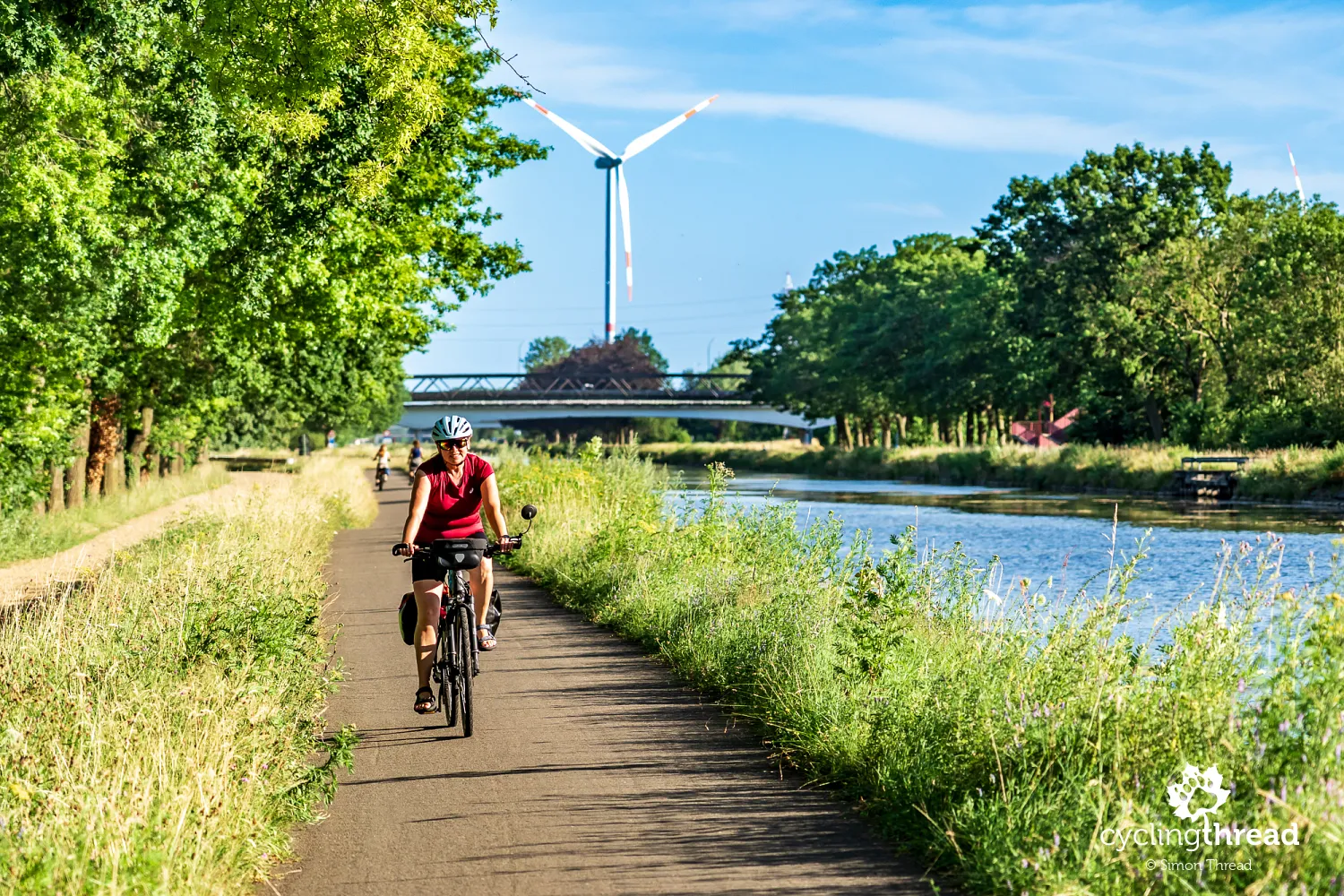
At the end of the day, we leave the Meuse valley and reach the Zuid-Willemsvaart, a canal connecting Maastricht with 's-Hertogenbosch in the Netherlands over a distance of almost 120 kilometres. It was built in the first half of the 19th century on the initiative of King William I as an important waterway linking the industrial areas around Liège and Maastricht with the northern part of the then United Kingdom of the Netherlands. Its name derives from William I, while "Zuid" distinguished it from other planned canals named after the monarch. Today, the long, straight sections of the Zuid-Willemsvaart also form a very convenient cycling corridor, which we follow north for a while. After a dozen or so kilometres, we turn towards Maasmechelen, a former mining town that will become the starting point of the Kempen Route proper the next day.
Taking bicycles on trains across Belgium
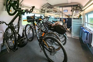
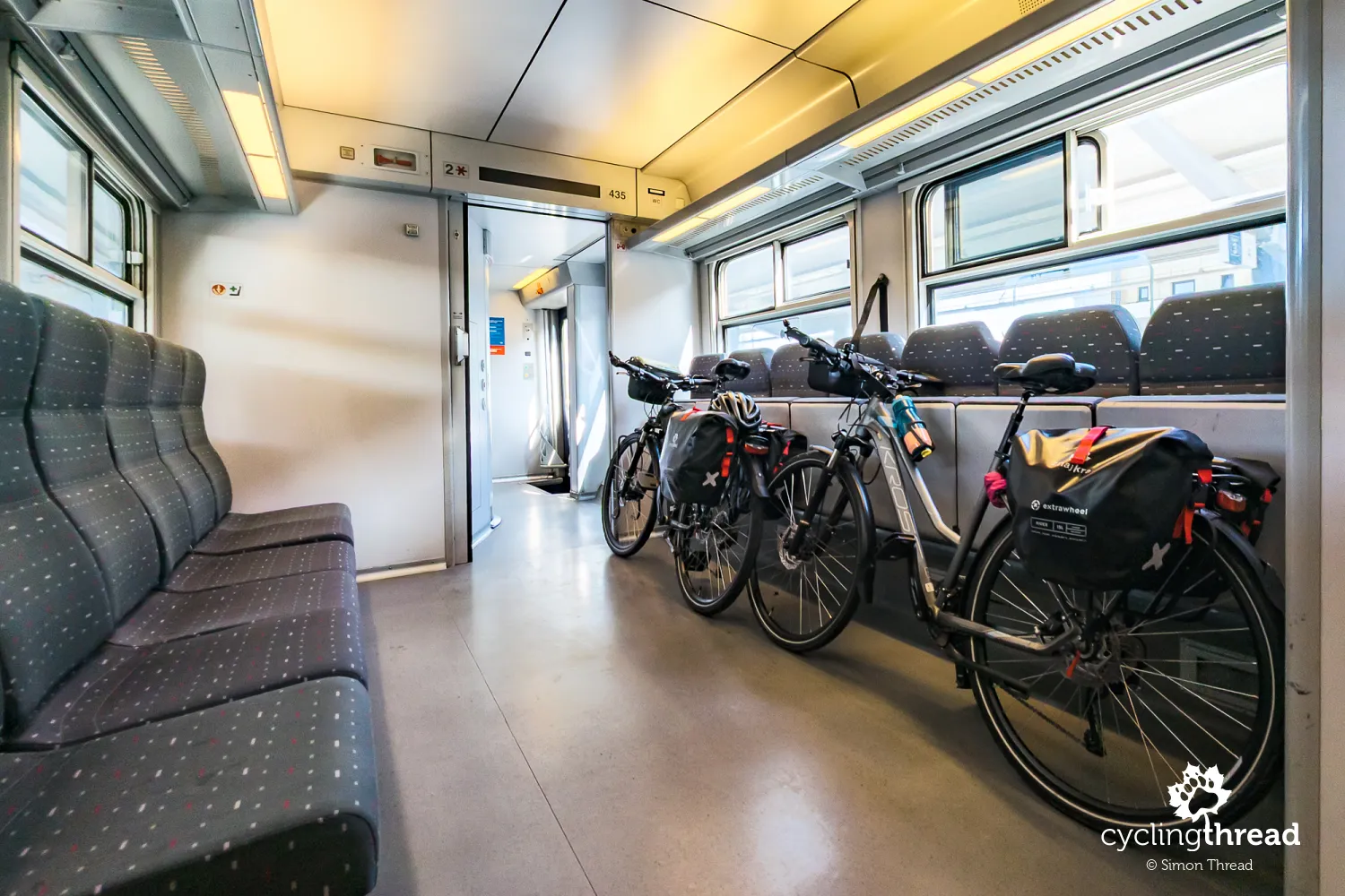
Cyclist-friendly trains made the logistics of our journey through Flanders considerably easier. We left our car in Hasselt, from where it was easy both to take a train to the start of the trip in Tongeren and to return after finishing in Antwerp. We used local trains twice, and both had large compartments for passengers travelling with bicycles. Tickets, including bicycle tickets, can be bought online or from machines at railway stations, even immediately before departure. On the local services we used, advance reservations for bicycles were not required.
Six days of cycling across Flanders
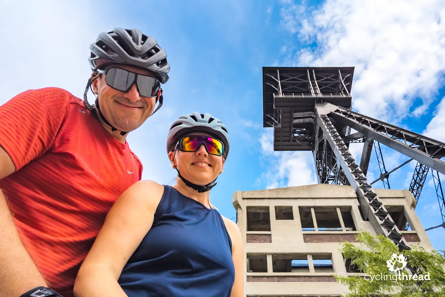
Our entire journey through Flanders took six days, including the final day devoted to exploring Antwerp. We rode the full Kempen Route, while the short sections of the Hill Route and Meuse Route made us want to return one day and experience them in their entirety. Flanders revealed itself as an exceptionally cyclist-friendly and safe region, with a great deal of cultural and historical interest. Limburg's mining heritage intertwined with forests, canals, heathlands and the Meuse valley, all connected by excellent cycling infrastructure. The greatest showpieces were, of course, the famous "iconic" cycling projects, but the ordinary, everyday quality of the cycle paths was equally impressive.
Why the Kempen Route ranks so highly
And perhaps it is precisely this everyday quality that remains most strongly in our minds after returning from Flanders. Cycling through Water and Cycling between Terrils are spectacular and look excellent in photographs, but the quality of the whole journey is determined by hundreds of kilometres of calm, safe riding between them. Add cycle highways, the node network, cyclist-friendly places, good signposting and solutions that make routes accessible to people with different abilities and needs. The Kempen Route brings all these qualities together in a single journey, and its place in the top ten of our ranking of Europe's best cycle routes is the best confirmation of the impression cycling in Flanders made on us.
Back to topHave a safe ride! 💚
Simon Thread
(Szymon Nitka)
I'm a passionate cycling traveler and the voice behind Cycling Thread. I explore Europe on two wheels, documenting the most scenic routes, inspiring places and cyclist-friendly practices. My writing blends personal experience with practical insights and a deep love of travel. I'm also a contributor to National Geographic Traveler magazine.