Moselle Cycle Route - through vineyards and historic towns in Germany
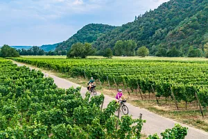
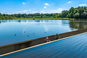
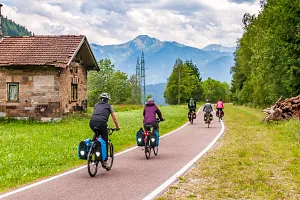
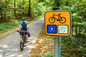
Moselle Cycle Route passes through one of Europe's most distinctive wine landscapes, among steep vineyards, medieval castles and historic towns right beside the river. One of its greatest attractions is how close it stays to the Moselle - for long stretches, you ride beside the water, following the river's sweeping bends with vineyards covering almost every part of the surrounding slopes. The route links Trier's Roman monuments with the historic centre of Koblenz, while well-developed cycling infrastructure takes you through places such as Bernkastel-Kues, Traben-Trarbach and Cochem. After many earlier cycling trips in Germany, we were especially curious to see how this famous European classic would compare with other popular long-distance routes.
Join us on our new 🟢 Komoot account!
Cycling Partners



Route on the map
GPX file (GPS track): cyclingthread.com-moselle-2026.gpx
Moselle Cycle Route - table of contents
- Moselle Cycle Route among Germany's most popular
- Four stars for quality from ADFC
- From the French border to the Moselle's mouth
- Vineyards and wine culture along the Moselle
- Comfortable cycle paths along the Moselle
- Accommodation and facilities for cycling holidays
- How we organised our stay in Trier
- Bicycle assistants on trains along the Moselle
- Schengen - a short visit to Luxembourg
- A quiet start between Perl and Trier
- Unusual signposts where three countries meet
- Two banks of the Moselle, two countries
- Wormeldange and Luxembourg's Riesling vineyards
- Nittel beneath a pale limestone cliff
- Oberbillig - a break overlooking Luxembourg
- Riverside cycle paths on Trier's outskirts
- A hotel in Trier full of bicycles
- Trier's Roman monuments, palace and museum
- The great river bends begin beyond Trier
- Who we meet along the route
- A Roman villa above Mehring
- Between rows of vines instead of beside the water
- Following the former Moselbahn railway
- A wine station opposite Trittenheim
- Neumagen-Dhron - a Roman ship and flood marks
- Piesport - a Roman wine press and Moselloreley
- Ripening grapes right beside the path
- Schloss Lieser - a palace across the river
- Bernkastel-Kues - half-timbered houses and the famous Doctor
- RadBus services help you explore nearby routes
- Book accommodation along the Moselle in advance
- A historic wine press hidden in Erden
- Slate soils in the vineyards near Wolf
- Traben-Trarbach - a bridge gate and Art Nouveau villas
- Monorails on the steep vineyard slopes
- Pünderich - railway arches and views of Marienburg
- Marienburg above the great Zeller Hamm bend
- Zell - a black cat and wine tasting
- Bullay's double-deck road and railway bridge
- Bremm, Stuben's ruins and steep Calmont
- The valley's natural amphitheatre opposite Briedern
- What the huge vineyard signs mean
- Beilstein beneath the ruins of Metternich Castle
- Cochem - a romantic castle above the old town
- A less safe section beyond Cochem
- A floating bar overlooking Bischofstein
- Hatzenport - a church among terraced vineyards
- Alken and Thurant Castle's two towers
- Kobern-Gondorf - a useful warning and a market square break
- The last vineyards around Winningen
- Koblenz - where the Moselle meets the Rhine
- A bicycle lift in our Koblenz hotel
- Campsites as an alternative to hotels
- Returning by train from Koblenz to Trier
- Our impressions of Moselle Cycle Route
Moselle Cycle Route among Germany's most popular
Moselle Cycle Route, known in Germany as Mosel-Radweg, follows the German section of the river from Perl to Koblenz, where the Moselle flows into the Rhine. It is one of Europe's best-known riverside cycle routes and one of Germany's most popular cycling holiday destinations. This is supported by the annual ADFC-Radreiseanalyse survey, in which the route regularly appears among Germany's ten most popular long-distance cycle routes. It is also a member of Germany's Top River Routes, which include the Elbe Cycle Route and Ruhr Valley Cycle Route, among others. The German section continues the French cycle route along the Moselle, which is now part of the long-distance Blue Route (La Voie Bleue).
Four stars for quality from ADFC
In March 2024, Moselle Cycle Route received four stars under the quality certification scheme run by the German cycling association ADFC. This is one of the most important awards for long-distance cycle routes in Europe, based on a detailed assessment of infrastructure and riding conditions. The criteria include surface quality, cycle path width, safety, signposting, access to public transport and tourist facilities. On the Moselle, particularly high marks were given to comfortable riding, clear route guidance, good rail and bus connections and a wide range of services for cyclists. Four stars confirm the route's existing quality and represent a commitment to maintaining it, as certification also involves regularly monitoring its condition and addressing any problems found.
From the French border to the Moselle's mouth
The German section of Moselle route is 248 kilometres long and starts in Perl, close to the point where Germany, France and Luxembourg meet. It initially passes through the state of Saarland and then Rhineland-Palatinate, crossing three distinctive parts of the valley: Obermosel, Mittelmosel and Untermosel. Along the way, it visits Trier, one of Germany's oldest cities, followed by numerous wine towns, including Bernkastel-Kues, Traben-Trarbach, Zell and Cochem. Here, the river flows between the Eifel and Hunsrück uplands, forming the broad bends that give the route its distinctive shape. The final kilometres lead to Koblenz, where the Moselle meets the Rhine at the famous Deutsches Eck. The official itinerary consists of ten short stages, although the entire German section can comfortably be ridden in four or five days.
Vineyards and wine culture along the Moselle
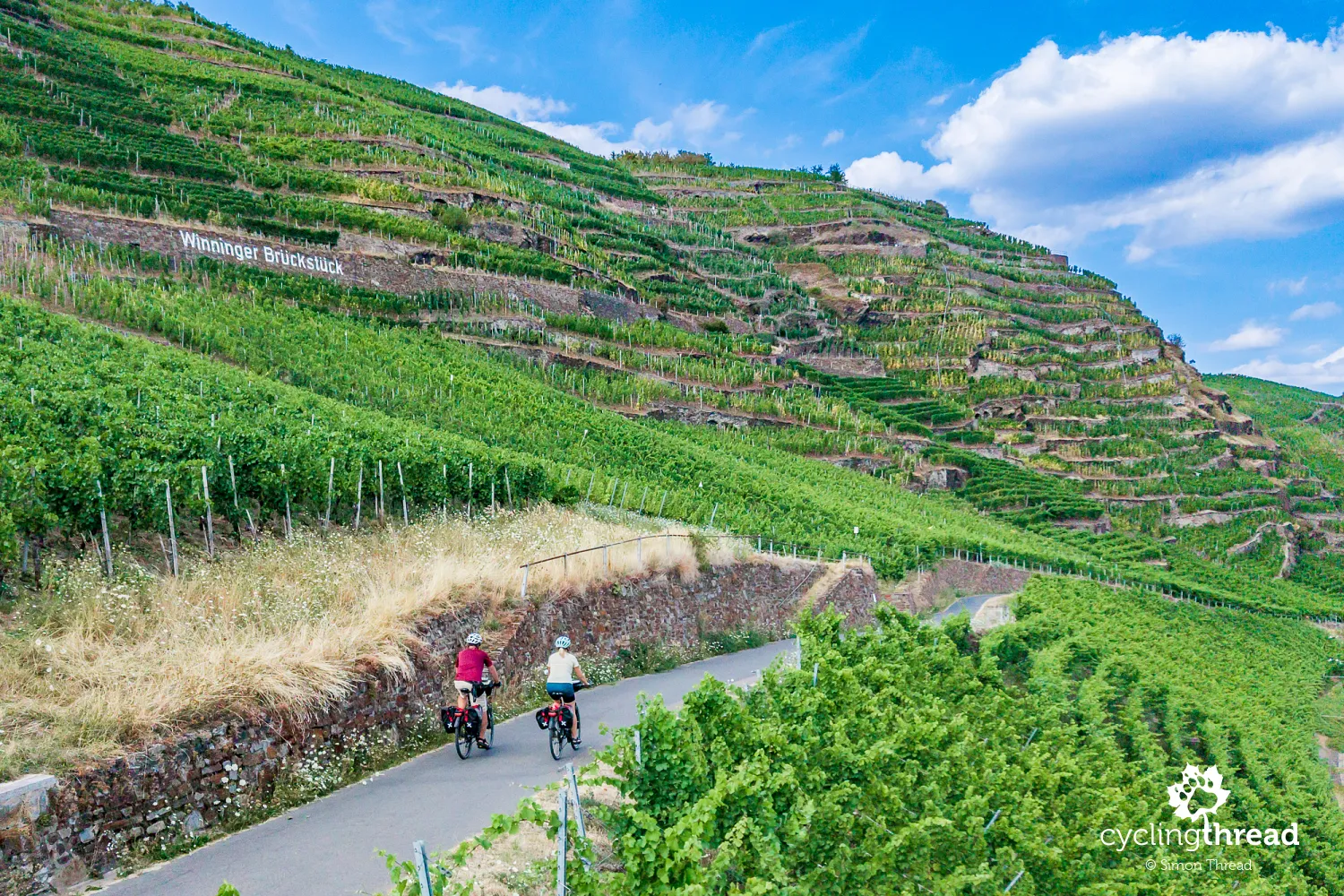
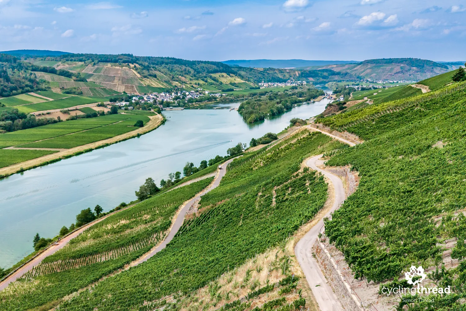
Vineyards are the most distinctive feature of the Moselle Valley landscape, often covering almost entire hillsides above the river. The region is one of Germany's oldest wine-growing areas, with traditions dating back to Roman times. It is particularly known for Riesling, which benefits from the steep, sunny slopes and slate soils. Near Bremm lies Calmont, considered one of Europe's steepest wine-growing areas. Wine is present in the scenery and in the everyday life of the towns along the way. Small estates, family wineries, places serving local wines and traditional wine festivals make a journey along Moselle Cycle Route an encounter with the region's interesting culture too.
Comfortable cycle paths along the Moselle
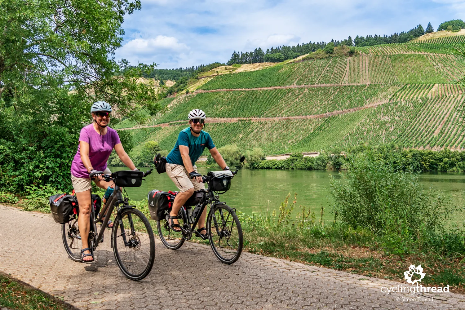
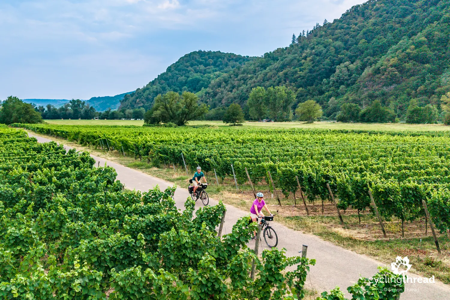
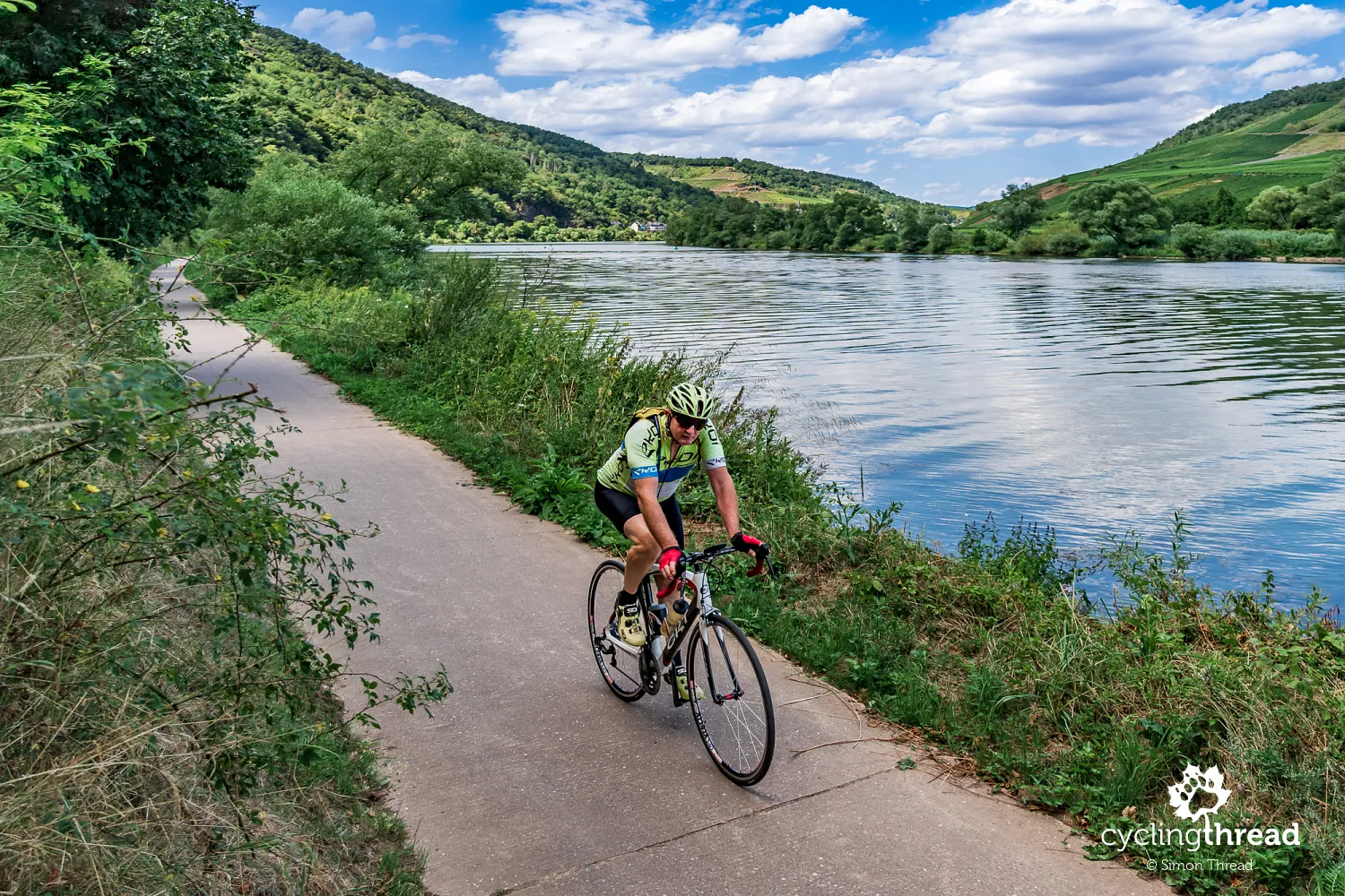
One of the greatest strengths of Mosel-Radweg is its cycling infrastructure, which makes it possible to follow the river with little effort and away from motor traffic. Smooth asphalt cycle paths dominate, often running directly beside the Moselle, between the river and the vineyards or through small towns. The route is almost flat, with bigger climbs appearing when cyclists leave the main route. Its gentle profile, good surfaces and wide cycle paths make it suitable for many different riders - from families with children and older people to less experienced touring cyclists and those riding tandems or tricycles. On many stretches, you can ride on either side of the river, using bridges and local ferries, although the official route follows one selected bank. Only towards the end of the journey do slightly longer sections beside roads appear.
Accommodation and facilities for cycling holidays
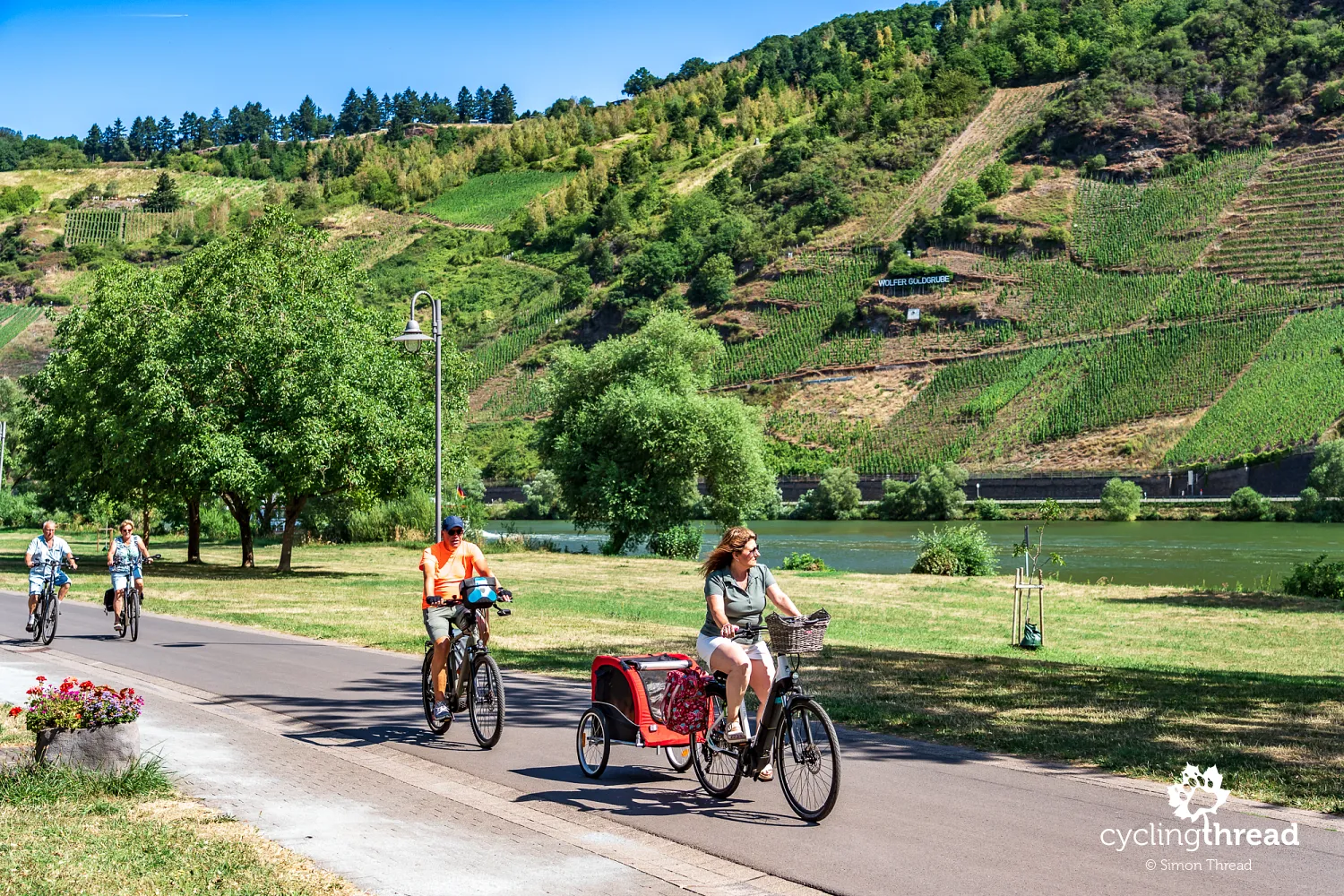
The popularity of Moselle route means there is a wide choice of accommodation in every larger town along the river. Alongside traditional hotels and guesthouses, you can stay at family wine estates, small bed and breakfasts and campsites right beside the Moselle. Properties belonging to Germany's Bett+Bike scheme are an important part of this offer - around 130 certified properties operate across the Mosel-Saar region, providing secure bicycle storage, basic tools and the option of staying for just one night. Companies offering ready-made tours with accommodation bookings and luggage transfers make things easier still, allowing people to enjoy the route without planning the whole journey themselves.
How we organised our stay in Trier
Our plan for organising a trip along Moselle Cycle Route proved both practical and very convenient. We drove to Trier and left the car in a free park-and-ride car park for our entire stay in the Moselle region. We booked the same hotel in Trier for the first three nights, so we did not have to pack our bags and change accommodation every day. On the first day, we took our bikes on the train to Perl, where we began Moselle route and cycled back to our hotel in Trier. We devoted the whole second day to exploring the city and its many monuments, especially those from Roman times. Only on the third day did we leave Trier to continue along the Moselle towards Koblenz. After reaching the end of the route in Koblenz, we returned to Trier by train to collect our car.
Bicycle assistants on trains along the Moselle
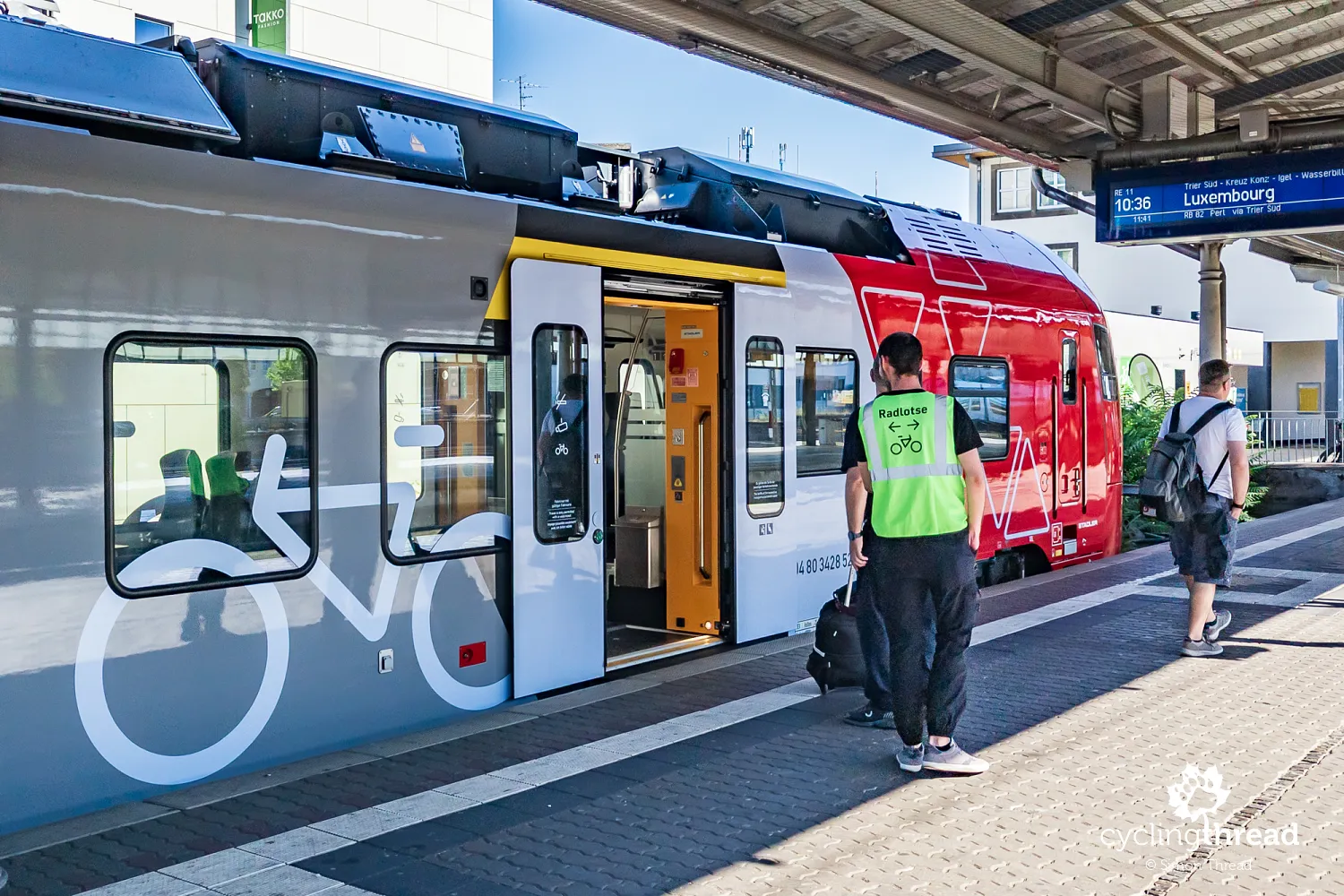
While we were waiting at Trier station for the train to Perl, the vest worn by one of the men on the platform caught my attention. It said "Radlotse", meaning "bicycle guide". We discovered that special assistants help passengers travelling with bicycles on regional services RB 81 between Koblenz and Trier and RB 82 between Trier and Perl. Their job is to make boarding and leaving the train easier, direct cyclists to the appropriate parts of the train and help position bicycles safely on board. The service operates during the cycling season on weekends and public holidays, and on weekdays during the school summer holidays in Rhineland-Palatinate. These assistants are especially useful when a dozen or more cyclists with panniers are waiting on the platform at the same time.
Schengen - a short visit to Luxembourg
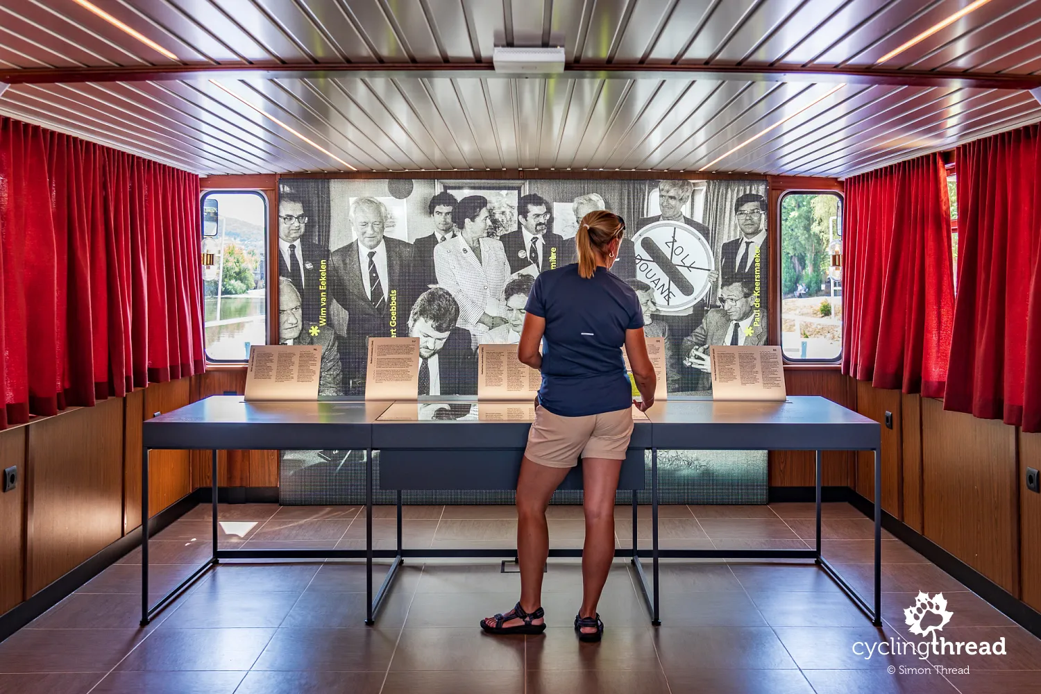
We began our cycling journey along Moselle Cycle Route with a short trip into Luxembourg - to Schengen, a small village across the river, close to the borders with Germany and France. Its name is familiar to almost every European because this is where, on 14 June 1985, an agreement was signed that began the process of removing border controls between European countries. The original agreement involved five countries: Belgium, France, the Netherlands, Luxembourg and the Federal Republic of Germany. For us, as regular travellers around Europe, Schengen has a special meaning, because the freedom to cross borders is one of the greatest advantages when organising cycling trips. Today, riding from one country to another without stopping at the border feels completely natural, although European travel was very different just a few decades ago.
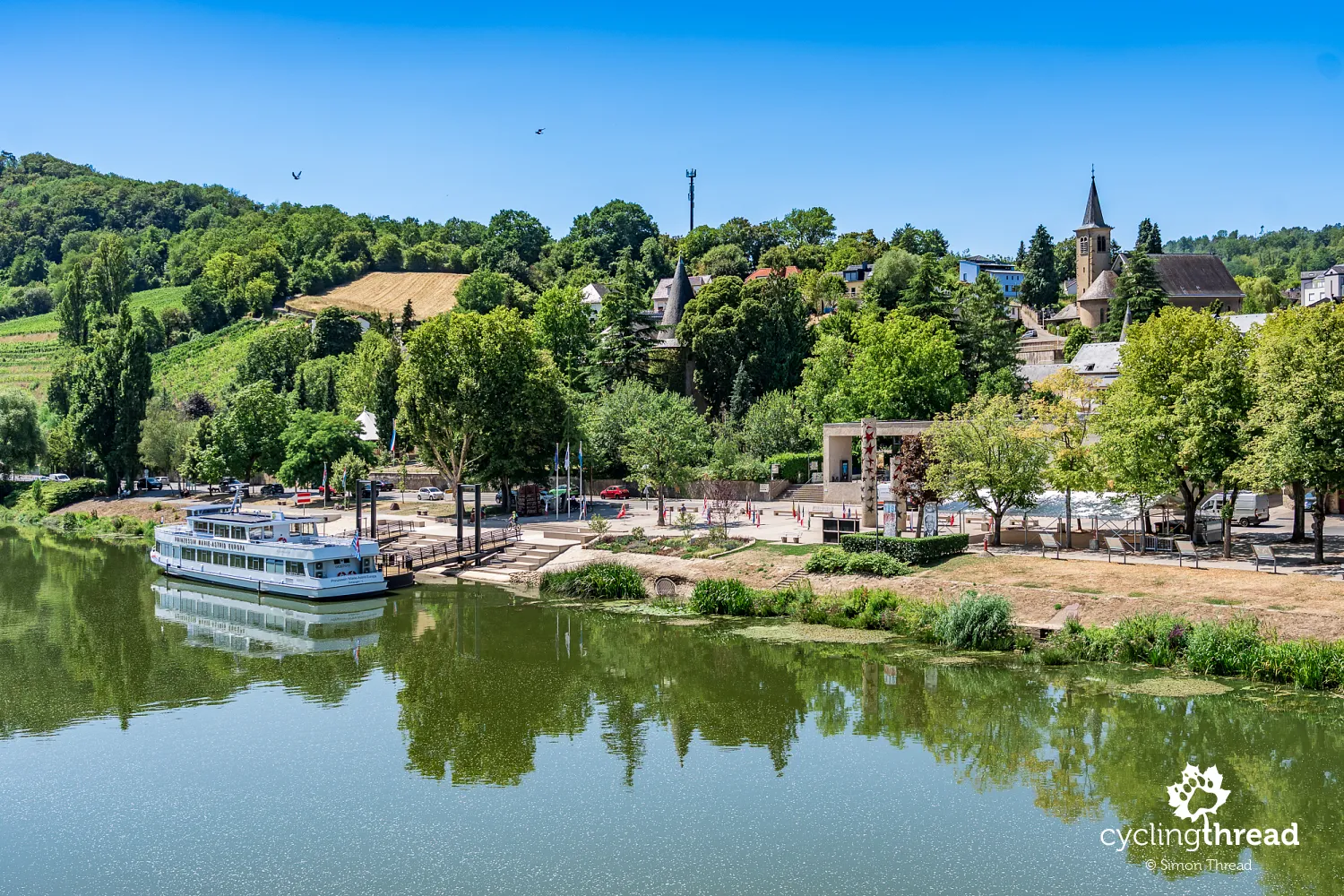
In Schengen, it is worth stopping at the riverside European Museum pavilion, dedicated to the history of the agreement and the development of the Schengen Area. A new interactive exhibition opened here in June 2025 to mark the agreement's 40th anniversary. The historic MS Princesse Marie-Astrid, on which the document was signed in 1985, also returned to the village. After the ceremony, the ship spent many years sailing on the Danube before being bought back and brought home to Luxembourg. Following extensive restoration, it is now named Prinzessin Marie-Astrid Europa and forms part of the museum, where visitors can see the room in which the agreement was signed.
A quiet start between Perl and Trier
Our first day on Moselle Cycle Route was something of a surprise. We had expected to see plenty of touring cyclists, but met relatively few between Perl and Trier. We had also expected frequent cafés, restaurants and other places for a short break, yet there were surprisingly few directly beside the route. Only over the following days did we realise that cycling tourism along the Moselle is concentrated mainly on the section starting in Trier. This is where many cyclists begin their journey towards Koblenz, including those travelling with cycling tour operators. Our first stage therefore felt quite different from what we had expected, and much quieter than the rest of the trip.
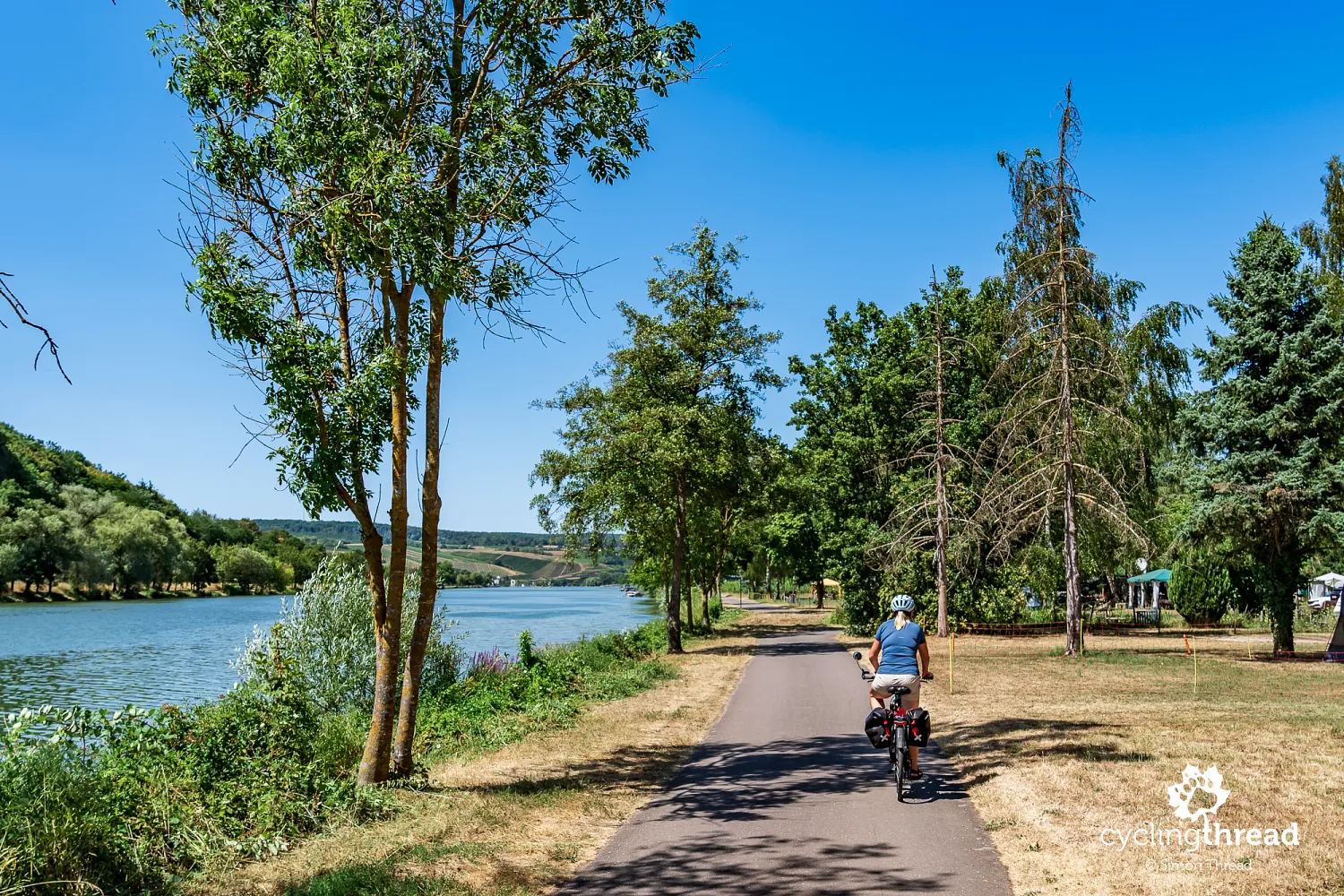
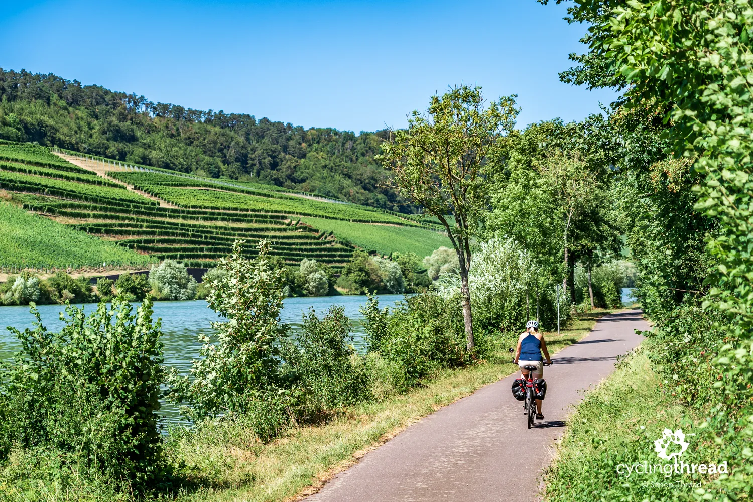
This pattern, shaped by tour operators, does not mean that starting in Perl is not worthwhile. It certainly is, because it gives you a broader view of the river itself and helps put a cycling journey along the Moselle into context. Here, the valley is still relatively wide and the landscape more open than in its middle section, where the river begins forming distinctive, deep bends surrounded by steep slopes. Vineyards are already present, but they do not yet dominate the surroundings as much as they will in the following days. You can also observe everyday life in small towns less focused on large numbers of cycling visitors. This introduction makes the later changes in scenery, buildings and visitor numbers more noticeable, giving the journey a natural continuity that would be missing if you started in Trier.
Unusual signposts where three countries meet
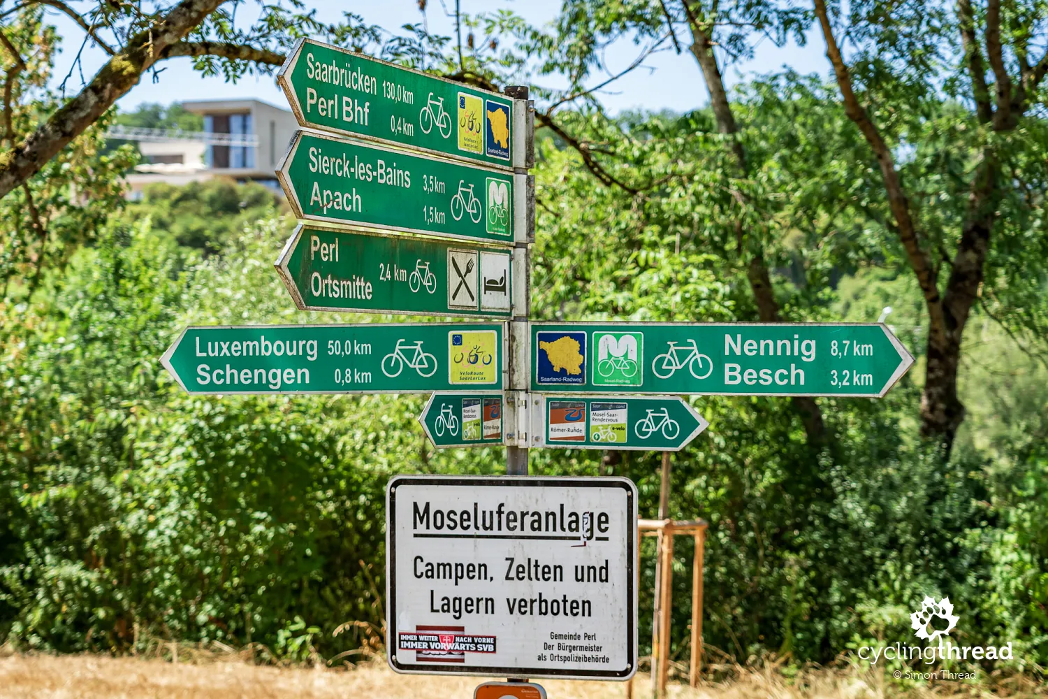
In Perl, we noticed cycle signposts that looked different from those we knew from other parts of Germany. Instead of the familiar white signs with green lettering, or red as we had recently seen on Ruhr Valley Cycle Route, we found ageing green signs with white lettering, similar to those used in neighbouring Luxembourg. This is a distinctive feature of the border area between three countries, where different regional and international cycle routes meet. A single post carried directions to German, French and Luxembourgish towns, along with symbols for several routes, including Saarland-Radweg and Véloroute SaarLorLux. Over the following kilometres, we returned to the more familiar German cycle route signposting system.
Two banks of the Moselle, two countries
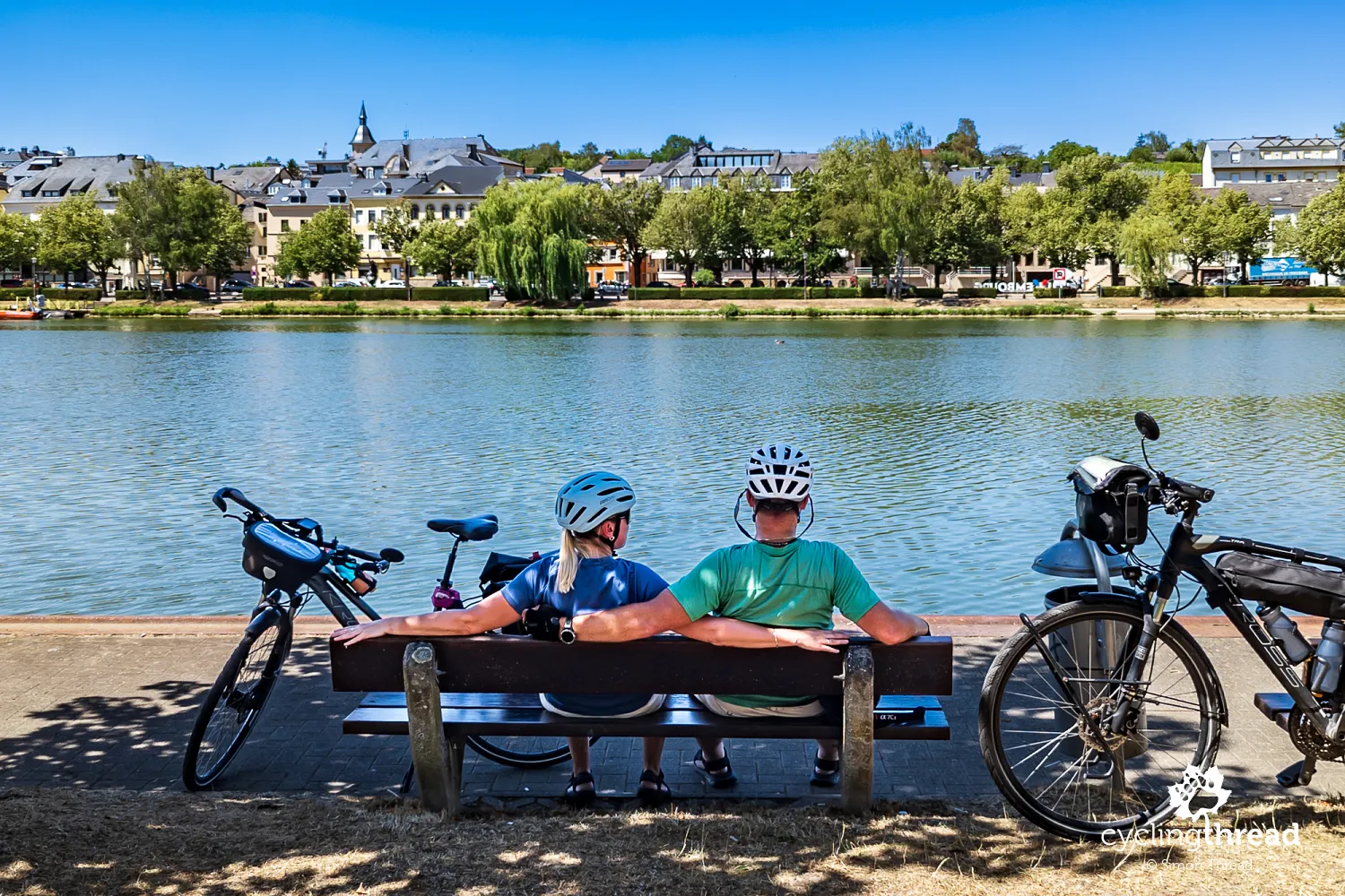
We began discovering the particular character of Moselle route within the first few kilometres. Although its official course usually follows one of the river's two banks, cycle paths run along both sides on many stretches. Towns also line both banks, while the national border adds another point of interest to the first stage. For much of the journey from Perl to Trier, we ride through Germany on the Moselle's right bank, while Luxembourg lies across the river on the left. One of the first towns along the way is Remich, a popular Luxembourgish holiday destination that we viewed from the German bank.
Wormeldange and Luxembourg's Riesling vineyards
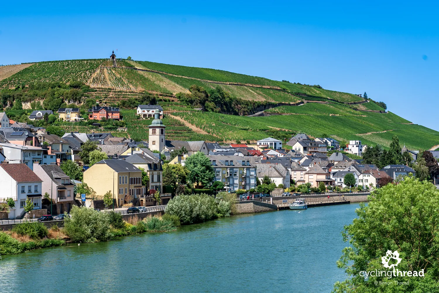
One of the most distinctive views on our first day was Wormeldange, a small town on the Luxembourgish bank of the Moselle. It is one of Luxembourg's most important wine centres, especially known for Riesling, which benefits from the sunny slopes rising directly above the town. Wormeldange is sometimes called the capital of Luxembourgish Riesling, and its vineyards are among the country's best known. Above the town stands the famous Koeppchen hill with its small chapel, clearly visible from the German bank. Wormeldange also has local wineries, while its annual wine festivals reflect the importance of wine growing to the region's residents.
Nittel beneath a pale limestone cliff
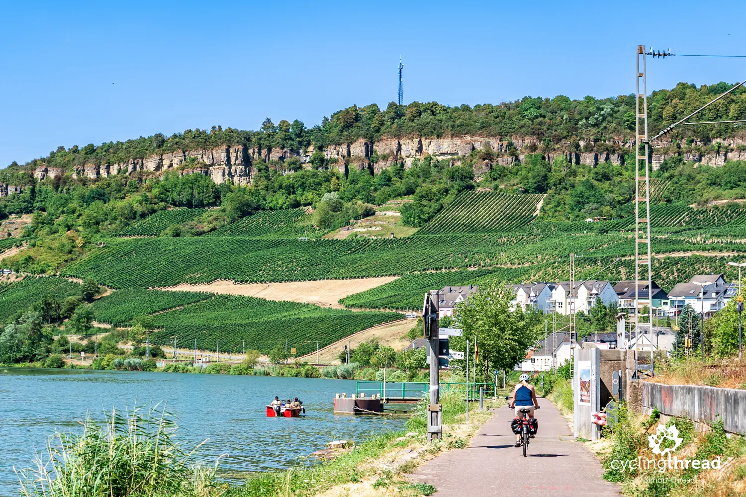
The next place to catch our attention was Nittel, a small wine village on the German side of the Moselle. An impressive wall of pale limestone, known as Nitteler Fels, rises above its buildings, setting this part of the valley apart from the surrounding vineyard-covered hills. It is also an excellent example of the varied landscapes we will see along Mosel-Radweg. The rocks are the remains of ancient marine deposits from millions of years ago and are among the most distinctive geological formations along the upper German Moselle. Nearby vineyards grow varieties including Elbling, particularly associated with the Obermosel region. Walking paths also follow the rocky slopes, offering views of the valley from above.
Oberbillig - a break overlooking Luxembourg
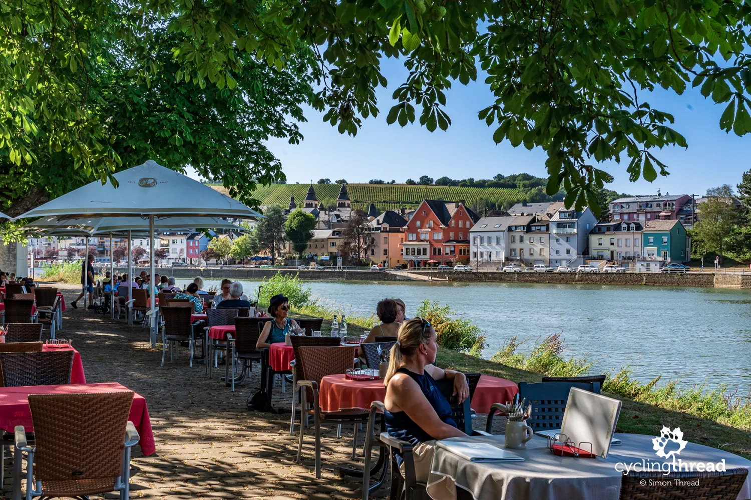
We stopped for a longer break in Oberbillig, a small German village opposite Wasserbillig in Luxembourg, close to where the Sauer joins the Moselle. We found a restaurant with a garden right beside the water, its tables set in the welcome shade of spreading trees. That shade was a blessing, as our late-July visit coincided with exceptionally hot weather, with temperatures along the Moselle reaching 39 degrees Celsius that day. From our table, we could see Wasserbillig's colourful buildings, church towers and the vineyards covering the hills on the Luxembourgish side. A small passenger and car ferry links the two villages and also carries bicycles.
Riverside cycle paths on Trier's outskirts
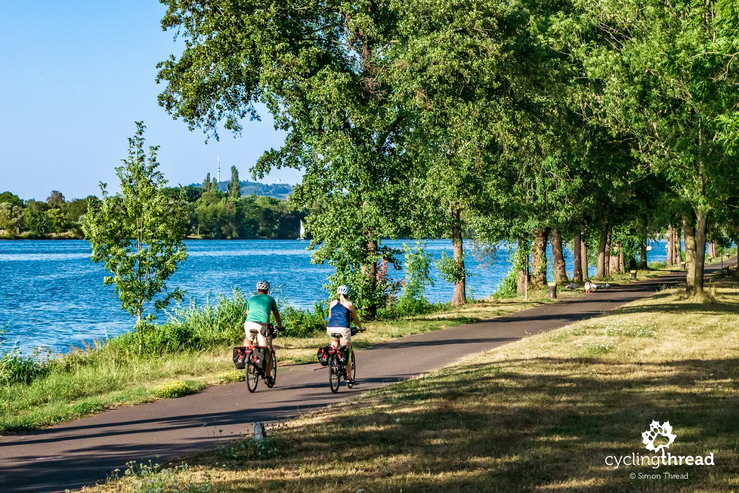
Over the following kilometres, Trier's proximity became increasingly noticeable. The cycle paths grew wider, sometimes resembling comfortable avenues, and more sporty riders on road bikes began appearing. The quiet, almost leisurely feel of the earlier sections gradually gave way to busier cycle traffic near a large city. It was also the first point in our journey when we could see how important the paths along the Moselle are for local commuting and recreation as well as tourism.
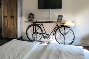
A hotel in Trier full of bicycles
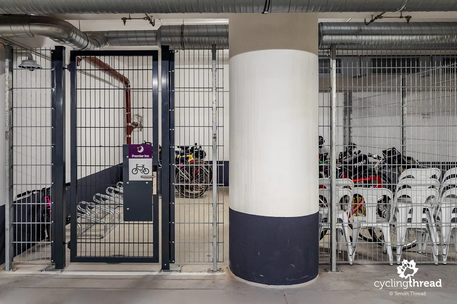
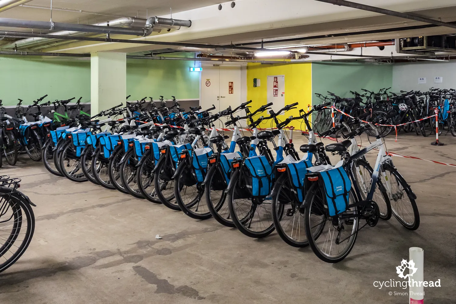
We spent three nights at our hotel in Trier, and the number of bicycles in its underground car park was the clearest sign that Trier is the main starting point for cycling trips along the Moselle. Almost a hundred bicycles stood in the area reserved for cyclists, about half of them waiting for customers of a large cycling tour operator. The hotel was, of course, part of Germany's Bett+Bike scheme for accommodation adapted to the needs of people travelling by bicycle. Guests had secure bicycle storage, basic tools and a pump for small repairs before the next day's ride. Like all Bett+Bike properties, it also accepted guests staying for just one night.
Trier's Roman monuments, palace and museum
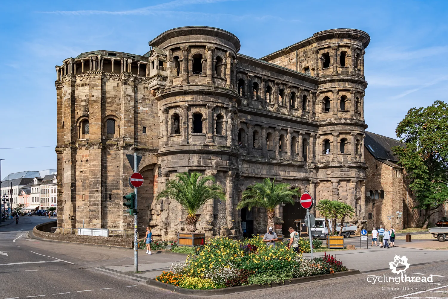
We devoted the extra day we had planned in Trier entirely to exploring this remarkable city. Trier is considered Germany's oldest city, with origins dating back to Roman times, when it became the most important centre of the Roman Empire north of the Alps under the name Augusta Treverorum. Its best-known monument is Porta Nigra, a monumental second-century city gate that has survived in remarkably good condition. The city also has the remains of three large Roman bath complexes, including the Imperial Baths (Kaiserthermen) and Barbara Baths (Barbarathermen), as well as an amphitheatre that could hold around 20,000 spectators. Another exceptional monument is the Basilica of Constantine, a former Roman palace hall whose vast, almost undecorated interior remains impressive today. All these sites are on the UNESCO World Heritage List.
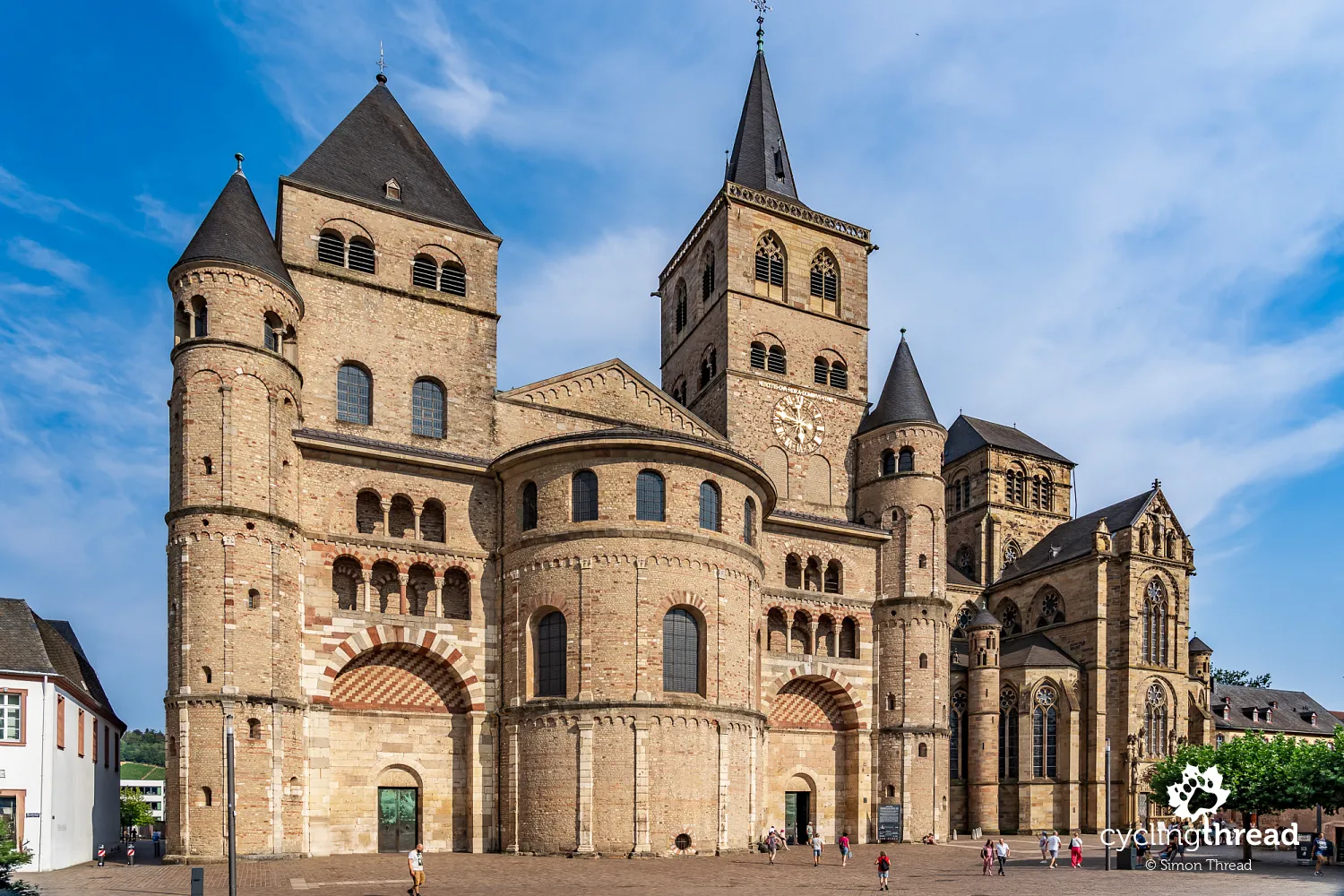
Right beside the Basilica of Constantine stands the Electoral Palace (Kurfürstliches Palais), once the residence of the archbishops of Trier, who were among the electors of the Holy Roman Empire for centuries. Its most distinctive part is the Rococo south wing, with its richly decorated pink-and-white façade and elegant palace garden. Trier's two most important churches, standing side by side in the historic centre, have a very different character. St Peter's Cathedral (Trierer Dom) is Germany's oldest cathedral, with origins in the fourth century, although its present appearance reflects many later alterations. The neighbouring Church of Our Lady (Liebfrauenkirche) is among the earliest examples of Gothic architecture in Germany. Both churches are also UNESCO-listed and form one of the country's most valuable groups of religious buildings.
Another fascinating place was Rheinisches Landesmuseum Trier, the Rhenish State Museum, which holds one of Germany's richest collections of Roman artefacts. Its collections cover archaeological finds from Trier and the wider region, from prehistoric times to the Middle Ages, but the Roman exhibits are the most impressive. They include monumental floor mosaics, sculptures, tombstones, everyday objects and the famous hoard of Roman gold coins, one of the largest of its kind ever discovered. The collection of stone funerary monuments is particularly interesting, with reliefs showing scenes from the lives of people in the former province. A visit helps explain the importance of Roman Trier and complements the monuments that have survived across the city.
The great river bends begin beyond Trier
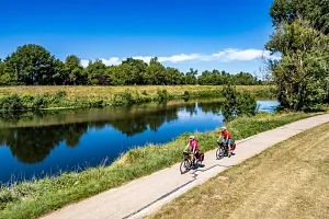
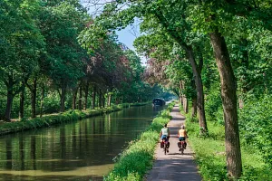
Leaving Trier first takes us through a local industrial area, but soon afterwards the most beautiful section of Moselle Cycle Route begins, continuing almost all the way to Koblenz. The valley slopes grow higher and steeper, with extensive vineyards covering almost every patch of land suitable for growing vines. The Moselle forms increasingly picturesque bends, while small wine towns appear between the river and the hills, with distinctive houses, churches and wine estates. The cycle paths usually run right beside the water, making it feel, for many kilometres, as though you are almost part of these picturesque scenes.
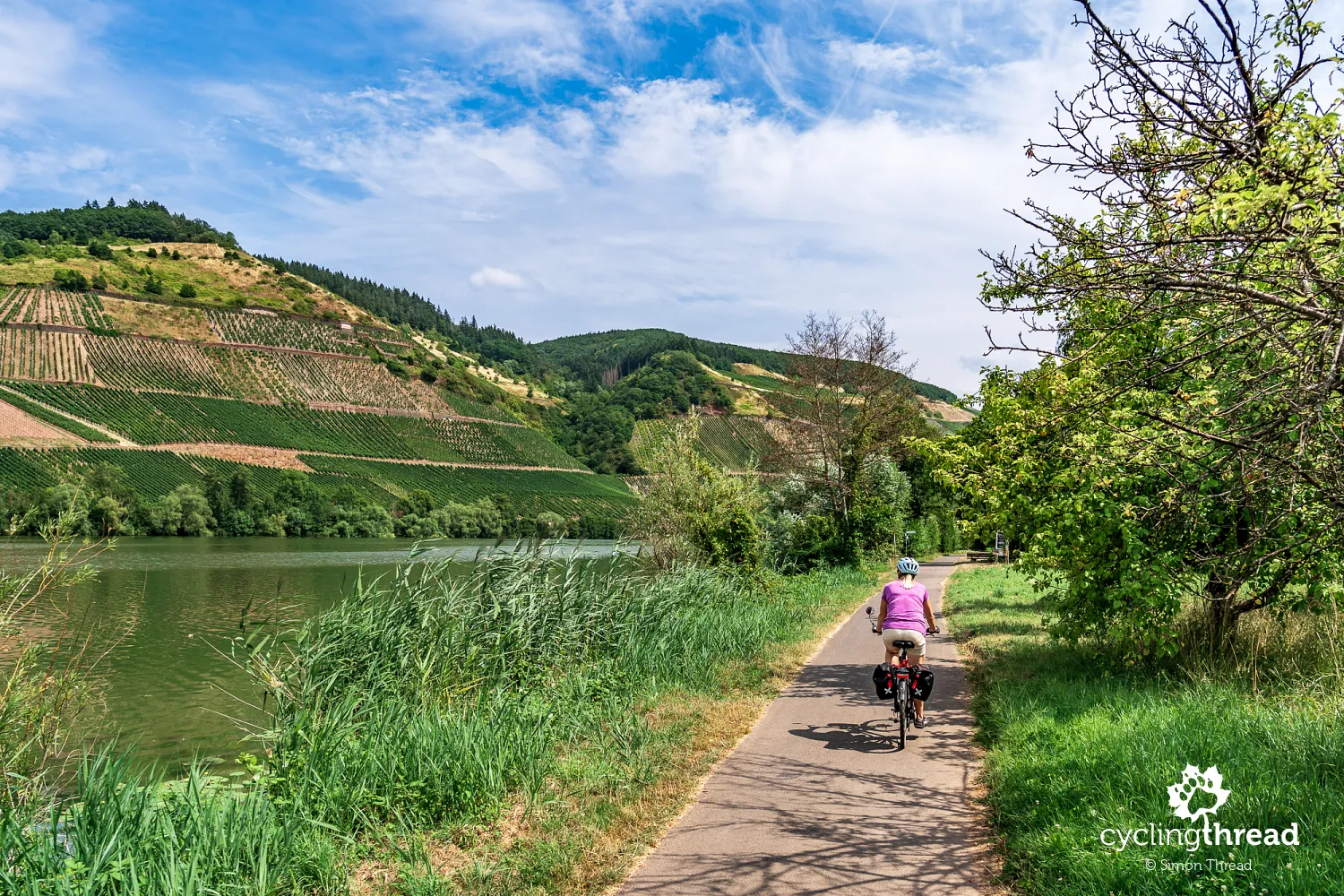
Who we meet along the route
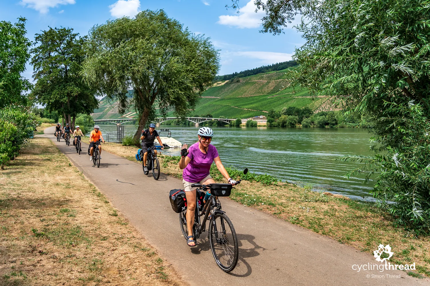
We quickly notice Moselle route's popularity and its pleasantly festive atmosphere. This really is a river where cycling tourism is part of everyday life. Solo travellers, couples of all ages, families with children and groups of friends ride along the Moselle. Many use e-bikes, covering the kilometres with little effort, while others ride conventional touring bikes, almost always with panniers. We also meet people on organised tours, with operators providing accommodation, luggage transfers and a planned itinerary. This variety creates a relaxed holiday atmosphere, with bicycles a natural part of the towns we pass. Despite the route's popularity, cycle traffic is spread evenly and never becomes a nuisance.
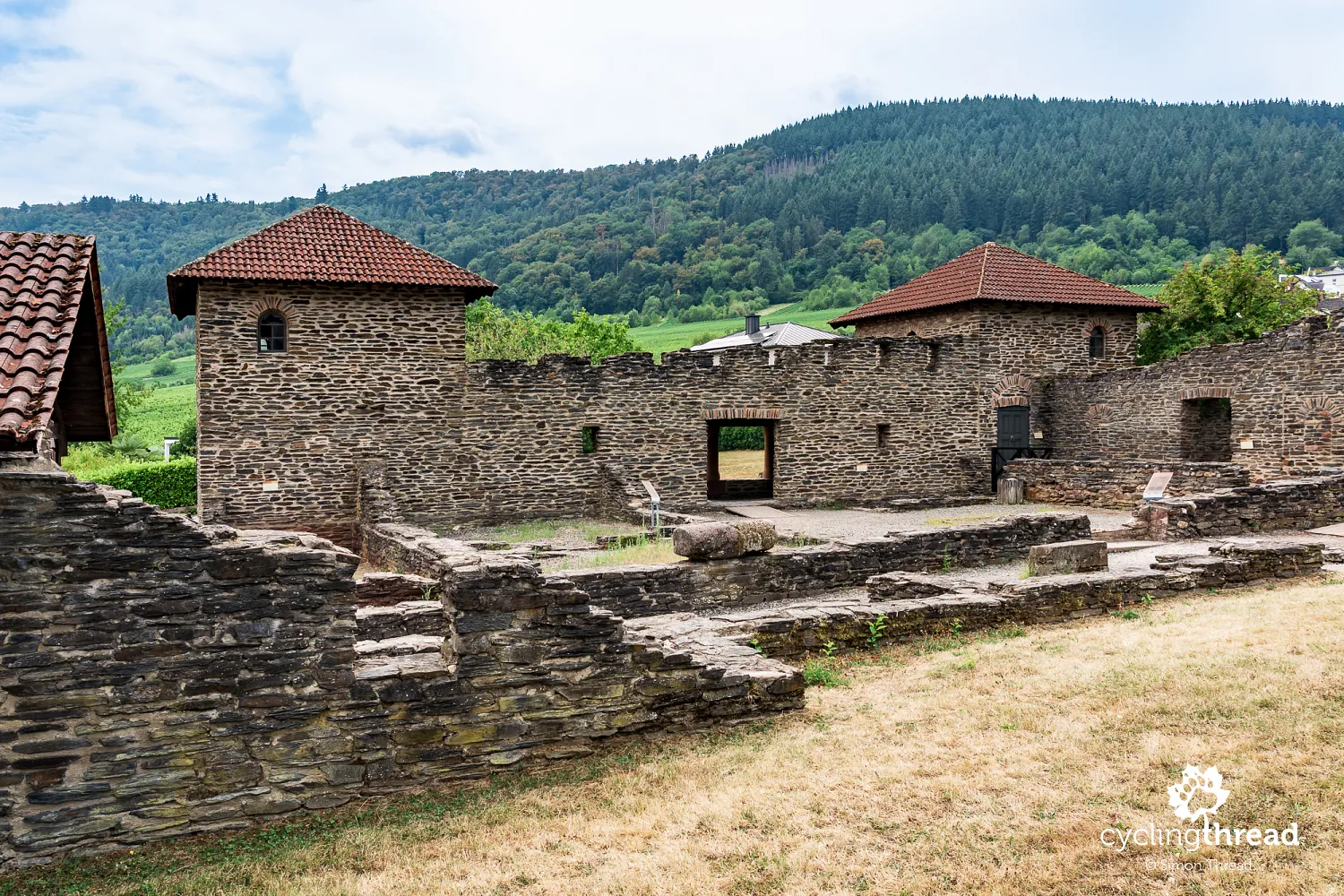
A Roman villa above Mehring
One of the first places worth briefly leaving the riverside cycle path for is the remains of a Roman villa in Mehring. Getting there means leaving the main route and making a short climb with a few dozen metres of elevation gain. The foundations uncovered here belonged to a large Roman country estate dating back to the second century AD. Part of the building has been reconstructed, helping visitors imagine the former residence and learn about its inhabitants' living conditions. Although the site has clear historical value and recalls the Moselle Valley's Roman past, we found it a little... disappointing. After Trier's impressive monuments, these remains seemed fairly modest, although the short detour itself requires little effort.
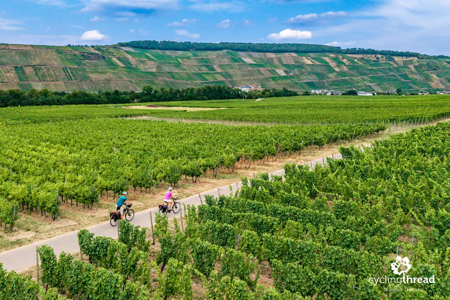
Between rows of vines instead of beside the water
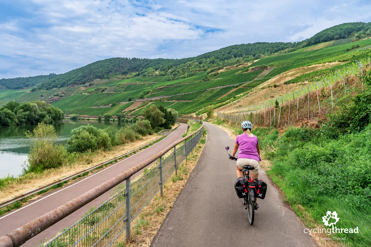
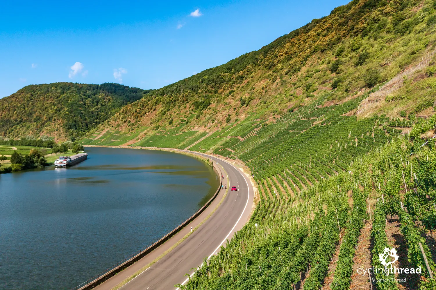
For most of the journey, Moselle Cycle Route stays almost directly beside the river, on comfortable cycle paths running parallel to its banks. Views of the water, passing boats and vineyards on the opposite slopes accompany us almost constantly. There are places, however, where the route unexpectedly leaves the Moselle, turning almost at a right angle towards extensive vineyards. We then ride between rows of vines, crossing large areas of cultivation on the gentler parts of the valley. Up close, it is easier to appreciate the scale of local wine production. It also makes a pleasant change from riding beside the water, showing the Moselle's wine landscape from another perspective.
Following the former Moselbahn railway
Beyond Leiwen, Moselle Cycle Route joins one of two cycle path sections following a former railway line. The historic Moselbahn connected Trier with Bullay and was around 102 kilometres long, but cyclists now use only two short parts of its former course: 3.8 kilometres between Leiwen and Neumagen-Dhron and a slightly shorter section between Kindel and Wolf. Most of the line could not be reused because parts of the former trackbed were built over, converted into roads or incorporated into private properties. The railway also often left the riverbank, passing through towns and areas higher than today's cycle route. The surviving sections nevertheless add interest to the journey and recall the days when rail was one of the valley's most important forms of transport.
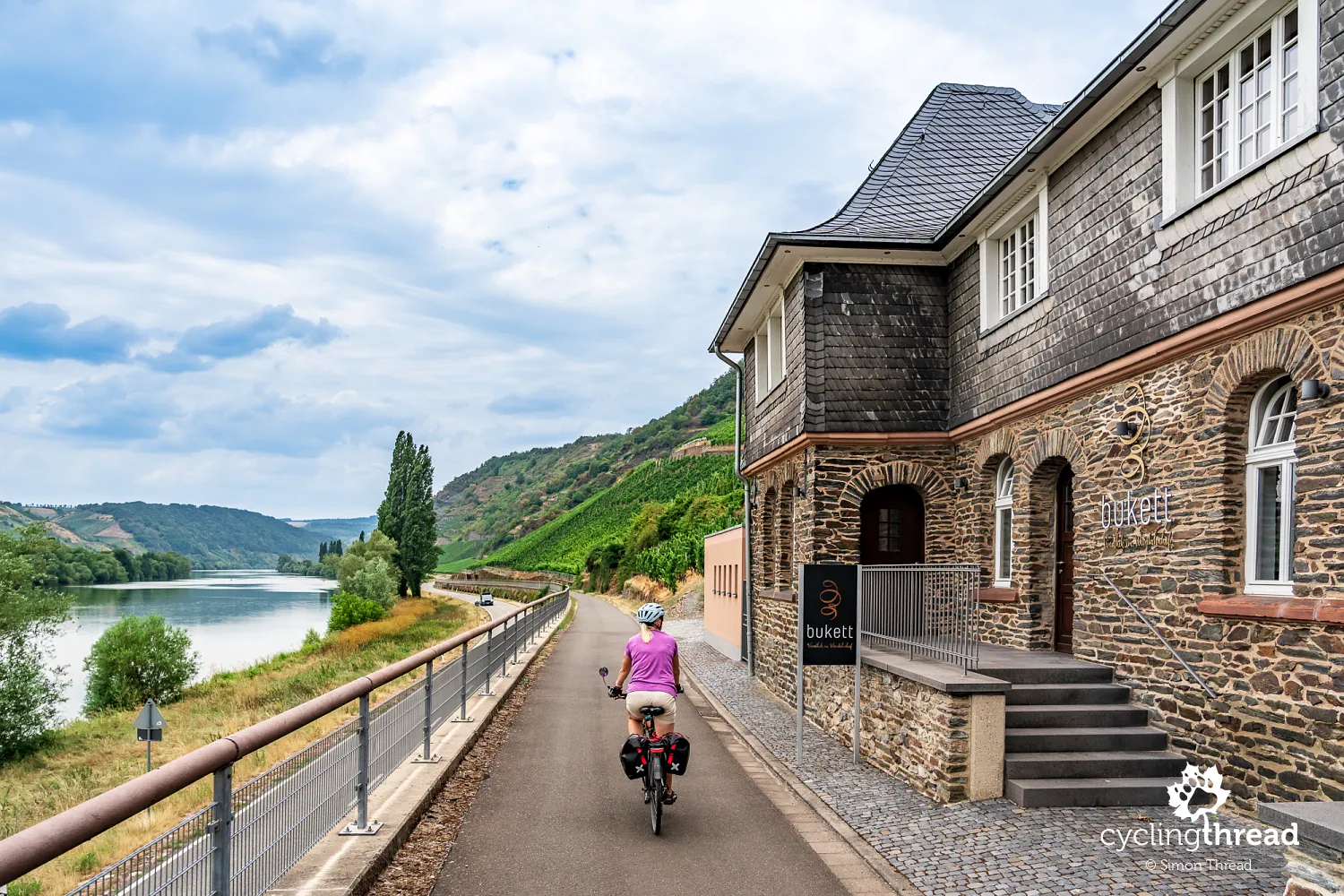
A wine station opposite Trittenheim
Between Leiwen and Neumagen-Dhron, look out for one of the surviving buildings of the former Moselbahn: a beautifully restored station that now operates as a wine bar, a so-called "wine station". The old railway infrastructure has found an entirely new use here, bringing together transport history and the region's wine traditions. Where passengers and railway staff once passed through, you can now stop for a glass of local wine and a rest during your cycling trip. It is a particularly successful example of reusing railway heritage while preserving a building's historic character and giving it a new role in tourism. Together with the cycle path on the former railway, the station provides a coherent reminder of more than a century of travel along the Moselle.
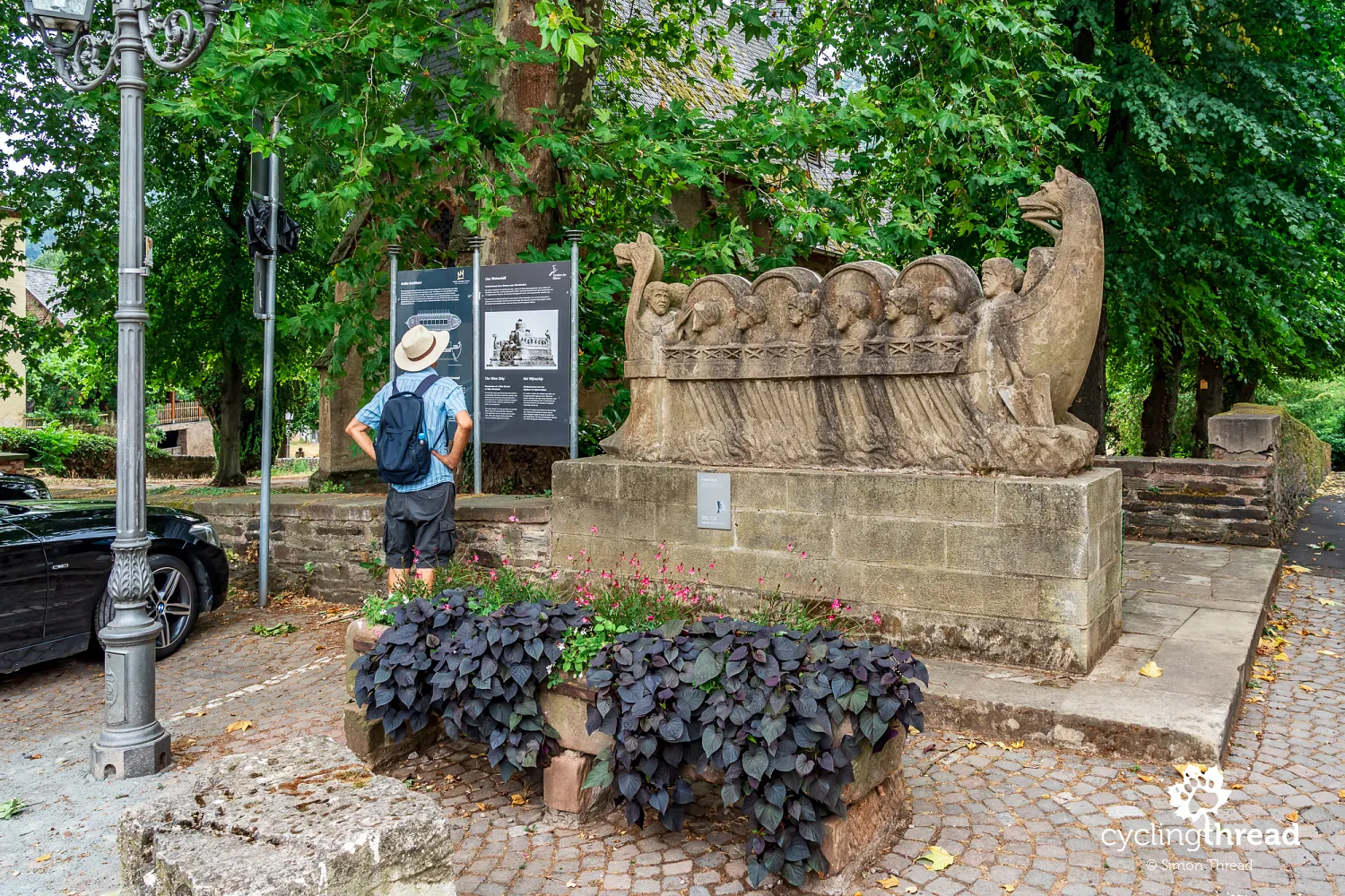
Neumagen-Dhron - a Roman ship and flood marks
This railway section ends in Neumagen-Dhron, one of Germany's oldest wine towns, with a history dating back to Roman times. Its most distinctive reminder of that era is a stone sculpture depicting a Roman wine transport ship, discovered in the town itself. The original is now in the museum in Trier, while Neumagen-Dhron has a copy of the sculpture and a full-size reconstruction of the wooden vessel. They recall the Moselle's former importance as a trade route and the region's centuries-old wine traditions. For us, Neumagen-Dhron was also a good place for a break - we stopped for lunch at a restaurant overlooking a small marina.
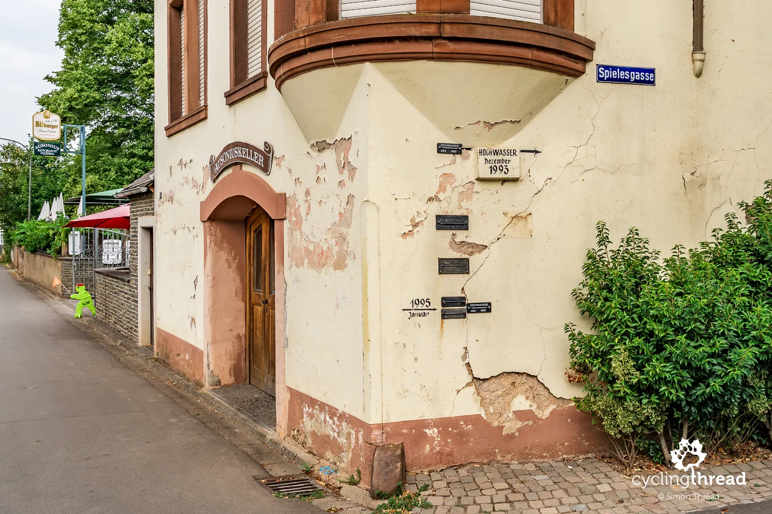
Neumagen-Dhron's long history is reflected in its Roman monuments and in traces of much more recent events that reveal a great deal about life in riverside towns. On the wall of a building on Spielesgasse, marks record the water levels reached during successive floods. A plaque commemorating the flood of December 1993 is especially striking, positioned surprisingly high above the heads of passers-by. Below it are marks from January 1995 and other periods when the Moselle rose. It is hard to believe that the peaceful river we enjoy cycling beside could ever have reached such a level.
Piesport - a Roman wine press and Moselloreley
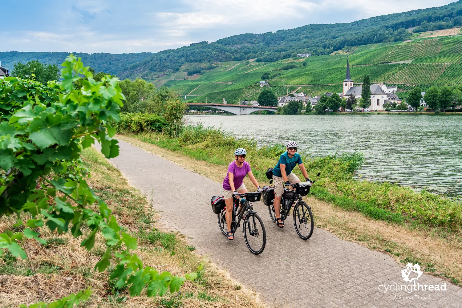
Beyond Neumagen-Dhron, we return to long rows of vines and reach one of the most beautifully situated towns along the Moselle - Piesport. From a cyclist's perspective, its setting is its greatest attraction: a broad river bend, open views across the valley and an almost unbroken stretch of vineyards. The river curves around a peninsula occupied by the town's buildings and extensive vineyards, while steep vine-covered slopes rise above the opposite bank. These are home to the famous Piesporter Goldtröpfchen vineyard, whose name literally means "little drops of gold" and is among the region's best known. Riesling is the main variety grown here, benefiting from the south-facing slopes and slate soils. Another eye-catching feature is the road climbing the valley side, its tight hairpin bends recalling Alpine mountain passes.
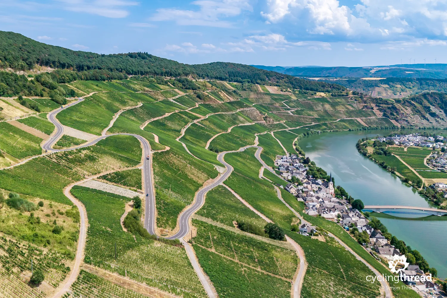
Wine growing in Piesport has a history of almost two thousand years, and its most valuable evidence is the Roman wine press discovered in 1985. The complex, found at the foot of the Goldtröpfchen vineyard, measured 44 metres long and 20 metres wide, making it the largest Roman facility of its kind discovered north of the Alps. Up to 130 people worked here in ancient times, processing huge quantities of grapes harvested on the surrounding slopes. Some of the equipment has been reconstructed, showing how wine was made many centuries ago. Interestingly, during the autumn Römisches Kelterfest, the old press is used to squeeze grapes again. It is a remarkable example of continuity in Moselle wine growing, with today's vineyards occupying the same slopes cultivated by the Romans.
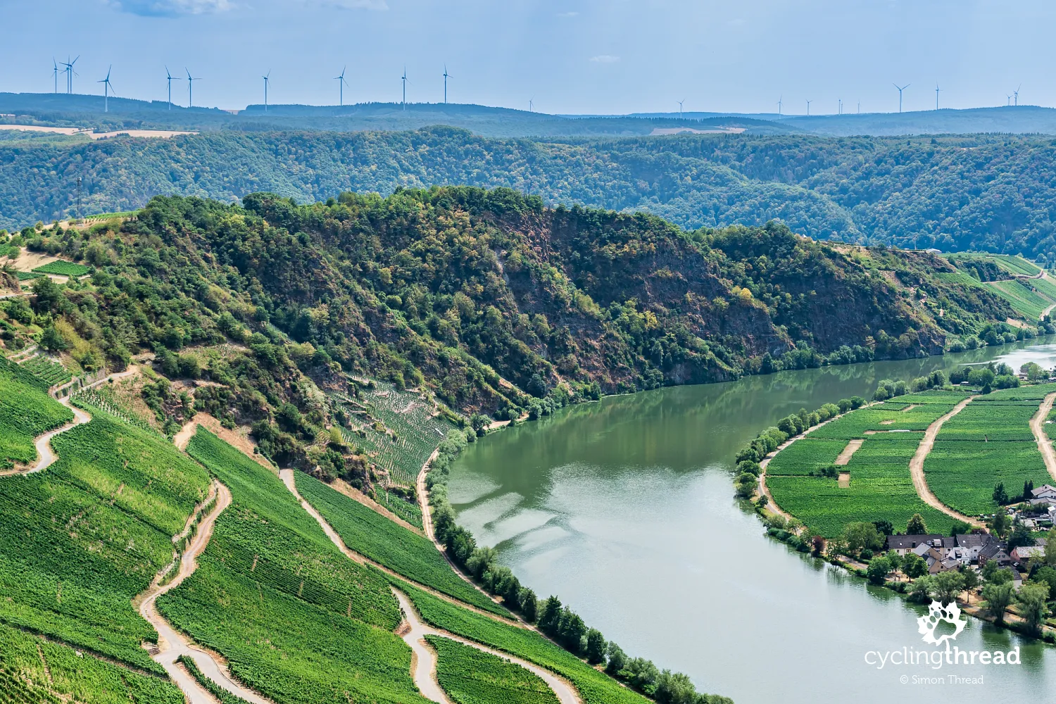
Near Piesport, another striking sight is Moselloreley - a massive rock formation rising almost vertically from the Moselle's left bank, opposite the part of the village known as Reinsport. Its name refers to the famous Loreley rock on the Rhine, and its steep face stands out among the surrounding vineyards. Copper and lead ores were once mined here, and during the Second World War the abandoned mine tunnels sheltered local residents from air raids. Today, they are home to bats. Despite the difficult terrain, vines are still grown on the slopes of Moselloreley, and harvested grapes are transported by boat to the opposite bank. The rocks reach right down to the water, leaving no room for a riverside path, so this part of the valley is best viewed from across the Moselle.
Ripening grapes right beside the path
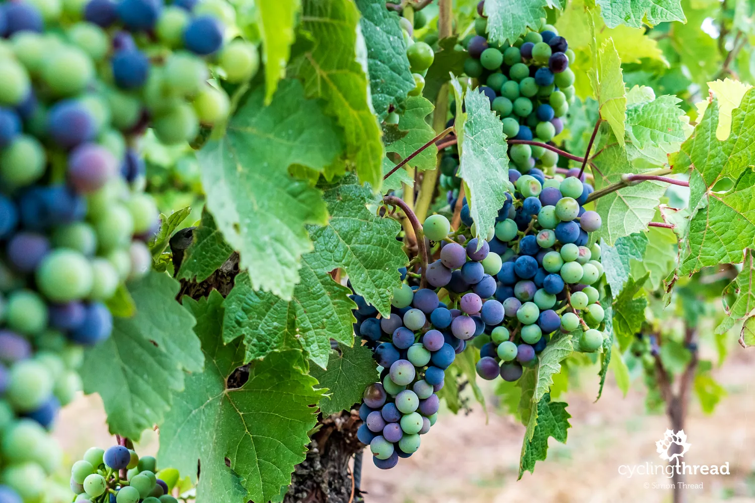
When we travelled along the Moselle in late July and early August, the vineyards were entering the grape-ripening period. Many vines carried multicoloured bunches with berries in shades of green, purple and dark blue, just beginning to develop their final colour. This natural ripening stage is called véraison, when the fruit starts to soften, accumulate sugars and change colour. Although the Moselle is mainly associated with pale Riesling grapes, dark varieties are also grown here, including Spätburgunder, or Pinot Noir. Along the Moselle, vines often grow right beside the path, making it easy to observe their development up close.
Schloss Lieser - a palace across the river
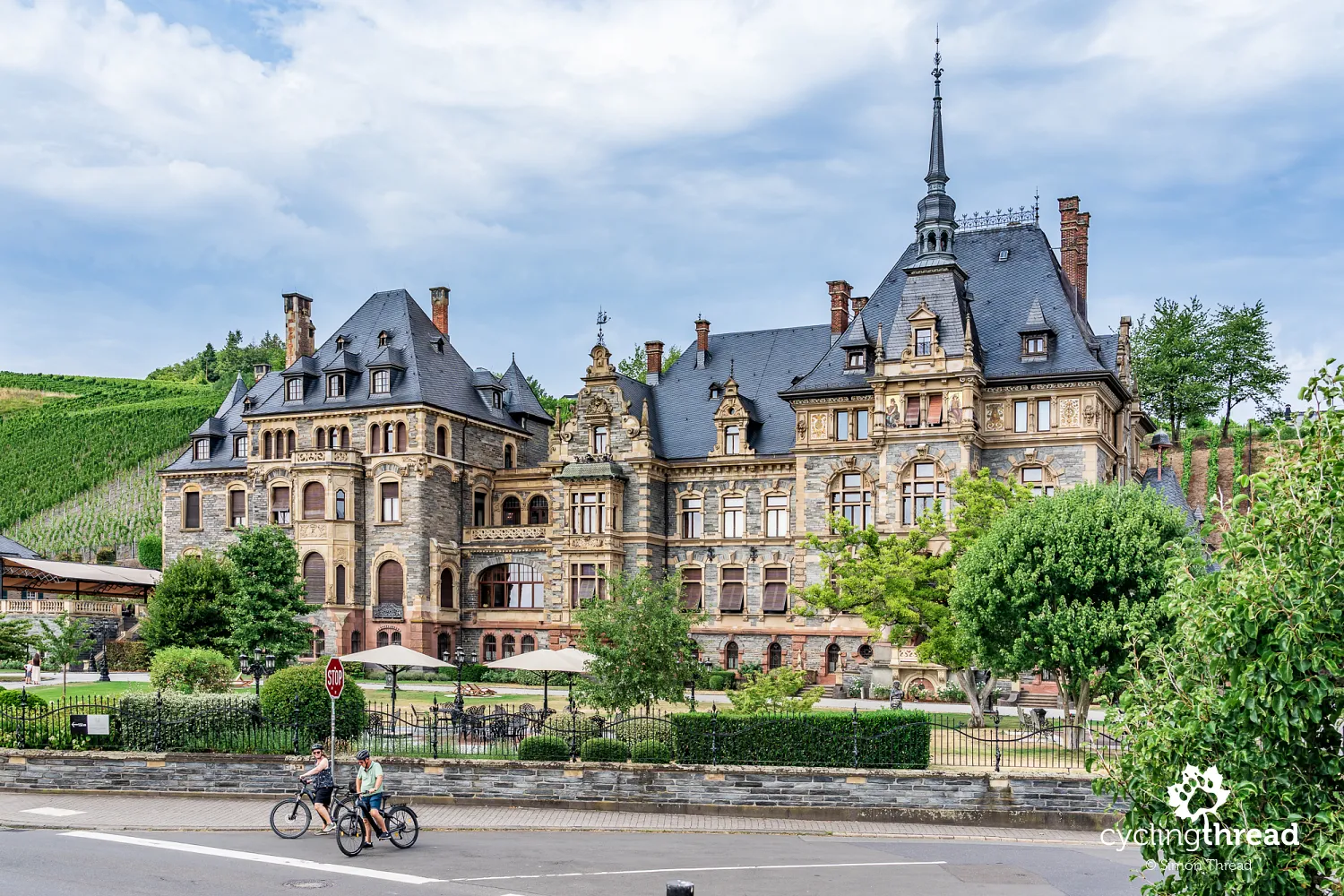
Another place that catches the eye while cycling along the Moselle is Schloss Lieser, an impressive palace almost directly beside the river. Its distinctive outline, with turrets, ornamental gables and a richly decorated façade, is clearly visible from the cycle path on the Moselle's right bank. It is worth crossing the nearby bridge and riding up to the building to examine its architectural details. The palace was built in the late nineteenth century as a grand residence for the wealthy Puricelli family of industrialists, in a style reflecting German historicism. After years of neglect, it was carefully restored and now houses a luxury hotel. In its heyday, its guests included Emperor Wilhelm II, reflecting the high social standing of its former owners.
Bernkastel-Kues - half-timbered houses and the famous Doctor
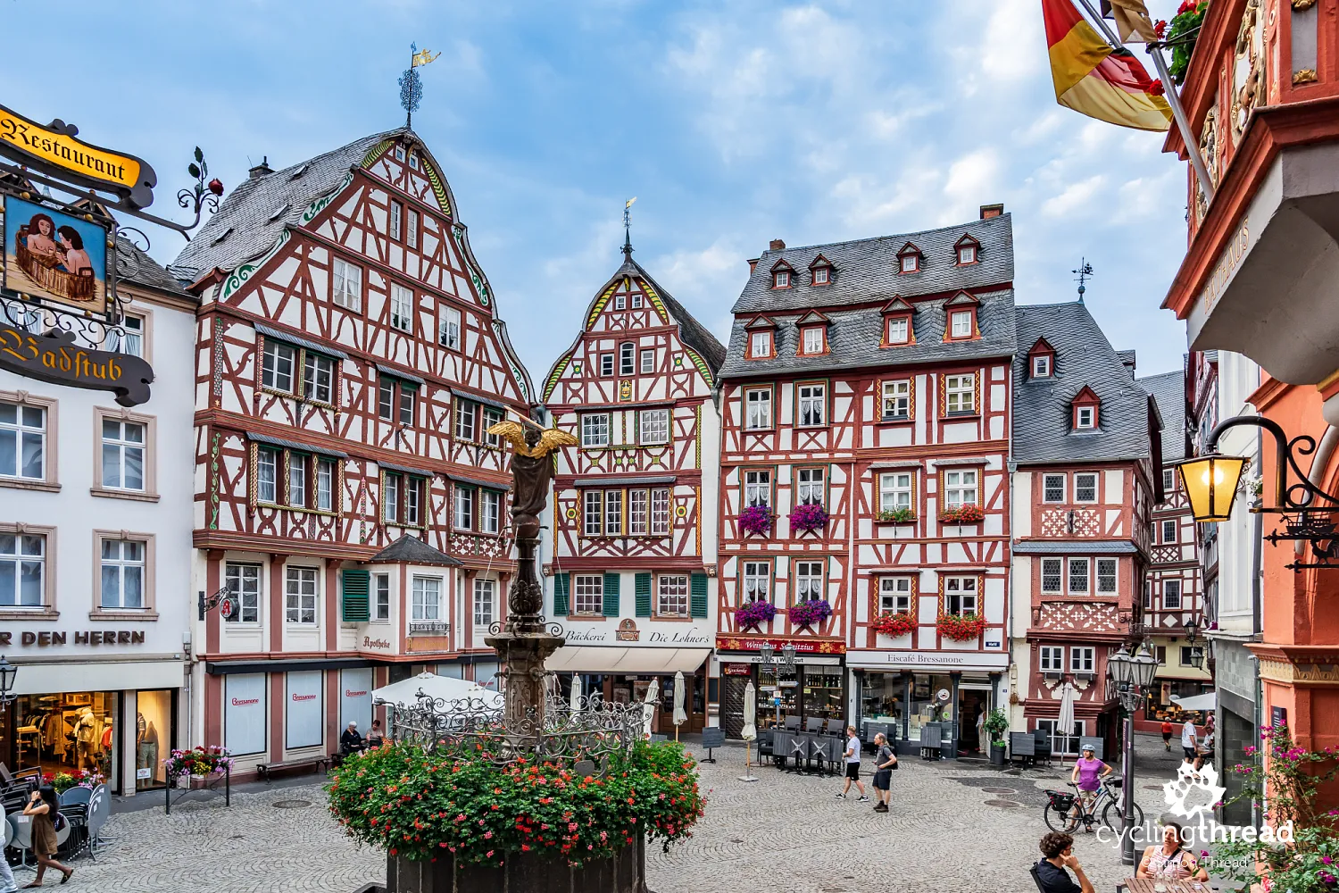
Bernkastel-Kues, which we reached towards the end of the day, is one of the Moselle's best-known and most visited towns. It consists of two historic parts on opposite banks, linked by a bridge offering beautiful views of the buildings, vineyards and ruins of Landshut Castle above the valley. Bernkastel's main attraction, however, is its small old town, hidden behind the first row of waterfront buildings. Leave the main street and explore the side lanes to reach a tiny market square, one of the most picturesque in the entire Moselle Valley. Narrow half-timbered houses, several hundred years old, surround it, with wooden beams, decorative details and upper floors projecting beyond the ground floor. It almost looks like the set of a historical film, although restaurants, cafés and shops still occupy the old buildings.
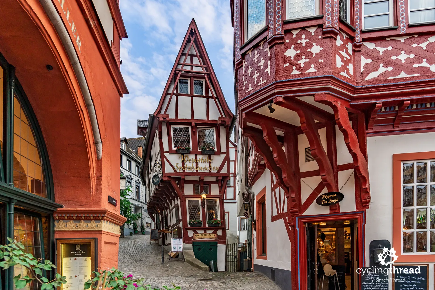
Spitzhäuschen, one of Bernkastel-Kues's symbols, is especially eye-catching and is sometimes called a gingerbread house or a sugar cube. This exceptionally narrow early-fifteenth-century building, tucked into a corner of the square, has a tiny ground floor beneath much wider upper storeys supported by a timber frame. Its proportions seem almost impossible, yet it has stood here for more than six hundred years. Nearby are the Renaissance town hall from the early seventeenth century and the richly decorated façades of neighbouring houses. Bernkastel-Kues is best explored on foot, leaving your bicycle outside the narrowest lanes and taking time to appreciate the architectural details and intimate scale of the historic centre, which is almost invisible from the riverside cycle path.
Above Bernkastel's market square lies one of the Moselle's most famous and prestigious vineyards - Bernkasteler Doctor. It covers only around 3.25 hectares on a steep slope directly above the historic old-town houses. Riesling is the main variety grown here, producing some of Germany's most highly regarded and expensive wines. The vineyard's name is linked to a legend about Boemund II, Archbishop of Trier, who is said to have recovered from illness after drinking the local wine. Grateful for this miraculous cure, he gave it the name Doctor, which survives today. Its small area, favourable sunshine and distinctive slate soils make Bernkasteler Doctor one of the best-known examples of the special importance of individual vineyard sites in German wine growing.
RadBus services help you explore nearby routes
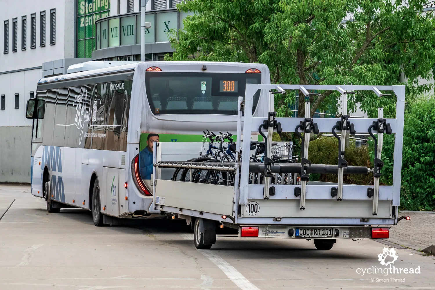
In Bernkastel-Kues, we also noticed a bus with a trailer designed to carry bicycles. This was RadBus Maare-Mosel, service 300, connecting the Moselle Valley with the much higher Eifel region. It runs between Bernkastel-Kues and Daun, allowing cyclists to avoid demanding climbs and start their ride in the uplands. Its trailer holds up to 17 bicycles, with services available throughout the day. Express service 555 follows a similar route and also carries a bicycle trailer. Both are particularly useful for anyone planning to ride Maare-Mosel-Radweg, which leads from the Eifel towards the Moselle Valley, partly along a former railway. These buses form part of a wider network for cyclists in Rhineland-Palatinate, with more than 20 RadBus services covering the Moselle Valley, Eifel, Hunsrück and the Ahr and Ruwer valleys.
Book accommodation along the Moselle in advance
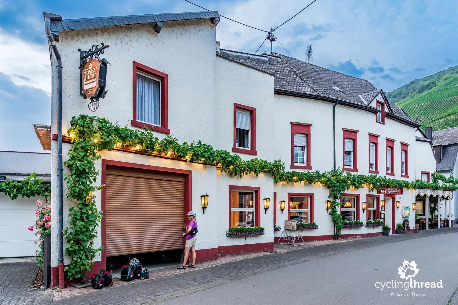
That night, we stayed in what is probably the most common type of accommodation here - a small, apparently family-run guesthouse in Graach an der Mosel, near Bernkastel-Kues. There is a restaurant on the ground floor and a garage for bicycle storage next door, a standard feature at many local properties. This is a good moment to mention the importance of planning a Moselle trip well in advance. The region is a popular European cycling destination, and during summer cyclists compete for available rooms with visitors coming to relax, explore or taste wine. It is therefore worth booking accommodation several months ahead, especially in well-known towns such as Bernkastel-Kues, Traben-Trarbach and Cochem. Booking early also brings better prices and a wider choice of properties offering secure bicycle storage and accepting one-night stays.
A historic wine press hidden in Erden
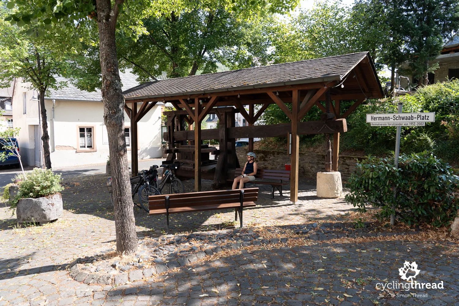
While travelling along the Moselle, it is worth occasionally leaving the main cycle route and following parallel streets through small towns beside it. These short detours can reveal interesting places that are impossible to spot from the riverside path. Erden is a good example, with its Alte Baumkelter, a historic wooden grape press. Its main component is a huge beam that used leverage to press the fruit and extract juice for wine production. Devices of this kind were standard equipment on wine estates for centuries before more modern presses replaced them. The surviving example in Erden recalls the effort once needed to process grapes and shows how deeply wine traditions are rooted in everyday life in the Moselle Valley.
Slate soils in the vineyards near Wolf
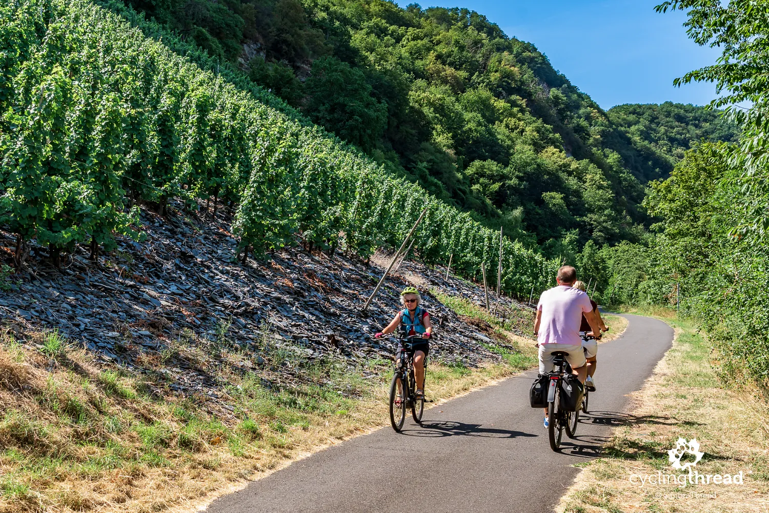
Just before the small settlement of Wolf, a distinctive sight catches our attention - the ground around the vines beside the cycle path is almost entirely covered in small slate fragments. This is a characteristic feature of the Moselle's wine landscape, where slate soils play an important role in growing grapes, particularly Riesling. The dark stones warm up during the day, storing solar energy before gradually releasing heat and reducing the drop in temperature after sunset. A layer of slate fragments can also limit water evaporation from the soil and help protect it against erosion during heavy rain. In many places, slate is a natural part of the ground, but wine growers sometimes also spread it where it does not occur naturally. Beside the path to Wolf, you can examine this up close without climbing the valley's steep slopes.
Traben-Trarbach - a bridge gate and Art Nouveau villas
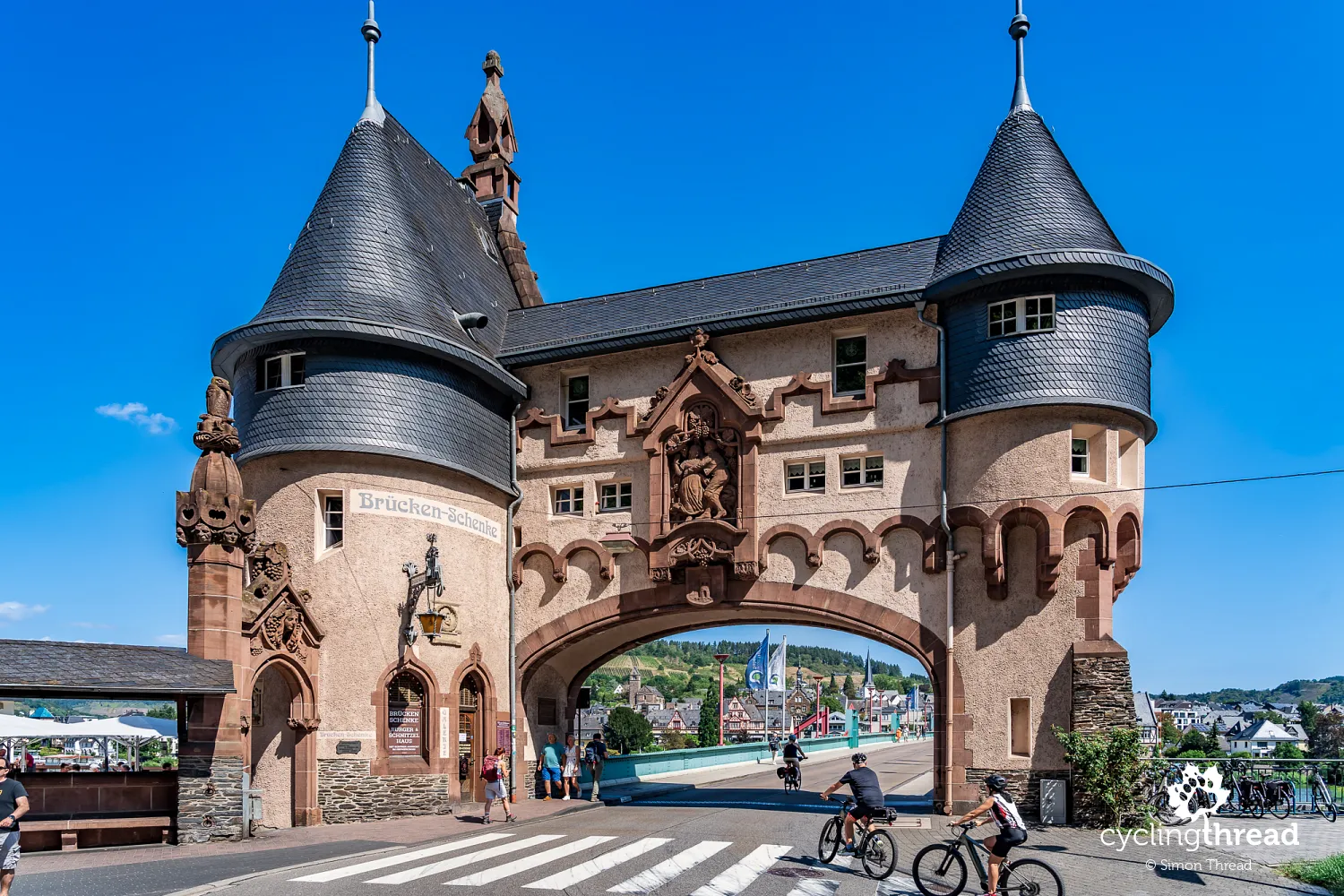
We enter Traben-Trarbach across the Moselle's most distinctive bridge, whose ornamental gateway looks almost like part of a medieval castle. This is Brückentor, built in the early twentieth century to a design by Berlin architect Bruno Möhring, a representative of German Art Nouveau. Two round towers with conical roofs and a richly decorated façade form a monumental entrance to the bridge linking the town's historic parts. Interestingly, the bridge itself was destroyed during the Second World War and later rebuilt, while the distinctive gateway survived. Today, it houses a restaurant, and riding beneath its broad arch is one of the most recognisable moments on Moselle route. Viewing platforms on the bridge also offer good views of the buildings on both banks and the vineyards surrounding the town.
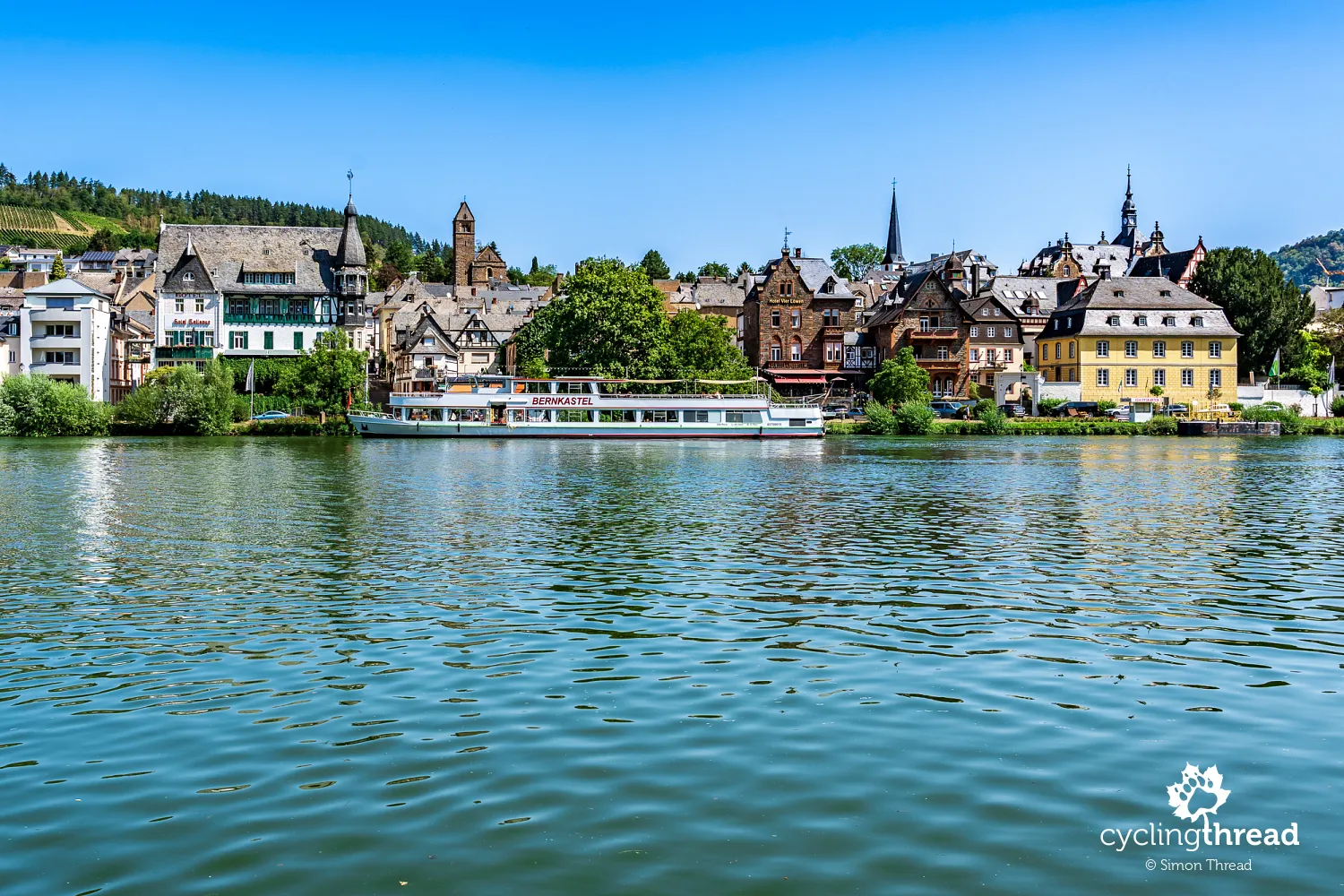
Across the bridge, grand buildings recall Traben-Trarbach's most prosperous period. Around the turn of the twentieth century, the town was one of Europe's most important wine trading centres and, according to frequently repeated accounts, second only to Bordeaux in wine exports. Wealthy merchants and winery owners built impressive villas, hotels and commercial premises here, often in the Art Nouveau style fashionable at the time. The previously mentioned Bruno Möhring was one of the architects who had a particularly strong influence on the town's appearance. His designs feature decorative façades, distinctive roofs and a combination of different building materials. As a result, Traben-Trarbach has a very different character from the small wine towns we passed earlier along the Moselle.
Monorails on the steep vineyard slopes
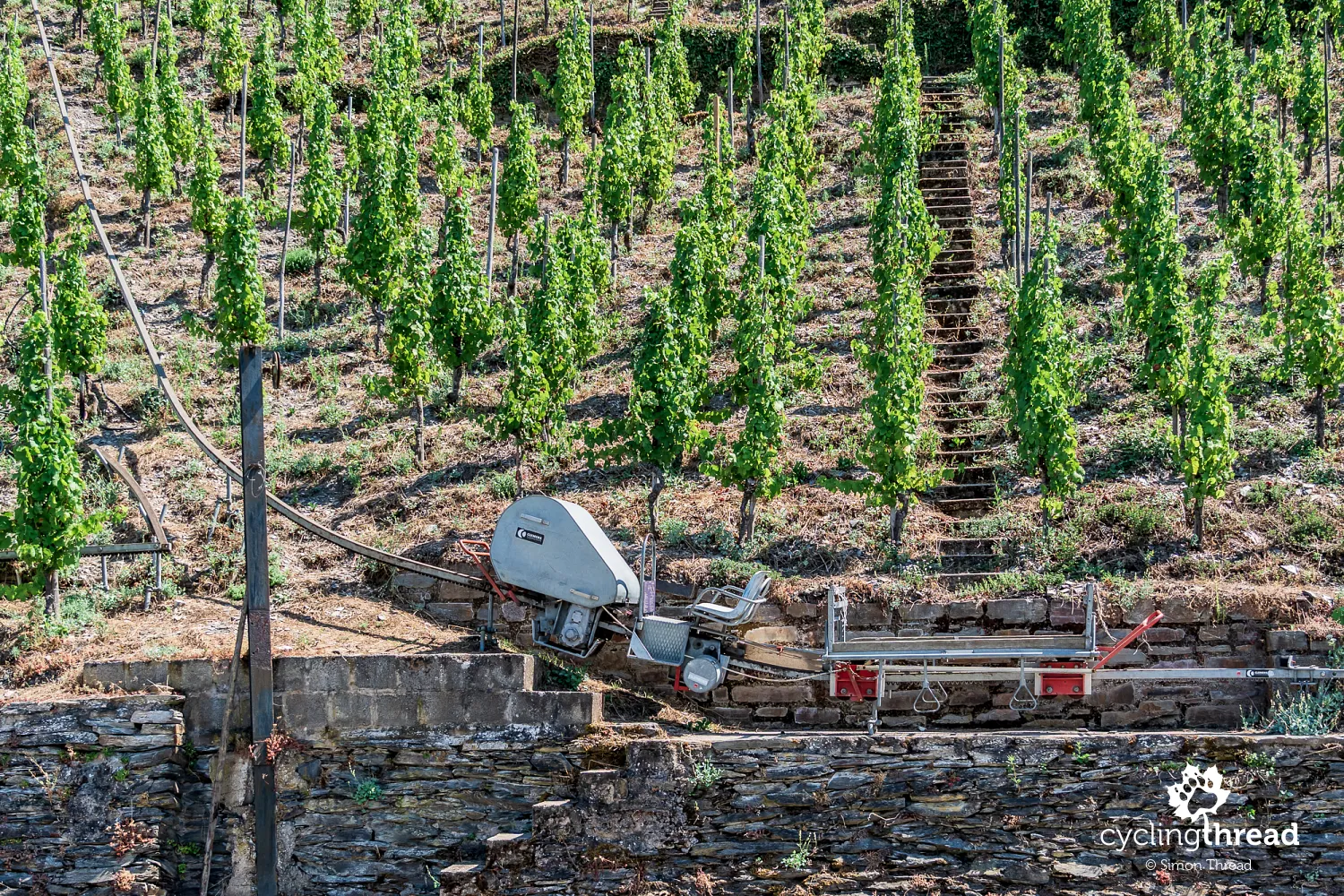
Beyond Traben-Trarbach, some of the Moselle Valley's slopes become so steep that it is hard to believe vines can be regularly cultivated on them. In some vineyards, gradients exceed 60 per cent, making conventional agricultural machinery almost impossible to use. This explains the distinctive monorails, known as Monorackbahnen, whose narrow tracks climb between the rows of vines. These modest-looking systems are among the more interesting examples of technology adapted to the exceptionally difficult conditions of Moselle wine growing. Small vehicles running on a single rail carry workers, tools, crates and harvested grapes. They greatly reduce the effort involved in moving heavy loads up and down steep slopes, although tending the vines and much of the harvesting still require manual work.
Pünderich - railway arches and views of Marienburg
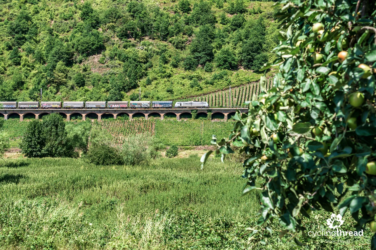
One of the most distinctive structures on the next section of Moselle Cycle Route is the impressive railway viaduct near Pünderich, running along the opposite side of the valley. Pündericher Hangviadukt is around 786 metres long and consists of 92 arches, creating a striking structure against the vine-covered hills. It was built in the 1870s as part of the railway connecting Koblenz with Trier and remains in use today. From the cycle path, the arrangement of stone arches is clearly visible, stretching through the vineyard landscape for almost a kilometre.
In Pünderich, life still follows the rhythm of the river and the surrounding vineyards. Many traditional half-timbered houses, narrow lanes and old wine estates have survived, and the village feels much quieter than popular Bernkastel-Kues or Traben-Trarbach. One of its distinctive features is a small ferry carrying pedestrians and cyclists to the opposite bank of the Moselle. The crossing avoids a detour to the nearest bridge and recalls the time when ferries were the main way of crossing the river. Pünderich's waterfront offers beautiful views of the steep vineyards and the buildings of Marienburg high above the opposite bank.
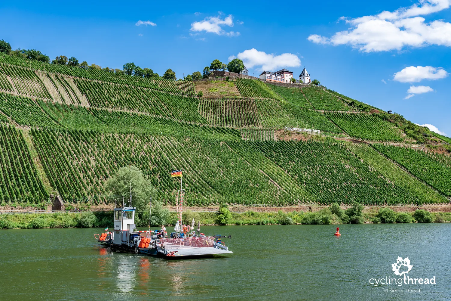
Marienburg above the great Zeller Hamm bend
Marienburg occupies a remarkable position on a narrow ridge around which the Moselle forms the huge bend known as Zeller Hamm. Its history dates back to the Middle Ages, when an Augustinian convent was established here, later converted into a complex serving religious purposes. Today, the most distinctive building is the church, whose pale walls and tower are clearly visible from the valley. Marienburg is best known for its location - from around the buildings, you can see the Moselle on both sides of the hill, along with extensive vineyards and riverside towns. It is one of the region's best-known viewpoints, although reaching it means leaving the riverside cycle path and tackling a noticeable climb.
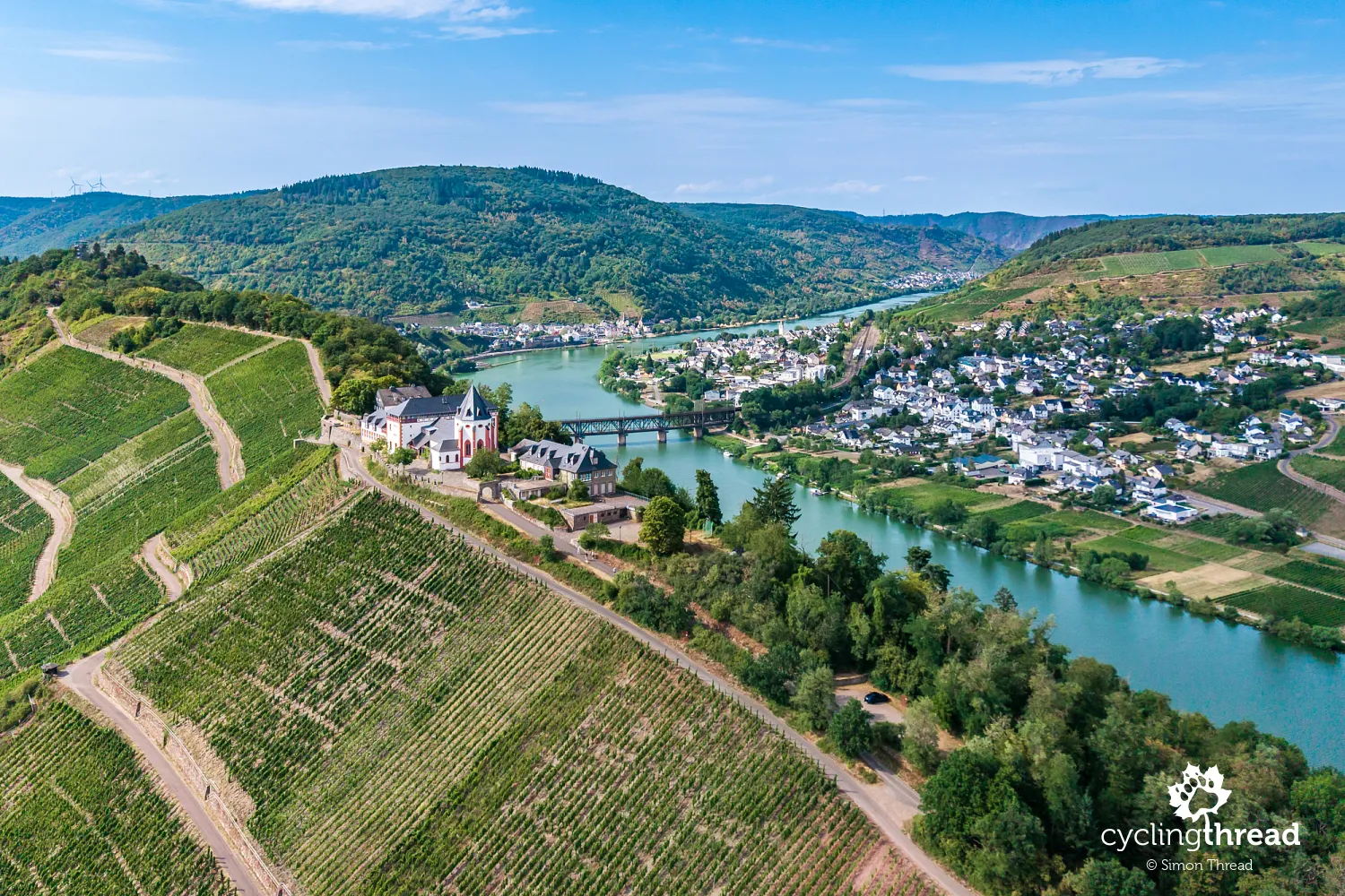
Zeller Hamm is one of the most impressive sections of the entire Mosel-Radweg. Here, the cycle path runs almost at water level, right beside the river as it makes a huge turn around the hill topped by Marienburg. For several kilometres, we ride through remarkable scenery, watching steep vineyard-covered slopes, small towns across the Moselle and boats slowly rounding the bends. The width of the valley and the way the river turns around the vine-covered peninsula are particularly striking. From a bicycle, it is difficult to see the full shape of the bend familiar from photographs taken near Marienburg, but riding right beside the water offers a completely different experience of this landscape.
Zell - a black cat and wine tasting
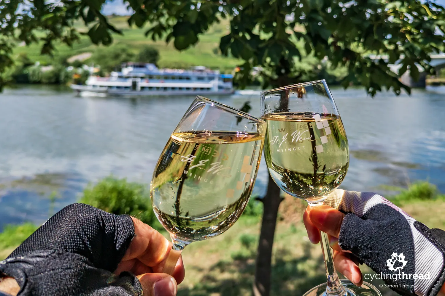
In Zell on the Moselle, we stop at a winery on the edge of town to try the local wine. We choose a table overlooking the river and order two glasses of white wine, which tastes particularly good in these surroundings. Zell is best known for Zeller Schwarze Katz, or "Black Cat", a wine whose name is linked to a local nineteenth-century legend. According to the story, a cat jumped onto one of the barrels prepared for sale and fiercely defended it. The merchants took this as a sign that the barrel contained the best wine. The story soon became popular, and the black cat appeared on labels and winery signs. Finally, we order a glass of strawberry wine, a pleasant change from the Riesling found everywhere along the Moselle.
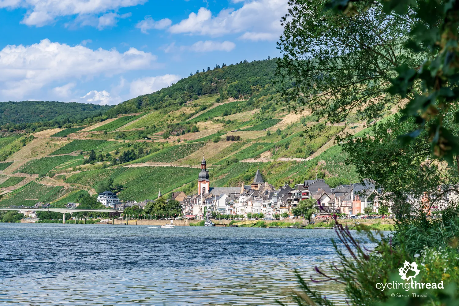
Zell is one of the larger wine centres in the middle Moselle Valley, with a history dating back to Roman times. During the Middle Ages, it developed into an important trading town, and parts of its old fortifications survive, including its distinctive towers. The historic centre occupies a narrow strip between the river and the steep slopes, so the buildings extend along the waterfront. The route crosses to the opposite bank on a footbridge in the town centre, giving us views of the old town and the vineyards rising above its rooftops.
Bullay's double-deck road and railway bridge
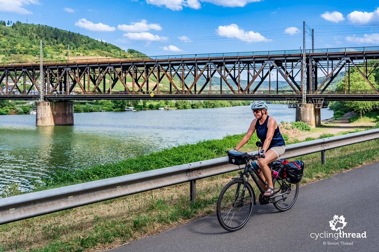
Beyond Zell, we reach Bullay, where one of the route's most unusual bridges crosses the Moselle - Doppelstockbrücke, meaning "double-deck bridge". Its distinctive design carries the railway on the upper level and road traffic on the lower one. The steel structure, supported by substantial piers, is an interesting example of nineteenth-century railway engineering adapted to the Moselle Valley's challenging terrain. It was built in 1877-1878 as part of the Moselle railway connecting Koblenz with Trier and was Germany's first structure of its kind. Destroyed towards the end of the Second World War, it was rebuilt and reopened in 1947.
Bremm, Stuben's ruins and steep Calmont
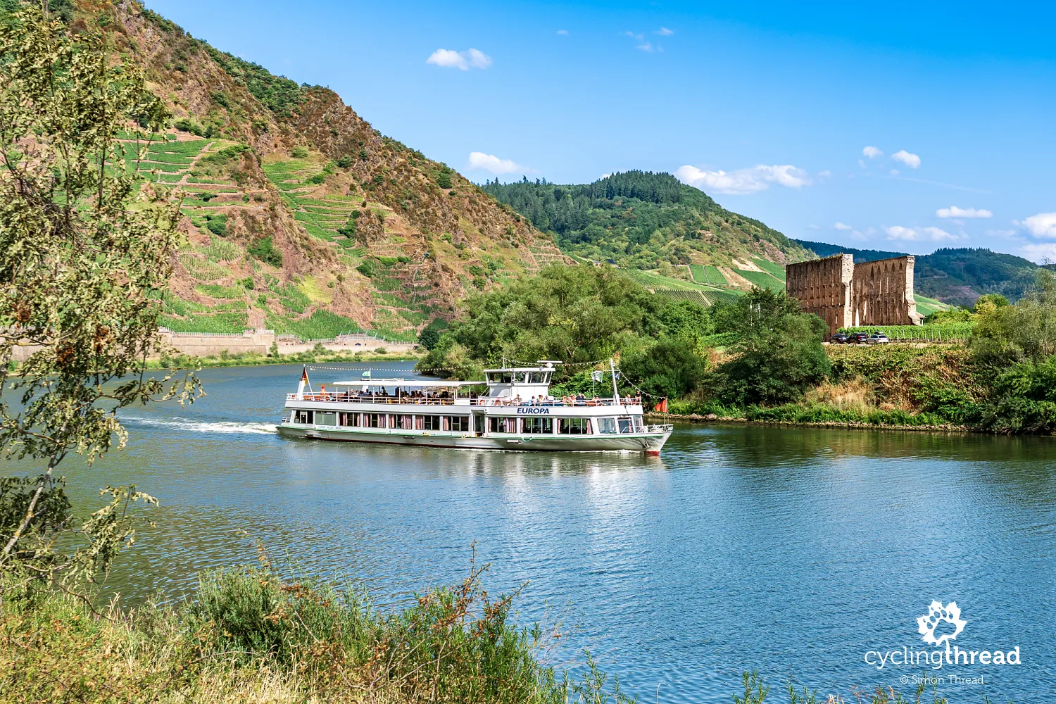
Bremm is a small village with a long history dating back to Roman times. For centuries, its residents' lives were closely linked to wine growing, and wine traditions remain an important part of local identity. Its historic buildings include half-timbered houses, former wine estates and narrow lanes recalling the village's past. One of the area's most interesting monuments is the ruined Stuben convent, on the opposite side of the Moselle bend. This Augustinian convent was founded in the twelfth century, and parts of its Gothic church survive today. The picturesque ruins, surrounded by vineyards, are among the best-known historic sights in this part of the valley.
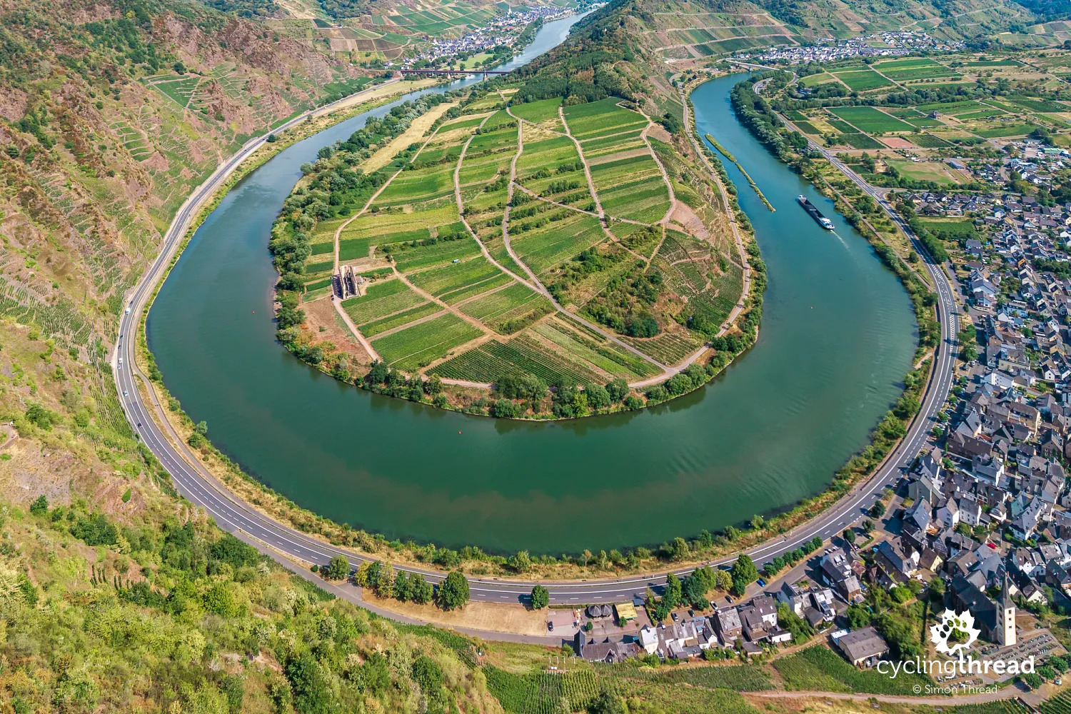
Nearby, the Calmont slope rises above the Moselle and is considered Europe's steepest vineyard. Its gradient reaches around 65 degrees in places, making vine cultivation exceptionally demanding and requiring great care. Riesling is the main variety grown on these steep slopes, where wine growers use narrow paths, terraces and special transport railways to move tools and harvested grapes. The hillside is also crossed by Calmont Klettersteig, a demanding walking route equipped in places with steel cables and ladders, offering a very different perspective on the vineyards. From above, there is one of the best-known views of the Bremmer Hamm bend, often used in photographs promoting the Moselle Valley.
The valley's natural amphitheatre opposite Briedern
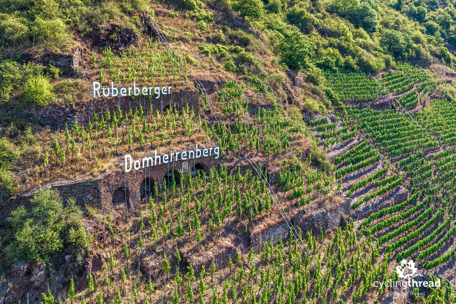
Beyond Bremm, the Moselle takes us around another broad bend, below the Rüberberger Domherrenberg vineyards opposite Briedern. Here, the river forms a broad, almost regular arc, while the high, imposing valley slope resembles the stands of a huge football stadium, with the river taking the place of the pitch. We spend a long time riding beside the same hillside, watching successive vineyards slowly pass by. Across the river are the buildings of Briedern, a small wine village whose history also dates back to the Middle Ages.
What the huge vineyard signs mean
Looking at the Moselle's vineyards, it is hard to miss the huge signs placed directly on the slopes, visible from a considerable distance. Most give the names of vineyard sites, known in Germany as Weinlage, such as Piesporter Goldtröpfchen, Wehlener Sonnenuhr, Ürziger Würzgarten and Bremmer Calmont. These names identify specific growing areas used by several producers, rather than individual wine estates, which are called Weingut. The site names then appear on wine labels, indicating where the grapes were grown. Not every sign has this meaning, however - the slopes also display town names, symbols and slogans linked to local wine traditions. They make it easier to identify the vineyards you pass and connect them with wines you can try in nearby towns.
Beilstein beneath the ruins of Metternich Castle
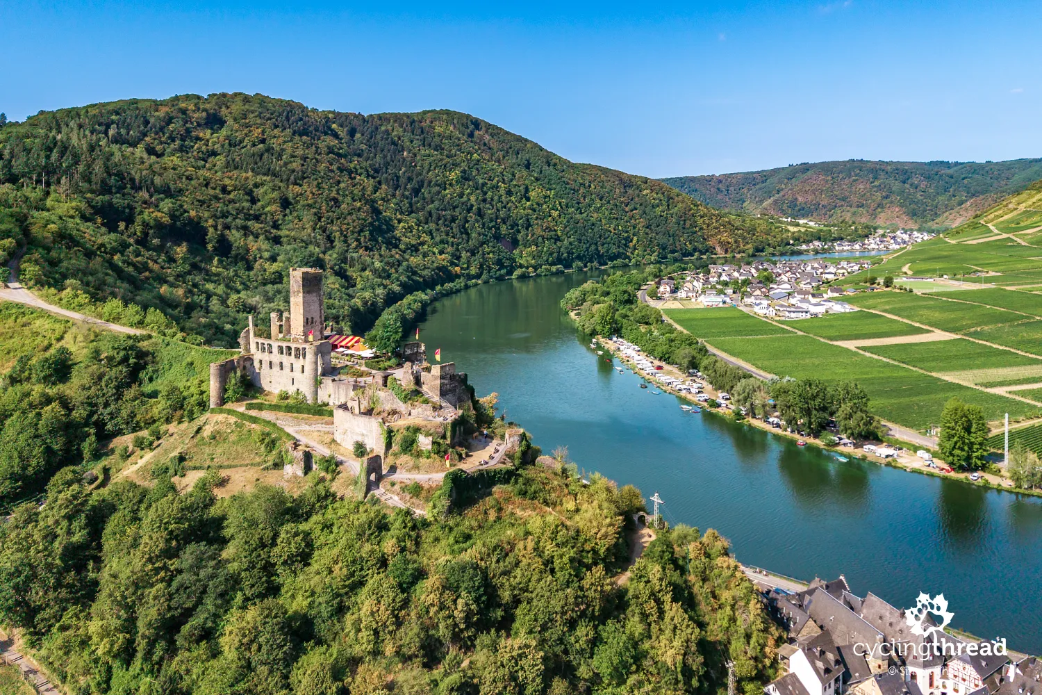
Soon afterwards, Beilstein appears on the opposite, right bank of the Moselle, one of the most romantic small towns in the entire valley. It has preserved an almost medieval layout, with narrow cobbled lanes, half-timbered houses and a small market square surrounded by historic buildings. Its picturesque character has earned it the nickname "Sleeping Beauty of the Moselle", and its buildings have often provided a setting for films. The ruins of Metternich Castle, dating back to the thirteenth century, rise above the rooftops. French troops destroyed the fortress in 1689, and it never regained its former importance. You can cross to Beilstein on a ferry that also carries bicycles, then explore the town on foot and climb the castle tower for views of the Moselle and surrounding vineyards.
Cochem - a romantic castle above the old town
Our next stop is beautiful Cochem, one of the best-known and most visited towns along the Moselle. It gave us one of the most beautiful scenes we remember from the whole journey. Above the town stands Reichsburg Cochem, a monumental castle on a hill around 100 metres above the river. Its origins date back to the eleventh century, when it served as an important defensive site and controlled shipping on the Moselle. In 1689, French troops destroyed it during the War of the Palatine Succession, and it remained a ruin for almost two centuries. In the nineteenth century, Berlin businessman Louis Ravené bought the remains and rebuilt the castle in a romantic Gothic Revival style, following contemporary ideas of medieval castles. Today's Reichsburg is therefore largely the work of nineteenth-century architects rather than a faithful reconstruction of the original fortress. Guided tours explore its richly furnished interiors and the history of its successive owners.
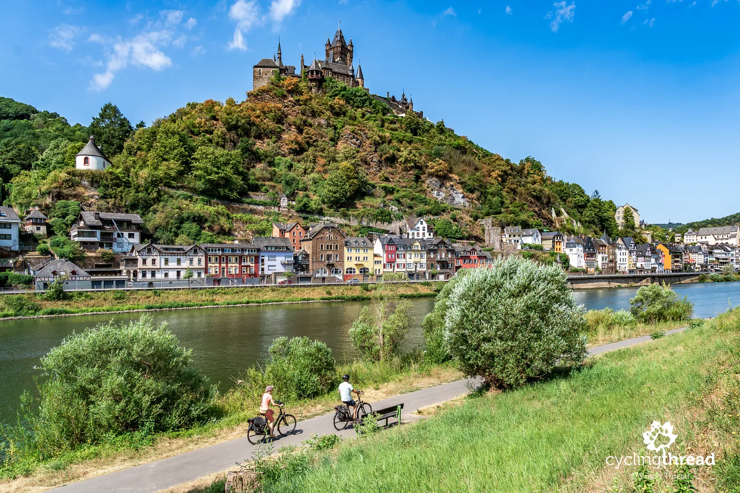
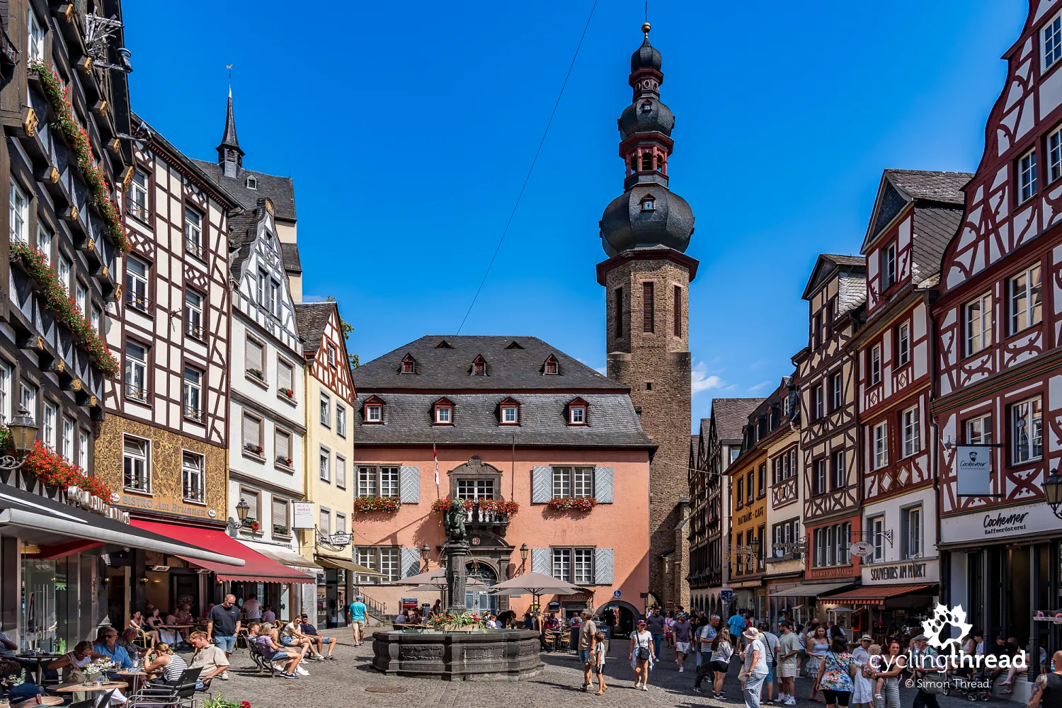
Cochem's historic centre spreads below the castle hill, with narrow streets, colourful half-timbered houses and a small market square. Its most distinctive building is the eighteenth-century Baroque town hall, while the houses surrounding the square create one of the Moselle's most recognisable views. Look out too for the surviving sections of medieval town walls and old gates, including Enderttor, recalling the days when Cochem was fortified. Another unusual attraction is Bundesbank-Bunker, a former secret bunker belonging to Germany's central bank, where reserve banknotes were stored during the Cold War in case of an economic crisis. It is now open to visitors. Cochem is also one of the Moselle's main tourist centres, so its streets, restaurants and riverside promenade attract considerably more visitors than the smaller towns along the route, especially in summer.
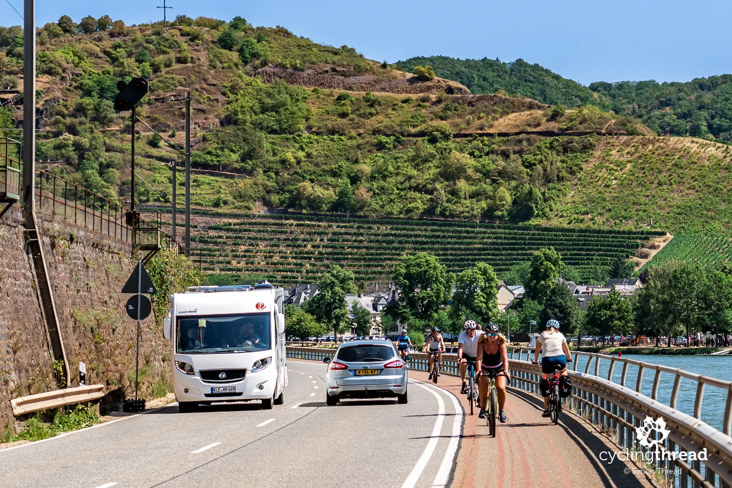
A less safe section beyond Cochem
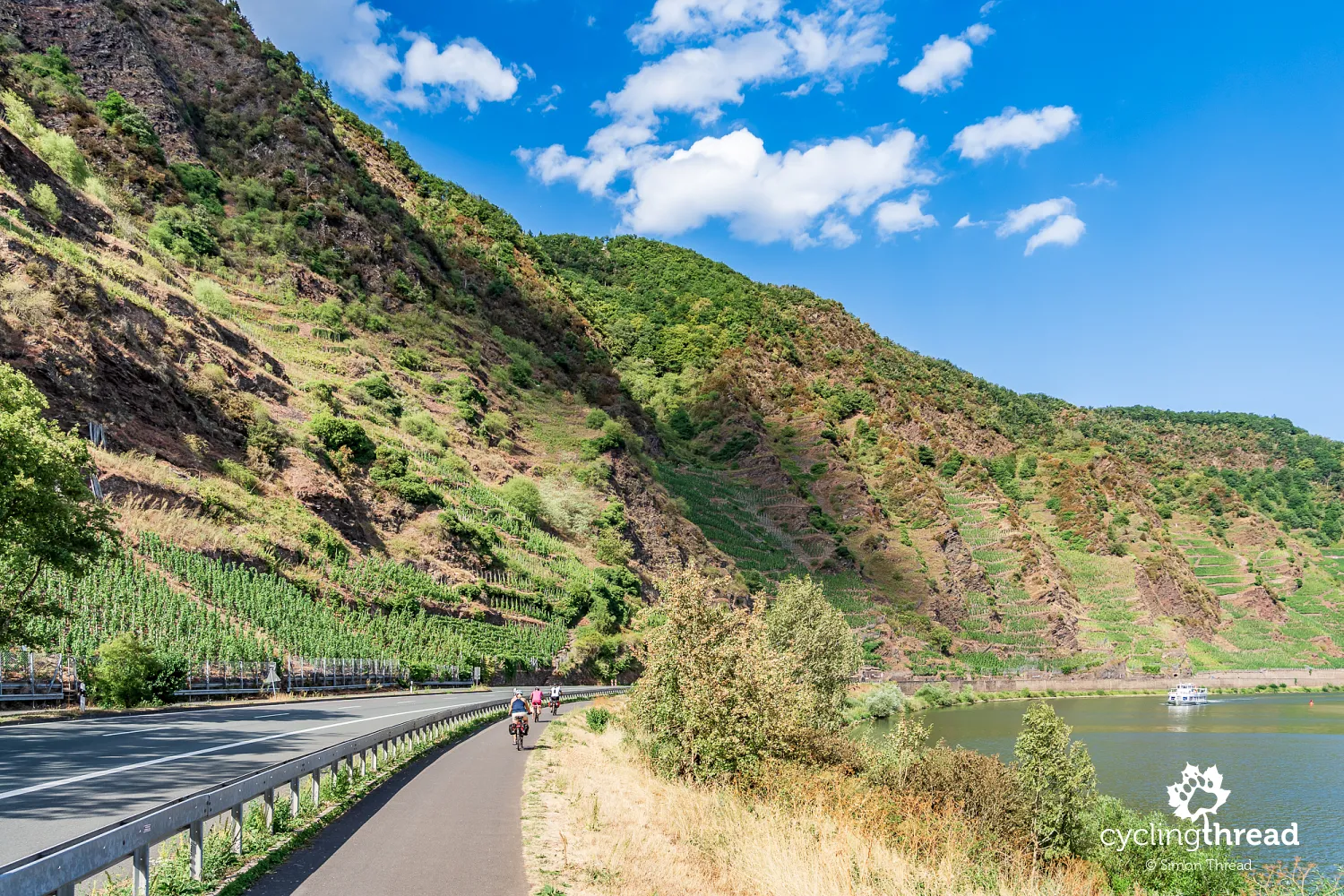
A few minutes after leaving Cochem, we encounter a layout that, for the first time, surprises us by contrasting with the comfortable conditions we have enjoyed so far on Moselle route. This is a two-way cycle path directly beside the road, with no physical separation from the fast-moving cars alongside it. In a situation like the one in the photograph, where cars travelling in both directions meet cyclists riding both with and against the flow of traffic in a relatively narrow space, it is difficult to feel comfortable or completely safe. Warning cones have also been placed at several points, further reducing the width available to cyclists. It may be a temporary arrangement, but it compares poorly with the high standard of the rest of the route.
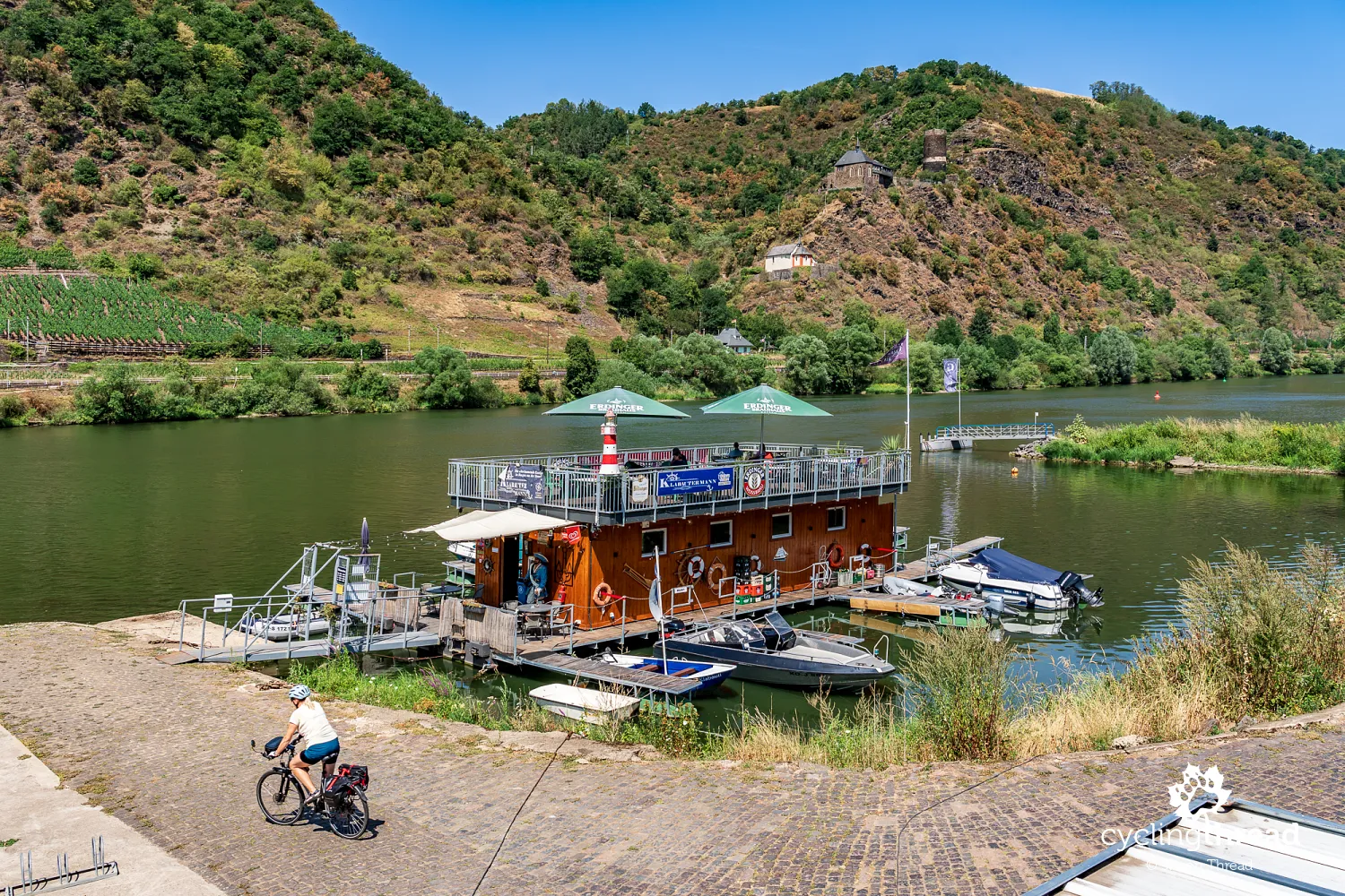
A floating bar overlooking Bischofstein
A stop for drinks at a rather unusual bar makes a pleasant break from cycling along the Moselle. Instead of a traditional riverside garden, we find a floating venue on a wooden barge, with a roof terrace, parasols and a small motorboat marina. We take a seat overlooking the Moselle, with boats and ships passing from time to time. Across the river, on a steep rocky slope, stands Burg Bischofstein, a medieval castle with a distinctive round tower. Built in the thirteenth century, it was destroyed by French troops in 1689 and rebuilt in the 1930s. Today, the castle serves as a holiday centre and is not open for regular sightseeing visits.
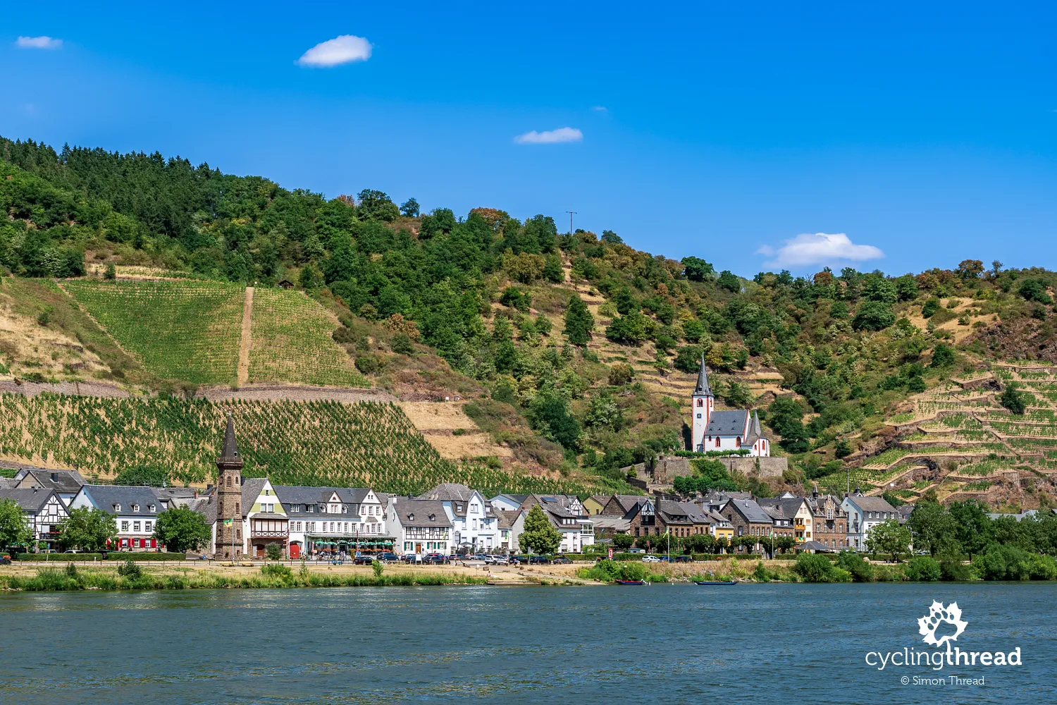
Hatzenport - a church among terraced vineyards
We change sides of the river and soon see Hatzenport on the opposite bank - another small wine village whose buildings stretch along the Moselle. Its most distinctive monument is the old Church of St John (St. Johann), standing on the slope among vineyards, slightly above the village centre. Its slender tower stands out clearly against the surrounding rows of vines, creating one of the most recognisable views in this part of the valley. Hatzenport is also known for its terraced vineyards, particularly Hatzenporter Stolzenberg. Stone walls supporting the terraces survive on the steep slopes, reflecting centuries of work by local wine growers.
Alken and Thurant Castle's two towers
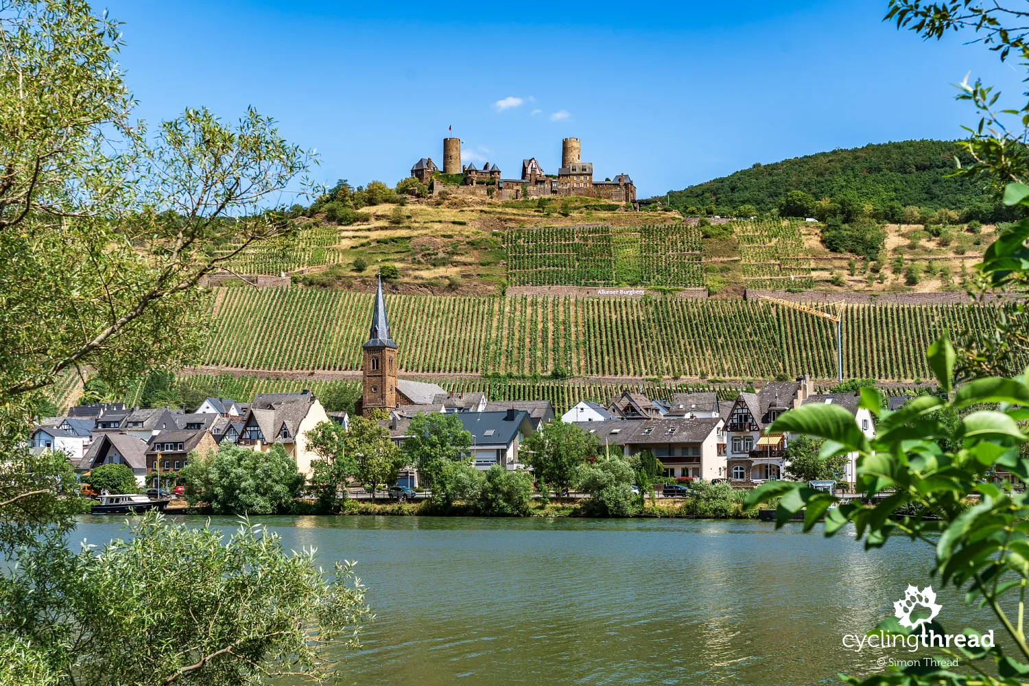
After another crossing of the Moselle, we are delighted once again. This time it is Alken, a wine village overlooked by picturesque Thurant Castle, that catches our attention. The fortress was built in the early thirteenth century and is one of the oldest castles along the Moselle. Its distinctive feature is its two towers, surviving from the time when the castle was divided between the archbishops of Trier and Cologne. Each side had its own buildings, courtyard and defences, making this a rather unusual fortress. Burg Thurant is now privately owned, but part of it is open to visitors, including gardens, courtyards and viewpoints. Below the hill lies historic Alken, with narrow lanes, half-timbered houses and remains of medieval town walls. It is one of the most picturesque views on the final section of Moselle Cycle Route.
Kobern-Gondorf - a useful warning and a market square break
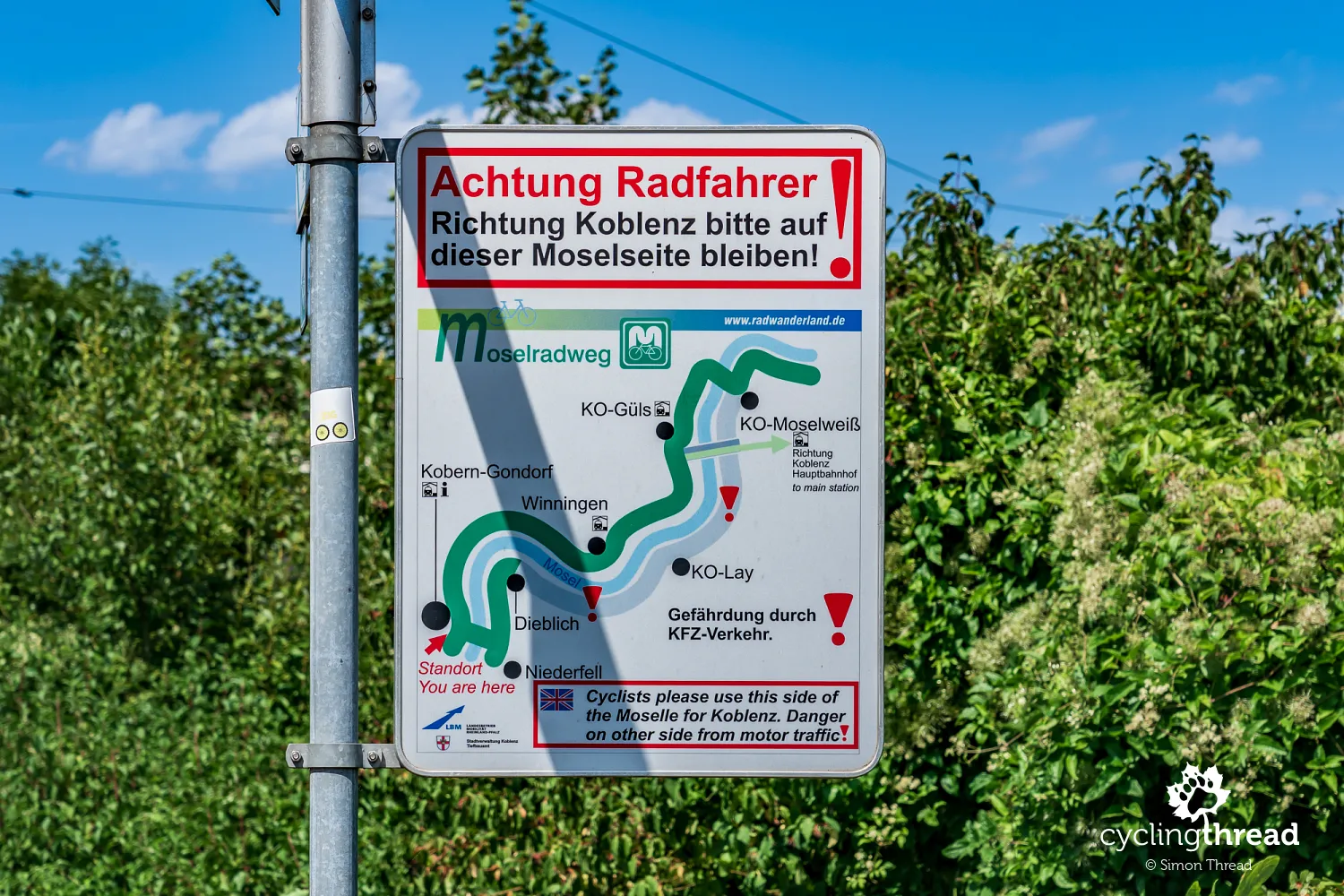
Entering Kobern-Gondorf, we noticed an information board beneath the cycle signposts drawing attention to a potentially dangerous section before Koblenz. It warned cyclists against using the route on the opposite bank of the Moselle, where motor traffic presents a greater risk. A simple map showed the recommended route and places requiring particular care. This is a good example of communicating with cyclists through information about local problems and hazards as well as standard directional signs. Such measures are especially valuable on long-distance tourist routes used by people unfamiliar with local conditions. They also show that looking after safety can involve clear, reliable information as well as building infrastructure.
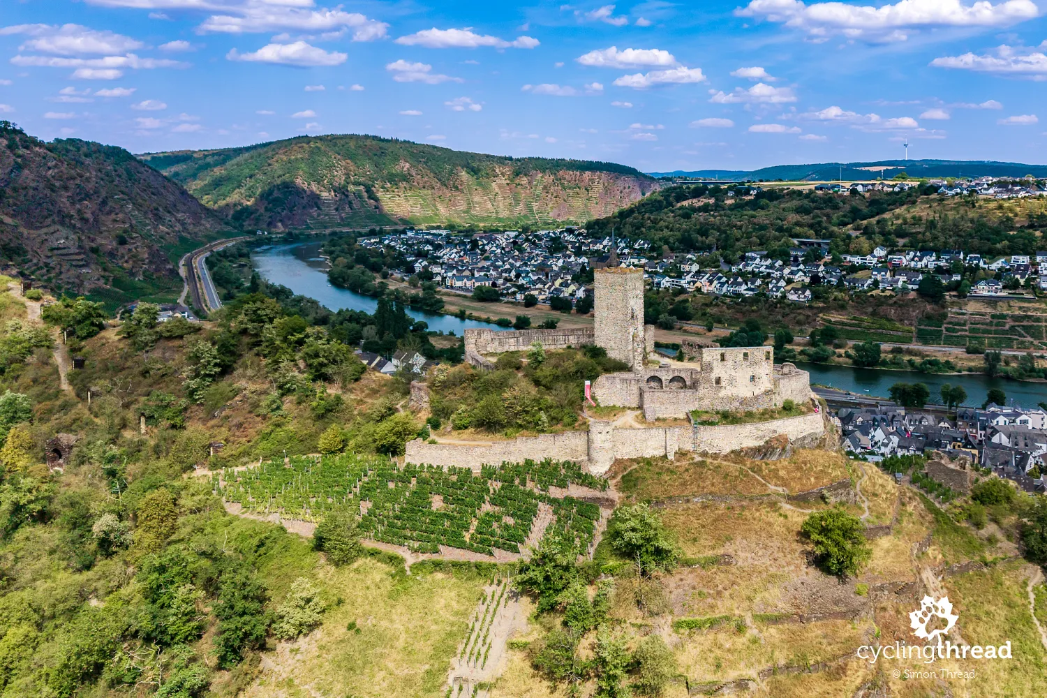
We stop again in Kobern-Gondorf, this time for a meal in the intimate surroundings of the small market square in historic Kobern. Traditional houses and historic buildings surround the square, while restaurant tables offer a chance to rest from cycling. Above the village stand the ruins of Niederburg Kobern, a twelfth-century castle that once guarded the Moselle Valley. Parts of its defensive walls and a distinctive tower survive, visible from many places nearby. Higher still are the remains of a second fortress, Oberburg, and St Matthias' Chapel (Matthiaskapelle), built in the thirteenth century on a hexagonal plan.
The last vineyards around Winningen
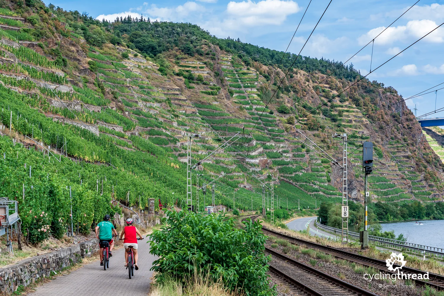
Over the next few kilometres, we slowly say goodbye to the vineyard scenery that has accompanied us almost continuously since Trier. Around Winningen, we pass the last extensive vineyards covering the steep slopes above the Moselle. The village itself is one of the region's oldest wine centres, known for terraced vineyards whose stone walls have held the soil on steep slopes for generations. Further on, the valley gradually widens, with more buildings, roads and urban infrastructure appearing. Koblenz, where our cycling journey along the Moselle will end, feels increasingly close. Before reaching the river's confluence with the Rhine, however, we look back several more times at the last vineyards and the valley's distinctive slopes.
Koblenz - where the Moselle meets the Rhine
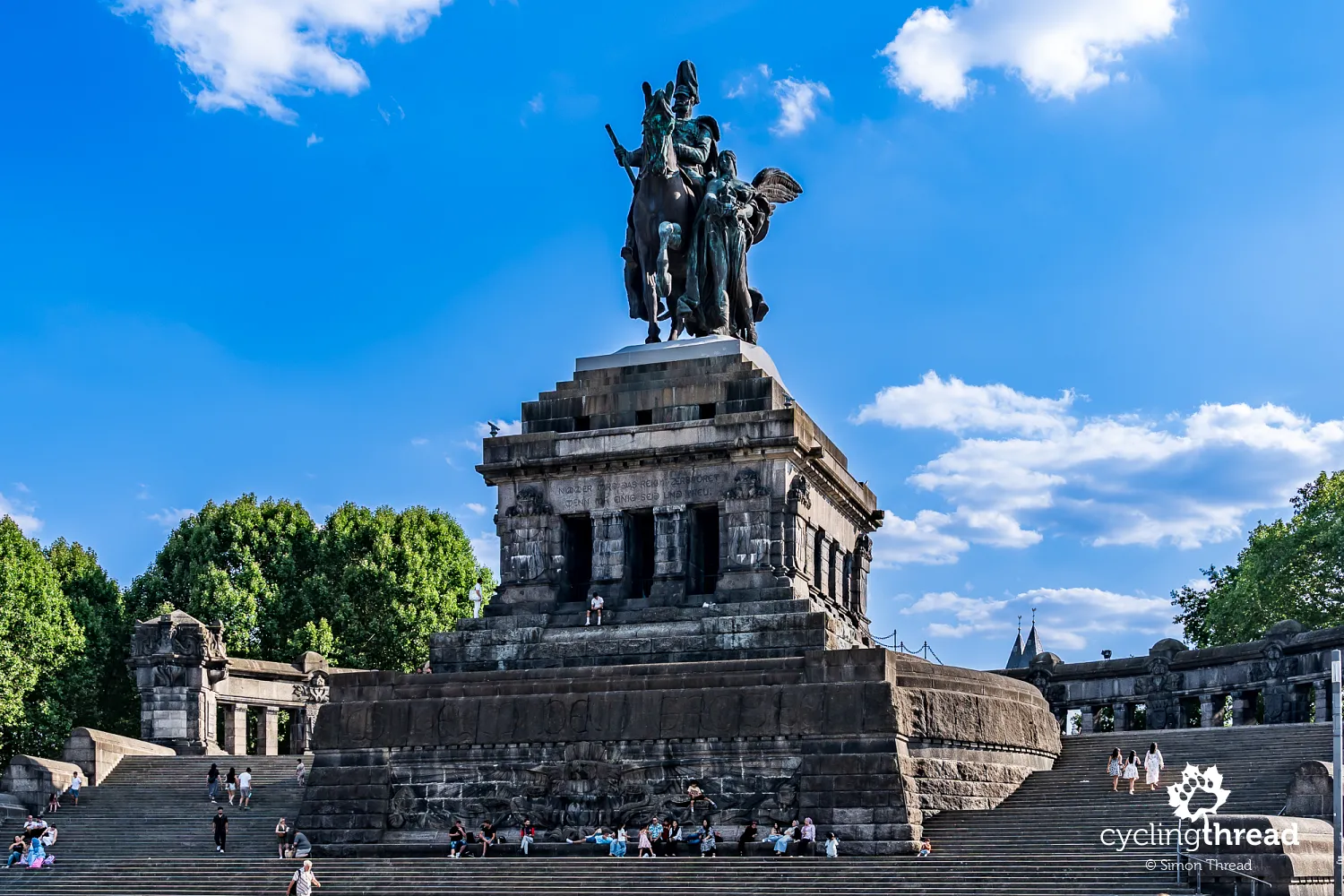
Koblenz is the final city on Moselle Cycle Route and the place where the river ends its journey by flowing into the Rhine. This is the location of Deutsches Eck, or "German Corner", a distinctive headland separating the two rivers and one of the city's best-known sights. A monumental equestrian statue of Emperor Wilhelm I stands above the broad square. Including its base, the monument is around 37 metres high and was created in the late nineteenth century as a symbol of German unification. Destroyed during the Second World War, it was not rebuilt until 1993. Today, Deutsches Eck is a popular place for walks and meetings, and a natural finishing point for cyclists completing their journey along the Moselle.
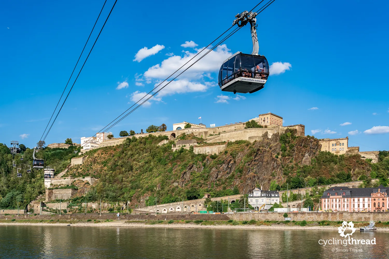
Across the Rhine, high above the river, stands Ehrenbreitstein Fortress, one of Europe's largest surviving fortification complexes. Its present form dates mainly from the nineteenth century, when the Prussians expanded the fortifications as part of Koblenz's defensive system. A cable car crosses the Rhine to the fortress, linking the area near Deutsches Eck with the hill on the opposite bank. The ride provides broad views of the Moselle's mouth, central Koblenz and the surrounding hills. The fortress houses historical exhibitions and museum collections, while Ludwig Museum near Deutsches Eck presents contemporary art, particularly works by French artists. The area around the Moselle's mouth therefore combines the city's major historic attractions with its cultural offer.
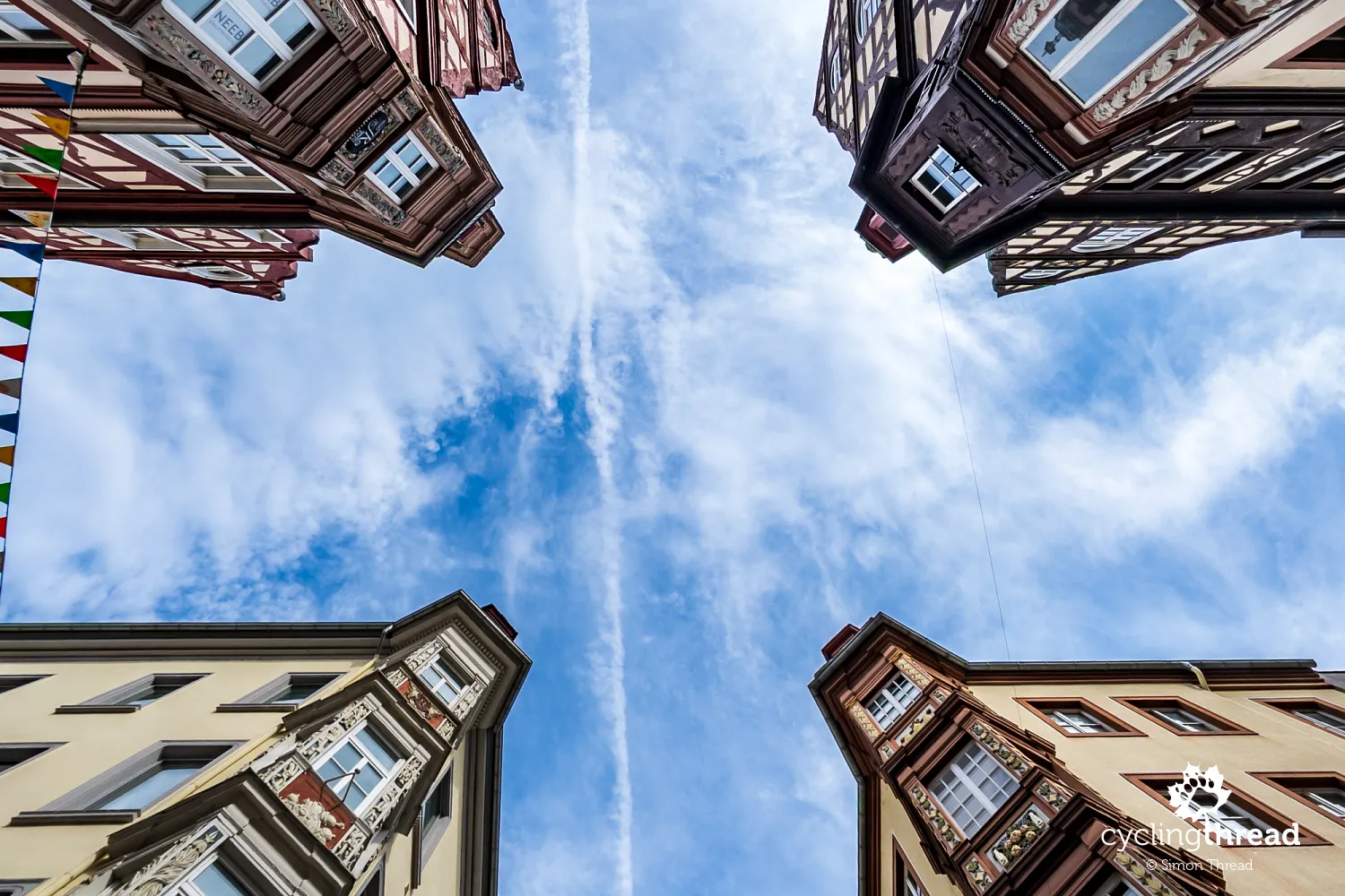
A walk through central Koblenz shows that, despite more than two thousand years of history, the city has not preserved the consistently historic character of many smaller towns along the Moselle. This is mainly due to destruction during the Second World War, when Allied bombing reduced much of the city to ruins. A memorial board showing a photograph of the devastated city recalls the scale of the disaster and allows a comparison with today's streets. Many buildings were replaced in the following decades, so historic churches, squares and individual houses now stand beside post-war architecture. The old town is still worth exploring, including Jesuitenplatz and Florinsmarkt, along with the junction of Am Plan, Marktstraße, Löhrstraße and Altengraben, known as Vier Türme, or "Four Towers". Its name comes from four corner buildings decorated with striking oriel windows, creating one of historic Koblenz's most distinctive views.
A bicycle lift in our Koblenz hotel
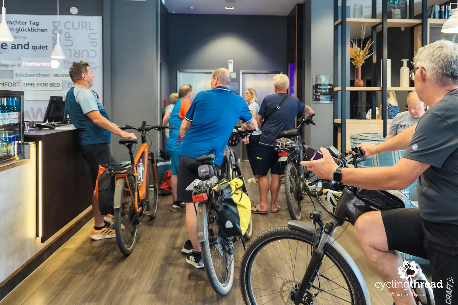
At our hotel in Koblenz, the bicycle symbol among the lift's floor buttons made us smile. We had never seen a cycling facility marked in this way before. A secure, lockable bicycle storage room awaited on the indicated level, while a small queue of cyclists at reception also showed the hotel's popularity with touring cyclists. Details like these show that a welcoming approach to cyclists does not always require major investment - sometimes thoughtful use of space and clear signs are enough. It is no surprise that the hotel lift later featured in our collection of cyclist-friendly hotels and interesting ideas for cycling tourism.
Campsites as an alternative to hotels
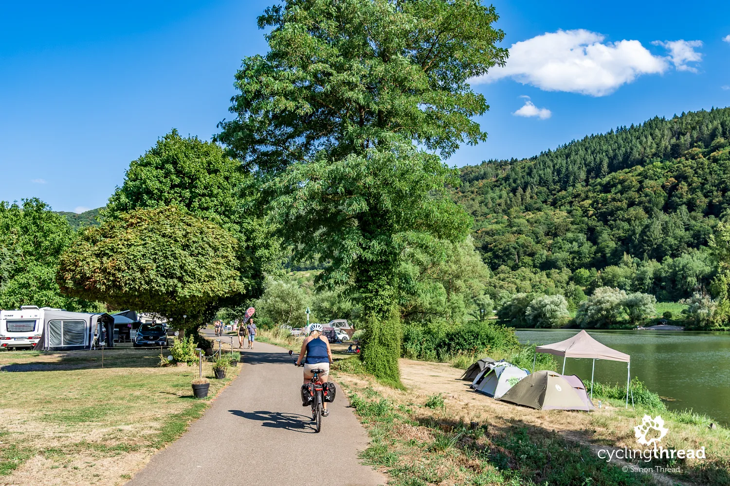
There is a very wide choice of accommodation throughout the Moselle Valley. You can stay in luxury hotels, mid-range properties, small family guesthouses or numerous campsites. The campsites are particularly noticeable while riding, as many lie directly beside the river and the cycle path often crosses their grounds. From the saddle, we mainly see motorhomes and caravans, which account for much of their business. However, there are also places welcoming visitors with their own tents, making campsites an interesting alternative for cyclists planning a more independent and budget-friendly journey along the Moselle.
Returning by train from Koblenz to Trier
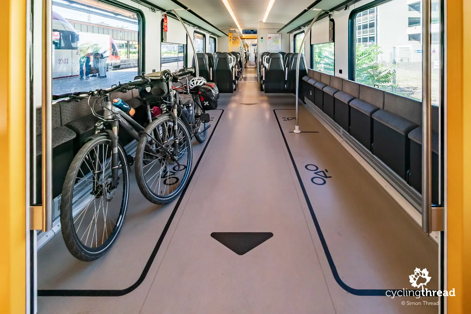
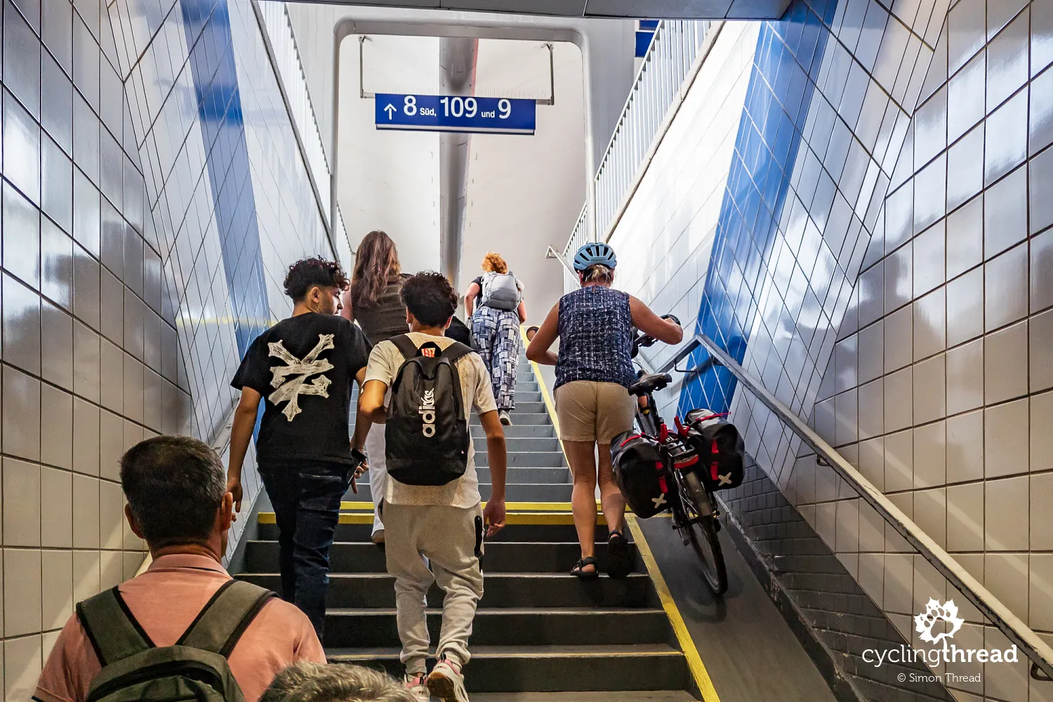
At the end, we still had to return to Trier and our parked car. Far from being an unwelcome necessity, this became one final attraction of our stay in the Moselle region. For long stretches, the train followed the river through towns we had visited and familiar landscapes, reminding us of the wonderful time we had spent on Moselle route. Under the fare rules in Rhineland-Palatinate, bicycles travel free on regional trains after 9 am from Monday to Friday and all day on weekends and public holidays. At the station, we also noticed a wide space beside the steps to the platforms for wheeling bicycles - a simple facility that is still far from common. Together with trains providing bicycle spaces clearly marked by large symbols on the carriages, details like this completed the picture of rail as a natural partner to cycling tourism along the Moselle.
Our impressions of Moselle Cycle Route
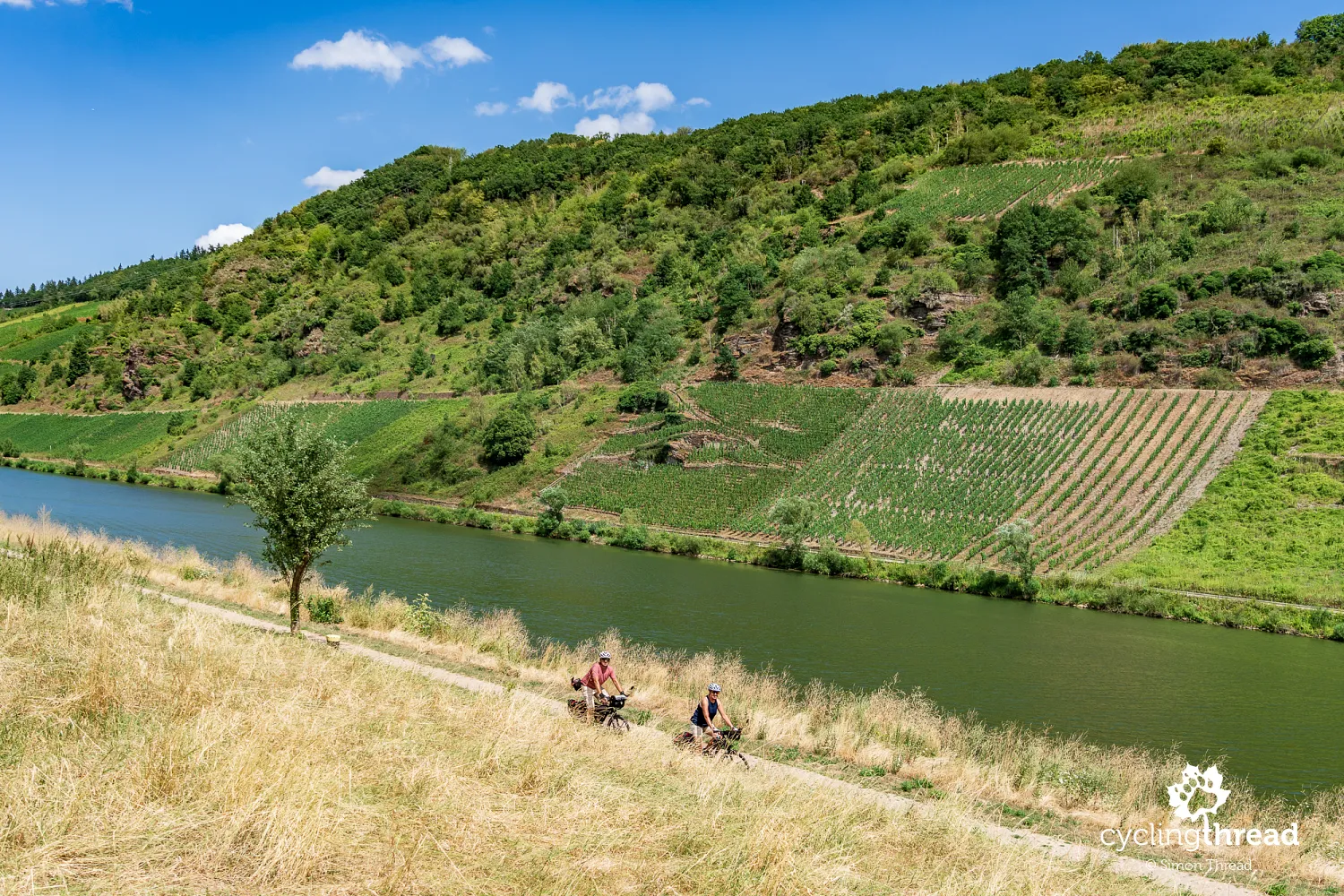
Moselle Cycle Route is one of those routes where lasting memories come from both comfortable riding and the remarkable surroundings that accompany cyclists for almost the entire journey. Picturesque river bends, steep vineyard-covered slopes, medieval castles and small towns create varied scenery that changes almost around every corner. Cycling infrastructure is another major strength - for the vast majority of the route, you ride on comfortable paths separated from motor traffic. Asphalt dominates, although many sections also have rather old paving blocks. The surfaces are well maintained, however, and the few arrangements that raise concerns do little to affect our very positive overall assessment.
What we took away from Mosel-Radweg above all was a sense of exceptional continuity. It had been a long time since we had ridden a route where successive cycle path sections joined together so smoothly. There is no constant need to work out where to go, look for the route's continuation across the street or adjust your riding to suddenly changing conditions. Routes through towns, junctions and connections with local roads are generally intuitive, allowing a relaxed rhythm and more time to enjoy the surroundings. We later experienced a similar sense of continuity and predictability while cycling along the Meuse in Belgium.
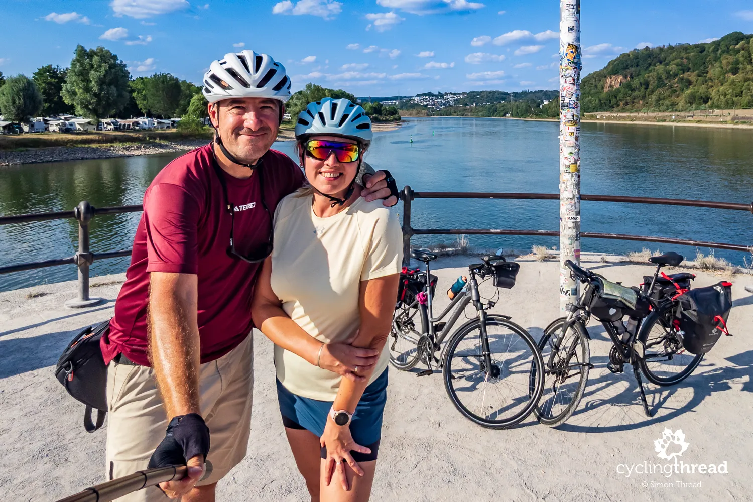
The gentle profile, clear signposting and wide range of services for cyclists make Moselle Cycle Route an excellent choice for people starting out on multi-day cycling holidays too. We liked it so much that, after adding up the scores in our ranking of Europe's best cycle routes, it took second place! That high score reflected the scenery and cycling infrastructure, but also the ease of organising a trip, the wide choice of accommodation, convenient rail connections and the welcoming atmosphere of the riverside towns.
Back to topHave a safe ride! 💚
Simon Thread
(Szymon Nitka)
I'm a passionate cycling traveler and the voice behind Cycling Thread. I explore Europe on two wheels, documenting the most scenic routes, inspiring places and cyclist-friendly practices. My writing blends personal experience with practical insights and a deep love of travel. I'm also a contributor to National Geographic Traveler magazine.