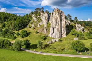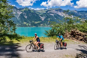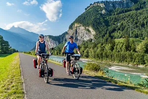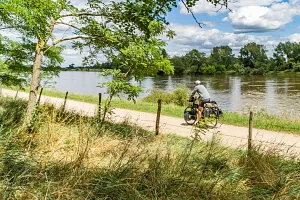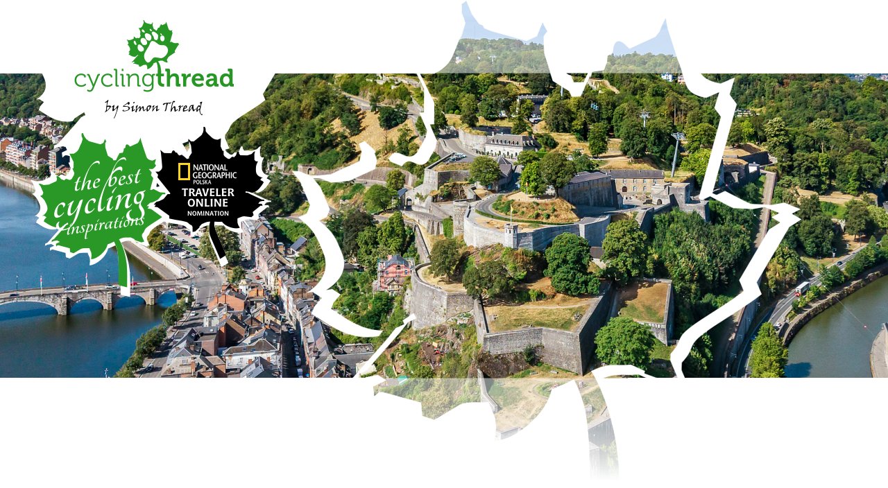
Meuse Cycle Route in Wallonia - EuroVelo 19 in Belgium
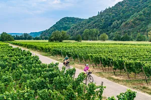
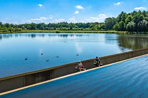
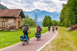
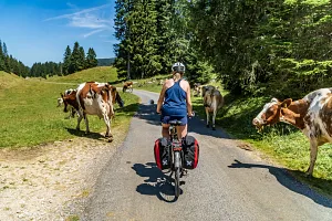
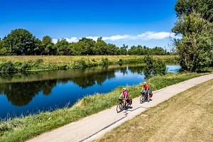
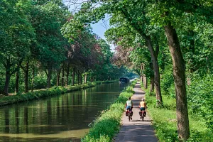
The Meuse Cycle Route runs through Wallonia among limestone cliffs, historic towns and industrial landscapes that gradually give way to riverside nature. One of its greatest attractions is the closeness of the water: for long stretches, we ride right beside the river, passing bends, stone embankments and citadels overlooking the valley. The route links the striking skyline of Dinant with the historic sights of Namur and Liège, introducing lesser-known towns and the heritage of a region that played an important part in Europe's industrial history. Wallonia's RAVeL network lets us explore these places at a relaxed pace, almost entirely away from motor traffic.
Join us on our new 🟢 Komoot account!
Cycling Partners



Route on the map
GPX file (GPS track): cyclingthread.com-meuse-2026.gpx
EuroVelo 19 in Wallonia - table of contents
- Along the Meuse through three countries
- EuroVelo 19 from source to sea
- Close to the river, away from traffic
- Givet: starting beneath the fortress
- Agimont and the RAVeL rail trails
- Hastière's Romanesque abbey beside the Meuse
- Freÿr Castle and a road section
- Dinant: rock, citadel and saxophones
- A former convent hotel in Dinant
- Bienvenue Vélo and accommodation for cyclists
- Between the cliffs, near river level
- Surfaces and shared space along the route
- Annevoie Gardens: fountains without pumps
- Namur where the Meuse meets the Sambre
- Namur Citadel: history and views
- A walk through Namur's historic centre
- The former riverside mills at Beez
- Along the Meuse with full panniers
- Natural cliffs beside working quarries
- Andenne: ceramics and Neanderthal discoveries
- The industrial valley from the RAVeL path
- Huy: collegiate church, fort and market square
- Walloon food on Huy's market square
- Cycling past Tihange nuclear power station
- A bridge over the Ampsin-Neuville locks
- Flône Abbey and Chokier Castle
- Industrial heritage between Huy and Liège
- Val Saint-Lambert: two centuries of crystal
- Seraing and Ougrée: the ironmaking valley
- Entering Liège along former waterways
- Liège: exploring the historic centre
- Santiago Calatrava's Liège-Guillemins railway station
- Monsin Island and the Albert Canal
- Houseboats and marinas near Visé
- Route signs and numbered junctions
- Lanaye: a cycle ferry and huge locks
- The Caster cutting and Eben-Emael fort
- Cycle rickshaws in Kanne for everyone
- Belgian and Dutch food beside the Meuse
- RivierPark Maasvallei: the valley's natural side
- Oud-Rekem and leisurely riverside stops
- Uikhoven: a ferry to the opposite bank
- Maasmechelen and a Messerschmitt memorial
- RivierPark Maasvallei and art beside the Meuse
- Maaseik: lime trees and a historic pharmacy
- Maasplassen: lakes created by gravel extraction
- Roermond and the train back to Dinant
- The Meuse: varied landscapes and everyday life
Along the Meuse through three countries
Meuse By Bike passes through three countries and even more regions, but on our journey we spent most of our time in Belgian Wallonia. We started in Givet in France and crossed into Belgium after just a few dozen minutes. Halfway through our third day of riding, we reached the border with the Netherlands, which we followed through the borderlands of Belgian and Dutch Limburg for the next day and a half. Along the way, the landscape changed from the narrow, limestone-lined valley near Dinant to the industrial surroundings of Liège and the open spaces and broad waters of the Meuse further north. Wallonia's historic towns, Dinant, Namur, Huy and Liège, added plenty of variety to the journey. For those who enjoy slow travel, each could be a reason to spend a whole day exploring at leisure.
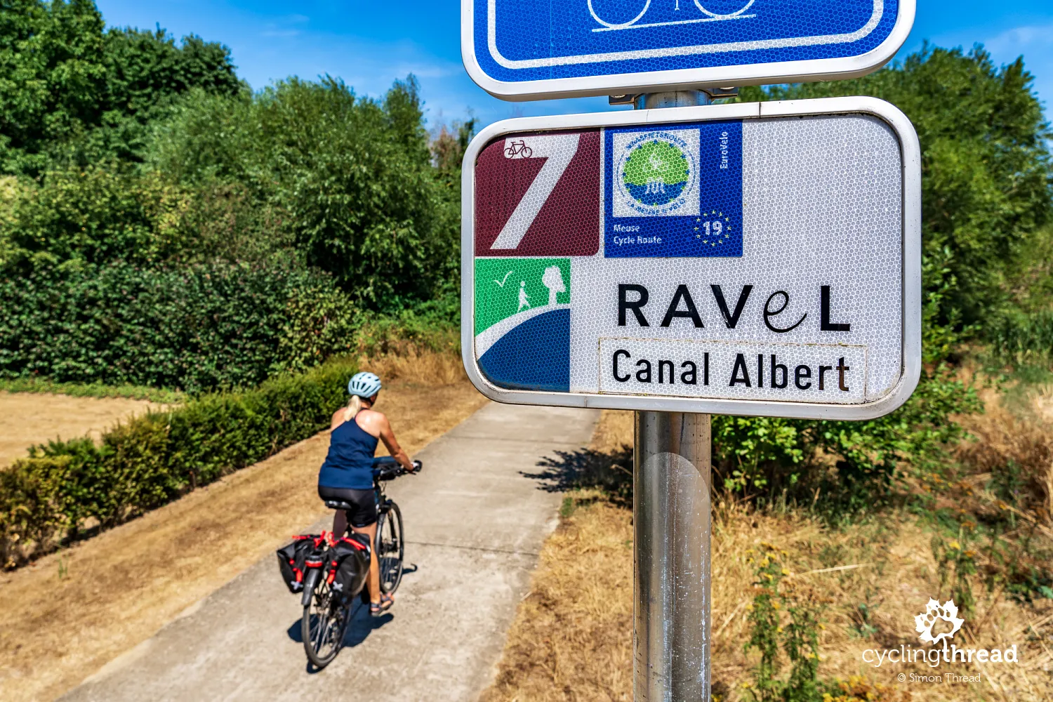
The languages change along the way too: French dominates in Wallonia, while Dutch is spoken in Limburg, where we ride the final kilometres of this trip. The river guiding us is first the French Meuse, then the Dutch Maas. The route name on the signs changes as well: in Wallonia we see the French La Meuse à vélo, in Limburg Maasroute appears, and on the final kilometres we see the longer LF Maasroute, referring to the Dutch term for long-distance cycle routes. The way cycle routes are signposted and tourist information is presented also changes. Differences extend to infrastructure standards, surfaces and the organisation of cycle traffic, reflecting local approaches to cycling tourism. All these sections share one feature, however: the yellow and blue symbol of the European EuroVelo cycle route network.
EuroVelo 19 from source to sea
The Meuse Cycle Route in Wallonia is part of EuroVelo 19, the European route following the river from its source in France to the North Sea coast in the Netherlands. The full route is 1,050 kilometres long and is well suited to exploring in stages, for example on a trip of several days through one country or between selected towns along the Meuse. Work to connect the French, Belgian and Dutch sections began back in 2010, and the route joined the EuroVelo network in 2019. Although further routes have already been announced, EuroVelo 19 still has the highest number among the network's official routes. It is because of that number, rather than our experience of riding it, that it comes last on our list of the best EuroVelo routes.
Close to the river, away from traffic
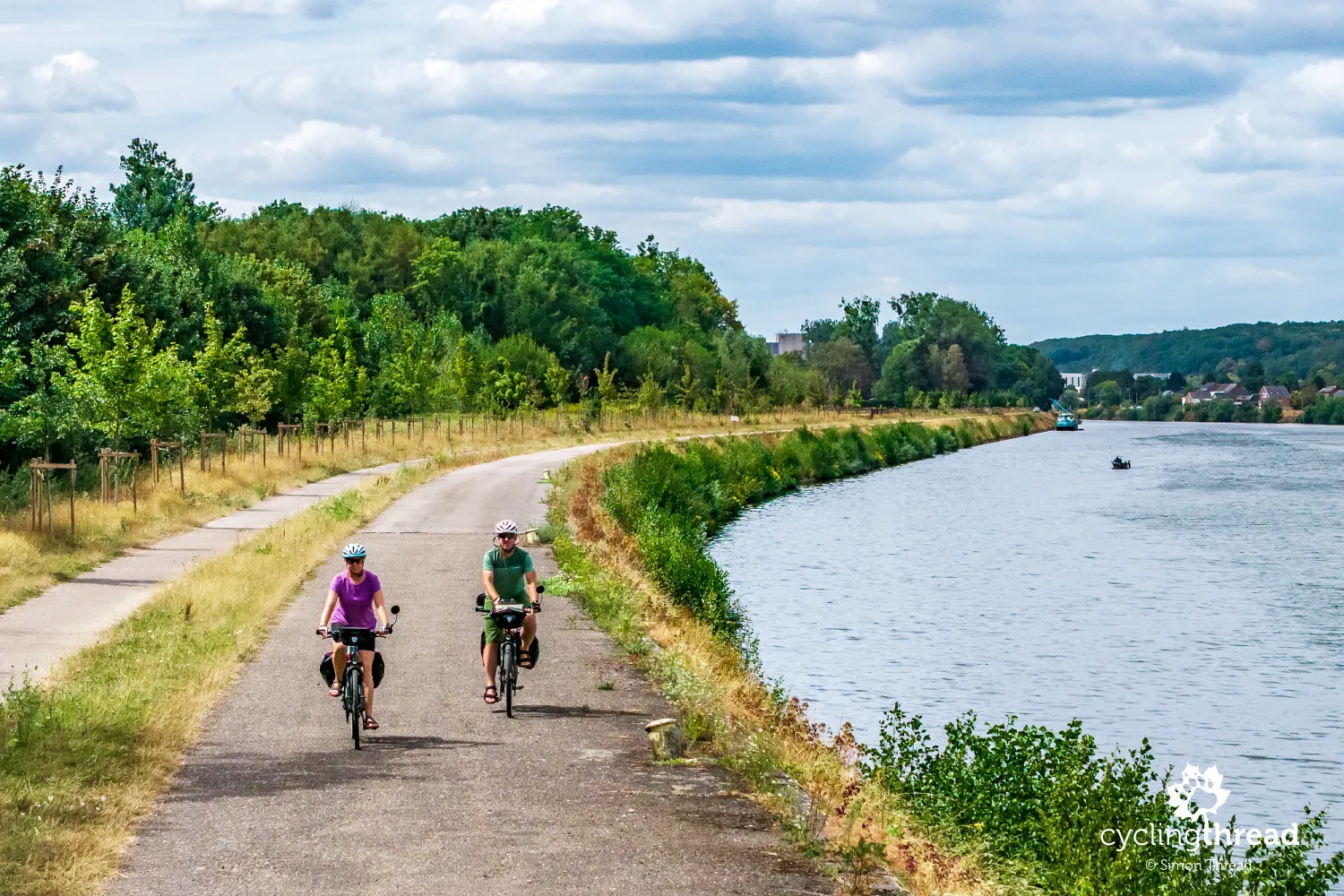
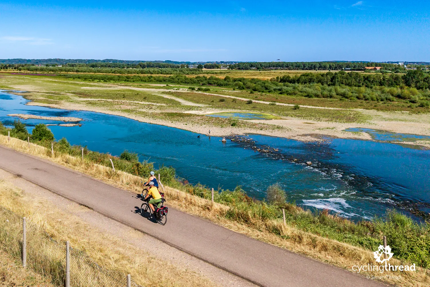
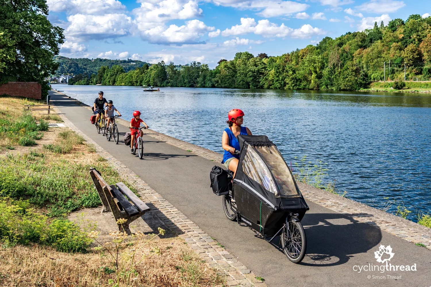
One of the greatest strengths of the Meuse Cycle Route is its long stretches close to the river, usually on paths separated from motor traffic and forming part of Wallonia's RAVeL network. Many reuse former transport infrastructure, allowing us to watch the water, passing barges and the opposite bank in peace. Following the valley also means relatively few climbs, although approaches to bridges, accommodation or hilltop attractions occasionally interrupt the route's gentle profile. EuroVelo 19 should not be imagined as one continuous riverside promenade, however: there are also sections on ordinary roads, diversions around industrial sites and places requiring more attention. A good example is the stretch between Waulsort and Anseremme, where the official route takes cyclists onto the N96 road for several kilometres. Our distance from the river changes too: sometimes we ride just above the water, at other times along a flood embankment or through a settlement a little further from the riverbed.
Givet: starting beneath the fortress
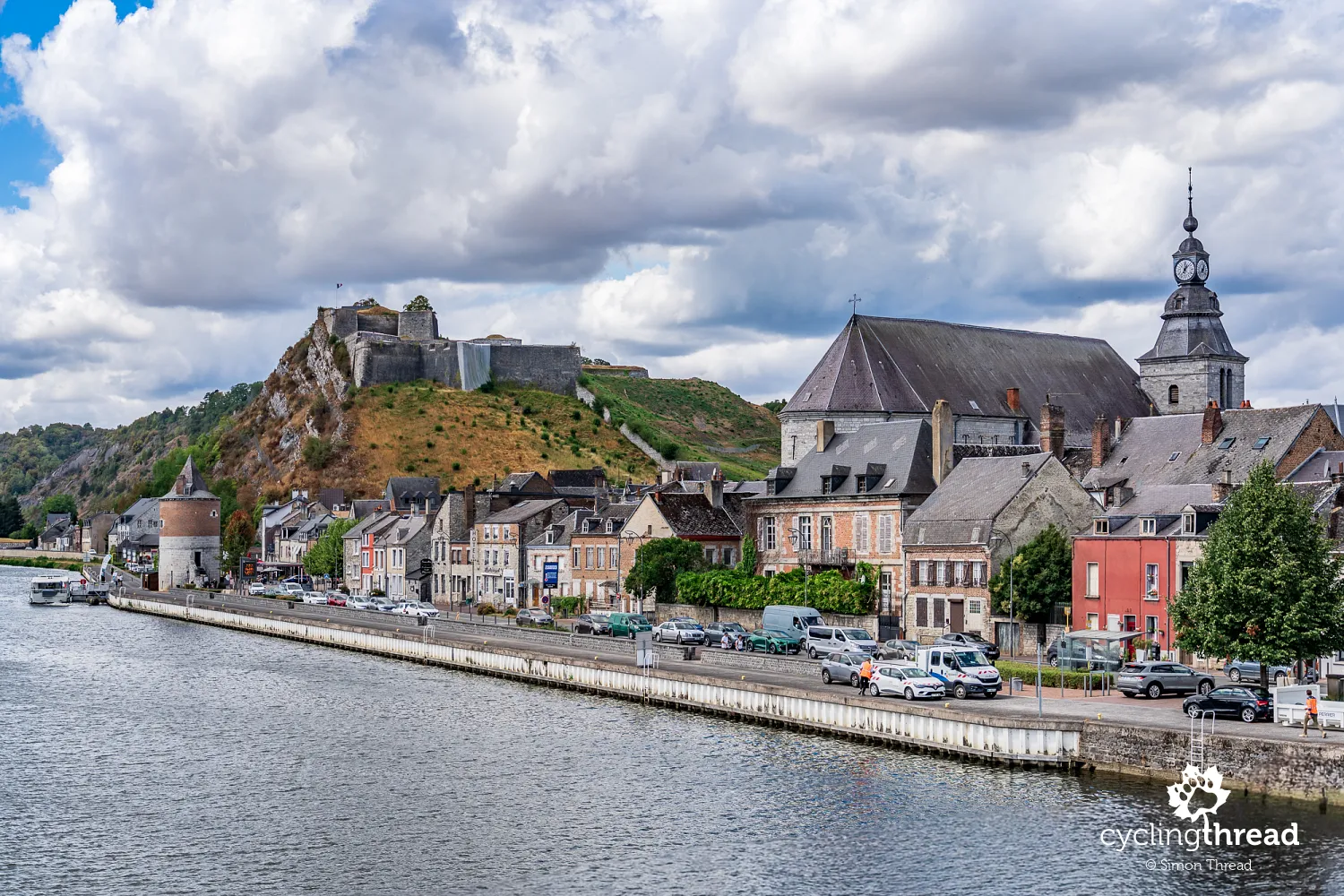
Givet is still in France, but its position in a narrow strip of territory surrounded by Belgium immediately reminds us of the borderland character of this part of the valley. Charlemont Fortress rises above the town, its fortifications, expanded over the centuries, showing the strategic importance of this passage along the Meuse. From the waterfront, we can see both the rocky slope beneath the fortress and the buildings gathered on either side of the river, linked by a bridge. The historic centre is worth a visit too, with Saint-Hilaire Church among its narrow streets and a small square surrounded by the town hall and historic houses. A walk through this part of Givet reveals a quieter, more intimate side of the town, contrasting with the imposing fortifications above. From here, only a few kilometres separate us from the Belgian border, beyond which the Meuse valley retains its familiar character.
Agimont and the RAVeL rail trails
Near Agimont, the route uses part of former railway line 156, introducing us to a characteristic feature of Wallonia's cycling infrastructure early in our ride. Close to the old station, we join a separate RAVeL path heading towards Hermeton-sur-Meuse, away from ordinary motor traffic. The alignment and gentle gradients reveal its railway origins, though cyclists and walkers have now replaced the trains. The river disappears from our immediate surroundings for a while, reminding us that a riverside route does not mean riding beside the water without interruption. At Hermeton, the route returns to the Meuse valley before continuing towards Hastière, where the river and the buildings along its banks once again dominate the landscape. This short section neatly illustrates the character of RAVeL, where former transport infrastructure now serves a very different kind of journey.
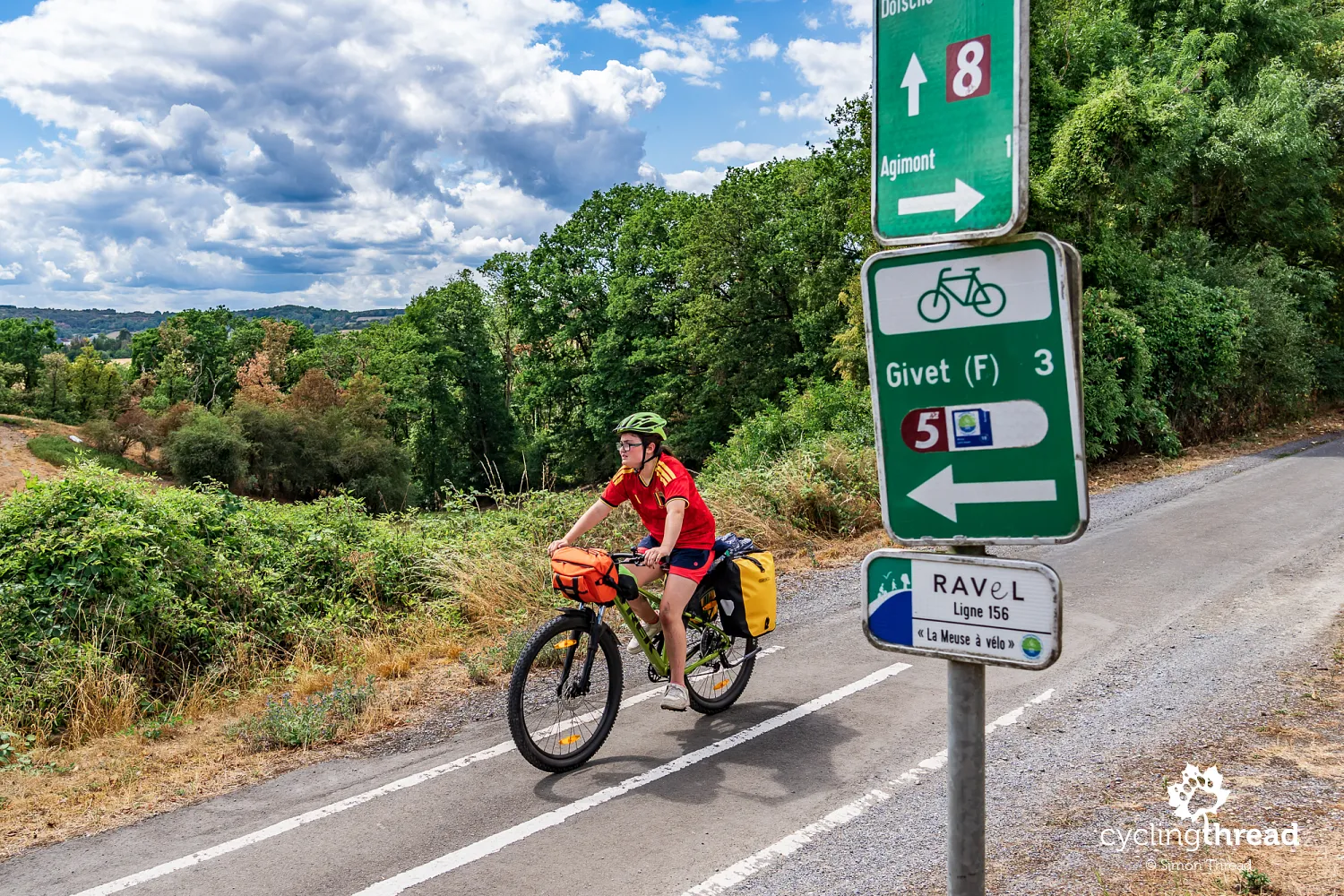
The name RAVeL appears so often in Wallonia that it is worth explaining. It stands for Réseau Autonome des Voies Lentes, a regional network of routes intended for non-motorised users, mainly cyclists and walkers. Former railway lines and service roads along rivers and canals form its backbone, so descriptions of RAVeL as an exclusively railway-based network are clearly mistaken. Reusing former transport corridors makes it possible to create modern recreational routes with gentle gradients, separated from motor traffic, even in heavily built-up areas. Along the Meuse, we encounter both types of infrastructure: a short stretch of former railway near Agimont, just beyond Givet, followed by much longer shared walking and cycling paths directly beside the river. RAVeL serves local people as well as visitors, so we share the path with walkers, runners and people cycling between neighbouring towns and villages.
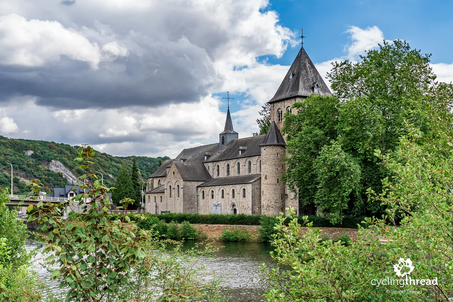
Hastière's Romanesque abbey beside the Meuse
In Hastière, the former abbey church draws our attention close to the Meuse, in the part of the settlement called Hastière-par-Delà. Its substantial tower, simple shape and stone walls suit a valley where buildings have used local materials for centuries. The church retains Romanesque elements, including the nave and crypt, with a Gothic chancel added later, so it is not a monument from a single period. Inside are medieval paintings and choir stalls, worth a few moments if the church is open as you pass. It makes a convenient short stop for cyclists, combining a visit with a crossing of the river and a view of the valley from the bridge. Further towards Dinant, the surroundings of Waulsort and a road section requiring more attention still lie ahead before we return to quieter riverside paths.
Freÿr Castle and a road section
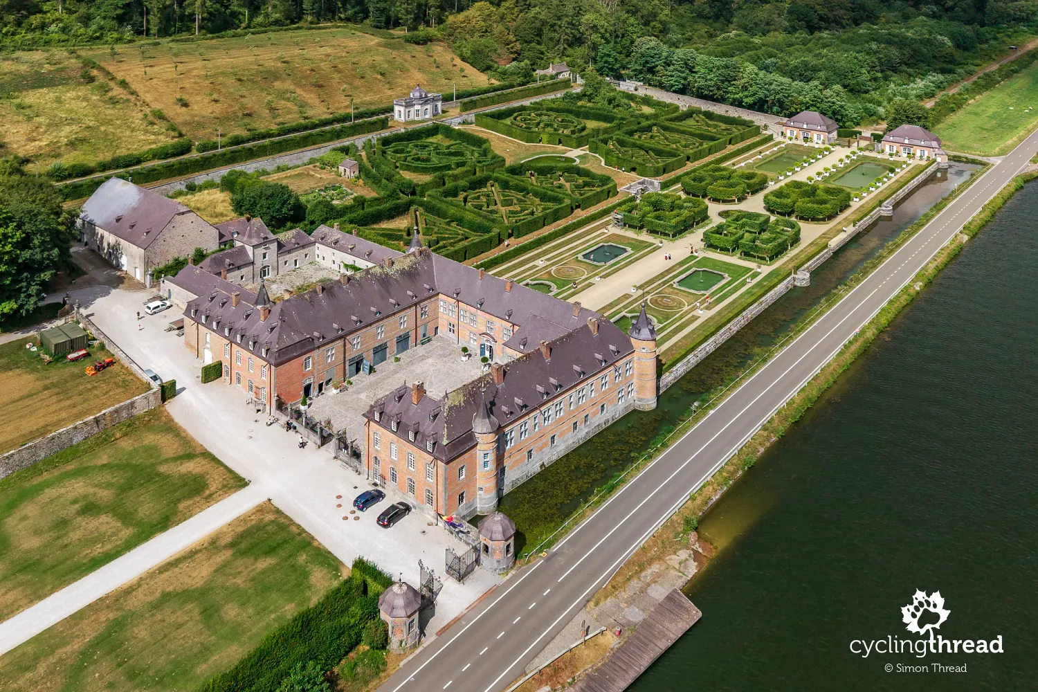
Between Waulsort and Dinant, we pass Freÿr Castle on the left bank of the Meuse, opposite tall limestone cliffs. The former residence of the Dukes of Beaufort-Spontin stands out for its brick and stone façades, corner towers and gardens stretching along the river. Its present appearance results from successive alterations that transformed an earlier defensive stronghold into a grand residence, with furnished interiors open to visitors. The French-style gardens are an equally important part of the estate, with formal pools, fountains and avenues enclosed by clipped hornbeam hedges, creating green rooms and mazes. A particular attraction is the centuries-old orange trees grown in wooden tubs, which spend the warmer months outdoors and are moved into the orangery for winter. The riverside road gives us a view of the residence's setting, while exploring the interiors and garden terraces requires a longer break from riding.
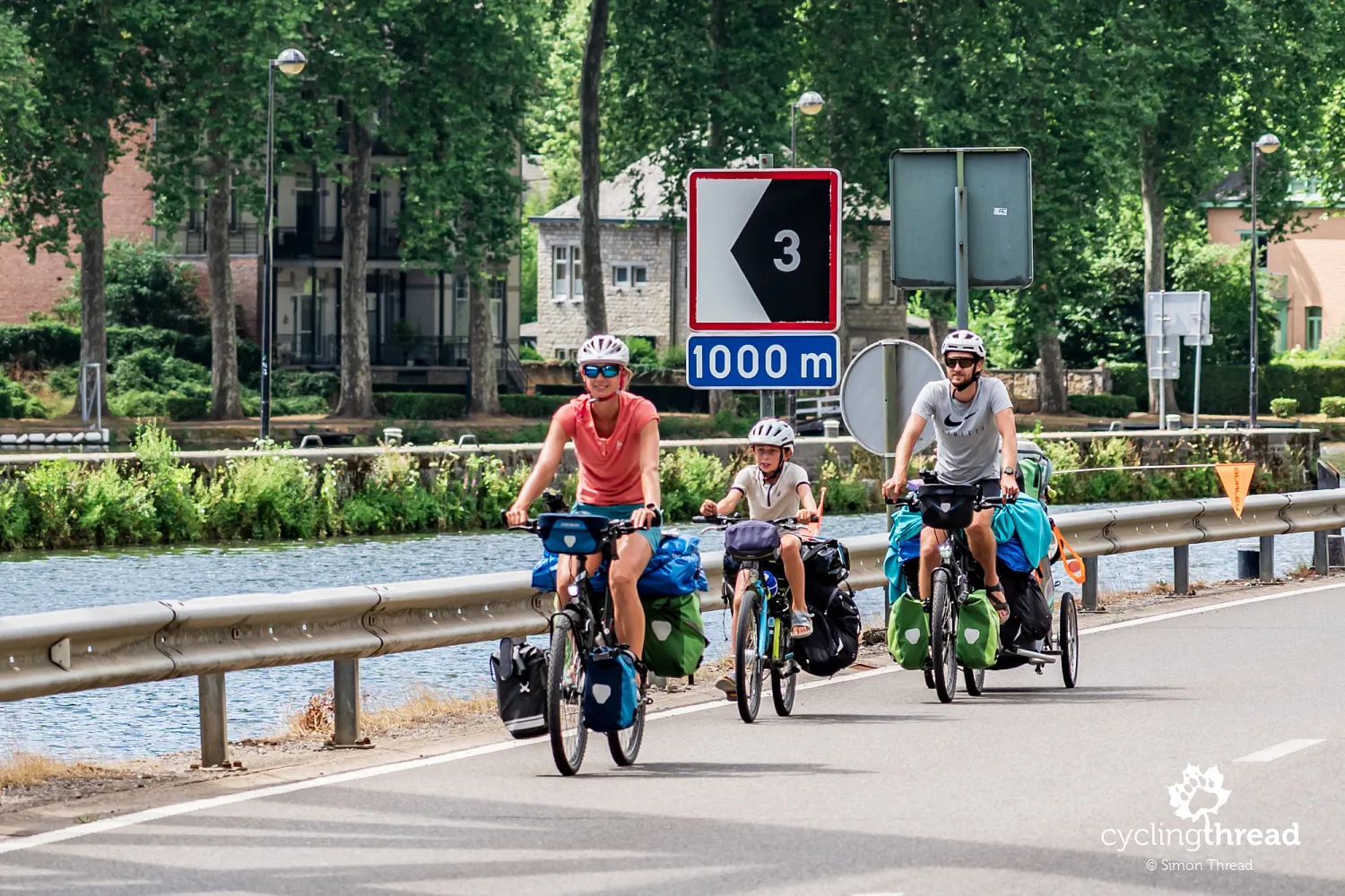
On this section, be prepared for several kilometres in mixed traffic on a road without a hard shoulder, though fortunately with little motor traffic. It is useful to know this in advance, especially when travelling with children and accustomed to separate cycle paths. Although I mention this less comfortable stretch, I would not want to overstate the difficulty. A friendly family we met managed it without problems, despite travelling with a particularly demanding combination of passengers and luggage. Two children, including one riding independently, and a substantial amount of baggage showed that even on a family tour, this section before Dinant can be a temporary inconvenience rather than a reason to abandon a cycling holiday.
Dinant: rock, citadel and saxophones
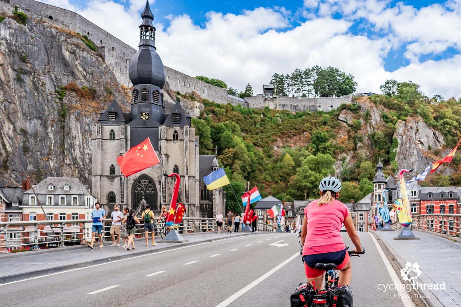
Bayard Rock is one of Dinant's most recognisable landmarks, although the formation itself occupies little space between the buildings and the river. A narrow passage carrying the road separates the tall limestone pinnacle from the hillside, and passing cars give a clear sense of its scale. The place is associated with the legend of the Four Sons of Aymon and the extraordinary horse Bayard, said to have helped them escape pursuit by Charlemagne. The historical widening of the passage through the rocks is a separate story, linked to the transport needs of the growing town. For those arriving from Givet, this landmark signals the approach to the built-up part of Dinant, where the valley narrows sharply again. It is best viewed from a safe spot beside the route, as stopping in the narrow passage itself is hardly ideal for photographs or a relaxed look at the rock.
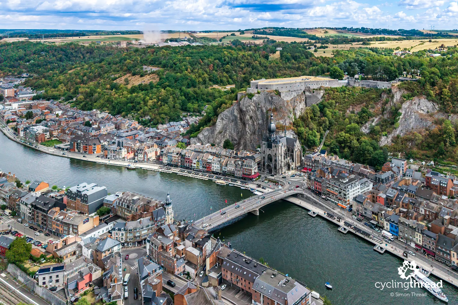
Dinant is easiest to remember as a series of distinct layers: water, a narrow strip of houses, the collegiate church, a sheer rock face and the citadel at the top. This setting makes it look different from most towns we pass later along the Meuse, where there is more space for development. The most characteristic view opens up from the opposite bank, near our hotel, so even a short stop is worth combining with a change of perspective. Up close, the elements of the skyline separate into streets, terraces and passageways. For a cycle tourist, Dinant is also somewhere a planned break can easily grow longer, as the main sights lie close together. After the quieter stretches of the valley, we find ourselves in a much more tourist-oriented setting, with restaurants, sightseeing boats and busy waterfronts.
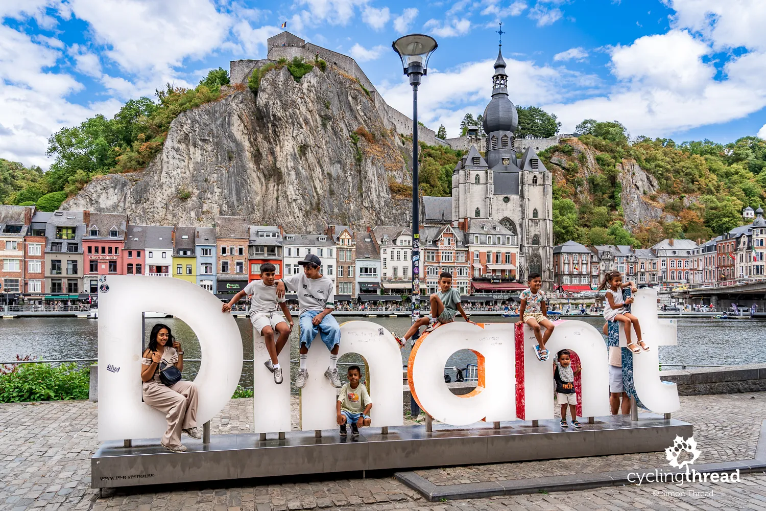
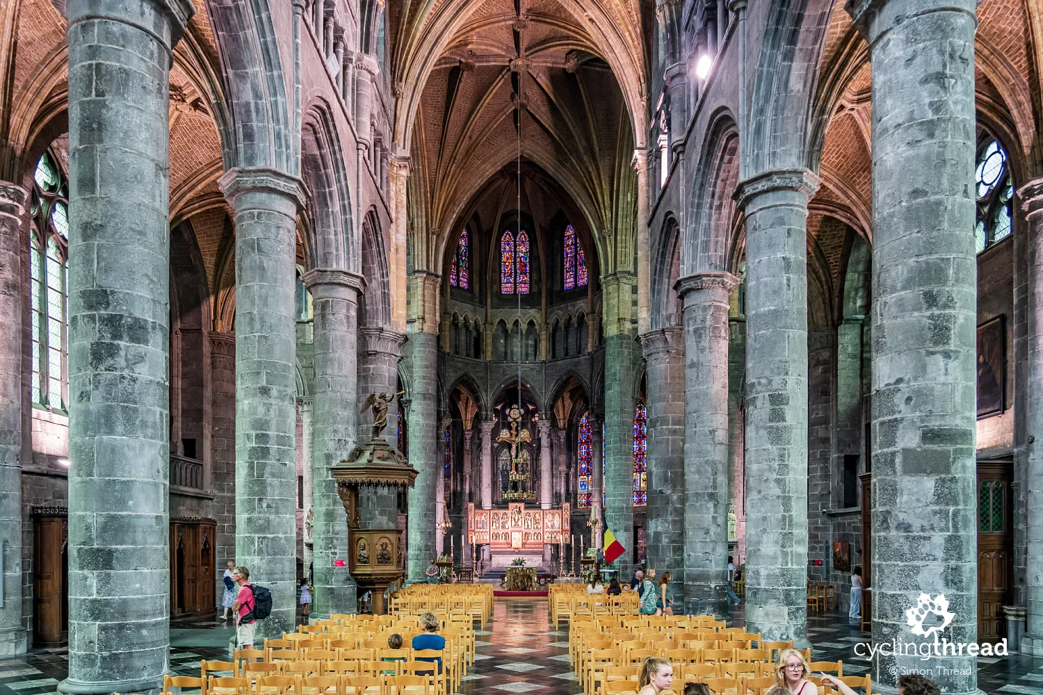
The Collegiate Church of Notre-Dame and the citadel above it form Dinant's most characteristic view, although their histories reflect very different roles in the town. Construction of the Gothic church began in the 13th century, after part of the cliff collapsed onto the earlier Romanesque church in 1227. Its most recognisable feature is the tower's onion-shaped dome, whose distinctive form dates from 1566. Much higher stands the citadel, with origins in the 11th century, when the bishops of Liège fortified the rocky hill to control this strategic passage through the Meuse valley. The present fortress was built in 1821, when Dinant belonged to the United Kingdom of the Netherlands. You can reach it by cable car or climb 408 steps cut into the rock, then look out from the terraces to see how little space the river left for the town's buildings.
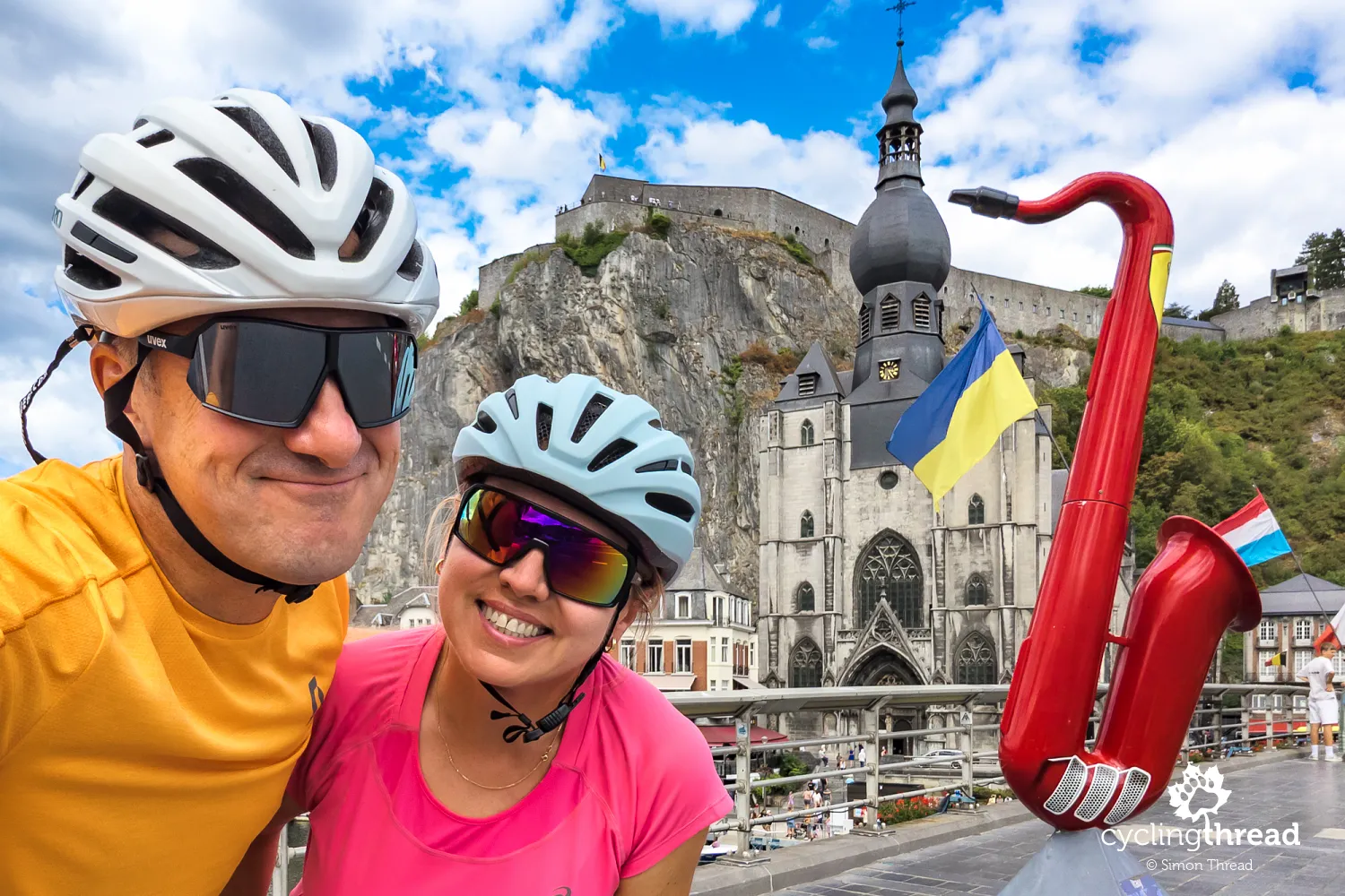
Alongside its rocky skyline, Dinant's other distinctive symbol is the saxophone, present in street decorations and the story of its most famous resident. Adolphe Sax was born here in 1814 and later developed the saxophone as an instrument maker, creating an instrument that found international success far beyond the Meuse valley. In the town centre, a few hundred metres from the collegiate church, you can visit a small exhibition about his life, known as Maison de Monsieur Sax, and see a seated figure of the inventor outside. Large, colourful saxophones beside the bridge often introduce visitors to his name before they read any information boards. It makes a good subject for a short walk between visiting the church and returning to the bikes, without requiring hours in a museum. The musical theme gives Dinant a character of its own, evident even during a relatively brief stop.
A former convent hotel in Dinant
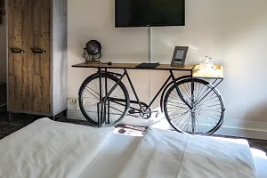
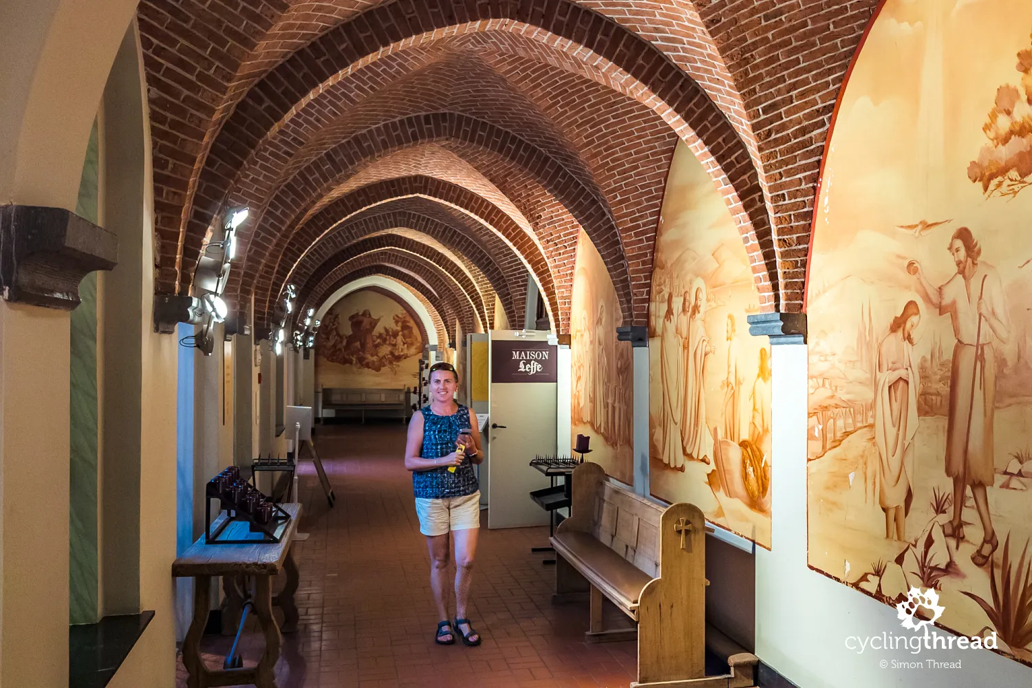
Our hotel in Dinant was the most interesting place we stayed during our journey along the Meuse Cycle Route. Hotel La Merveilleuse occupies the former Bethléem Dominican convent, on the hillside above the Meuse near the town centre. The neo-Gothic complex opened in 1902 and served as an enclosed convent for almost a century, with the last nuns leaving in 1991. Its later conversion into a hotel preserved the historic layout, while a glass roof over the inner courtyard created a restaurant space. The former chapel houses Maison Leffe, a museum devoted to the history of the Belgian beer, whose tradition dates back to 1240 and is linked to the nearby Abbey of Notre-Dame de Leffe. Practical facilities include a separate, lockable bicycle room, allowing us to set off for an evening walk around Dinant with peace of mind after finishing our day's ride.
Bienvenue Vélo and accommodation for cyclists
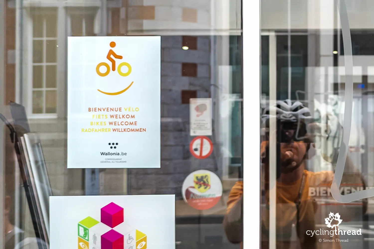
When planning overnight stops along the Meuse, it is worth checking both the location of your accommodation and its bicycle storage arrangements. In Wallonia, Bienvenue Vélo is a useful label identifying places with services designed for cyclists. These include accommodation offering secure bicycle storage, basic tools and information about local routes. The valley has city hotels, smaller guesthouses, rooms and campsites, but they are not evenly distributed along the route. If travelling by e-bike, it is also worth asking about battery charging when booking. In larger towns, staying near the centre makes evening sightseeing easier while the bike remains in a secure, locked room.
Between the cliffs, near river level
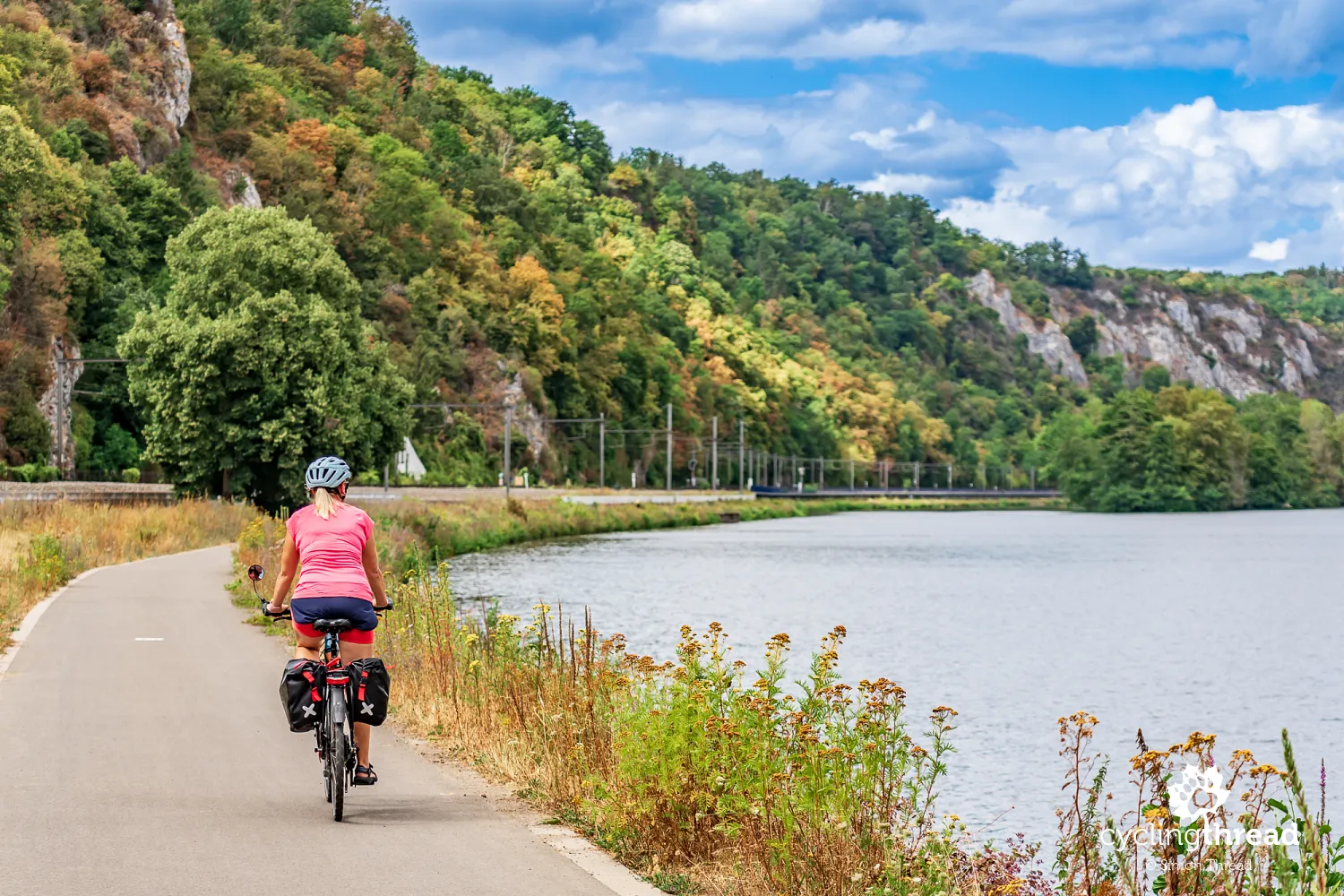
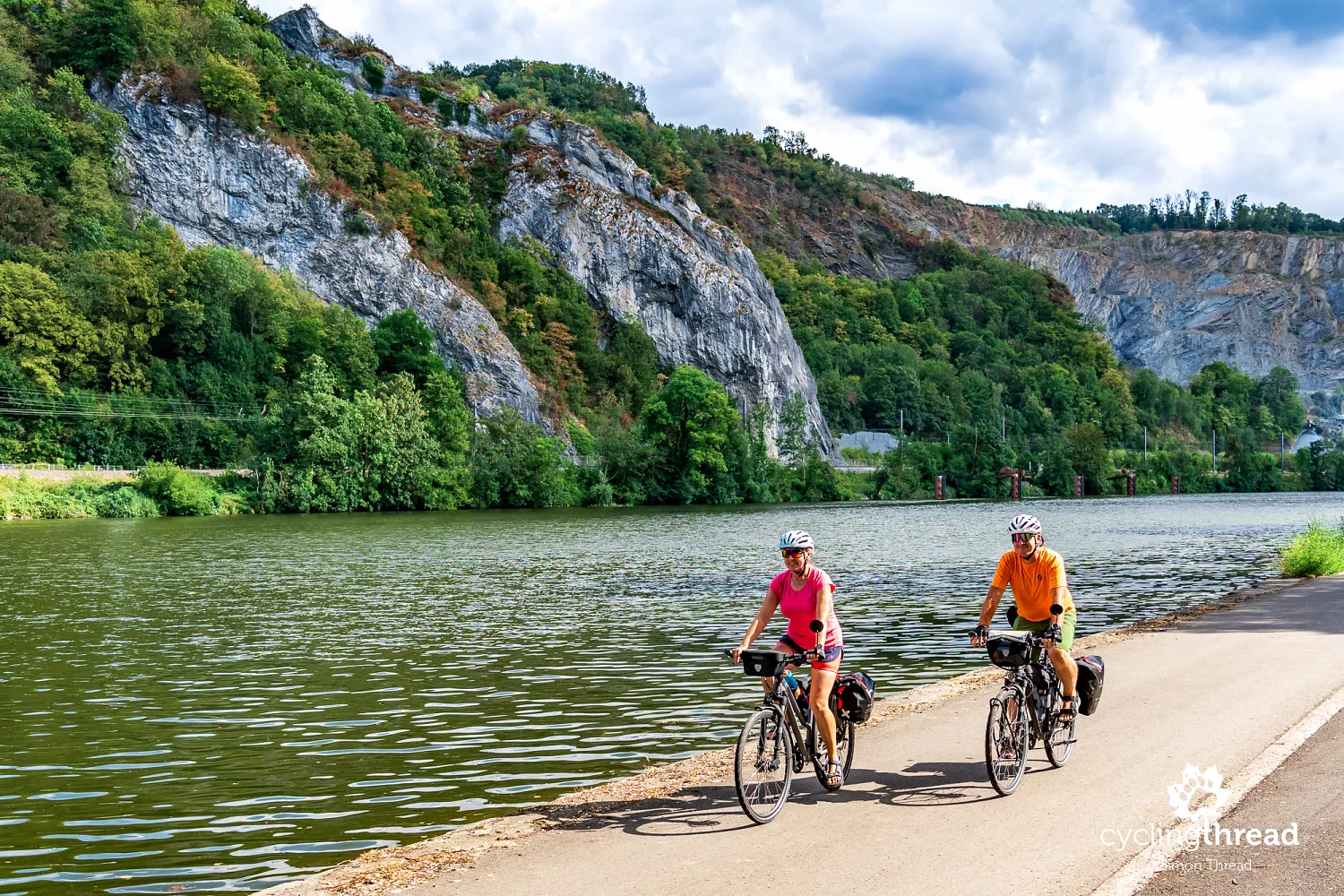
Beyond Dinant, limestone cliffs continue to accompany the river, although they vary from high rock faces to wooded slopes with isolated outcrops. From the bike, we can clearly see how the valley cuts through successive rock layers and how buildings adapt to the limited space available. On one bank, houses stand almost at the water's edge; on the other, a road, railway or narrow strip of greenery fits between the river and the slope. This section also helps explain why towns along the Meuse so often developed around bridges and places where crossing the valley was easier. The rocky surroundings do not mean constant climbing, as the main route mostly stays at river level. More effort is needed only when we choose to visit attractions higher up or further from the waterfront.
Surfaces and shared space along the route
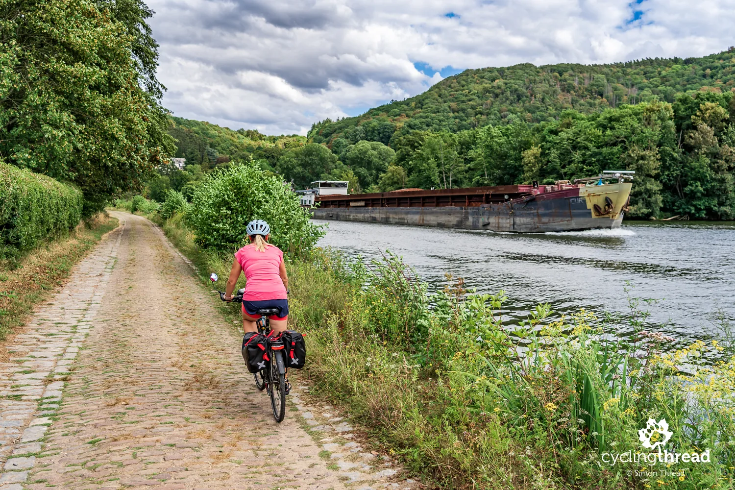
Hard surfaces dominate the Meuse Cycle Route, but their type and comfort change from one part of the valley to the next. Concrete is common alongside asphalt, with occasional short gravel or unsurfaced stretches. We also noticed a fine gravel section near Houx lock and cobbled stretches in the same area. On a touring bike with slightly wider tyres, this variety is usually no great problem, but it can matter when planning a ride on very narrow tyres. In towns, comfort also depends on how sections of infrastructure connect, street crossings and bridge access. What matters more than the mere presence of asphalt is the excellent continuity of the route and the space to pass other users comfortably on cycle paths that are usually quite wide.
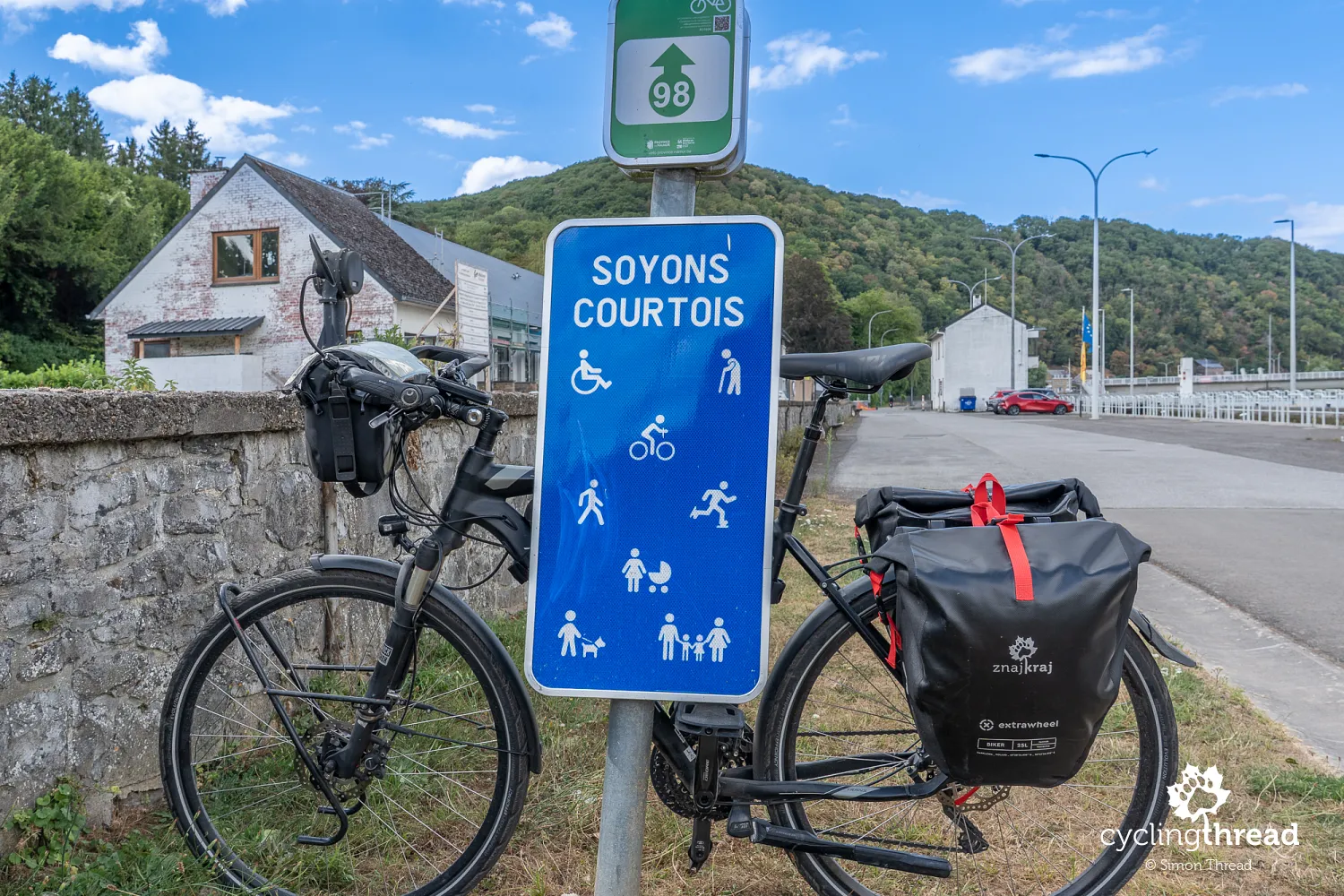
In one settlement, we come across a sign addressed to cyclists and other users of the riverside path. It is a simple board reading “Soyons courtois”, or “Let's be courteous”, with silhouettes of people we might meet along the way. Alongside a cyclist are walkers, a runner, a wheelchair user, an older person with a walking stick, parents with children and someone walking a dog. Together, they remind us that this comfortable path beside the Meuse is a shared space used by local people in many different ways. For a cycle tourist, that means passing pedestrians considerately, slowing down where visibility is limited and leaving others enough room. On a long journey, it is easy to become accustomed to uninterrupted riding without cars, but the absence of motor traffic does not mean the whole width of the path belongs to cyclists.
Annevoie Gardens: fountains without pumps
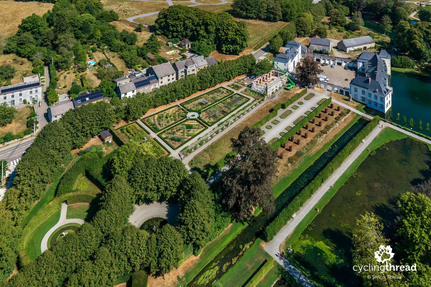
Annevoie Gardens lie a little off the Meuse Cycle Route, so it is best to treat a visit as an additional stop between Dinant and Namur. Their creation began around 1758 under Charles-Alexis de Montpellier, an ironworks owner who used industrial income to enlarge his residence and lay out the gardens. His travels around Europe provided inspiration, combining French symmetry and long views with Italian water features and a freer English style. Ponds, channels, cascades and fountains were created among the avenues and carefully shaped greenery, using natural springs and differences in ground level. Particularly interesting is the fact that the fountains operate without pumps, thanks to gravity and a carefully designed hydraulic system. The same water that helped the Montpellier family develop its industries also became the foundation of its grandest garden project.
Namur where the Meuse meets the Sambre
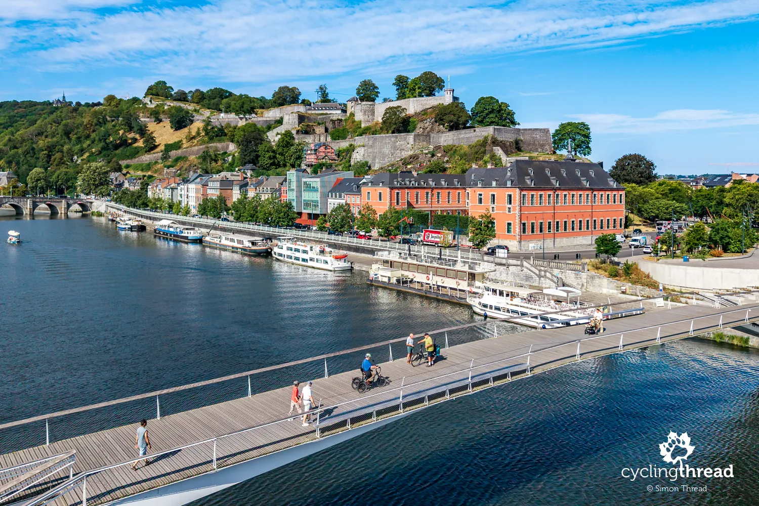
Approaching Namur, we continue along the Meuse valley, but the surroundings become increasingly urban and the riverside paths carry more everyday traffic. On the Jambes side, the buildings open up a view of the opposite bank, where the citadel gradually rises on the hill at the meeting of two rivers. It is one of those cycling approaches where a city's main landmark appears before you reach the historic centre. We cross the Meuse on L'Enjambée, the walking and cycling bridge opened in 2020, reaching the foot of the citadel near the distinctive red building of the Parliament of Wallonia. Moments later, we stand on the Grognon headland, where the Sambre flows into the Meuse and their waters join before continuing towards Liège. This was the oldest part of Namur, whose development depended for centuries on controlling crossings and trade on both rivers.
Namur Citadel: history and views
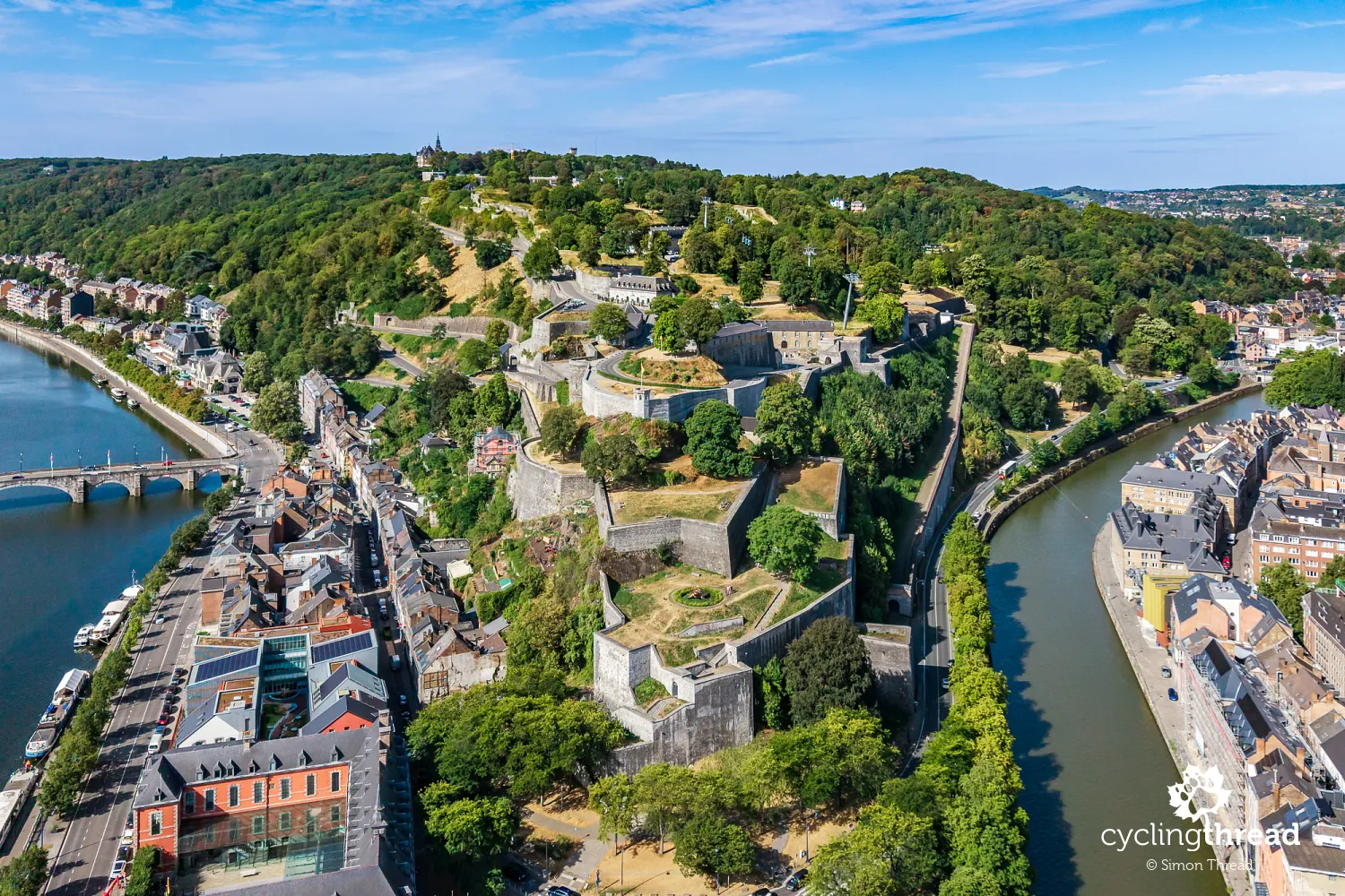
Namur Citadel occupies a broad hill between the Sambre and the Meuse, with a history of fortifications stretching back to Roman times. In the Middle Ages, it was the seat of the Counts of Namur; later, the fortress was repeatedly expanded and adapted to changing methods of warfare. The 17th century was particularly important, when two famous military engineers worked on its defences: Menno van Coehoorn, associated with defending the fortress, and Sébastien Le Prestre de Vauban, in the service of Louis XIV. In 1692, Namur fell to the French army in a siege personally directed by the king, before allied forces under William III of Orange recaptured it three years later. Further rebuilding, including work in the 19th century, left an extensive system of bastions, ramparts, passageways and underground galleries. Today, the citadel is one of Belgium's largest fortification complexes, with guided tours available in part of its underground network.
A walk through Namur's historic centre
Namur's historic centre lies mainly north of the Sambre, its narrow streets, small squares and historic houses creating a more intimate setting than the broad Meuse waterfront. Places worth seeing include Place du Marché aux Légumes, the Baroque Saint-Loup Church, built by the Jesuits in the 17th century, and Saint-Aubain Cathedral, built between 1751 and 1767 to a design by Italian architect Gaetano Matteo Pisoni. Namur is also the capital of Wallonia, whose parliament occupies the former Saint-Gilles hospital and hospice just below the citadel. The historic complex, with medieval origins, provided care for centuries before being restored and handed over to parliament in 1998. Its position right beside the Meuse and distinctive red façades make it easy to recognise even from the opposite bank.
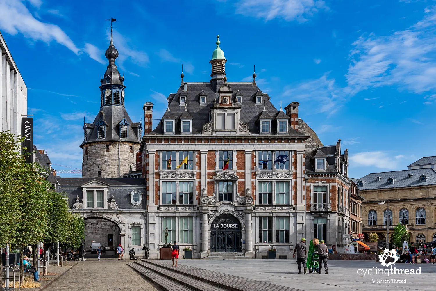
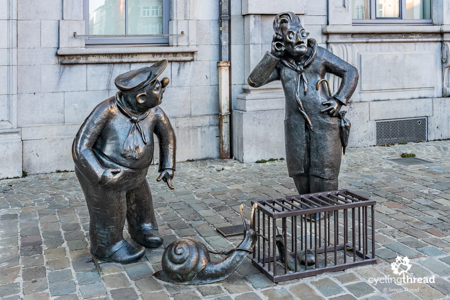
On a walk, it is worth reaching Place d'Armes, whose main architectural feature is the grand former commercial exchange. Built from 1932 in a neo-Renaissance style using brick and pale limestone, it looks much older. It formed part of the reconstruction of this area after the destruction of the First World War, funded by German war reparations. Outside stands an appealing sculpture of two men with snails, installed in 2000 and created by Belgian sculptor Suzanne Godard. It depicts Djoseph and Françwès, characters from Jean Legrand's drawings: one leads a snail on a leash, while the other keeps his in a cage, as though both feared their charges might escape. It is a playful reference to the calm temperament and leisurely speech traditionally associated with the people of Namur, symbolised by the snail.
The former riverside mills at Beez
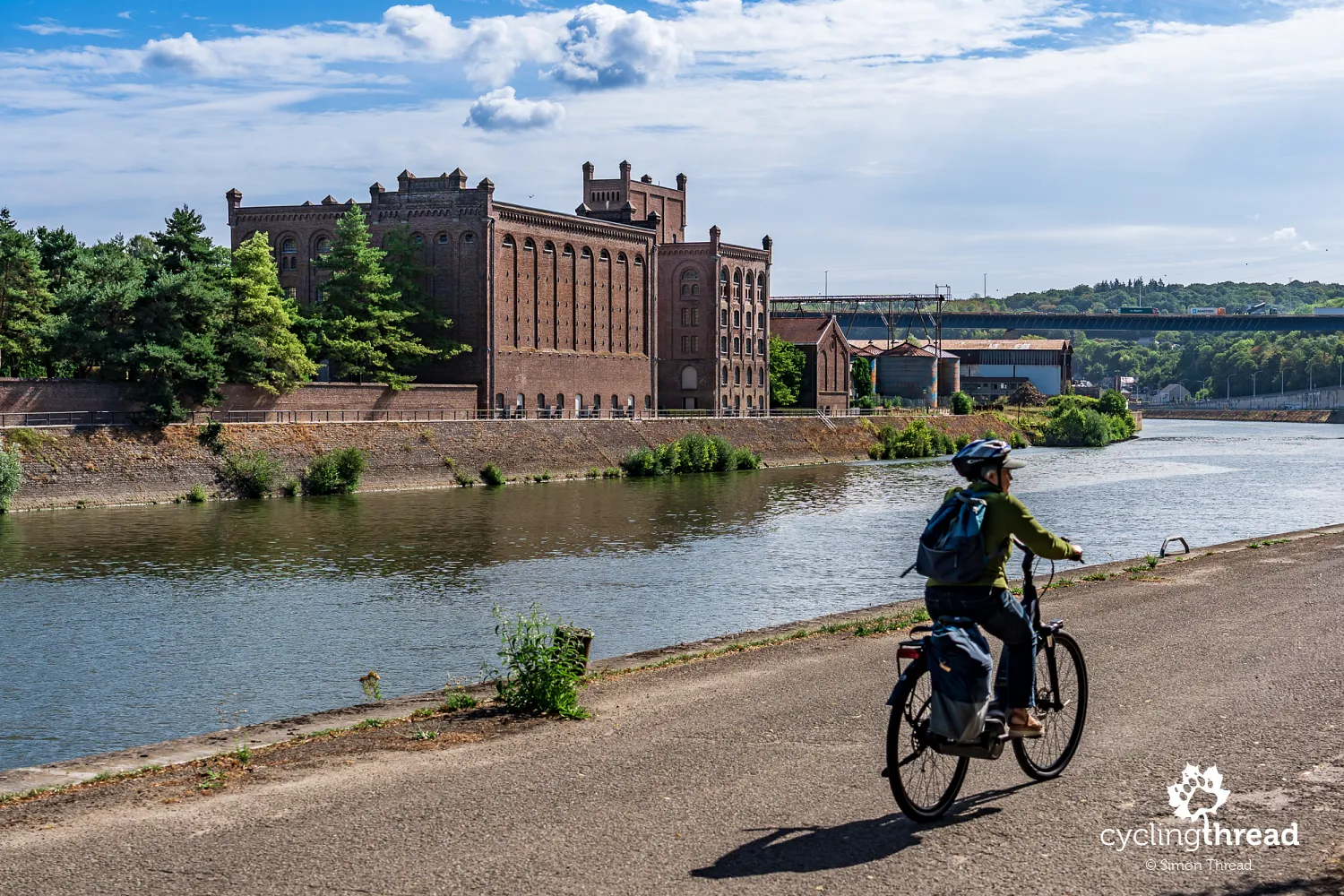
Beyond central Namur, in Beez, a large brick complex of former mills draws our attention from across the river as we ride towards Huy. It is an example of industrial architecture with an almost grand civic appearance, featuring regularly spaced windows, tall façades and decorative brickwork. Its position between the Meuse and the railway was no accident, as both forms of transport supported production and the movement of goods. Today, the buildings have new uses, including housing regional archives, preserving an important element of the industrial landscape rather than replacing it with entirely new development. Seen from the waterside, the mills introduce the next part of our journey, where factories, warehouses and cargo-handling infrastructure become increasingly common. Here, as in many places further on, Wallonia's industrial heritage can be appreciated directly from the route, without seeking out a museum or a specially opened visitor site.
Along the Meuse with full panniers
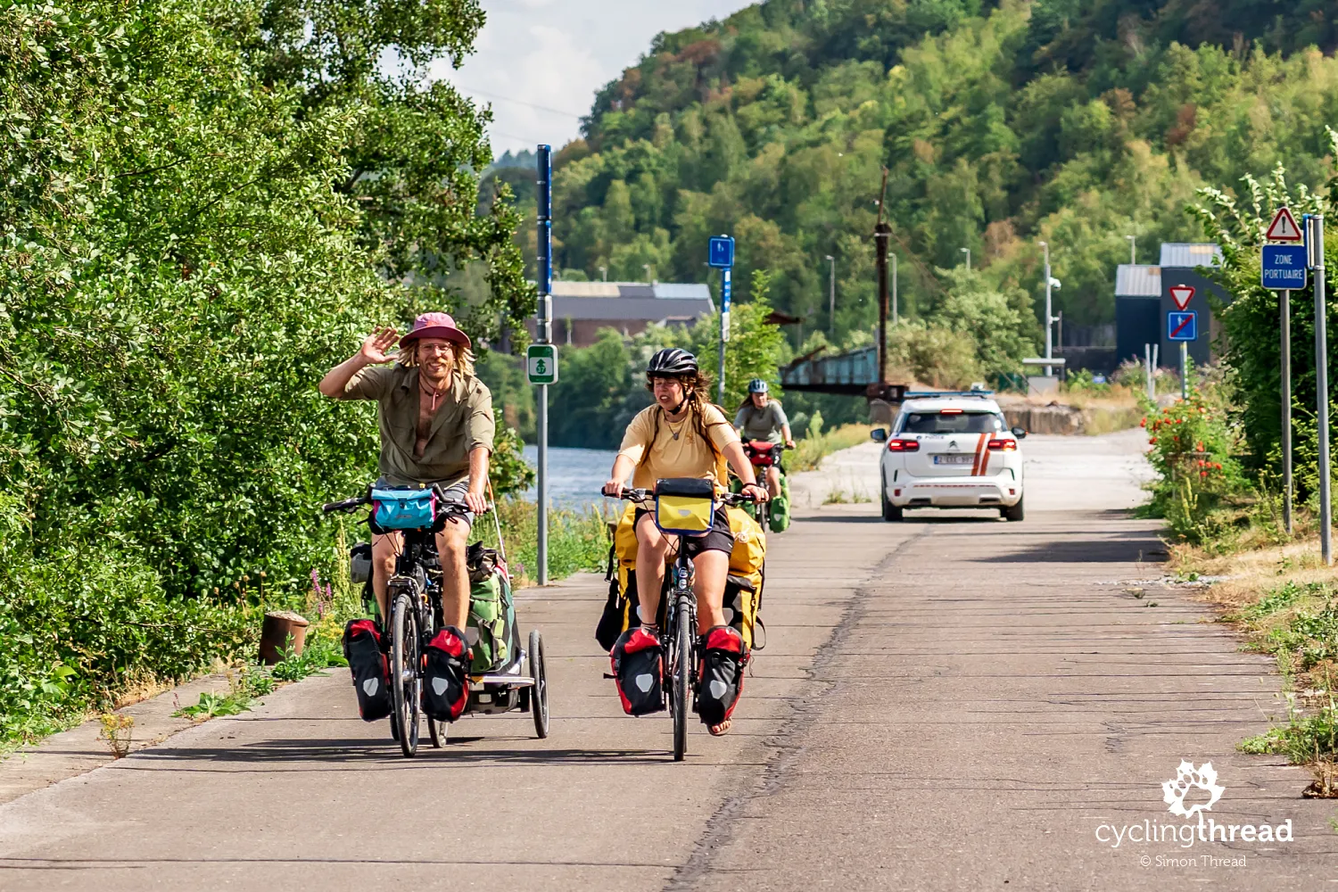
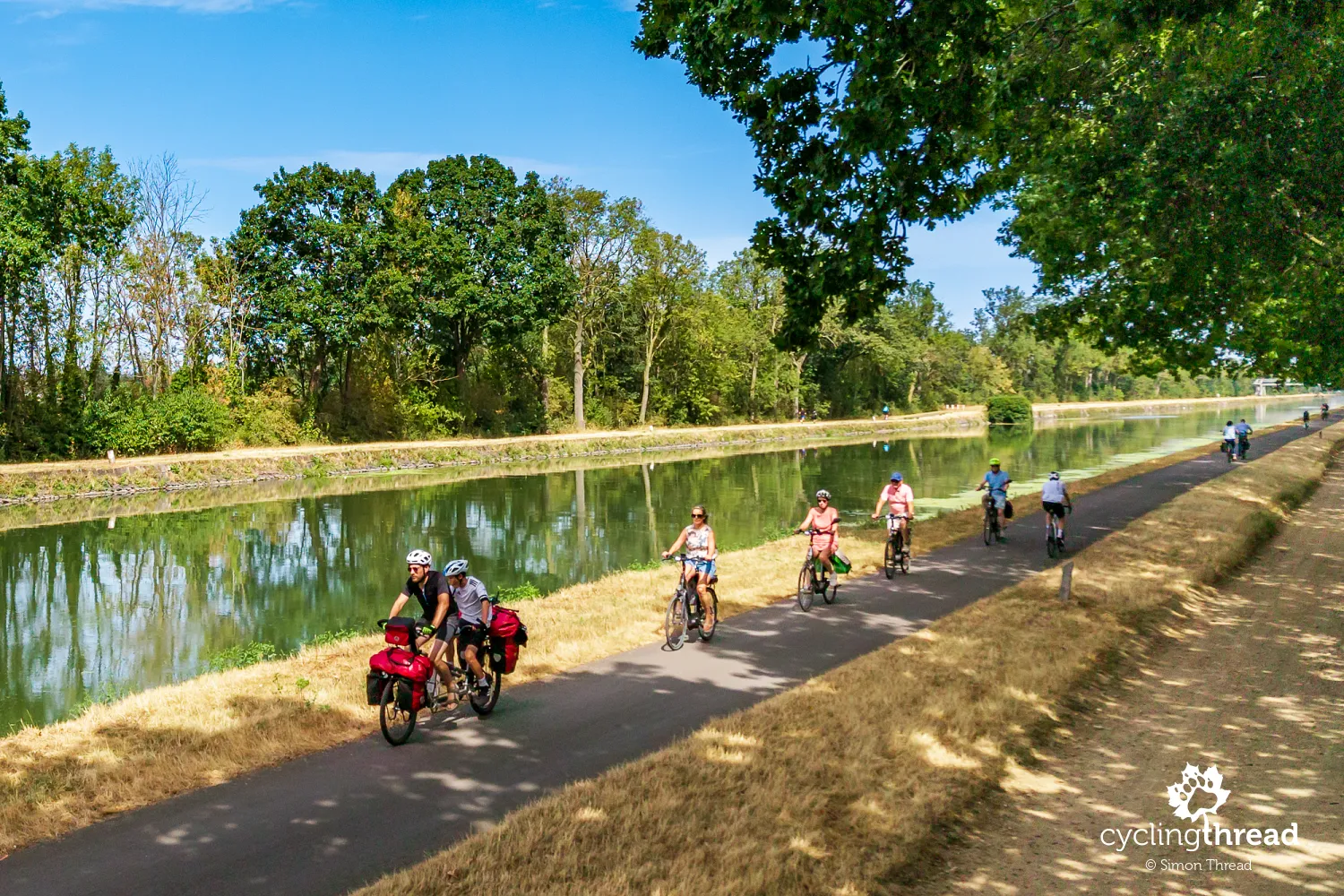
On this stretch, we notice how many cyclists along the Meuse are carrying a full set of four panniers, probably including camping equipment such as tents, sleeping mats and sleeping bags. Some are towing trailers as well. That is hardly unusual in cycle touring, but the number of heavily loaded bikes on a single route clearly catches our attention. Some of their owners may be covering a much longer section of EuroVelo 19 than our journey through Wallonia. The gentle profile of the Meuse Cycle Route and its many comfortable paths away from motor traffic also make carrying a full touring load easier.
Natural cliffs beside working quarries
East of Namur, the natural cliffs of the Meuse valley stand alongside quarries, revealing different sides of the same landscape. At times we ride beneath limestone walls surrounded by greenery; moments later, we look into excavations whose regular terraces reveal years of extraction. Stone was an important raw material for construction and for lime and cement works, while the river and railway made it easier to carry heavy loads over longer distances. Industry remains a visible part of the valley, but between the factories and cargo quays are quiet stretches with trees, water and rocky cliffs right beside the cycle path. From the saddle, we can observe both natural formations and hillsides reshaped by people. Even over a short distance, the surroundings change several times.
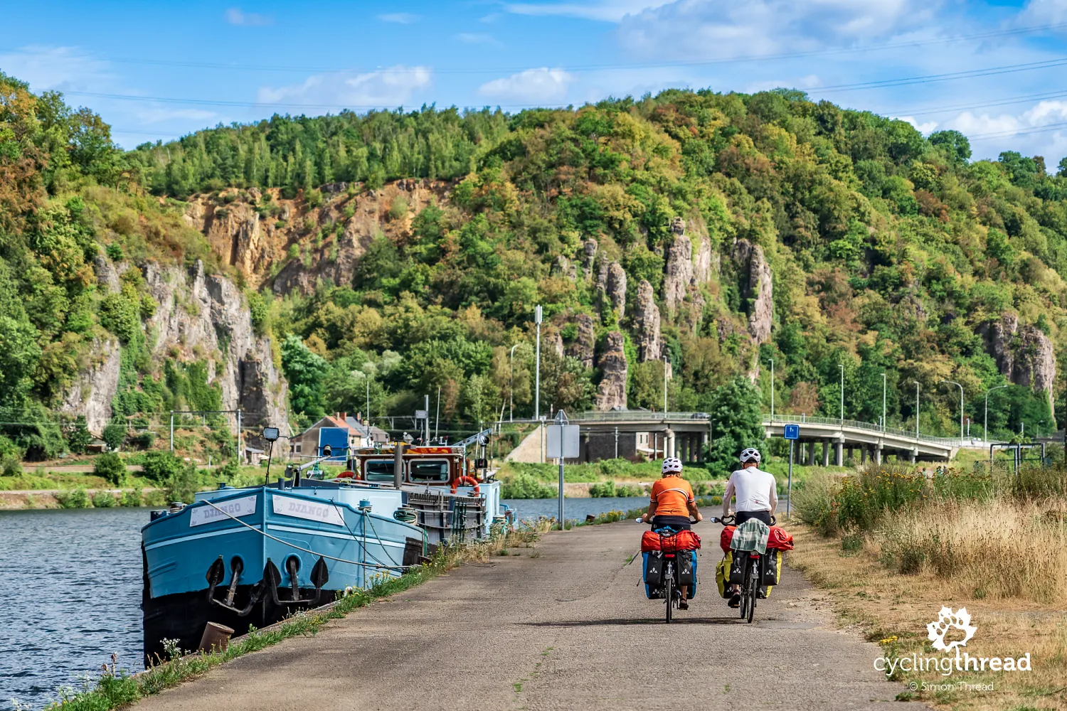
Andenne: ceramics and Neanderthal discoveries
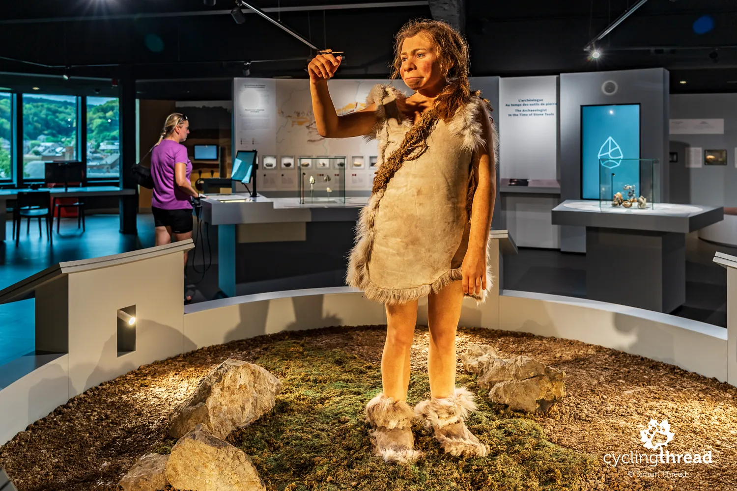
Andenne has a long ceramic tradition, which is explored at the Espace Muséal d'Andenne (EMA), housed in the Le Phare building in the town centre. The museum presents the history of local ceramics, from everyday objects and traditional craftsmanship to industrial production and artistic works. Another section takes visitors much further back in time, to discoveries made in nearby Scladina Cave. Its central figure is Raga, a reconstruction of a Neanderthal girl aged around eight whose remains were found during archaeological excavations. The exhibition also explains how researchers interpret bones, stone tools and layers of sediment to understand prehistoric life. A visit to EMA requires a short detour from the Meuse Cycle Route and can be combined with a walk through the historic centre, including the Collegiate Church of Sainte-Begge.
The industrial valley from the RAVeL path
Between Namur and Huy, the valley's industrial character appears not only in quarries but also in factory quays, warehouses and installations standing directly beside the water. The river connects businesses from different sectors, and tall silos remind us that some are linked to agriculture and food processing. One example is the Proxani plant near Andenne, producing livestock feed. Across the Meuse, we see its extensive buildings, metal tanks and handling equipment, along with barges moored at the quay. From our bank, the scale of the complex and its closeness to the river transport route are easy to appreciate.
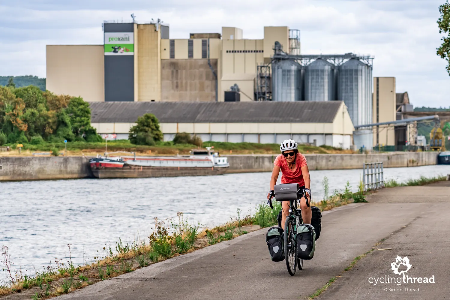
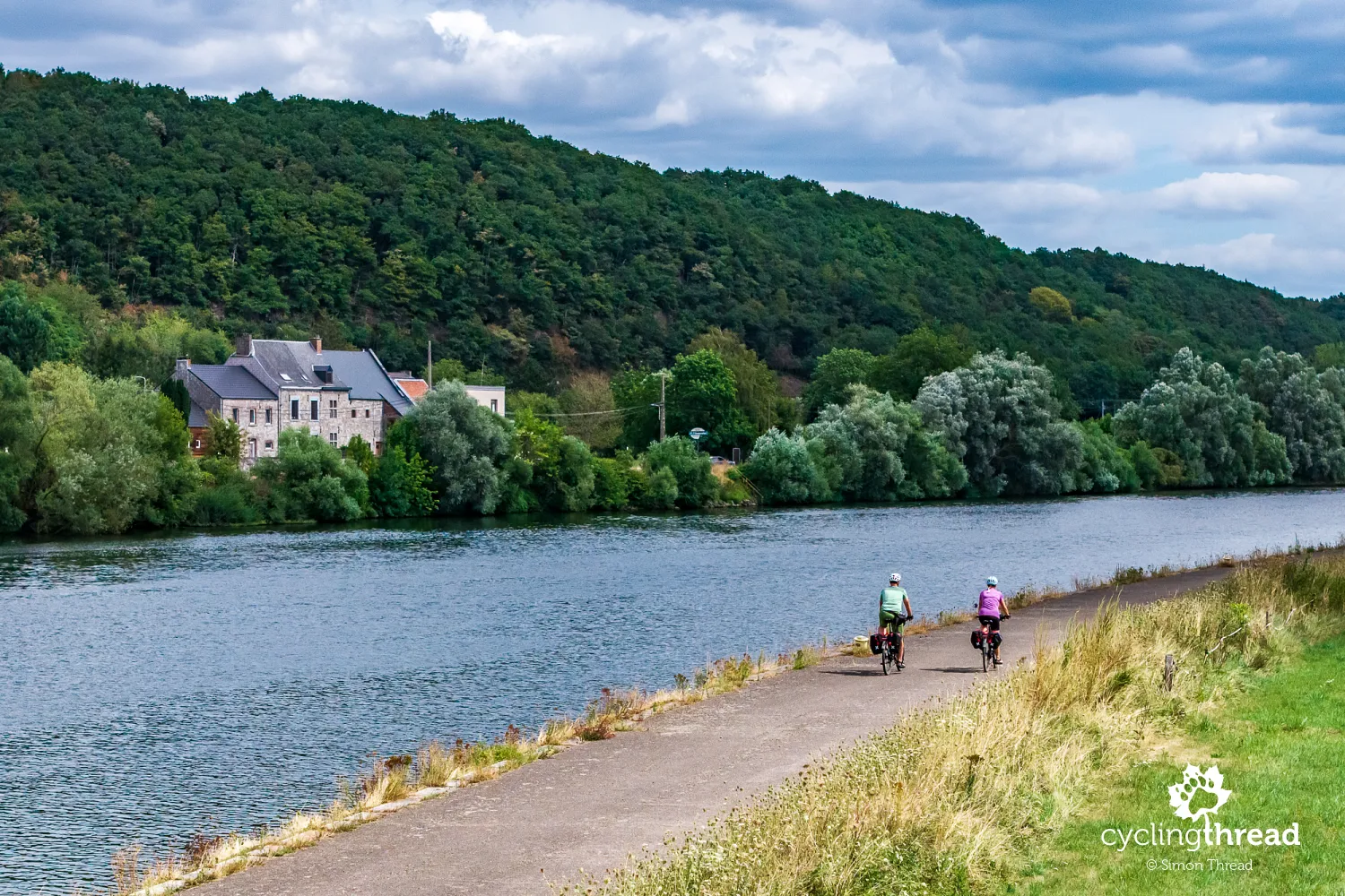
It is in industrial surroundings like these that we particularly appreciate the riverside RAVeL network, which lets us observe the working valley from a comfortable path separated from motor traffic. Between Namur and Huy, the official Meuse Cycle Route follows the right bank, alternating between asphalt and concrete surfaces. Despite nearby towns, bridges and factories, we can maintain an easy, steady pace without frequent stops or having to give way to cars. Long stretches right beside the water also make navigation straightforward: most of the time, we simply follow the river. This infrastructure is less spectacular than striking bridges or specially designed viewpoints, but its value on a multi-day tour is hard to overstate. Just remember the other users, as local residents, walkers and runners also use the riverside path.
Huy: collegiate church, fort and market square
In Huy, we encounter a layout familiar from Dinant: a monumental church at the foot of a hill, with fortifications overlooking the Meuse valley. The Gothic Collegiate Church of Notre-Dame and Saint-Domitien was built between 1311 and 1536, replacing an earlier Romanesque church. Its most characteristic feature is the massive western tower, while the richly decorated Bethléem portal is considered one of the region's finest examples of Gothic sculpture. It is at the rear, on the side away from the river, so you need to go around the building to see it. Much higher stands the fort, built by the Dutch between 1818 and 1823 on the site of earlier defences with medieval origins. During the Second World War, the German occupiers used it as a prison through which more than 7,000 people passed, including resistance members and political prisoners. Today, it houses a memorial to the victims of Nazi repression.
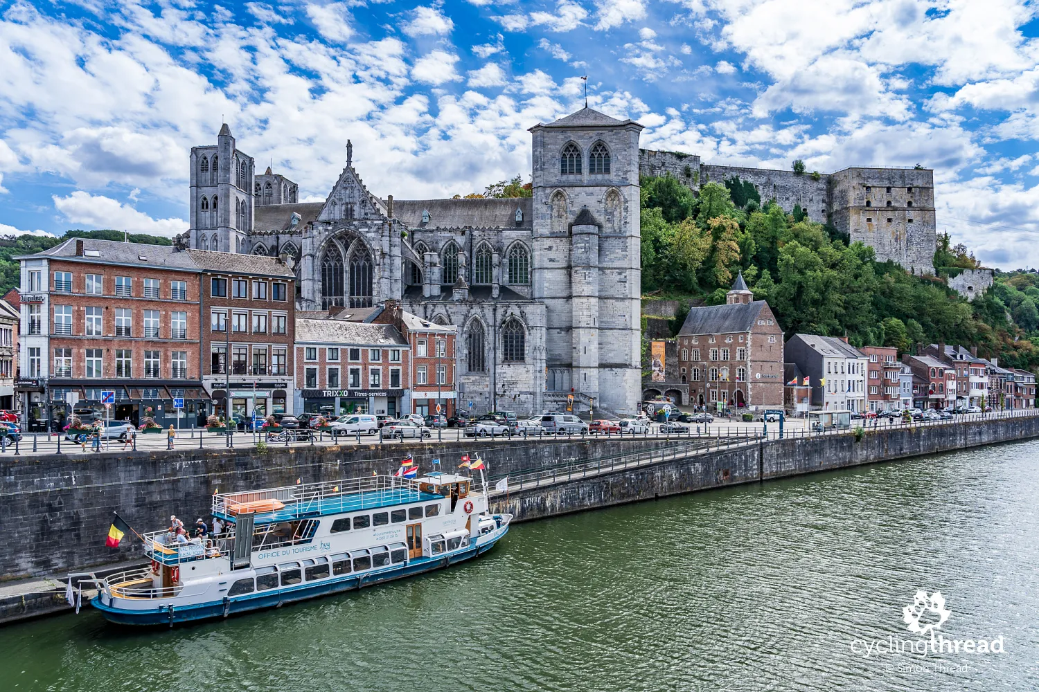
Huy's market square, the Grand-Place, is close to the river, but its atmosphere differs noticeably from the busy Meuse waterfront. Historic houses, restaurants and cafés surround it, with the elegant town hall, built in 1765–1766 in a Neoclassical style, occupying one side. The square's most valuable historic feature, however, is Li Bassinia, a fountain dating from 1406 whose name comes from the local Walloon dialect. Its octagonal basin and decorative structure recall a time when public fountains were an important part of the town's water supply. Particularly interesting are its small figures, including people associated with the town's history and former privileges. Huy was once one of the most important towns in the Prince-Bishopric of Liège, and in 1066 received a document considered one of Europe's oldest town charters.
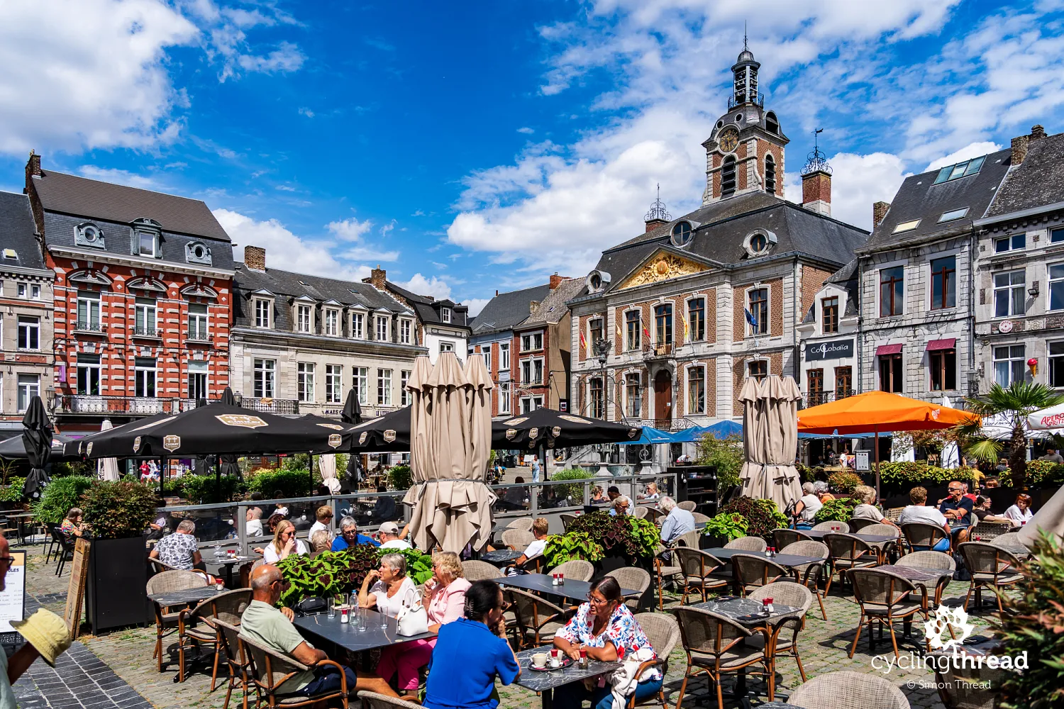
Walloon food on Huy's market square
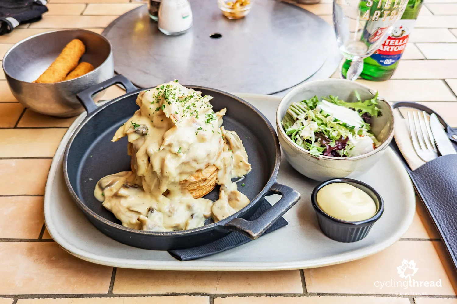
The atmosphere on Huy's market square was so pleasant that we could not resist stopping for a meal. It is a good opportunity to explain what we ate during our trip through Wallonia. Every day on the road, apart from our stay in Liège, we ordered vol-au-vent and boulets à la liégeoise, or Liège-style meatballs. One day Ola had the vol-au-vent and I had the meatballs; the next day we swapped. We enjoyed them every time, and although these are probably quite ordinary dishes for people in Wallonia, it had been a long time since we had taken so much pleasure in food served in everyday local restaurants on our travels. We remember Wallonia as the region with the best food among those we have visited recently.
Cycling past Tihange nuclear power station
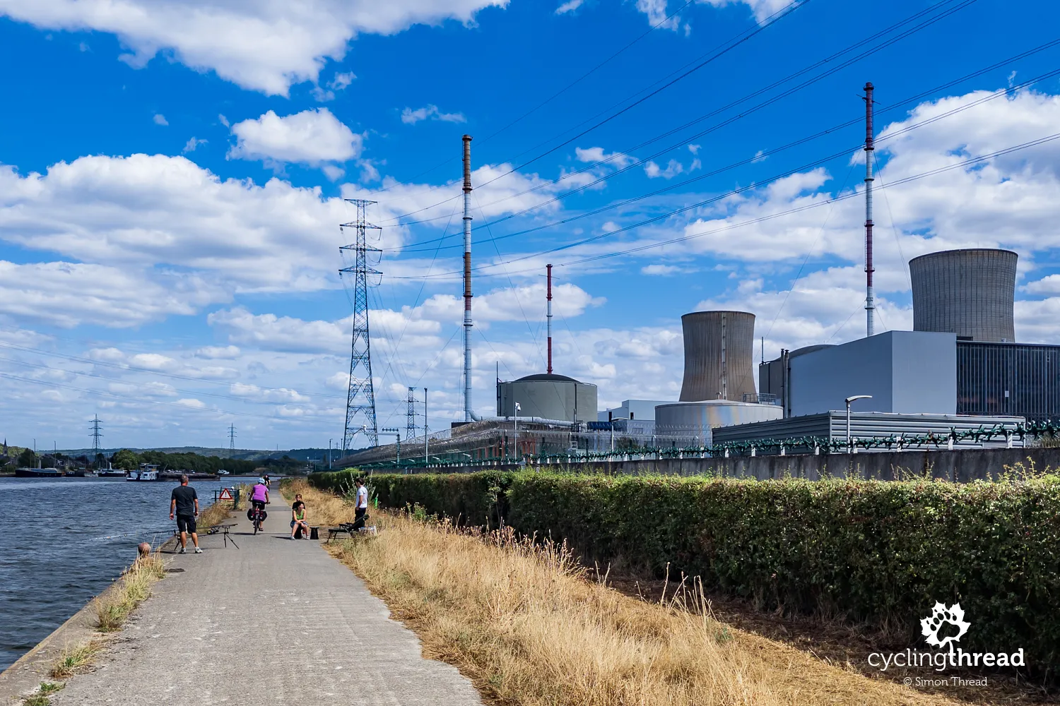
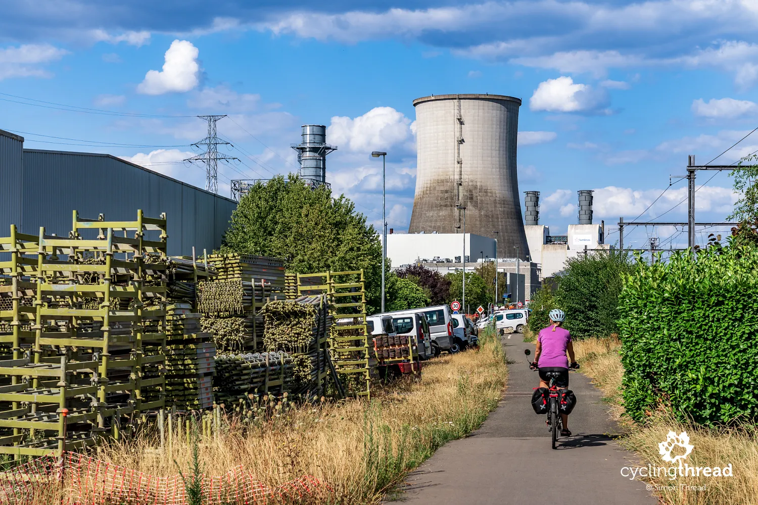
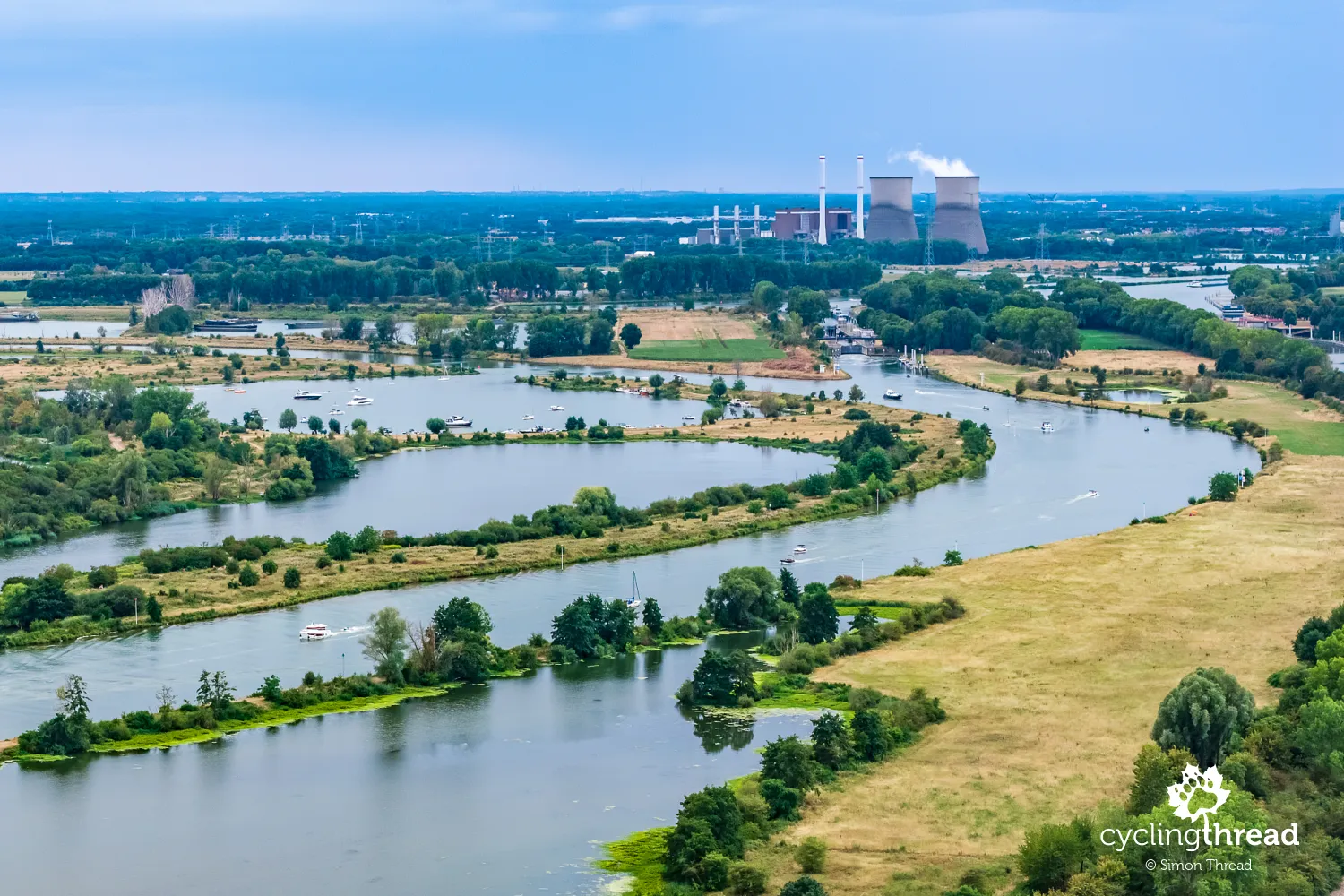
Beyond Huy, the structures of Tihange nuclear power station rise above the valley, making it one of the most distinctive landmarks on the ride towards Liège. Its presence reminds us that the river is also part of the energy infrastructure, and that our journey passes places important to the everyday functioning of the whole country. In 2026, the history of the complex needs to be distinguished from the operation of its individual units: Tihange 1 and Tihange 2 have been permanently shut down, while Tihange 3 has received an operating extension to 2035. From the riverside path, of course, these differences are difficult to identify from the buildings and cooling towers alone. For a cycle tourist, the power station is primarily a prominent landmark, signalling an increasingly industrial part of the valley. The opportunity to ride so close to a nuclear power station is itself a rather unusual experience.
A bridge over the Ampsin-Neuville locks
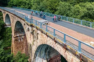
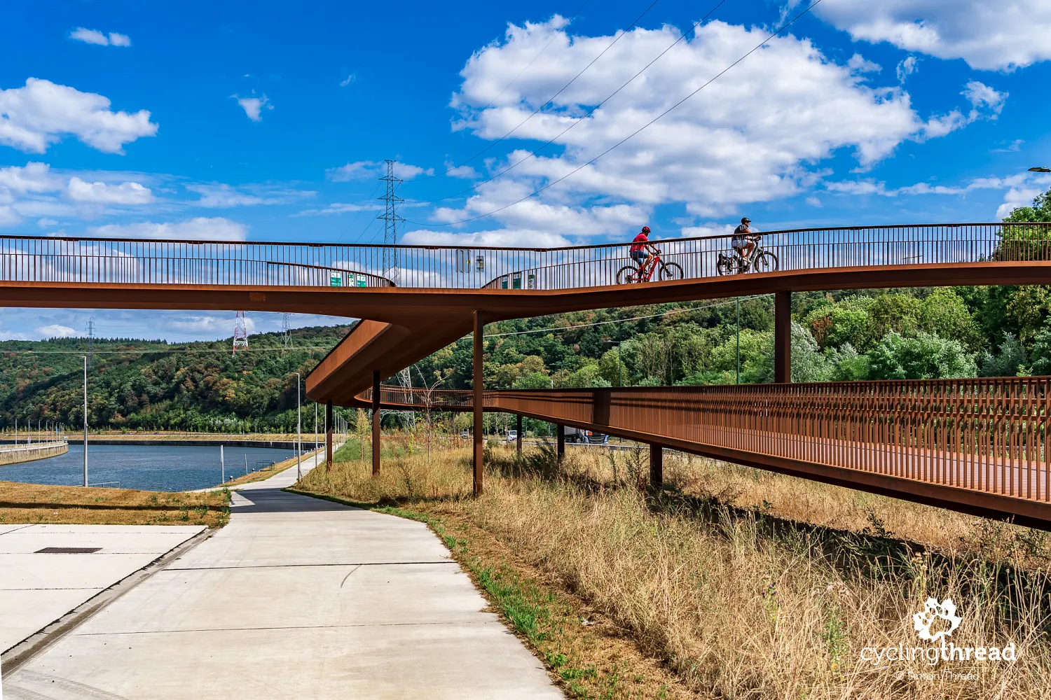
Beyond Tihange, near Amay, we pass one of the most interesting examples of new cycling infrastructure along the Meuse. It is the striking walking and cycling bridge at the Ampsin-Neuville lock complex, opened in June 2024 as part of a major waterway upgrade. The 620-metre structure, built from weathering steel with its characteristic rusty-brown surface, passes over the N90 road, the locks and the Meuse weir. Gentle curves and long ramps make it comfortable to cycle across, while its overall appearance fits the industrial surroundings. The project also included two new locks, the larger measuring 225 metres long and 25 metres wide, allowing vessels with a carrying capacity of up to 9,000 tonnes to pass. Another interesting feature is the adjacent 700-metre artificial river, serving as a fish pass, the longest of its kind in Wallonia. Ampsin-Neuville shows how upgrading river transport can also improve cycling conditions and support the natural environment.
Flône Abbey and Chokier Castle
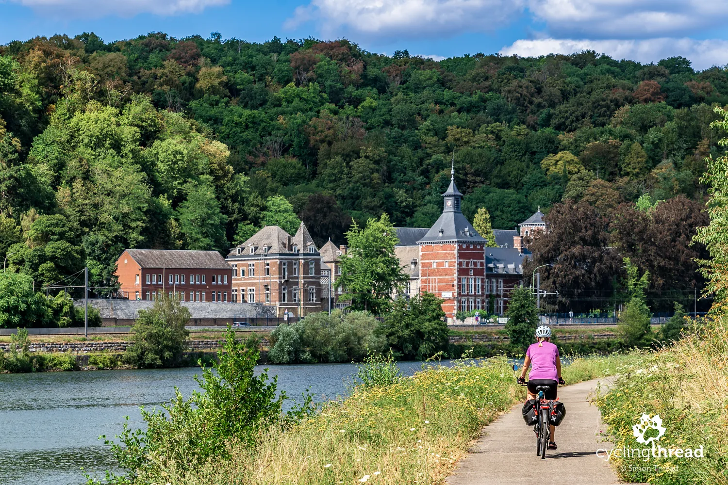
Further along the Meuse, a large complex of red brick and pale stone catches our attention, with a distinctive tower topped by a tall spire. Although it looks like a riverside palace from the opposite bank, it is the former Flône Abbey in Amay, whose buildings now house a school. Its wings form a picturesque group at the foot of a wooded slope, with reflections and the nearby water adding to its grand appearance. A road and railway run between the complex and the river, reminding us how many functions must fit into the narrow strip of land on the valley floor. From our bank, we can see both the tower and the long façades, partly hidden by riverside trees. There is no need to leave the route to take a look, as the abbey accompanies us briefly on the opposite side of the Meuse.
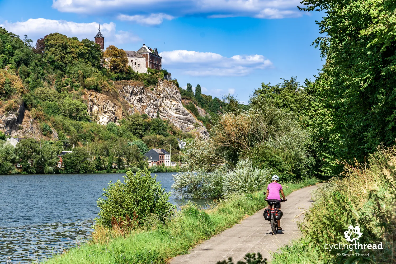
The next castle beside the Meuse appears much higher, on a rocky outcrop above the river and the buildings below. It is Chokier Castle, whose position recalls a medieval stronghold guarding this part of the valley, although its present form largely results from an 18th-century rebuilding. The old fortress was then transformed into a more comfortable residence, retaining features including an earlier round tower visible above the trees. From the Meuse, a regular façade with a triangular pediment stands almost on the edge of the pale rock. The castle remains privately owned and is not open for ordinary visits, but its most characteristic view is directly visible from the riverside cycle path. Riding close to the water, we can clearly appreciate the height of the rock and the building's position above the small houses below.
Industrial heritage between Huy and Liège
Between Huy and Liège, industry becomes increasingly frequent, though it does not form one uninterrupted strip of identical factories along the entire route. Industrial halls, chimneys, storage yards and quays alternate with housing, green stretches of riverbank and rocks rising above the valley. The river carried heavy raw materials, its valley made railway construction easier, and nearby deposits encouraged iron and steelmaking, mining and building-material production. We pass both working factories and modern cargo terminals, as well as sites that have lost their original purpose and await redevelopment. Around Seraing and Ougrée in particular, industry becomes the dominant feature, contrasting with the historic towns we visited earlier. Raw-material handling equipment lines the quays, while railway tracks and access roads connect the factories with the rest of the valley.
Val Saint-Lambert: two centuries of crystal
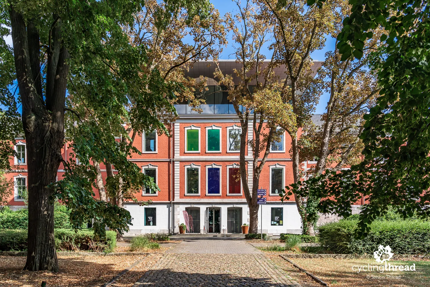
We discover another chapter of the valley's history at Val Saint-Lambert in Seraing, where a brick building with colourful windows appears behind the trees. This is the former abbot's palace, known as Château du Val, part of an old Cistercian abbey complex where the famous crystal works began operating in the 19th century. Founded in 1826, the manufacturer developed the production of blown, cut and engraved crystal, finding customers far beyond Belgium. Its position beside the Meuse helped with transport, while production halls and workers' houses gradually supplemented the monastic buildings. Today, the former palace houses a museum about the factory's history and crystal-making, its coloured glazing immediately hinting at the subject inside. In 2026, the manufacturer celebrates its bicentenary with the Cristal Vivant exhibition, bringing historic pieces together with contemporary work.
Seraing and Ougrée: the ironmaking valley
Seraing is one of those places along the Meuse whose name remains closely associated with European industrial history, particularly iron and steelmaking and the businesses developed by John Cockerill. In the 19th century, the valley became an important manufacturing centre, drawing on local raw materials, river transport and an increasingly dense railway network. We pass the headquarters of the John Cockerill industrial group, still operating today, whose name recalls the beginning of this story in 1817. The modern company works in areas including industrial technology, energy and hydrogen production, taking it far beyond traditional iron and steelmaking. Around the route, former factory remains stand alongside working businesses and land earmarked for new investment. The scale of the halls, installations and riverside industrial sites helps us imagine how strongly manufacturing shaped the town's development and its residents' lives.
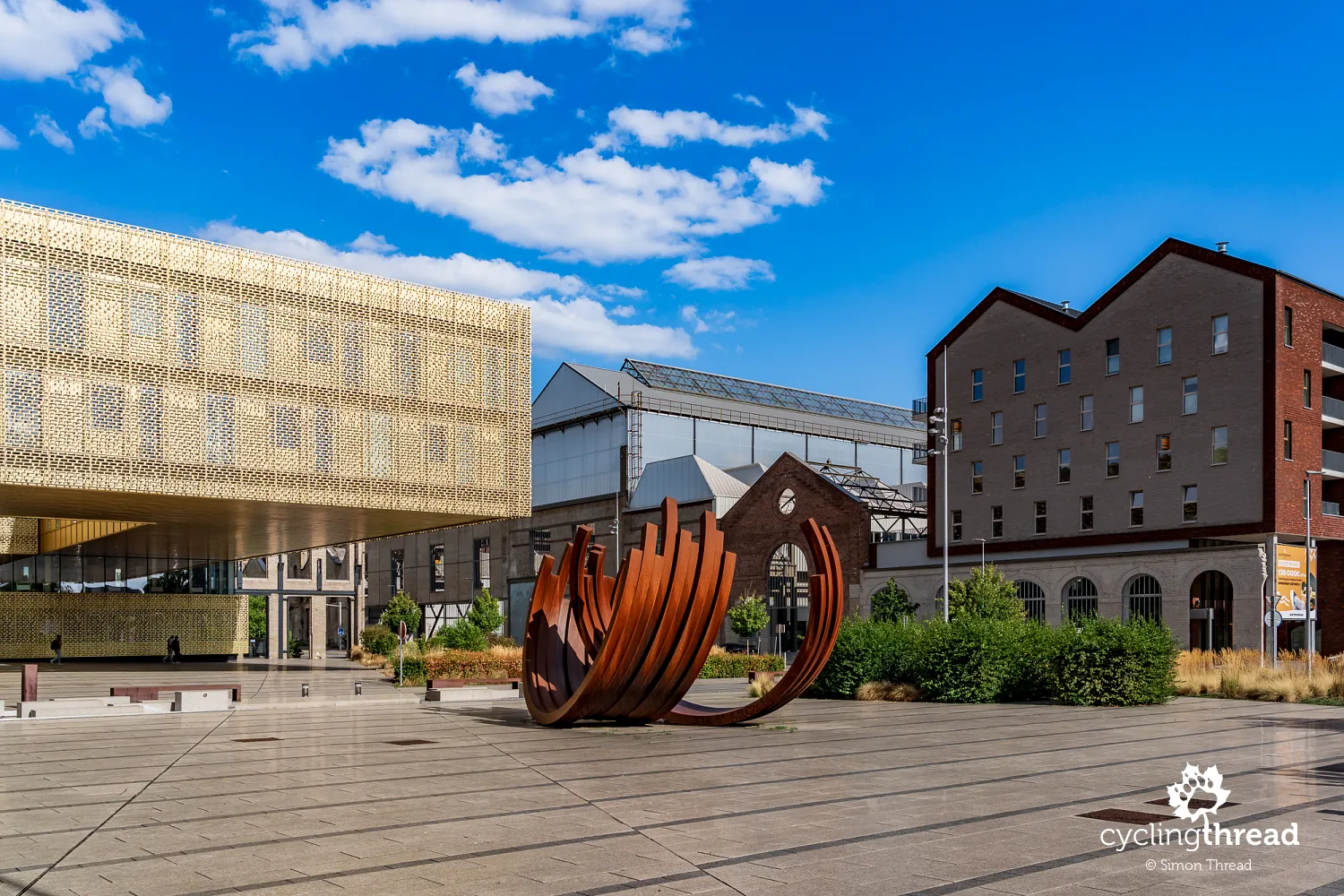
It is also worth knowing that blast furnace B survives in Ougrée, part of Seraing, as one of the most distinctive industrial heritage structures around Liège. It stands across the Meuse from our route, however, so we do not ride directly past it. The enormous structure produced pig iron and remains evidence of the scale of an industry that occupied much of the valley for decades. The former works are not freely accessible, although occasional guided visits allow people to approach the surviving installations. Its surroundings are undergoing changes and demolition, so photographs from different years may show different arrangements of chimneys and auxiliary buildings.
Entering Liège along former waterways
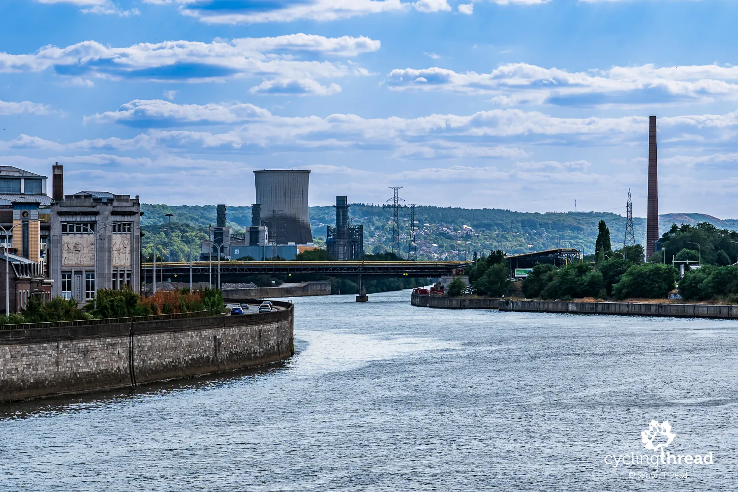
Our entry into Liège is rather complicated, winding along side streets between industrial land and the railway. Eventually, the route takes us along a wooden walkway beneath one of the bridges to the right bank of the Meuse, from where we reach the Ourthe Canal. This is a remnant of an ambitious 19th-century project to connect the Meuse and the Moselle, creating a waterway between the basins of two major European rivers. Construction began in 1827 under William I, King of the Netherlands, but technical difficulties, high costs and political changes meant the full project was never completed. Today, the surviving canal sections recall a time when water transport was expected to play a key role in this part of Europe's industrial development. The name of the planned connection immediately brings back memories of our journey along the Moselle Cycle Route, which we finished just a week earlier.
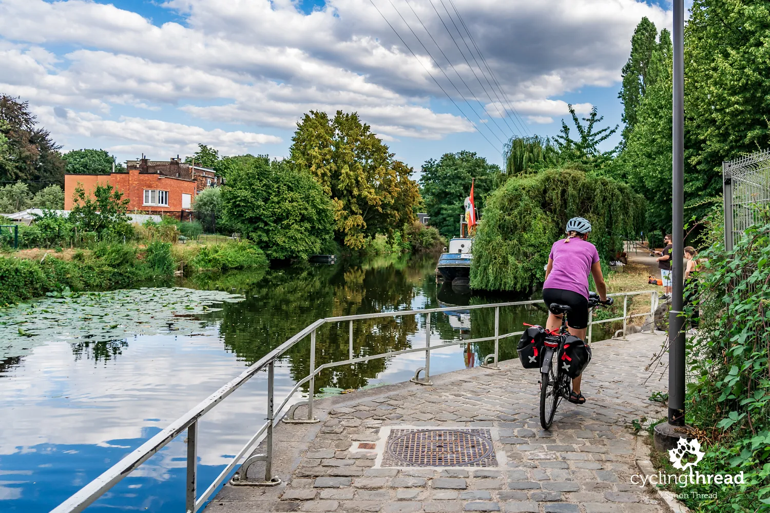
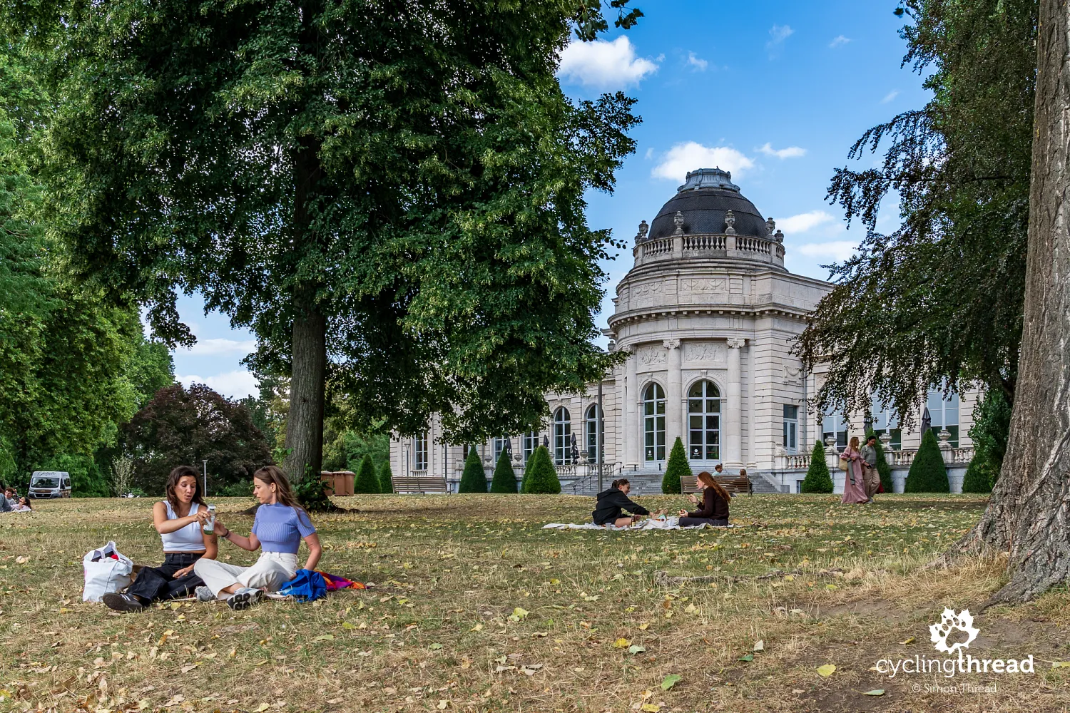
After another crossing, we return to the Meuse and reach La Boverie Park, occupying the southern part of an island between the river and the Dérivation Canal. Broad avenues, lawns and mature trees create a peaceful place to rest, contrasting sharply with the industrial surroundings on our way into the city. Among the greenery stands La Boverie museum, housed in the former Palace of Fine Arts, built for the 1905 World's Fair. Designed by architects Charles Soubre and Jean-Laurent Hasse, the building reopened as an art museum after extensive renovation in 2016, also hosting temporary exhibitions in partnership with the Louvre in Paris. Beside it is the striking La Belle Liégeoise walking and cycling bridge, also opened in 2016, linking the park to the Guillemins district and the area around its famous railway station. We continue along the riverside boulevards, passing modern office buildings, bridges and the increasingly urban landscape of Liège.
Liège: exploring the historic centre
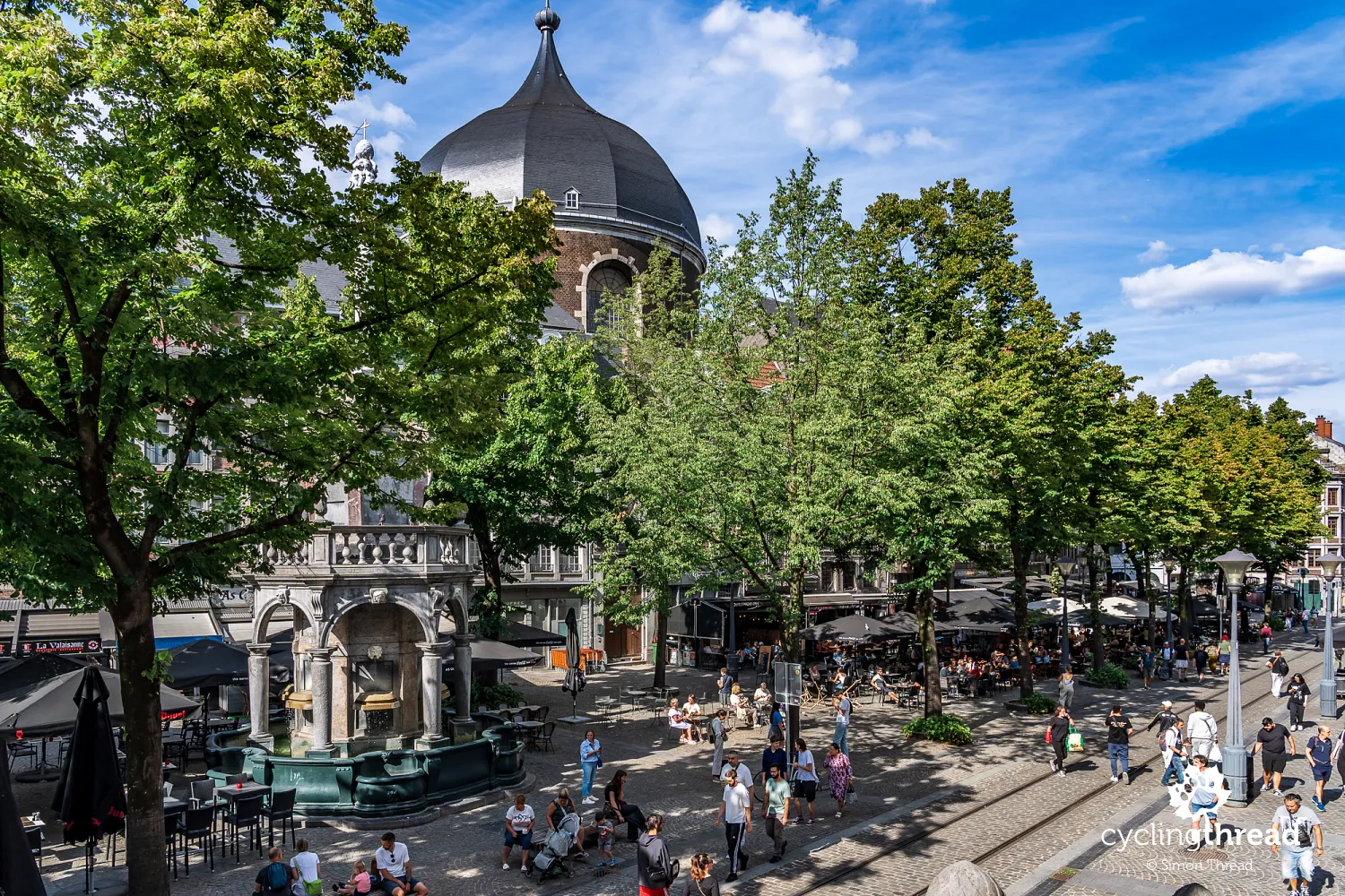
Liège's historic centre, where we are staying that night, lies a little further from the river, so we leave the waterfront and enter the narrow city streets. Around Place Saint-Lambert, we are reminded of the former power of the prince-bishops, whose extensive palace remains one of the city's most important buildings, although the cathedral that once stood beside it has not survived. Nearby is the beautiful Place du Marché, with the town hall and the Perron monument, a symbol of civic freedoms, surrounded by historic houses and restaurant terraces. Further on, streets lead towards older buildings at the foot of the hills, with narrow passageways and small courtyards hidden between the houses. Two nights in Liège gave us time to explore this area on foot, without bikes and panniers, and enjoy more leisurely walks.
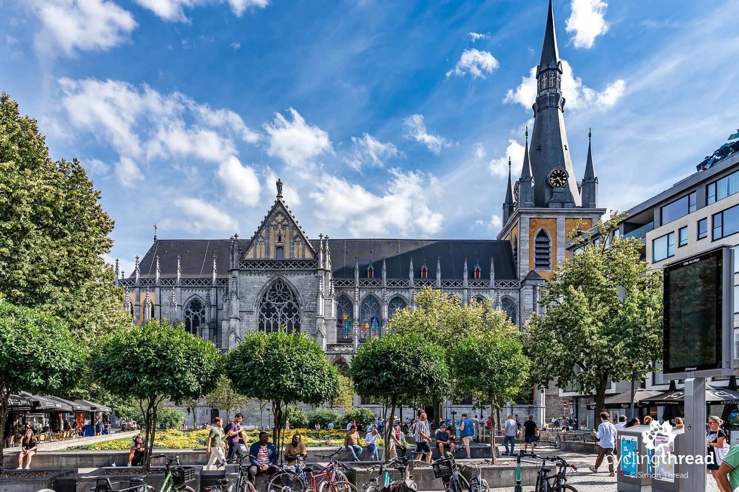
One of the most important monuments in Liège's historic centre is Saint-Paul Cathedral, a former collegiate church that took over the cathedral's role after Saint-Lambert was destroyed during the revolution in the late 18th century. The Gothic church, begun in the 13th century, impresses with its spacious interior, historic stained glass and rich furnishings, while the adjoining cloisters offer a moment's rest from the busy streets. On our walk through the centre, we also see the grand building of the Royal Opera of Wallonia, opened in 1820 and one of French-speaking Belgium's leading musical institutions. The Museum of Walloon Life is also worth visiting, occupying a former Franciscan convent and presenting the region's everyday life, work, crafts, domestic customs and local traditions. It provides an interesting addition to the industrial history of the Meuse valley that we have been discovering from the cycle route.
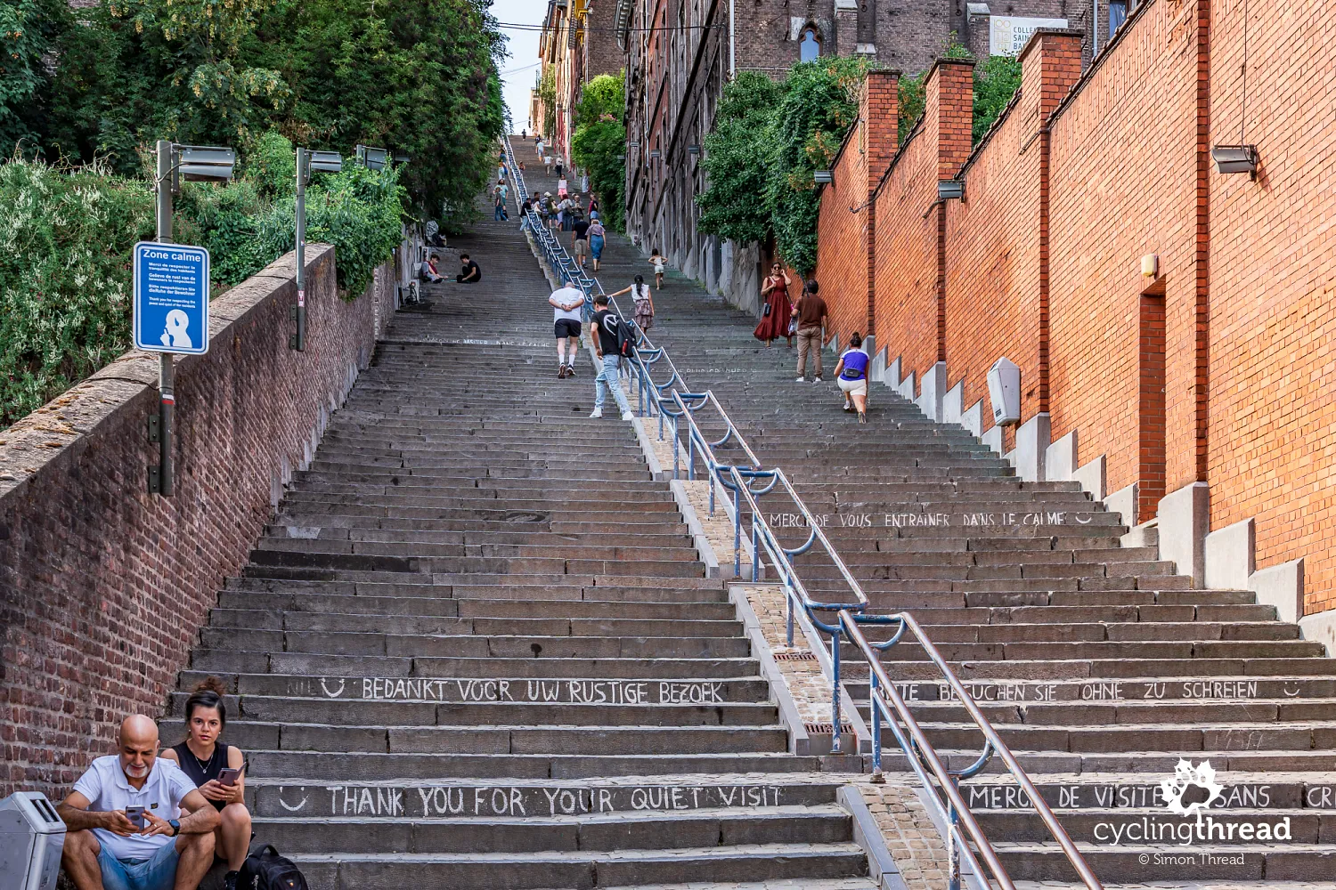
The Montagne de Bueren steps are among Liège's most recognisable sights, although they lie a little further from the river and require a walk away from the waterfront boulevards. A long flight of 374 steps climbs between the houses towards the hill, creating an impressive perspective that we first admire from the street below. Built in the 19th century as a direct link between the citadel area and the lower town, the steps are named after Vincent de Bueren, who fought against Charles the Bold in the 15th century. On the way up, you can stop for a rest and look back at the rooftops falling away between the slopes. Notice the signs asking for quiet: they remind us that Montagne de Bueren is both a popular attraction and part of everyday life for the people living in the neighbouring houses.
Santiago Calatrava's Liège-Guillemins railway station
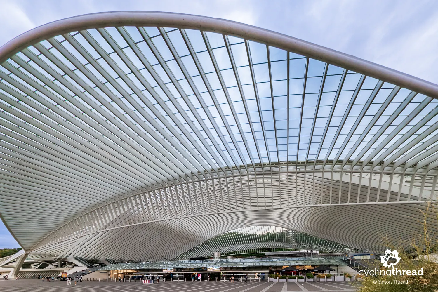
Liège-Guillemins station is an attraction worth leaving the riverside route for, even if you have no plans to take a train. Designed by Santiago Calatrava and opened in 2009, it is distinguished by an enormous glass and steel roof, its white structure resembling a series of ribs spanning the platforms. It is worth viewing the building from several angles, as its open spaces, stairways and passages reveal changing arrangements of arches and supports. Light enters through the glass roof, emphasising the rhythm of the structure and giving the interior a sense of lightness despite its vast size. Beneath the roof, the station functions as normal, so arriving trains and the everyday movement of passengers accompany the architectural experience. From the station area, you can return to the Meuse and cross La Belle Liégeoise bridge to La Boverie Park, linking these places in a short city loop.
Monsin Island and the Albert Canal
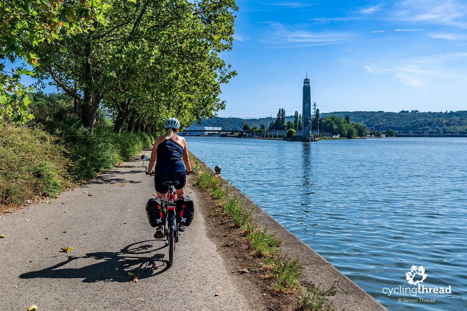
After a day exploring Liège on foot, we return to the Meuse Cycle Route and continue towards Limburg. We soon reach Monsin Island, beside which stands the monumental Mémorial Albert Ier, a memorial to King Albert I with a distinctive tall tower. This is where the Albert Canal branches off from the Meuse, forming one of Belgium's most important waterways and connecting Liège with the port of Antwerp. Opened in 1939, it improved freight transport between Wallonia's industrial hinterland and the North Sea, and its construction was one of Belgium's largest infrastructure projects of the interwar years. Much of Monsin Island is now occupied by port facilities, warehouses and factories, also served by road and rail. After walking through Liège's historic centre and resting in leafy La Boverie Park, we are once again in industrial surroundings where the river primarily serves as an important transport route.
Houseboats and marinas near Visé
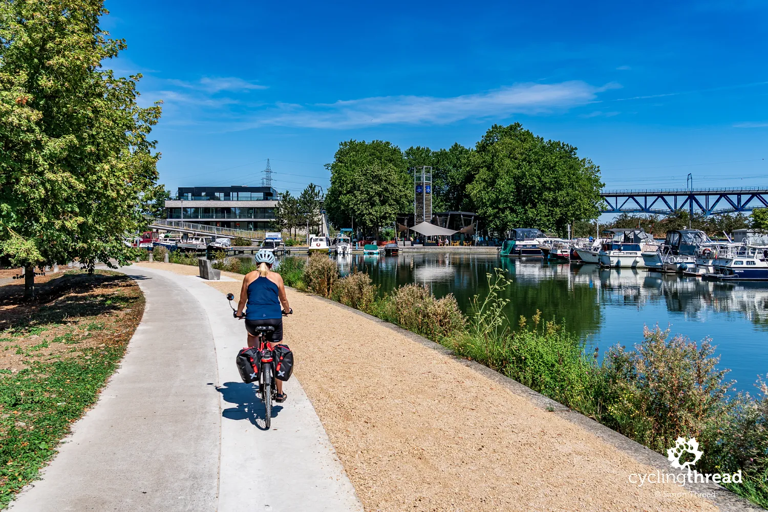
We remember Visé as a pleasant town with riverside promenades and yachts moored along the quays. After Liège's industrial outskirts, the surroundings change noticeably, with more space beside the water for walking and relaxing. The route stays close to the Meuse, allowing us to see the marinas and buildings on both banks without taking a detour. Masts, small jetties and boats rocking beside the shore give this part of the valley a leisurely feel. In such surroundings, it is easy to slow down and take a short break rather than treating Visé as just another name on a sign towards the border. From the promenade, we continue north, passing the last moored yachts and increasingly scattered buildings, beyond which broader views of the water open up again.
Route signs and numbered junctions
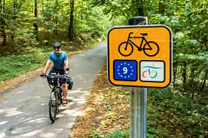
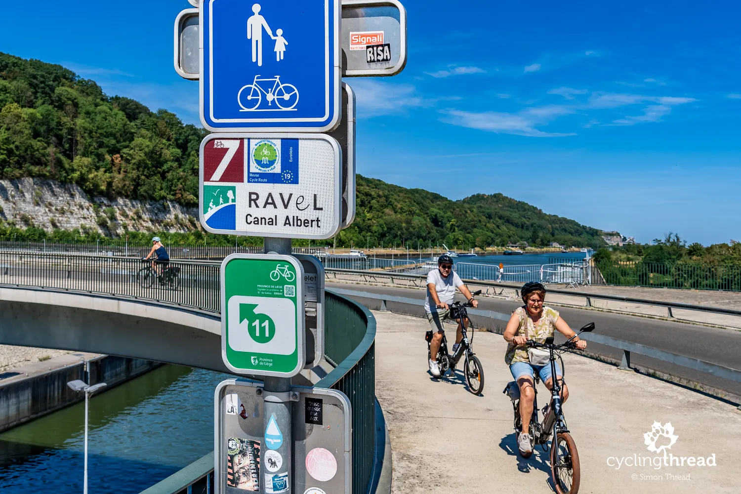
Along the Meuse, we used several overlapping signposting systems, including the numbered junction network, which is still unfamiliar to some European cycle tourists. We followed both La Meuse à vélo and regional route signs, as well as small signs bearing the numbers of cycling junctions. The principle is simple: using a paper map or online planner, you note the numbers of successive junctions, then follow the signs from one to the next. This also makes it easier to create your own variations, such as visiting smaller settlements or taking a ferry to the opposite bank. Remember that a junction number identifies a specific point rather than a long-distance route, so the two types of signs serve different, complementary purposes. A GPX track saved on your phone or navigation device can be a useful addition, especially when leaving larger towns, following temporary diversions or returning to the main route after visiting nearby attractions.
Lanaye: a cycle ferry and huge locks
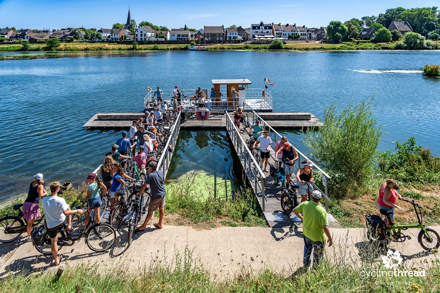
At Lanaye, we encounter one of the most memorable cycling scenes of the whole journey: a ferry crossing the Meuse with its deck full of dozens of cyclists and their bikes. It connects Lanaye in Belgium with Eijsden in the Netherlands, allowing passengers to change both riverbank and country in just a few moments. For a moment, it looks like a floating section of cycle path bringing together people on many different rides. Among the passengers are cyclists with panniers and others without luggage, perhaps just heading out for a short local ride. The small ferry lets them link routes on either bank without adding kilometres to reach the nearest bridge. We remain on the Belgian bank and head towards the Albert Canal, where the open valley will soon give way to tall limestone walls.
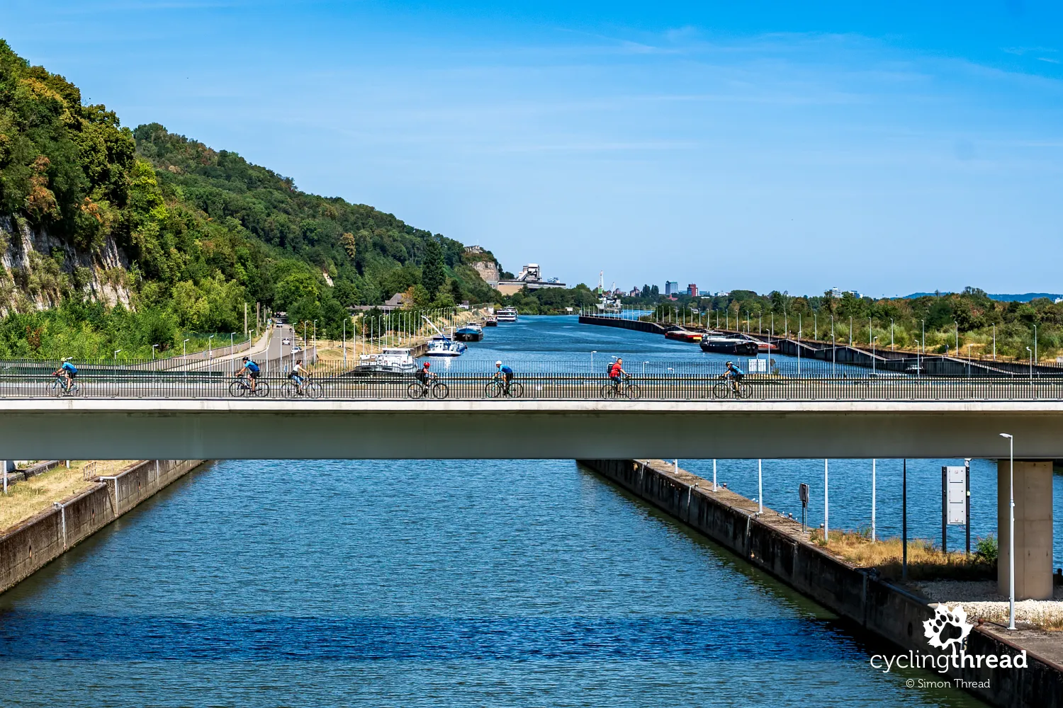
Before rejoining the cycle path along the Albert Canal, however, we ride through the Lanaye lock complex, right beside the Belgian-Dutch border. It is one of the most important structures on Belgium's inland waterways, allowing vessels to overcome the difference in water level between the Albert Canal and the Meuse. The fourth and largest lock, opened in 2015, is particularly impressive, with a chamber 225 metres long and 25 metres wide. These dimensions accommodate large barge convoys carrying goods between the port of Antwerp and the Meuse basin. From the bike, we can observe enormous gates, concrete structures and extensive harbour basins that reveal the scale of modern water transport. After crossing the complex, we return to the comfortable canal-side route and continue towards Maasmechelen.
The Caster cutting and Eben-Emael fort
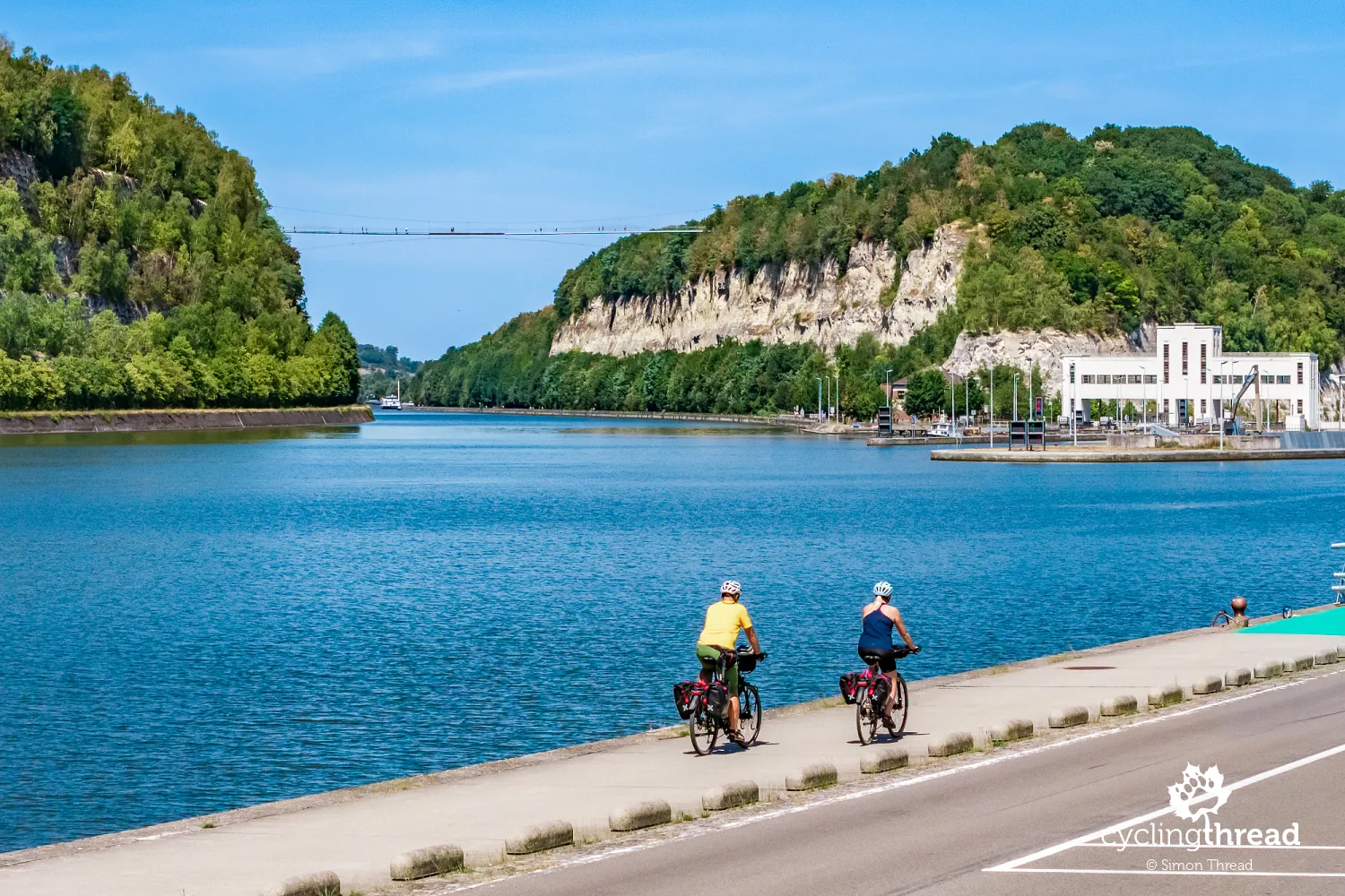
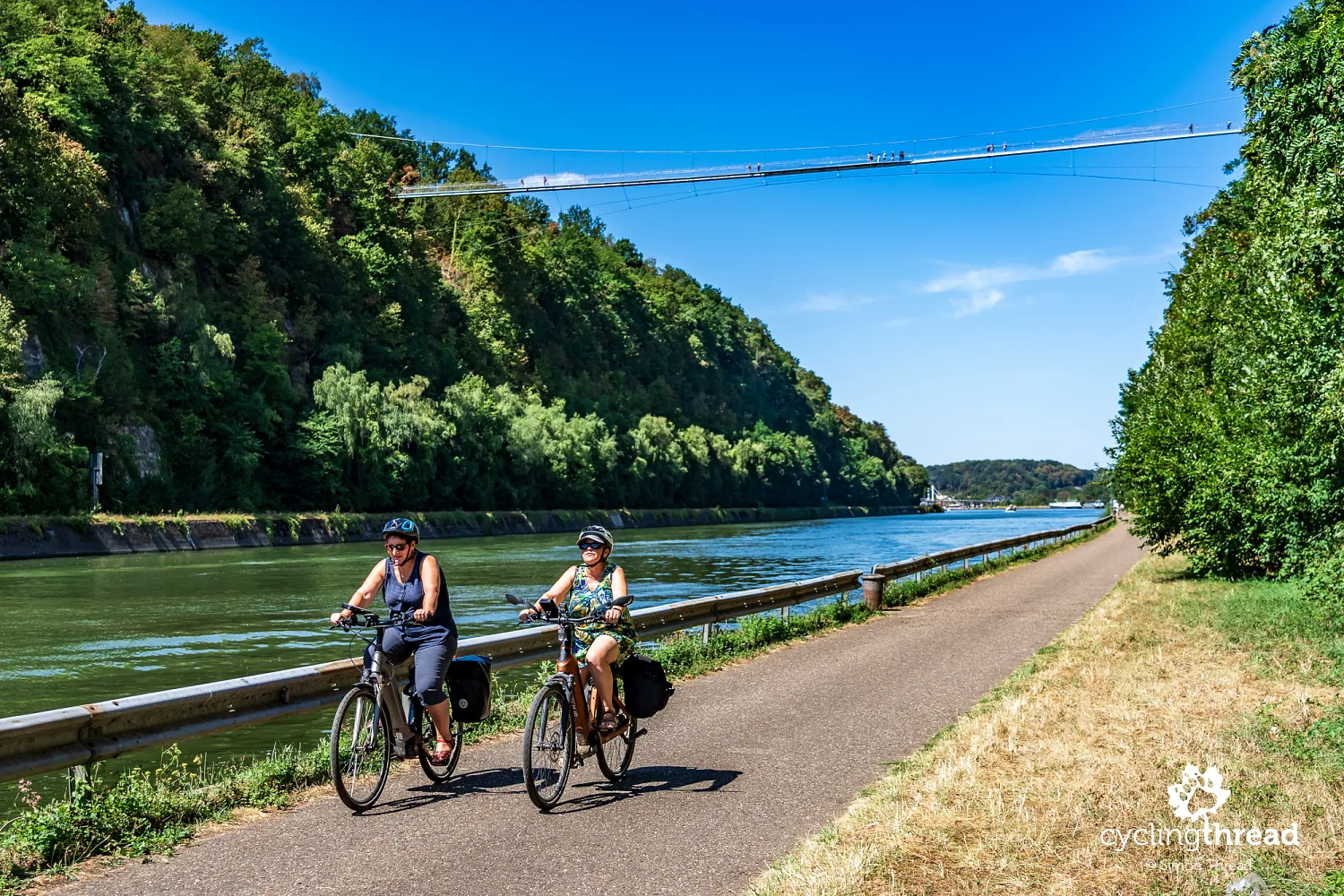
The route continues along the Albert Canal through the Caster cutting, which looks from the saddle like a deep, artificially excavated gorge. It was created during canal construction in the 1930s, cutting through the limestone ridge and separating previously connected parts of the hill. Pale walls rise high above the water, with the cycle path at their foot offering close views of exposed rock layers. Above the canal hangs the Passerelle de Caster, a pedestrian bridge more than 200 metres long and around 55 metres above the water. It links the Caster plateau with the grounds of Eben-Emael fort, restoring a walking connection between the two parts of the divided hill. From below, its slender structure looks small against the rock faces; only the barges passing beneath it help reveal the scale of the entire cutting.
Around the cutting, we can also see concrete defences associated with Eben-Emael fort, positioned to protect an important section of the Albert Canal and nearby crossings. The high sides of the cutting formed a natural obstacle to attacking troops, complementing the bunkers, artillery positions and underground passages. Despite these defences, German troops landed by glider on top of the fort in May 1940 and quickly disabled much of its armament. The attack became one of the best-known episodes at the start of the German invasion of Belgium, revealing the vulnerability of fortifications to a new method of warfare. Riding beside the canal, we see only part of this extensive complex, most of which remains hidden inside the hill. Exploring it properly requires a separate visit to its interiors and grounds with surviving combat structures.
Cycle rickshaws in Kanne for everyone
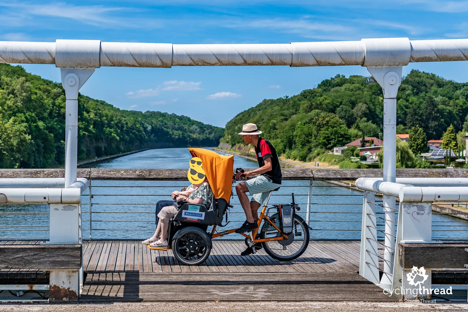
On the bridge in Kanne, we witness another special cycling scene: older people riding in an adapted cycle rickshaw driven by a volunteer from Fietsen Alle Jaren in Maastricht. The initiative gives older people and those with limited mobility who can no longer cycle independently another chance to take part in bike rides. Passengers sit comfortably at the front, with a trained volunteer at the handlebars. The rides are free and take place both in the city and its surroundings, sometimes visiting places connected with passengers' memories. A few weeks earlier, we saw a similar scene on the Kempen Route in Bokrijk, where people with disabilities from the Ter Heide care centre were travelling in rickshaws. Both encounters show a similar approach to social inclusion in Belgium and the Netherlands: cycling enables people to join shared outings even when they cannot ride independently.
Belgian and Dutch food beside the Meuse
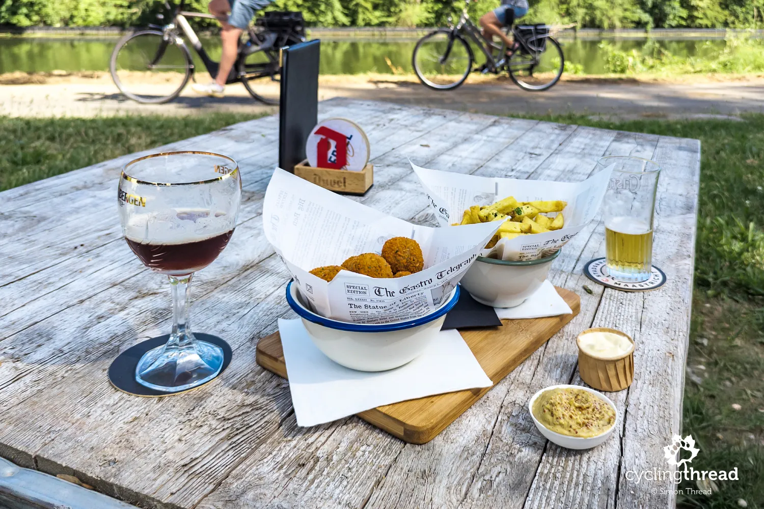
Along the way, we stop at a small restaurant beside the Meuse, where food from both sides of the river meets on our table. The Netherlands is represented by bitterballen, small, crisp balls with a thick meat filling, usually served with mustard and very popular as a snack with beer. Belgium naturally contributes fries, thicker, traditionally fried twice and served with one of many sauces. We are only a few kilometres from the border, so this Dutch-Belgian combination suits the character of our route. We will approach the Netherlands several more times that day, although we remain on the Belgian side of the Meuse throughout.
RivierPark Maasvallei: the valley's natural side
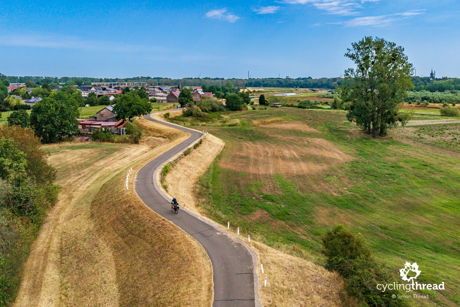
Soon afterwards, we reach RivierPark Maasvallei, an extensive natural area along the Meuse on the border between Belgium and the Netherlands. Here, the river regains a more natural character, forming broad bends, gravel banks, former channels and floodplains that provide habitats for many birds and other animals. Particularly interesting is the way the Meuse forms the national border for a considerable distance while uniting both banks through a shared landscape and network of cycle routes. Recent decades have seen extensive work on river restoration, floodplain recovery and flood protection. For us, it marks a clear change after the industrial surroundings of Liège: riverside meadows, trees and small settlements replace ports, locks and factories. In many places, the route stays close to the water, revealing a quieter, more natural side of the Meuse valley.
Oud-Rekem and leisurely riverside stops
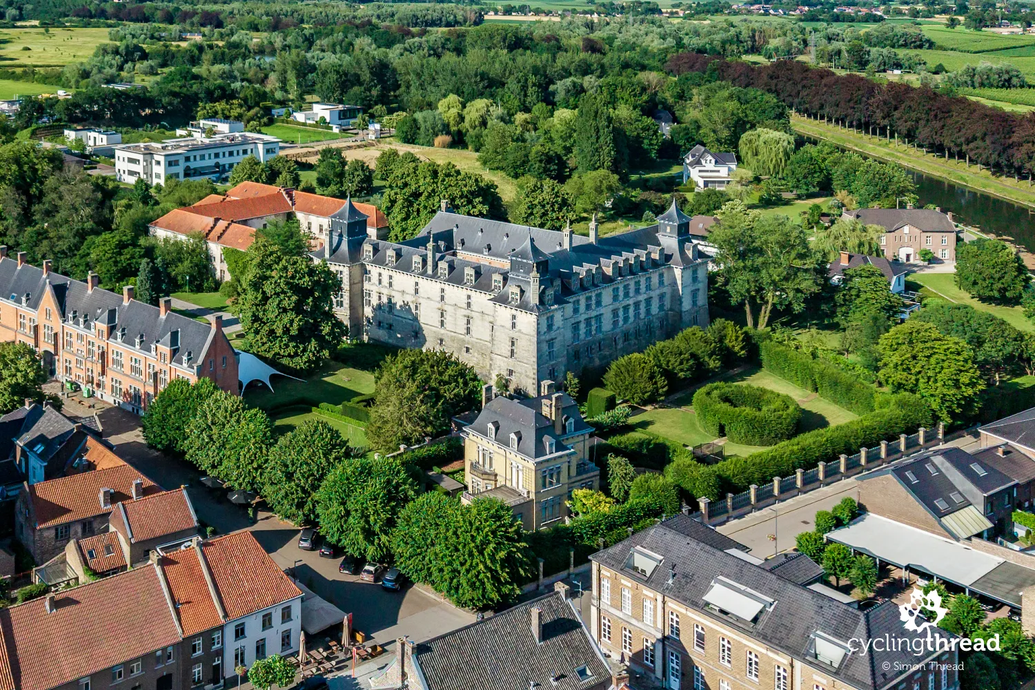
Oud-Rekem is one of those places worth leaving the rhythm of riverside riding for, its appeal lying in a small, well-preserved historic centre. Historic houses, former public buildings and the surroundings of d'Aspremont-Lynden Castle form a compact area best explored on a short walk. The village lies in the municipality of Lanaken and introduces architecture different from that of the larger Walloon towns seen earlier. There is no single dominant landmark as prominent as Dinant's citadel, so the proportions of the streets, façade details and relationships between buildings draw more attention. Oud-Rekem suits this quieter part of the journey, where larger towns gradually give way to small settlements scattered across the broad valley floor.
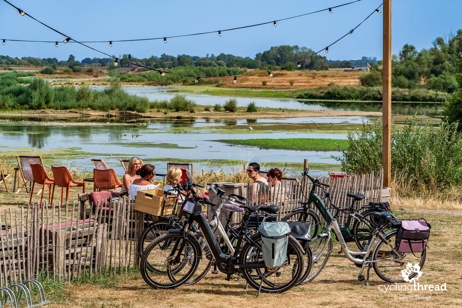
In this part of the Meuse valley, though really along the entire route, I particularly enjoy the scenes at riverside cafés and restaurants. People arrive by bike, meet friends, chat over coffee or food, then continue their ride or simply stay to enjoy the river view. Bicycles stand right beside the tables, often without dedicated racks, and nobody seems especially concerned. Such places show how naturally cycling fits into everyday life here. It need not mean sporting effort or a major expedition; it can simply be a way to spend a free afternoon, meet friends or share a meal beside the water. It is one of the scenes I most enjoy bringing home from our cycling journeys.
Uikhoven: a ferry to the opposite bank
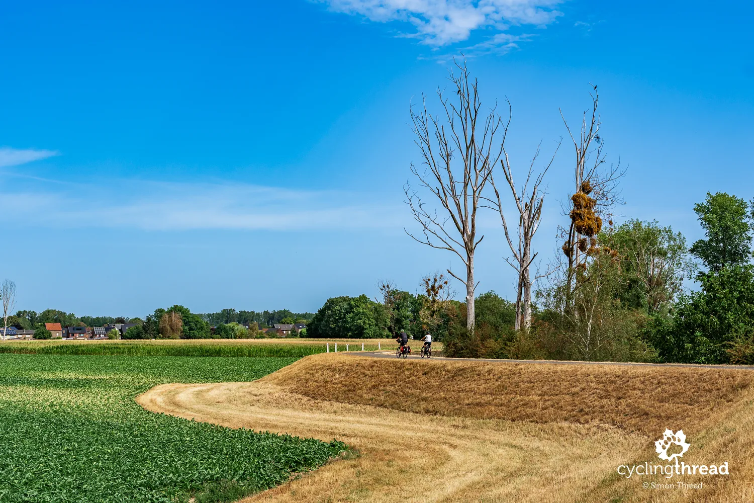
Uikhoven lies closer to the Meuse, bringing us back to a landscape shaped by the river, its embankment and the buildings of a small riverside settlement. Here, the valley's borderland character is particularly clear, with the Dutch bank directly across the water and no obvious difference in the surrounding landscape. A pedestrian and cycle ferry links Uikhoven with Geulle aan de Maas, offering a short trip across the border and the chance to plan a loop through both countries. It operates seasonally and also depends on river conditions, so avoid planning a late return without checking the timetable. Even if you remain on the Belgian side, the crossing is a good place to watch the current and life on the opposite bank. Further on, the route passes through the quieter surroundings of Maasmechelen, where individual village names are often more useful than the idea of one compact town.
Maasmechelen and a Messerschmitt memorial
Maasmechelen is a municipality made up of several settlements and districts, so its riverside area should not be imagined as a single centre directly beside the route. On our ride, we mainly explore its eastern part, with flood embankments, fields and small clusters of buildings near the Meuse. For a while, our route also follows the Zuid-Willemsvaart, a 19th-century canal linking Maastricht with 's-Hertogenbosch that long played an important role in carrying goods between Belgium and the Netherlands. Maasmechelen's better-known attractions, associated with former mining and Hoge Kempen National Park, lie further from the river and require a detour. We stay in the riverside part of the valley, enjoying comfortable cycle paths and a landscape that now feels distinctly more rural than the industrial surroundings of Liège.
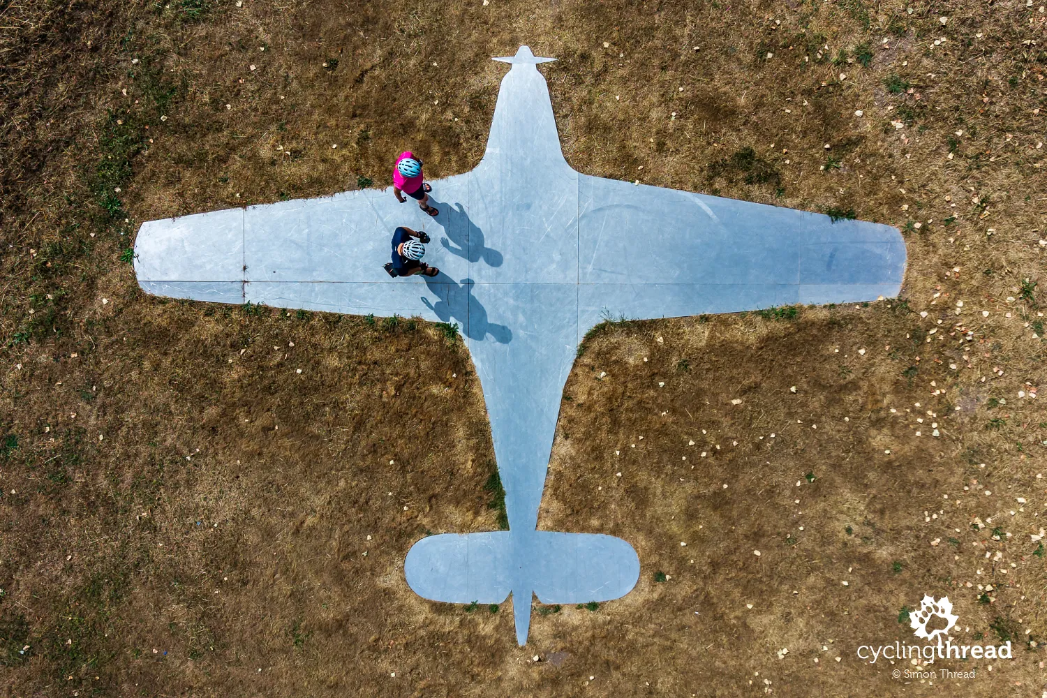
A metal aircraft silhouette laid flat on the ground near Vucht, now part of Maasmechelen, recalls a very different story. It commemorates the forced landing of a German Messerschmitt Bf 108 Taifun here on 10 January 1940, four months before the German invasion of Belgium. Two officers were on board, carrying secret documents concerning the planned attack, and had lost their way, reaching the Meuse instead of the Rhine. Realising they had landed in what was then neutral Belgium, they tried to burn the documents, but some material fell into Belgian hands. The event became known as the Mechelen Incident, revealing part of Germany's preparations for its offensive in western Europe. Today, beside a quiet road among fields, the aircraft outline helps us imagine its dimensions, while the full shape of the memorial is best seen from above.
RivierPark Maasvallei and art beside the Meuse
RivierPark Maasvallei is not a single enclosed park with a designated entrance, but an extensive river landscape covering land on both the Belgian and Dutch sides of the Meuse. It links natural areas, settlements, paths and places associated with the valley's history, accompanying us over many kilometres of the journey. Here, the river creates a mosaic of meadows, scrub, floodplain woodland, exposed banks and former extraction sites, with different access rules in different areas. For cyclists, the road and junction network remains the basis for exploring, while some of the more interesting waterside approaches and viewpoints are mainly intended for walkers. There is no need to attempt every off-road trail to get to know the park and its main features. Simply leave time for short walks away from the bike and for observing places where the border river has far more freedom than on its regulated stretches through the larger towns.
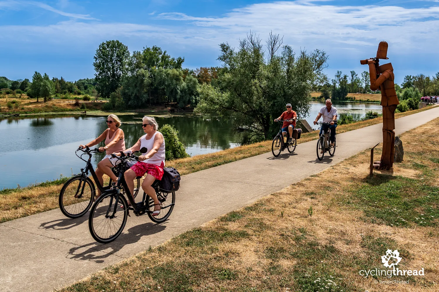
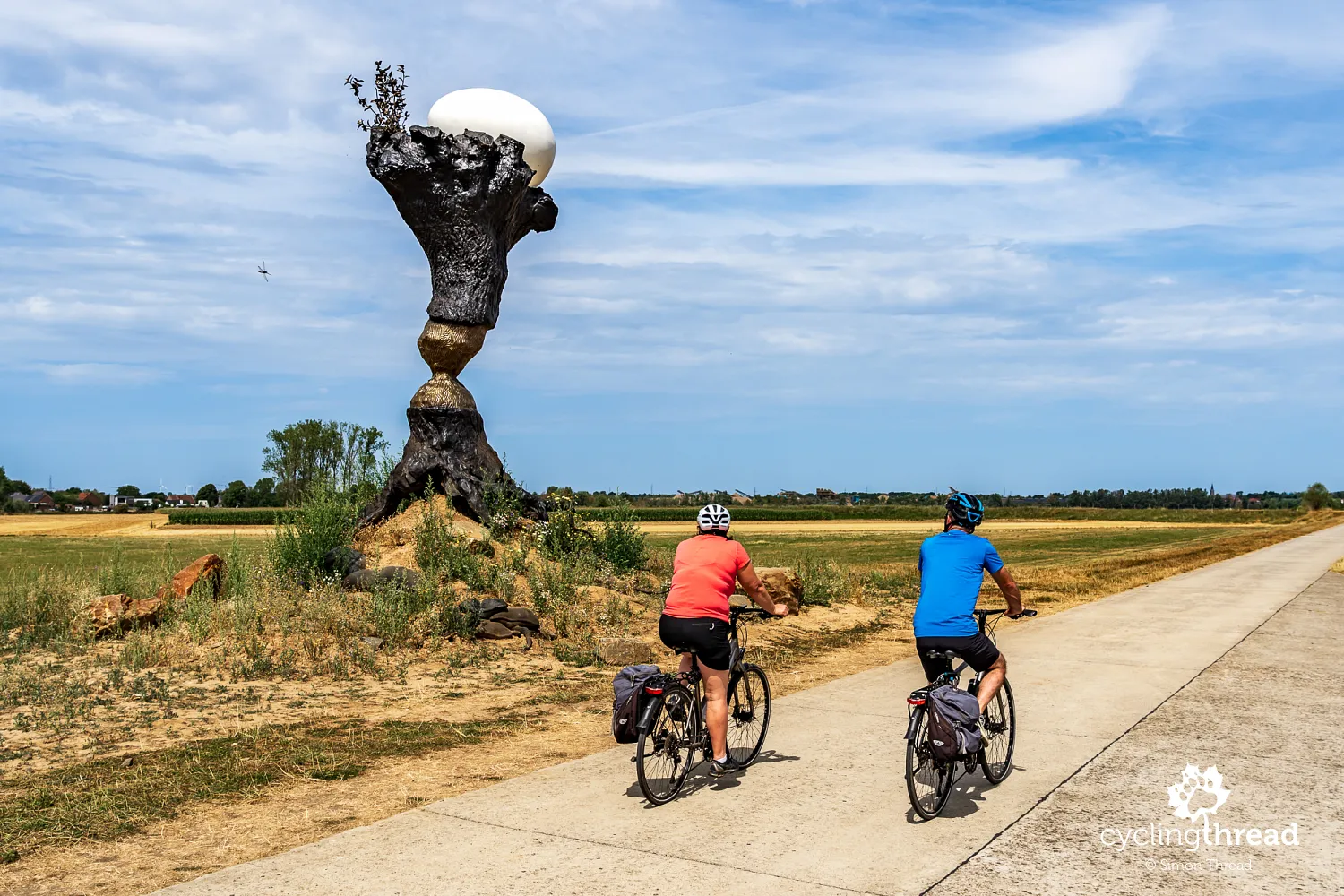
On the open stretches of the Meuse valley, works of art also appear directly beside the cycle paths. Near Rotem, we pass Future Fossil by Koen Vanmechelen, a monumental sculpture resembling a charred willow trunk topped by a large, pale egg. Forms resembling old sandbags at its base refer to flood protection, while beaver tooth marks on the trunk recall the animals that also reshape the riverside environment. The egg symbolises the possibility of a new beginning emerging from a landscape affected by water and human activity. The work belongs to Kunst aan de Maas, a project connecting contemporary art with the nature and history of the valley on the Belgian side. It stands right beside the route, making it easy to take a closer look during a short break before continuing between fields and riverside land.
Maaseik: lime trees and a historic pharmacy
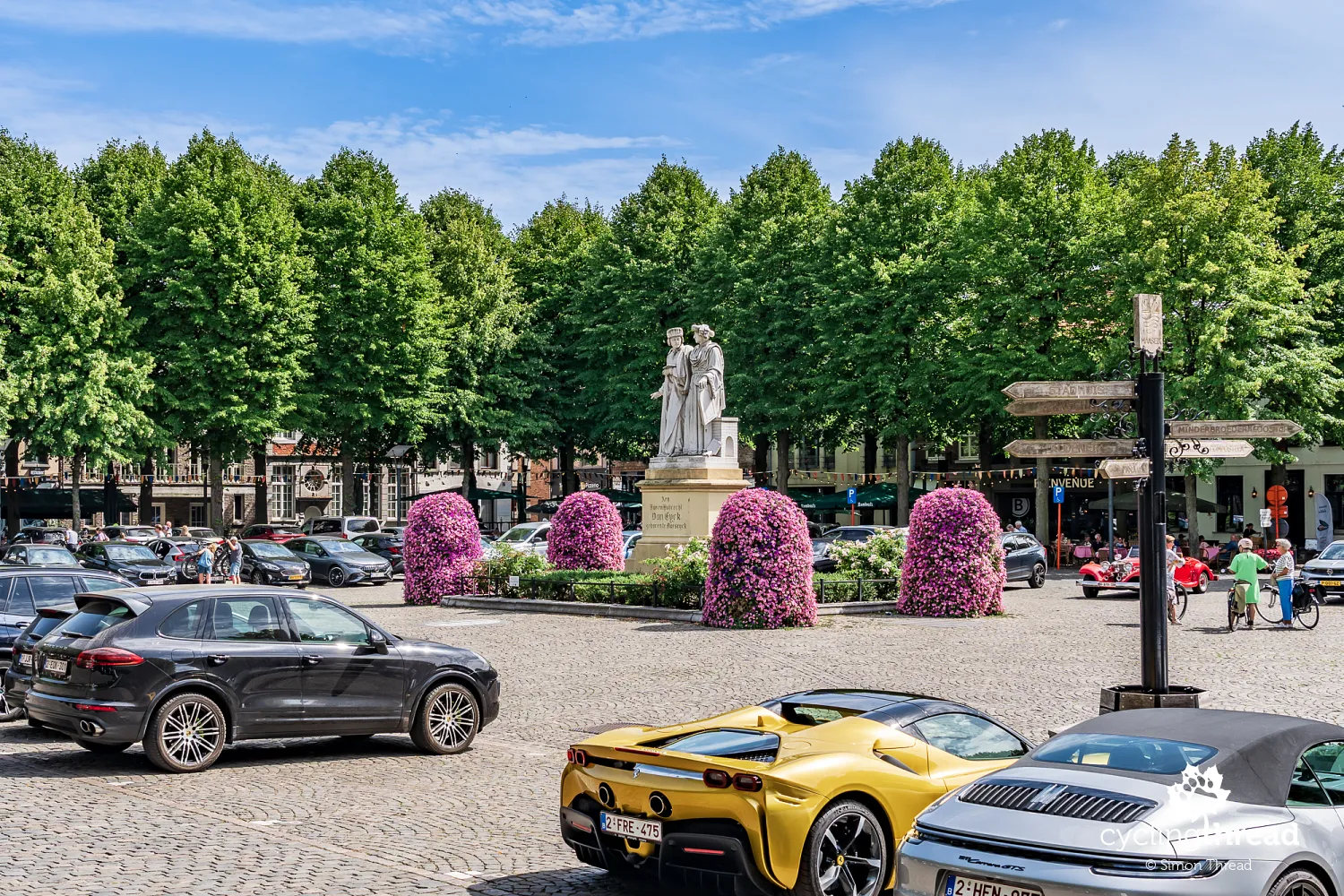
Maaseik's market square requires a short detour from the river, but is one of the most distinctive town stops in Belgian Limburg. Historic houses surround the broad square, while rows of lime trees shade restaurant terraces and strolling residents. At its centre stands a monument to the brothers Jan and Hubert van Eyck, recalling the tradition linking their origins to Maaseik, although details of their biographies remain uncertain. Among the historic buildings, look out for the old town hall and the Apotheekmuseum, housed in Belgium's oldest private pharmacy, which operated from 1704 to 1959. Original furniture, apothecary vessels and equipment survive, recalling earlier methods of preparing medicines. After a long ride along riverside embankments, the square offers a pleasant change, with numerous cafés and restaurants inviting a longer stop.
Maasplassen: lakes created by gravel extraction
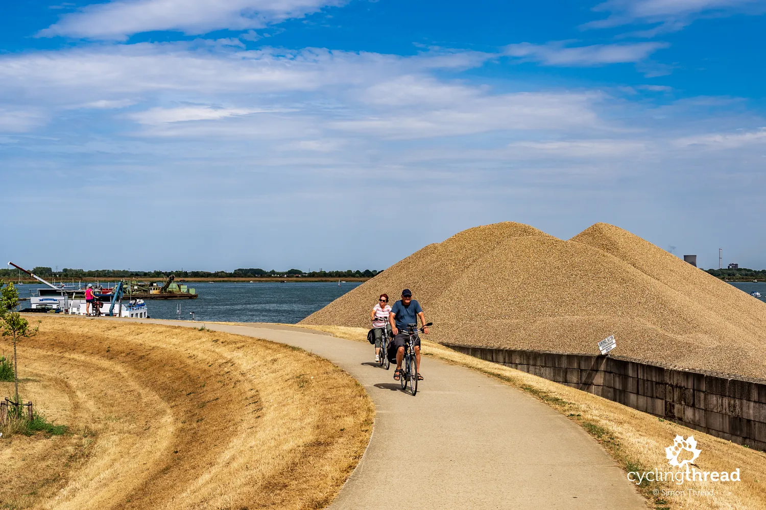
The Maasplassen are an extensive group of lakes that give the area around Roermond a very different character from the rocky valley at the start of our journey. Many were created by gravel extraction, with later development combining water-based recreation, green spaces and bird habitats. From the bike, we see not only the Meuse itself but also side lakes, marinas, causeways and peninsulas, sometimes making a closer look at the map necessary. The path may follow a lake while the main river remains hidden beyond another strip of land, so simply following one riverbank is no longer enough. Sailing boats and leisure craft replace cargo barges in the foreground, although the river's economic importance remains. This landscape also continues the story of extraction, showing how the function of a large part of the valley can change once mining ends.
Roermond and the train back to Dinant
We finish our ride in Roermond, where the Meuse meets the Roer and the extensive lakes give way to urban waterfronts and historic buildings. We only have time for a brief look at the town, although the market square and Munsterplein invite a longer walk. One of its most important monuments is the Munsterkerk, a church originating in a former Cistercian convent and distinguished by its four towers. This time, however, we cannot explore further and head for the railway station. From Roermond, we return by train, changing in Liège and Namur, to Dinant, where we left the car. Through the windows, we see parts of the valley again, having spent the previous days discovering them from the saddle.
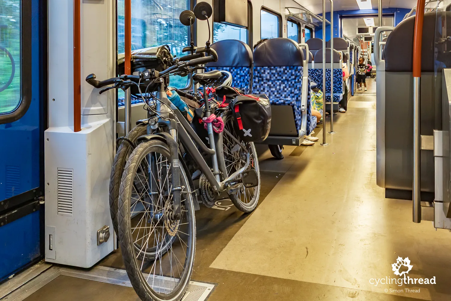
Railways help when planning a journey along the Meuse, but returning to the starting point is not equally straightforward everywhere. In Wallonia, stations in Dinant, Namur, Huy and Liège make it possible to combine cycling with public transport, while Givet is the end of a line approaching from Charleville-Mézières in France. Unfortunately, there is no regular direct passenger rail service between Givet and Dinant, leaving buses as the public transport option for cyclists. On Belgian trains, bicycles require the appropriate supplement, and carriage depends on available space and the conditions of the particular service. If finishing in Roermond, it is worth arranging the logistics before departure rather than assuming every part of the valley can be retraced by train without changes.
The Meuse: varied landscapes and everyday life
Looking back over the whole route, we consider the variety of landscapes one of the journey's most distinctive features. It clearly sets it apart from routes where similar fields and riverside meadows continue for days. Between Givet, Dinant and Namur, the Meuse flows through a valley cut into limestone, surrounded by rock faces, wooded slopes and settlements gathered beside the water. Further on, quarries, factories, railway sidings and cargo quays become increasingly frequent, particularly on the approach to Liège. Beyond the city, the valley gradually opens out, and in Limburg the landscape consists of flood embankments, gravel bars, pastures and former river channels. Near Roermond, the Meuse passes through an extensive area of lakes, marinas and recreational land. This variety reminded us of our recent ride along the Ruhr Valley Cycle Route, where riverside nature also stood alongside industrial heritage and each stage revealed a different side of the region.
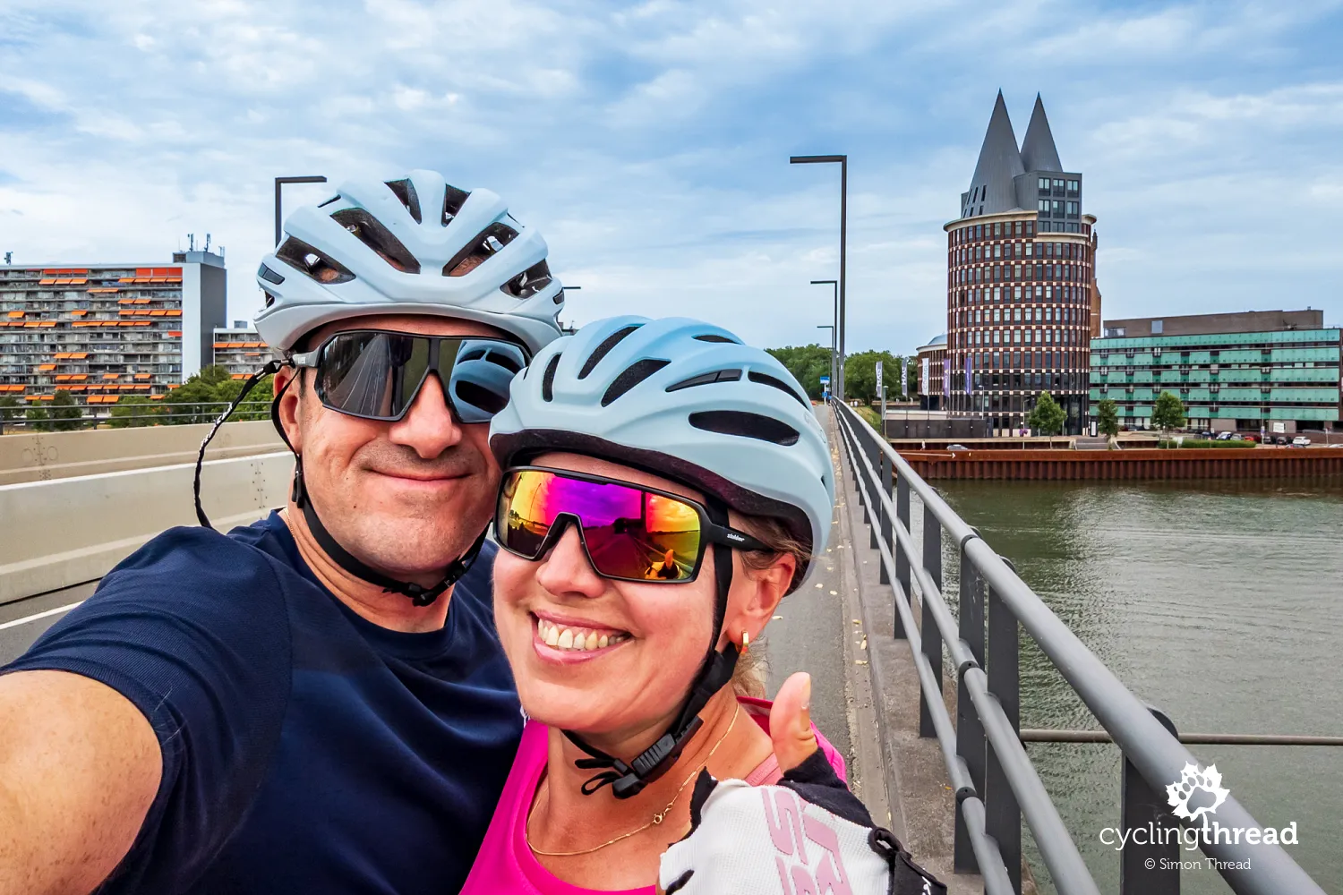
A major strength of Meuse By Bike is the opportunity to discover Belgium from a perspective that travelling by car or visiting only the largest cities cannot offer. Well-developed cycling infrastructure makes it easy to observe everyday life beside the river: people relaxing at waterfront cafés, cyclists using local routes, working barges and small settlements rarely visited by international tourists. We particularly liked the way bicycles are treated as a natural means of getting around and enjoying free time, rather than solely as sporting equipment. As a result, a long journey along EuroVelo 19 is made up of many ordinary, enjoyable moments alongside visits to the main sights. After several days beside the Meuse, we will remember not only beautiful landscapes and historic towns, but above all the variety of places and everyday scenes best discovered by bike.
Back to topHave a safe ride! 💚
Simon Thread
(Szymon Nitka)
I'm a passionate cycling traveler and the voice behind Cycling Thread. I explore Europe on two wheels, documenting the most scenic routes, inspiring places and cyclist-friendly practices. My writing blends personal experience with practical insights and a deep love of travel. I'm also a contributor to National Geographic Traveler magazine.